
Scan the QR code and open PeakVisor on your phone
Bound by its stunning untamed Atlantic coastline, County Donegal (Contae Dhún na nGall) is one of Ireland's most culturally and naturally rich counties. Gaeltacht heritage, the spectacular Seven Sisters, and some of the highest sea cliffs in Europe make County Donegal an unforgettable hiking destination. There are 525 named mountains in County Donegal. The highest and the most prominent mountain is Errigal (751 m / 2,464 ft).
County Donegal is the northeasternmost county of Ireland. It is bordered by Northern Ireland to the east, the Atlantic Ocean to the west, and County Leitrim to the south. With a total area of 4,860 sq km (1,880 sq mi), it is the fourth-largest county in Ireland and the largest in Ulster.
County Donegal's landscape is wild, blanketed in peatlands, forests, and rugged mountains carved by strong Atlantic winds. It's the fourth-most forested county in Ireland, with a total area of roughly 555 sq km (214 sq mi), accounting for over 11% of the county.
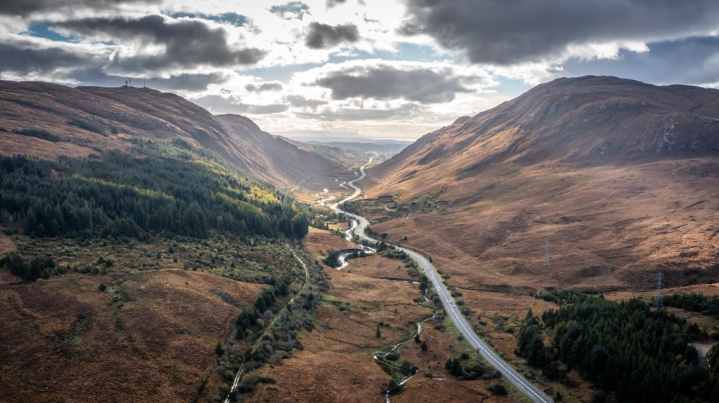
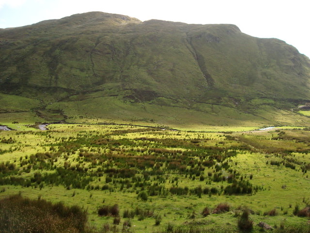
Ulster's most mountainous county, Donegal, has an inland geography defined by two mountain ranges: the Derryveagh Mountains to the north and the Bluestack Mountains to the south. Both are low mountain ranges barely exceeding 750 m (2,460 ft) in elevation.
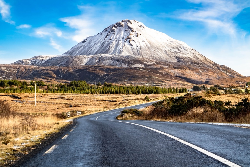
Glenveagh National Park, Ireland's second-largest national park, encompasses the larger Derryveagh Mountains. They're home to the Seven Sisters mountain chain, which includes Donegal's county top, Errigal. Reflecting its conical quartzite peak in Dunlewey Lough below, Errigal is one of Ireland's most photographed mountains.
The Bluestack Mountains are lower and less popular than the Derryveagh Mountains. They run from east to west across the width of County Donegal, separating the north and south of the county. The highest summit in the Bluestack Mountains is Croaghgorm (674 m / 2,211 ft).
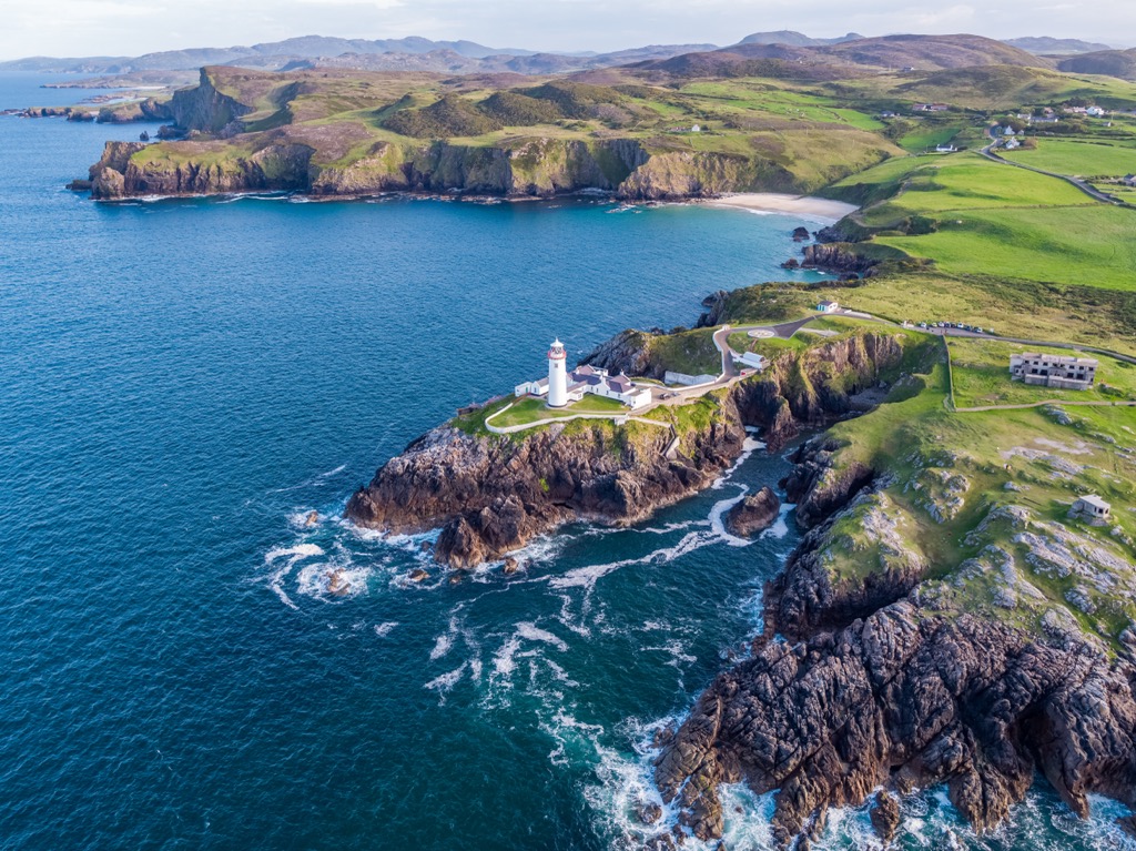
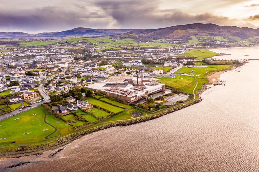
Home to the longest coastline of any Irish county, Donegal's coastline is punctuated with deep sea loughs. A sea lough—or “loch”— is a tidal inlet that can range from a small inlet to a large body of water. Its two largest loughs lie along its northern coastline: Lough Swilly, between the Inishowen Peninsula and the Fanad Peninsula, and Lough Foyle, between County Donegal and County Derry.
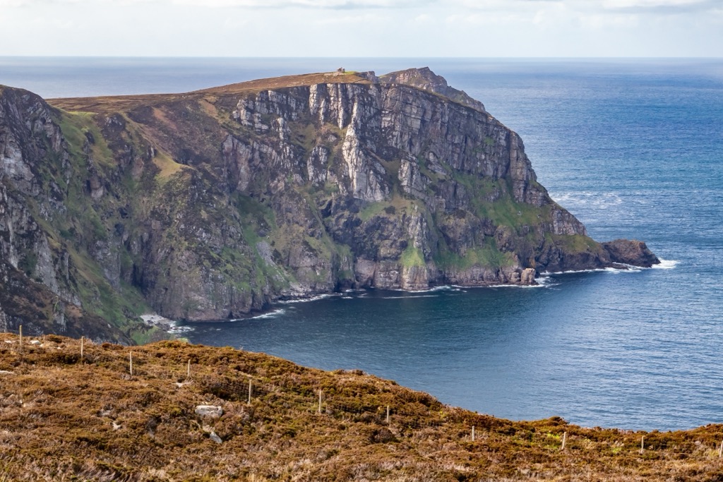
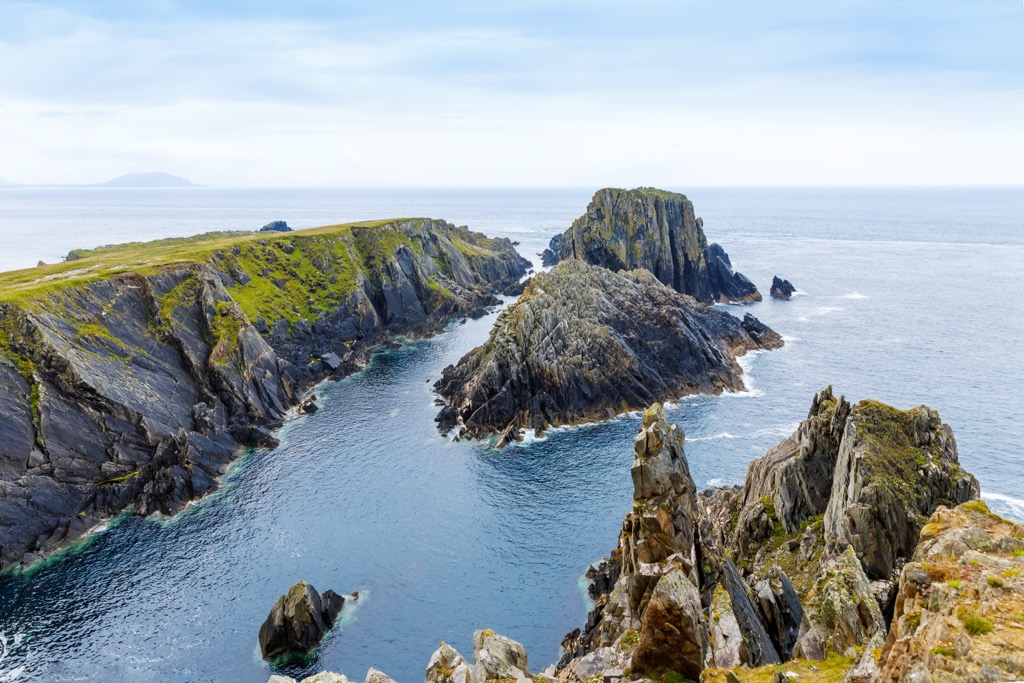
The Slieve League (Sliabh Liag) (601 m / 1,972 ft) cliffs on the southwestern tip of Donegal are among the highest sea cliffs in Europe. They measure 601 m (1,972 ft) high—three times higher than the famed Cliffs of Moher. Rising steadily to the coastline before plunging dramatically into the turbulent Atlantic below, the Slieve League cliffs are one of the most popular viewpoints in Ulster.
Lough Derg is the largest inland lough in County Donegal, with a surface area of 8.8 sq km (3.4 sq mi). It's a popular destination for anglers and is stocked with perch, pike, and brown trout.
While Lifford is Donegal's county town, it isn't the largest settlement. Letterkenny is by far the largest town in the county, with a population of over 22,000 people. Other notable settlements include Buncrana, Ballybofey, and Donegal Town.
County Donegal is one of the oldest geological regions of Ireland and is also the most seismically active. Some parts of the county are comprised of Precambrian granites dating back over 500 million years. Inishtrahull, an island roughly 10 km (6 mi) off Malin Head, is home to the oldest rocks in Ireland: granite gneiss dating back 1.78 billion years.
The main geological units of Donegal are an outcrop of Devonian granite that stretches from Ardara north for 75 km (46 mi) to the tip of the Fanad Peninsula. The southern parts of Donegal are mostly Lower Carboniferous sandstones and limestones.
Quartzo-feldspathic rocks cover most of the rest of the county. They're part of the Dalradian Supergroup, the same rock strata as the Grampian Highlands in Scotland.
County Donegal lies atop the Leenan Fault running between Lough Swilly and Donegal Bay. Numerous tremors have been recorded in the county over the past two hundred years, but none have exceeded magnitude three on the Richter Scale.
Donegal is Ireland's most ecologically diverse county. Over half of the country's plant and animal species can be found in its wild corners.
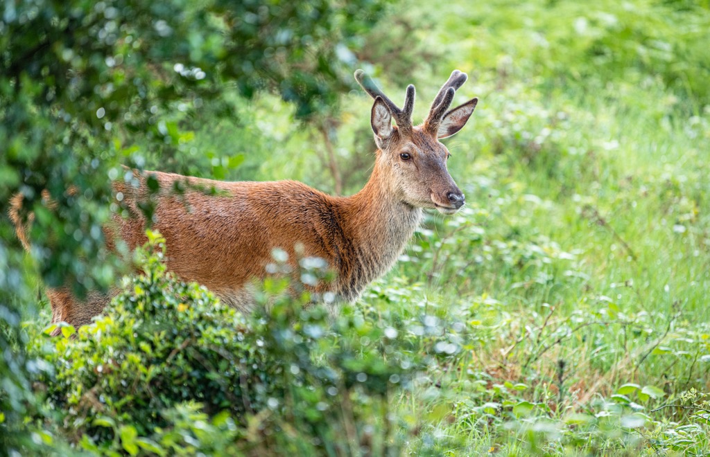
Red deer are the largest mammals in Ireland, weighing as much as 240 kg (529 lbs). Herds of red deer thrive within Glenveagh. A wide variety of bat species inhabit Donegal, including pipistrelle bats, Natterer's bats, whiskered bats, and long-eared bats.
Other notable mammal species in County Donegal include Irish hares, badgers, European hedgehogs, red squirrels, stoats, pine martens, otters, red foxes, and pygmy shrews. Numerous marine mammals inhabit Donegal's coastline, including grey seals, harbor seals, orcas, and humpback whales.
Golden eagles, Ireland's second-largest bird species, have been successfully reintroduced to Donegal, and it's now the only area of the country with a breeding population. With a wingspan of up to 2.3 m (7.5 ft), golden eagles are twice the size of common buzzards.
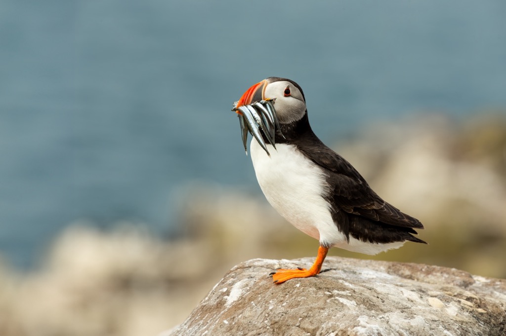
Other bird species in Donegal include Ireland's national bird, northern lapwings, Atlantic puffins, goldfinches, corn crakes, and barnacle geese.
Donegal is home to Ireland's only terrestrial reptile species, the viviparous lizard. Two of Ireland's three amphibian species, the common frog and smooth newt, inhabit Donegal.
Roughly 11.4% of County Donegal is forested, with the most heavily forested area confined to the southeast around Lough Derg and along the border with County Fermanagh. Coastal and mountainous regions are mostly devoid of woodlands.
Common tree species in County Donegal include Scots pine, birch, hazel, sessile oaks, rowan, European larch, aspen poplar, and horse-chestnut.
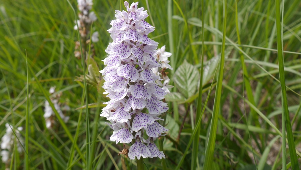
The flora of western County Donegal is similar to that of the Hebrides in Scotland. Numerous orchid species grow here, including spotted, early purple, and bird's-nest orchids. Several hardy species, such as crowberries and junipers, grow along the southern coastlines between the beaches and coves.
Other notable wild plants and flowers in County Donegal include ferns, honeysuckle, harebell, bog cotton, Irish spurge, mountain sorrel, purple saxifrage, and dwarf willow.
Humans have inhabited County Donegal for approximately 10,000 years since the thawing of the area after the last glacial period. Early flint tools, known as microliths, have been discovered across the county and are believed to date back to the Early Mesolithic Age.
The Clann Ó Domhnaill (O'Donnell dynasty), a branch of the Clann Dálaigh, ruled Donegal from the 13th century to the 17th century. Other notable and powerful clans from County Donegal include the Ó Dochartaigh (O'Doherty) and the Ó Gallchobhair (O'Gallagher).
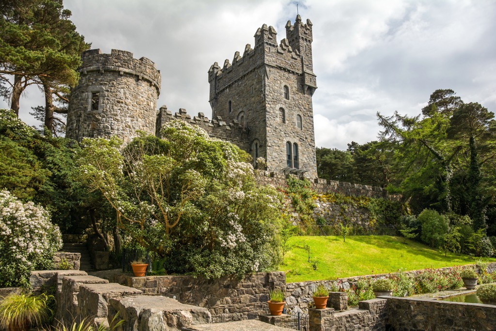
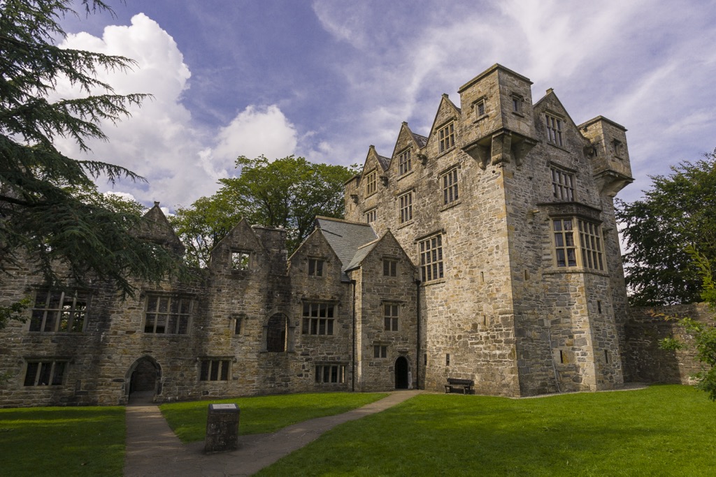
For several centuries, one of Ulster's most powerful and wealthy clans, Clann Ó Domhnaill, ruled over Tír Chonaill (Tyrconnell), a Gaelic kingdom that now encompasses most of Donegal. Donegal Castle, near Donegal Town, was the clan's stronghold until the mid-15th century.
Donegal was one of the counties worst affected by the Great Famine. Large parts of the population emigrated via Foyle Port. Between 1846 and 1851, an estimated 40,000 people died or emigrated.
Donegal played a significant role in the Irish Civil War; its border position made it a strategic area for anti-Treaty forces to stash munitions and hide. It was also severely affected by the partition of Ireland, which cut off Donegal from Derry and left it isolated from the rest of the Republic of Ireland.
Due to their low elevation, it's unclear when the first ascents of County Donegal's mountains occurred. However, the mountains have likely been used as strategically valuable positions throughout centuries of conflict.
Slieve Snaght (615 m / 2,018 ft), located on the Inishowen Peninsula, was significant in the Ordnance Survey's Principal Triangulation of Great Britain and Ireland. In 1827, Captain Thomas Drummond and his team of surveyors camped atop Slieve Snaght during foul weather.
While atop Slieve Snaght, Drummond used limelight to signal to the director of the Ordnance Survey, Thomas Colby, positioned 108 km (67 mi) away on Divis (478 m / 1,568 ft). It was the first time limelight was used in surveying. Limelight, which is the process of burning calcium oxide, or “quicklime,” is more famous for its use in 19th-century theatre productions. Though it hasn’t been used since the invention of the electric lightbulb, we still regularly use the expression “in the limelight” when somebody or something is receiving a lot of attention.
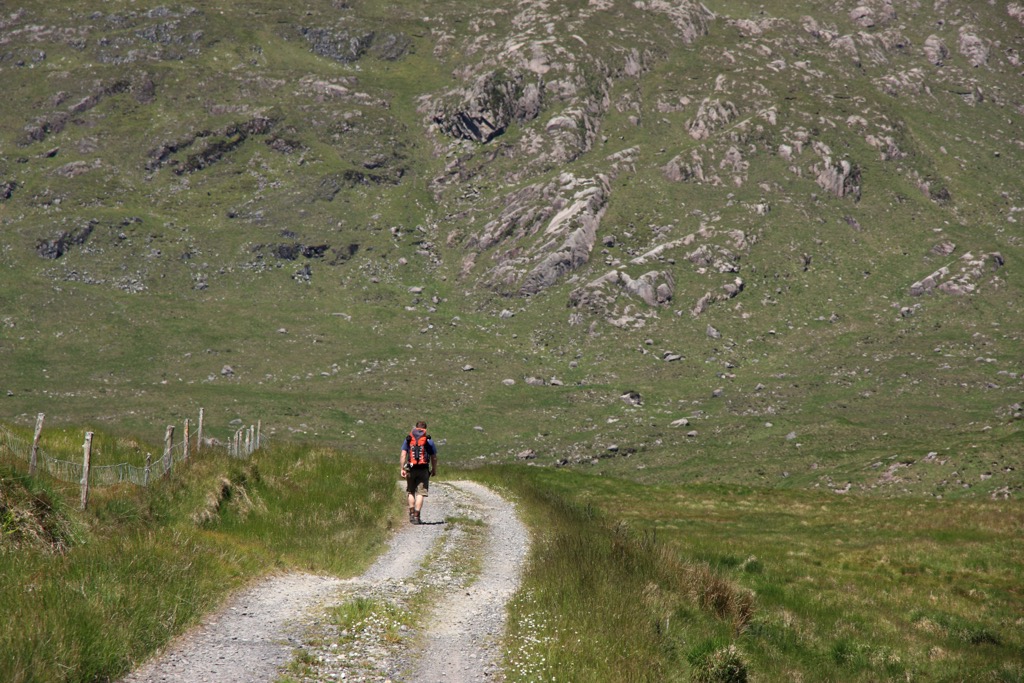
One of the wildest parts of Ireland and home to some of its finest untouched natural beauty, County Donegal offers countless hiking opportunities off the beaten path.
While Dongeal's mountains are modest in height, they can still be potentially dangerous if you're under-prepared. Weather in Donegal is changeable, so pay close attention to weather forecasts. Wear appropriate clothing, bring plenty of provisions, map your route carefully, and inform others of your itinerary.
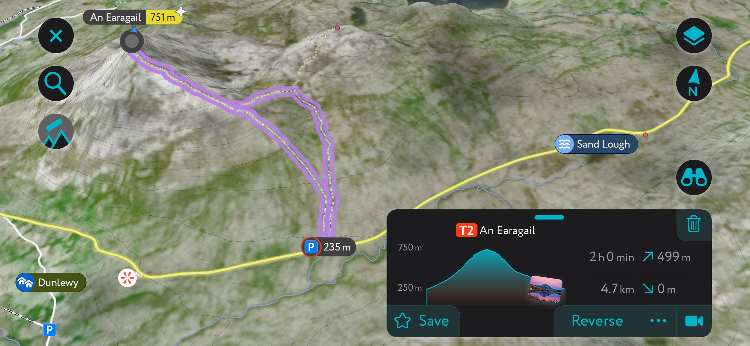
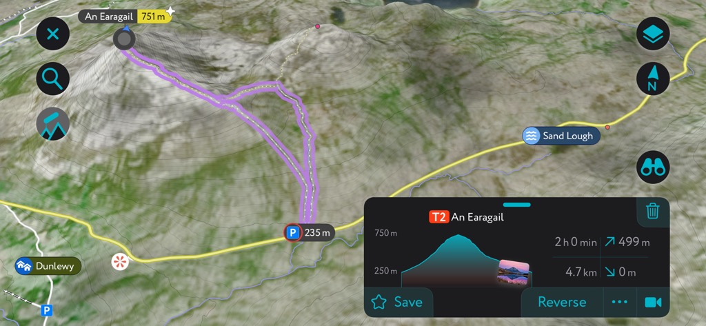
The southwesternmost of the Seven Sisters, Errigal (An Earagail), is the highest summit in County Donegal. This stunning quartzite mountain glows pink at sunset and reflects off Dunlewey Lough below. Its beauty makes it one of the most photographed mountains in Ireland.
Recent infrastructure improvements have made Errigal an even more enjoyable climb. Due to new pathways, boggy areas at the bottom of the mountain are now easily traversed. From Errigal's summit, you'll be treated to views as far as Benbulbin (1,726 ft) in County Sligo, Slieve Snaght at the heart of the Inishowen Peninsula, and the Aran Islands off County Galway.
Errigal is near Gweedore within Glenveagh National Park. The best route up Errigal is on the path from the Errigal Mountain Hike Parking Base along the R251 road. The Errigal hike is steep and relatively strenuous but offers no significant hurdles in good weather.
Follow the path through boglands for roughly 1.4 km (0.8 mi) to reach the foot of Errigal. Climb the steps up the mountain—these steps can be slippery, so watch your footing.
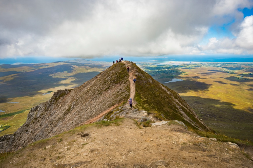
From Errigal's summit, you can follow the 40 m (131 ft) long One Man's Pass to Errigal's second summit. Descend the way you came. This hike of Errigal is approximately 4.5 km (2.8 mi) long.
Slieve League (601 m / 1,972ft), or Sliabh Liag, is a mountain and group of cliffs overlooking Donegal Bay on Donegal's southwestern coastline. Standing at roughly 598 m (1,962 ft) high, they're Ireland's second-highest cliffs after Croaghaun (688 m / 2,257 ft) on Achill Island in County Mayo.
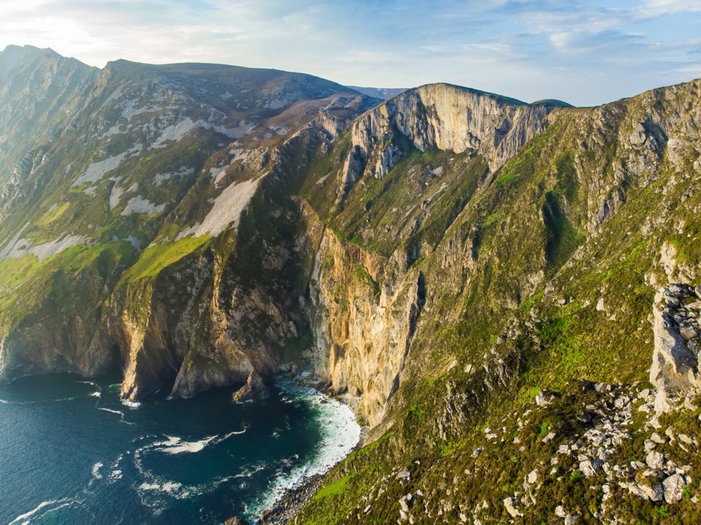
One of the highest accessible sea cliffs in Europe, Slieve League provides excellent views across Donegal Bay to County Sligo and Benbulbin. One of the best spots to see the cliffs is from the Bunglass Viewpoint near Teelin village. The Slieve League Car Park just outside Teelin marks the start of the Pilgrim's Path, Slieve League's most popular trail.
The Pilgrim's Path is steep, narrow, and rocky. Sure-footedness and a head for heights are needed, as the clifftops have little to no clifftop barriers. The walk from Teelin to the Bunglass Viewpoint is roughly 3 km (1.8 mi) long.
You can also continue up stone stairs before leaving the Pilgrim's Path to reach Slieve League's highest point. Here, consider taking the One Man's Pass, a 400 m (1,312 ft) long clifftop walk along a sharp, rugged ridge if you want to get your blood pumping.
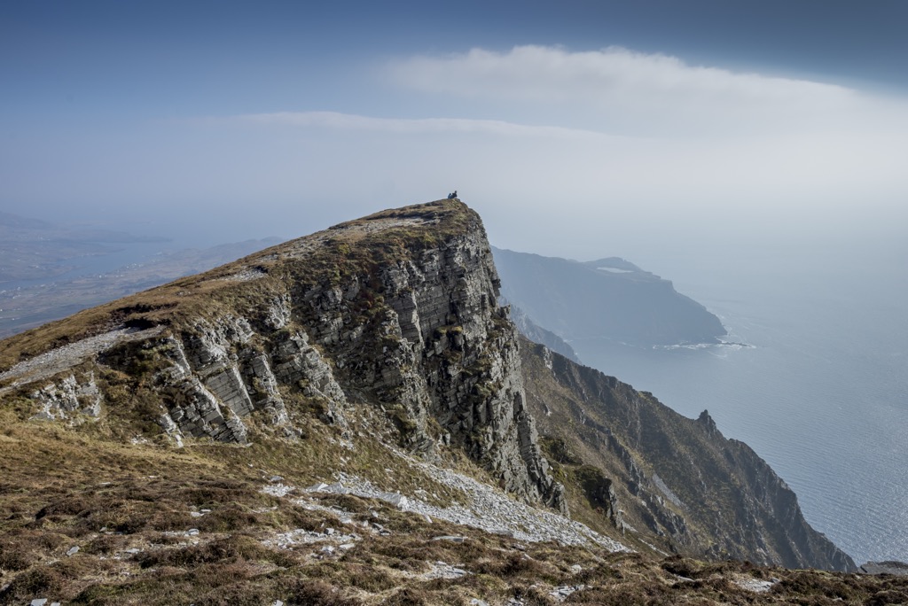
You'll find the One Man's Path near Cnoc Ramhar (435 m / 1,427ft). Alternatively, there's a less challenging, longer path to the right of the One Man's Pass, leading to Slieve League's top.
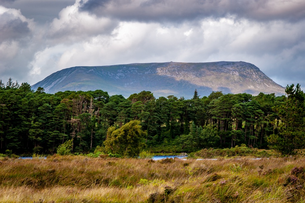
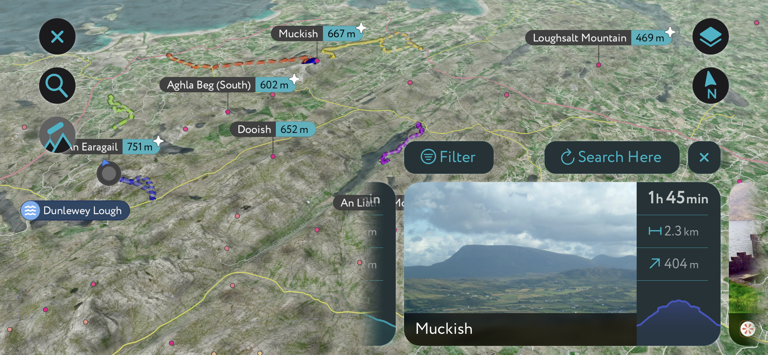
The second-highest of the Seven Sisters, Muckish (667 m / 2,189 ft), is the opposite of its tallest sister, Errigal. It's a flat-topped mountain with a long plateau at the chain's far northeastern end. Its distinctive shape earned it the unusual name Muckish, meaning "the pig's back."
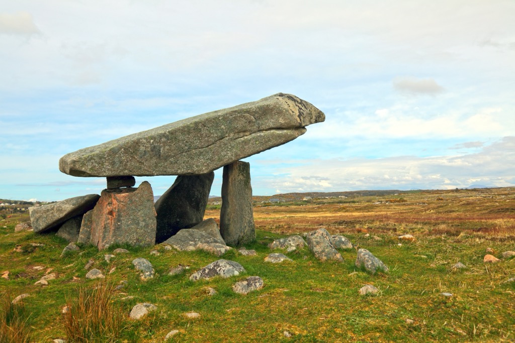
Atop Muckish's plateau, a large cairn marking a Bronze Age court tomb is visible from sea level. On a clear day, Muckish affords spectacular views of the Seven Sisters and Glenveagh National Park.
Two popular routes ascend Muckish: the Miner's Path from the north and the Muckish Gap route from the southwest. The Muckish Gap route is the easiest of the two main routes. However, the trail is ill-defined and muddy, so bring waterproof hiking boots. Despite its modest height, Muckish can be dangerous, especially in low visibility.
From the Muckish Trailhead near the Bridge of Tears, walk north uphill to the saddle between Muckish and Crocknalaragagh (Na Leargacha) (471 m / 1,542 ft). From here, the route becomes less steep as you reach Muckish's flat top. A cross marks Muckish's summit.
Return the way you came, being careful of steep terrain. The walk from the Muckish trailhead to Muckish is roughly 6 km (3.7 mi) round-trip.
The Bluestack Mountains are often overlooked in favor of the Derryveagh Mountains and Donegal's coastline, but they offer some hidden gems for hikers. One of the most challenging mountain hikes in the Bluestack Mountains is the ascent of Croaghgorm (674 m / 2,211 ft).

Croaghgorm, which means "the blue stack" in Irish, is a stroll off the beaten path—there's no marked trail on this mountain, apart from a few sheep tracks. So, it's essential to map out your route carefully.
One of the best places to start your ascent of Croaghgorm is from the small parking area northeast of Letterbarra near Meenaguise More. You can map out a route from here that leads onto Croaghgorm's ridge, avoiding the steepest area of the range.
The route leads via Croaghgorm Far South West Top (567 m / 1,860 ft) to reach its true summit. This Croaghgorm hike is approximately 10 km (6.2 mi) round-trip.
Consider a hike to Malin Head if you're searching for an idyllic, easy-going coastal walk in County Donegal. Malin Head is famous for being mainland Ireland's most northerly point, boasting beautiful beaches and rugged coastal scenery, including rock stacks and islets.
From Malin Head, you can see Inishtrahull, Ireland's most northerly island, located 10 km (6 mi) off the Inishowen Peninsula. The walk along is short and family-friendly. In autumn, this route is excellent for bird watching, with skuas, auks, and shearwaters undertaking their seasonal southern migration.
From Malin Head Car Park, you'll walk west from Malin Head along the shoreside path to Hell's Hole (Pólifreann), a narrow coastal cavern where you can experience the true force of the North Atlantic. Return the way you came. This Malin Head hike is roughly a 2.5 km (1.5 mi) round-trip.
The Bluestack Way is one of the best long-distance hikes in County Donegal, meandering for over 64 km (39.7 mi) from Donegal Town through the Bluestack Mountains to Ardara. Yellow arrows and "walking man" signs mark the entirety of the Bluestack Way. It forms part of the International Appalachian Trail, which stretches from Maine to Morocco.
Highlights of the Bluestack Way include the serene Lough Eske, the medieval Disert graveyard, and the moorlands on Cloghmeen Hill (429 m / 1,407 ft). From atop Cloghmeen Hill, it's possible to see seven counties on a clear day.
Hikers usually complete the Bluestack Way in three days. You'll find several hotels and accommodation options along the route, including Harvey's Point Hotel on Lough Eske, The Bluestack Centre Hostel, and Marguerite's B&B in Glenties.
The Bluestack Way is usually completed over three stages:
You can learn more about the Bluestack Way on the Sport Ireland Outdoors website.
At PeakVisor, we love information. That’s why we write articles like this one.
Check out the PeakVisor app for even more information on thousands of hikes across the globe. We’ve compiled information on all publicly maintained walking tracks worldwide, formatted into our 3D maps.
PeakVisor started as a peak identification tool—you’ll have noticed the photos throughout this article—but we’ve evolved into purveyors of the finest 3D maps available. We continue to expand our offerings. You can track your hikes directly on the app, upload pictures for other users, and keep a diary of all your outdoor adventures.
Most recently, the PeakVisor App has included up-to-date weather reports, including snow depths, at any destination. We've also been hard at work adding the details of hundreds of mountain huts, including information on overnight accommodation, dining options, and opening hours. You can also use our Hiking Map on your desktop to create .GPX files for routes to follow later on the app.
A blend of quaint villages, Gaeltacht culture, and friendly locals means there's no shortage of charming places to plan your Donegal hiking adventures.
Donegal Airport, a regional airport with flights from Dublin and Glasgow, is located 12 km (7.5 mi) north of Dungloe in northwest County Donegal.
Ireland West Airport (Knock Airport) is the nearest international airport to County Donegal, located 98 km (61 mi) south of Ballyshannon.
Letterkenny is the largest town in County Donegal. With a population of over 22,500, it has over 15,000 more residents than the next largest town, Buncrana.
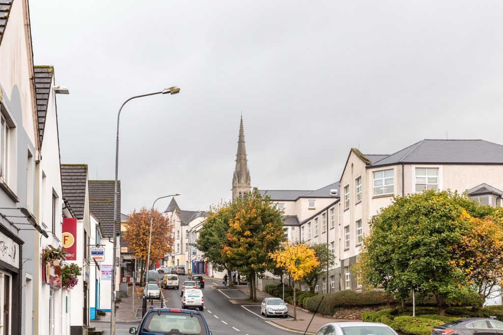
Letterkenny is dubbed the “Cathedral Town” due to its tallest building, St. Eunan's Cathedral, the seat of the Diocese of Raphoe. Its mix of nightlife and late 19th-century architecture make it one of the best towns to visit in the county.
Letterkenny is the perfect base to explore Glenveagh National Park and the Derryveagh Mountains, which are under 25 km (15.5 mi) away. You'll also be a stone's throw from Lough Swilly, one of only three glacial fjords in Ireland.
Buncrana is Donegal's second-largest town and the largest on the Inishowen Peninsula, with a population of roughly 6,900. It's a picturesque town located where the River Crana flows into Lough Swilly.
Buncrana is one of the best places to stay if you want to explore the Inishowen Peninsula. Popular hiking areas like Slieve Snaght and Malin Head are less than 40 km (25 mi) away. Lisfannon Beach, a Blue Flag beach, is located just south of the town.
Donegal Town is the county's namesake and one of the most historically significant settlements. It was the historical capital of the Gaelic kingdom of Tyrconnell, once ruled by the O'Donnell dynasty. Donegal Town has a population of over 2,700.
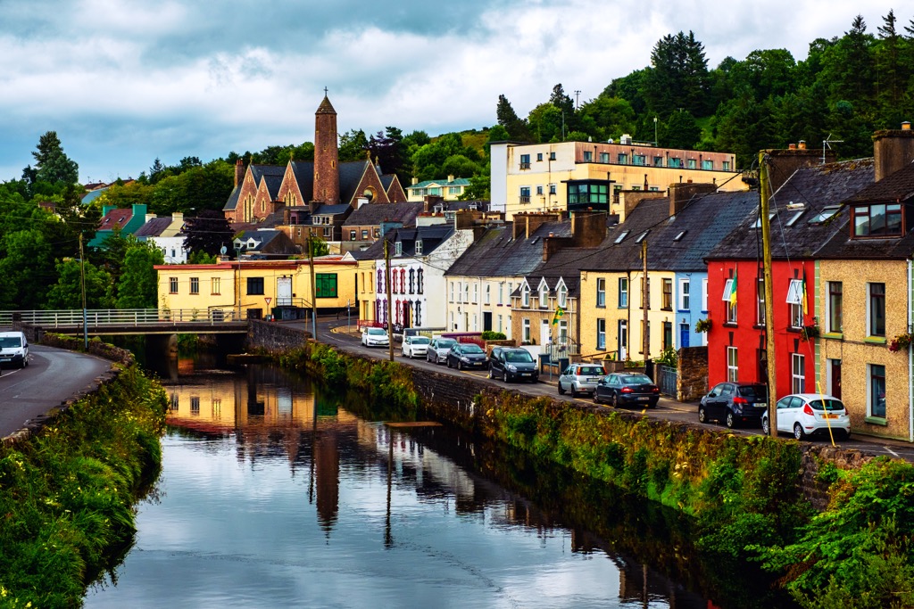
Donegal Town provides easy access to many of the best hikes in the county's south. The Bluestack Mountains are less than 12 km (7.5 mi) to the north. The town is also the starting point of the Bluestack Way, which ends in Ardara, one of County Donegal's most beautiful towns.


