
Scan the QR code and open PeakVisor on your phone
Hiking in Northern Ireland is an unforgettable experience, thanks to the country's varied landscape. From tranquil forests to craggy islands to sublime mountains, you won't be short of walking opportunities. Northern Ireland is home to two notable mountain ranges—the Sperrin Mountains and the Mourne Mountains—as well as several standalone mountains.
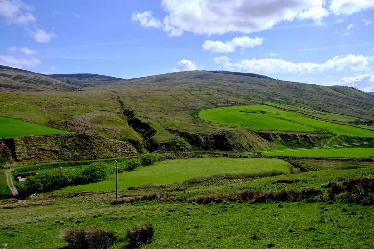
The Sperrin Mountains is the largest upland region in Northern Ireland. The range stretches for roughly 40 miles along the border of County Tyrone and County Derry. A glacial mountain range, the Sperrins' dramatic valleys and peaks were carved during the last Ice Age. It contains 17 named peaks, 10 of which are over 500 m high. The highest mountain in the Sperrins is Sawel Mountain (678 m). Other significant summits include Mullaghclogha (635 m), Mullaghaneany (629 m), and Meenard (628 m). With a mixture of beautiful heathlands, charming valleys, and historic sights, Sperrins is one of Northern Ireland's top hiking destinations.
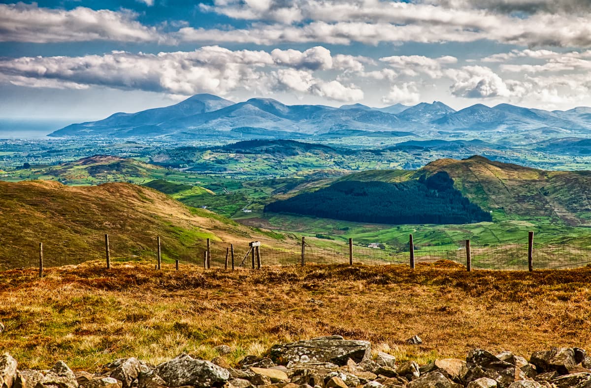
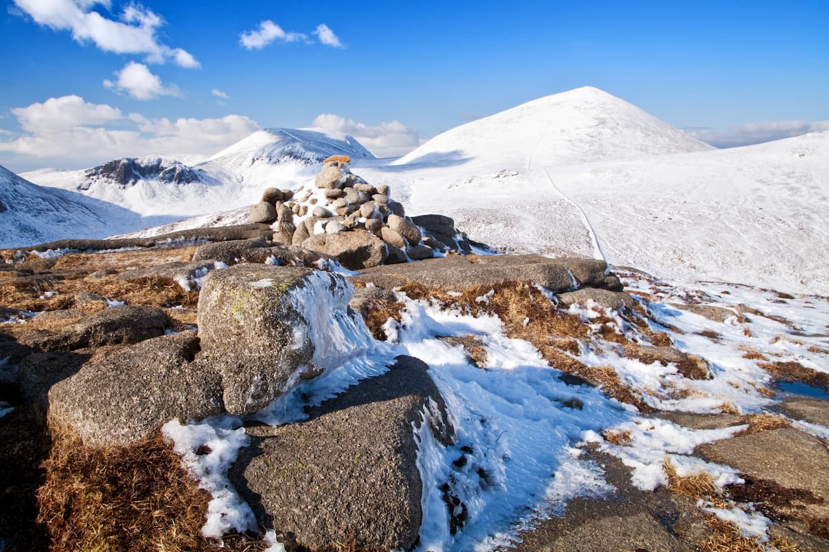
The Mourne Mountains are hugely popular with hikers and feature many of the tallest peaks in Northern Ireland. The Mourne Mountains are situated in the southeastern county of County Down, roughly 30 miles south of Belfast. The range is generally split into the High Mournes to the east and the Low Mournes to the west. You'll find this stark, granite range contains over 30 named peaks which exceed 500 m. One prime example is Slieve Donard (848 m), the tallest mountain in Northern Ireland and the province of Ulster. As well as Slieve Donard, the Mourne Mountains are home to several of the other highest mountains in the country, such as Slieve Commedagh (765 m), Slieve Binnian (736 m), and Slieve Bearnagh (725 m).
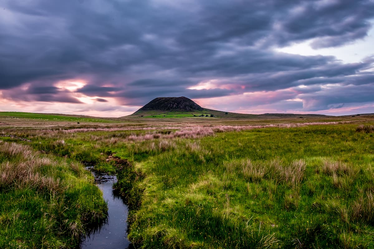
In the northeastern corner of Northern Ireland in County Antrim, you'll find several noteworthy standalone mountains. Slemish (437 m) is popular with travelers due to its association with Saint Patrick and its stunning volcanic rock formation. Another popular climb is Trostan (550 m), the highest point in County Antrim, which offers sublime panoramas of the surrounding hillsides and boglands.
Hikers looking to escape Belfast for the day are in luck thanks to the Belfast Hills surrounding the Northern Irish capital. The Belfast Hills boasts several prominent summits, including Divis (477m), Black Mountain (389 m), and Cavehill (368 m). Each hill provides a rewarding hike with stunning views of Belfast's cityscape.
While Northern Ireland doesn't contain any national parks, there are several forest parks and coastal trails ideal for getting lost in nature. Rathlin Island, the only inhabited island of the coast of Northern Ireland, is known for its craggy coastline and is perfect for birdwatchers looking to catch glimpses of rare species, including puffins, razorbills, fulmars, and more. Another popular hiking destination is Lough Neagh. The largest freshwater lake in Northern Ireland, Lough Neagh is encircled by several parks, including Parkanaur Forest Park and Drum Manor Forest Park.
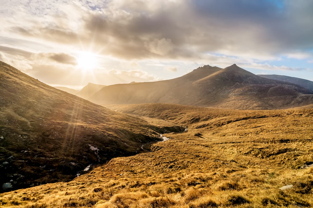
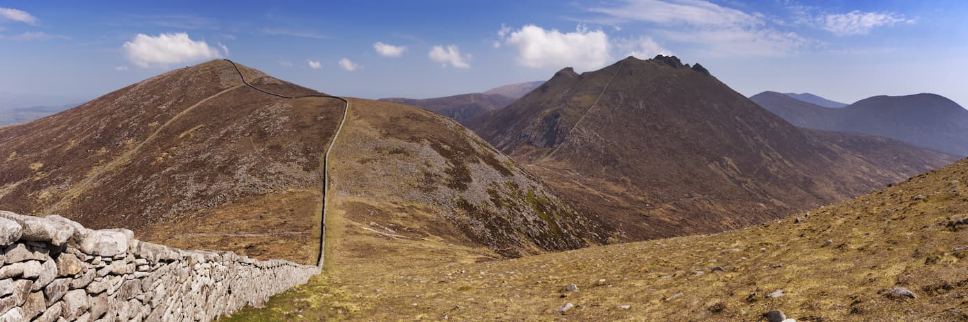
Hikers looking for one of Northern Ireland's most challenging treks will want to tackle 3 of the 4 highest summits in the Mourne Mountains at once—Slieve Donard (848 m), Slieve Commedagh (765 m), and Slieve Bearnagh (725 m). This hike is around 11 miles in length and is only suitable for experienced hikers. It will take you on a looped walk up Slieve Bearnagh, then Donard, and finally Commedagh.
To start this hike, head to the Trassey Car Park near Meelmore Lodge. Head left and follow the Trassey Track up into the mountains. After passing through three gates, you'll see the famous Hare's Gap up ahead. Continue to follow the path and take a right before the steep ascent to a quarry. This path will take you onto the saddle between Slieve Meelmore (682 m) and Slieve Bearnagh. On the saddle's col, you'll encounter the historic Mourne Wall. Follow the wall up to the summit of Slieve Bearnagh. Scrambling can be necessary during this steep and rugged part of the trek.
After traversing Slieve Bearnagh North Tor (698 m), take the sheer pathway down towards Hare's Gap. From the Hare's Gap, head up the col between Slieve Beg (593 m) and Slieve Commedagh and follow the old Brandy Pad smuggler's road. After passing under the southern peaks of Commedagh, trek to the saddle between Slieve Commedagh and Slieve Donard. From here, begin your ascent up Slieve Donard. Once you reach the top of Slieve Donard, head down the way you came and tackle Slieve Commedagh, following the Mourne Wall.
To descend from the mountain, continue to follow the Mourne Wall to Slievenaglogh (583 m) before traveling back to the Hare's Gap and onto the Trassey Track.
While still challenging, hiking Slieve Meelmore and Slieve Meelbeg (701 m) is less arduous than the likes of Slieve Donard. The hike up two of Mourne Mountains' lesser peaks is still steep, but much shorter at 6 miles. You can start your ascent up to Meelbeg from the Ott Car Park. Follow the beaten path onto the saddle between Slieve Loughshannagh (616 m) and Carn Mountain (585 m). At the saddle's col, Follow the Mourne Wall to your left all the way to the top of Loughshannagh, Meelmore, and then Meelbeg.
To descend, head about halfway down Meelbeg back to an intersection in the Mourne Wall, following the right hand side down into a valley. You'll want to head west towards the Fofanny Dam Reservoir, which will lead you to Slievenaman Road. Turn left on the road to reach the Ott Car Park.
Sawel Mountain is the highest of the Sperrins and is the county top of both County Derry and County Tyrone. Despite being 678 m tall, Sawel has a gentle gradient and is a fairly straightforward climb. Most problems climbing Sawel Mountain occur due to bad weather and boggy conditions. Regardless, make sure you come well prepared with the correct equipment. This hike is around 10 miles and should take about 5 or 6 hours.
You can start this trek by parking along the Glenelly or Sperrin Road and walking a mile to a forested area past the Glenelly River. Approaching from the south, you'll find a path that runs along a wire fence, which can act as a guide to the top of the mountain. Once you reach the top of the ridge, ascend to the west to reach Sawel Mountain's summit.
To descend the mountain, head southwest along the fence onto the western side of Dart Mountain (621 m). From here, you should see a bog road, which will take you back to Glenelly Road.
While there are several marked trails in the Sperrins, one of the best hiking routes is the off-road Robber's Table hill walk. This area of the Sperrins is known as Robber's Table as 17th-century highwaymen would come to the hills to share and trade loot stolen from caravans traversing the uplands. This walk is around 7 miles long and takes 3 or 4 hours. While hilly and potentially boggy in places, hikers who exercise regularly should have no trouble completing this journey.
Start this walk by parking at Gortin Glen Forest Park and heading west onto Lisnaharney Road. After five junctions, you should see a signpost for the Lisnaharney Public Right of Way on the right. Head along this trail, which will lead you over a hill. Descend the hill and turn left, before turning left again onto the Eskeradooey Public Right of Way. You'll scale another hill before coming back onto the Lisnaharney Road. Turn left on the road to head back to Gortin Glen Forest Park Car Park.
Cavehill, also known as Cave Hill, is one of the most popular hiking locations near Belfast, due to the stunning scenery the summit provides. The Cave Hill County Park is located just 5 miles north of Belfast, adjacent to Belfast Castle. Several hiking trails lead to the top of Cavehill, but the most challenging climb is the Cave Hill Trail. This hike is around 4 miles and takes roughly 2 hours.
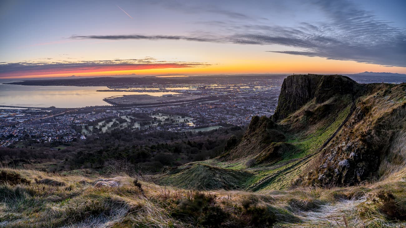
The trail system up Cavehill is color-coded, and the Cave Hill Trail has green markers. You can pick up this trail from several locations, including Belfast Castle Car Park, Upper Hightown Road, Upper Cavehill Road, and Belfast Zoo. You'll find this trail initially leads through a wooded area, before bearing to the left up a hill past the Devil's Punchbowl. After climbing sets of stairs, keep left to reach McArt's Fort at the hill's summit. From atop Cavehill, you'll have stunning views of Belfast, Divis, and Black Mountain.
You'll descend from Cavehill down the southern slopes, joining onto the main hiking trails. Turn left at the crossroads, passing through the top of Carr's Glen, before walking back onto the Upper Cavehill Road. The Belfast Hills are great for hiking, with Black Mountain and Divis also providing excellent hiking opportunities.
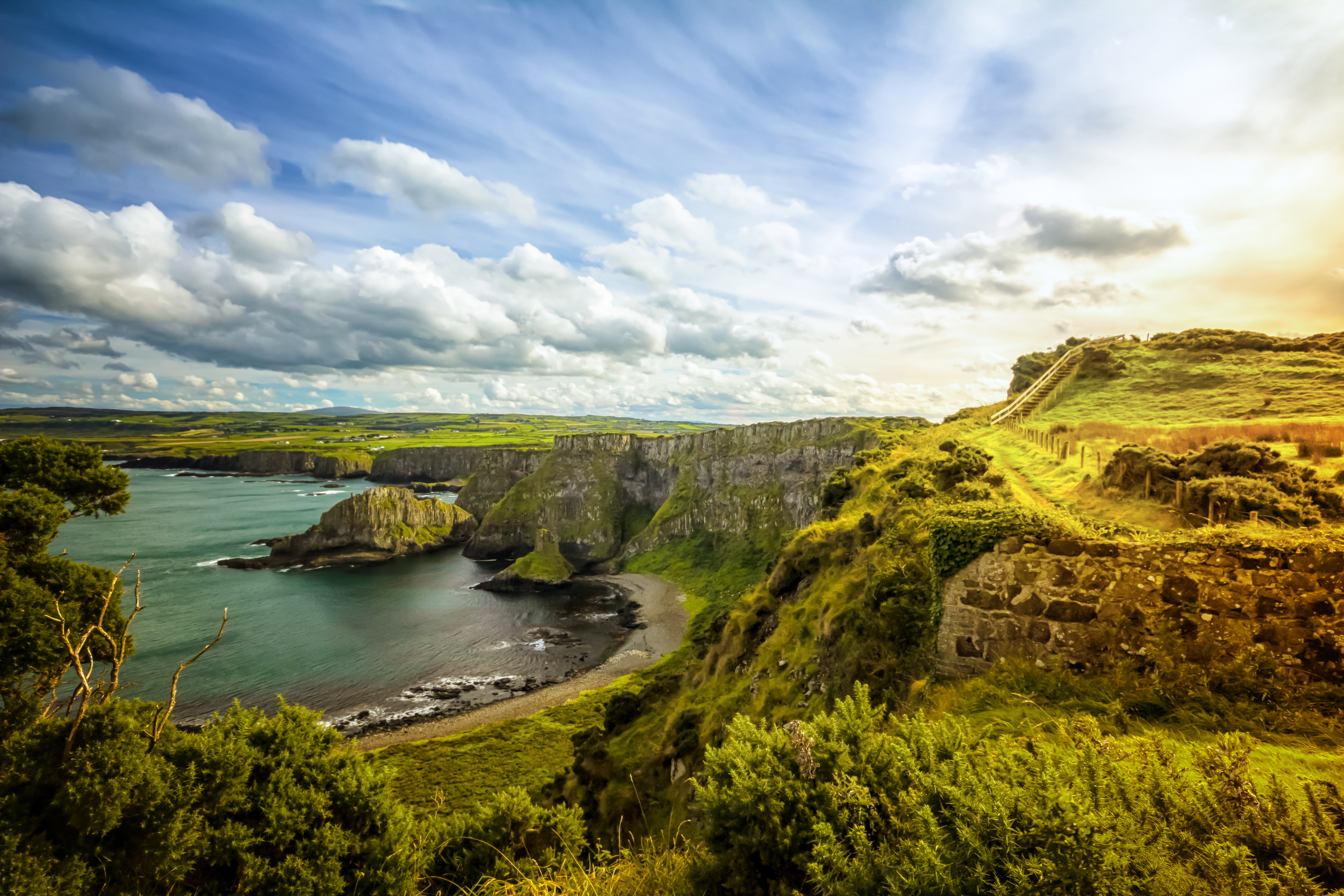
The Giant's Causeway is one of Ireland's best known natural landmarks. Located on the coast of County Antrim, tourists flock from across the world to see these 40,000 interwoven basal salt pillars. One of the best ways to experience the Giant's Causeway is taking the Causeway Coastal Walk. This walking route is around 8 and a half miles and takes approximately 4 hours.
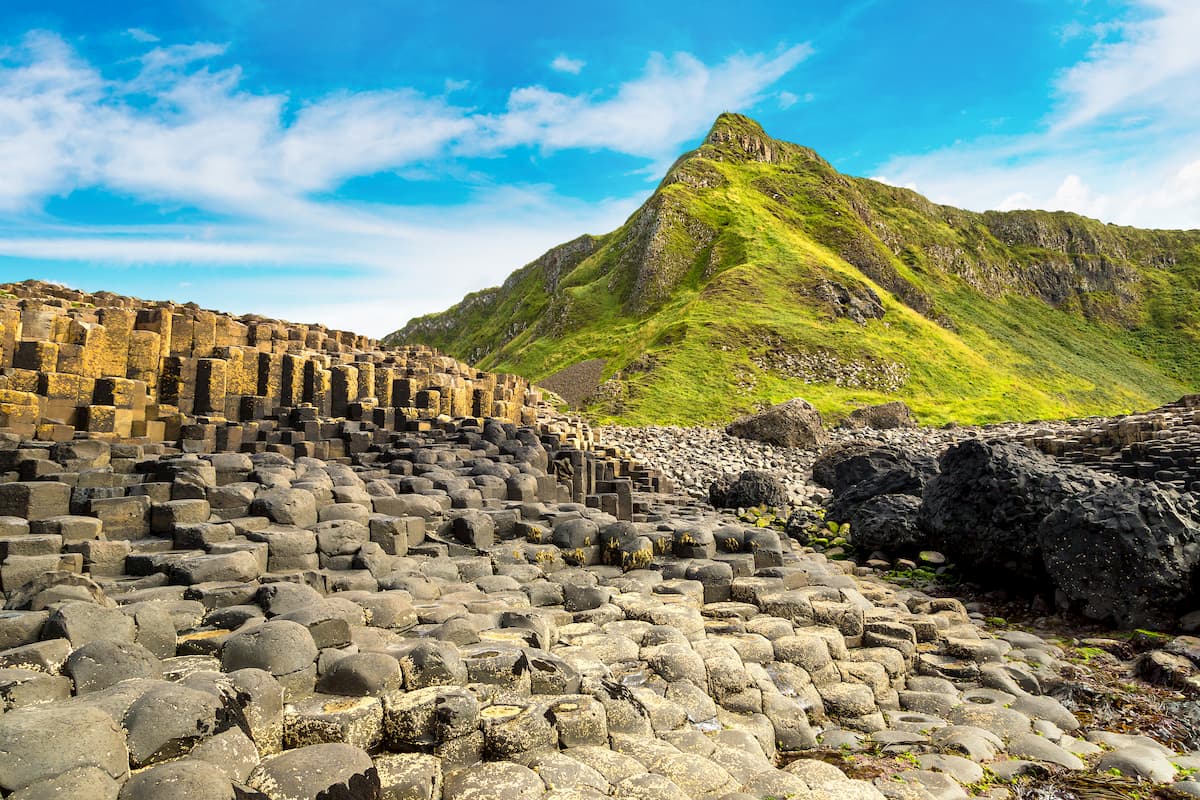
You'll start this hike from the Carrick-a-Rede Car Park before heading across the magnificent Carrick-a-Rede Rope Bridge, which connects the tiny Carrick-a-Rede island to the mainland. The trail is signposted and follows the coastline west from Carrick-a-Rede. When you descend onto White Park Bay, ensure you travel three hours either side of low tide. If you travel during high tide, you'll need to walk up to the coastal road. Both routes will take you to the historic salmon fishing village of Portbradden.
Continuing along the winding trail, you'll hike through a scenic limestone arch. The next section of the walk near the Portmoon Salmon Fishery features several stark cliffs that offer panoramic views of the ocean. During the final stretch of your journey, you'll pass by the Bays of Port na Tober and Port na Spaniagh before descending the Shepherd's Steps onto the Giant's Causeway. While this hike is a one-way trip, you can get a bus from the visitor's center to Carrick-a-Rede Car Park.
Cuilcagh (665 m) sits on the border between Northern Ireland and the Republic of Ireland. As well as being the county top of both Cavan and Fermanagh, Cuilcagh has a prominence of 599 m, making it the second most prominent mountain in Northern Ireland. The Cuilcagh Way is one of the region's most popular hiking destinations and consists of several different trails totaling over 20 miles. Those looking to climb to the top of Cuilcagh should plan a trip along the Cuilcagh Mountain Loop Walk. This hike is around 12 miles and takes roughly 6 hours.
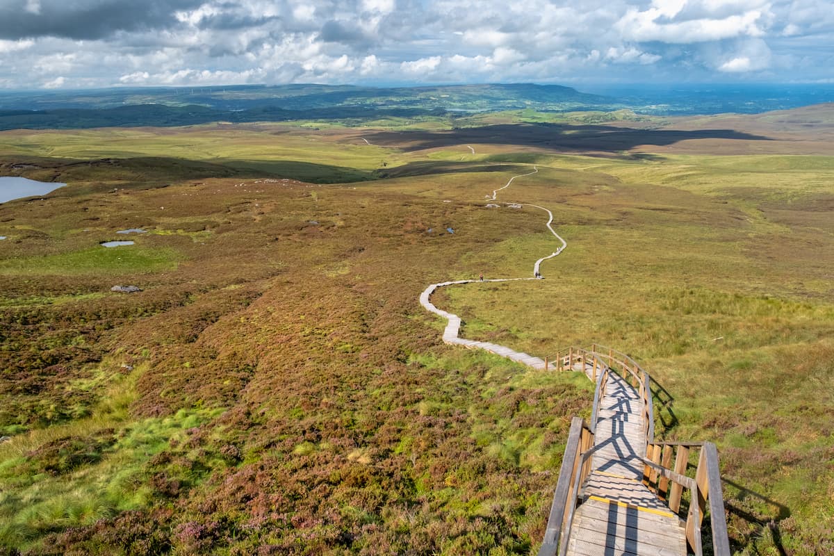
The Cuilcagh Way is famed for its extensive boardwalk trails that snake across the region's vast bogs. These boardwalk trails lead up Cuilcagh, with 450 steps to the mountain's summit. Despite these boardwalks making the route easy to follow, this hike is strenuous and shouldn't be undertaken by inexperienced hikers. You can start this hike by heading south from the Marble Arch Caves Visitor Centre Car Park along the Legnabrocky Trail.
The Legnabrocky Trail is around 8 miles and constitutes most of the hike. From atop Cuilcagh, you'll have gorgeous views of surrounding counties and Lough Atona. To descend, follow the yellow marked Ulster Way down Cuilcagh's steep cliffs. You'll follow the Ulster Way across the blanket bogs to Florence Court Forest and the visitor's center.
Slemish is the perfect mountain for intermediate hikers looking to discover some local history. Slemish has a strong association with Saint Patrick, who spent 6 years tending livestock on the mountain while enslaved by a local chieftain. The climb up Slemish is relatively short but strenuous. Hiking Slemish is a 2-mile round trip that takes about an hour.
Pick up the trail at Slemish Car Park near the village of Broughshane. Here you'll find a grassy, beaten path that leads to the base of the mountain. You can choose your own route up Slemish with no set trail over the rugged terrain. As mentioned, the climb is brief but challenging; however, scrambling isn't generally required. The easiest way to descend the Slemish is via the mountain's southern face.
Belfast is Northern Ireland's capital city and one of the best places to visit in the country. Belfast is the second-largest city on the island of Ireland and boasts tons of intriguing cultural sights, such as the Titanic Museum, Belfast Castle, and St George's Market. Despite being a major metropolitan city, Belfast is just a short drive from many of Northern Ireland's best hiking areas. The Belfast Hills are just a few miles to the west, and the Sperrins, Mourne Mountains, and Lough Neagh and within an hour and a half of central Belfast.
Belfast is also home to some of the best hotels in Northern Ireland. Popular choices include The Merchant Hotel, The Fitzwilliam Hotel, and The Titanic Hotel. If you're planning to travel to Northern Ireland from abroad, the chances are you'll pass through Belfast International Airport, which provides flights to the UK, Spain, France, and more.
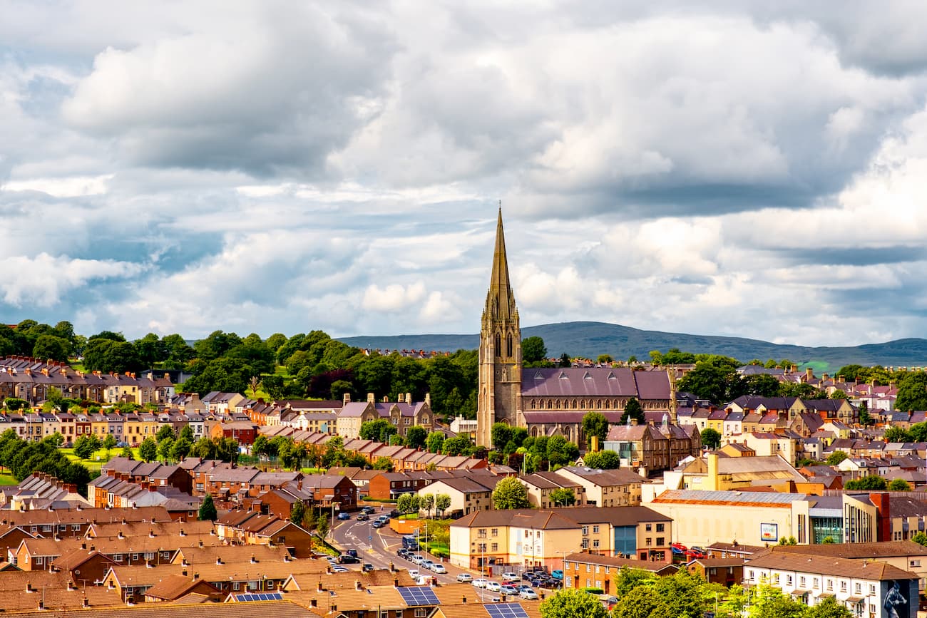
Derry, officially known as Londonderry, is the second-largest city in Northern Ireland. Derry straddles the River Foyle in the northwestern corner of the country, providing access to many of the best hiking spots in the west of the island. Derry is an ancient walled city with plenty of history. While in Derry, ensure you check out St Columb's Cathedral and the Tower Museum.
Derry is one of the best places to stay if you want to explore the Sperrins, which are roughly 20 miles southeast. You could also head across the Irish border to Glenveagh National Park, which is less than an hour away. You'll find a range of great hotels in Derry, from the reasonably priced Premier Inn Derry to the upscale Shipquay Hotel.
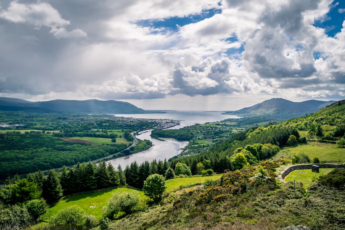
Positioned in the southeast of Northern Ireland along the border between County Armagh and County Down is the city of Newry. A small cathedral city, Newry boasts several superb historic attractions and nearby hiking areas. Newry is one of the best places to stay if you're looking to scale the Mourne Mountains, which are just 15 miles east of the city.
Another excellent hiking area near Newry is the Ring of Gullion, which is about 12 miles southwest. Home to Slieve Gullion (570 m), the Ring of Gullion is known for its family-friendly activities and ancient burial tombs that date back to 3,000 BC. There are dozens of cozy hotels in and around Newry, such as The Flagstaff Lodge, Carrickdale Hotel & Spa, and Mourne Country Hotel.
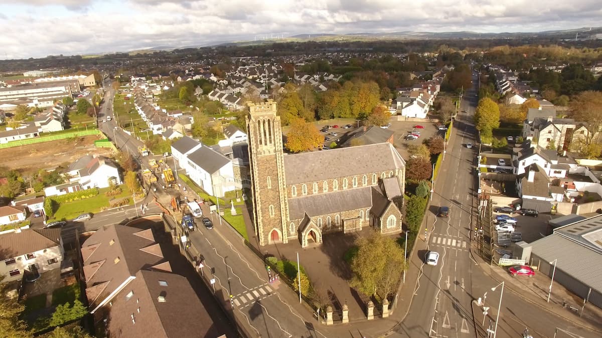
Ballymena is one of the most picturesque towns in Northern Ireland. Evidence shows the area which is now Ballymena has been inhabited since the fifth century. There are several intriguing historic sights here, such as a free market established in the 16th century. Ballymena has strong ties to Saint Patrick due to the vicinity of Slemish, which is just 8 miles away. Located in County Antrim, Ballymena is also an excellent base for those looking to visit the Giant's Causeway, situated 30 miles to the north. If you plan to stay in this quaint town, consider booking a room at The Adair Arms Hotel or The Tullyglass Hotel.
Perched on the River Bann in County Derry, Coleraine is a popular tourist destination. One reason Coleraine has become a hotspot for travelers is its proximity to the Giant's Causeway, which is just 10 miles away. Coleraine is also impeccably managed, having won various Tidy Towns awards in recent history. While staying in Coleraine, book a round of golf at the famed Royal Portrush Golf Course, or hike along the stunning Downhill Strand for picture-perfect sea views. There are a few reasonably priced hotels in Coleraine, including The Bushtown Hotel and The Lodge Hotel.
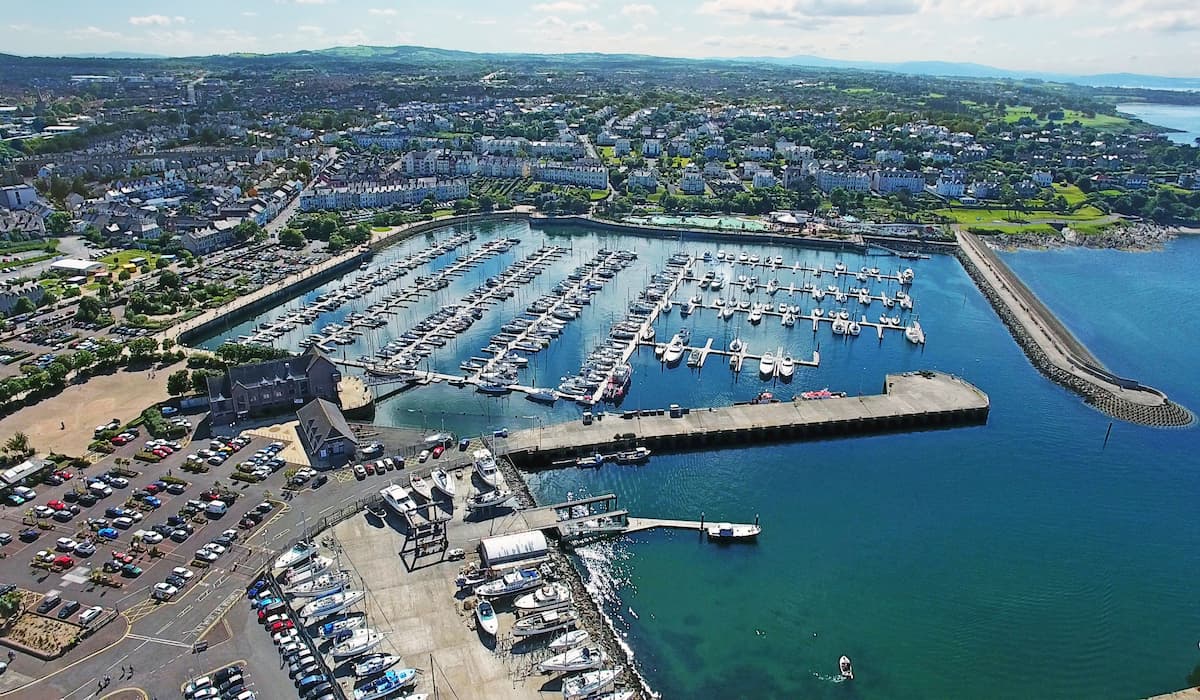
Another one of Northern Ireland's most popular seaside resorts is Bangor. Situated on the coast of County Down just 13 miles from Belfast, Bangor is known for its ornate Victorian architecture, beautiful seaside, and vibrant nightlife. Bangor is also home to some great family-friendly attractions, like the Bangor Aurora Aquatic and Leisure Complex and the Pickle Funpark. Popular accommodation in Bangor includes The Salty Dog Hotel and The Marine Court Hotel.


hewitts-gb
hewitts-ireland
marilyns-gb
marilyns-ireland


