Slieve Commedagh (from Irish Sliabh Coimhéadach, meaning 'the guarding/watching mountain') is a mountain with a height of 767 m (2,516 ft) in County Down, Northern Ireland. It is the second-highest of the Mourne Mountains, after Slieve Donard, and the second-highest mountain in Northern Ireland.
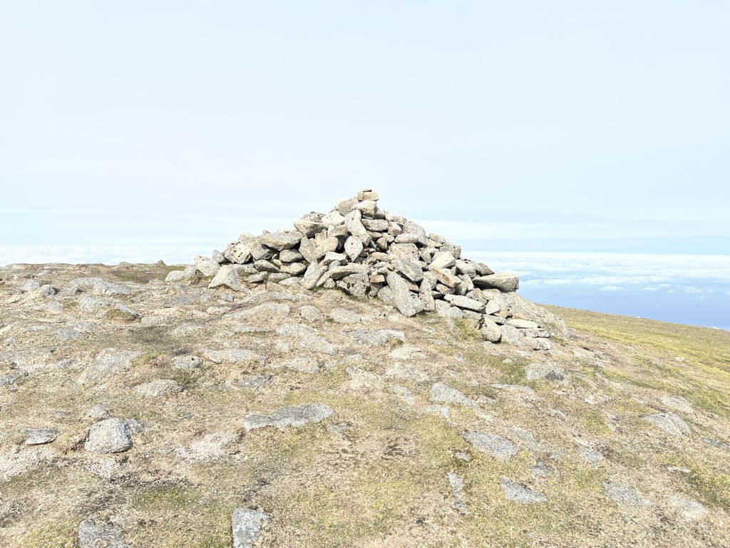
Slieve Commedagh lies to the northwest of Slieve Donard, and the two are linked by a col. The Mourne Wall passes east–west over the mountaintop, and there is a small one-room tower at the summit. There is also the remains of an ancient burial cairn on the summit. On its southern side is a group of granite tors known as 'the Castles'.
The Slieve Commedagh massif also includes the summits of Slievecorragh (to the east), Shan Slieve, Slievenamaddy and Slievenabrock (to the north).
There's a trail leading to the summit.
By elevation Slieve Commedagh is
# 2 out of 82 in Mourne & Slieve Croob AONB # 2 out of 343 in Northern Ireland # 74 out of 2703 in the Mountains of Ireland
By prominence Slieve Commedagh is
# 13 out of 82 in Mourne & Slieve Croob AONB # 65 out of 343 in Northern Ireland
We use GPS information embedded into the photo when it is available.
3D mountains overlay
Adjust mountain panorama to perfectly match your photos because recorded by camera photo position might be imprecise.
Move tool
Rotate tool
Zoom
More customization
Choose which peak labels should make into the final photo and what photo title should be.
Next
Photo Location
Satellitte
Flat map
Relief map
Latitude
Longitude
Altitude
OR
Latitude
°'''
Longitude
°'''
Apply
Register Peak
Peak Name
Latitude
Longitude
Altitude
Register
Teleport
PeakVisor
This 3D model of Sagarmatha National Park in Nepal was made using the PeakVisor app topographic data. The mobile app features higher precision models worldwide, more topographic details, and works offline. Download PeakVisor maps today.
Download OBJ model
PeakVisor
The download should start shortly. If you find it useful please consider supporting the PeakVisor app.
PeakVisor for iOS and Android
Be a superhero of outdoor navigation with state-of-the-art 3D maps and mountain identification in the palm of your hand!