Scan the QR code and open PeakVisor on your phone
Showcasing some of Northern Ireland’s most iconic mountains, c of Outstanding Natural Beauty is an adventure destination that simply can’t be missed during a trip to the Emerald Isle. The park contains 82 named mountains, the highest and most prominent of which is Slieve Donard (850 m/2,789 ft).
Discover one of Ireland's most famous mountain ranges at the Mourne and Slieve Croob AONB.
This nationally recognized Area of Outstanding Natural Beauty encompasses the Mourne Mountains, which stretch for 14 miles (22.5 km) across County Down in Northern Ireland. The AONB covers approximately 57,000 hectares, 20,000 of which are home to the Mourne’s mountains and moorlands.
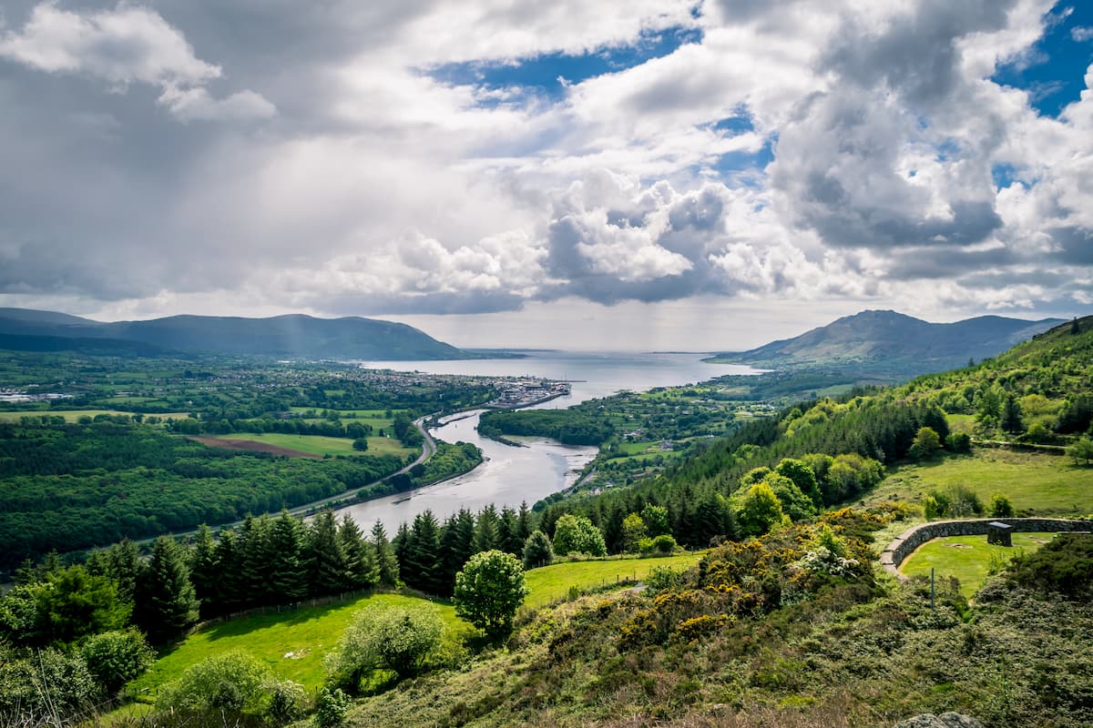
To the north of the Mournes are the picturesque Dromara Hills, and the park also contains over 24 miles (38.6 km) of rugged Irish coastline. Two Northern Ireland’s largest rivers, the River Lagan and the River Bann spring from the slopes of the Mournes and the Dromara Hills.
The Mourne and Slieve Croob AONB is located roughly 20 miles (32 km) south of Belfast, and 70 miles (112 km) southeast of the Sperrins, Northern Ireland’s only other major mountain range.
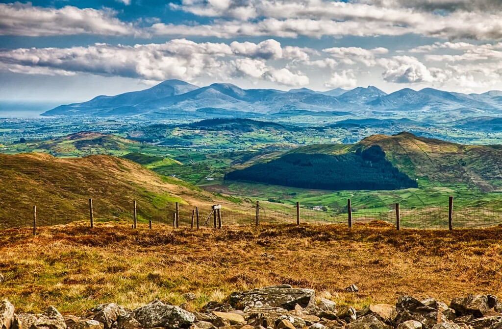
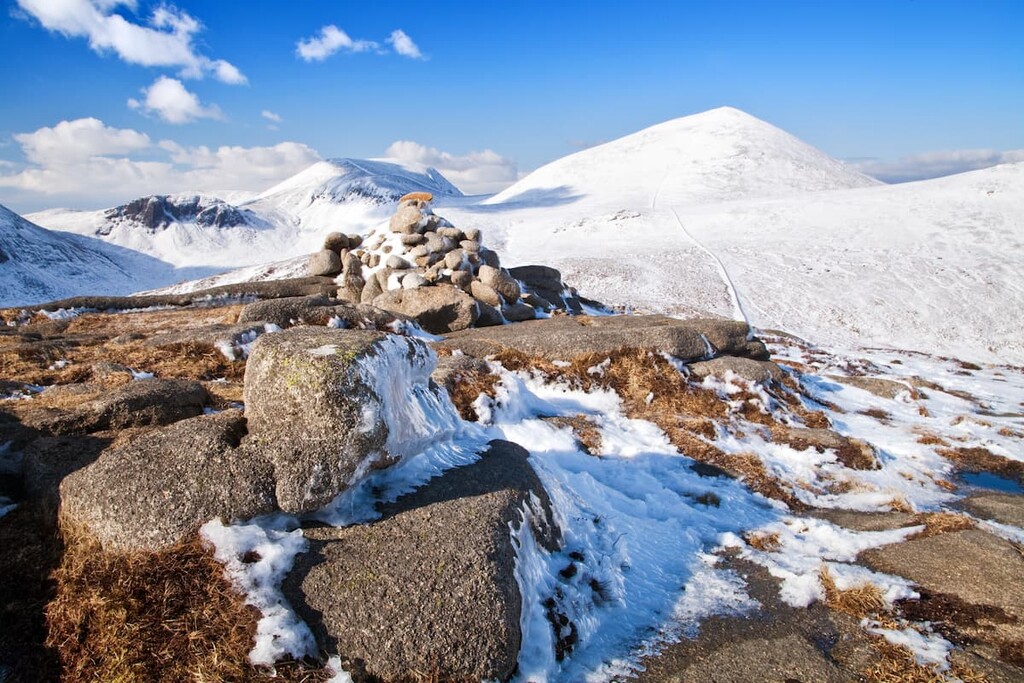
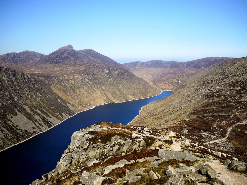
The Mourne Mountains are home to 12 summits over 600 m (1,968 ft), including Slieve Donard (850 m/2,788 ft), the tallest mountain in Northern Ireland. Other notable peaks within the Mourne Mountains include Slieve Commedagh (765 m/2,509 ft) and Slieve Binnian (747 m/2,450 ft).
To the north of the Mournes is the Dromara Hills, which includes Slieve Croob (586 m/1,922 ft), a popular Marilyn with a long hiking tradition. The Mournes are among the most famous mountains in Ireland due in part to the song The Mountains of Mourne by renowned Irish songwriter Percy French.
The Mournes are relatively new compared to other ranges across the UK and Ireland.
These peaks formed around 50 million years ago, when an enormous chunk of shale sank into the earth's crust, causing molten granite to spill over and create these hills and mountains. The original shale that covered the mountains has disappeared due to erosion from rain, snow, and the last Ice Age, leaving the acidic granite peaks we see today.
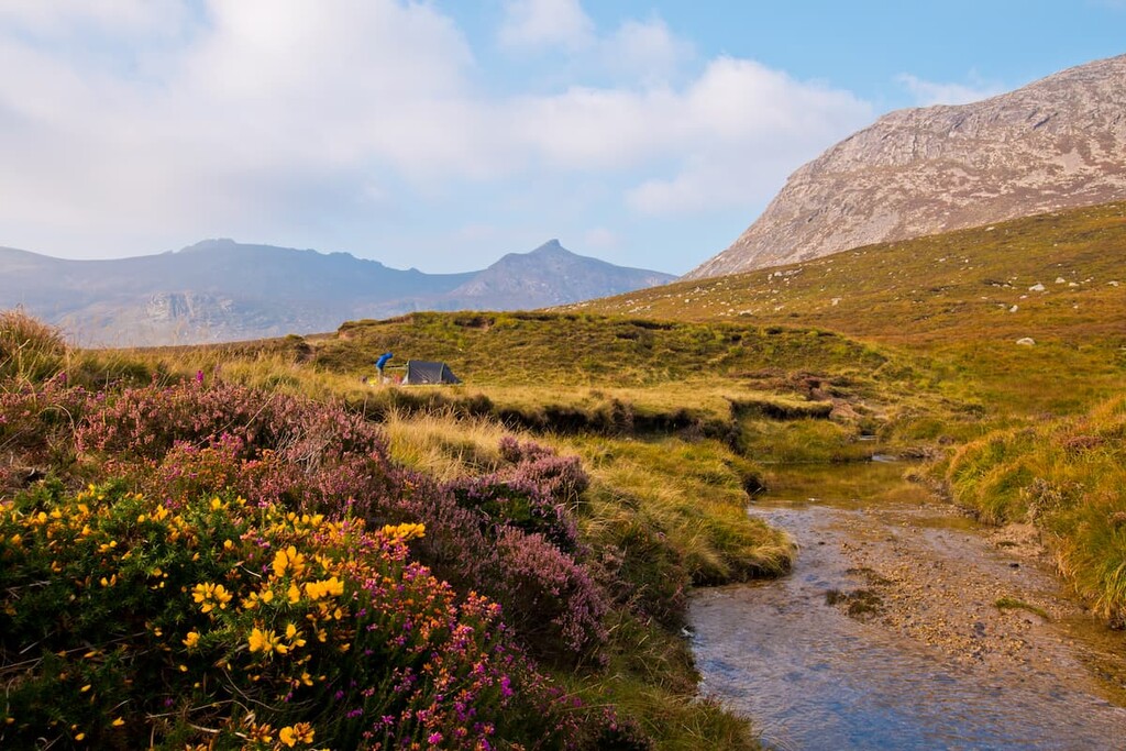
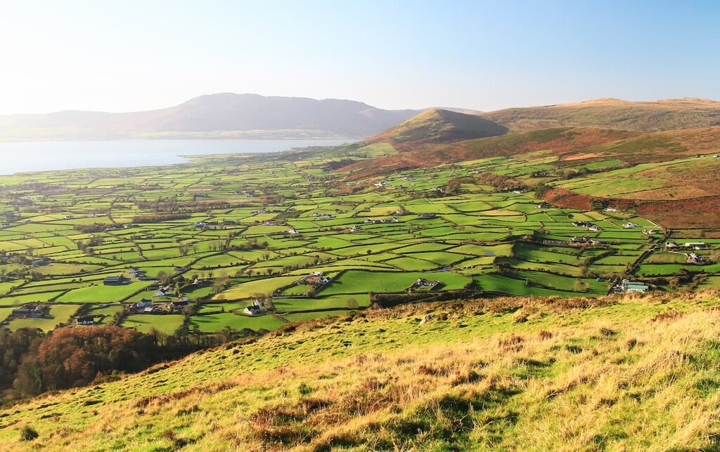
Away from the mountains, the Mourne and Slieve Croob AONB consists of woodlands, moorlands, and coastline. The area's diverse landscape and isolation mean it's an excellent area for nature watchers, with rare bird species like Peregrine falcons and ravens nesting high up in the hills.
During the winter, you may spot a snow bunting and in summer ring ouzels can be seen on the remotest slopes in the Mournes. There have also been sightings of red grouse on Millstone Mountain (512 m/ 1679 ft); however, they are not confirmed to breed in the region.
Across the area’s heathlands and moorlands, you’ll likely come across extensive areas of wetland flora, including black bog-rush, star sedge, and black butterwort. These boggy regions are home to some rare insects, so keep an eye out for ground beetles and sawflies. Keeled skimmer dragonflies are among the rarest insects you’ll see in the AONB.
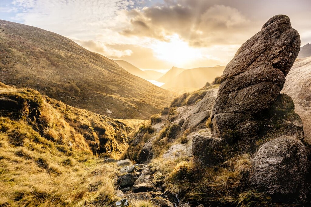
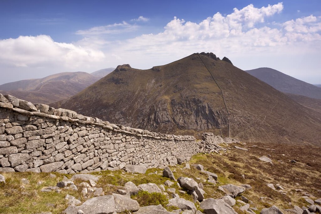
One of the most famous man-made features in the Mourne and Slieve Croob AONB is the Mourne Wall, which was built in the early 20th century to keep livestock out of the Silent Valley Reservoir. The wall stretches for 22 miles (35 km) across 15 peaks in the Mourne Mountains, and is commonly used by hikers as a waypoint.
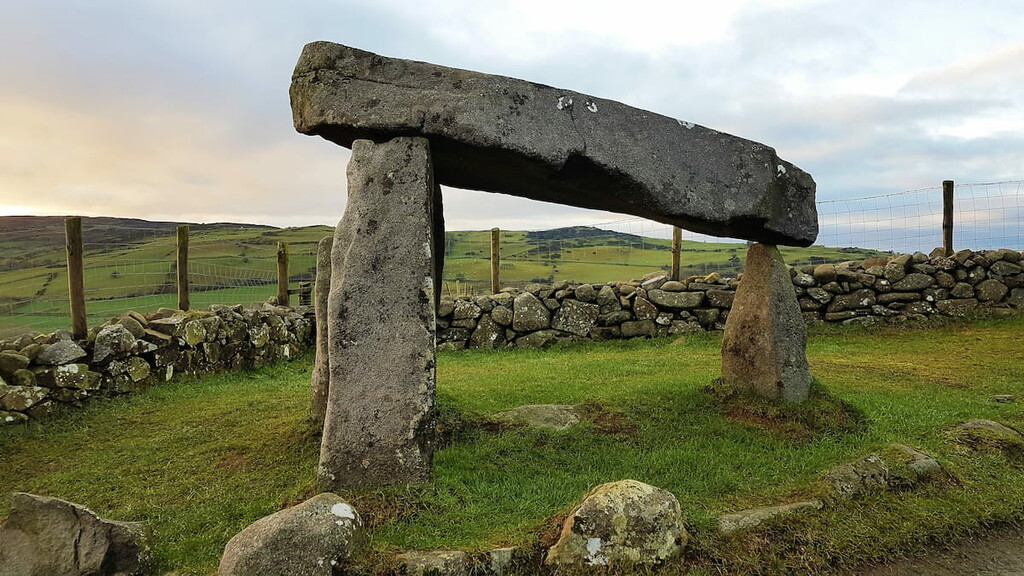
Early Celtic settlers have been living in the Mournes since the last Ice Age. The remains of ancient farmlands, as well as Middle Age castles like the 12th-century Dundrum Castle, are still visible across the region. Among the most impressive structures in the Mourne and Slieve Croob AONB are the region’s megalithic tombs which date back around 5,000 years.
One of the best examples is the Kilfeaghan Dolmen on the slopes of Knockshee (347 m/ 1138 ft), a portal tomb famed for its 35 ton capstone, which would be difficult to move even with modern technology.
The area was designated an AONB in 1986. Due to the area’s cultural and natural significance, many believe the Mourne and Slieve Croob AONB should be delcared Northern Ireland’s first national park.
Planning an adventure in the Mournes? Read on to find out about the best hiking trails and where to stay during your visit to the Mourne and Slieve Croob AONB.
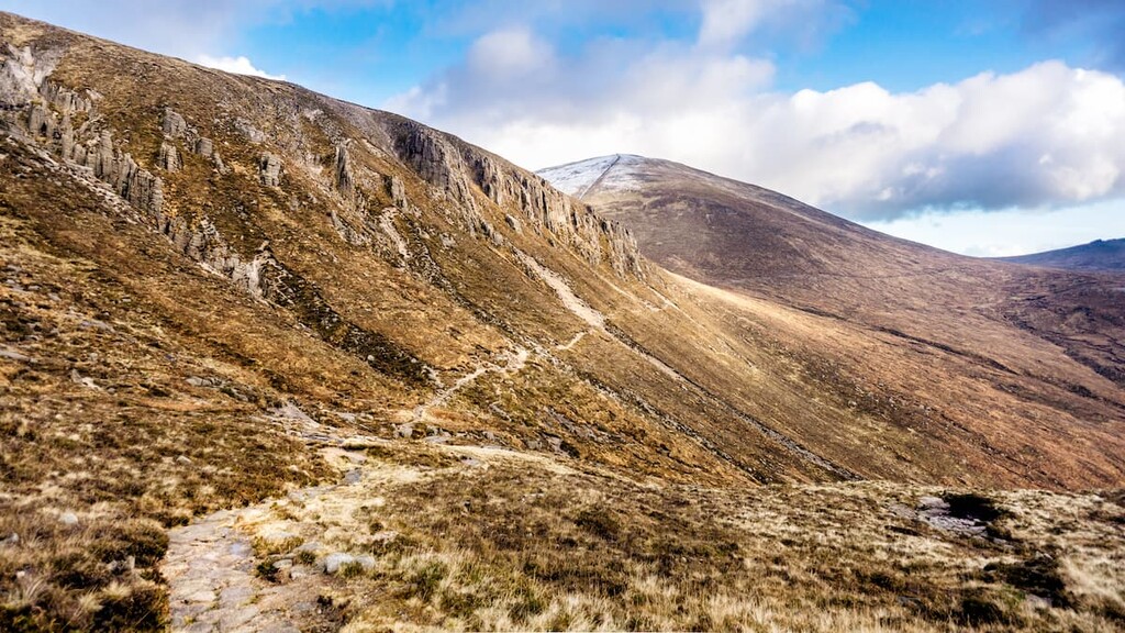
The tallest mountain in Northern Ireland, Slieve Donard is among the most popular treks in the country and is a must for any avid climber visiting the Mourne and Slieve Croob AONB. The mountain is steeped in Irish folklore and is named after Saint Donard, who was said to have had a hermitage at the summit.
There are several short linear routes up Slieve Donard, including along the Glen River from Donard Park, and via Bloody Bridge.
One of the best ways to experience the Mournes is by following the circular route from the Trassey car park near Newcastle, which will take you up three of the four highest peaks in the range. This walk is around 12 miles (19.3 km) and takes approximately 8 hours to complete.
At the Trassey car park, locate the clear path waymarked the Ulster Way that leads directly into the mountains. After passing through 3 double gates, you'll be able to spot the saddle between Slieve Bearnagh (739 m/2,424 ft) and Slievenoglogh (497 m/1,630 ft), known as Hare's Gap. Continue following the same path until your reach until you reach a quarry. At a fork in the trail, keep right onto the col between Slieve Bearnagh and Slieve Meelmore (687 m/2,253 ft).
On the col, you'll come across the Mourne Wall. At the wall, turn left and follow it to the summit of Slieve Bearnagh, the fourth highest of the Mournes. The walk to the summit is tricky and involves navigating some rocky outcrops. After reaching the Summit Tor, continue to the North Tor and into Hare's Gap.
Take extra care in this area as Hare's Gap is steep and hazardous. From Hare's Gap, follow the Brandy Pad, a clear path once used by smugglers. Keep left at the cairn on the col between Slieve Beg (642 m/2,106 ft) and Slieve Commedagh.
After passing under the Castles, a group of tors on Slieve Commedagh's southern side, bear left on the path to reach the col between Slieve Donard and Slieve Commedagh. Here, follow the Mourne Wall to the summit of Slieve Donard before retracing your steps to scale Slieve Commedagh. The views here are among the best in the Mournes, with views across the Irish Sea and of the town of Newcastle.
To descend, continue along the Mourne Wall, over Slievenaglogh, and into Hare's Gap. The best way to descend is on its south side. At Hare's Gap, pass through the gate to return to the Trassey track, which leads back to your starting point.
Slieve Croob, also known as "The Twelve Cairns", is among the most frequently climbed mountains in Northern Ireland, thanks to its clear paths and rich history. The large cairn that once adorned its summit is believed to be a burial mound that has been damaged by visitors and erosion over time.
Traditionally, locals climb to the peak of Slieve Croob on Lughnasadh, a harvest festival in early August, while carrying a stone to help bury the twelve kings supposedly laid to rest at the summit. The southern slopes of Slieve Croob are also home to Legananny Dolmen, a megalithic structure dating back over 5,000 years. The hike up Slieve Croob is 3 miles (4,8 km) and takes 2 or 3 hours.
The best way to climb Slieve Croob is from the car park on Dree Hill Road near Dromara. From the car park, cross through the green gate and follow the clear transmitter road across the moorlands and up the mountain. The track is clear and easy-to-follow but can be muddy. At the end of the road, three stiles lead onto the open mountainside, with a clear walk to the summit.
Unfortunately, some of the beauty of the mountain is ruined by the transmitters and compounds located on the slopes, but the views from the top on a clear day provide gorgeous vistas of the High Mournes and even Scotland in the distance. Near the summit, you'll be able to spot the spring of the River Lagan, which runs from Slieve Croob all the way through Belfast.
The cairn atop Slieve Croob was several meters high when recorded during the nineteenth century; however, now all that remains are scattered stones and a few minor cairns. Before retracing your steps down the mountain, stop to spot some of the local bird species, with buzzards, kestrels, and meadow pipits common in the area.
Slieve Binnian is the third-highest mountain in Northern Ireland and is popular thanks to its spectacular tors and views as far as the Wicklow Mountains beyond Dublin. This circular route takes you along the Mourne Wall, past the mammoth North Tor, and along the edge of Blue Lough. The hike is 7 miles (11.3 km) and takes approximately 5 hours.
Starting from the Carrick Little car park (also known as the Slieve Binnian car park), follow the clear track over rolling fields.
At the Mourne Wall, turn left and follow it up into the mountains. You can follow the wall all the way to the top, apart from near the summit, where the wall runs into a granite cliff. Here you'll need to head right and carefully scramble up to the peak. After scaling the Summit Tor, continue along Slieve Binnian's ridge to a group of large tors known as the Back Castles.
Fortunately, you won't have to climb any of these tors, passing the vast Noth Tor on your left. At the col between Slievelamagan (702 m/2,303 ft) and Slieve Binnian, keep right and follow the clear downhill path. Continue to bear right, avoiding any off-shoots, to reach the shores of Blue Lough.
The path then leads you along the edge of Annalong Wood. Continue along the forest's fence line to return the gate in the Mourne Wall. Cross the wall, and follow the path back to the car park.
While Slieve Meelmore (687 m/2,253 ft) and Slieve Meelbeg (702 m/2,303 ft) aren't as famous as their neighbors, they provide a rewarding climb up 2 of the 7 highest mountains in the Mournes. You'll also get to climb to the summit of Slieve Loughshannagh (671 m/2,201 ft) along the way.

The route is relatively easy to follow as the majority of the walk follows the Mourne Wall; however, during heavy snow the trek can be tough going. This walk is 5.5 miles (8.9 km) and takes roughly 4 hours.
From the Ott car park, cross the road, pass through a stile, and follow the stone path. Soon the path splits in two—follow the upper path onto the col between Slieve Loughshannagh and Carn Mountain (640 m/2,099 ft). At the Mourne Wall, turn left and follow it up Slieve Loughshannagh, then Slieve Meelbeg, and finally Slieve Meelmore.
To descend, return to an intersection in the Mourne Wall and walk into the valley by the right-hand wall. When the wall meets a river, follow the river downstream along the well-trodden trail. Before a patch of woodlands, you'll come across the Ulster Way, which you'll need to follow southwest. Past the Fofanny Dam, the Ulster Way emerges on Slievenaman Road. At the road, turn left to return to the Ott car park.
Looking for a place to stay near Mourne & Slieve Croob AONB? Here are some of the best places to check out:
The city of Newry is one of the closest major settlements to the Mourne and Slieve Croob AONB. Newry is less than 10 miles (16 km) from the park boundary, and with a population of around 30,000 people, it's peaceful while still offering some interesting local attractions.
While in Newry, ensure you stop to admire Newry Cathedral and take a tour of the Newry and Mourne Museum. There are also some top-rated hotels in Newry, including the Canal Court Hotel and the Mourne Country Hotel.
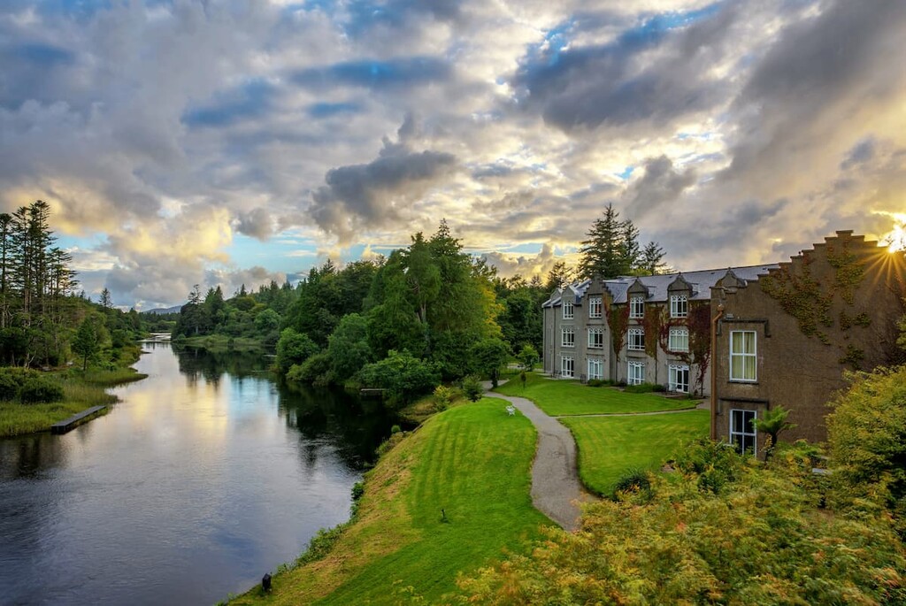
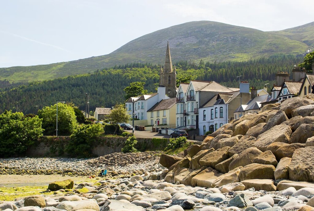
Adventure seekers looking to stay as close to the Mournes as possible should consider staying in Newcastle. This seaside resort town is notable as it sits at the foot of Slieve Donard, the highest mountain in Northern Ireland. You'll also have the verdant Tollymore Forest Park right on your doorstep.
Ensure you visit Newcastle during the summer to make the most of the town's pristine sandy beaches. As a popular vacation destination, Newcastle boasts plenty of hotels, like the Slieve Donard Resort, the Harbour House, and the Burrendale Hotel.

Hikers looking to explore the southern Mournes should rent a room in Kilkeel. A small seaside town, Kilkeel is less than 15 miles (24 km) from Slieve Donard and Slieve Binnian, and only 5 miles (8 km) from Knockchree (358 m/1,174 ft).
There are also a couple of beaches around in case you fancy taking a dip in the Irish Sea. You’ll find a few hotels in and around Kilkeel, like the Kilmorey Arms Hotel and the Greencastle B&B.
Ballynahinch is one of the best places to stay if you're looking to hike in the Dromara Hills. The town is just 10 miles (16 mi) from Slieve Croob and is the nearest significant settlement to this popular peak.
While there's not much to do around town, you'll be just 15 miles from Belfast, in case you fancy a day out in the Northern Irish capital. Hotels in the area include the Spa Cottage B&B and the Millbrook Lodge Hotel.