Scan the QR code and open PeakVisor on your phone
Wicklow Mountains National Park is one of Ireland's most popular hiking destinations and with good reason. Over a million adventurers travel to this breathtaking park each year to scale the Wicklow Mountains, hike through its verdant valleys, and fish in its loughs. Wicklow Mountains National Park is the largest of Ireland's six national parks, covering roughly 50,000 acres of pristine countryside, earning County Wicklow the nickname 'The Garden of Ireland.'
One of the main reasons Wicklow Mountains National Park is so popular is due to its proximity to Ireland's capital, Dublin. Wicklow Mountains National Park is located around 30 km south of the city, making it a popular hiking destination for Dubliners, as well as holidaymakers looking to experience the Irish countryside without straying too far from the capital.
Another significant reason people visit this park is to explore the Wicklow Mountains. There are 51 named peaks in the Wicklow Mountains, many of which offer challenging hikes that will test even the most experienced climbers. The Wicklow Mountains are composed mainly of granite and are part of Europe's largest granite mass, which stretches from Dun Laoghaire in County Dublin down to New Ross in County Wexford.
One of the most popular mountains to summit in the Wicklow Mountains is Lugnaquilla. Lugnaquilla is one of only 13 Furths (also known as Irish Munros) and, with an elevation of 925 m, is the highest mountain in Ireland outside of County Kerry. Due to Lugnaquilla's treacherous climbing conditions, it's a favorite with experienced hikers looking for a challenge.
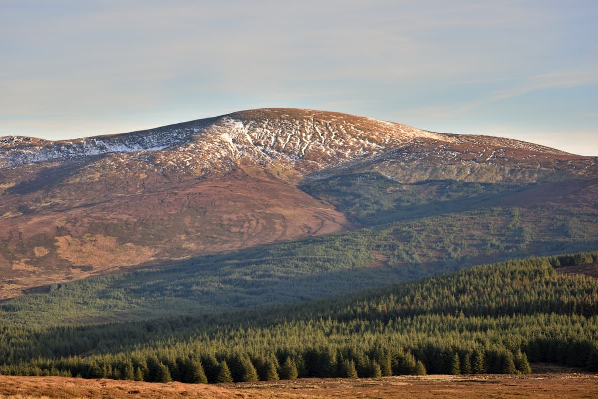
You'll find several other sizable peaks in Wicklow Mountains National Park, with most of the range over 600 m high. Mullaghcleevaun is the 2nd highest summit in the Wicklow Mountains at 846 m, and is another rewarding climb, as the summit boasts stunning views of the surrounding wilderness. Other favorite mountains in Wicklow Mountains National Park include Tonegalee (814 m), Kippure (705 m), and Scarr (633 m).
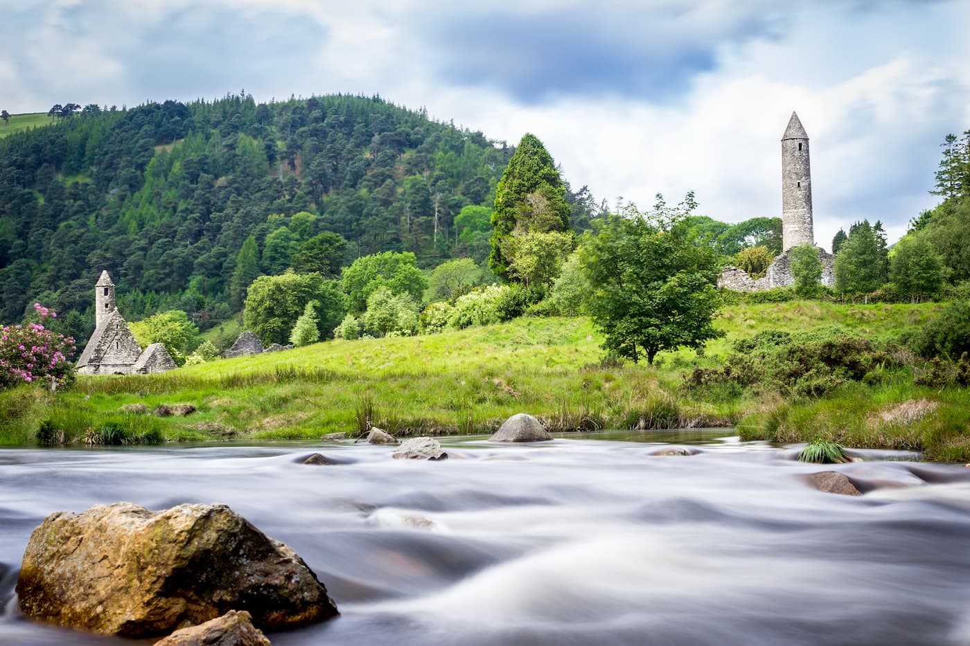
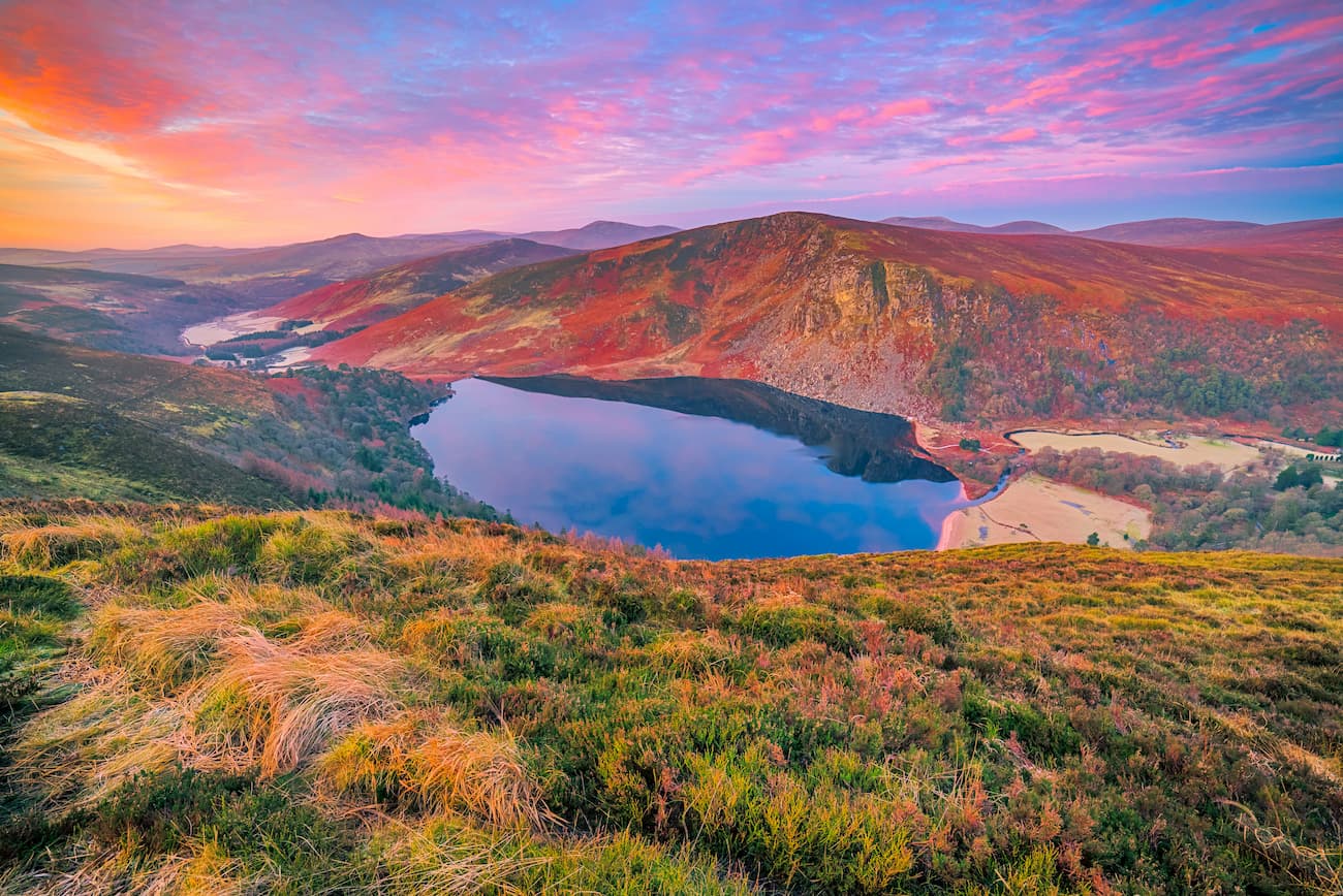
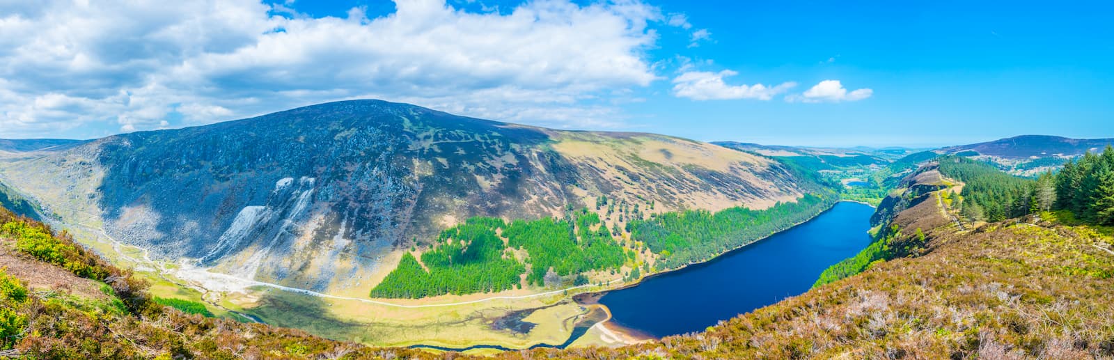
Undoubtedly one of the most visited areas in Wicklow Mountains National Park is Glendalough Valley. Roughly translated as "the valley of two lakes," Glendalough is often considered one of Ireland's most attractive natural environments, with two serene loughs surrounded by rolling hills and picturesque mountains. Glendalough is also home to plenty of history and contains the ruins of a 6th-century monastery founded by St Kevin.

Lugnaquilla is the 13th tallest peak in Ireland and sits on the southern edge of Wicklow Mountains National Park. There are several ways you can scale the mountain, including from Glen of Imaal and Aghavannagh. One of the most popular routes to take up the Lugnaquilla is the Glenmalure Loop Walk.
The Glenmalure Loop Walk is around 15 km in length and should take around 6 hours to complete. The Glenmalure Loop is slightly longer than the Glen of Imaal Trail but affords rewarding views along the journey. You can pick up this trail from the Baravore Car Park, close to the Glenmalure Hostel.
You'll traverse the precipitous Fraughan Rock Glen along the trail, so ensure you take care in this dangerous area. From the clifftops, you'll take a short but steep walk to the summit. This part of the climb will require some scrambling. After passing across the Lugnaquilla Plateau to the peak, you'll circle around and climb over Cloghernagh (799 m), before descending through a forested area. Once you reach the road, head left to circle back to your starting point.
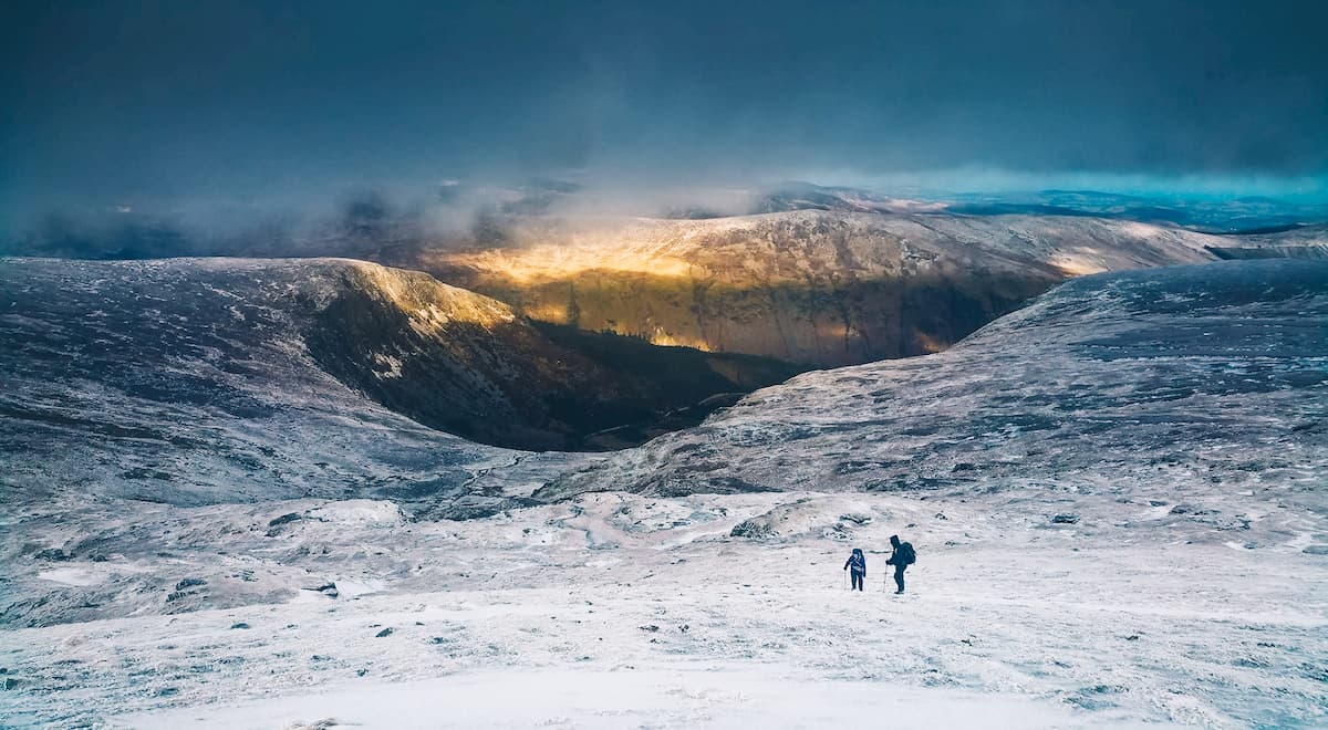
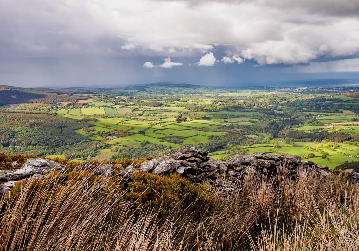
Lugnaquilla boasts some of the best views in the Wicklow Mountains, with panoramas of Glendalough and the Glen of Imaal. On a clear day, you can see across the Irish Sea, with Snowdonia's snow capped mountains visible in the distance. Note that there are no marked trails on Lugnaquilla, so ensure you're well-equipped and plan your route out before attempting to scale the mountain. The Lugnaquilla Plateau is dangerous, especially in bad weather. Hikers have been known to get lost on the plateau during heavy fog.
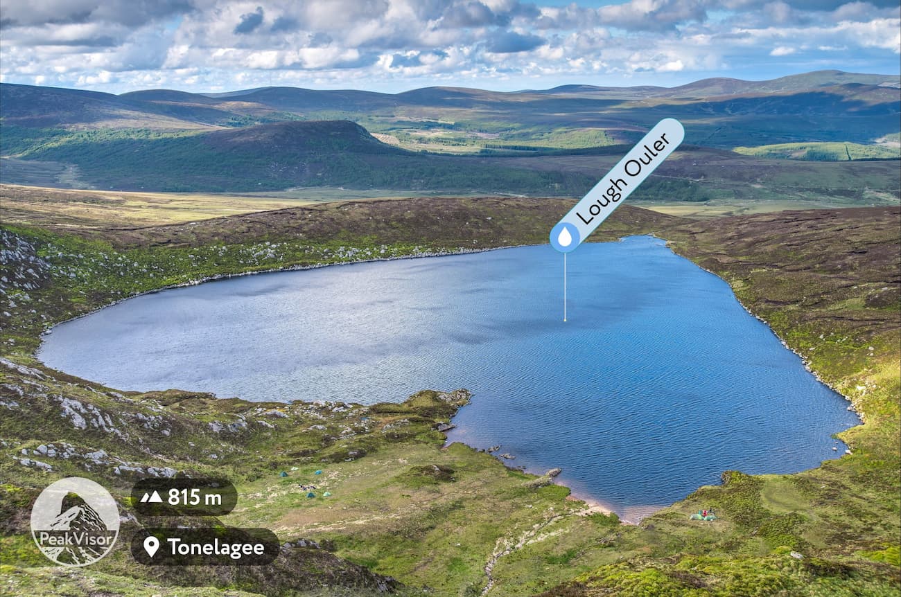
As the 2nd highest of the Wicklow Mountains, Mullaghcleevaun is one of the park's best hikes. A great way to experience two mountains at once is on the Mullaghcleevaun and Tonelagee Mountain Loop. This route is ideal for adventurers looking to explore Mullaghcleevaun and the range's 3rd tallest peak, Tonelagee.
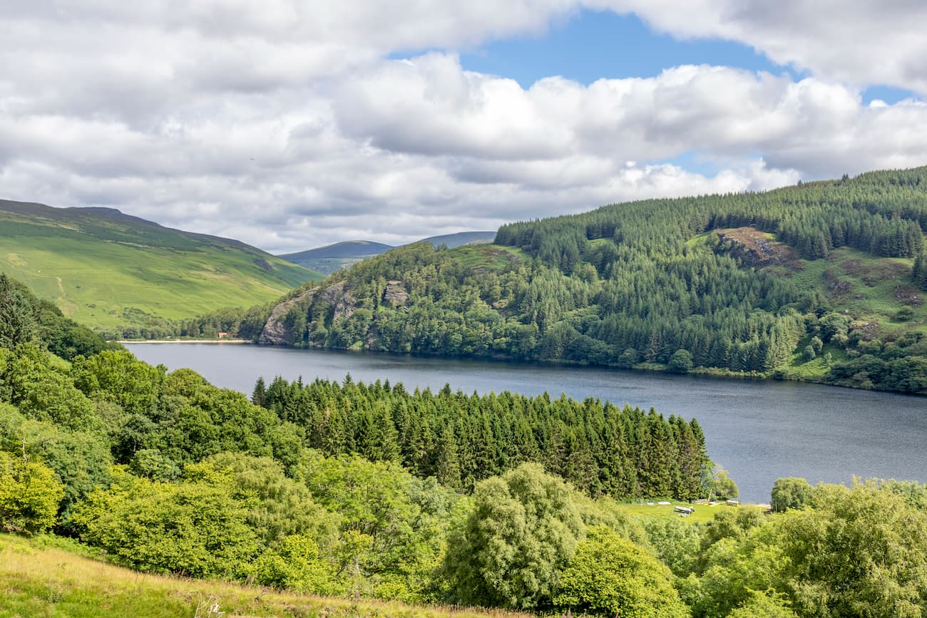
This lengthy and challenging hike is around 16 km in length and should take about 6 hours to complete. You can reach this trail by heading along the 200 year old Military Road. This hike is a ridge walk that will lead you up Tonelagee from the serene Lough Ouler. While the hike up the mountain's face is more strenuous and requires scrambling, it's a shorter route with better scenery.
From the summit on Tonelagee, head north along the ridge, scaling the peak of Stoney Top (713 m) on the way to Mullaghcleevaun (846 m). During this section, try to avoid the area's peat bogs, which can severely hamper your progress. Once you reach the top of Mullaghcleevaun, circle to the Mullaghcleevaun East Top (794 m) before descending towards Carrigshouk (572 m). You can make your final descent from Carrigshouk. Try to avoid the steepest cliffs on this section of your hike, and retrace your steps towards the East Top if you're struggling to find a suitable route.
Intermediate hikers looking for a suitable mountain trek in Wicklow Mountains National Park might want to consider Scarr. While Scarr can be tricky in places due to strong winds on the exposed ridge near the summit, it's much smaller than many of the park's mountains, at 633 m. The trail up Scarr is 8 km long and takes about 4 hours to complete.
To start this hike, head the southern shores of Lough Dan. Pick up the trail that runs through the woodlands, which will gently ascend towards Scarr. After a short climb, you'll have a stunning view of Lough Dan. The path will get much steeper at this point, before evening out at the ridge near the summit. From atop Scarr, you'll be treated to vistas of Glendalough and the surrounding mountains. To descend the mountain head back the way you came down the ridge.
Another mountain trek which is ideal for all hikers is the Maulin Mountain Loop. Maulin is one of the smaller peaks in the Wicklow Mountains, but still offers gorgeous panoramas and some intriguing sights along the way. The Maulin Mountain Loop is around 6 km in length and should take 2 or 3 hours.
The Maulin Mountain Loop is part of the famous Wicklow Way hiking trails. To start your journey, head to the Crone Wood Car Park near Enniskerry. You'll need to follow the route clearly marked with red discs and footprints from the car park. This trail will lead you through densely forested areas on the way to the summit. The trail is quite steep in places but doesn't require any scrambling. One of the best sights along this route is the Powerscourt Waterfall, one of the highest waterfalls in Ireland at 121 m.
Djouce is perfect if you're searching for a quick hike in Wicklow Mountains National Park. Despite being one of the higher peaks in the Wicklow Mountains at 715 m, Djouce offers a short journey to the summit. The Deerpark route up Djouce is around 4.5km and should take an hour or two.
You can pick up the trail at either of the car parks at Long Hill. The route can be steep in places but doesn't require any scrambling or additional equipment. The path is easy to follow and is marked with blue signposts. Once you reach the summit, you'll be able to pick out some notable landmarks, including the Powerscourt Waterfall and Great Sugar Loaf.

If you're looking to experience the best of Glendalough Valley, consider the Miner's Road Walk. This short hiking trail runs for 5 km and should take just over an hour to complete. This leisurely walk is suitable for hikers of all abilities and passes some of the region's best historic and natural sights.
You can pick up this trail along the northeastern edge of the Upper Lake. Follow the pathway east, along the shoreline of this serene lake. Along the walk, you'll pass through scots pine woodlands and by the ruins of an old mining village. About halfway along the trail, you can spot St Kevin's Bed, a historic cave located across the lake. Watch for an array of local wildlife along this trail, including feral goats, which are often seen on the path.
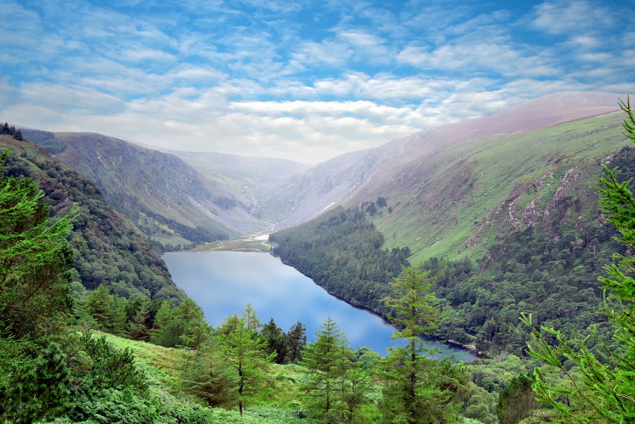
The Glenealo Valley Trail is a lengthy and tough walk for hikers who don't fancy scaling one of the Wicklow Mountains. This trail is around 9 km and should take about 3 hours to complete. This trail will lead up the Spinc, a steep hill which elevates to 380 m. You can start the trail by heading up to the beautiful Poulanass Waterfall before joining onto a boardwalk.
After reaching the boardwalk, climb roughly 600 steps up the Spinc to a viewing platform overlooking Glendalough's Upper Lake. Follow the boardwalk along the clifftops, which will slowly descend into Glenealo Valley. The scenic Glenealo Valley features heathlands, bogs, and herds of free-roaming wild deer. Keep following the track, which weaves its way back to the start point.
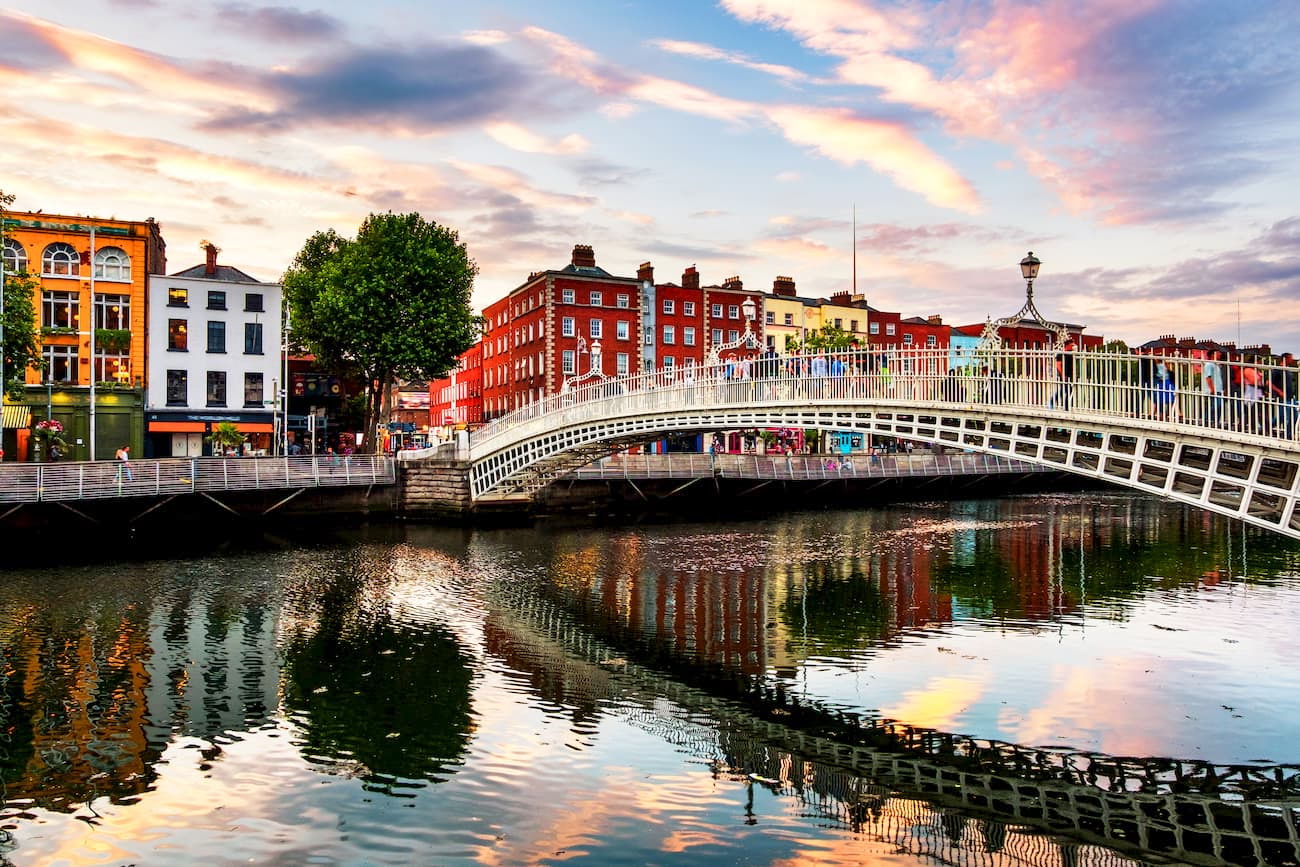
Ireland's capital Dublin is perfect for travelers looking to mix traditional Irish culture with beautiful countryside. Before heading into the mountains, take a tour of the Guinness Storehouse, plan a picnic at Phoenix Park, or learn about Ireland’s history at Dublin Castle. Dublin is also home to many of the best restaurants and hotels in the country, making the perfect base from which to explore Ireland.
You can reach Wicklow Mountains National Park by heading south of the city. You can take several routes into the mountains, including along the M50 or the R759. Dublin is around 30 km away, and the drive should take around an hour. If you're traveling to Dublin from abroad, book a flight to Dublin Airport, Ireland's premier transport hub.
Bray is one of the most popular holiday destinations in County Wicklow. This seaside resort is positioned roughly 20 km south of Dublin and around 25 km from Wicklow Mountains National Park. Bray offers a peaceful place to stay, while still offering plenty to do and access to many of Ireland's biggest attractions.
During your time in Bray, plan a walk along with Bray Head, or discover the picturesque Killruddery House. You can reach Wicklow Mountains National Park by heading southwest along R755 or northwest along the L1011. This drive should take around 45 minutes.
For travelers looking to escape the city and stay in a village as close to the Wicklow Mountains as possible, consider Annamoe. Annamoe is positioned just southeast of the Glendalough Estate and Lough Dan. The village is encircled by woodlands and sits upon the Inchavore River, ensuring a peaceful and idyllic setting for your holiday. You can reach Wicklow Mountains National Park from Annamoe by driving along the R759 for 16 km.
Why not book a hotel directly in the heart of the Wicklow Mountains? The Glendalough Hotel is one of the park's most famous establishments, with over 40 hotel rooms located within the tranquil Glendalough Valley. The hotel is advertised as being only a few steps from St Kevin's 6th-century monastic site, meaning you'll have plenty of opportunities to explore Wicklow Mountains National Park's historic landmarks. Many of the hotel's suites flaunt views of nearby mountains, rivers, and woodlands, so you can feel at one with nature.