
Scan the QR code and open PeakVisor on your phone
From the sublime Dartry Mountains to the rugged Atlantic coastline to historic megalithic monuments, County Sligo (Contae Shligigh) is a hidden gem for hillwalkers. There are 44 named summits in County Sligo. The highest and most prominent mountain is Truskmore (647 m / 2,123 ft).
County Sligo is part of the province of Connacht in northwestern Ireland on the Atlantic coast. It encompasses an area of 1,838 sq km (710 sq mi), making it the 22nd largest of Ireland's 32 counties.
County Sligo is sparsely populated — it's home to around 70,200 people, ranking 27th in Ireland for population density. County Sligo borders County Leitrim to the northeast, County Roscommon to the south, and County Mayo to the west.
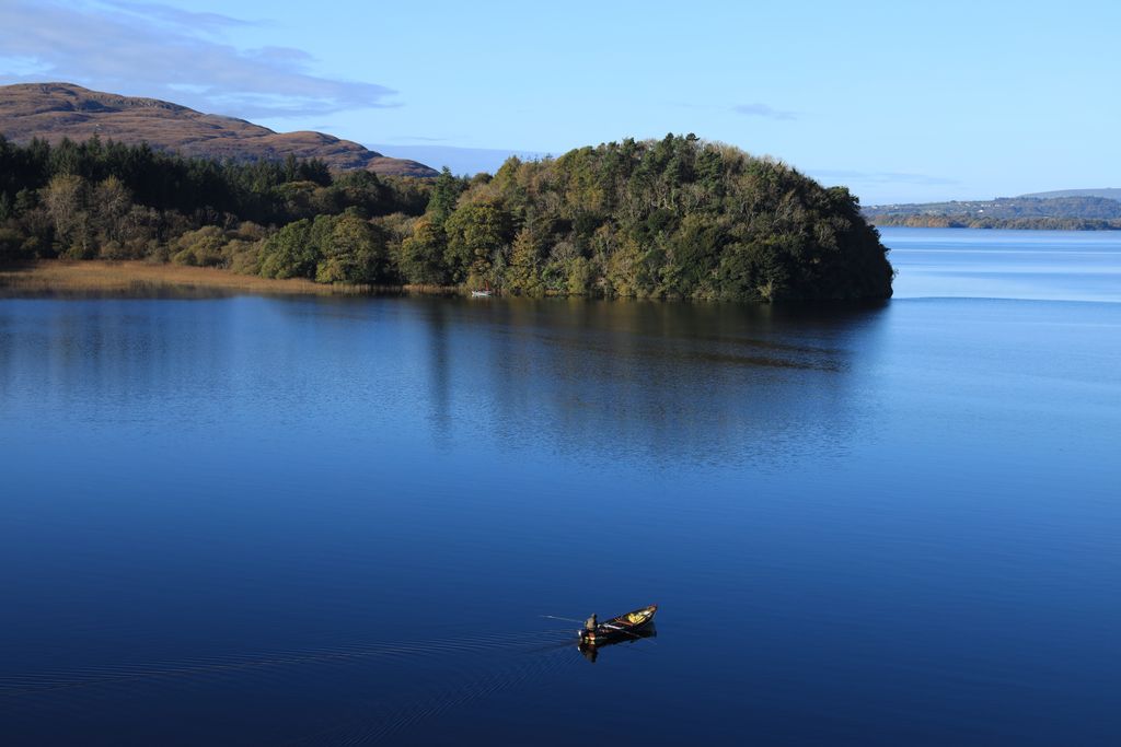
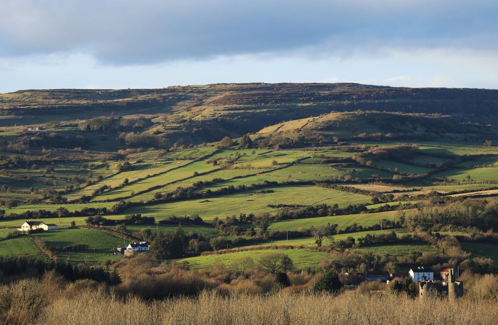
Situated on a coastal plain, County Sligo's landscape mainly consists of rolling hills and grasslands interspersed with lakes. There are nine lakes in County Sligo, the largest of which is Lough Gill, with a surface area of 12.8 sq km (4.9 sq mi).
County Sligo's winding coastline is over 190 km (118 mi) long and features peninsulas, bays, and sandy beaches. As with most of Ireland, County Sligo is sparsely wooded with little to no native woodlands. Just over 12% of County Sligo is forested.
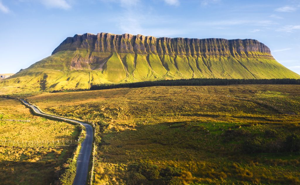
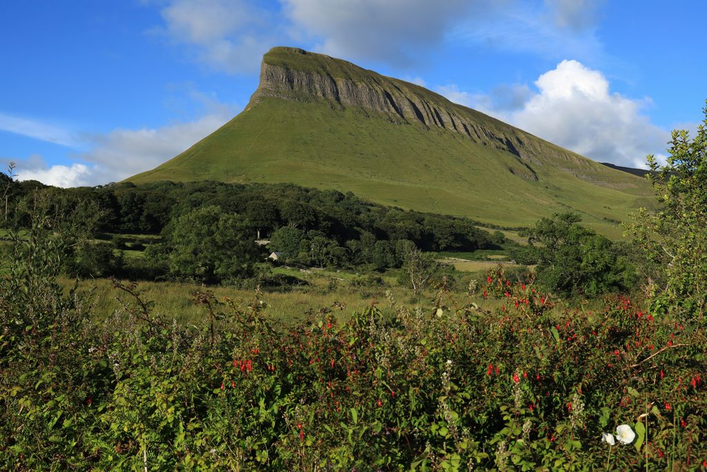
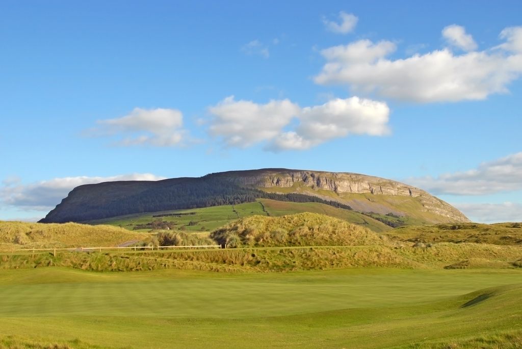
County Sligo is home to several hill and mountain ranges, including the Bricklieve Mountains, the Ox Mountains, and the Curlew Mountains. The Dartry Mountains, located just north of Sligo Town, are the largest mountain range in County Sligo, boasting many of its highest summits, including Truskmore, Tievebaun (611 m / 2,004 ft), and Annacoona Top (597 m / 1,958 ft). Benbulbin (526 m / 1,726 ft), an impressive tabletop mountain, is one of Sligo's most iconic landmarks.
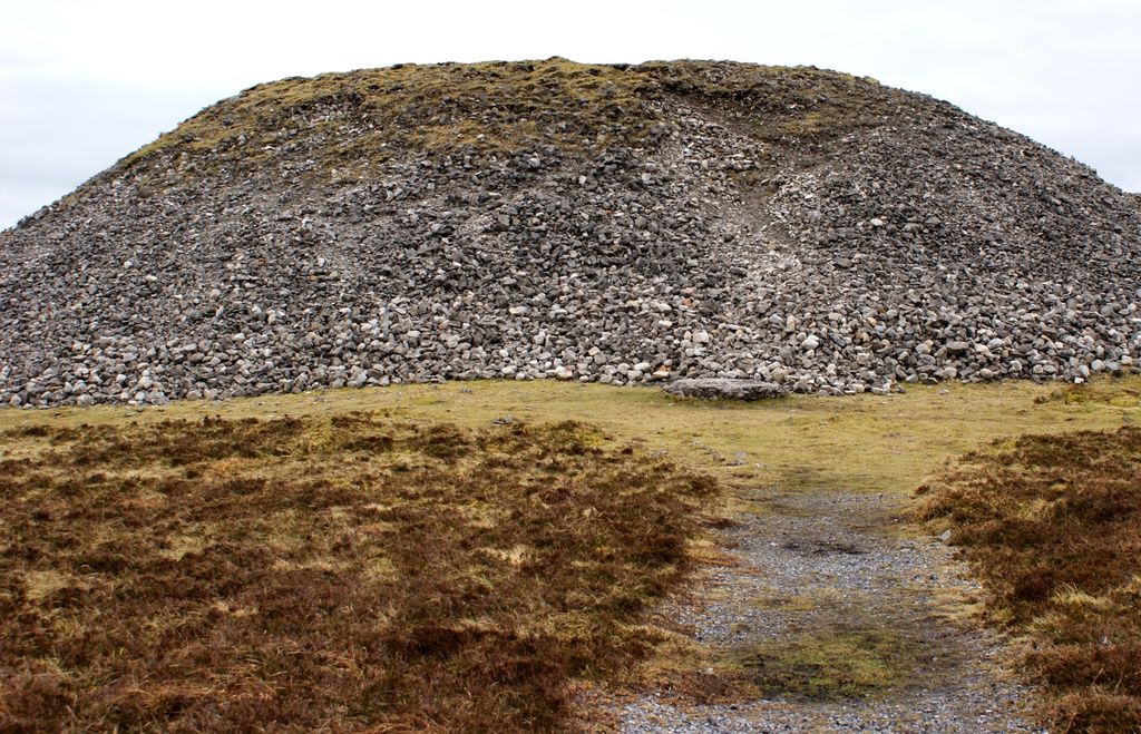
Another famous feature of County Sligo's landscape is its megalithic sites. County Sligo is densely packed with over 5,000 prehistoric sites — the highest concentration in Western Europe. These sites include Carrowmore, Ireland's biggest megalithic cemetery, dating back to before 3,000 BCE. Carrowmore lies in the shadow of Knocknarea (327 m / 1,073 ft), which is topped with Queen Maeve's Cairn (Miosgán Meadhbha).
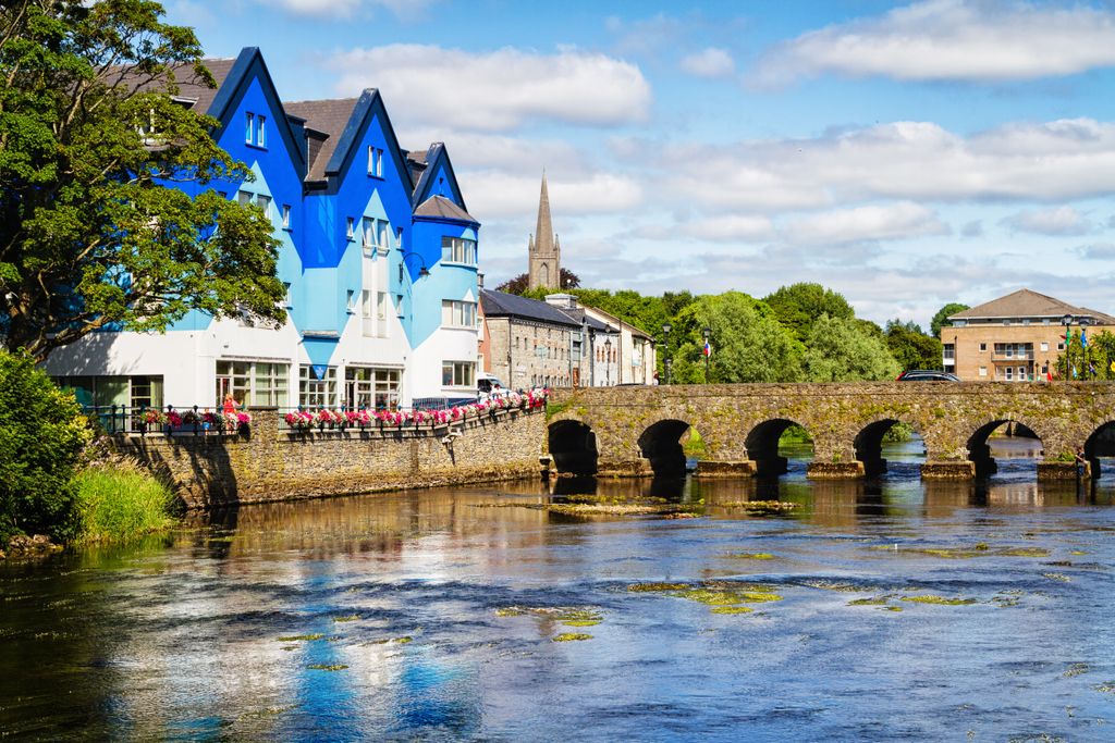
Sligo town is by far the largest settlement in County Sligo, with a population of over 20,600 — over 18,000 more people than the next largest town. Other significant settlements in County Sligo include Tubbercurry, Strandhill, Ballymote, and Enniscrone.
County Sligo, along with the rest of Ireland, has a long and complex geological history. The oldest rocks in County Sligo are schists and gneiss located south of Lough Gill, which metamorphosed from sedimentary rocks around 1,550 million years old.
Most rocks in County Sligo originate from the Carboniferous Period between 358 and 298 million years ago. During this period, Sligo lay below a shallow, warm sea just south of the equator.
Most of Sligo's carboniferous rocks are sandstones and limestone, the latter of which is highly karstic, resulting in numerous cave systems across the county, including the Carrowmore Caverns and Polliska near Geevagh. Diarmuid and Grainne's Cave below the Cliff of Annacuna is the highest in Ireland.
Lough Nasool, just north of Lough Arrow, is a vanishing lake drained by a karstic sinkhole that has disappeared and reappeared numerous times throughout history. Additionally, there are several turloughs in Sligo — temporary lakes that form in limestone depressions. These unique bodies of water are rarely found outside of Ireland.
The Dartry Mountains comprise limestones on top of mudstones. The uppermost limestone layer is composed of the harder Dartry Limestone Formation, which is rich in fossils. Glacial movement from northeast to southwest during the last glacial period sculpted Benbulbin into its unique shape.
Sligo is a nationally significant county for biodiversity — around 20% of its area is designated for nature conservation.
Ireland is home to 26 mammal species, most of which live in County Sligo, including red squirrels, pine martens, fallow deer, foxes, otters, and badgers. Nine bat species also reside in County Sligo, such as brown long-eared bats, common pipistrelles, and soprano pipistrelles.
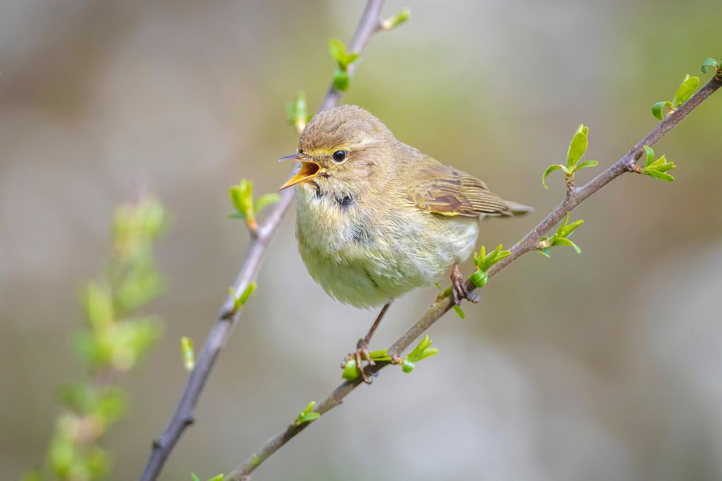
The forests of County Sligo are scarce but brimming with bird species, including sparrowhawks, buzzards, chiffchaffs, willow warblers, and ravens. Ireland's smallest bird species, the goldcrest, can also be spotted in County Sligo.
As with the whole of Ireland, there are no snakes in County Sligo. However, it is home to Ireland's only terrestrial reptile, the viviparous lizard.
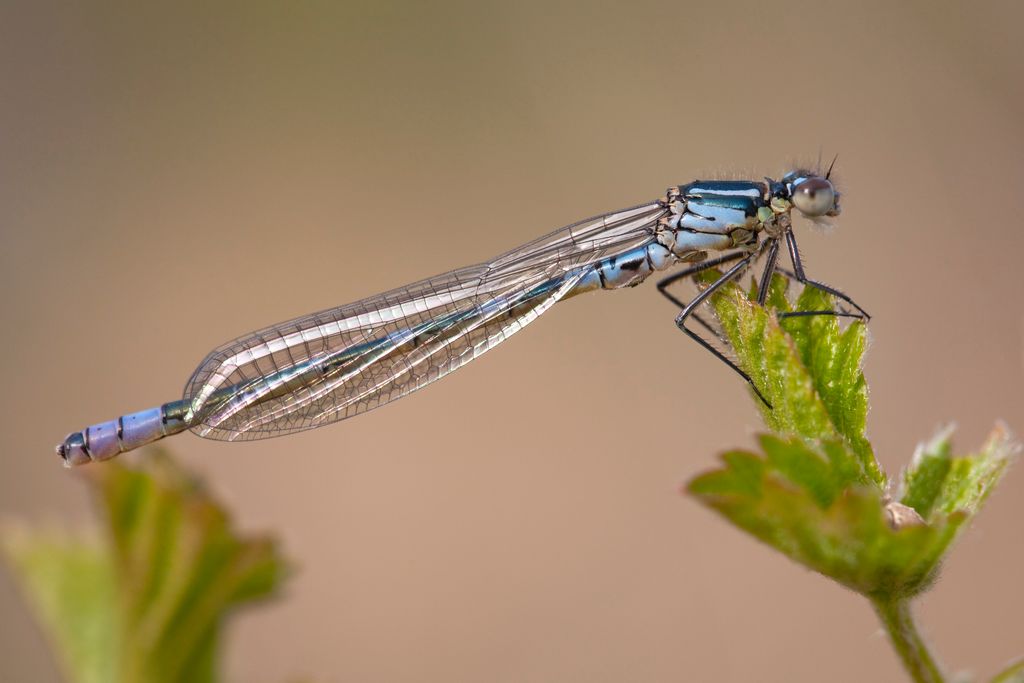
Various butterflies and damselflies inhabit County Sligo's wetlands, including the Irish damselflies, black-tailed skimmers, marsh fritillaries, and large heaths.
County Sligo's extensive waterways and lakes are home to a wide variety of fish, bivalves, and crustaceans. The Easkey River has a healthy freshwater pearl mussel population, while within Lough Gill are white-clawed crayfish, Atlantic salmon, and several lamprey species.
County Sligo's woodlands are limited but fascinating — they're mainly composed of upland oak woodlands and wet woodlands surrounding lakes like Lough Gill. These wet woodlands comprise predominantly willows and alders, while the upland oak woodlands are made up of sessile oaks interspersed with plants like strawberry trees and ivy boomrapes.
There are 76 protected plant species in County Sligo, such as fringed rock-cress, which can only be found in Western Ireland, and is common around Rosses Point.
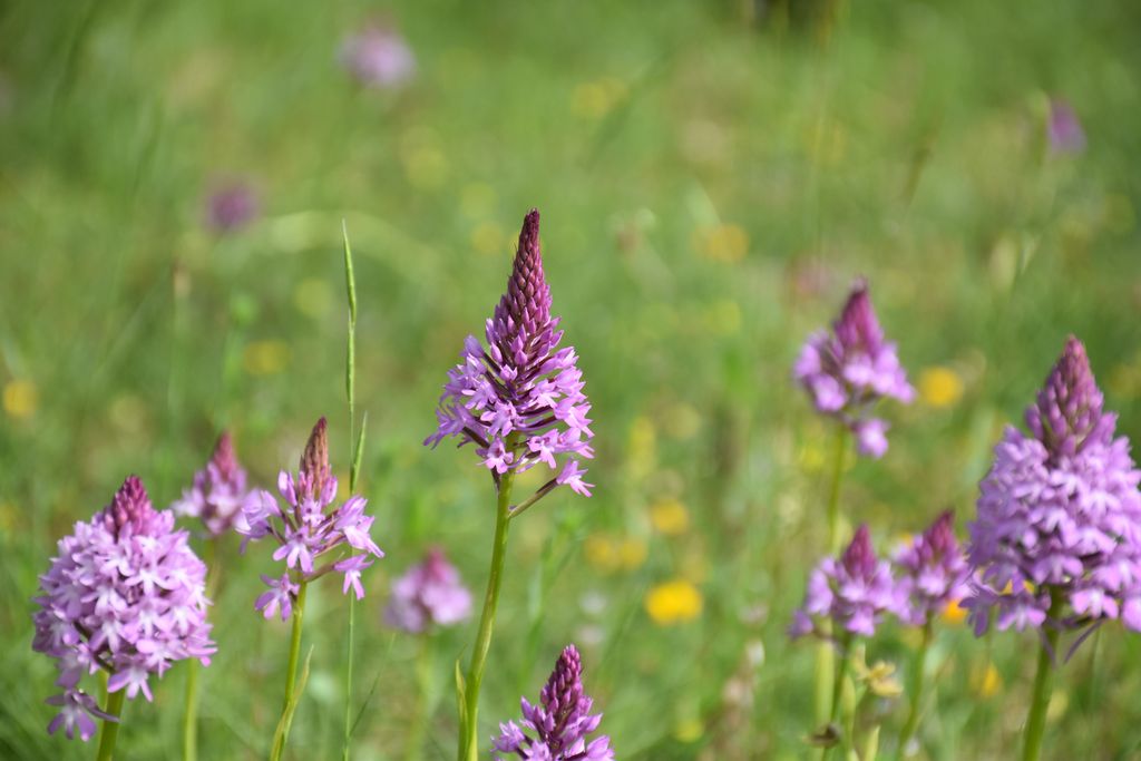
One of the rarest habitats in County Sligo is fixed dunes, which host plant species like wild thyme, wild carrots, and pyramidal orchids. Another of County Sligo's protected plant species, the petalwort, grows on its dunes.
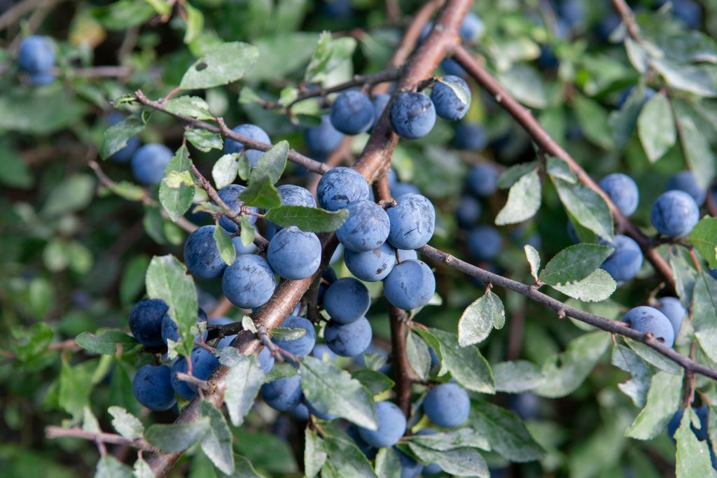
County Sligo's mountains feature alpine and arctic flora that have been around since the last glacial period, like fringed sandworts, alpine saxifrage, alpine meadow-grass, and dwarf willows. Other common plants along County Sligo's hiking trails include heather, primrose, foxgloves, and blackthorn.
Two of Ireland's only carnivorous plant species, butterworts and sundews, can be found in County Sligo. Both species eat small insects, like gnats, aphids, and even moths, by trapping them in the sticky mucus-like liquid that coats their leaves.
While it's unclear exactly when recreational hiking became popular in Ireland, it's thought to have been sometime in the mid to late 20th century. Local infrastructure improvements and increased car usage made some of County Sligo's more remote hiking areas more accessible.
By the 1980s, hiking and hillwalking had gained widespread popularity across Ireland. The Sligo Mountaineering Club (SMC), County Sligo's primary mountaineering group with over 100 members, was founded in 1974 following a group climb up Knocknarea. There are no mountain huts open to the public within County Sligo, partly due to the low elevation of its mountains.
While hiking may have only become popular recreationally within the last century, locals have scaled County Sligo's summit for thousands of years. Benbulbin is steeped in Irish mythology and is said to have been the hunting grounds of the legendary Fianna warrior-hunters in the 3rd century CE.
Atop Knocknarea is Queen Maeve's Cairn, which is 55 m (180 ft) wide and 10 m (32 ft) high. It dates back to 3,000 BCE and is the largest cairn in Ireland after the Brú na Bóinne in County Meath.
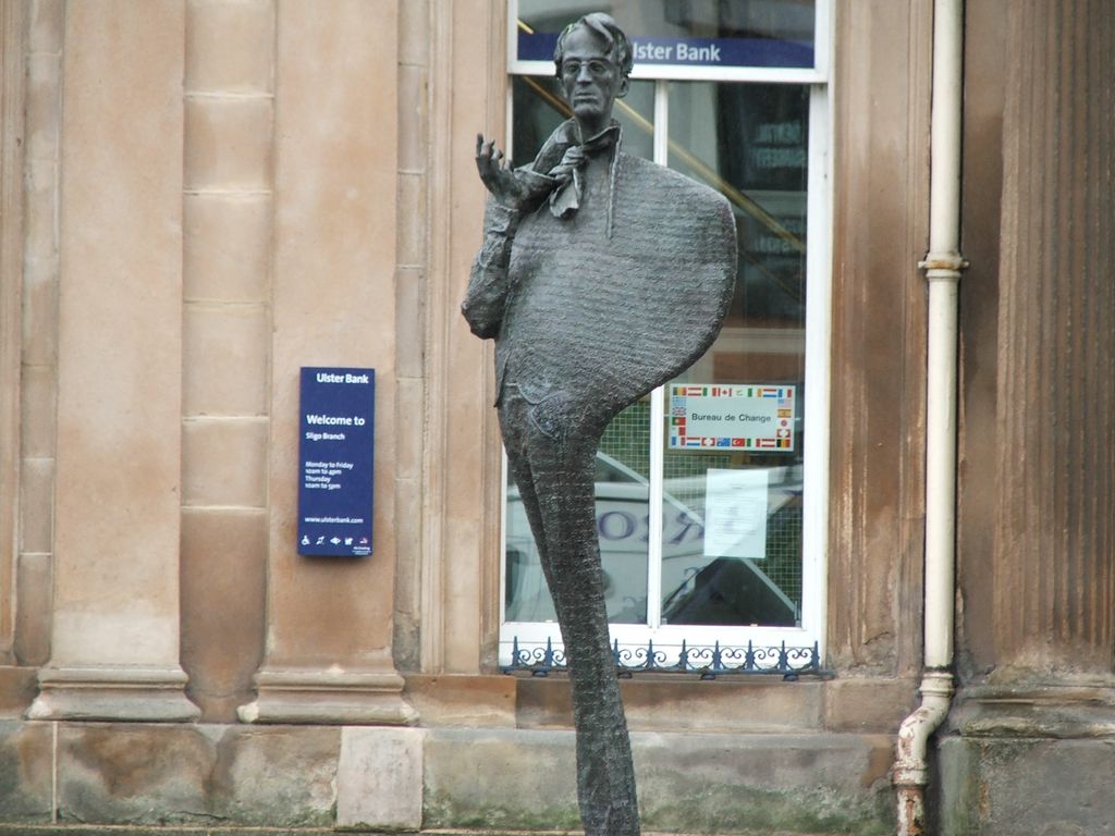
County Sligo's nickname is 'Yeats Country' due to its association with the Yeats family, which includes poet and writer William Butler Yeats, and his brother, the artist Jack Butler Yeats. A bronze statue of W.B. Yeats was unveiled on Stephen Street in Sligo Town in 1989 to commemorate the 50th anniversary of his death.
Despite their modest height, County Sligo's mountains can be potentially hazardous due to changing weather conditions, poorly maintained trails, and steep slopes.
Ensure you bring appropriate clothing, footwear, and plenty of snacks and water. Check the latest weather reports, and inform others of your itinerary when hiking in County Sligo.
Call 999 or 112 and request Mountain Rescue when connected to an operator if you encounter difficulties while hillwalking in County Sligo.
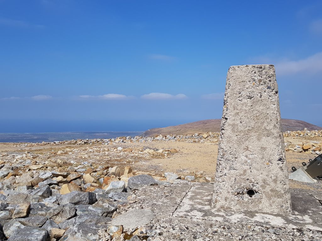
Truskmore (Trosc Mór) (647 m / 2,123 ft) isn't the most beautiful hill in County Sligo, but it's a rewarding climb for any hikers looking to bag Sligo's county top. From the route to the summit, you'll have some of the finest views of the iconic Benbulbin and the rest of the Dartry Mountains, with the Atlantic Ocean visible in the distance.
Truskmore is located in the Dartry Mountains on the border with County Leitrim. Its summit is easy to spot from a distance, topped with a 175 m (574 ft) tall transmission mast.
Truskmore is a relatively straightforward but steep climb — sturdy hiking shoes are a must. The easiest route to Truskmore is along the paved road from the north. You can pick up this trail by parking at the Gleniff Barytes Mill Site. Simply follow the paved road south to the summit. This Truskmore hike is roughly 16 km (10 mi) round-trip.
Alternatively, you can leave the beaten path and enjoy an isolated trek from Eagle's Rock Viewing Area Car Park. Follow the old miner's path as it zigzags up the hill to its summit plateau. From here, you can follow old stone walls to the summit mast. There is no path from here on Truskmore, so map your route carefully. This hike from Eagle's Rock Viewing Area Car Park is approximately 10 km (6.2 mi) long.
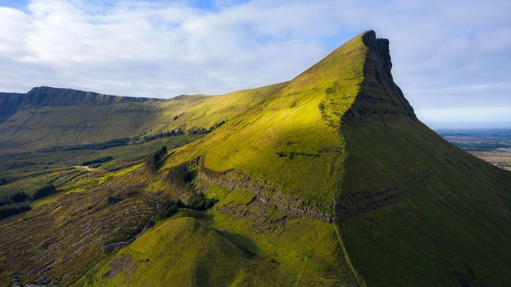
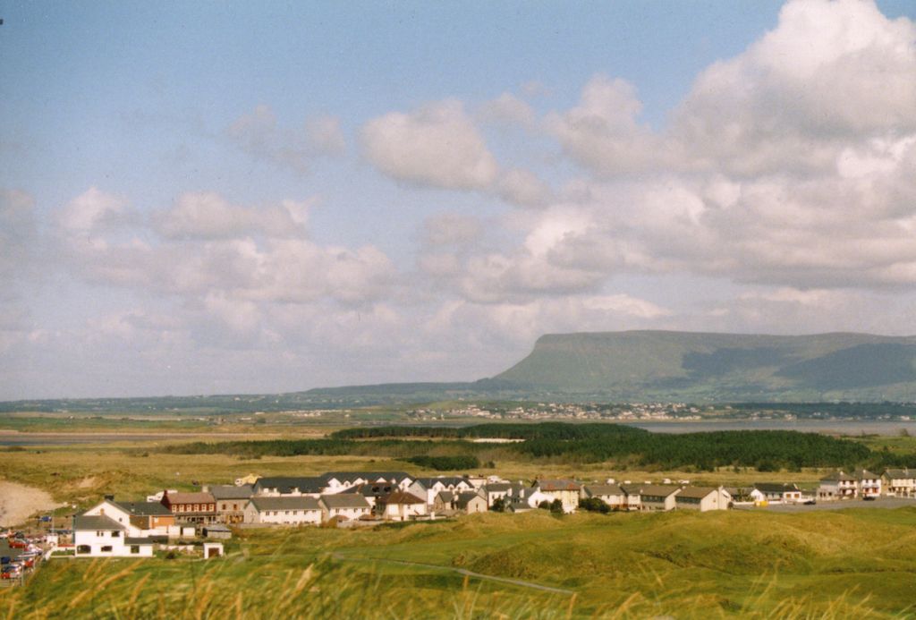
Benbulbin (Binn Ghulbain) (526 m / 1,726 ft), or Ben Bulben, is Ireland's most famous table mountain and one of County Sligo's most iconic landmarks. Its crumpled cliffs and dramatic plateau have featured in Irish folklore for thousands of years, inspiring poet WB Yeats to write Under Ben Bulben.
From Benbulbin, you'll be treated to spectacular views of Benwiskin, Truskmore, and the Atlantic coastline. Benbulbin's north face is a challenging climb; however, its south side is straightforward thanks to its gentle slopes. This route can be fairly boggy in places, so wear waterproof shoes.
You can pick up the trail to Benbulbin from Luke's Bridge. The trail leads south onto the plateau via Benbulbin South-East Top (505 m / 1,657 ft) before crossing the plateau to reach Benbulbin's true summit. Return the way you came, taking a slight detour, keeping left when descending to avoid Benbulbin's steepest slopes.
This Benbulbin hike is approximately an 11 km (6.8 mi) round-trip. It's worth noting that dogs aren't allowed on this walk.
Situated roughly 6 km (3.7 mi) west of Sligo Town is another of County Sligo's most impressive hills, Knocknarea (Cnoc na Riabh) (327 m / 1,073 ft). It's a long, rounded, isolated summit with rugged limestone cliffs. The summit provides panoramas of the entire Coolera Peninsula and Sligo Bay.
On Knocknarea's summit is Queen Maeve's Cairn. It's believed to contain an ancient passage tomb and is clearly visible from the bottom of the mountain. Queen Maeve's Cairn is a National Monument, which is becoming increasingly eroded by visitors who climb on it and take stones.
The best way to experience Knocknarea is on the Queen Maeve Trail. You can pick up this looped trail from the Knocknarea Hill Walk Car Park. Follow the clearly signposted trail, which can be muddy after rain, so wear appropriate shoes. Dogs aren't allowed on this trail.
After the first gate, the trail gets steeper, but poses no real difficulties, making it suitable for families. Along the way, you'll pass the Knocknarea Deserted Village and the scenic Queen Maeve Trail viewpoint overlooking the ocean. The Queen Maeve Trail is approximately 8 km (5 mi) long.
Benwiskin is only the seventh highest summit in the Dartry Mountains, but it's easily one of its most dramatic. Shaped like a crashing wave, Benwiskin is growing in popularity as a hiking destination, with its dizzying peak affording views stretching to Slieve League (595 m / 1,955 ft) in County Donegal.
Just south of Benwiskin, below the Cliffs of Annacuna, is Diarmuid and Grainne's Cave, the highest cave in Ireland. This cave has a wide mouth and is visible along the way to Benwiskin.
There are several routes to Benwiskin, but none are easy. The Gleniff Horseshoe is the most commonly taken route to Benwiskin. You can pick up the trail from the Ballintrillick Forestry. At the fork in the trail, keep left, away from Diarmuid and Grainne's Cave.
The trail soon disappears, so you'll need to cross boglands to reach a fence which acts as a guide to the top. Return the way you came. This hike is approximately 4 km (2.5 mi) long.
If you're looking for an easier route and don't mind walking for a bit longer, start your Benwiskin hike from Luke's Bridge to the south.
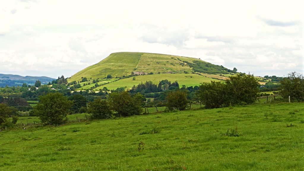
Knocknashee (Cnoc na Sí) (330 m / 1,082 ft) is an isolated hill within the Ox Mountains, famed for its Bronze Age hillfort. It's one of the largest Bronze Age hillforts in the country, measuring 700 m (2,296 ft) long and 320 m (1,049 ft) wide, and home to 30 huts at its height.
Knocknashee is also popular for its sweeping views — on a clear day, you can see across Connacht to Croagh Patrick (764 m / 2,507 ft). Knocknarea is visible to the north.
The Knocknashee Walk is steep but family-friendly. It's easy to follow, with red arrow markers along the route. Sturdy footwear is recommended. You can pick up the trail to the southeast of the hill at Gortnadrass.
The path leads up to a stile, from which you can carry on straight to the summit cairn, or follow the looped trail around the hill, taking in views of the surrounding landscape, including the 15th-century Court Abbey and Keshcorran (359 m / 1,178 ft) in the Bricklieve Mountains. The Knocknashee Walk is approximately 5.5 km (3.4 mi) long.
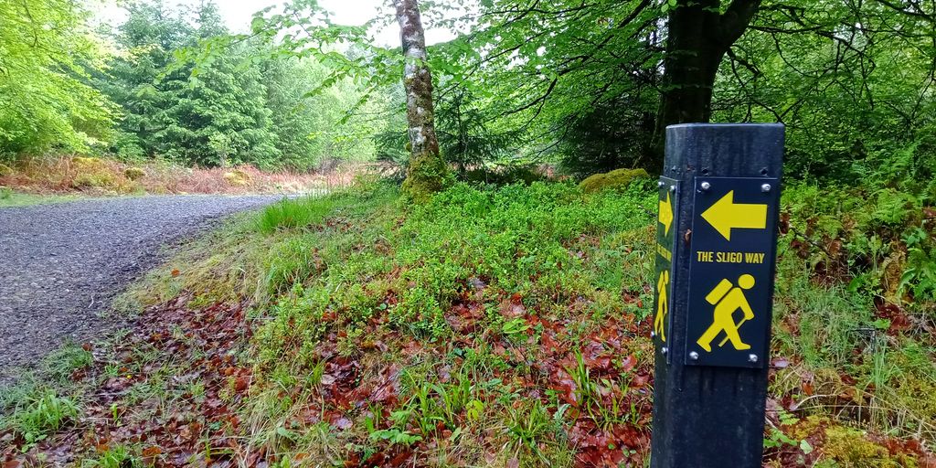
The Sligo Way is County Sligo's best waymarked long-distance trail, spanning around 80 km (50 mi) from Largan Church on Lough Talt near the County Mayo border to Dromahair, County Leitrim. Most hikers complete the Sligo Way over three days. It's worth noting there are few accommodation options during the first 40 km (25 mi) of this trek.
At the start of the route, you'll pass along the eastern edge of Easky Lough, with spectacular views of the Ox Mountains, Donegal Bay, and Nephin (806 m / 2646 ft) on the way. Later in the hike, you'll pass through lakeside woodlands and several historic sites like the 15th-century Moylough Castle and the Neolithic Giant's Grave court tombs.
With a total elevation change of around 900 m (2,952 ft), there are no significant climbs along the Sligo Way.
The seven sections of the Sligo Way are as follows:
From its touristy seaside villages to its bustling county town, County Sligo offers a variety of places to make a base while exploring its stunning hills and mountains.
Ireland West Airport Knock is the nearest international airport to County Sligo, located around 55 km (34 mi) southeast of Sligo Town. Ireland West Airport offers flights from the UK and Spain, as well as seasonal services from Cologne, Bergamo, and Faro.
Sligo Town, or simply Sligo, is the largest and county town of County Sligo. It has a population of 20,608 and is home to 29.5% of the county's population.
Sligo is well-positioned for exploring the county's finest mountains — Knocknarea and the Dartry Mountains are both within 10 km (6.2 mi) of the town center. During your downtime, consider checking out three historic manor houses dotted near Sligo: Temple House, Lissadell House, and Coopershill.
Sligo MacDiarmada Train Station connects Sligo Town to Dublin, Longford, and Mullingar.
Tubbercurry (Tobar an Choire) is County Sligo's second-largest town with a population of 2,307. Located in the south of County Sligo, Tubbercurry is the perfect place to stay if you're hiking in the Ox Mountains.
Tubbercurry is a quiet town known as a hub of traditional Irish music. The South Sligo Summer School is an annual festival in July that celebrates the county's musical heritage.
There's no train station in Tubbercurry, but there are regular bus services to Galway, Sligo Town, and Castlebar.
Check out Strandhill if you want to be beside the seaside during your Sligo hiking adventure. Strandhill is the third-largest town in County Sligo, with a population of around 1,596. It's on Coolera Peninsula within walking distance of Knocknarea.
Strandhill is a popular tourist spot due to its scenic beach and excellent surfing conditions. Despite its size, Strandhill is home to several hostels, as well as Strandhill Lodge and Suites, which has been voted the Best Small Hotel in Ireland by TripAdvisor.
There's no train station in Strandhill, but there are regular bus services to Sligo Town.


