Scan the QR code and open PeakVisor on your phone
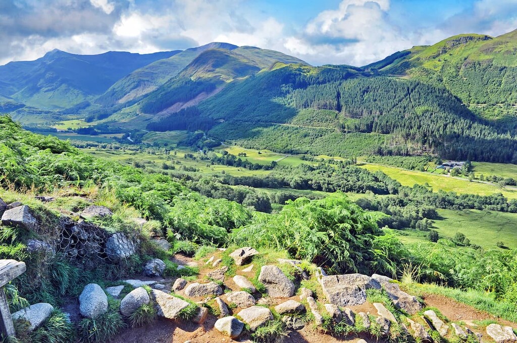
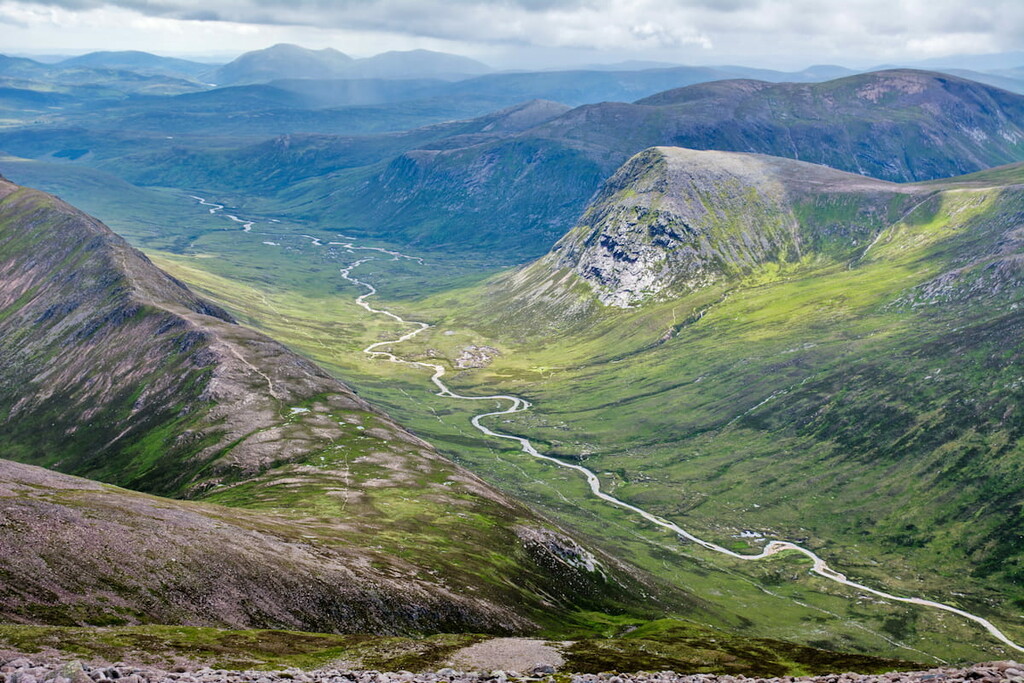
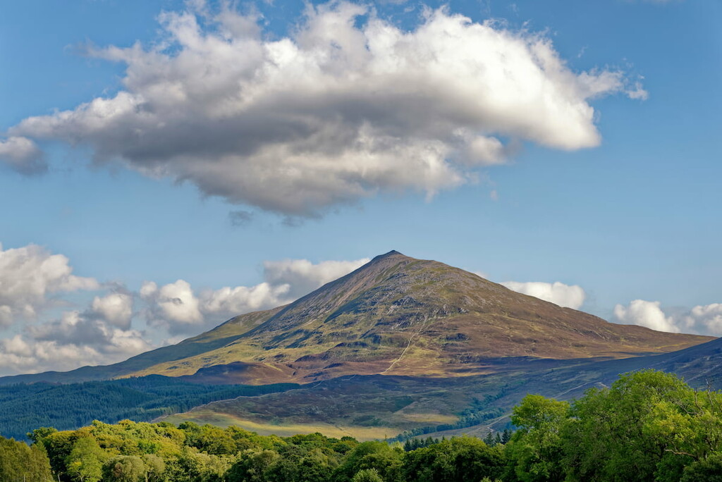
The Grampian Mountains are one of Scotland's largest mountain ranges, encompassing approximately 3,931 square miles between the Northwest Highlands and the Central Lowlands. It's among the most famous mountain ranges in the U.K., with hikers traveling from across the world to scale the highest peaks on the British Isles.
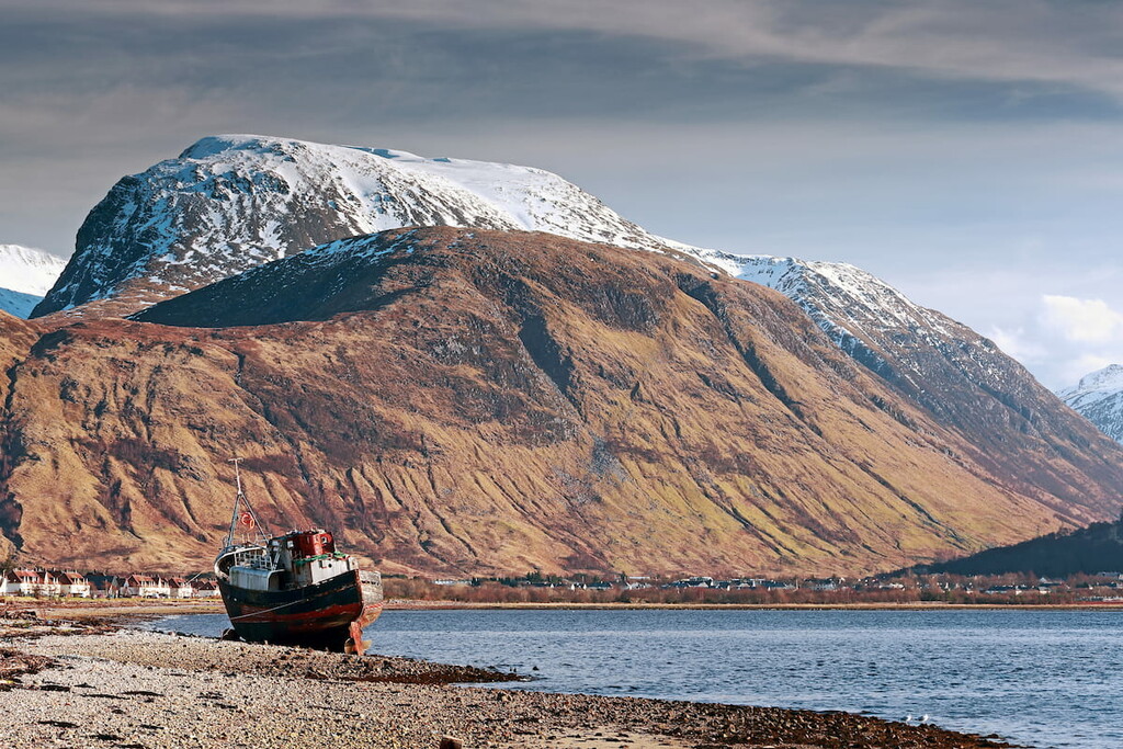
The Grampian Mountains are renowned for containing Ben Nevis (1,345 m), the highest mountain in the U.K. This range is home to Cairngorms National Park, the largest national park in the U.K., as well as Loch Lomond and the Trossachs National Park. The Grampian Mountains also boast many of the other highest summits on the British Isles, including Ben Macdui (1.309 m), Braeriach (1,296 m), and Cairn Toul (1,291 m).
The Grampian Mountains were formed over 400 million years ago when a chain of volcanic islands created by the closure of the Iapetus Ocean collided with the Scottish Highlands. This event, known by geologists as an orogeny, caused these two landmasses to collide, crumpling the Earth into the extensive range we see today. The boundaries of the Grampian Mountains are clearly defined, with the Great Glen and the Highland Boundary Fault to the northwest and southeast, respectively.
The name "Grampian Mountains" originates from Roman historian Cornelius Tacitus, who wrote about The Battle of Mons Graupius during a conflict with native Caledonians in 83AD. However, the exact location of Mons Graupius is often debated by historians and may refer to a more specific area within the range.
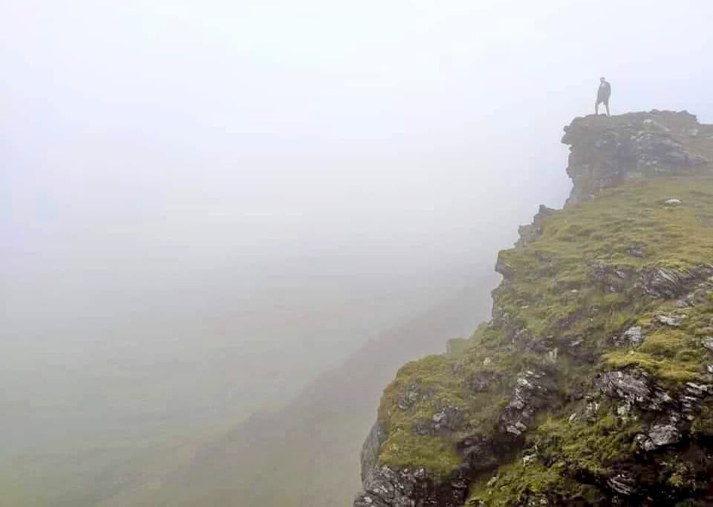
While the U.K. isn't renowned for its vast mountain ranges, the Grampian Mountains are unquestionably home to some of the best and most challenging summits in the region. Keep reading to learn about some of the best peaks to scale in this sublime Scottish mountain range.
Sat on the western edge of the Grampian range, Ben Nevis is the tallest mountain in the U.K. As a result, Ben Nevis is among the most popular climbs in the country, with over 125,000 hikers looking to bag "The Ben" each year. At 1,345 m, Ben Nevis is dwarfed by many major peaks across Europe but is still a challenging climb for even experienced mountain hikers.
The most popular and easiest way of scaling Ben Nevis is via the Mountain Pass. Often referred to as the Pony Track, the Mountain Pass is 10 miles long, ascends 1,352 m, and takes around 8 hours to complete. The Mountain Pass is a there-and-back walk and not looped trail. You can pick up this trail from the Visitor's Centre in Glen Nevis near Fort William.
Despite being a busy route, the Mountain Pass shouldn’t be underestimated, and visitors should check the information boards at the visitor center to ensure they have the correct equipment. The Mountain Pass is rugged and stony along the whole route and leads along sheer cliff edges. During heavy snow, it's easy to lose the path up the mountain in dangerous areas, so mapping out your route and bringing a compass is crucial.
Highly experienced hikers looking for a challenge might prefer to climb Ben Nevis via the Carn Mor Dearg Arête. This walk is longer than the Mountain Pass, taking most hikers at least 10 hours to complete, and will take you up Carn Mor Dearg (1,222 m), the 9th highest mountain in Scotland. Hikers attempting Ben Nevis via the Carn Mor Dearg Arête will need to be comfortable with heights and experienced at scrambling. You can take this route up Ben Nevis in two different ways—either from the North Face car park at Torlundy or by turning left at the fork in the road on the Mountain Pass by Lochan Meall An T-suidhe.
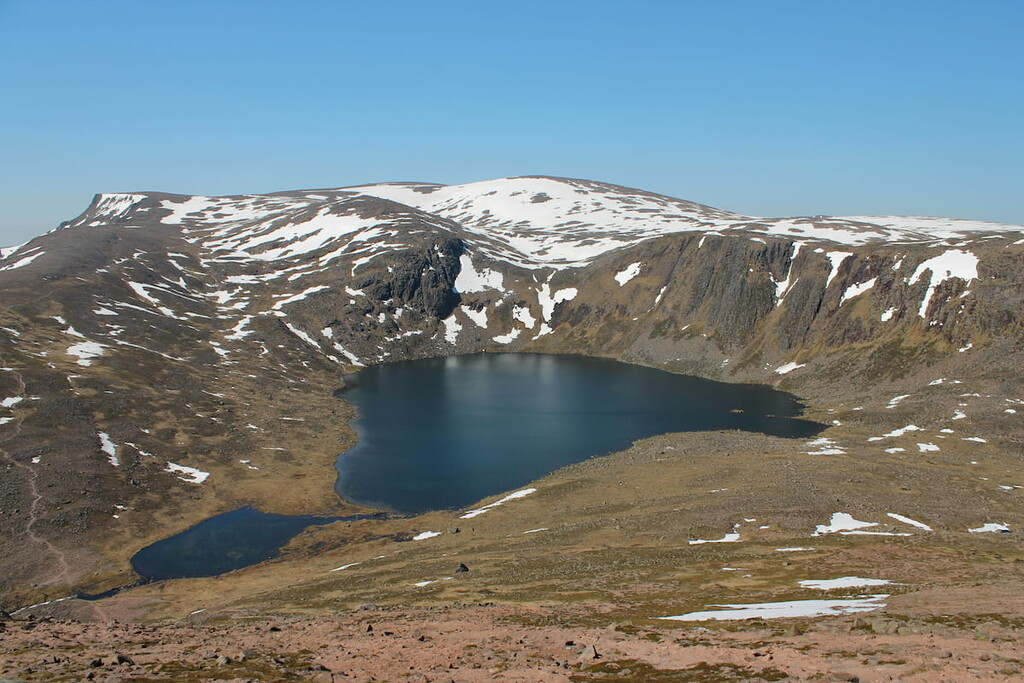
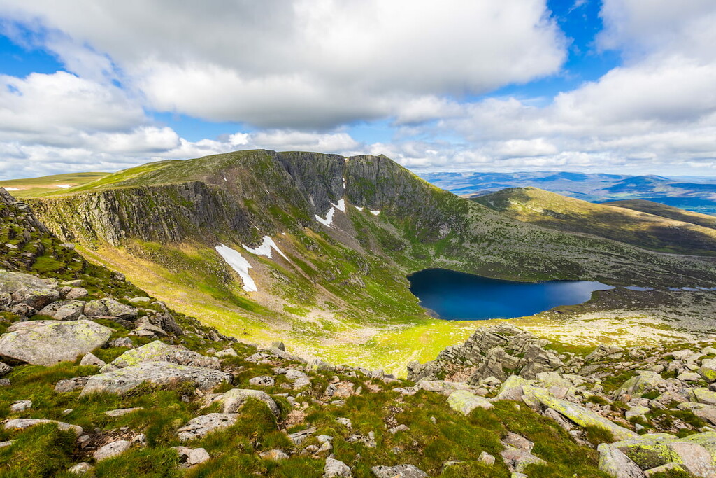
Ben Macdui is the 2nd highest mountain in the U.K. and the highest peak in Cairngorms National Park. While not as high as Ben Nevis, Ben Macdui is located in a much wilder area at the heart of the Cairngorms range. With long walks across exposed plateaus and extreme weather conditions, Ben Macdui shouldn't be underestimated.
Perhaps the most popular way of scaling Ben Macdui is from Deeside, avoiding the ski areas on Cairn Gorm (1,244 m). Climbing Ben Macdui from Deeside is around 18 miles, ascends 1068 m, and takes roughly 10 hours. You can pick up this trail of the National Trust car park at Linn of Dee. As Ben Macdui is prone to bad weather, ensure you map your course carefully.
There are several variations on the Deeside route. For example, after passing through Glen Luibeg, you'll have the option to climb Carn a'Mhaim (1,037 m) before following the mountain's arete to the top of Ben Macdui. The summit of Ben Macdui is marked with a cairn and trig point. To descend, you can follow the pony track used by Queen Victoria when she scaled Ben Macdui before passing over Derry Cairngorm (1,155 m).
Another popular but more difficult route up Ben Macdui is from Speyside. This route is around 11 miles, ascends 932 m, and takes roughly 7 hours. You can pick up this trail from the car park at the Cairngorm Ski Centre. Climbing Ben Macdui from Speyside is considered more challenging as it involves navigating the mountain's exposed plateau, which is difficult even in perfect conditions. During the ascent, you'll walk along the Lairig Ghru mountain pass, which provides stunning vistas of Braeriach (1,296 m) and Cairn Toul (1,291 m).
With its mammoth plateau and lengthy approach, Braeriach is perfect for an epic Highland hike. The 3rd highest mountain on the British Isles, Braeriach is considered by some to be the finest mountain in Cairngorms National Park. One of the most common ways up Braeriach is the there-and-back route from Loch an Eilein car park near Coylumbridge but can also be climbed in conjunction with Cairn Toul as part of the Cairngorm 4000 challenge. This there-and-back route up Braeiach is around 16 miles, ascends 1,217 m, and takes roughly 9 hours.
The ascent of Braeriach is surprisingly straightforward; however, the descent is steep and rugged if you chose to descend on the circular route via Gleann Einich. Braeriach's plateau is also very exposed and can be tough to navigate. This walk will lead you towards the Lairig Ghru mountain pass and along Lochan Deo before joining onto the Chalamain gap. Follow the paths up onto Sron na Lairige's (1,184 m) lower ridge before making your way to the mountain's summit.
From Sron na Lairige, make your way up the slopes of Breariach to the southwest. The summit of Braeriach overlooks rocky cliffs and provides sweeping panoramas of the region, with Cairn Gorm (1,244 m) to the northeast, Ben Macdui to the east, and Lochnagar (1,155 m) far to the southeast.
The easiest way to descend is to retrace your steps; however, you can extend your walk by returning via Gleann Einich. This route is best completed in good weather, as it involves crossing steep hills, bogs, and streams. Head northwest along the rim of Coire Ruadh before descending to the west into Coire an Lochain. You'll then head further downhill, weaving down into Gleann Einich before reaching ground level.
Despite being only the 10th highest Munro, Ben Lawers (1,214 m) is among the popular mountains in Scotland, thanks to its relatively straightforward ascent. That being said, this hike can be tricky in bad weather, and hikers should map a route regardless. During this hike, you'll also get to bag another Munro, Beinn Ghlas (1,103 m). The hike up Ben Lawers is around 7 miles, ascends 942 m, and takes approximately 4 hours.
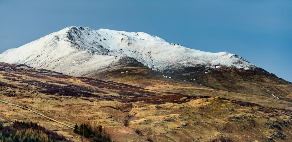
The best place to start this walk is from the Ben Lawers car park. One of the reasons Ben Lawers is such a popular climb is the car park is already located high up in the mountains, and the trails are well-defined and easy to follow. You'll first ascend Beinn Ghlas to the right of Ben Lawers before making your final ascent. From Beinn Ghlas, you'll have views of neighboring Meall Corranaich (1,069 m) and Meall nan Tarmachan (1,044 m).
The summit of Ben Lawers is marked with a large cairn. Hikers looking to extend their Highland walk can continue onto An Stuc (1,118 m), Meall Garbh (1,118 m), and Meall Greigh (1,001 m). Bear in mind this walk will take far away from your starting point, so you'll want to make travel arrangements beforehand. To descend on the original route, you'll return to the mountain pass, bypassing the summit of Beinn Ghlas by following the bealach (mountain pass) between the mountain and Meall Coranaich (1,069 m) before rejoining the original trail.
Perhaps the most popular of all of Scotland's mountains, Ben Lomond (974 m) is the perfect place to start bagging Munros. Ben Lomond is a favorite among hikers due to its well-trodden paths, easy ascent, and the beautiful views it provides of Loch Lomond and the surrounding Trossachs. There is one main route up Ben Lomond and two potential ways of descending. The hike up Ben Lomond is 7 miles, ascends 990 m, and takes around 5 hours.
The best place to start your Ben Lomond trek is at the Rowardennan car park. The path begins by taking you through some woodlands before opening onto the mountainside and zigzagging up Ben Lomond. Ensure you stop to admire the views across Loch Lomond before reaching the ridge. After passing some stark cliffs, you'll reach the trig point at the summit of Ben Lomond. The easiest way to descend the mountain is to retrace your steps.
A different and more complicated way of descending Ben Lomond is to the northwest. This route will take down onto the Ptarmigan ridge, with stunning views of The Cobbler (884 m), before a steep descent back to the Rowardennan car park.
The Cobbler, also known as Ben Arthur, is among the most popular Corbetts in the Grampian Mountains. It's also one of the best rock climbing destinations in the Southern Highlands. With its distinctive shape and clear paths, The Cobbler is among the top short hill walks in Scotland. This climb up this Corbett is 6.5 miles, ascends 920 m, and takes around 5 hours.
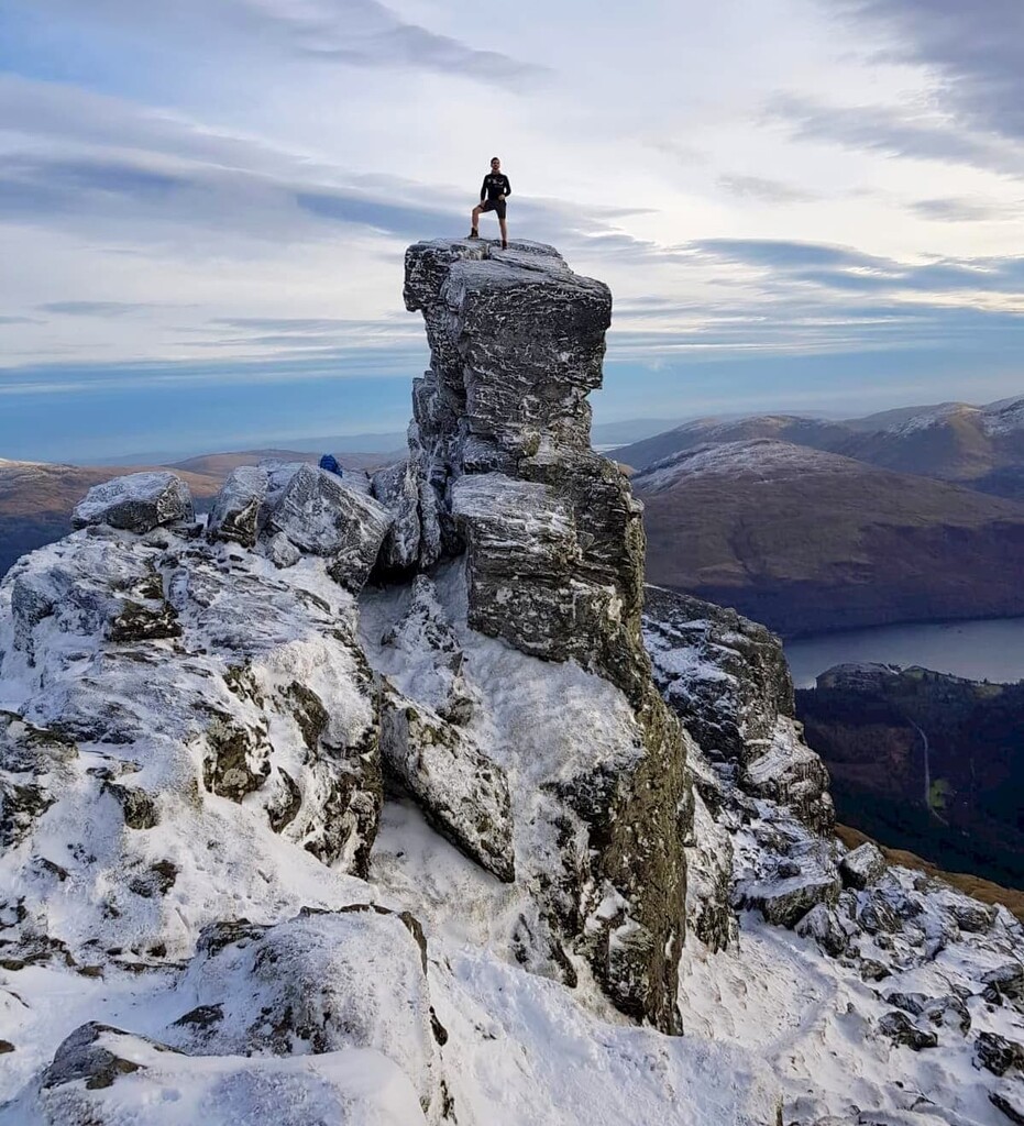
You’ll find the start of this walk by parking at the car park off the A83 near Succoth. Similar to Ben Lomond, this path leads you initially through some woodlands before weaving up the hillside. The correct path is easily recognizable due to its red waypoint markings. This same trail has been used since the late 19th century and features aclear stone path, making it difficult to get lost. Atop The Cobbler is a small summit plateau.
Most hikers won't want to scale the true central summit of The Cobbler, which involves a Grade 5 scramble up a rocky outcrop. Avid rock climbers looking for a real challenge might also want to attempt The Cobbler's even harder south peak. The best spot for views of the surrounding mountains is The Cobbler's north peak, with views of Beinn Ime (1,011 m) just to the north, Beinn Narnain (926 m) to the northeast, and Ben Lomond to the east. This a there-and-back trail, so retrace your steps to return to the car park.
Lochnagar, also known as Beinn Chìochan, is known for its stunning northern corrie and is considered one of the most beautiful mountains in the Cairngorms. The mountain's natural beauty has been noted in literature over the years, including in Lachin y Gair by Lord Byron and The Old Man of Lochnagar by Charles, Prince of Wales. As a result, Lochnagar is very popular, with mostly clear paths up the mountain. Climbing Lochnagar from Glen Muick is 11 miles, ascends 930 m, and takes approximately 6 hours.
Start your walk from the car park at Glen Muick before walking up the Spittal to the visitor's center. After crossing through Glen Muick, the trail leads by the edge of the Royal Balmoral Estate. After passing the Clais Rathadan gorge, the trail is a well-defined stone path thanks to modern renovations. For the best views of Lochnagar's corrie, take a slight detour up to the summit of Meikle Pap (978 m).
From Meikle Pap, you can either retrace your steps or continue up the slope known as The Ladder. The Ladder is the most challenging part of the walk and involves crossing a boulder field and walking close to the edge of cliffs. You'll also have the opportunity to bag Cac Carn Mor (1,149 m) on the way to the true summit of Lochnagar.
On your descent, return to Cac Carn Mor before heading southeast towards Glas Allt glen. The stream here rolls off the hillside forming Glen Allt falls, which is well-worth admiring. You'll finish your descent by the Royal Lodge of Glas-allt-Shiel, frequented by Queen Victoria and more recently by Prince Charles. Here, follow the path along Loch Muick back to your starting point.
Similar to Ben Lomond, Schiehallion (1,083 m) is one of the most frequently climbed and best-known mountains in Scotland. Schiehallion is popular due to its conical shape and the views it provides of Loch Rannoch. Schiehallion also has scientific importance, as Astronomer Royal Maskelyne used the mountain to take the first accurate measurement of the Earth's weight in 1774. The hike up Schiehallion is 6 miles, ascends 731 m, and takes around 5 hours.
Pick up this trail from the Braes of Foss car park. The original path used to take hikers straight up the mountain's northern flank before renovations in 2001. Today the path circles further south before climbing up to the mountain's ridge. From atop the ridge, take in views Loch Tummel and Beinn a'Ghlo (1,027 m) to the northeast.
The most difficult part of the climb up Schiehallion is close to the summit when you'll have to pass over a small boulder field. Reaching the summit is well worth it, though, with panoramas of Cairn Gorm (1,244 m) and Carn Mairg (1,041 m) to the southeast and Loch Avon and Loch Etchachan to the south. To descent, retrace your steps back down the mountain.
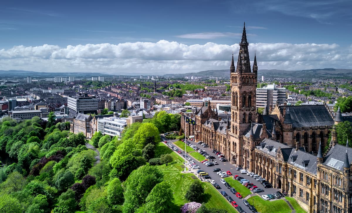
Scotland's largest city, Glasgow, is surprisingly close to some of the best hiking destinations in the Grampian Mountains. Glasgow is less than 20 miles from Loch Lomond and the Trossachs National Park, which boasts Ben Lomond, Ben More (1,169 m), and Ben Lui (1,130 m). Glasgow is also home to some of the top attractions in Scotland, like Kelvingrove Gallery and Glasgow Cathedral. You won't be short of places to stay in Glasgow either, with classy hotels like Hotel du Vin, Radisson Blu, and Malmaison.
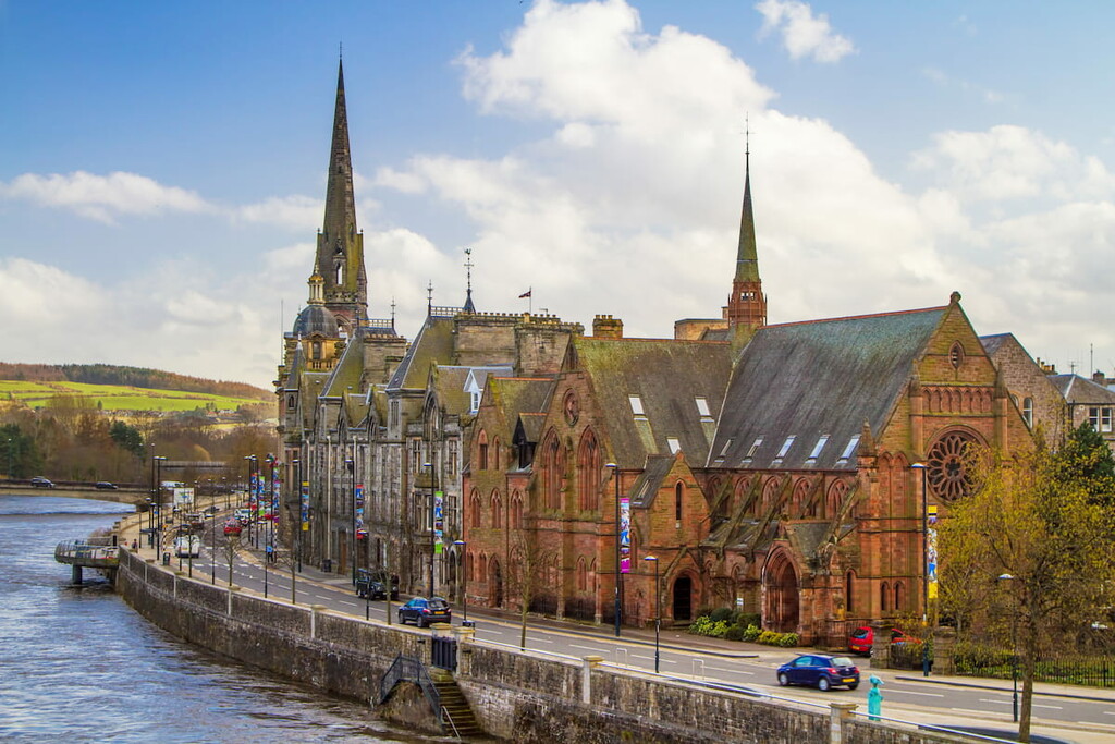
Perched at the mouth of the River Tay, Perth is ideal for hikers looking to stay close to both of Scotland's national parks. Perth is less than 35 miles from both Loch Lomond and The Trossachs and Cairngorms National Park, which contain many of the best peaks in the Grampians. Perth itself features some interesting local cultural and historical attractions, like the 16th-century Black Witch Castle and the Perth Museum & Art Gallery. Hikers looking to stay in Perth should consider booking a room at The Royal George Hotel, Mercure Perth Hotel, or Station Hotel.
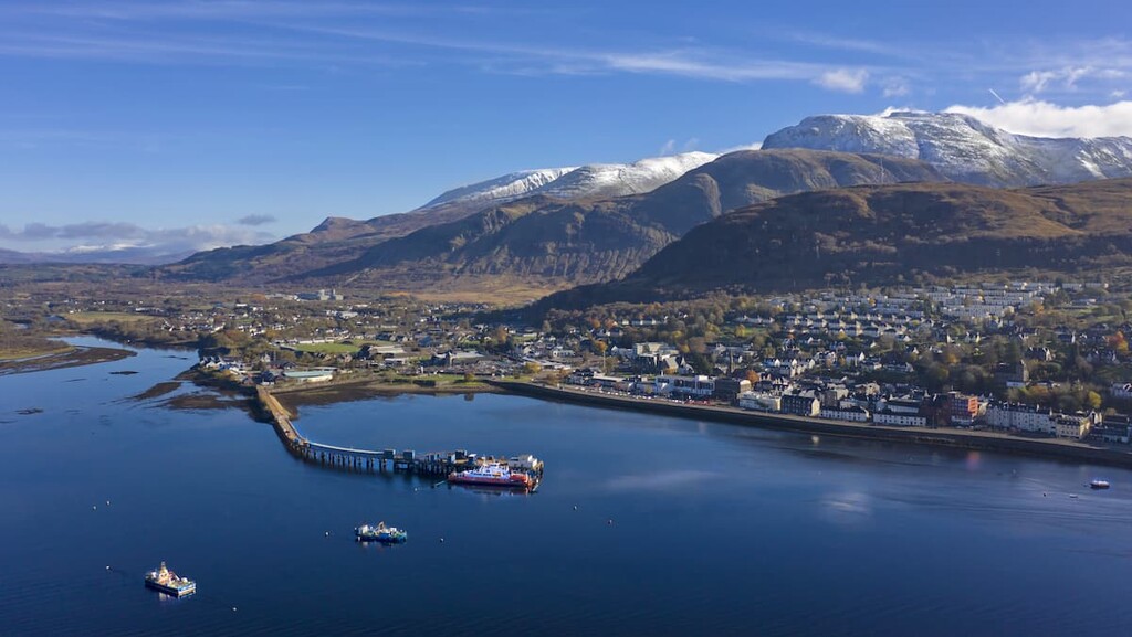
Fort William is the de-facto destination for hikers looking to scale Ben Nevis. The highest mountain on the British Isles is just 5 miles from town, and other nearby mountains include Aonach Mòr (1,221 m) and Stob Coire Easain (1,115 m). During your stay in Fort William, be sure to check out the Ben Nevis Distillery and the West Highland Museum. Despite its Highland location, Fort William is a sizable town with several hotels, including Clan Macduff Hotel, Moorings Hotel, and The Imperial Hotel.
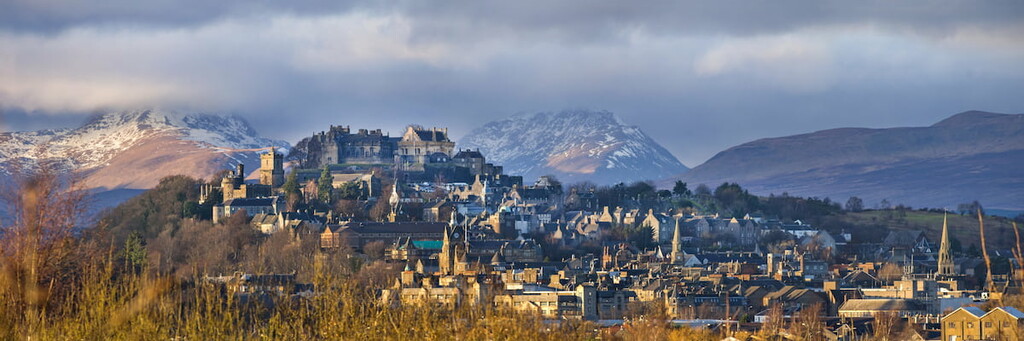
Located 26 miles north of Glasgow, Stirling is the closest major city to Loch Lomond and the Trossachs National Park. This historic settlement dates back over 4,000 years, with impressive historic sites like the 15th-century Holy Rude Church and the ruins of medieval Cambuskenneth Abbey. If you're planning a stay in Stirling, consider booking a room at the Stirling Highland Hotel or Hotel Colessio.
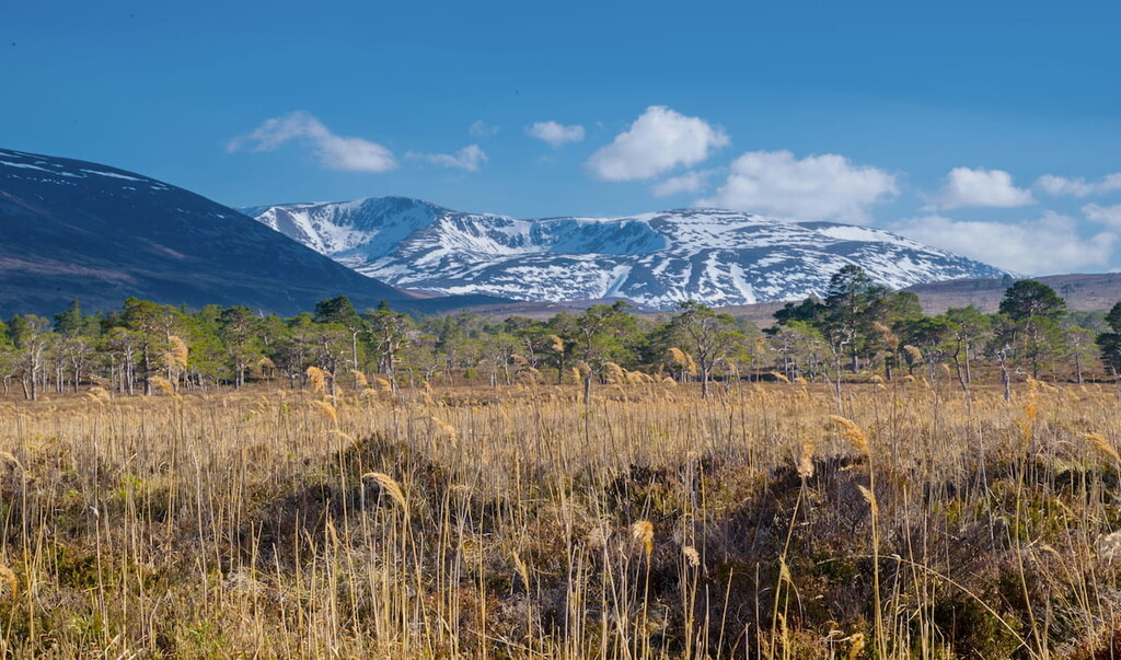
If you're looking to explore the best of Cairngorms National Park, there are few better places to stay than Aviemore. This Highland town serves as a starting point for trails that lead up several mountains including Ben Macdui, Braeriach, and Bynack More (1,090 m). Aviemore is also home to one of the most popular ski resorts in Britain. Popular hotels in the area include Cairngorm Hotel, High Range Lodge Hotel, and Macdonald Aviemore Resort.
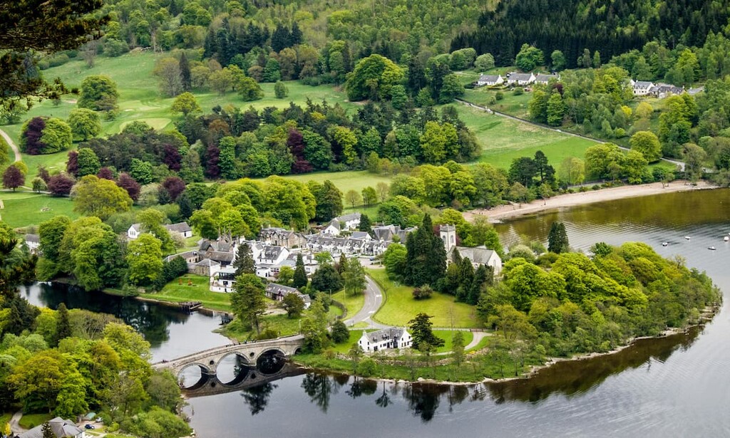
Located at the heart of the Grampian Mountains, Kenmore is superb for those looking to make the most of their Highland adventure. Sat on the eastern edge of Loch Tay, Kenmore provides easy access to two of the best Munros in Scotland, Schiehallion and Ben Lawers. Kenmore also boasts some great historic attractions, like the Croft Moraig Stone Circle and The Scottish Crannog Centre. If you plan on staying in Kenmore, book a room at The Kenmore Hotel, the oldest inn in Scotland.