Scan the QR code and open PeakVisor on your phone
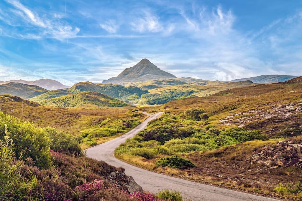
Escape civilization and explore the most remote peaks in Britain with a hiking adventure in the Northwest Highlands of Scotland. There are 6034 named summits in Northwest Highlands. The highest and the most prominent mountain is Càrn Eige (1,183 m/3,881 ft).
The Northwest Highlands encompass the northern third of Scotland, an area of approximately 7,112 square miles (18,419 square km) in size. The region is separated from the Grampian Mountains by the Great Glen, which runs for 62 miles (100 km) from the Moray Firth directly southwest to Loch Linnhe.
The Caledonian Canal, which follows a similar route to the Great Glen, separates the Northwest Highlands from the rest of Scotland. The Caledonian Canal is known for being home to Loch Ness, Scotland's most famous lake and home to the legendary Loch Ness Monster.
Along with the northwestern portion of the mainland, the Northwest Highlands include many islands off Scotland's western coastline, known as the Inner Hebrides.
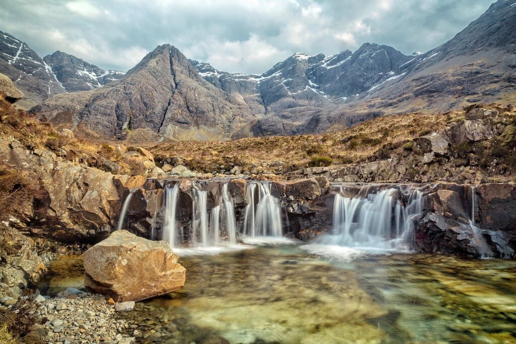
Notable examples include the largest of the Inner Hebrides, the Isle of Skye, the Isle of Mull, and the Small Isles archipelago. The Isle of Skye is home to the Cuillin Hills, one of the most popular hiking destinations in the Northwest Highlands.
Back on the mainland, the Northwest Highlands are characterized by several hill ranges, the most popular of which are in the central and western areas.
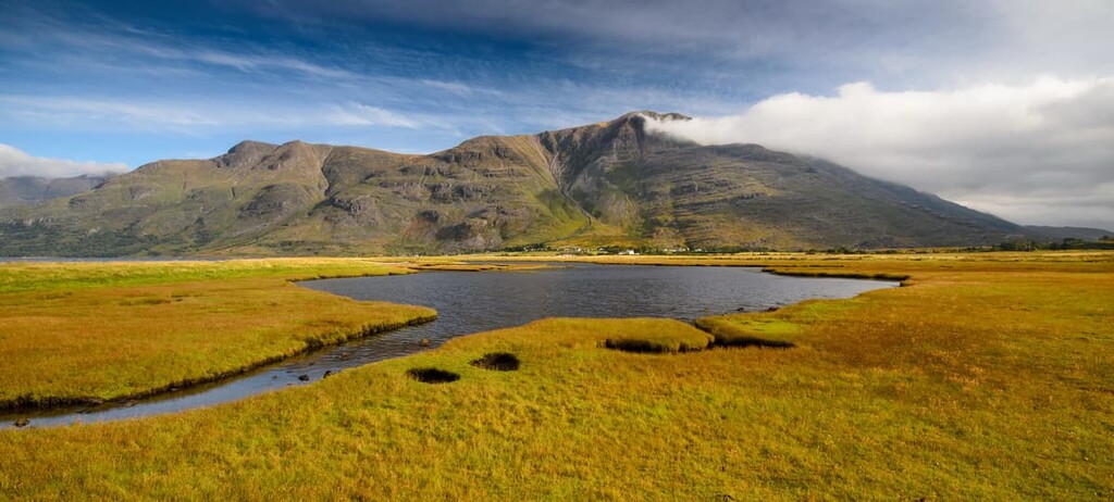
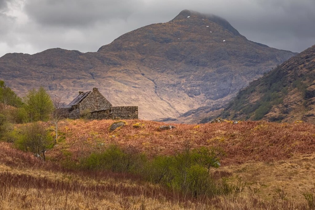
In the Wester Ross area is the Torridon Hills, which feature several Munros and some of the oldest rocks on earth. Just outside the Torridon Hills is the village of Ullapool, which is a short distance from a range of nine Munros known as the Fannichs, as well as the stunning An Teallach massif.
To the northwest in the historic county of Sutherland are Assynt and the Assynt-Coigach National Scenic Area, which contains Eas a' Chual Aluinn, the highest waterfall in Scotland. Assynt is also home to Stac Pollaidh (612 m/2,007 ft), a popular mountain due to its accessibility.
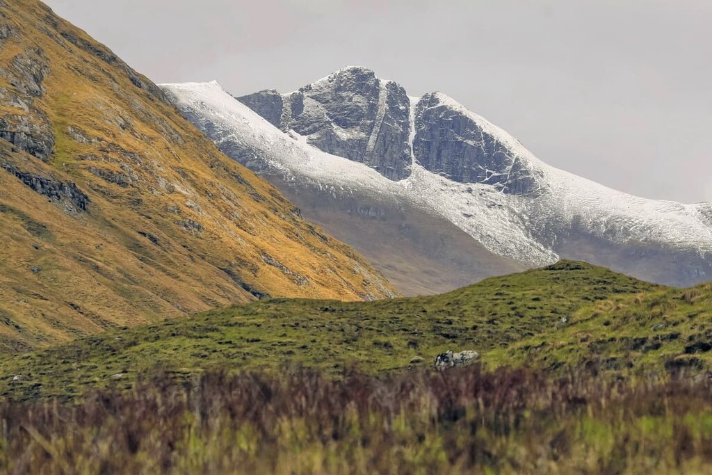
The highest point in the Northwest Highlands, Càrn Eige, is situated to the south in the isolated Glen Affric, around 33 miles (54 km) north of Britain's tallest mountain, Ben Nevis (1,345 m/4,412 ft).
The largest settlement in the Northwest Highlands is Inverness, which has locally been dubbed "The Capital of the Highlands.” Inverness is located to the northeast and it overlooks the Moray of Firth. The boundary of the Northwest Highlands is approximately 75 miles (122 km) north of Scotland's largest city, Glasgow, and 93 miles (150 km) miles from the capital, Edinburgh.
While Northwest Highlands may not contain as many of Britain's highest summits as the neighboring Grampian Mountains, there are still around one hundred Munros to be found across this wild region. A Munro is a local term used to describe any Scottish mountain over 3,000 feet (914.4 m) tall.
Càrn Eige, along with its twin, Mam Sodhail (1,181 m/3,874 ft), is the tallest mountain in the region. Sgùrr Alasdair (992 m/3,254 ft) is the second-most prominent mountain in the Northwest Highlands and is the highest mountain on the Isle of Skye.
Other notable mountains in the region include Bidean a' Ghlas Thuill (1,062 m/3,484 ft), the highest peak in the An Teallach massif near Ullapool, and Spidean a' Choire Leith (1,055 m/3,461 ft), the highest of the Torridon Hills.
As with much of Scotland, the geology of the Northwest Highlands is complex. The Northwest Highlands are a popular location for geologists, as the region is often considered a "Cradle of Geology" due to the presence of Lewisian Gneiss on the western coastline.
Lewisian Gneiss is the oldest known rock in Europe at around 3 billion years old. Much of the landscape has been shaped by the Moine Thrust Belt, a linear tectonic feature that runs across most of the Northwest Highlands.
Many of the mountains in the west of the Northwest Highlands are composed of Torridonian sandstone, which formed between the Mesoproterozoic and Neoproterozoic around 1 billion years ago. These reddish rocks can be found throughout the Torridon Hills and the surrounding mountains. The presence of Torridonian sandstone has caused the formation of inselbergs atop many of the region's mountains.
The eastern portion of the Northwest Highlands is boggier and more remote than the region to the west, with much of the area composed of Moine rock, the composition of which is still largely a mystery to geologists.
The effects of the last major glaciation are visible along the coastline, where small coves and inlets have been made in the Lewisian Gneiss. Meanwhile, in areas with much softer Torridonian sandstone, towering sea cliffs, and large stacks, like the 60-meter (197 ft) Old Man of Storr, have been created by millions of years of erosion.
As one of the wildest and most diverse areas of the United Kingdom, the Northwest Highlands are home to some rare and endangered animals.
Scottish wildcats, the last native wildcat species on the British Isles, are one of Scotland's best-known and most endangered residents. Scottish wildcats are becoming increasingly rare due to breeding with domestic species.

The largest mammals common to the Northwest Highlands are Highland cattle, Highland ponies, and red deer. Over the years, sightings off the coast of aquatic giants like humpback whales have become more frequent. While exploring the region's 10,000-year-old Caledonian Forests, you may come across elusive species like pine martens and red squirrels.
The Northwest Highland's coastlines and mountains are home to a number of rare bird species, making it a hotspot for birdwatchers. A fine example is the Isle of Rùm, home to a colony of 70,000 Manx shearwaters The island was also integral to reintroducing white-tailed sea eagles to the British Isles. Other species to watch for include western capercaillies, puffins, and guillemots.
The most common types of plants across the Northwest Highlands are bryophytes and lichens, which far outnumber vascular species. There are thought to be around 2,500 species of bryophytes and lichens in the Scottish Highlands, compared to 1,500 vascular species.
The mountain slopes of the Northwest Highlands are home to a rare bryophyte community known as a "Northern Hepatic Mat." This "Northern Hepatic Mat" consists mainly of rare liverworts, including purple spoonwort and alpine notchwort.
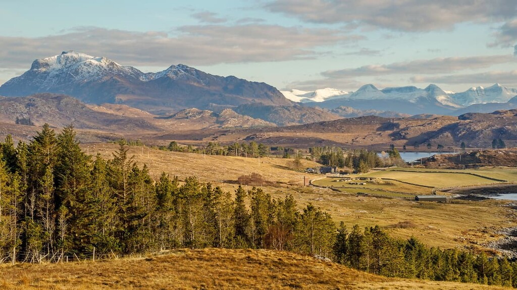
Like much of Scotland, the Northwest Highlands feature remnants of Caledonian Forests which have been present in the area since the last major glaciation. Deforestation has decimated much of the region's forests, with only 35 remnants left in the country. These forests are composed mainly of Scots pine, birch, oak, ash, and hazel.
The Northwest Highlands also boasts some flora rarely found outside of Scotland. For example, the slopes of Sgùrr an Utha (796 m/2,611 ft) in Lochaber is the only place in the UK where you can find Diapensia lapponica, the pincushion plant.
While hiking through the Northwest Highlands, be on the lookout for some of Scotland's iconic flora. During fall, Scottish bluebells can be seen in the region's marshlands, while you may get lucky and spot Scottish thistles along the roads and trails. A notable example of a species that's endemic to the Northwest Highlands is the Scottish primrose, which can only be found in Caithness and the Orkney Islands.
The Northwest Highlands have a long human history, dating back around 12,000 years to the Paleolithic. Throughout early human history, evidence suggests that Highlanders were mainly a nomadic people without fixed settlements. Most of the population spoke Gaelic, while the people of the Lowlands predominantly spoke the Scots language.
The first evidence of farmlands across the Northwest Highlands date back to around 3,000 BCE. Recorded history in the Northwest Highlands began after the arrival of the Romans in the first century CE.

Feudal clan warfare was common across much of Northwest Highlands during the Middle Ages, often resulting in bloody battles. Clan MacLeod (Clann Mhic Leòid) and Clan MacDonald (Clann Dòmhnaill) were involved in some of the Northwest Highland's worst skirmishes, including the Battle of the Spoiling of the Dyke in 1578 and The Eigg Massacre in 1577. Clan Campbell (Na Caimbeulaich), which controlled Argyll and the surrounding area, is often considered history's most powerful Highland clan.
During this period, Scotland was also ruled by a monarchy independent of England. One notable king was Macbeth, King of Alba, who ruled in the eleventh century and was the subject of the Shakespearean play Macbeth.
One of the most critical moments in the Northwest Highlands' history happened in the mid-eighteenth century. After Scotland's bloody wars between clans and with the English, landowners realized they could make more money off the land by renting it as sheep walks and farmland.
This realization led to an event known as the Highland Clearances, which resulted in many poor Highlanders being forcefully removed from their homes, with many emigrating overseas. The Highland Clearances are one of the primary reasons for the Scottish diaspora. Most Highland descendants live outside of Scotland, with large populations in the USA, Canada, and Australia.
Today, the Northwest Highlands has a population of around 200,000 people. The entirety of the mainland is managed by the Highland council area, while the Isle of Mull is part of Argyll and Bute.
The largest settlement by far is Inverness, with a population of around 50,000 people. Most modern settlements are dotted along the region's coastline, with Lairg being one of the largest inland settlements, with a population of 800 people.
Looking to plan a wild getaway in the Northwest Highlands? Read on to find out about the region's main hiking areas.
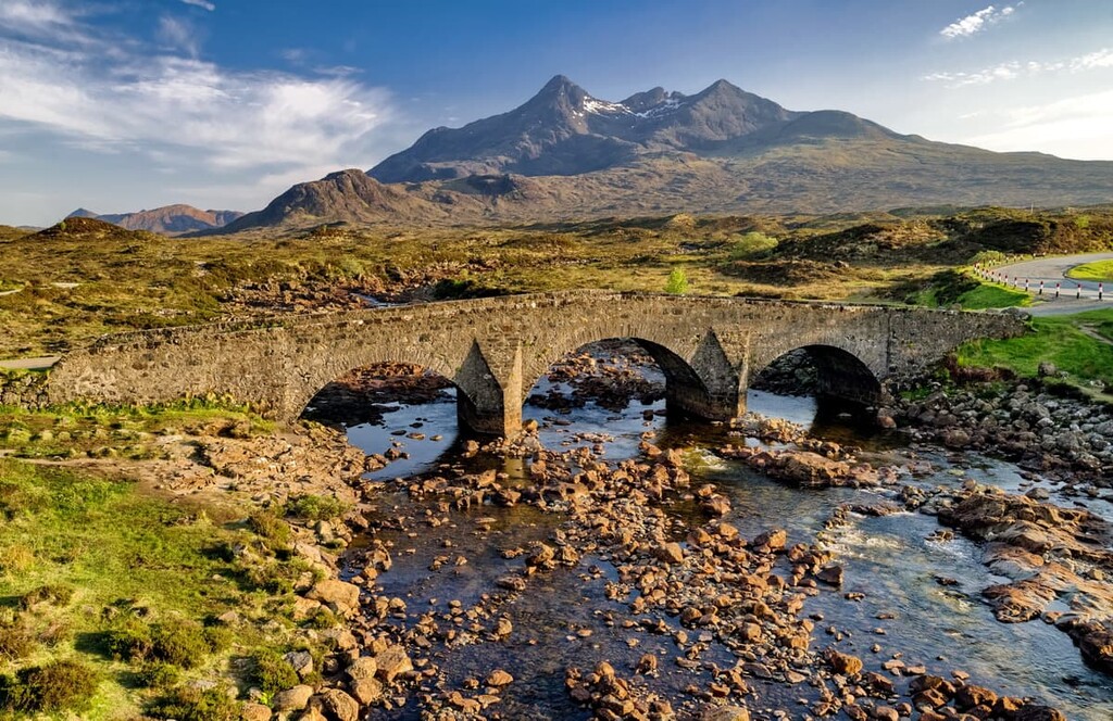
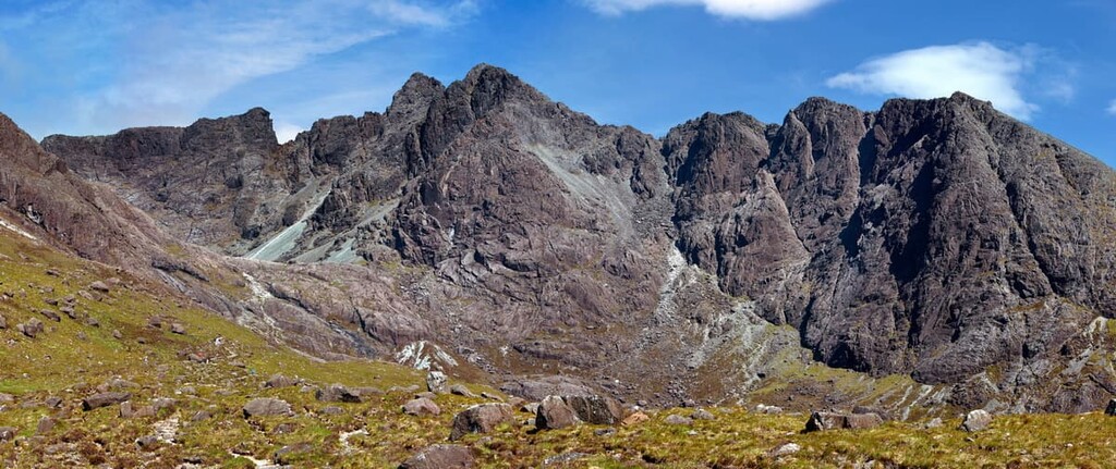
The Cuillin Hills are among the most popular mountains in the Northwest Highlands due to the Isle of Skye's dramatic landscape. The hills are split into two areas, with the Red Cuillins to the east separated from the Black Cuillins by Glen Sligachan.
A large portion of the Cuillins, including Sgùrr Alasdair and Blà Bheinn, form part of the Cuillin Hills National Scenic Area. The area is managed by NatureScot.
The Black Cuillins dominate the central ridge and contain many of Skye’s highest peaks. The Black Cuillins are considered some of the most challenging mountains in Scotland, as many require scrambling and rock climbing to reach the summit.
The highest mountain is Sgùrr Alasdair, the second most prominent mountain in the Northwest Highlands. The most difficult of the Cuillin Hills is Sgùrr Dearg (986 m/3,234 ft), commonly known as The Inaccessible Peak. As its nickname suggests, Sgùrr Dearg is a notoriously tough trek that requires rock climbing to reach the summit. Sgùrr Dearg is considered one of the biggest obstacles in Munro bagging.
Sat at the center of the stunning Black Cuillins, Sgùrr Alasdair is the highest mountain on the Isle of Skye and the tallest mountain in Britain that’s not located on the mainland. As with any of the Cuillin Hills, hikers will need to bring along navigational equipment, appropriate footwear, and a head for heights to scale the mountain successfully.
The best way to climb Sgùrr Alasdair is from the end of the Glen Brittle Road near the glen’s campground. While the route initially follows a path, the mountain soon becomes hazardous, so hikers should pay close attention and take great care.
You'll have to climb up the Great Stone Chute, a very steep loose scree chute, to reach the top of Sgùrr Alasdair. There's also a short scramble to the summit. The trek up Sgùrr Alasdair is 6 miles (9 km) long, ascends 992 m (3,254 ft), and takes around 6 hours.
An outlier in the Cuillin Hills, Blà Bheinn (928 m/3,044 ft), or Blaven, is regarded as one of Britain's most beautiful mountains and one of the most manageable climbs in the Cuillin Hills. The climb is straightforward compared to the rest of the range, with only a small scramble to reach the summit. The area is managed by the John Muir Trust.
The best way to climb Blà Bheinn is from the east near Broadford. Park at the car park just across the Allt na Dunaich and follow the path across the moors towards the mountains. The hike up Blà Bheinn is around 5 miles (8 km), ascends 990 m (3,248 ft) of elevation, and takes roughly 5 hours.
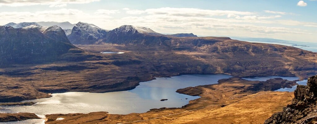
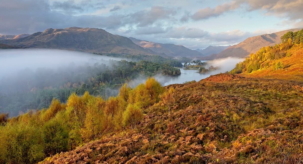
The untamed Glen Affric is located approximately 18 miles (30 km) north of the Great Glen and 15 miles (24 km) west of Loch Ness. The glen is notable for containing a ridge of eight Munros, including Càrn Eige (1,183 m/3,877 ft) and Mam Sodhail (1,181 m/3,874 ft), the highest mountains in Scotland located to the north of the Great Glen. It is considered one of the most beautiful glens in Scotland.
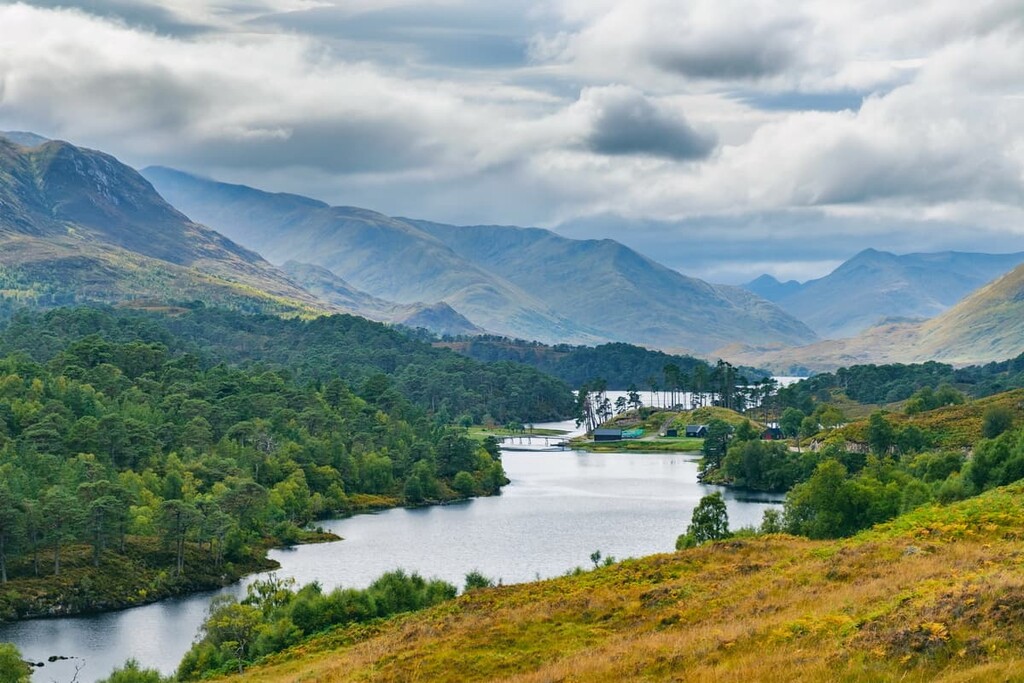
The glen itself forms a part of the Glen Affric National Nature Reserve, which covers 56 square miles (145 square km) and contains the third-largest area of Caledonian pinewoods in the country. The area is operated by Forestry and Land Scotland.
Despite being one of the most striking areas of the Northwest Highlands, Glen Affric is very isolated, with the nearest road located 6 miles (10 km) from Càrn Eige. However, there is a Scottish Youth Hostels Association hostel at Alltbeithe if you're looking to spend the night nearby.
Due to its isolation, Glen Affric doesn't get as many visitors as other areas of the Highlands, and many people who come to the glen come to scale Càrn Eige and Mam Sodhail. These remote peaks involve a lengthy approach and return thanks to the lack of nearby roads.
While these are the highest mountains in the Northwest Highlands, they aren't as challenging as the likes of the Cuillins of Skye. There are a few boggy and rocky sections, but much of the walk involves trekking along grassy ridges. You can also extend your walk along this horseshoe-shaped ridge to include another Munro, Beinn Fhionnlaidh (1,005 m/3,297 ft).
The best place to start this walk is from the car park at Chisholm Bridge on the edge of Loch Beinn a Mheadhoin to the southeast of Càrn Eige. The walk is 17 miles (28 km), ascends 1,727 m (5,666 ft), and takes around 12 hours.
Perched on the edge of Loch Broom in Wester Ross, the fishing village of Ullapool is a hub for hiking in the Northwest Highlands. The Fannichs, a range of nine Munros, sits to the southeast of Ullapool, the tallest of which is Sgùrr Mòr (1,110 m/3,641 ft).

Another popular hiking destination near Ullapool is An Teallach, a sublime mountain massif composed of ten summits over 914 m (3,000 ft), although some of these are not classified as Munros in their own right. The highest peaks are Bidein a' Ghlas Thuill (1,062 m/3,484 ft) and Sgùrr Fiona (1,058 m/3473 ft).
There are also several other popular mountains located close to Ullapool. Beinn Ghobhlach (635 m/2,083 ft) is a hill which is famed for the panoramic views it provides of Loch Broom and Little Loch Broom.
The Fannichs are an isolated range of mountains situated 35 miles south of Ullapool near Loch Fannich. The most popular part is the eastern Fannichs, which include Sgùrr Mòr, the highest of the range. As the Fannichs are isolated, they're usually climbed as part of the hiking group, as navigating the boggy pathless mountainsides is difficult.
It’s popular to climb Sgùrr Mòr along with three other Munros: Beinn Liath Mhòr Fannaich (954 m/3,129 ft), Meall Gorm (949 m/3,113 ft), and An Coileachan (923 m/3,028 ft). Hikers can pick up the trail by parking at the small car park north of Torrandhu bridge on the A835.
Getting to and from these mountains is time-consuming, with long walks across boggy moors. However, hikers are rewarded with one of the finest ridge walks to the Northwest Highlands. The hike up the eastern Fannichs is 15 miles (24 km) long, ascends 1,435 m (4,708 ft), and takes around 10 hours.
An Teallach is one of the most dramatic massifs in Scotland, with its teeth-like ridge and untamed landscape. The hike up An Teallach's two main summits, Bidein a' Ghlas Thuill and Sgùrr Fiona, starts boggy before becoming steep and rugged higher up.

A full traverse of An Teallach requires exposed scrambling in areas, while the linear route is much easier. However, it is possible to complete the full traverse and avoid scrambling by following the bypass paths. Hikers should bring navigational equipment, a good pair of hiking boots, and a head for heights when attempting An Teallach.
To start your ascent of An Teallach, head to the village of Dundonnell and park at the layby just east of the Dundonnell Hotel along the A832. The hike is 11 miles (17 km) long, ascends 1,438 m (4,717 ft), and takes roughly 8 or 9 hours.
Despite being only 635 m (2,083 ft) tall, Beinn Ghobhlach feels more like a mountain than some of its neighbors. With its distinct conical peaks and the views it provides of the Scoraig Peninsula between the Loch Brooms, Beinn Ghobhlach is among the finest Grahams (mountains between 2,000–2,500 ft/609.6–762m in elevation) in Scotland.
Beinn Ghobhlach features no distinct hiking paths, and much of the landscape is boggy or covered in thick heather, so bring navigational equipment. This walk is ideal for anybody looking for a shorter, less strenuous walk near Ullapool.
The best place to start this hike is from the end of the road to the village of Badrallach to the south of the mountain. The walk is 7 miles (11 km), ascends 780 m (2,559 ft), and takes around 5 hours.
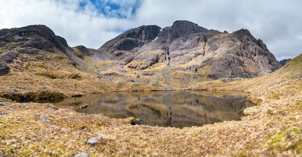
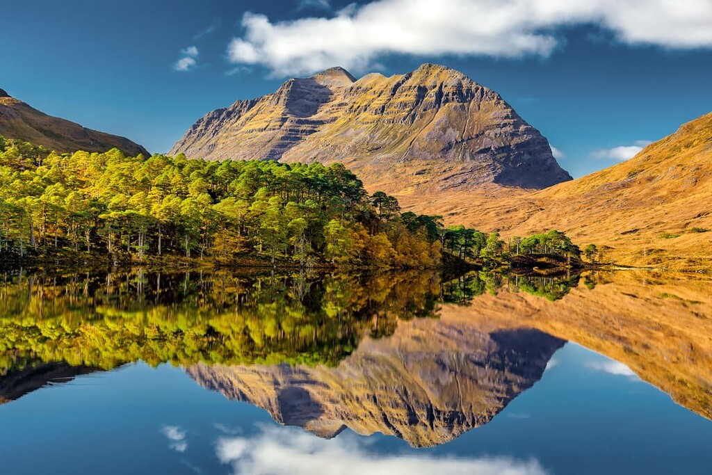
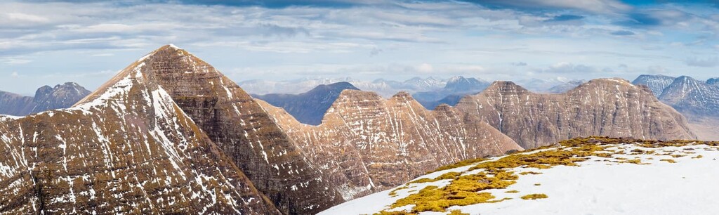
Encircling the village of Torridon, the Torridon Hills are another spectacular untouched area of the Northwest Highlands. The range is home to six sandstone Munros that are popular with hikers due to their rugged sublime peaks, which are perhaps only surpassed in beauty by the Cuillins of Skye. The hills are located in Wester Ross, around 20 miles (30 km) southwest of the Fannichs.
The highest mountain in the Torridon Hills is Liathach, which boasts two Munros, Spidean a' Choire Leith (1,055 m/3,461 ft) and Mullach an Rathain (1,023 m/3,356 ft). Other popular hiking areas include the Beinn Eighe massif, Beinn Alligin (986 m/3,234 ft), and Beinn Dearg (914 m/2,998 ft), the latter of which falls just short of Munro status.
Liathach and its twin Munros are some of the finest mountains in the Northwest Highlands, along with An Teallach and the Cuillins of Skye. With a varied ascent that takes hikers across boulder fields and up steep scrambly sections, Liathach is sure to be one of the most memorable climbs on your adventure in the Northwest Highlands.
You can start this walk from the car park near Glen Cottage to the south of Liathach. Most of the route is clear due to the mountain's popularity, with some simple scrambling to reach the ridge.
There's some much tougher scrambling at the Am Fasarinen pinnacles, although you can avoid this by using the bypass paths. The descent from Mullach an Rathain is also very tricky, so consider hiring a guide if you lack experience. The hike up Liathach is 7 miles (11 km), ascends 1,326 m (4,350 ft), and takes around 9 hours.
Home to the second-highest peaks in the Torridon Hills, Beinn Eighe is well-worth exploring. The massif is notable for its lengthy ridge and its Cambrian basal quartzite cap, which gives it a distinct light color, a unique feature in the Torridon Hills.
The massif forms part of the 11,757-acre (4,757 ha) Beinn Eighe National Nature Reserve. The area is managed by NatureScot and the National Trust for Scotland. The best part of Beinn Eighe is the western summits, which include two Munros: Ruadh-Stac Mòr (1,010 m/3,313 ft) and Spidean Coire nan Clach (993 m/3,257 ft).

Hiking Beinn Eighe requires less scrambling than its neighbors, and its ridge affords breathtaking vistas of the surrounding Torridon Hills. On the descent, you'll also pass Coire Mhic Fhearchair, the most picturesque of the Torridon corries.
You can pick up the trail from the Beinn Eighe car park along the A896 south of Beinn Eighe. The majority of the walk is well-defined; however, there is a challenging descent down an eroded scree chute to Coire Mhic Fhearchair, which requires great care. This walk along the western ridge of Beinn Eighe is 11 miles (18 km), ascends 1,116 m (3,661 ft), and takes approximately 8 hours.
The final part of the trinity of classic Torridon mountains, Beinn Alligin, is a must for any avid hiker. The mountain's name means "jeweled hill" in Gaelic, an appropriate name for a mountain adorned with a series of pinnacles known as the Horns of Alligin.
As with its neighbors, Beinn Alligin features two Munros: Tom na Gruagaich (922 m/3,024 ft) to the south and Sgùrr Mhòr (986 m/3,234 ft) to the north. Of the three Torridon ridges, Beinn Alligin is the only one with a defined path along the entire route, even if it's very steep in sections. If you include the Horn of Alligin in your hike, some exposed yet straightforward scrambling is necessary.
You can start this walk from the Beinn Alligin car park along the Abhainn Coire Mhic Nobuil river to the south of Beinn Alligin. The walk is 6 miles (10 km) long, ascends 1,110 m (3,641 ft), and takes about 6 hours.
The Knoydart peninsula in Lochaber draws hikers from across the world and is one of the most popular areas of the Highland's Rough Bounds. The peninsula is tucked between Loch Nevis and Loch Hourn, around 23 miles (38 km) northwest of Fort William. Knoydart is considered one of the last true wildernesses in the UK.
Knoydart forms part of the 125,270-acre (50,696 ha) Knoydart National Scenic Area, 25,930 acres (10,495 ha) of which are water. It is managed by NatureScot.
The highest mountain in Knoydart is Sgùrr na Cìche (1,040 m/3,412 ft), a Munro instantly recognizable due to its pointed peak. Other notable mountains in the area include Ladhar Bheinn (1,020 m/3,346 ft), Meall Buidhe (946 m/3,103 ft), and Ben Aden (887 m/2,910 ft).
Sat on the eastern edge of Knoydart, Sgùrr na Cìche is one of the most unusually shaped mountains in the Northwest Highlands. Due to the remote nature of Knoydart, Sgùrr na Cìche is often climbed either from Loch Nevis or via its neighbors: Sgùrr nan Coireachan (953 m/3,126 ft) and Garbh Chioch Mhor (1,013 m/3,323 ft).
With mile after mile of boggy ground and rugged mountainside to traverse, the route up Sgùrr na Cìche is long and draining. Hikers should bring navigational equipment and plenty of food and water. Sgùrr na Cìche is also one of the wettest areas in Britain, so make sure you bring waterproof clothing.
The best place to start this trek is from the parking area at the northwestern corner of Loch Arkaig, where the River Pean flows into the lake. The walk is 16 miles (26 km) long, ascends 1,523 m (4,996 ft), and takes around 12 hours.
Although Ladhar Bheinn is very remote, it's still a popular mountain that provides a memorable hike and sweeping views across Knoydart to the ocean. Ladhar Bheinn is also home to the dizzying Coire Dhorrcail, which is surrounded by rugged, towering cliffs.
As with Sgùrr na Cìche, this hike up Ladhar Bheinn is long and unrelenting, with no paths up the slopes and a rugged ridge that requires scrambling in a few areas. Similar most of the Northwest Highlands, hikers will need navigational equipment, appropriate clothing, and a head for heights.
The best place to start your ascent of Ladhar Bheinn is from the village of Inverie to the south of the mountain. The walk is 14 miles (22 km) long, ascends 1,399 m (4,589 ft), and takes approximately 10 hours.
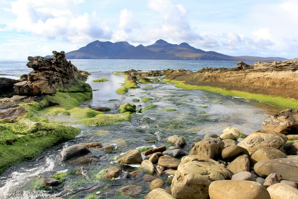
Situated approximately 10 miles (16 km) south of the Isle of Skye off the west coast of Scotland, the Small Isles are an often overlooked hiking destination. This archipelago consists of four main islands: Rùm, Eigg, Canna, and Muck. Rùm is the largest of the islands by a considerable margin, at 40.4 square miles (104 square km) in area.
The Small Isles are part of the Small Isles National Scenic Area, which covers 182 square miles (472 square km), including all four main islands. The area is managed by NatureScot.
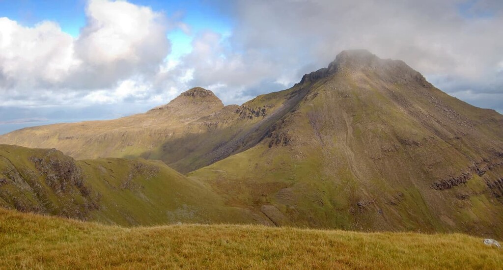
The Small Isles are popular hiking areas due in part to Rùm Cuillin, a series of gabbro peaks on Rùm that include the highest summit on the Small Isles, Askival (812 m/2,664 ft). This mountain makes Rùm the smallest Scottish island with a summit of over 762 m (2,500 ft). Another notable peak is An Sgùrr (393 m/1,289 ft) on Eigg, a striking column-like hill similar in composition to the Giant's Causeway in Northern Ireland.
The Rùm Cuillin Traverse is by far the most popular walk on the Isle of Rùm, taking hikers over the island's five main summits. These summits include Askival, Ainshval (781 m/2,562 ft), and Trollabhal (693 m/2,273 ft).
The Rùm Cuillin is similar in appearance to the Cuillins of Skye but offers a slightly easier but equally memorable day of hiking. There is plenty of scrambling to be done on the Rùm Cuillin; however, most of it is straightforward.
It's worth noting that this is a very long walk, with only two possible escape points and only one place to fill up on water. As a result, map your route out carefully, and ensure you bring enough food and water. While the walk is tricky, you'll be rewarded with some of the finest views of the Inner Hebrides along the way.
To get to Rùm, take the ferry from Mallaig. Then, start your walk from the famed Kinloch Castle less than a mile from the ferry pier. If you plan to complete this walk over two days, spend the night at the Dibidil bothy. This traverse of the Rùm Cuillin is 13 miles (21 km), ascends 1,847 m (6,059 ft), and takes around 12 hours.
There are few hills more striking than the Sgùrr of Eigg. An Sgùrr rises abruptly from the Isle of Eigg, with a prominence of 393 m (1,89 ft). The walk up An Sgùrr is short but steep, and there's a path that leads to the summit.
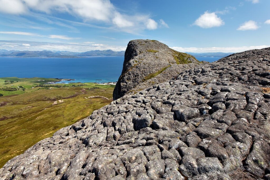
Surrounded by vertical cliffs on each side, hikers attempting An Sgùrr will need to be comfortable with heights. The hill's ridge is rocky, and the path can be boggy in place, so hiking boots are also required.
You can reach Eigg by catching the ferry from Mallaig. You can start this walk right from the ferry pier. The hike up An Sgùrr is 5 miles (8 km), ascends 403 m (1,322 ft), and takes around 3 hours.
From quaint villages to centers of Highland culture, here are a few of the best places to stay in the Northwest Highlands.
Perched at the mouth of the River Ness, Inverness is considered the capital of the Highlands. Located on the northeast coast, Inverness isn't ideal for accessing many of the best hiking areas in the Northwest Highlands. However, it is less than 15 miles (24 km) from the legendary Loch Ness.
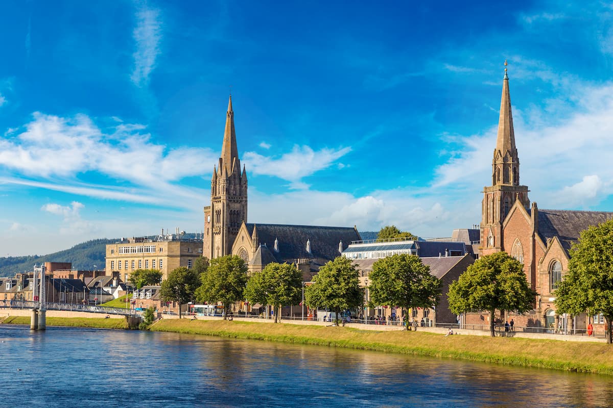
Inverness is superb for soaking up Highland culture, with top attractions like the Inverness Museum and Art Gallery and the postcard-perfect nineteenth-century Inverness Castle. Top hotels in Inverness include the Royal Highland Hotel and the Glen Mhor Hotel.
Often ranked as one of the most picturesque towns in the UK, Portree is the capital of the Isle of Skye. Around 150,000 people visit Portree every year to hike on The Lump, photograph the Fairy Pools, and explore the Cuillin Hills.
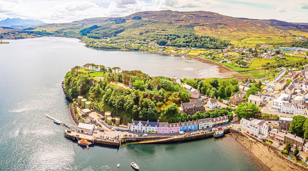
The likes of Sgùrr Alasdair and the other Cuillins are situated 10 miles (16 km) south of Portree. If you're spending your next getaway on Skye, book a room at the Portree Hotel or the Cuillin Hills Hotel.
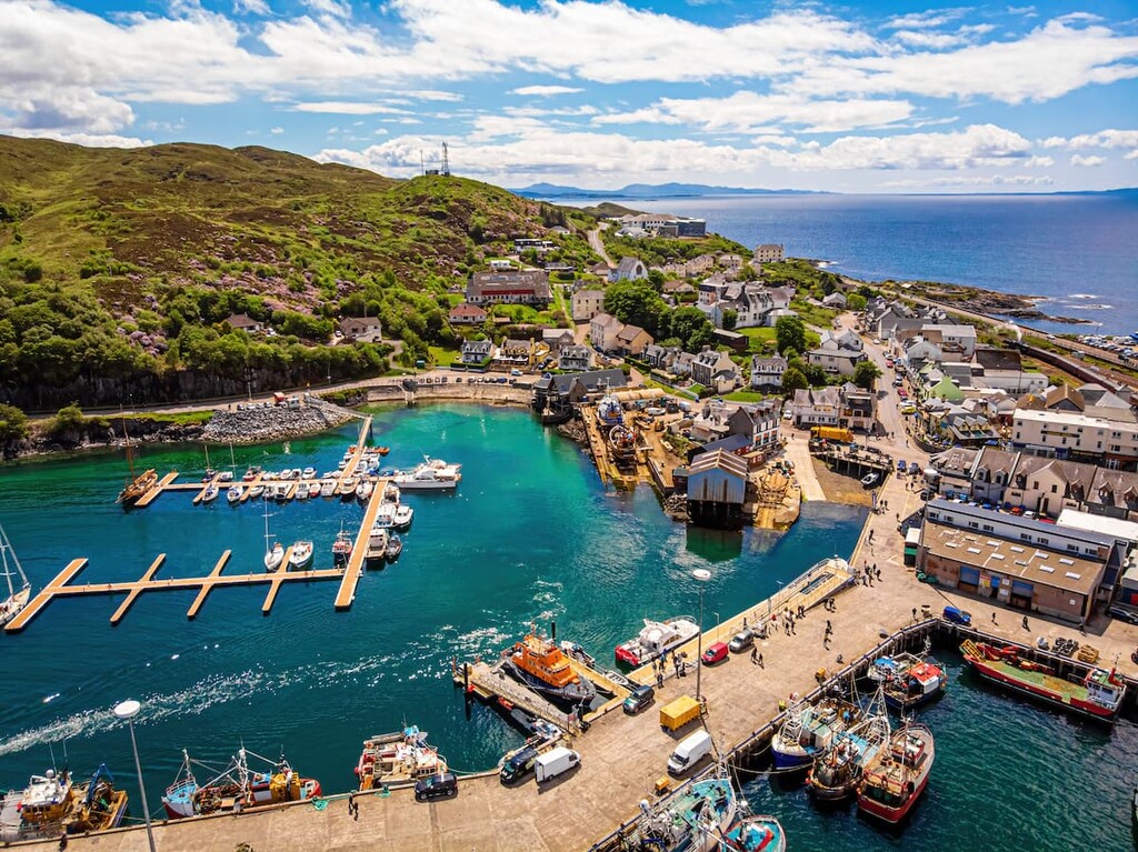
Located 45 miles (72 km) northwest of Inverness in Wester Ross, Ullapool is one of the largest settlements on the east coast of the Northwest Highlands. It's an oasis for hikers, with some of Scotland's most beautiful mountains nearby, with An Teallach located 6 miles (10 km) to the south and the Fannichs located 10 miles (16 km) to the southeast.
The village itself is also charming, with views across Loch Broom and the mountains as a backdrop. Looking to stay in Ullapool? Consider the Arch Inn or the Harbour House.

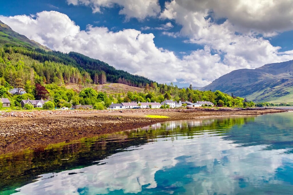
Encircled by the sublime Torridon Hills, the village of Torridon is another favorite spot for avid hikers. The village sits on the edge of Loch Torridon, around 80 miles (130 km) west of Inverness.
As you'd imagine, there's no better place from which to explore the Torridon Hills, with the likes of Liathach right on your doorstep. The best hotel in Torridon is The Torridon, but there's also a hostel in the village.
If you're looking for a base from which to explore Glen Affric, you can't do much better than the village of Cannich. Cannich is the nearest significant settlement to Glen Affric, located approximately 13 miles (21 km) northeast of Càrn Eige.
Cannich itself is also an attractive village due to its location at the confluence of the River Cannich and the River Affric. One of the best places to stay in Cannich is the Glen Affric Holiday Park. There are also a number of B&Bs just outside the village.
While the likes of Inverie and Cleadale on Eigg are stunning places to spend a night, Mallaig is the most convenient place to stay if you're looking to explore Knoydart and the Small Isles. This fishing village is a major transport hub, operating regular ferries to Inverie and each of the Small Isles.
Note that ferries to Inverie only run from April to October. While it is possible to stay in Inverie at the Knoydart Lodge, the village is only accessible by ferry or a 17-mile (27 km) hike. Hotels in Mallaig include the West Highland Hotel and the Steam Inn.