Get PeakVisor App
Sign In
Search by GPS coordinates
- Latitude
- ° ' ''
- Longitude
- ° ' ''
- Units of Length

Yes
Cancel
❤ Wishlist ×
Choose
Delete
Complete with extinct volcanoes, rare wildlife, and a stunning coastline, the Isle of Rùm offers unforgettable hiking experiences within Scotland’s Inner Hebrides. There are 27 named summits in Rùm National Nature Reserve. The highest and the most prominent mountain is Askival (812 m/2,664 ft).
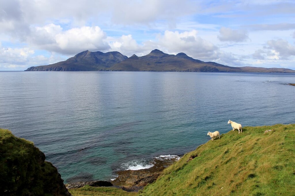
The Isle of Rùm is one of the Small Isles, part of the Inner Hebrides archipelago off the west coast of Scotland. Rùm is considerably larger than the other Small Isles, at over 40 square miles (104 square km). The next largest is the Isle of Eigg at 12 square miles (31 square km).
Rùm is part of the Lochaber area of the Scottish Highlands, located approximately 20 miles (32 km) off the coast. The island is around 10 miles (16 km) south of the largest of the Inner Hebrides, the Isle of Skye, and 15 miles (24 km) north of Ardnamurchan Point, mainland Scotland's most westerly spot. You can reach the Isle of Rùm by catching the MV Lochnevis ferry from the port of Mallaig.
The Isle of Rùm is part of the larger Small Isles National Scenic Area, which encompasses the islands of Eigg, Canna, Muck, and Sanday, as well as several small islands and skerries. The Small Isles National Scenic Area covers approximately 182 square miles (472 square km).
Due to its isolated position off Scotland’s west coast, there are few major settlements near Rùm. The nearest notable town is Fort William, which is approximately 60 miles (96 km) away. The Isle of Rùm is roughly 200 miles from the Scottish capital, Edinburgh.
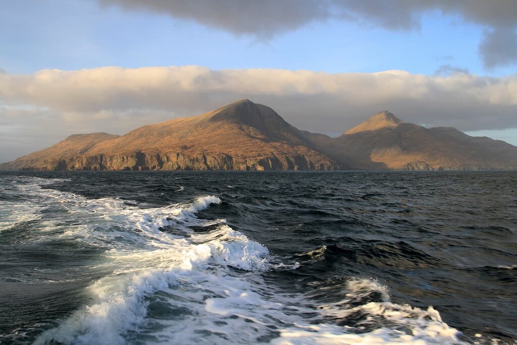
Rùm is home to the highest peaks on the Small Isles, many of which are part of the Rùm Cuillin range. The Rùm Cuillin features the only two Corbetts on the Small Isles, Askival and Ainshval (781 m/2,562 ft).
Rùm is the smallest Scottish island with summits exceeding 762 m (2,500 ft). The island itself is very rugged and boasts several other notable peaks, including Sgùrr nan Gillean (764 m/2,506 ft), Leac a' Chaisteil (761 m/2,496 ft), and Hallival (723 m/2,372 ft).
The geology of Rùm is fascinating, due partly to the powerful volcanic activity that helped shape the landscape. This volcanic activity happened during the Palaeogene era around 40 million years ago. Visitors can see evidence of this volcanic activity at the large caldera on Rùm's southside.
Essentially, Rùm has three different geological regions. The central igneous Rum Cuillin is composed of basalt and gabbro, with granite hills to the west, and Torridonian sandstone to the north and east.
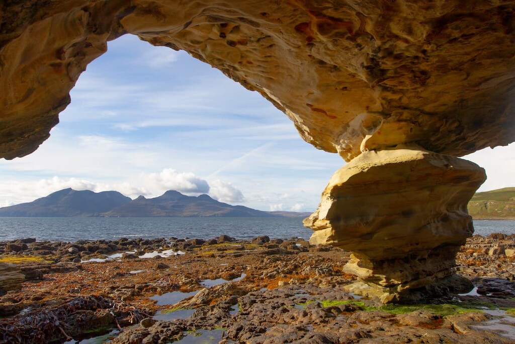
Over millions of years, erosion, climate, and changing sea levels have all played a part in shaping Rùm's landscape. Examples of this are the raised beaches near A'Bhrideanach and Harris, as well as the island's periglacial landforms.
One of the main reasons Rùm is a national nature reserve is due to the island's rare flora and fauna.
Over 205 bird species have been recorded on Rùm over the years. Rùm is designated a Special Area of Conservation (SAC) due to its colony of 70,000 Manx shearwaters. This colony is the largest of its kind globally and accounts for around 23% of the world's population.
Rùm is also a Special Protection Area (SPA), as it's a breeding ground for several rare bird species, including red-throated divers, merlins, and kittiwakes.
The island was also integral to reintroducing white-tailed sea eagles to western Scotland. Conservationists brought 82 young eagles from Norway to Rùm in the 1970s, which have been successfully breeding in the region ever since.
The ocean surrounding Rùm and the Small Isles is also vital to conservation efforts, with approximately 300 square miles (776 square km) designated Nature Conservation Marine Protected Areas (NCMPA).
The ocean around the Small Isles contains the United Kingdom's only colony of fan mussels and is also a habitat for common seals, harbor porpoises, and basking sharks.
The flora of Rùm is varied, with a mixture of woodlands, grasslands, marshes, and heathlands across the island. Over 800 species of bryophyte and lichen have been reported across Rùm. While touring the island, be on the lookout for rare orchids, including lesser butterfly orchids, bog orchids, and heath spotted orchids.
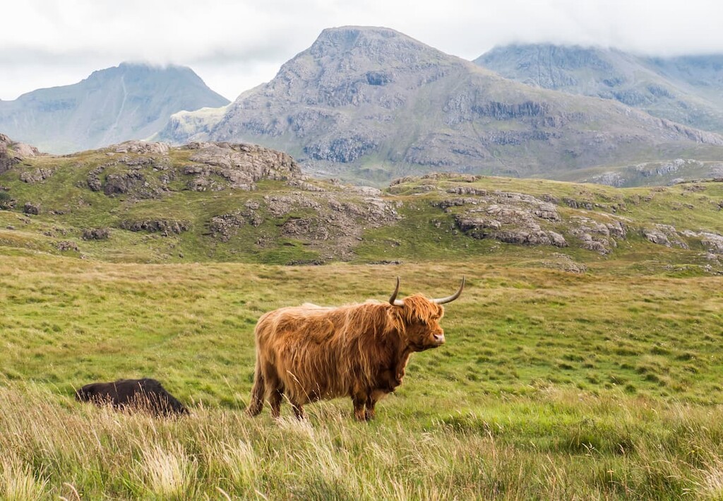
During your visit you'll also spot several mammals on Rùm, including Highland cattle, otters, and Rùm ponies.
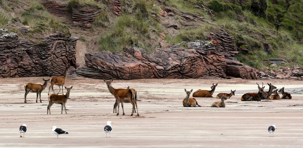
Rùm has also been the site of a red deer study since 1953. The study is a joint venture by the University of Edinburgh, Imperial College London, the University of Cambridge, the James Hutton Institute, and NatureScot. It aims to understand the effect island isolation has on the herd's behavior, population, and genetics.
The Isle of Rùm has a long human history, predating records. It's believed the first settlers to Rùm came around 7,500 BC. These Mesolithic pioneers came to the island to mine for bloodstone at Bloodstone Hill (388 m/1,272 ft), a rare and valuable flint-like material used to make arrowheads.
By the Iron Age, the settlers of Rùm had spread to the surrounding islands of Canna, Eigg, and Muck. The first mention of Rùm in human history was around 650 AD.
Following the end of clan warfare in the Small Isles, Rùm entered a period of prosperity, with the population reaching around 443 people by the year 1795. The population then dwindled significantly when the land was leased as a sheep-walk for 800 sheep. As a result, 300 residents were relocated from Rùm to Nova Scotia.
Throughout the 19th and early 20th century, Rùm was purchased by several wealthy landowners and tycoons looking to turn the island into a Highland hunting retreat.
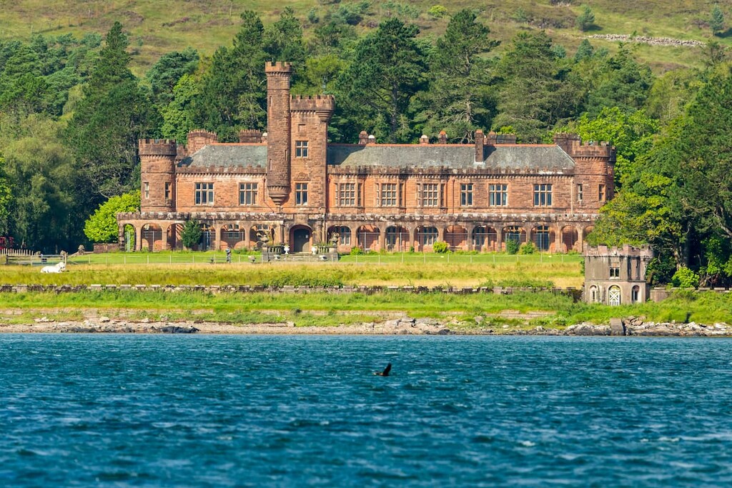
The most famous example is John Bullough, a wealthy textile tycoon who bought the island and built the opulent Kinloch Castle overlooking Loch Scresort.
Ownership of Rùm was returned to local residents by Lady Monica Bullough, who sold the island for £23,000. Despite its size, Rùm only has a population of 22 people, with Kinloch serving as the only notable settlement. By comparison, Rùm’s much smaller neighbor, Isle of Eigg, has a population of roughly 83 people.
If your next Highland adventure is a roam around Rùm, check out the island's main hiking areas and trails.
The most popular long-distance hike on Rùm is the Rùm Cuillin traverse. This spectacular trek takes hikers on one of the best hill walks in the Inner Hebrides, passing over the five main summits on Rùm, including its two Corbetts and a Graham, Trollabhal (693 m/2,273 ft).
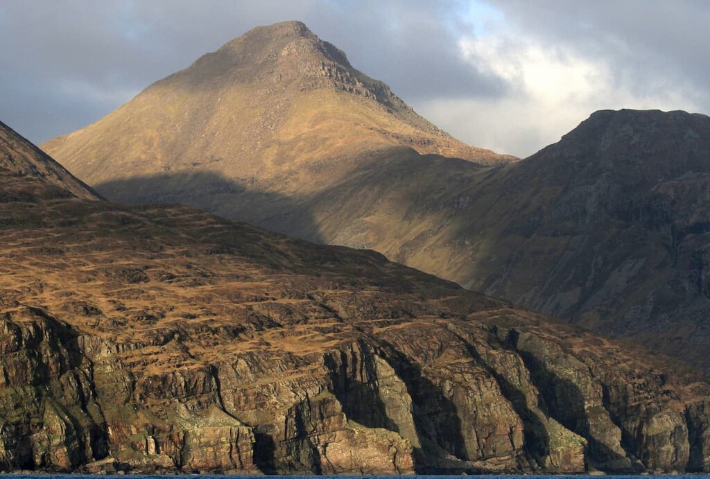
This lengthy hike features some light scrambling, only one place to stop for water, and two possible escape routes. As a result, hikers should bring navigational equipment, appropriate clothing, and plenty of food and water. The hike is 13 miles (21 km), ascends 1,847 m (6,059 ft), and takes around 12 hours to complete.
Starting at Kinloch Castle, walk north until you meet a junction with a bridge near the community hall. Turn left until you see a metal gate on your left. Through the gate, follow the Allt Slugan a'Choilich into the woods. You should walk southwest uphill, with the stream to your left.
After passing through a gate in the deer fence, you'll reach the edge of a coire, with Barkeval (591 m/1,938 ft) visible straight ahead. Walk till you reach a small dam and use it to cross the river. This small dam is the only place to stop for water until Bealach an Oir, so ensure you fill up your canteens.
From the small dam, head south and then slightly east to the Cnapan Breaca felsite rock sheet. Then, head southwest to the rugged plateau of Bealach Baic-mheall. Cross this boulder-strewn mountain pass in a southeasterly direction and locate the hillside path to your left.
The path becomes steeper and harder to follow as you reach the summit of Hallival (723 m/2,372 ft). Ensure you stop to spot the Manx shearwaters that nest on the mountain slopes. You'll descend from Hallival to the south, taking care on the mountainside's loose scree and large slabs.
At around 599 m (1,965 ft), you'll reach bealach along a narrow ridge, which you can follow to Askival's Pinnacle. Upon reaching the sheer cliffs of Askival's Pinnacle, you'll need to follow the clear path to the left to avoid any serious scrambling.
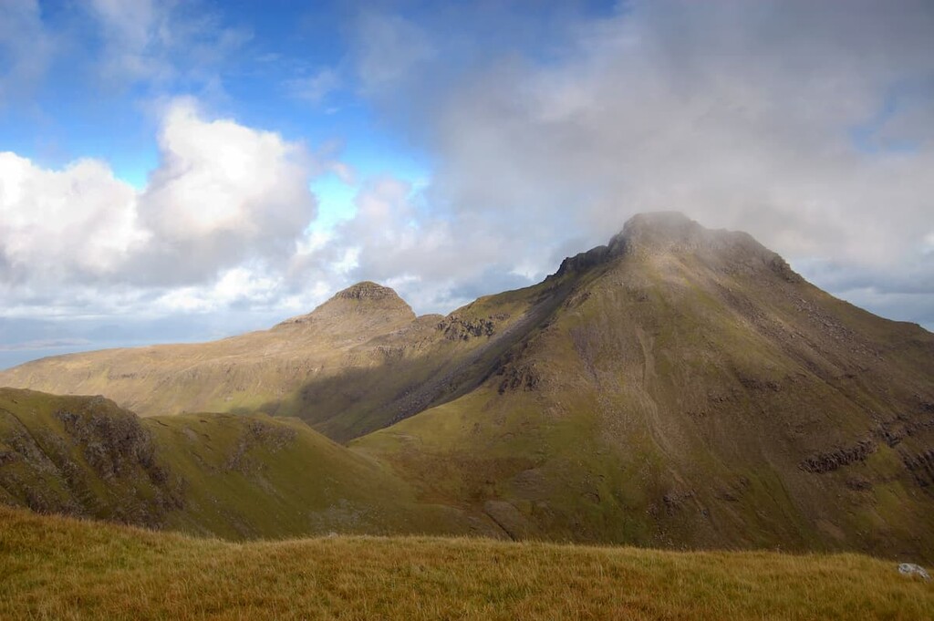
You'll have to scramble to reach the summit cairn on Askival, Rùm's highest point. From here, you'll get to enjoy panoramas of the surrounding Small Isles and the Isle of Skye to the north. Descend to the west onto the mountain's crags before turning left onto the loose gravel path.
From here, you'll head for the Bealach an Oir. If you're looking to complete this hike over two days, descend further and spend the night at the Dibidil bothy. At the end of the mountain pass, head up the steep grassy slopes to flatter land and walk west.
When you reach a large fan rock formation, turn north towards the eastern summit of Trollabhal. Take a short detour along the summit ridge to reach the true western summit.
Descend carefully to the southeast, along a zigzagging track through a small gully. You'll soon reach the Bealach an Fhuarain under Ainshval. Here, it's possible to head west to Loch Fiachanis and abandon the walk.
From Bealach an Fhuarain, walk southwest along the trail and then cut south, weaving up the hillside past loose scree. From the spur, you should have a steep ridge crest on your right. On the ridge, follow the clear path south to the summit of Ainshval.
From here, you'll tackle the last summit and then make your final descent. Walk south onto the small bealach and then west on the path above a nameless coire. Continue to walk around the coire to reach the last summit of the day, Sgùrr nan Gillean.
To descend, follow the cairns to the south until you reach some steep crags. Avoid the crags by walking through a long gully. At the bottom of the crags, follow the Papadil path east to the Dibidil bothy. Head northwest from the bothy's door and carefully ford the hazardous river before joining the coastal path back to Kinloch.
The hike up Orval (571 m/1,873 ft) takes you to the highest point on Rùm’s northern side, returning via the island's scenic western coastline. Orval provides sweeping views back across the Rùm Cuillin and north towards the Isle of Skye. The walk is boggy in places and there are no paths on Orval, so bring a pair of good hiking boots and navigational equipment.
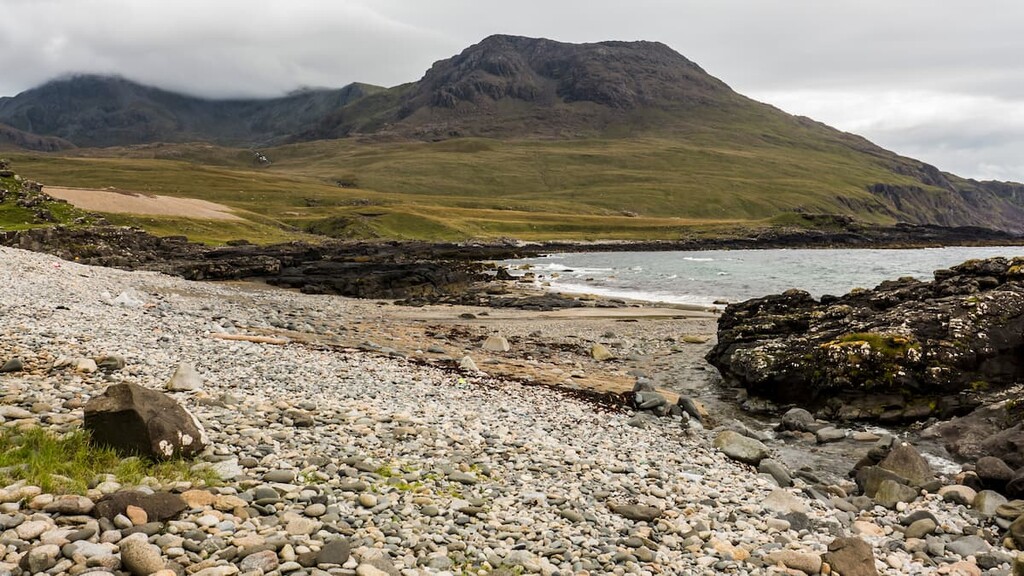
The hike up Orval is 17 miles (27 km), ascends 961 m (3,152 ft), and takes around 8 hours. From the CalMac ferry port on Loch Scresort, follow the clear landrover track as it passes the island's primary school. After the school, turn right at the fork and walk along the coast past the old pier and the hostel.
At the junction, follow the signpost to Kinloch Castle. Just before the island's cafe and shop, at the crossroad, turn left, climbing uphill with the Kinloch River on your right.
After leaving the woodlands, you'll reach another crossroads where you'll turn left again. Cross over a concrete bridge, and upon reaching Malcolm's Bridge, turn right following the path along the burn. This track was originally used by miners heading for Bloodstone Hill.
After crossing moorlands, the trail will take you onto the Bealach a' Bhraigh Bhig mountain pass. Leave the path here and head southwest up the slopes of Orval. Navigate this steep section by keeping on Orval's left side, over steep cliffs onto the mountain plateau.
Cross the dip in the escarpment and enjoy over Fionchra (463 m/1,519 ft) to the Isle of Skye. To reach the summit of Orval, walk south to reach a trig point and the summit cairn. After taking in panoramas of the Rùm Cuillin, walk to where the plateau narrows into a bealach.
Instead of following the escarpment round to Sròn an t-Saighdeir (523 m/1 716 ft) head southwards over Orval's minor summit. Continue to descend southwards onto a minor bealach before keeping left to avoid a tricky ridge near Loch Monica.
Near the Harris Lodge, turn right, passing the lavish Bullough family mausoleum. When passing the coast, ensure you stop for a quick break at the picturesque beach. You can then follow the trail back to Malcolm's Bridge and retrace your steps to the ferry port.
The Kilmory Bay walk is a long-distance yet simple walk along Rùm's spectacular northern coastline. The trail is clear throughout the whole route and is well-worth experiencing if you want to see Rùm's red deer population and the best views across to the Isle of Skye.
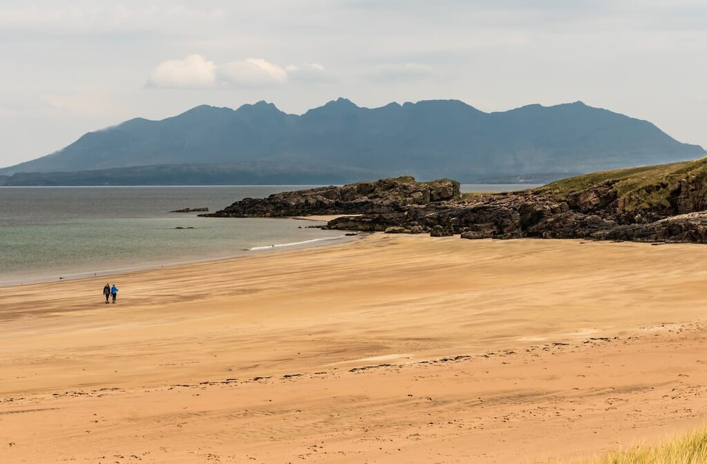
This linear hike to Kilmory Bay is 11.5 miles (18 km), ascends 255 m (836 ft), and takes around 5 hours. From the CalMac ferry pier on Loch Scresort, follow the landrover track past the primary school and turn right at the fork. Pass the old pier and hostel and turn onto the trail signposted for Kinloch Castle.
At the crossroads after the castle, turn left before the island's cafe and shop. Follow the trail with the Kinloch River on your right until the road forks. Turn right, and follow the path straight as it drops into Kilmory Glen. The Kilmory area has been the site of Rùm's red deer study since 1953, one of the longest-running large animal studies in history.
Ignore any offshoots and walk until to see the cottage used by researchers in the distance. Avoid the cottage and leave the track by a large boulder with "beach" written on it.
You'll soon reach Kilmory Bay's beautiful beach with the Skye Cuillin in the backdrop. Just upstream is an ancient burial site if you fancy seeing some local history. Return to Kinloch Castle the way you came.
The walk to Harris from Kinloch is a straightforward trek across the heart of Rùm to its gorgeous west coast. Paths on the walk are ideal, but the distance makes this a strenuous hike. Due to the length and quality of the trail, consider completing this walk on a mountain bike.
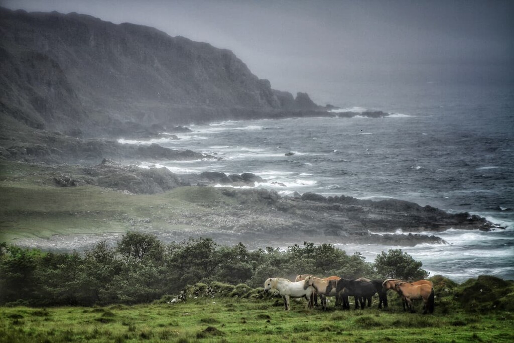
The walk from Kinloch to Harris is 15 miles, ascends 617 m (2,024 ft), and takes around 6 hours on foot. Follow the landrover tracks from the CalMac ferry pier, taking the right fork after the primary school towards the coast. After the old pier, keep left past the island's hostel.
Then, keep on the track signposted for Kinloch Castle. Past the castle at the crossroads, turn left, climbing uphill with the Kinloch River on your right. Take a left at the fork after exiting the woods. Cross over a concrete bridge and then over Malcolm's Bridge.
Crossing moorlands, you'll reach the highest point of the walk, with stunning views over Loch an Dornabac to the Rùm Cuillin. As the trail heads down to Hugh's Brae, you'll be treated to views of Rùm's west coast. Be on the lookout for Rùm ponies which often graze in the area.
Upon reaching the cottage at Harris, take a stroll down the rugged coastline and head east to visit the bay's beautiful beach. This is a linear walk, so retrace your steps back to your starting point.
Planning to spend a few days exploring the rugged Isle of Rùm? Check out the closest major communities and towns.
The port of Mallaig is among the best places to stay on a visit to Rùm. This quaint village serves as the mainland ferry port for the Small Isles, with the MV Lochnevis offering regular services. The ferry takes around 80 minutes to reach Rùm.
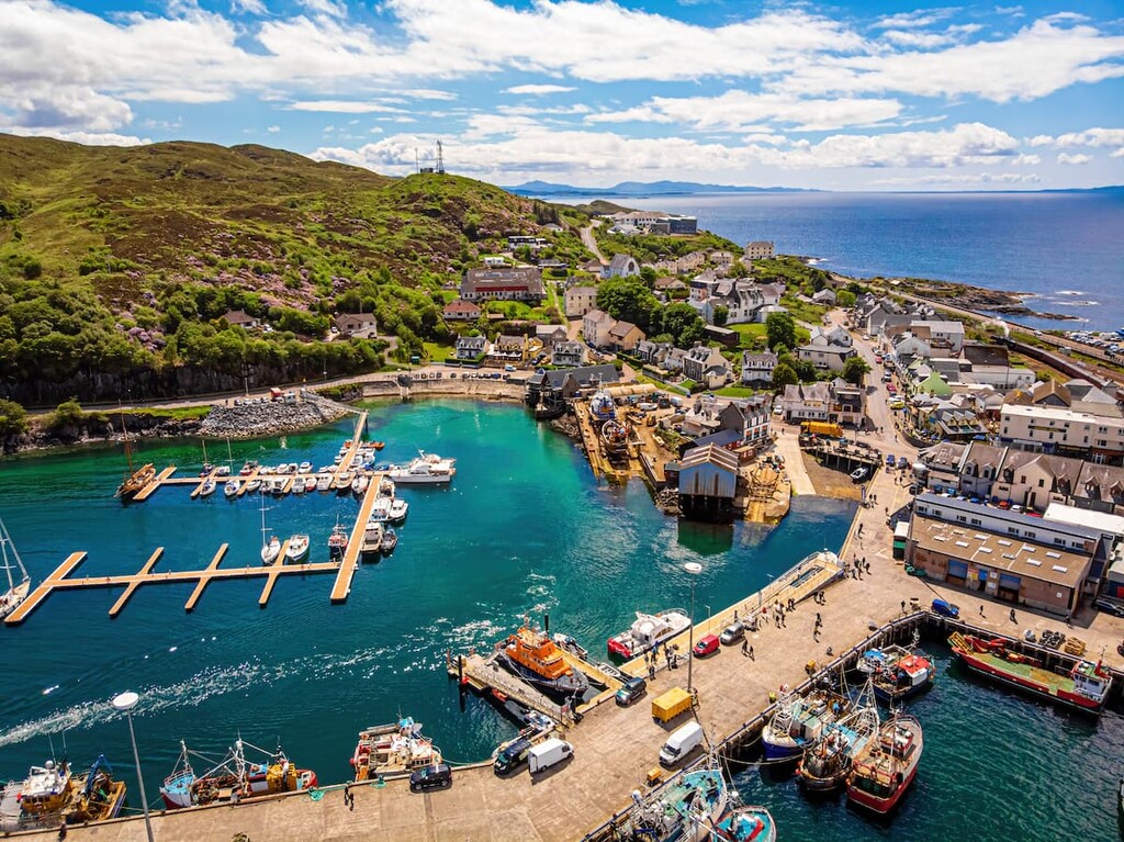
When you're not off exploring Rùm, Mallaig has some interesting local attractions. Spend a day at the serene Loch Morar or soak up some sun on Camusdarach Beach. You'll also find a few quality hotels in Mallaig, like The Marine and The West Highland Inn.
With a population of approximately 22 people, Rùm lacks any significant settlements. The area surrounding Kinloch Castle is the island's only community, with a cafe, shop, and a community hall.
The area does provide access to many of the best hiking trails on Rùm, with the likes of Hallival just over 2 miles (3.4 km) away. While staying in Kinloch, ensure you take a tour of the extravagant 19th-century Kinloch Castle to learn more about Rùm's recent history.
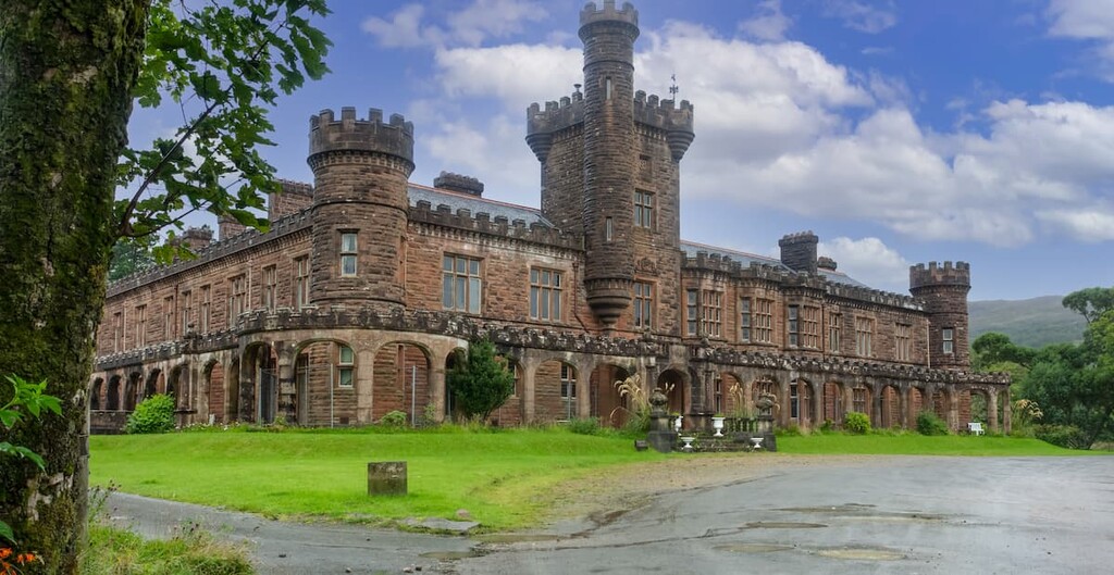
If you plan on staying on Rùm, book accommodation along Loch Scresort at the Ivy Cottage Guest House, the Kinloch Village Campsite, or the Rùm Bunkhouse. It's worth noting while there is a shop on Rùm, provisions are scarce and are only brought over weekly. Therefore, visitors should bring their own supplies to avoid any shortages.
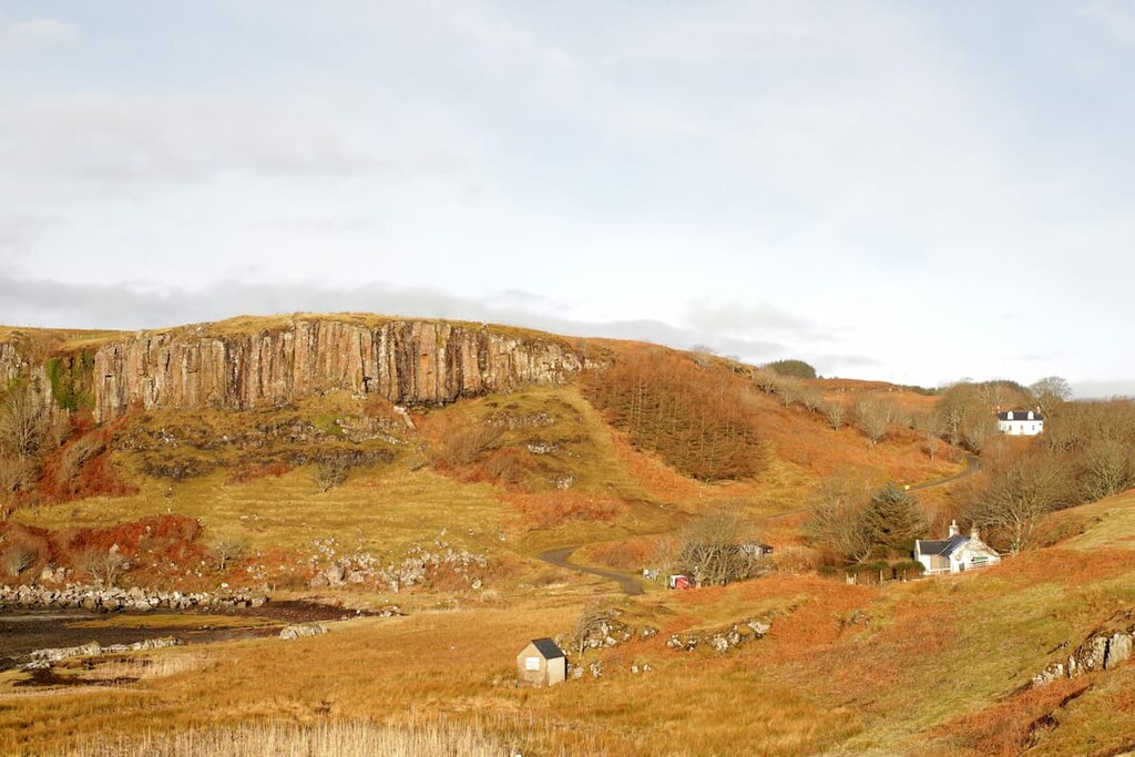
Cleadale is a small village on the Isle of Eigg, the most populated of the Small Isles, with around 87 residents. Situated on the north side of the island, Cleadale is a small settlement surrounded by dramatic cliffs that's ideal for an isolated getaway and is well-worth visiting.
You can reach Rùm from Eigg by catching the ferry from the CalMac ferry port. You'll find some self-catered accommodation options on Eigg, including The Glebe Barn, Tigh Eilidh, and the Lageorna Guesthouse.
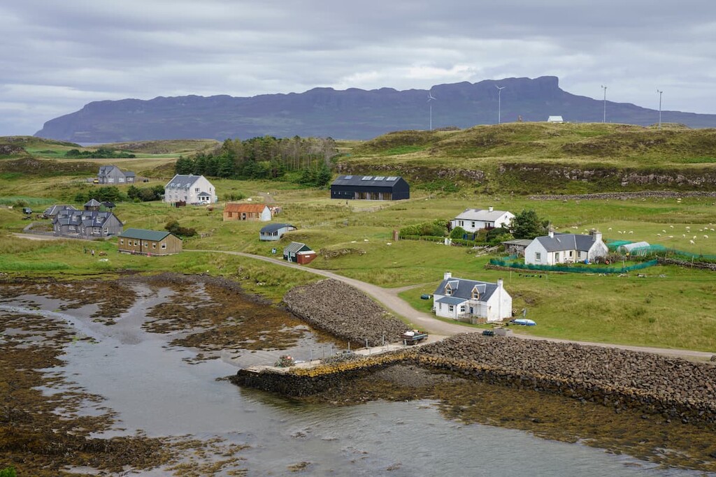
The Isle of Muck is home to the only other significant settlement on the Small Isles, Port Mòr. With a population of around 15 people, there's not much to do in Port Mòr other than relax and enjoy ocean views or plan a hike across the island.
As with Eigg, you can reach Rùm from Muck via the island's CalMac ferry port. If you're planning to spend a night in Port Mòr, book a room at the Port Mòr House Hotel.
Explore Rùm National Nature Reserve with the PeakVisor 3D Map and identify its summits.


