Scan the QR code and open PeakVisor on your phone
Boasting unspoiled landscapes, rare wildlife, and fascinating cultural heritage, Small Isles National Scenic Area is one of Scotland's best-kept secrets. The area contains 60 named summits, the highest and most prominent of which is Askival (812 m/2,664 ft).
The Small Isles National Scenic Area comprises four large islands as well as several skerries and smaller islands located in the northwestern part of the United Kingdom. The Small Isles are located off the west coast of Scotland within the Inner Hebrides archipelago. You can reach the islands by catching the purpose-built MV Lochnevis ferry from Mallaig.
The entirety of the Small Isles National Scenic Area covers an area of approximately 182 square miles (472 square km).
The Small Isles sit roughly 12.5 miles (20 km) south of the largest of the Inner Hebrides, the Isle of Skye, and 12.5 miles (20 km) north of Ardnamurchan, mainland Scotland's most westerly point. The isles are part of the Lochaber area of the Scottish Highlands and are less than 9 miles (15 km) from the mainland.
Due to their isolated location off the west coast of Scotland, there are no significant settlements near the Small Isles. The nearest major town on the mainland is Fort William, which is 58 miles (95 km) away. The islands are approximately 190 miles (305 km) northwest of the Scottish capital, Edinburgh.
Within the Small Isles, there are four main islands: Rùm, Canna, Eigg, and Muck. Each island has its own unique geographic features and attractions.
Rùm is considerably larger than the other Small Isles, at 40.4 square miles (104 square km) in area. The majority of Rùm is managed as the Rùm National Nature Reserve by NatureScot (formerly Scottish Natural Heritage).
Rùm has a population of about 25 people, most of whom are employed by NatureScot or who provide other community support services on the island. Rùm is home to the Small Isles National Scenic Area’s highest point—Askival.
The next largest island, Eigg, encompasses only 11.8 square miles (30.6 square km). Eigg is owned by the Isle of Eigg Heritage Trust, which makes it a community-owned and managed island.
Additionally, parts of the islands are also managed by the Scottish Wildlife Trust as a nature reserve. Eigg has a permanent population of around 80 people, many of whom work in tourism, agriculture, or renewable energy.
To the northeast of Rùm is Canna (4.4 square miles/11.3 square km), which has been managed by the National Trust for Scotland (NTS) since 1981. The highest point on Canna is Carn a' Ghaill (210 m/688 ft).
Located just south of Canna is the Isle of Sanday, which is connected to Canna by a tidal sand bank. In 2018, a bridge and road were constructed to provide a permanent link between the two islands.
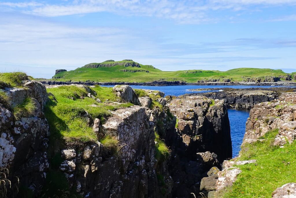
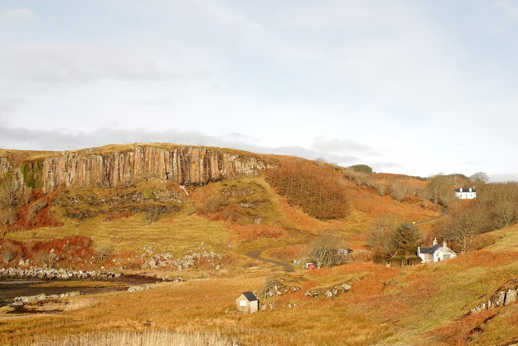
It's among the prettiest of the islands, thanks to its stark basalt cliffs. However, it is also one of the least populous of the islands, with Canna and Sanday having a combined total population of less than 30.
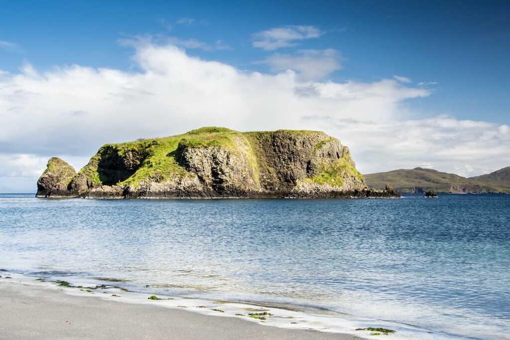
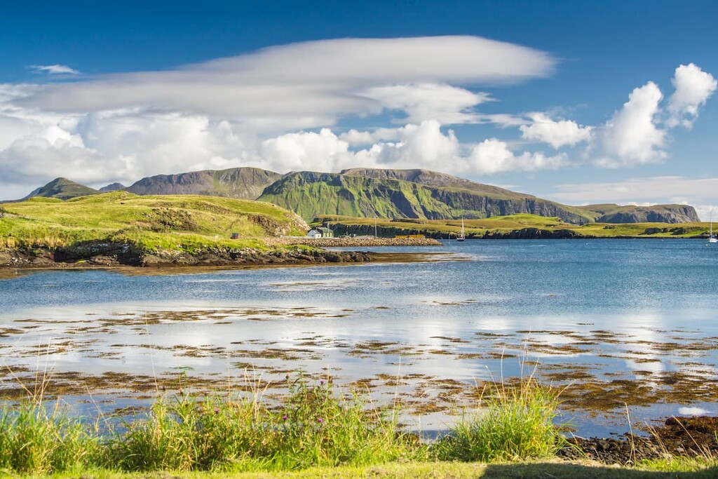
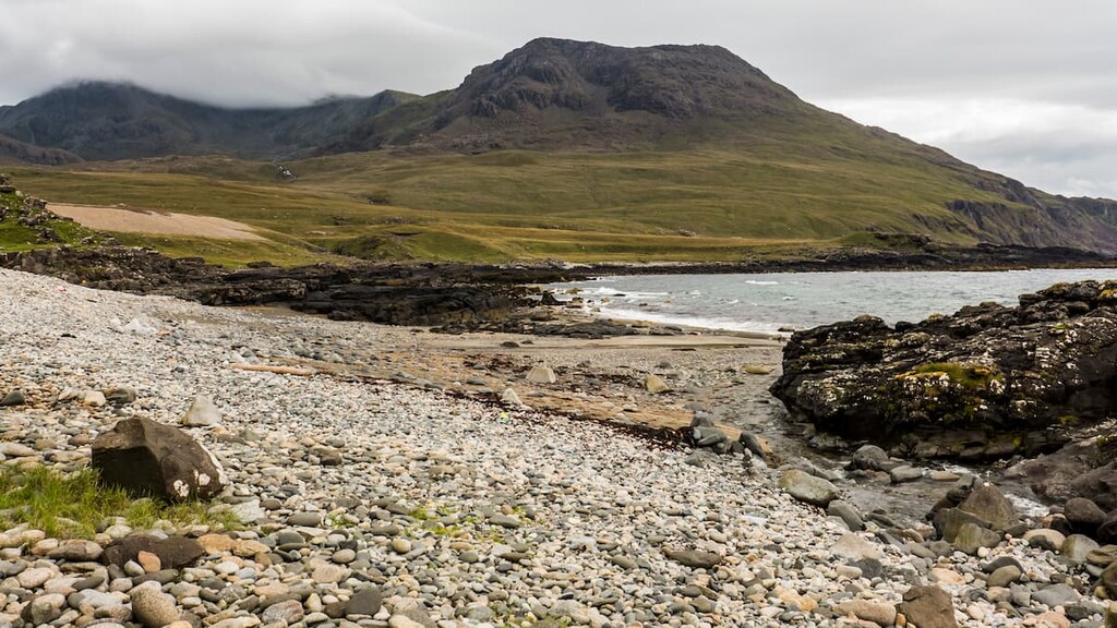
The smallest and southernmost island is Muck (2 square miles/ 559 hectares), characterized by its fertile, low-lying landscape and sandy beaches. The island's highest point, Beinn Airein (137 m/449 ft) affords stunning views of the rest of the Small Isles.
Muck is owned by the MacEwen family and it has a total population of about 30 people. Much of the island is used for agricultural purposes, particularly for sheep grazing. In recent years it has also become a more popular tourist attraction, thanks to its relative remoteness, despite its proximity to the mainland.
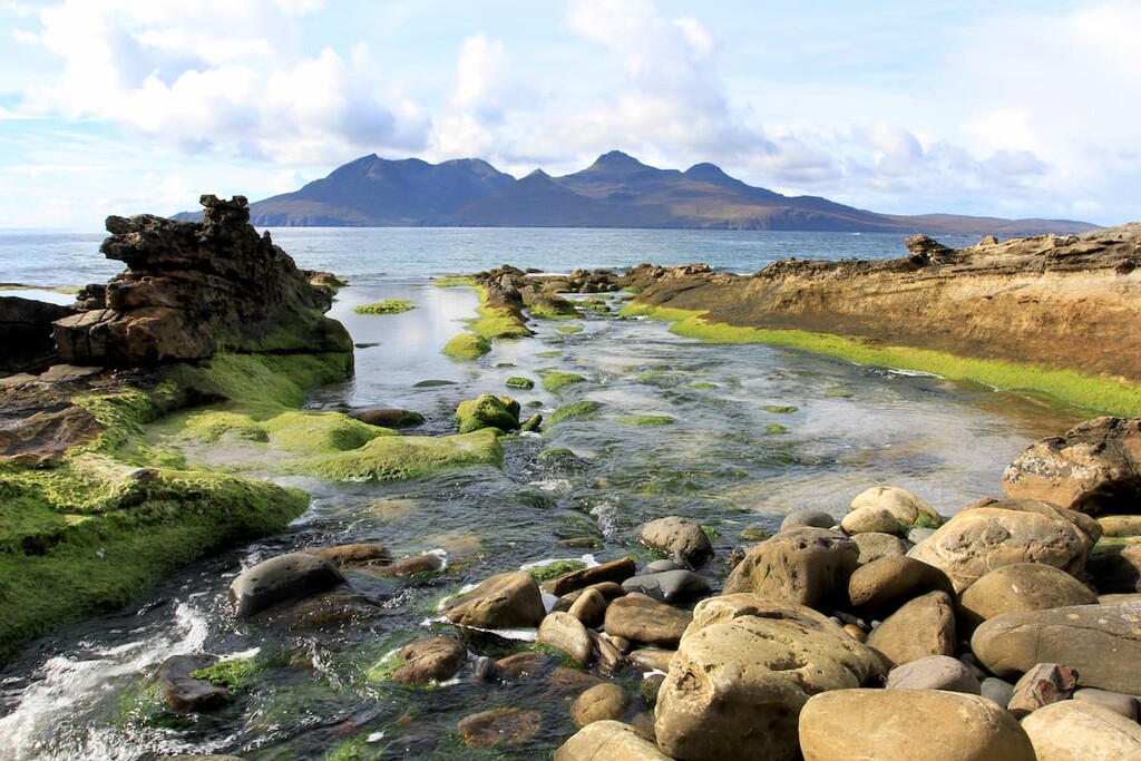
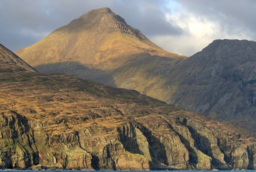
There are several notable summits on the small isles, mostly within the Cuillin Range on Rùm. The Rùm Cuillin is home to the Small Isles' only two Corbetts, Askival and Ainshval (781 m/2,562 ft).
As a result, Rum is the smallest Scottish island with a summit of over 762 m (2,500 ft). Other significant peaks on Rum include Hallival (723 m/2,372 ft), Trollabhal (693 m/2,273 ft), and Orval (571 m/1,873 ft).
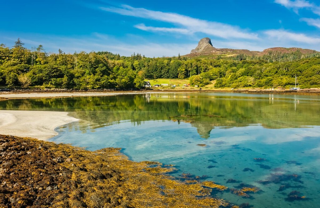
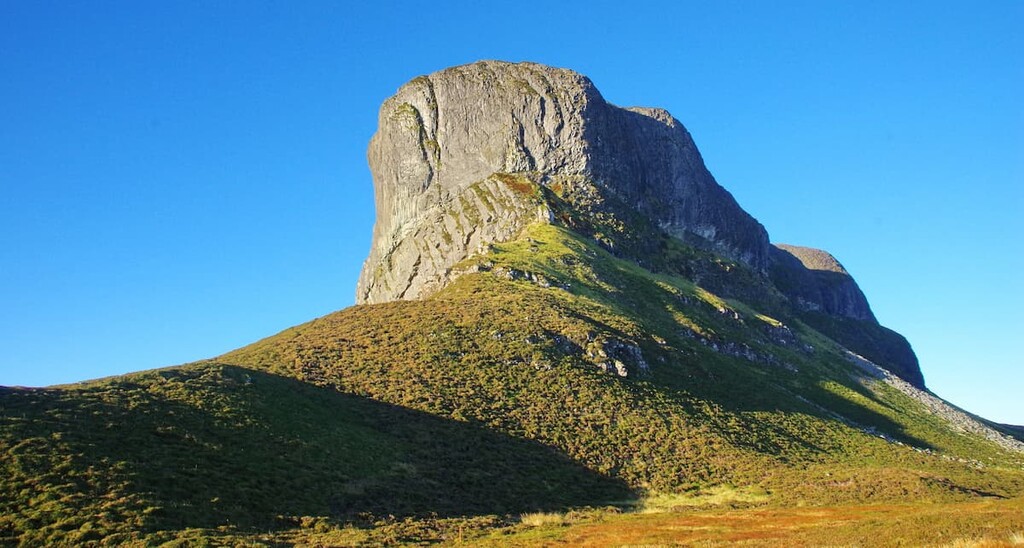
Across the other Small Isles, there are several sizable hills. An Sgùrr (393 m/1,289 ft) is the highest hill on Eigg. The hill was formed when pitchstone lava flowed into a river valley, filling the glen. Over millions of years, the surrounding basalt eroded away, leaving behind pitchstone lava, creating similar column-like structures to those found at the Giant's Causeway in Northern Ireland.
The geology of the Small Isles has been of great interest to geologists for decades. Much of the landscape was formed around 60 million years ago during the Palaeocene period by basalt volcanic eruptions on the isles of Rum and Skye.
Eigg, Muck, and Canna are composed almost entirely of volcanic rock. Rum itself is the core of an eroded volcano that erupted over 60 million years ago, leaving behind a stunning landscape that exists to this day.
The Small Isles are important to conservation efforts due, in part, to the fauna that inhabit the islands.
Rùm is designated a Special Area of Conservation (SAC) as it's home to a colony of 70,000 Manx shearwaters, the largest of its kind in the world. Rum was also instrumental in reintroducing white-tailed sea eagles to the region in the 1970s, with 82 young eagles brought over from Norway.
Rùm, along with Canna and nearby Sanday, are Special Protection Areas (SPA) as they are essential breeding sites for several seabirds, including kittiwakes, Atlantic puffins, and guillemots. Birds are the most common wildlife on the Small Isles, with 130 species recorded on Eigg alone.
Around 300 square miles (776 square km) of ocean around the Small Isles are designated Nature Conservation Marine Protected Areas (NCMPA) as they host the United Kingdom's only colony of fan mussels. You may also spot some fascinating wildlife off the coast, including harbor porpoises, basking sharks, and minke whales.
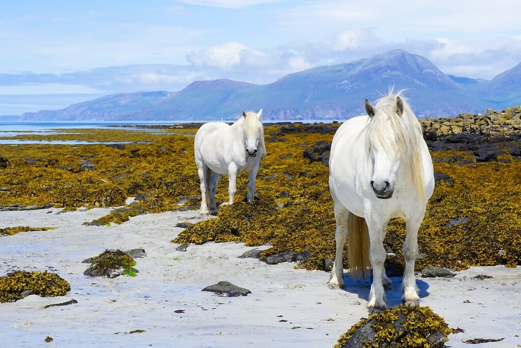
Heading inland, you'll find a few mammal species, mainly on Rùm. The largest of the Small Isles is home to herds of red deer, feral goats, Rùm ponies, and Highland cattle.
Interestingly, Rùm is also the site of a long-standing red deer study. The study, which is jointly conducted by the University of Edinburgh, Imperial College London, the University of Cambridge, the James Hutton Institute, and NatureScot, has been in place since 1953. It seeks to understand the genetic trends and behaviors of the isolated red deer population on the island.
The human history of the Small Isles is extensive, with humans continuously inhabiting the islands for around 9,000 years. Early Mesolithic settlers came to Rùm to mine bloodstone, a rare mineral used to make arrowheads. Over time, people moved to the more fertile lands of the surrounding islands, and by the Iron Age, each island was defended by fortifications.
Following the medieval feudal times, the Small Isles were heavily affected by the seventeenth century Jacobite uprising and the potato famine, which saw the population dwindle. Most of the population either emigrated, died, or were displaced by the expansion of sheep farms. This resulted in all of Rùm’s original population being wiped out.
Throughout the Victorian era until World War II, the Small Isles became popular with land barons and wealthy British tycoons looking to purchase entire islands as summer retreats or to improve their real estate portfolios.
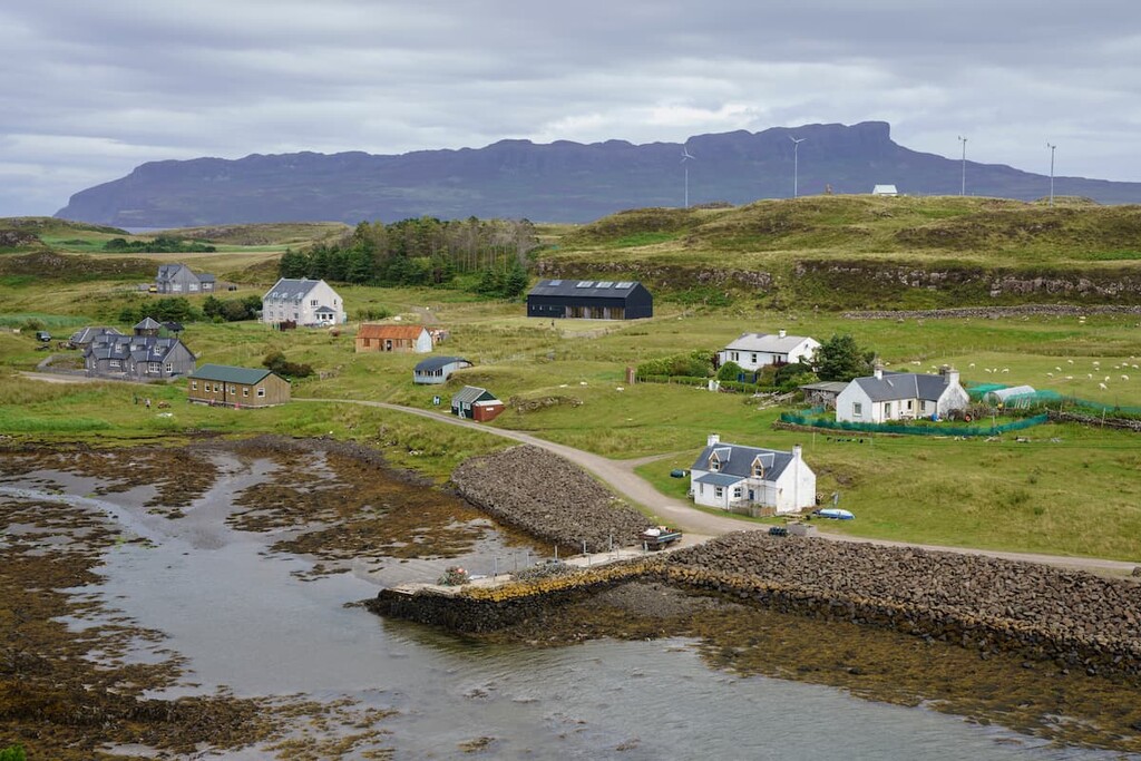
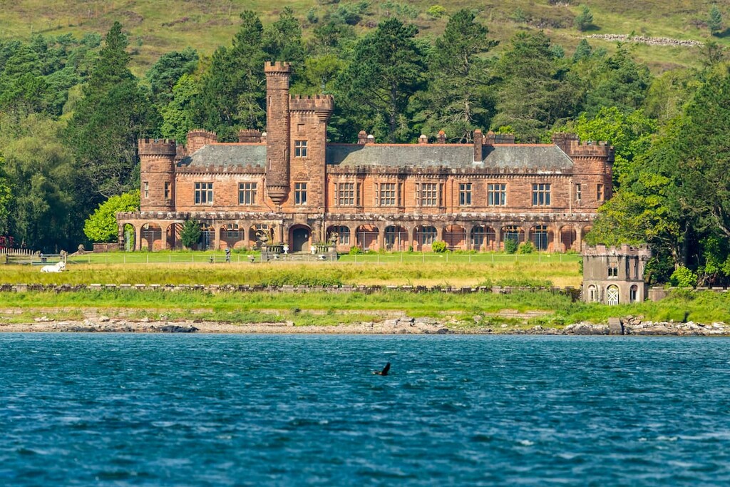
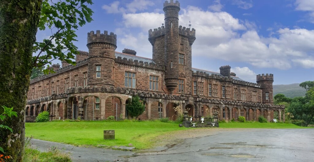
One notable example was textile tycoon John Bullough, who bought Rùm in the late nineteenth century and built the lavish Kinloch Castle. The castle, which is managed by NatureScot, can be visited on an organized tour during your trip to the island.
Today, the population of the Small Isles is 153, according to a 2011 census. The most hospitable and tourist-friendly island is Eigg, which has a population of 83, the largest of the islands. The next most populated is Muck with 27, then Rùm with 22 inhabitants, and Canna with 12 residents.
Searching for the best hiking opportunities on these stunning Scottish islands? Read on to find out about the main hiking areas in the Small Isles National Scenic Area.
The most physically demanding yet rewarding walk in the Small Isle National Scenic Area, the Rùm Cuillin traverse takes hikers on a sustained, rugged ridge walk across the 5 main summits of Rùm.
Some easy scrambling is required in several areas, and there are only two potential escape routes along the way. As a result, come prepared with navigation equipment, warm clothes, and plenty of food and water. The Rùm Cuillin traverse is 13 miles (21.5 km), ascends 1847 m (6,059 ft), and takes approximately 12 hours to complete.
Pick up the trail from Kinloch Castle and walk north along the obvious path until you reach a junction before a bridge to the community center. Turn left and walk until you see a metal gate on your left. Then follow the Allt Slugan a'Choilich, keeping the stream on your left, as you walk southwest up a hillside.
Passing through another couple of fences, you'll come to the edge of a coire, with Barkeval (591 m/1,938 ft) ahead. Walk on until you meet a small dam, one of the few places to refill on water. From the dam, head south and then slightly east to Cnapan Breaca. Then walk southwest to reach the boulder-strewn Bealach Baic-mheall plateau.
Cross the plateau to the southeast and pick up the faint trail to the left. The going gets tougher and the path steeper as you near the summit of Hallival. The area is great for spotting the island's Manx shearwater population, with many burrows near Hallival.
Descend Hallival to the south, scrambling down the loose scree. At a bealach (mountain pass) at around 599 m (1,965 ft), you can walk along the grassy ridge towards Askival, the highest peak on the Small Isles. You can avoid scrambling up Askival's pinnacle by following the path to the east. The summit is marked with a cairn.
Begin your descent to the west, down a tricky steep gravel and scree path. If you're completing this hike over two days and are looking for somewhere to stay, the Dibidil Bothy is nearby. At the far end of the bealach, walk uphill till the land flattens, ignoring the southwest deer path.
At a large fan rock formation, turn north, watching your step as you pass through boulders, slabs, and scree. At the top, take a slight detour along the ridge to the western summit of Trollabhal. Return then to the eastern summit, and descend along the faint winding path to the southwest, avoiding the area's slabs.
At the Bealach an Fhuarain under Ainshval, it is possible to abandon the route west towards Loch Fiachanais. You can scale Ainshval by following the southwest path and the zigzagging south up grass and scree hillside until you reach a spur on the ridge.
From the summit cairn of Ainshval, the end of the ridge is within reach. You'll ascend your final hill, Sgùrr nan Gillean (764 m/2,506 ft), by descending south from Ainshval onto the bealach. Then, follow the clear path west above an unnamed coire to the summit of Sgùrr nan Gillean.
Make your final descent by walking south through a gully, joining the Papadil path back to Dibidil bothy. To get back to your starting point, walk northeast from the bothy, carefully fording the river before taking the coastal path back to Kinloch Castle.
One of the only significant summits on Rùm not included in the Rùm Cuillin traverse, Orval is well worth scaling if you're looking to explore the north side of the island. There's no trail up Orval, so bring appropriate footwear, navigational equipment, and avoid climbing in bad weather. This hike is 17 miles (27 km), ascends 961 m (3,152 m), and takes around 8 hours to complete.
From the CalMac ferry pier, follow the car track around Loch Scresort. After passing the primary school, follow the right fork and then keep left when you rejoin the coast. At the next junction, follow the track signposted for Kinloch Castle. At the crossroads after the castle, turn left, climbing slowly uphill.
With the Kinloch River on your left, follow the track for over a mile and take a left at the fork in the road. Cross a bridge and then turn right onto the track originally made for mining at Bloodstone Hill (388 m/ 1,272 ft). Follow it across the moorlands and up onto Bealach a' Bhraigh Bhig.
At this point, leave the path and head southwest towards Orval. Keep left for the easiest traverse of the area's steep section. At the plateau surrounded by steep cliffs, walk across a dip in the plateau's escarpment and enjoy views across to the Isle of Skye.
Head south across the plateau to the top of Orval. The summit is marked with a trig point and a cairn. Orval affords epic views across the Rum Cuillin and of the nearby Isle of Canna to the north.
To descend, continue along the plateau until it turns into a bealach, with slopes curving over Sròn an t-Saighdeir (523 m/1,715 ft). Instead of heading to the true summit, you'll need to pass over Sròn an t-Saighdeir's minor summit to the south.
A gradual yet rough descent is made here. You can avoid the worst of the uneven ground by bypassing Loch Monica to the east. Passing Harris Lodge, turn right towards the lavish mausoleum of the Bullough family.
The track here passes along the coast and by a charming sandy beach, over the Glen Dulan River, and across the island. The trail leads back to Malcolm's Bridge, where you can retrace your steps to your starting point.
Perhaps the most striking hill within the Small Isles National Scenic Area, hiking up An Sgùrr is a must for anybody visiting the Isle of Eigg. Despite its imposing appearance, An Sgùrr is a relatively straightforward climb, with some light scrambling in places. However, due to the sheer cliffs around An Sgùrr, hikers should take extra care.
The hike up An Sgùrr is 5 miles (8 km), ascends 403 m (1,322 ft), and takes around 3 hours. From the pier at Am Laimhrig, follow the road uphill, passing a stone commemorating local ownership of the island. Continue on the path uphill through woodlands and past the community center on the right.
Out of the woods, you'll come to an open field. Head straight for the picturesque Galmisdale House, which is overshadowed by An Sgùrr in the background. Nearer the house, follow the right track up to a gate. Pass through the gate and turn left.
After passing through the abandoned settlement of Grulin, turn right onto the red waymarked trail at a small cairn. The trail leads over moorlands, heading directly for An Sgùrr's mile-long ridge. Here, the path turns right to the northside of An Sgùrr. Watch your step here, as the ground can be quite boggy.
The path will soon turn to the left, steeply up to a broad bealach. Walk to the far end of the bealach and turn left. The trail then runs up a stone staircase with the occasional paint mark showing the way. Atop the staircase is the summit of An Sgùrr, marked with a cylindrical trig point.
The views from atop An Sgùrr are spectacular, with panoramas of northern Eigg with the Isle of Skye in the backdrop. This is a linear trail, so return the way you came all the way back to your starting point.
Undoubtedly the best walk on the Isle of Canna is the coastal circuit. This route will take along the top of rugged coastal cliffs and over the highest hill on the island, Carn a' Ghaill. The way is mostly pathless and rough, so bring a good pair of hiking boots and navigation equipment.
The Canna coastal circuit is 12 miles (19 km), ascends 581 m (1,906 ft), and takes around 8 hours. From the ferry port, walk along the path northwest, passing Saint Columba's Church to your right. Take the next right onto a walled path just before a barn, and then head left through a gate and onto a field.
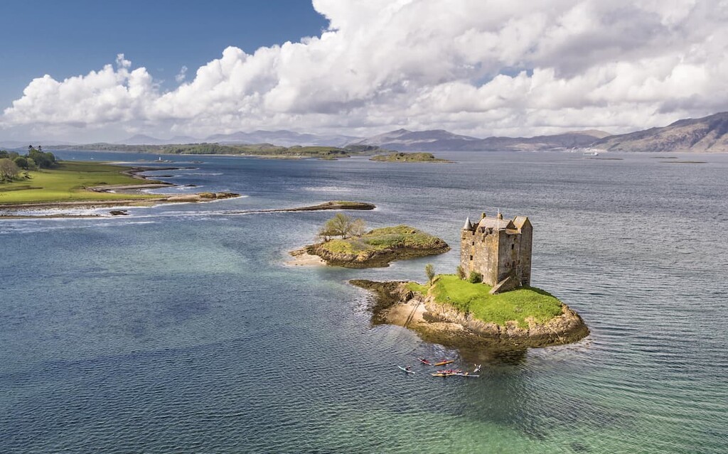
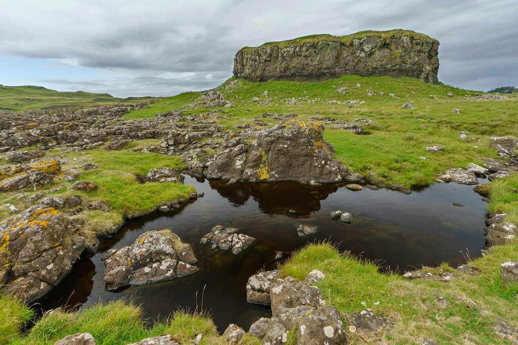
Head to the right across the field through another gate by some satellite dishes. If you have some spare time, take a short detour to the ruins of the seventeenth century Coroghan Castle, a former prison built atop a rugged seaside stack.
Follow the trail north uphill through a gate. After the gate, turn right and continue uphill. At the escarpment of the hill, bypass it to the left. Take a short detour to the right to reach the top of Compass Hill (139 m/456 ft). If you want to skip the hill, continue north to the fenceline atop the Canna's northern cliffs.
At the fence, head west and walk along the clifftops. There are some stunning views across to the Cuillin Hills of Skye. There are no paths here; however, sheep tracks make the route a little easier to follow.
After passing the second inlet along the coastline, you can head inland across the moorlands on a pathless trek to the top of Canna's highest hill, Carn a' Ghaill. The walk up Carn a' Ghaill is straightforward and grants some excellent views of the surrounding islands.
From Carn a' Ghaill, walk northwest back to the coastline and follow the fence over Beinn Tighe (305 m/1,000 ft). After Beinn Tighe, there are three rough descents, so take care. This area is among the best on Canna for birdwatching, with great skuas, white-tailed eagles, and golden eagles nesting on the cliffs.
The third descent leads to the low-lying center of Canna. Follow the fence to a stile and then walk downhill to a gate in a stone wall. Passing through the gate, you'll have to cross a stone wall to reach the coastal fence. At the fence, bear left and walk along the cliffs on Canna's west side.
Follow the clifftops past a picturesque inlet to reach the most westerly point of Canna. The cliffs will now turn south, over the fort of Dun Channa to the trig point of Sròn Ruail (129 m/423 ft). Continue along the cliffs as they warp around the island, now heading east. Keep an eye out for the ruins of Am Beannan, a medieval nunnery, below the dramatic cliffs.
After passing through a couple of gates, you'll come across farmlands at Tarbert and back onto a track. Make sure you stop to appreciate views across Tarbert Bay of nearby Rum. Follow the track as weaves left then right before heading east onto the A'Chill track. Here turn left to reach the island's post office and cafe, a short walk from your starting point.
If you're spending a day on the smallest of the Small Isles, Muck, then plan a leisurely hike to the island's highest point, Beinn Airein. This route will take you past the best of the island, including the beautiful sandy beaches at Gallanach. The hike up Beinn Airein is 4 miles (7 km), ascends 171 m (561 ft), and takes 2 or 3 hours.
From Muck's largest settlement, Port Mòr, follow the road past the old ferry terminal and gift shop, ignoring any turns. Enjoy an easy walk across the northside of Muck, with superb views across to the Rùm Cuillin. You'll then pass pristine beaches at Gallanach along with some farmhouses.
After the last farmhouse on your left, take a left turn through a metal gate climbing uphill. Follow the tractor tracks south, with Beinn Airein already visible. Pass through a gate with a sign about newly planted trees in the corner of the field, and follow the faint trail to the right through another gate.
Follow the fence to your right before passing through a gap to climb steeply uphill to the summit of Beinn Airein. The summit is marked with a trig point and boasts gorgeous views of Muck and the surrounding islands. This is a linear route and the quickest way back to retrace your steps.
If you're searching for somewhere to stay during your adventure at the Small Isles National Scenic Area, check out some of the area's main settlements and where to stay.
Mallaig is a small village that serves as the mainland ferry port for all the Small Isles. Mallaig is the perfect place to stay during your visit, as you can reach any of the Small Isles on regular ferries from the village.
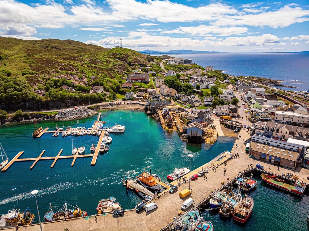
The area around Mallaig offers plenty of natural beauty, too, with Loch Nevis and Loch Morar nearby, as well as the gorgeous Camusdarach Beach, which has featured in several films. If you're looking to stay in Mallaig, rent a room at the West Highland Hotel or the Steam Inn.
The Isle of Eigg is the most populated of the Small Isles with roughly 87 residents, and its largest settlement is Cleadale. This small village on the northside of the island only numbers a few buildings but is encircled by dramatic cliffs, making it well worth visiting.
There are a couple of accommodation options near Cleadale, including Tigh Eilidh and Lageorna Guesthouse. If you'd prefer to stay as close to An Sgùrr as possible, consider staying at The Glebe Barn on the island's southside.
Despite its size, Rùm is very sparsely populated and offers very few accommodation options. One of the best places to stay on Rum is in the area around the historic Kinloch Castle in the community of Kinloch.
In Kinloch, visitors can check out the opulent nineteenth-century castle during an organized tour. The community is the ideal base from which to explore Rum, as there are several places to stay near along the shores of Loch Scresort, including the Ivy Cottage Guest House, the Kinloch Village Campsite, and the Rùm Bunkhouse.
Do keep in mind that, while there is a grocery store on the island, provisions are limited as they are brought over on a ferry only once a week. So, visitors are encouraged to bring their own food and supplies for their stay and to supplement their supplies at the community grocery store as needed.
Port Mòr is the largest settlement on the Isle of Muck, with a population of around 15 people. This small seaside village is ideal for escaping civilization and offers easy access to coastal hikes around the island and to Beinn Airein. There are only a couple of places to stay on Muck, and if you're looking for a hotel, choose the Port Mòr House Hotel.