
Scan the QR code and open PeakVisor on your phone
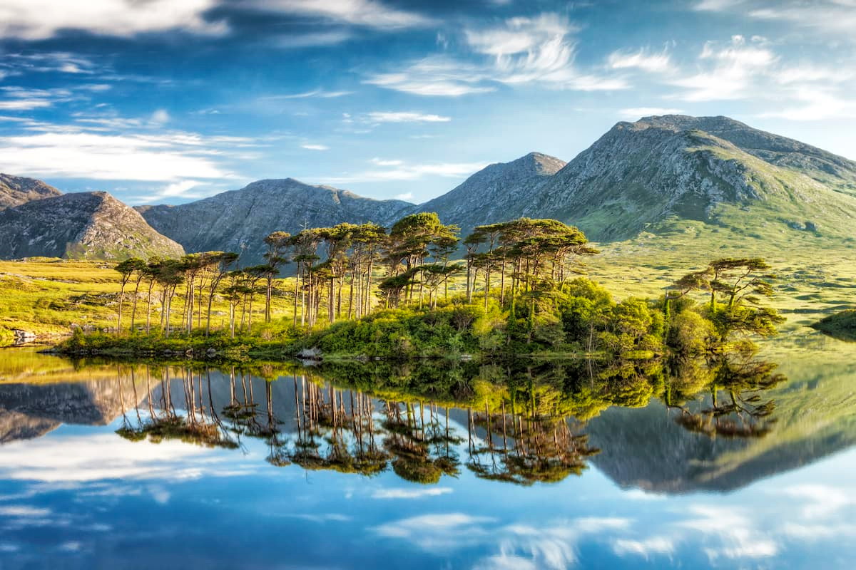
Discover the sublime countryside of western Ireland at Connemara National Park. Connemara National Park consists of over 5,000 acres of stark mountains, boglands, forests, and more. Over 250,000 people visit Connemara National Park every year to scale the Twelve Bens and roam through the park's lush valleys.
Connemara has been inhabited by humans for thousands of years, as is evident by the remains of old farmland dotted across the area. The oldest sign of human settlements in Connemara is a vast prehistoric tomb thought to be over 4,000 years old.
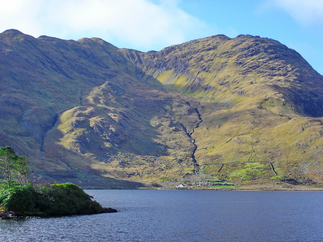
Hiking is one of the most popular activities at Connemara National Park due to the region's diverse landscape and the Twelve Bens mountain range. Benbaun (724 m) is the highest peak in the Twelve Bens and County Galway. Benbaun is a challenging climb, which affords stunning views of Connemara and the Atlantic Ocean. Other major peaks include Muckanaght (648 m) and Benfree (632 m). While not technically a mountain, Diamond Hill (440 m) is one of the most prominent points in Connemara National Park and is one of the best hikes in Ireland.
Nature watching is also very popular at Connemara National Park. The region is frequented by dozens of different bird species, including merlins, skylarks, and peregrine falcons. While ambling through Connemara National Park, you'll undoubtedly see Connemara ponies grazing in the valleys. These ponies are the largest mammal in the park and are a staple of Connemara.
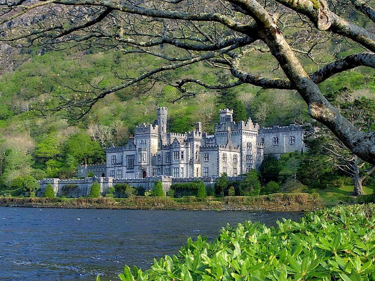
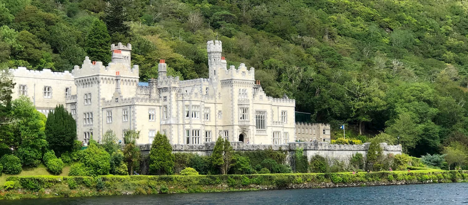
On the northern edge of the park perched on Pollacapall Lough is the picturesque Kylemore Abbey and Victorian Walled Gardens. The abbey is over 150 years old and was formerly a Benedictine nunnery. Visitors can tour the 6-acre gardens and take a tour of the abbey's interior.
If you're planning on visiting Connemara National Park from Galway, take the N59 northwest. You can also reach Connemara National Park by driving southwest down the N5 from Castlebar in County Mayo.
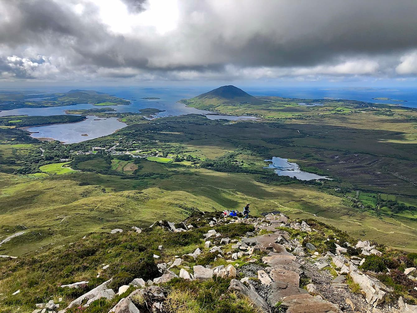
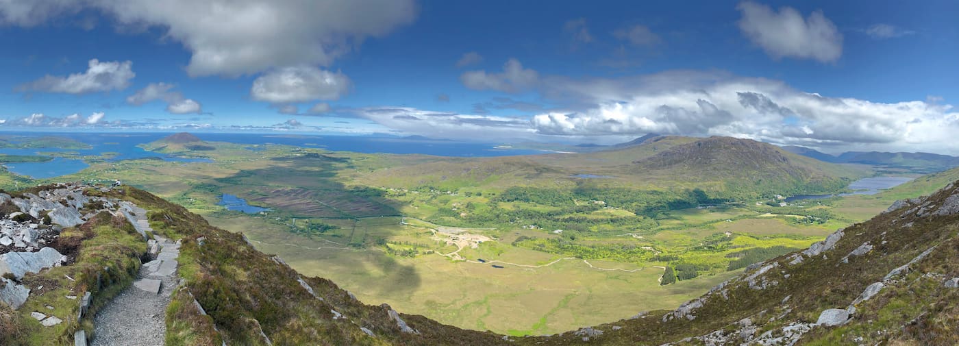
The Diamond Hill Loop Walk is one of the most popular trails in Connemara. This route is around 7 km long and should take about 2 hours to complete. You can pick up the trail in Letterfrack village. The walk up Diamond Hill is steep but doesn't require any scrambling or additional equipment.
You won't have any trouble following the trail as it's well worn and leads directly to the summit. The trail consists of gravel paths, boardwalks, and stairs. From atop Diamond Hill, you'll have sweeping views of Inishturk, Inishark, and Inishbofin just off County Galway's coast. At the end of the loop is a cafe, where you rest up and enjoy a snack or a cup of tea.
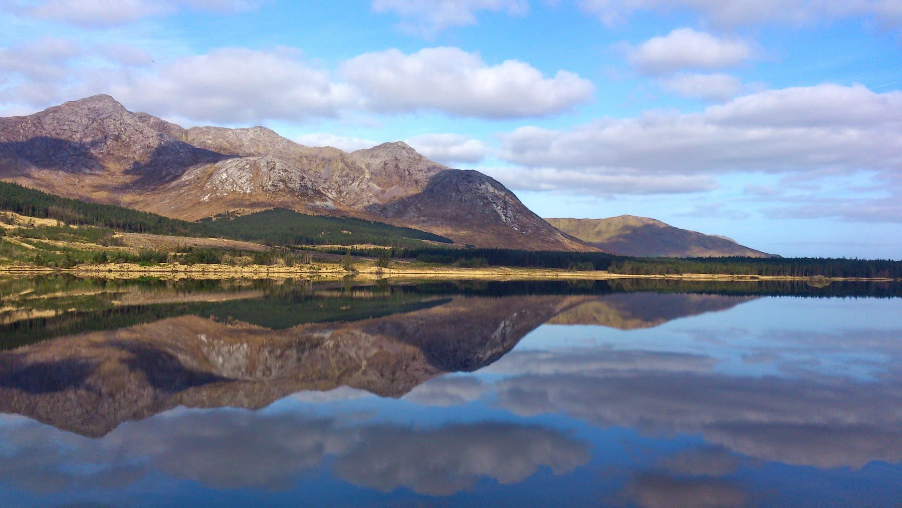
Benbaun is the highest of the Twelve Bens and is one of the most strenuous climbs in the park. This hike is around 9 km in length and should take 4 or 5 hours there and back. You can start your ascent up Benbaun not far from the Kylemore Pass Hotel along the R344. There is no marked trail up to the top of Benbaun, so ensure you plan your route carefully.
The best way to scale Benbaun is by first summiting Knockpasheemore (412 m) to the southwest. The hilltops here can feature peatlands, so be careful not to get stuck. After a while, you'll come across a small lake which you should keep to your left. The next stage of the climb is littered boulders and loose scree, and scrambling is required in places. You may find worn paths towards the peak of the mountain, which may make the climb easier. From atop Benbaun, you'll have excellent views of neighboring Bencollaghduff (689 m). To descend, retrace your footprints down the mountain. Descending Benbaun is hazardous, so ensure you note down the best route from your ascent.
Adventurers looking to scale three major peaks at once should consider the Muckanaght, Benfree, and Benbaun Loop Walk. This walk is around 11 km and should take 5 or 6 hours. The trek is considered challenging and should only be undertaken by experienced hikers.
The trek starts a couple of kilometers southeast of Kylemore Lake. Follow the Kylemore River south before cutting right towards Muckanaght (648 m). Once you reach the peak, head east along the saddle between Muckanaght and Benfree (632 m). Finally, make your ascent southeast to the summit of Benbaun (724 m). To descend from Benbaun, head down the northern face of the mountain. Parts of this hike will be very steep, with loose lots of loose rock, and scrambling will be necessary. Ensure you plan out a route carefully and bring appropriate equipment.

If you fancy scaling some of the Twelve Bens' lesser peaks, consider the Benchoona and Garraun Walk. The hike is around 11 km and should take 4 or 5 hours. Despite being a walk up some of the range's smaller mountains, this is still a tiring climb. As a result, ensure you map out a route and bring the correct gear. These northern peaks are less popular than the Twelve Bens' southern mountains and are perfect if you're looking to avoid other hikers.
To get to this hiking route, drive along the Lettergesh coastal road from Tully Cross. Park up at The Lettergesh Beach Car Park and continue on foot. To the left of the main road, you'll find a smaller country road. Turn right before the old post office, and head through the first gate to the right. At this point, you'll be facing the peaks of Benchoona (582 m) and Garraun (598 m). You'll see some woodlands at the base of the mountains. Head left around the tree line to begin your ascent, scaling Benchoona before Garraun. The walk up these mountains is direct but steep.
The Kylemore Abbey Walk is a leisurely hike suitable for all abilities. The trail is around 6 km in length, and completion time differs depending on how long you want to spend exploring the Victorian Walled Garden.
Start this walk at Kylemore Abbey by strolling around the ornate Victorian Walled Garden. Then exit the grounds and head east past Pollacapall Lough. To avoid the N59 road, head south towards Kylemore Lodge along the western shores of Kylemore Lough. Bear in mind this isn't a looped trail, so you'll have to walk back or arrange transport.
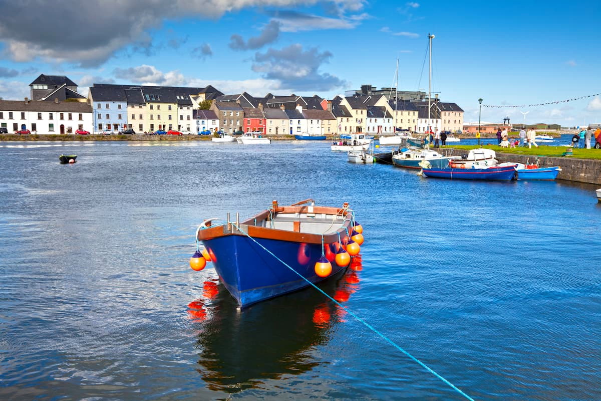
Galway is one of Ireland's most popular tourist destinations and is ideal if you don't mind taking a scenic drive along the Wild Atlantic Way to Connemara National Park. As the sixth biggest city in Ireland, Galway is home to many intriguing attractions, including the 17th century Spanish Arch and the National Aquarium of Ireland. Many of the top hotels in Connacht are in Galway, including Galway Bay Hotel and Galmont Hotel and Spa.
The quickest way to reach Connemara National Park from Galway is by following the N59 northwest. This drive is around 80 km and takes an hour and a half. If you feel like taking a more scenic route, there are several seaside roads like the R336, which boast stunning vistas of the islands just off Galway's coast.
Travelers looking to be right on Connemara's doorstep should book a hotel in Letterfrack. The scenic village of Letterfrack sits in the shadow of Diamond Hill, right on the edge of the national park. Thanks to its convenient location, Letterfrack is a tourist hotspot, with lots of restaurants, hotels, and amenities. You'll find plenty of reasonably priced accommodation in Letterfrack, such as Letterfrack Lodge and Clover Fox. No need to drive anywhere as Connemara National Park is just a short walk from Letterfrack.
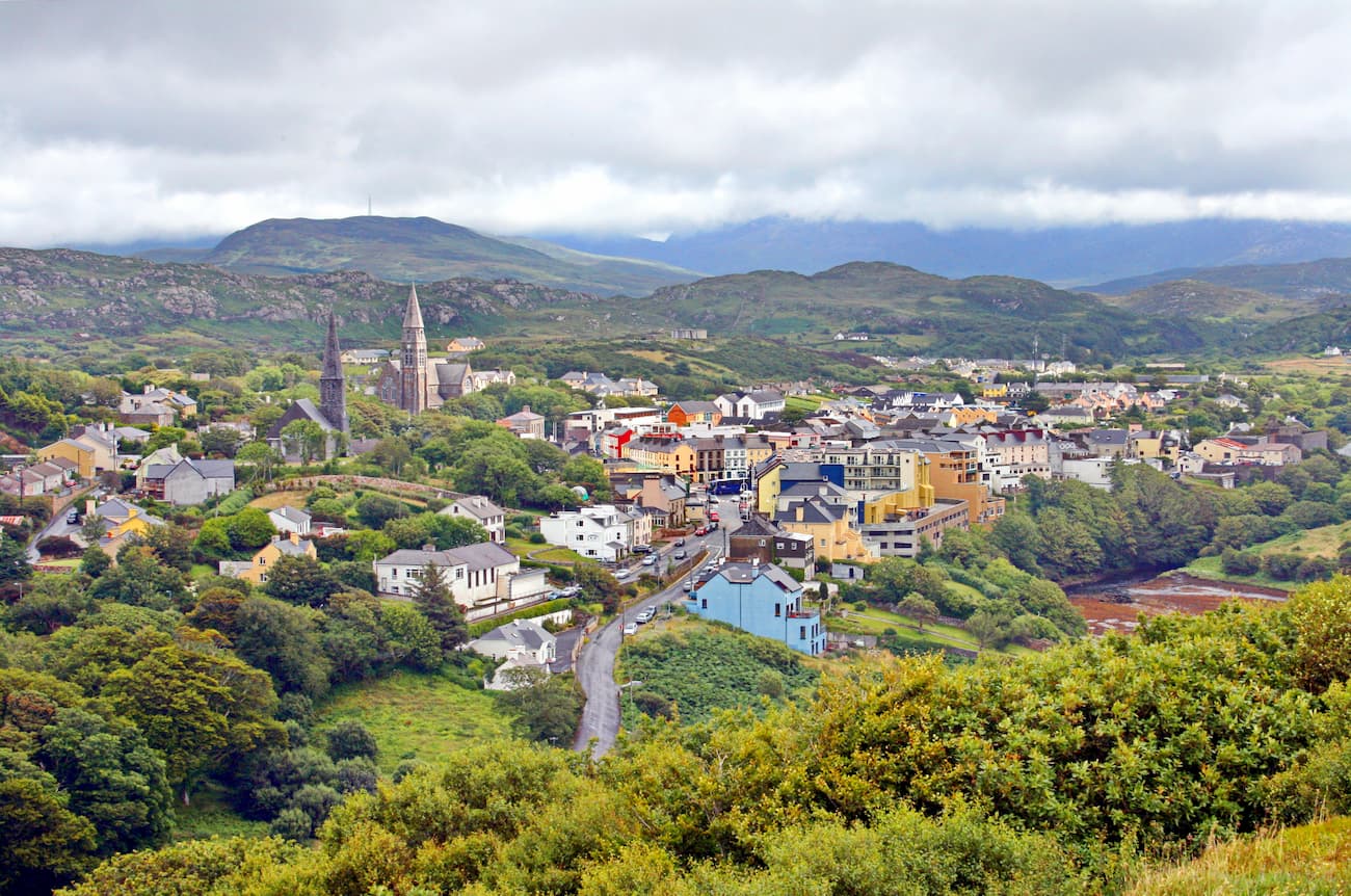
Dubbed the "Capital of Connemara," Clifden is ideal if you want to mix Irish culture with idyllic nature. Clifden is perched overlooking the Atlantic Ocean, and with the Twelve Bens as a backdrop, it's easy to see why it's popular with tourists. While in Clifden, stop by the Connemara Heritage and History Centre, and explore the ruins of Clifden Castle. If you're planning to stay in Clifden, consider booking a room at Clifden Station House or Abbeyglen Castle Hotel.
To reach Connemara National Park from Clifden, take the N59 north all the way to Letterfrack. The drive is 14 km and takes roughly 20 minutes.
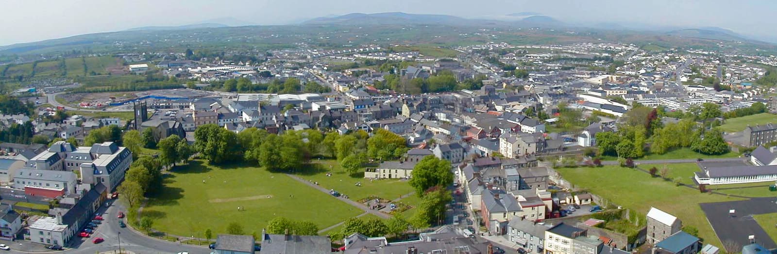
Castlebar is the ideal base if you're looking to explore both Ballycroy National Park and Connemara National Park. As the county town of Mayo, Castlebar has many of the best amenities in the region. Castlebar also contains interesting attractions, including Ireland’s only national museum not located in Dublin, the National Museum of Ireland - Country Life. Some of the most popular places to stay in Castlebar include the Ellison and Ivy Tower Hotel.
It's a straight drive along the N5 and N59 to reach Connemara National Park from Castlebar. The journey is 65 km and takes just over an hour.


.jpg)