
Scan the QR code and open PeakVisor on your phone
County Tipperary (Contae Tiobraid Árann) is one of 32 counties in Ireland, located in the southwestern province of Munster. Iconic ancient sites await hikers in County Tipperary, including the Rock of Cashel, Cahir Castle, and stunning natural attractions like the Galtee Mountains and Lough Derg. There are 144 named summits in County Tipperary. The highest and most prominent mountain is Galtymore (917 m / 3,012 ft).
County Tipperary is the sixth-largest county in Ireland, encompassing an area of roughly 4,305 sq km (1,662 sq mi). It has a population of over 167,000.
Ireland's largest inland county, Tipperary borders eight other counties: Offaly and Laois to the northeast, Kilkenny to the east, Waterford to the south, Cork to the southwest, Limerick and Clare to the west, and Galway to the northwest.
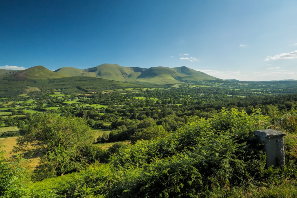
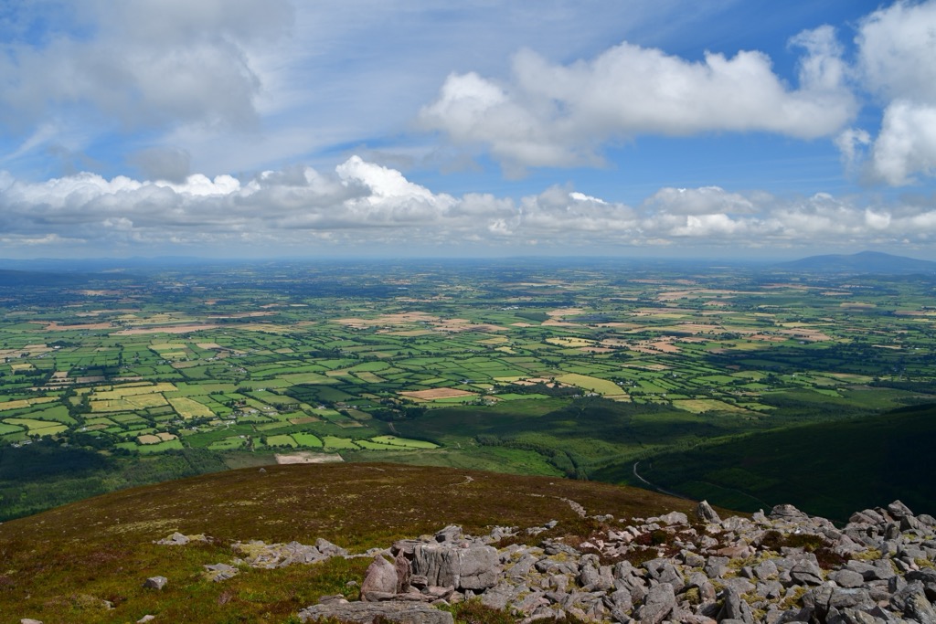
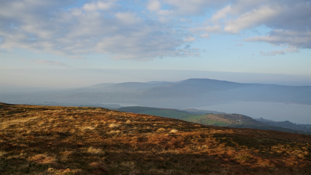
County Tipperary's landscape is diverse, with vast, fertile pastures at its center known as the Golden Vale. The Golden Vale is a key dairy farming area in Munster that extends into Limerick and Cork. Around the edge of Tipperary’s Golden Vale are four mountain ranges.
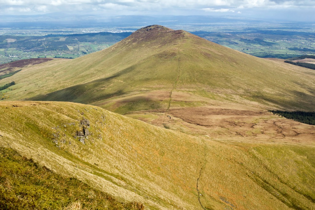
On its southwestern boundary with County Cork and County Limerick are the Galtee Mountains, the highest range in County Tipperary and home to Galtymore, one of 13 Irish Munros and the 5th-highest peak in Ireland. The Galtees are notable for being Ireland's highest inland mountain range.
Stretching east to west across County Tipperary's boundary with County Waterford are the Knockmealdown Mountains. The range's highest mountain is Knockmealdown (792 m / 2,598 ft) — County Tipperary's highest summit outside the Galtees. The Glen of Aherlow, a lush valley between Slievenamuck (369 m / 1,211 ft) and the Galtees, is among County Tipperary's most popular vacation destinations.
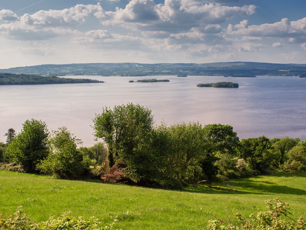
Two other smaller ranges, the Silvermine Mountains and the Arra Mountains, are located in North Tipperary near Lough Derg. The third-largest lake on the island of Ireland, Lough Derg has a surface area of 130 sq km (50 sq mi) and spans 38.6 km (24.0 mi) along County Tipperary's boundaries with Limerick and Clare. The Silvermine Mountains are part of the larger Slieve Felim Mountains, which include nearby Mauherslieve (543 m / 1,781 ft) and Slieve Felim (427 m / 1,401 ft).
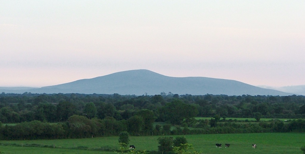
Aside from these ranges, County Tipperary has a few standalone mountains, like the Devil's Bit (480 m / 1,575 ft) near Templemore in the northwest and Slievenamon (Sliabh na mBan) (720 m / 2,362 ft) near Clonmel in the southeast.
The River Suir is County Tipperary's primary river, rising from the Devil's Bit and flowing for 185 km (115 mi) through Tipperary and Waterford. Ireland's longest river, the River Shannon, runs along County Tipperary's northwestern border and flows into Lough Derg.
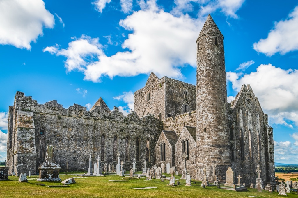
One of County Tipperary's most famous locations is the Rock of Cashel. This prominent limestone hill served as the traditional seat of the kings of Munster from the 4th century until the Norman invasion in the 12th century. It's topped with the well-preserved ruins of a 13th-century cathedral.
County Tipperary's county towns are Clonmel and Nenagh. There are two county towns in Tipperary, as it was split into two counties, North Tipperary and South Tipperary, until 2014. Clonmel is County Tipperary's largest town, with a population of over 18,300.
Ireland is one of the oldest areas in Europe, with some of the continent's oldest rock uncovered in County Donegal dating back over 1.7 billion years. However, County Tipperary isn't quite as old as Donegal — most of the county began forming roughly 430 million years ago in the Silurian period.
During this time, Ireland was split in two by the ancient Iapetus Sea. Mud and sand were deposited on the seafloor, forming the basis of many of County Tipperary's mountains, including Slievenamon, the Devil's Bit, and the Silvermine Mountains. Over 300 million years ago, during the Upper Carboniferous, some of this mud was compressed into shale, which is mainly found in the east of the county on the Kilkenny boundary within the Slieveardagh Hills.
By the Devonian period, around 416 million years ago, the Iapetus Sea had closed, and temporary rivers threaded their way across the newly formed landscape. During this time, Old Red Sandstone and conglomerates were created, making up the highest ridges and summits within the Galtees and Knockmealdown Mountains.
The Lower Carboniferous, over 323 million years ago, was one of the most critical periods for Tipperary's geology. The county was submerged beneath a shallow, warm sea rich in biodiversity. Sediment and the remains of sea creatures compressed on the seafloor resulted in the formation of Upper Carboniferous limestone.
Upper Carboniferous limestone is the most common rock in County Tipperary and is present across most of its lowlands, including the Golden Vale. As a result, County Tipperary has some karstic features, including Mitchelstown Cave near Burncourt.
From its vast grasslands to its exposed rocky summits, County Tipperary’s varied habitats support a wide variety of flora and fauna.
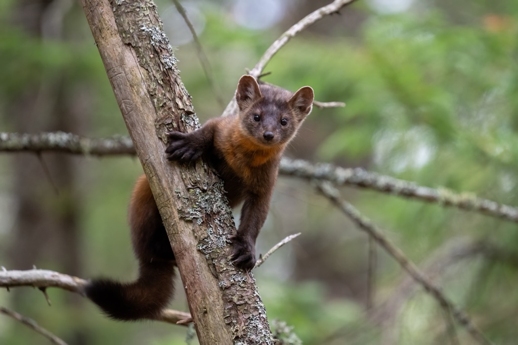
There are 27 terrestrial mammal species in Ireland, most of which can be observed in County Tipperary. Notable examples include red foxes, red squirrels, badgers, European hedgehogs, otters, Irish hares, pine martens, and pygmy shrews. County Tipperary has one of Ireland's largest wild deer populations, including herds of Ireland's largest mammal, the red deer.
Over 200 bird species have been identified in County Tipperary, including several globally threatened species like European turtle doves, black-bellied plovers, and redwings.
Other notable birds native to County Tipperary include starlings, jackdaws, kingfishers, hen harriers, Eurasian blue tits, common buzzards, peregrine falcons, barn owls, and great spotted woodpeckers.
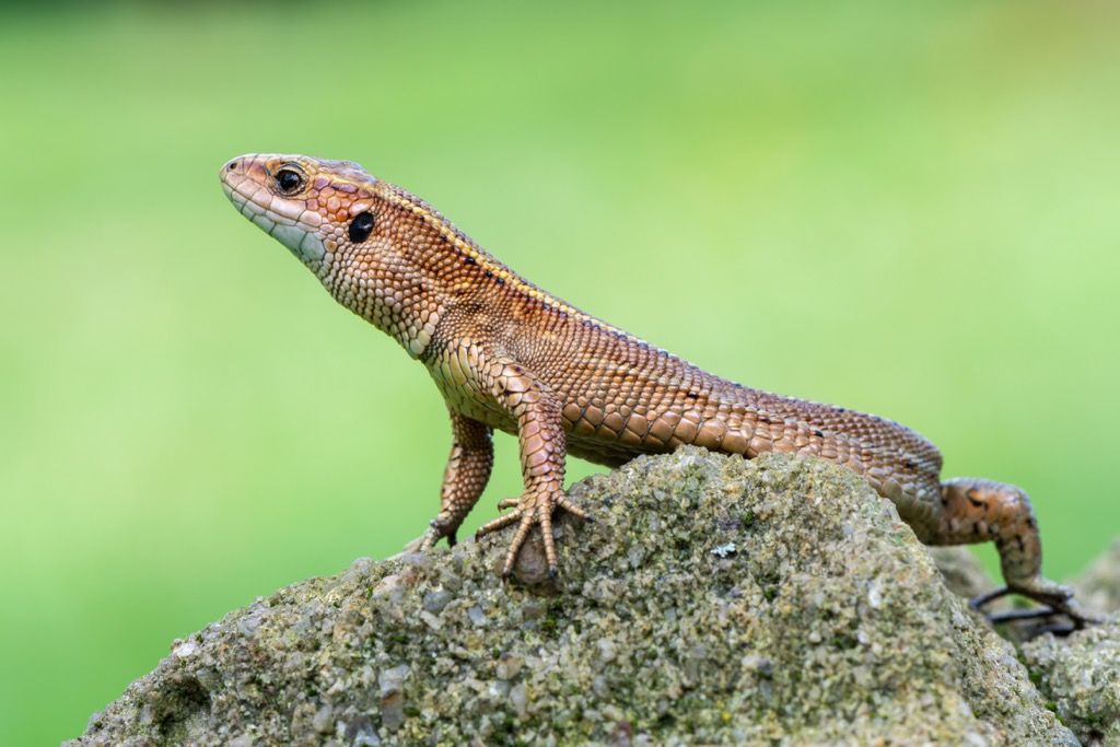
As with the whole of Ireland, there are no snakes in County Tipperary. Viviparous lizards and slow worms are the only reptile species in the country, and viviparous lizards are the only native species. Amphibian species include common frogs, smooth newts, and invasive Alpine newts.
Fishing is a popular pastime in County Tipperary — the River Suir is excellent for brown trout and salmon, while Lough Derg is home to pike, bream, and perch.
Over 12% of County Tipperary is woodland, and it has the fourth-largest forested area in the country, encompassing 52,235 ha (129,075 acres). Glengarra Wood is County Tipperary's largest woodland, covering roughly 570 ha (1,400 acres). Common trees in County Tipperary include oaks, ashes, hazels, rowans, pines, and willows.
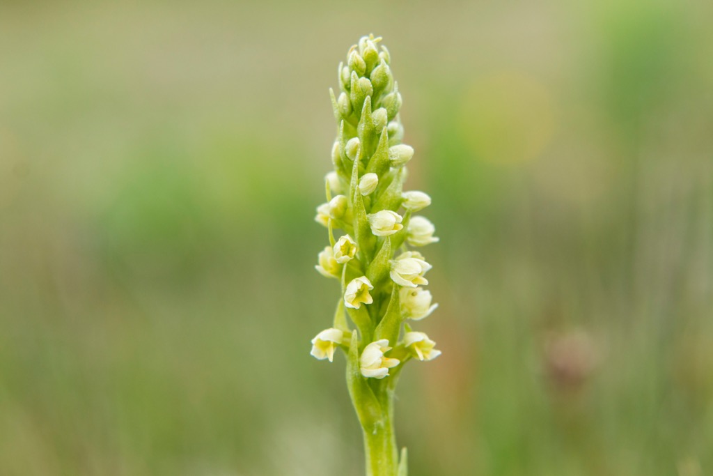
Dry heathlands are the primary habitat in the Galtee Mountains. Here, bell heather, bilberry, common bents, tormentil, and heath bedstraw are common plant species. Additionally, several rare arctic-alpine plants grow within the Galtees, including small-white orchids, alpine saw-wort, and mountain sorrel.
Heather grows across County Tipperary, including the shores of Lough Derg. Other plants around Lough Derg include juniper, blue-eyed grass, and Irish fleabane. There are stands of native forest around Lough Derg made up of oaks, birch, and ash. These native forests can be seen at Portumna Forest in County Galway.
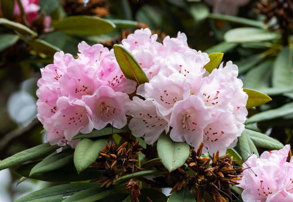
The Knockmealdown Mountains are home to swathes of upland heathlands, with purple heather and perennial grasses growing across the range. Common flowering plants in the Knockmealdown Mountains include rhododendrons, St. Patrick's cabbages, primroses, and blackberry bushes.
Several Special Areas of Conservation (SACs) protect County Tipperary's nationally significant flora. For example, the Spahill and Clomantagh Hill SAC in the Slieveardagh Hills protects its downy birch and hazel woodlands, home to green-winged orchids, frog orchids, and common spotted orchids.
Due to the low elevation and relative ease of County Tipperary's mountains, it's unclear when the first ascents of its highest summits took place — locals have been climbing the likes of Galtymore since prehistory.
Hiking out of necessity or for pilgrimages has been a common practice across Ireland for millennia. Croagh Patrick (764 m / 2,507 ft) - one of Ireland's most famous pilgrimages - has been a traditional trek for around 5,000 years.
Hiking didn't become a widely popular national pastime in Ireland until the early to mid-20th century. A shift in attitude towards nature across Europe in the 19th century, due to the Romantic movement, coupled with increased spending on outdoor infrastructure, helped popularize hiking in Ireland. Ireland's first national park, Killarney National Park, was established in 1932.
Author and cartographer J. B. Malone helped popularize hiking with his 1960s television documentary Mountain and Meadow, in which he embarked on hill walks in County Wicklow and the surrounding area. J. B. Malone is responsible for developing one of Ireland's most popular long-distance trails, the Wicklow Way. The Wicklow Way was the first of Ireland's 44 National Waymarked Trails.
The Tipperary Heritage Way, which follows part of the historic St. Declan's Way, was officially opened in 2002.
While County Tipperary's hills and mountains are modest in stature, their isolation and unclear trails mean you should plan any mountain hikes carefully.
Trials can be boggy in County Tipperary, so bring a solid pair of waterproof hiking boots. Pack plenty of provisions, check local weather forecasts, map your route carefully, and inform others of your itinerary.
Galtymore (Cnoc Mór na nGaibhlte) (917 m / 3,012 ft) sits directly on the Tipperary-Limerick boundary, and is the highest point in both counties. It's situated roughly 15 km (9.3 mi) west of Cahir, a popular tourist town due to the 12th-century Cahir Castle, one of Ireland's largest castles.
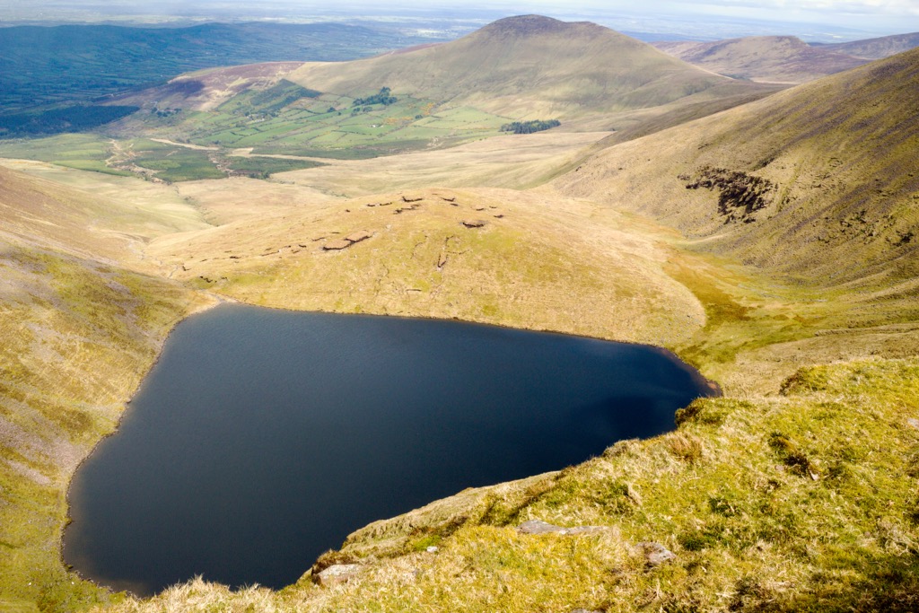
Galtymore is grass-covered with a plateau summit — known as Dawson's Table — with two peaks. On Galtymore's north side are three glacial corrie lakes: Borheen Lough, Lough Dineen, and Lough Curra. These dark-blue corries are surprisingly deep and contain arctic char left behind after the last glacial period.
Galtymore is popular with hikers looking to bag all the Irish Munros and the highest peaks in Ireland. Its summit affords uninterrupted views stretching across the Glen of Aherlow, Golden Vale to the north, and Caurrantoohil (1,039 m / 3,409 ft), Ireland's highest mountain, to the west.
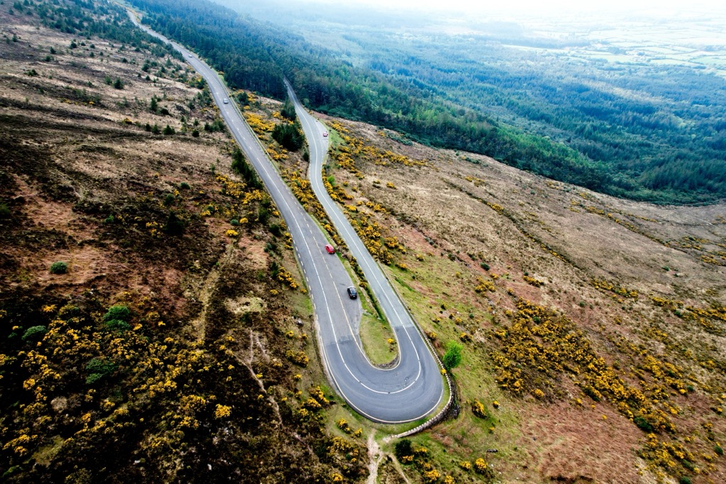
The most popular Galtymore hike is from the Galtyway Climb Car Park to the south, following the Black Road trail to the summit. It's a moderately difficult route, with some steep sections and exposed cliffs. Fog is common on Galtymore, so map your route carefully.
The route begins by following the old mountain road across the open mountainside, staying to the west of Knockeenatoung (601 m / 1,972 ft). The trail gets steeper as you near the summit of Galtybeg (798 m / 2,621 ft). You'll then walk across Galymore's plateau to reach its summit.
Descend the way you came. The Galtymore Black Road hike is approximately 11.2 km (7 mi) long.
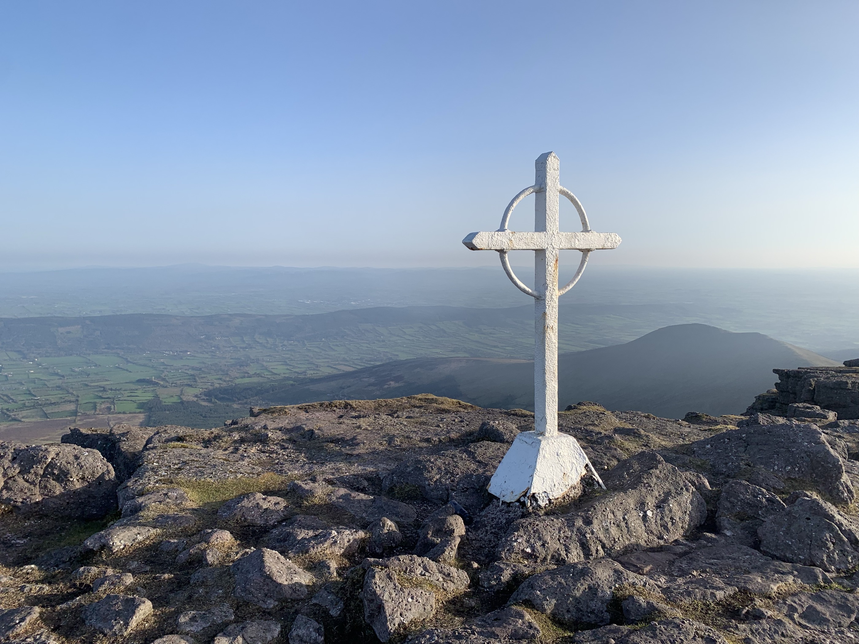
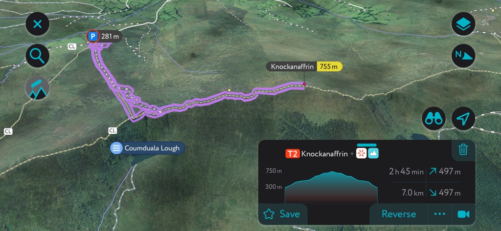
Knockmealdown (Cnoc Mhaoldomhnaigh) (791 m / 2,598 ft) is the highest summit and namesake of the Knockmealdown Mountains. Perched on the Tipperary-Waterford boundary, it's the highest summit in County Waterford and the sixth-highest in County Tipperary. Lismore is the nearest significant town to the Knockmealdown Mountains, located 12 km (7.5 mi) to the south.
Knockmealdown is a rounded mountain with a north-to-south ridge and a steep, barren east face. A trig point marks Knockmealdown's summit. Knockmealdown is popular with hikers who want to bag Waterford's county high point. On a clear day, its summit provides views of the Galtee Mountains to the west, the Comeraghs to the east, and Slievenamon to the northeast.
The best route to Knockmealdown is from Bay Lough Car Park via Sugarloaf Hill (662 m / 2,172 ft). The car park is located south of The Vee Pass. This is a moderately difficult route with clear tracks. Knockmealdown’s trails can be muddy, so waterproof hiking boots are recommended.
From the Bay Lough Car Park, follow the trail directly east up to Sugarloaf Hill's summit. The trail then heads southeast along the ridgeline to Knockmealdown. Descend the way you came. This Knockmealdown hike is approximately 9 km (5.5 mi) long.
Slievenamon (Sliabh na mBan) (720 m / 2,362 ft) is a standalone mountain in the Slievenamon Bog in southeastern County Tipperary to the north of Clonmel and Carrick-on-Suir.
Slievenamon is among the most culturally and historically significant mountains in County Tipperary. Four prehistoric sites rest atop Slievenamon, including a ruined burial tomb on Sheegouna (553 m / 1,814 ft). Slievenamon is the subject of the 19th-century song Slievenamon by Irish revolutionary Charlie Kickham, considered one of the county songs of Tipperary.
The mountain is also associated with folk hero Fionn mac Cumhail, who's said to have stood atop Slievenamon and declared whichever woman won a footrace to its summit would be his wife. Slievenamon's Irish name, Sliabh na mBan, means "mountain of the women."
The route to Slievenamon is steep but pretty straightforward, following an obvious track. You can pick up the trail from the Slievenamon Walk Parking Area. The trail leads initially through woodlands before opening up onto grassy mountainside.
From the summit, you'll be able to see Waterford's coastline. You can extend your walk from Slievenamon's summit to surrounding hills like Sheegouna in case you want to check out the burial mounds. Descend the way you came. This Slievenamon walk is approximately 6 km (3.7 mi) long.
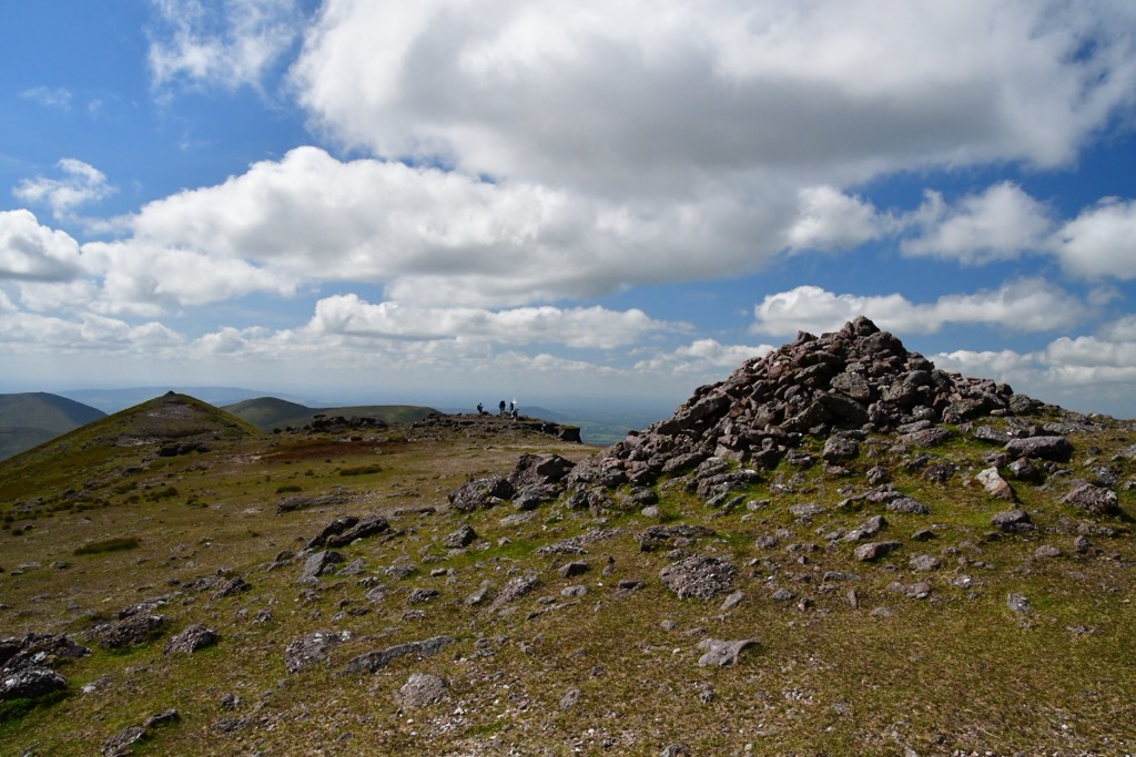
The Devil's Bit (Bearnán Éile) (480 m / 1,575 ft), or the Devil's Bit Mountain, is another historic County Tipperary mountain steeped in folklore. The Devil's Bit gets its name from when the devil supposedly took a bite out of the hill, leaving a gap between its main summit and a minor summit called "The Rock." The legend says the devil broke his tooth while taking a bite out of the Devil's Bit, spitting out the rock, which became the Rock of Cashel.
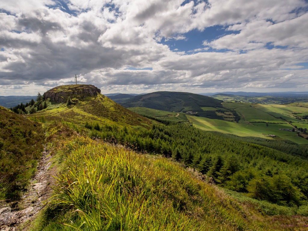
Atop Devil's Bit is a 13.5 m (45 ft) tall cross, which was erected in the mid-1950s and marks where you can see at least eight different counties: Clare, Galway, Kilkenny, Laois, Limerick, Offaly, Tipperary, and Waterford. You can spot the Comeragh Mountains, the Galtees, and Lough Derg from the Devil's Bit.
The Devil's Bit walk is short and straightforward. It's worth noting that dogs aren't allowed on this trail. You'll start this looped hike from the Devil's Bit Loop Walk Car Park. Purple arrows with a yellow background mark the trail. This clear path leads through forests and across open mountain slopes. The Devil's Bit hike is approximately 3.7 km (2.3 mi) long.
Keeper Hill (694 m / 2,277 ft), also known as Slievekimalta, is the highest summit in the Silvermine Mountains, roughly 10 km (6.2 mi) south of Nenagh. It's part of the larger Slieve Felim Mountains, which encompasses the entire mountainous area of Tipperary between Borrisoleigh, Dundrum, Murroe, and Silvermines.
Keeper Hill is relatively popular with hikers, partly due to its location around 20 km (12.4 mi) from Limerick City. From the summit, you'll have panoramic views of Lough Derg, the Knockmealdown Mountains, and the Slieve Bernagh Mountains, including Moylussa (532 m / 1,745 ft).
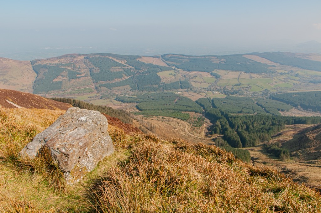
The best way to reach Keeper Hill's summit is on the marked Keeper Hill Trek, which begins from Doonane Forest Car Park. This is considered a challenging hike. It's a scenic walk, leading through some of County Tipperary's largest wooded areas and past some stunning waterfalls and gullies, including one famous waterfall known as the Spout.
The Keeper Hill Trek is one of Ireland's National Looped Walks and is marked with purple arrows. A trig point marks Keeper Hill's summit. This looped trail is approximately 8.2 km (5 mi) long.
The meandering Lough Derg, the third-largest lake on the island of Ireland, is one of Tipperary's most beautiful natural features. Anyone looking to enjoy views across this vast body of water should hike to the highest summit in the Arra Mountains, Tountinna (Tonn Toinne) (457 m / 1,499 ft).
Tountinna sits less than 3 km (1.8 mi) from Lough Derg's shoreline, making it the perfect vantage point to enjoy views of the lake and the River Shannon. You can pick up the trail to Tountinna from the car park near the Graves of Leinstermen, a stone dating back to around 1500 BCE that's thought to be a megalithic tomb.
Another popular trail, the Millennium Cross Loop, also starts from the Grave of the Leinstermen and leads along Lough Derg's shoreline. It leads up Laghtea Hill (326 m / 1,070 ft), which is topped with an 18 m (60 ft) tall cross.
The hike up Tountinna heads directly for the summit along country roads and then a paved road. From the summit, you can see the artificial lake along the River Shannon, created by the Parteen Weir Dam.
Return to your starting point by continuing past Tountinna, crossing the junction on the Lough Derg Way, and following the transmitter Road down the mountain. This Tountinna walk is approximately 6 km (3.7 mi) long.
The Tipperary Heritage Way is one of the best long-distance walks in County Tipperary, alongside the Lough Derg Way and the Slieve Felim Way.
This 56 km (35 mi) linear trail cuts through the heart of South Tipperary, following the course of Ireland's third-longest river, the River Suir, from the Vee Pass in the Knockmealdown Mountains to the historic town of Cashel. Hikers usually complete the Tipperary Heritage Way in two days.
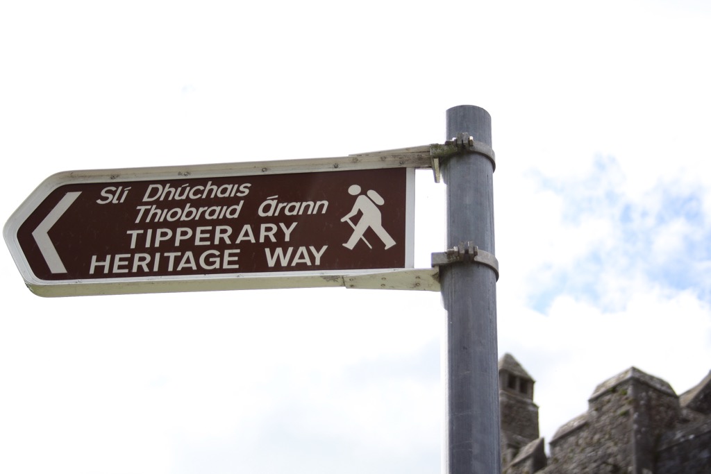
The route passes through the Golden Vale, Ireland's dairying heartland, visiting historic towns and villages, including Cahir, Ardfinnan, and Golden. Large parts of the Tipperary Heritage Way follow the ancient St Declan's Way, which once connected Ardmore in County Waterford to Cashel. St Patrick and King Henry II are among the historical figures who once trekked along St Declan's Way.
The Tipperary Heritage Way is a National Waymarked Trail, marked with yellow arrows on a black background. You can find a full breakdown of the Tipperary Heritage Way here.
At PeakVisor, we love information. That’s why we write articles like this one.
Check out the PeakVisor app for even more information on thousands of additional hikes, ski tours, and ski resorts across the world. In fact, we’ve compiled information on all publicly maintained walking tracks worldwide, formatted onto our 3D maps.

PeakVisor started as a peak identification tool—you’ll have noticed the photos throughout this article—but we’ve evolved into purveyors of the finest 3D maps available. We continue to expand our offerings. You can track your hikes directly on the app, upload pictures for other users, and keep a diary of all your outdoor adventures.
Most recently, the PeakVisor App has included up-to-date weather reports, including snow depths, at any destination. We've also been hard at work adding the details of hundreds of mountain huts, including information on overnight accommodation, dining options, and opening hours. You can also use our Hiking Map on your desktop to create .GPX files for routes to follow later on the app.

County Tipperary is sparsely populated, with numerous sleepy villages and towns to call home between hikes.
Ireland's second-busiest international airport, Cork Airport, is approximately 100 km (62 mi) southwest of Clonmel. Shannon Airport is around 70 km (43 mi) southwest of Nenagh.
Clonmel is the largest town in County Tipperary, with a population of over 18,300. Perched on the River Suir, Clonmel is a quiet town with a long history. It’s especially well-known for its resistance during the Cromwellian Siege of Clonmel in May 1650. It's one of two county towns in County Tipperary and was the county town of South Tipperary until 2014.
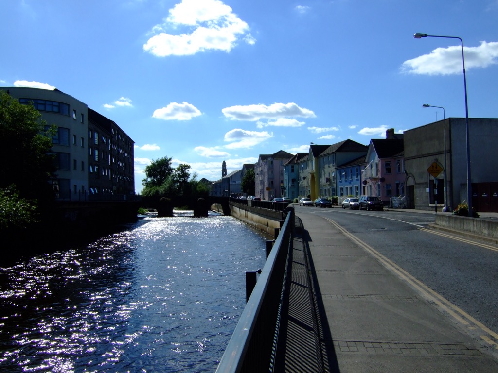
Clonmel is ideally positioned for exploring the mountains of South Tipperary — the Knockmealdown Mountains, the Galtees, and Slievenamon are all within 30 km (18.6 mi).
Clonmel railway station provides services and connections to Waterford City, Limerick City, Dublin, Cork, Tralee, and Galway.
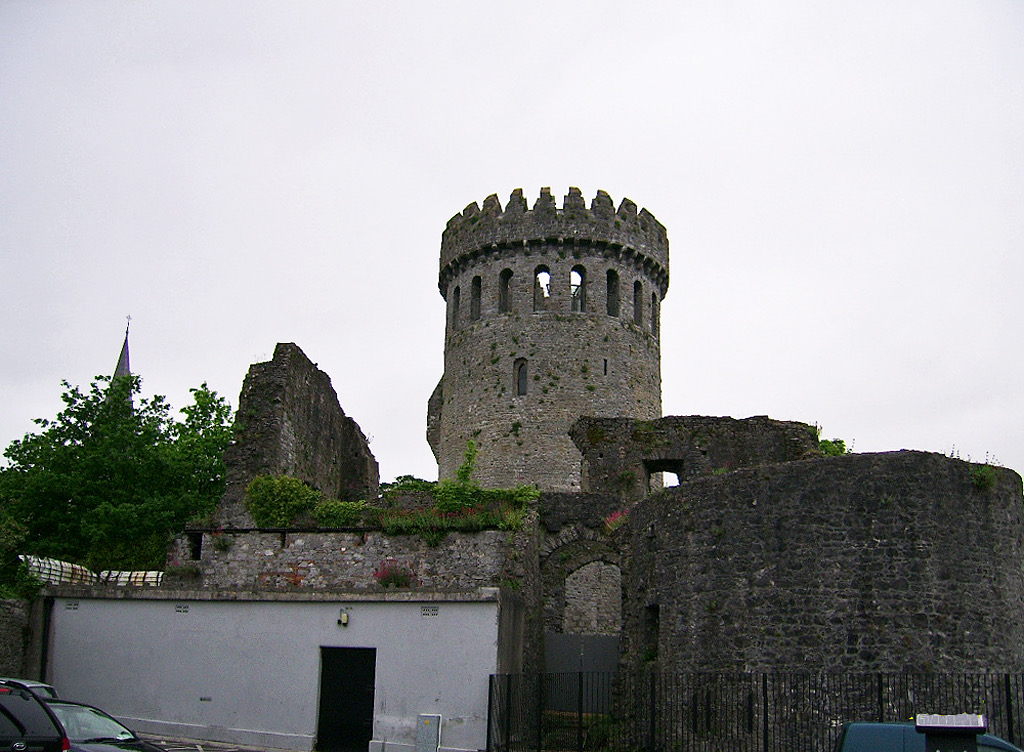
Nenagh is the second-largest town in County Tipperary, with a population of over 9,800. Alongside Clonmel, it's one of Tipperary's two county towns and the former county town of North Tipperary.
Nenagh dates back to the 13th century, with its most famous feature being the Norman-era Nenagh Castle, which was completed in 1220. Its circular keep stands 30 m (98 ft) tall and is considered one of the finest of its kind in Ireland.
Positioned less than 7 km (4.3 mi) from Lough Derg's shoreline, Nenagh is an excellent base from which to explore the Arra Mountains and the Silvermine Mountains. The Devil's Bit is also close to Nenagh, located 20 km (12.4 mi) to the east.
Nenagh railway station offers services directly to Limerick, with connections from Ballybrophy to Tralee, Cork, and Dublin.
Other towns and villages worth visiting in County Tipperary include Thurles, Cashel, Cahir, and Tipperary Town.


_-_geograph.org.uk_-_6531686.jpg)