Scan the QR code and open PeakVisor on your phone
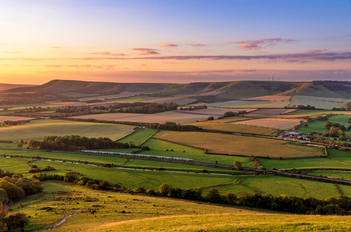
With its lush rolling hills and iconic white cliffs, the South Downs National Park is a one-of-a-kind hiking destination. One of England's newest national parks, the South Downs National Park covers over 600 square miles primarily within the coastal counties of Hampshire, East Sussex, and West Sussex. The park stretches along a significant portion of South East England, from Winchester to Eastbourne. It is the 3rd largest of England's 10 official national parks (excluding The Broads).
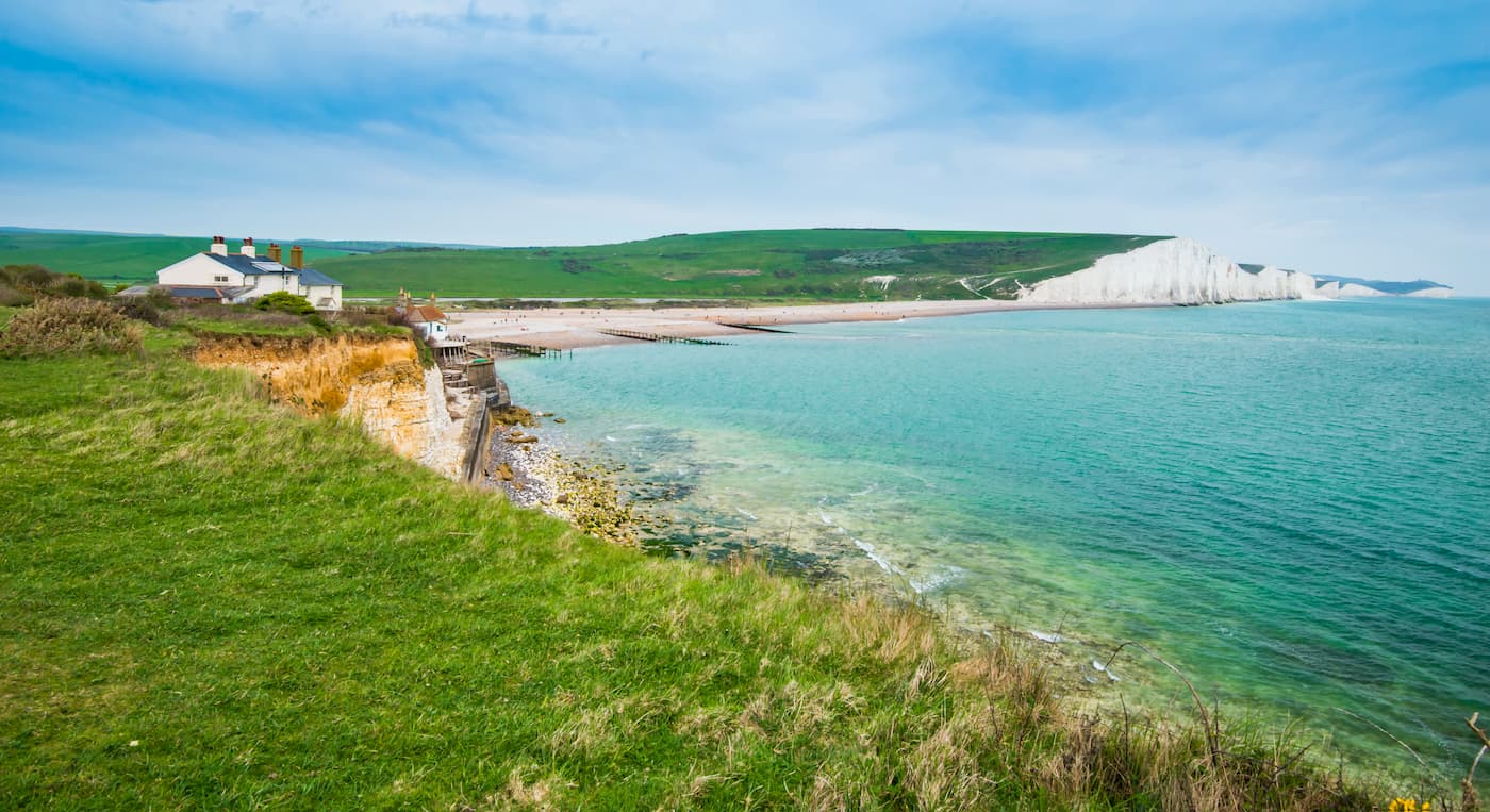
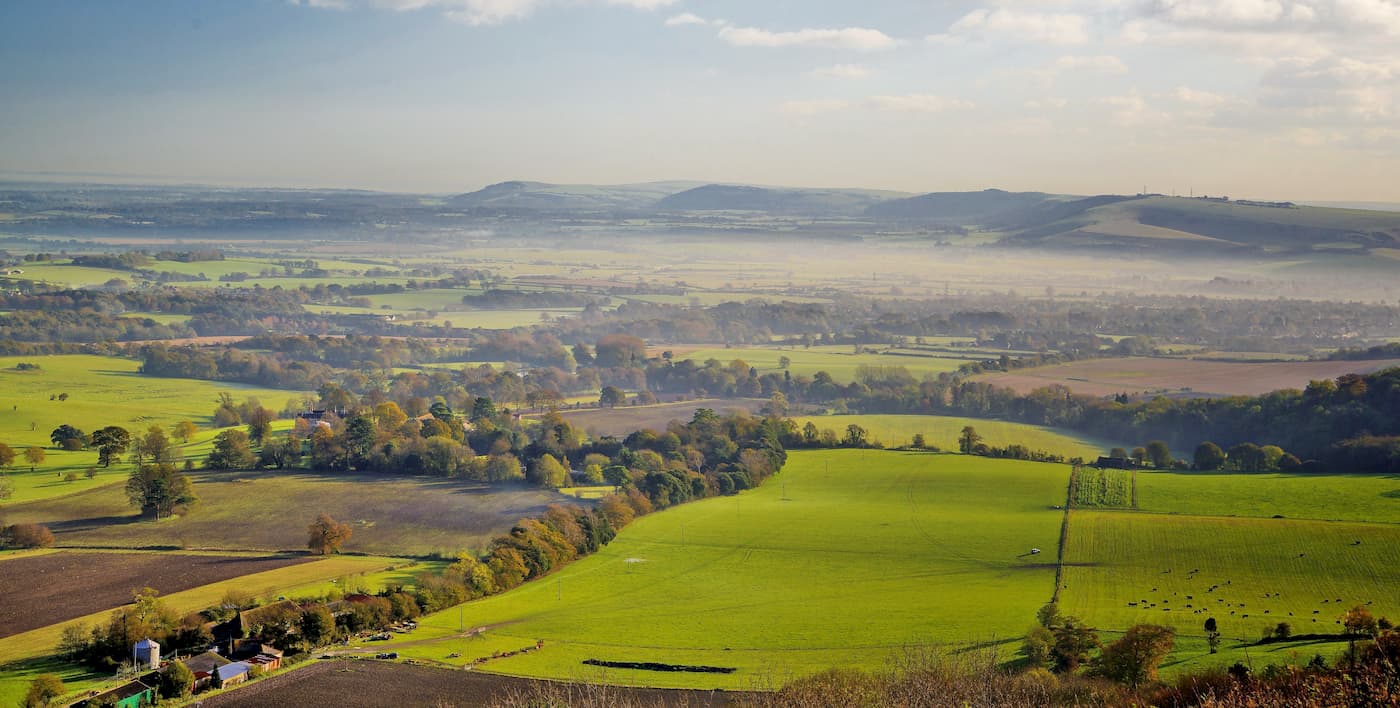
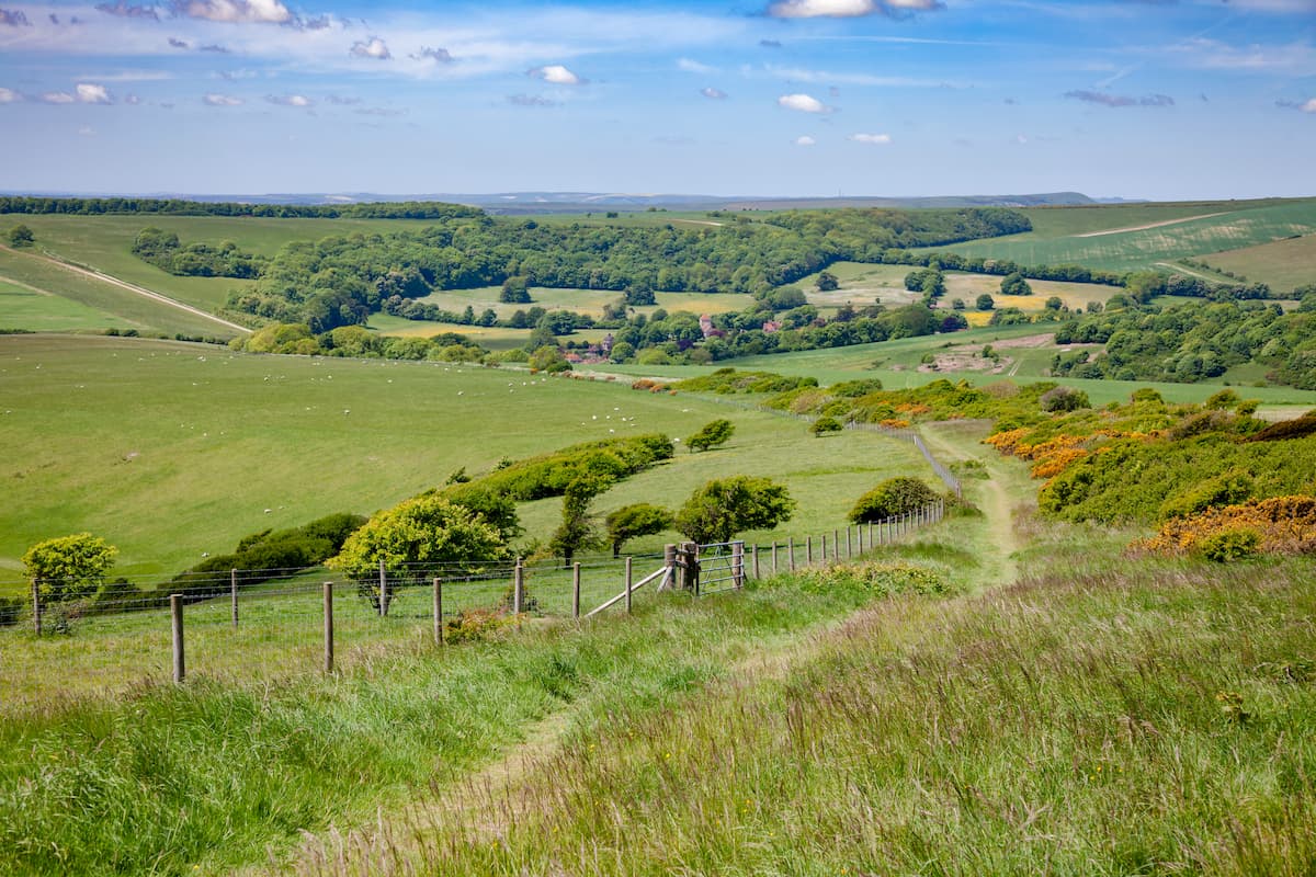
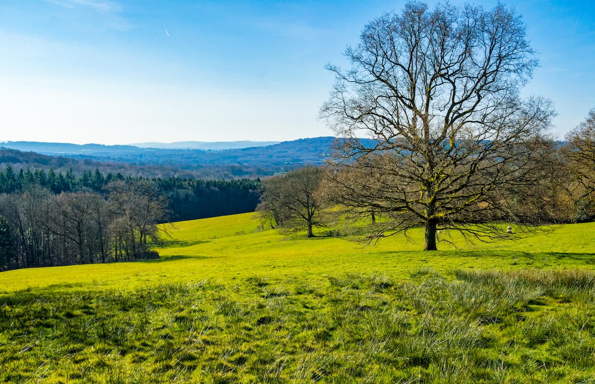
The geology of the South Downs National Park consists mainly of chalk hills, which ebb and flow across the landscape. Heathlands cover many of the hills across the South Downs and provide panoramic views across the Weald. One of the most famous sights in the South Downs National Park is the Seven Sisters. This series of stark chalk cliffs extends from Seaford to Eastbourne and boasts some of the best ocean views on the South Coast.
The highest point in the South Downs National Park is Blackdown (290 m) in West Sussex. Due to its prominence, Blackdown is classified one of the UK's Marilyns. Other notable Marilyns within the South Downs National Park include the county top of East Sussex, Ditchling Beacon (252 m), as well as Chanctonbury Ring (238 m).
Despite only becoming a national park in 2010, there has been significant interest in preserving the South Downs' historic landscape for over 100 years. The remnants of ancient settlements in the South Downs date back over 5,000 years, some of which are still partially visible. For example, Cissbury Ring once covered 65 acres on a hilltop and is the largest Iron Age fortification in Sussex.
South Downs National Park consists of several environments, from bogs to woodlands. As a result, the South Downs has become a popular area for nature watchers, with an array of fauna and flora inhabiting the region. The South Downs National Park is home to 23 dragonfly species and 39 butterfly species. Some animals, such as the greater mouse-eared bat, are only found within the South Downs.
With over 2,000 miles of paths, the South Downs National Park contains more hiking trails than any other national park in the UK. Read on to find out about the South Downs National Park's best trails and hiking areas.
The South Downs Way is the most famous trail in the South Downs National Park. This long-distance trail runs for 100 miles across the breadth of the South Downs from Winchester to Eastbourne. It's the only one of 16 National Trails contained entirely within a national park. The walk follows the ridge across the chalk downs, passing many of the park's best sights and highest hills.
This walk is strenuous and takes most hikers around 8 days to complete. If you would prefer a shorter walk, the South Downs Way can be divided up easily, for example, from Exton to Buriton (13 miles) or Lewes to Alfriston (13 miles).
The route along the South Downs Way is well-mapped and easy to follow. Due to the length of this trek, you'll want to book accommodation ahead of time. There are lots of quaint villages and settlements along the South Downs Way where you can spend the night, including Amberley, Exton, and Lewes.
Within the first 25 miles of your walk from Winchester to Buriton, you'll pass over Cheesefoot Head (188 m), Beacon Hill (214 m), and the highest point on the South Downs Way, Butser Hill (271 m).

Over the next 35-mile stretch, you'll head from Buriton to Cocking, through dense woodlands, and over Harting Down (270 m) which afford stunning views across the Weald. Close to Amberley, you'll pass over Bignor Hill (222 m), with the sea coming into view shortly after. The next section from Amberley to Lewes via Upper Beeding is 33 miles. During this segment, you'll pass over two of the South Downs' Marilyns. Firstly, you'll walk over the Chanctonbury Ring, which features the remains of a 6th-century hill fort. Then, after resting up in Upper Beeding, you'll tackle Ditchling Beacon, which provides panoramas of Ashdown Forest.
The final section of the South Downs Way takes you from Lewes to Eastbourne via Alfriston. This 25-mile trail heads first over Iford Hill (192 m), before heading to the best part of the walk, the Seven Sisters. The viewpoint on the Seven Sisters is Beachy Head, which flaunts picture-perfect vistas along the cliffs towards Eastbourne.
Another stunning long-distance hike, the Serpent Trail runs for 64 miles through the best of the South Downs' heathlands. The Serpent Trail begins in the town of Haslemere, near the northern edge of the South Downs National Park, before snaking its way southwest to Petersfield in Hampshire. This meandering walk will take roughly 5 days to complete, and you'll find a few towns that provide accommodation along the way, including Midhurst and Petworth.
The Serpent Trail is easy to follow, with the length of the walk marked with discs bearing a snake icon. One of the most notable sections of the Serpent Trail is during the first 7 miles when it meanders through grasslands on the way to the top of Blackdown (290 m), the highest point in the South Downs National Park. After trekking through Marley and Lynchmere Commons, you'll pass by Chapel Common and Iron Hill onto the Hampshire county line, about 14 miles in.
From the tiny village of Rake to Tullecombe, watch out for some interesting local wildlife, including adders and vibrantly colored fungi like flying agaric. After the village of Borden, you'll have covered just under 20 miles. The next notable hill along the walk is Bexley Hill (201 m), which is a popular bird watching area. The next town, Petworth, is a good place to stop around halfway through the walk.
The subsequent 10 miles weaves through heathlands and commons, through Fittleworth on the way to Burton Park. On the way to Midhurst via Heyshott Commons, be on the look-out for local fauna, including sand lizards and stonechats. During this section, you'll pass over Gallows Hill (71 m), the site of medieval executions.
The final 13-miles stretch from Midhurst to Petersfield will take you through Midhurst, Iping, and Steadham Commons. This section is great for deer watching, with roe deer roaming the countryside. The final leg passes through Dumpford and Nyewood, ending in Petersfield.
The Centurion Way is one of the most popular short-distance hikes in the South Downs National Park. The trail heads north from its starting point in the picturesque cathedral city of Chichester, ending the village of West Dean. The Centurion Way is 5.5 miles and takes around 2 hours to complete.
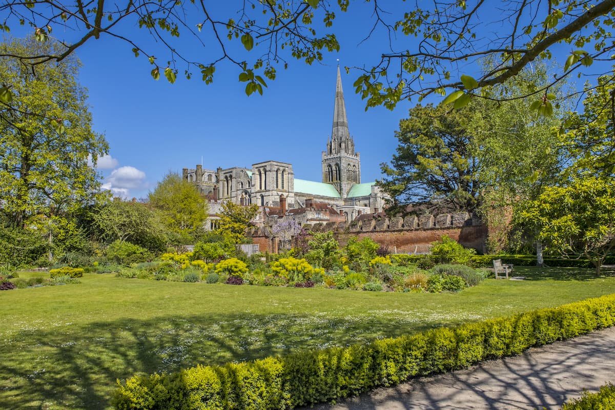
The path begins at the Bishop Luffa School, before following the disused railway line north. The path is called the Centurion Way as it passes over a section of old Roman road. At the start of the walk, you can take a short detour west to the Fishbourne Roman Palace, a 1st-century homestead which contains the largest collection of Roman mosaics in England. About a mile into the walk, you'll pass the Brandy Hole Copse, a scenic woodland area complete with tranquil ponds.
After 1.5 miles, you'll walk through the village of Mid Lavant. Once you come across a bridge spanning the Lavant River, you can either continue straight or cross over and follow a separate path. The trail ends at the West Dean tunnel. Consider heading into the village for a break before returning to Chichester.
Not far from Lewes is the village of Glynde. From Glynde, you can take a scenic walk up to the top of Mount Caburn (150 m), which provides sweeping views of the surrounding area. This circular trail from Glynde is 6.5 miles and takes around 3 hours.
From Glynde train station, head northwest towards the Mount Caburn National Nature Reserve. Following the uphill trail towards the peak of Mount Caburn, you'll be treated to panoramas of the countryside, with the ocean visible at Newhaven on a clear day. Head down the hill through the right-hand gate to descend. Follow the yellow arrow markers to Lewes Golf Club.
From here, you can either head into Lewes, or return to your starting point by following the arrows through the golf course, which will lead you by a pond and past some woodlands. This route will lead you back into Mount Caburn National Nature Reverse, before taking a left downhill track to Glynde.
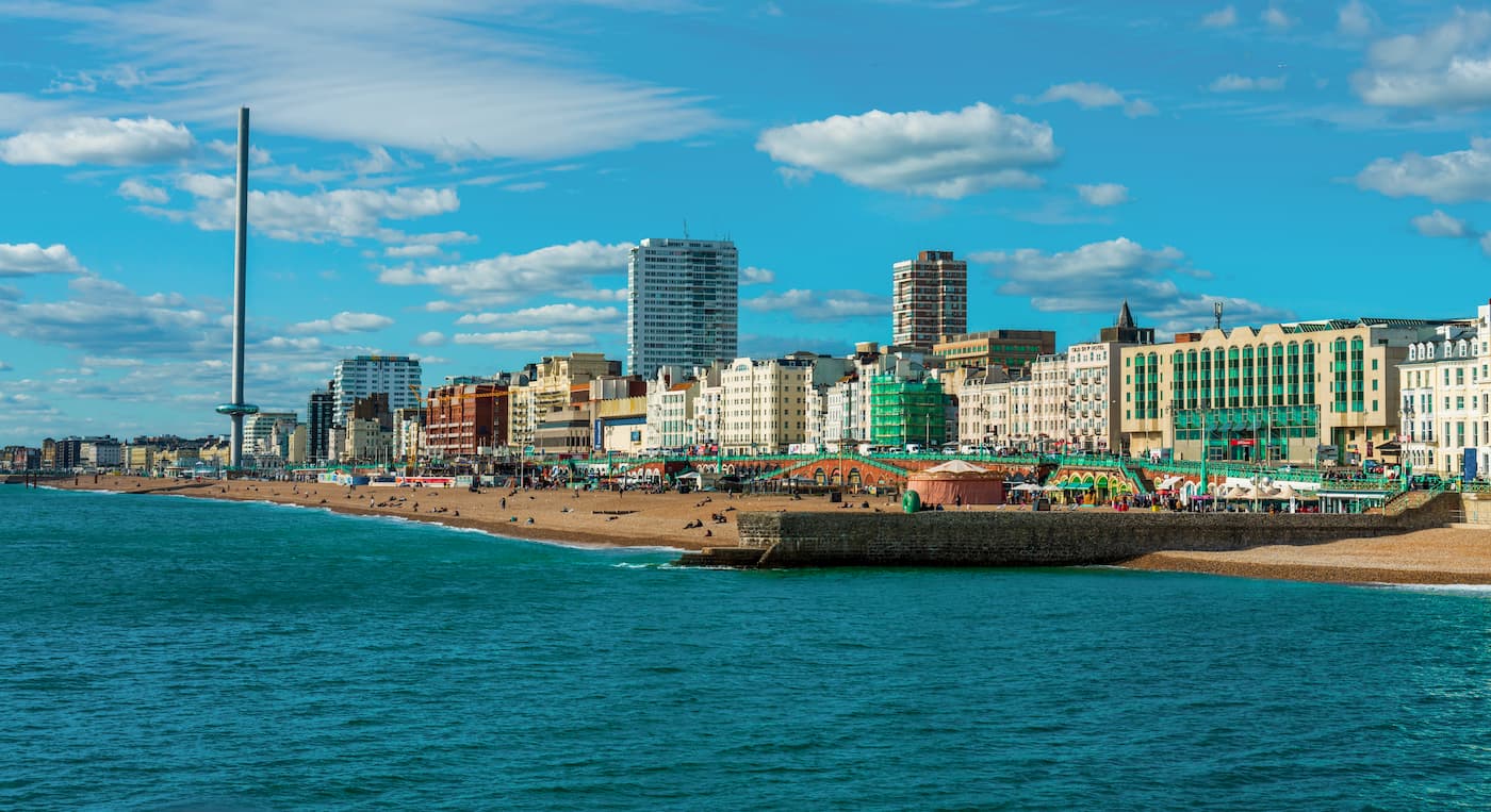
The seaside city of Brighton is a popular holiday destination and provides easy access to South Downs National Park. Brighton sits on the southern edge of the park and is just 30 miles from its center. While not exploring the nearby trails, you'll plenty to do around this quirky metropolitan area, with Brighton Pier providing plenty of entertainment, and i360 Viewing Tower which affords sweeping views of the city and surrounding South Downs from over 162 meters in the air. Many of Brighton's best hotels are along the seafront, and popular options include Brighton Marina House, the Sea Spray Hotel, and the Mercure.
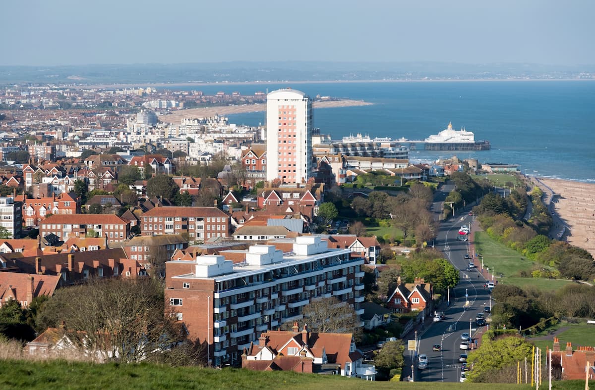
Straddling the eastern tip of the South Downs National Park, Eastbourne is another popular seaside resort worth visiting. After lazing around on Eastbourne beach or uncovering local history at the 200-year-old Eastbourne Redoubt, head 6 miles down the coast to one of the South Downs' biggest attractions, the Seven Sisters. If you're planning to walk the length of the South Downs Way, Eastbourne is the ideal place to book a room and relax after this lengthy trek. Some of the best places to stay in Eastbourne after completing the South Downs Way include the five-star Grand Hotel and seafront Langham Hotel.
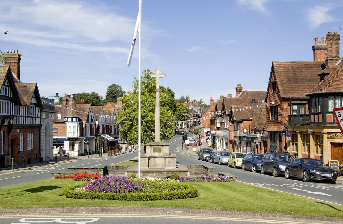
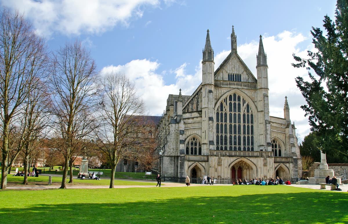
The city of Winchester is known for its grand Gothic cathedral, 19th-century university, and medieval Grand Hall. While Winchester is a superb location for learning about ancient English history, it's also ideal for getting outdoors. Winchester sits on the western edge of the South Downs National Park and only 14 miles from the New Forest National Park. Winchester marks the beginning of the South Downs Way and is a great place to rest up before this long ramble. If you plan on staying in Winchester, consider booking a room at the 17th century Lainston House or the centrally located Winchester Hotel and Spa.
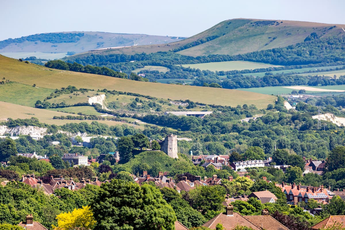
The postcard-perfect county town of East Sussex, Lewes, puts you within touching distance of many of the South Downs' best trails and highest hills. The town is perched on the western side of the Lewes Downs, which contains Mount Caburn and Cliffe Hill (164 m). The South Downs Way also runs directly through the center of Lewes. You'll find a few fascinating historic sights in Lewes, such as the Tudor Anne of Cleves House and the ruins of Lewes Castle. Despite being fairly small, Lewes is a popular vacation spot and features plenty of hotels like the Kings Head, the Cowshed, and the White Hart Hotel.
Petersfield is a quaint market town near the heart of the South Downs National Park. Marking the end of the Serpent Trail, Petersfield is less than 6 miles from Butser Hill and the Queen Elizabeth Country Park. While Petersfield is a fairly sleepy town, you'll find a few local attractions like the Petersfield Museum and the Georgian Uppark House. Popular hotels include The Old Drum and Langrish House.
Haslemere is one of the most northern towns in the South Downs National Park, on the edge of the South Downs and the Surrey Hills AONB. The starting point for the Serpent Trail, Haslemere is just 3 miles north of Blackdown, the highest point in the South Downs National Park. Just north of Haslemere in the Surrey Hills is the Devil's Punch Bowl, which includes Gibbet Hill (272 m) the second-highest hill in Surrey. There are lots of charming hotels in and around Haslemere, such as the Lythe Hill Hotel and Spa, The Station House, and Parkhurst Cottage.