
Scan the QR code and open PeakVisor on your phone
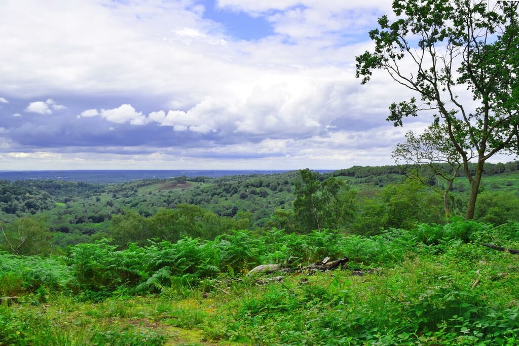
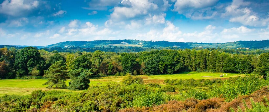
Explore some of the finest rolling hills in southern England with a trip to the Surrey Hills Area of Outstanding Natural Beauty (AONB). There are 104 named hills in the Surrey Hills AONB. The highest and the most prominent hill is Leith Hill (294 m/964 ft).
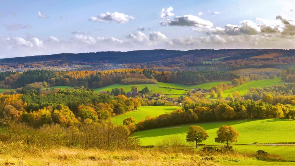
The Surrey Hills AONB is located in the county of Surrey in South East England. The area covers 163 square miles (422 sq. km) of land, which is approximately 25 percent of Surrey. The Surrey Hills were designated an AONB in 1958. They are managed by the Guildford Borough Council and the National Trust.
The Surrey Hills AONB is one of 34 AONBs in England. The area consists mainly of the North Downs and the Greensand Ridge, with three distinct environments: woodlands, downlands, and heathlands.
Approximately 18 percent of the AONB is heaths and commons, and around 25 percent of the park is open to the public. There are a number of rare environments in the Surrey Hills AONB, including box woodlands. One of the most important features of the Surrey Hills AONB is its chalk grassland remnants.
Around 1 percent of the park consists of chalk grasslands, a habitat for many endangered plant and animal species. The National Trust owns and manages all these environments. Areas with chalk grasslands include Ranmore Common, Box Hill (192 m/629 ft), and Leith Hill (294 m/964 ft).
Southern England is home to a number of rare and beautiful landscapes, and as a result, the Surrey AONB is close to several other parks. The Surrey AONB is connected to the Kent Downs AONB to the east and the South Downs National Park to the southwest.
Other nearby parks include the High Weald AONB, 45 miles (72 km) to the southeast, and the North Wessex Downs AONB, 50 miles (80 km) to the northwest.
The Surrey Hills AONB is very popular with hikers, partly due to its proximity to England's capital, London, which is just 25 miles (40 km) north. Other nearby major settlements include Guildford, 15 miles (24 km) to the west, and Crawley, 23 miles (37 km) to the south.
The formation of the Surrey Hills occurred at the same time as many of the most famous mountain ranges in Europe, including the Alps. The Surrey Hills formed around 65 million years ago during the Paleogene period.
The Surrey Hills are part of the Wealden anticline, a fold of stratified rock uplifted by the Earth's movement. These rock layers were formed under the sea during the early Early Cretaceous period, over 100 million years ago.
As the anticline was lifted above sea level, it created a 133 mile (215 kilometer) long axis that ran from the north coast of France through to Hampshire. Over the next 20 million years, the Wealden anticline was slowly eroded, with different layers of rock slowly revealed.
The hills of South East England vary significantly in geological age due to erosion. Many of the oldest hills are located at the heart of the High Weald AONB, while the youngest are within the Thames Valley and the North Kent Plain.
The Surrey Hills are some of the hardest rocks in the Wealden anticline. The hills are mostly composed of chalk and a type of sandstone known as greensand.
Today, the Surrey Hills are a series of modest hills, the highest of which is Leith Hill (294 m/964 ft), the county top of Surrey and is one of two Marilyns with Botley Hill (a peak with a prominence of over 150 m/492 ft). It is also the highest point in South East England.
Other notable hills in the Surrey Hills AONB include Gibbet Hill (275 m/902 ft), Colley Hill (236 m/774 ft), and Box Hill (192 m/629 ft).
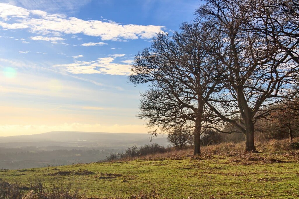
Home to rare environments like chalk grasslands and box woodlands, as well as lush heathlands and downlands, the Surrey Hills AONB boasts an array of fauna and flora that’s well worth checking out.
The Surrey Hills AONB is home to animals of all sizes, from the mid-sized red deer to over 600 moth species. Deer are the largest wild mammals in the Surrey Hills AONB. Several deer species frequent the area, including muntjac, red, fallow, and roe deer. You'll also encounter Exmoor ponies across the area's commons and heathlands.
Other large mammals in the Surrey Hills include European badger, red fox, and European otter. The Surrey Hills are also home to a number of small mammals rarely seen anywhere else in the UK.
These small mammals include water vole, stout, and hazel dormouse. You may also get lucky and spot Britain's largest rodent, the Eurasian beaver, which was reintroduced to the country in 2009.
Many of the birds which visit and nest in the Surrey Hills are protected by the 1981 Wildlife and Countryside Act due to habitat loss and rapidly declining populations.

Endangered bird species native to the Surrey Hills include nightingale, marsh tit, and yellowhammer. Other bird species seen across the Surrey Hills include nightjar, kingfisher, turtle dove, and grey partridge.
You'll also want to keep an eye out for some of the Surrey Hills' insects, especially when exploring the chalk grasslands. Over 40 butterfly species have been recorded in the Surrey Hills AONB, including purple emperor, European peacock, silver-washed fritillary, and grayling.
The Surrey Hills's chalk grasslands are home to innumerable plants, with as many as 40 different species within a square meter. While hiking across the Surrey Hills' chalk grasslands, you may spot horseshoe vetch, bee orchid, and salad burnet.
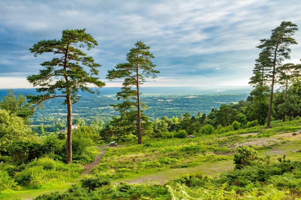
Approximately 40 percent of the Surrey Hills are covered in woodlands, including endangered box woodlands. Around 12 percent of the AONB is covered in ancient woodlands. Common tree species in the Surrey Hills include beech, oak, birch, and ash.

There are a number of notable plant species which are common across the park and grow in habitats, including farmlands, heaths, and scrub. These widespread species include corn spurrey, common fumitory, and cross-leaved heath.
The human history of the Surrey Hills revolves around the region's woodlands. There's evidence of human settlements in the Surrey Hills dating back to 2500 BCE, with Bronze Age burial mounds located on Box Hill.
There are also remnants of Iron Age fortifications across the area. Surprisingly, there is no evidence of Roman influence or management of the area.
By the start of the Medieval period, the Vale of Holmesdale was well established as fertile farming land, with several settlements nearby. Settlements were then founded further south, including Effingham, Wotton, and Bookham. These settlements were well-established in prehistoric times and were recorded in the Domesday Book in the eleventh century.
During the Medieval period through to the seventeenth and eighteenth century, the Surrey Hills was the center of the regional timber industry. The region's box woodlands were extensively farmed as box trees were popular for use in furniture. It was also an important area for making charcoal for gunpowder.
However, at the dawn of the industrial revolution, industry across the Surrey Hills faltered. Industry shrank due to the importation of cheaper timber and a change from charcoal to coal as a preferred fuel. Instead, there was a change of focus towards flint and chalk quarries.
The eighteenth and nineteenth centuries saw a rise in private land ownership across the North and South Downs, with many wealthy Londoners buying farmland to establish a country retreat. This diminished the opportunities for farmers to own land, with many landowners growing mature woodlands for leisure purposes instead.
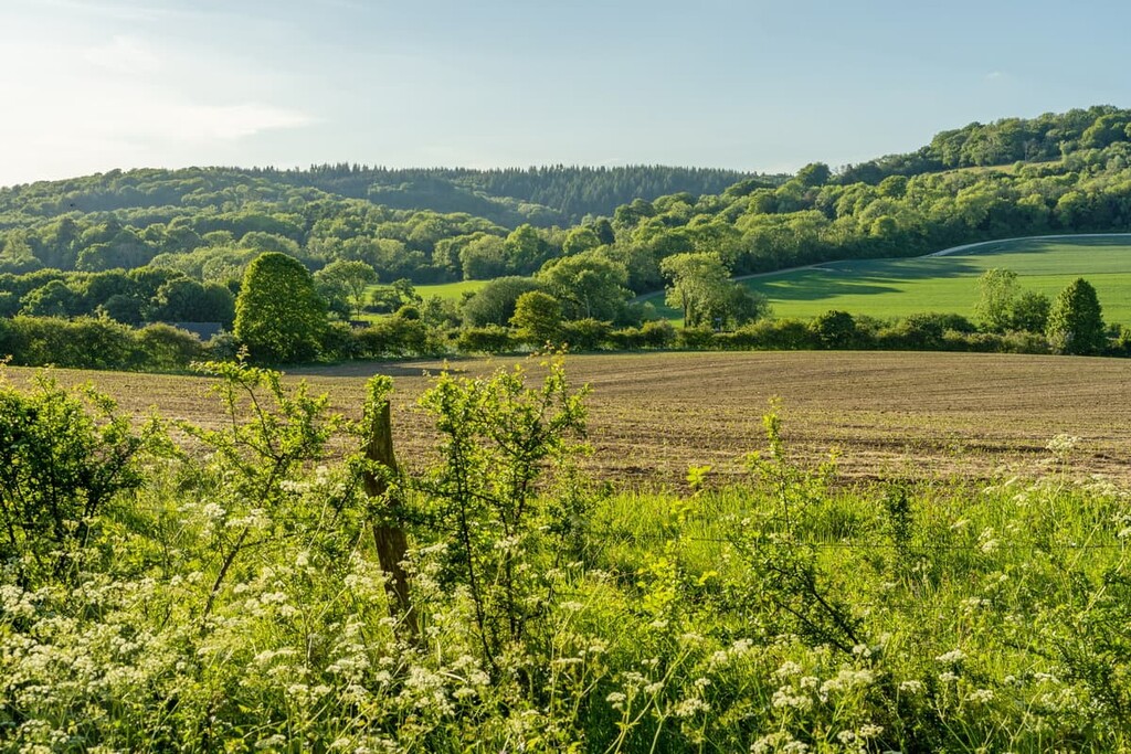
Today, the Surrey Hills are home to around 35,000 people and seven market towns. Due to its proximity to London, it is among the most frequently visited natural areas of England, with 30 million day visitors annually. Farming is still common across the AONB, and around 40 percent of the area is still designated as agricultural land.
The Surrey Hills was designated an Area of Outstanding Natural Beauty in 1958 to protect the area's rare habitats and wildlife.
Looking to escape the city with a hike through the scenic Surrey Hills? Here are some of the main hiking areas and trails.
The Devil's Punch Bowl and Hindhead Common are among the most popular areas of the Surrey Hills AONB. The Devil's Punch Bowl is a 697-acre (282 hectare) natural depression complete with lush heathlands. It is also a biological Site of Special Scientific Interest (SSSI).
You'll find several well-worn trails leading through and along the rim of the Devil's Punch Bowl. One of the best paths to the Hidden Hindhead Walking Trail.
This trail takes hikers from the National Trust car park up to the top of Gibbet Hill (275 m/902 ft), the highest point on the Devil's Punch Bowls' rim and the second-highest point in Surrey. The hill boasts the best views of the Devil's Punch Bowl, with London's skyline visible on a clear day.
The Hidden Hindhead Walking Trail is easy to follow and is marked with pink discs. On the way to Hindhead Common, you'll pass the Temple of the Four Winds, a lodge built by Viscount Pirrie in 1910.
When crossing Hindhead Common, keep an eye out for grazing Exmoor ponies. The Hindhead Common Walking Trail is 3 miles (5 km) long and takes roughly an hour and 30 minutes to complete.
If you're searching for a more strenuous walk, consider the Highcombe Hike. This trail is marked with yellow disks and leads through ancient woodlands, and climbs steeply around the southeast rim of the Devil's Punch Bowl. While more difficult, this trail should still be manageable for regular hikers. The walk is 3 miles (5 km) long and takes about 2 hours to complete.
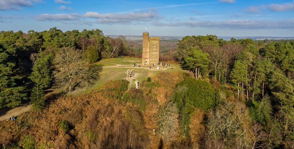
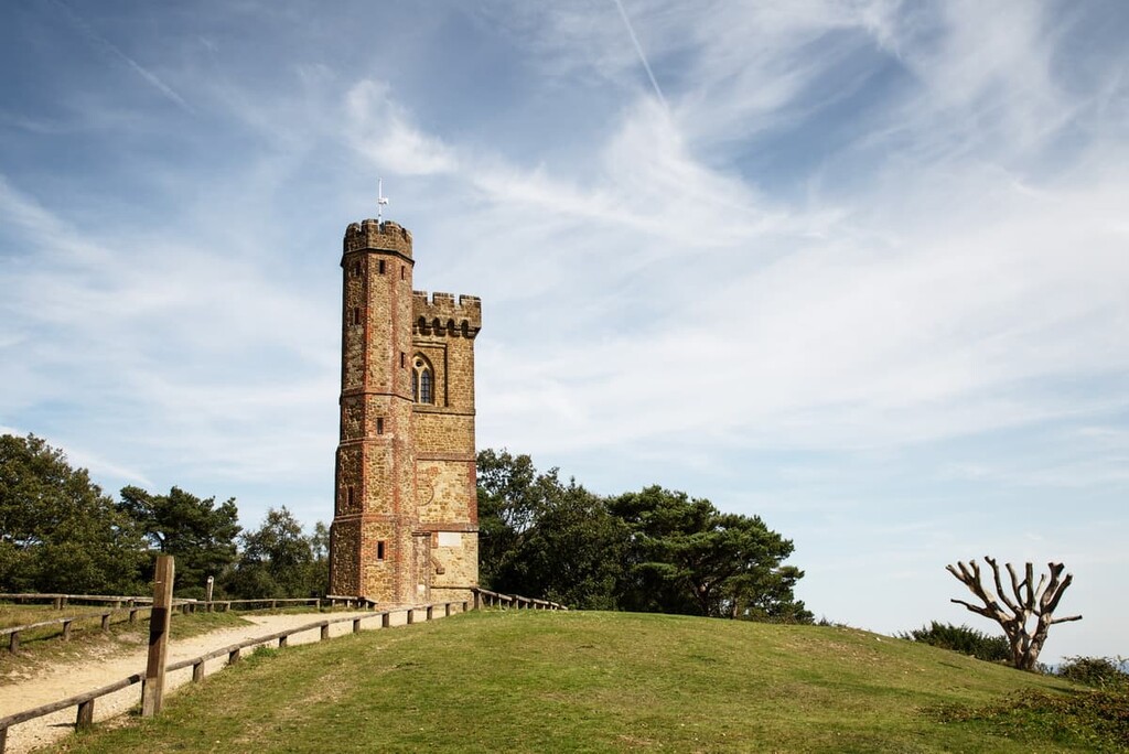
The county-top of Surrey and the highest point in the Surrey Hills AONB, Leith Hill (294 m/964 ft) is a must for any avid hiker. As well as being an excellent viewpoint, Leith Hill is topped with an eighteenth-century Gothic tower, built to raise the hill over 305 m (1,000 ft). Leith Hill Tower is now open to the public and is a popular tourist attraction.
There are several ways to scale Leith Hill, whether on the long-distance Greensand Way or one of four color-coded trails.
The longest path is the orange Woodland trail which takes hikers through the Leith Hill Place estate and up to the summit. Bear in mind there are some steep sections on this walk. The Woodland trail is 2.5 miles (4 km) long and takes an hour or two to complete.
You can also extend the Woodland trail by 1.5 miles (2.5 km) to include the Etherly Loop if you feel like a longer trek. The Etherly Loop is straightforward and leads hikers across the farmland surrounding Leith Hill. The walk can be muddy, so bring a good pair of hiking boots.
There are also two other walks worth considering on and around Leith Hill. The green Heathland Trail leads across the sandy Duke's Warren, which is filled with local flora, including bilberry, birch, and heather. The walk is around 1.75 miles (3 km) long and takes about an hour to complete.
The final hike is the pink Frank's Walk, which takes hikers through an arboretum, along a conifer avenue, and through Frank's Woods. The walk is steep and muddy in places so take care. The walk is about a mile (1.6 km) long and takes 30 minutes to complete.
Box Hill (192 m/629 ft) is perhaps the most interesting hill in Surrey due to its ancient box woodlands and steep chalk slopes overlooking the River Mole. Box Hill is historically significant with its Bronze Age burial mounds. It's also an important wildlife habitat and is home to 38 butterfly species. Over 850,000 people visit Box Hill annually.
There are several ways of hiking up Box Hill, including as part of the long-distance North Downs Way. Hike along the Box Hill loop if you're looking to take in as much of the area as possible. The walk starts at the Shepherd's Hut on the summit of Box Hill.
The walk starts by taking you across Donkey Green onto Lodge Hill (190 m/623 ft). Here you'll pass the nineteenth century Broadwood's Folly. Then, you'll pass over Mickleham Down and have the opportunity to rest up at the Running Horses pub. Then continue to follow the waymarkers onto Mickleham Gallops and into a valley.
You'll then head uphill before following a track across Headley Heath and through Dukes Meadow. The trail will then take you back up Box Hill to your starting point. The walk is 8 miles (12.9 km) long and takes 4 to 6 hours to complete.
If you don't fancy a long walk, there are two other short paths on Box Hill. There's a mile-long (1.6 km) walk called the Hilltop Stroll which starts from the visitor's center and goes by the Swiss Cottage, once home to John Logie Baird, the inventor of the television, and over Burford Spur.
There's also the Happy Valley circular walk, which leads from the Shepherd's Hut down Box Hill and through the picturesque Happy Valley. There's a series of steep steps down Box Hill, so bring appropriate footwear. The Happy Valley walk is 2.7 miles (4.3 km) long and takes an hour and 30 minutes to complete.
Several long-distance hiking routes run through Surrey, and one of the best in the Surrey Hills AONB is the Greensand Way. The Greensand Way runs from the town of Haslemere for 108 miles (173 km) to near Ashford in Kent.
The Surrey Hills AONB leg of this long-distance walk is 57 miles (91 km) long and includes many of the area's best hills and top attractions. The Surrey leg of the Greensand Way runs from Haslemere to Limpstead Chart near the Surrey county boundary.
The Greensand Way within Surrey is relatively easy to follow, with disc waymarkers featuring a picture of Leith Hill Tower posted on gates, stiles, and posts. Regardless, hikers should bring OS maps and map their route carefully to avoid getting lost.
The route is generally split into ten sections ranging from 3 to 8 miles (5 km to 13 km) in length. The walk can take anywhere from 4 to 10 days, depending on how quickly you complete each leg.
The walk starts from Haslemere and leads up Gibbet Hill (275 m/902 ft) and to one of the area's most popular attractions, the Devil's Punch Bowl. You'll then pass from Whitley Station to Hascombe village, passing over Hascombe Hill (199 m/652 ft), which features the remains of a first-century BCE Iron Age camp.
You'll then walk from Greenstreet Farm near Grafham to the top of Pitch Hill (259 m/849 ft). Along this stretch, you'll pass through Winterfold Heath, once owned by King Henry VII over 500 years ago.
One of the hilliest legs is from Pitch Hill to Broadmoor. This section leads from Pitch Hill over Holmbury Hill (261 m/856 ft), which once featured an 8-acre Iron Age fort. Before reaching Broadmoor, you'll pass over the highest point in South East England, Leith Hill (294 m/964 ft).
From Broadmoor to Deepdene, you'll see several interesting landmarks, like Tillingbourne Falls and Dorking, before scaling Box Hill (192 m/629 ft). Then from Deepdene, you'll stroll along the River Mole to Reigate Park. From Reigate Park, you'll walk over Reigate Hill (243 m/797 ft) and through the town of Reigate. You'll end this section at the Castle Hill estate.
The penultimate section leads to Oxted, passing the ruins of the thirteenth century Bletchingley Castle and passing over Tilburstow Hill (175 m/574 ft).
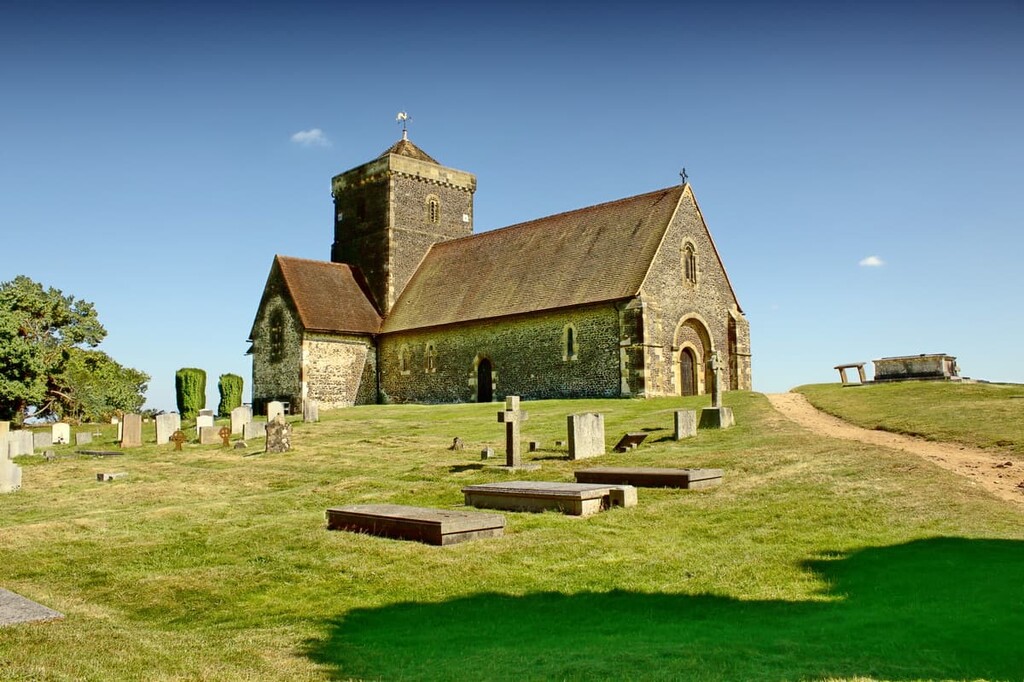
At the end of the section, ensure you stop by St Peter's Church in Tandridge, home to a yew tree (the Tandridge Yew) that’s thought to be the oldest tree in England at 2,500 years old. Finally, walking from Oxted to Limpstead Chart is fairly leisurely and takes you through Old Oxted and Limpsfield Common.
The North Downs Way is another very popular long-distance walking route through the southeastern part of England.
Similar to the Greensand Way, the North Downs Way traverses the very best of the Kent Downs AONB and the Surrey Hills AONB. The entirety of the North Downs Way is 153 miles (246 km) long. It is one of 16 National Trails in the UK.
The Surrey Hills section of the North Downs Way is approximately 42 miles (67.5 km) long and runs from Farnham in the west to Oxted near the Surrey county line. The walk is usually split into four sections and takes 4 or 5 days to complete.
The first stint is an 11-mile (18 km) walk from Farnham to Guildford. This section joins onto another long-distance path, the Pilgrims Way, passing through the Runfold Wood Nature Reserve. You'll also pass through the village of Puttenham, which features in Aldous Huxley's dystopian novel, Brave New World.
From Guildford, you'll walk 13 miles (21 km) to Westhumble, leaving the Pilgrims Way. Along this leg, you'll pass several Sites of Scientific Interest, as well as the charming hilltop St. Martha's Church.
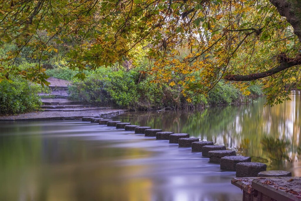
The third section runs from Westhumble to Merstham and is 10 miles (16 km) long. This is probably the best section of the walk, taking you over several hills. Start by using stepping stones to cross the River Mole before scaling Box Hill (192 m/629 ft) and rejoining the Pilgrims Way.
You'll then climb straight up Colley Hill (236 m/774 ft) and then Reigate Hill (243 m/797 ft). Each hill has viewing platforms that provide vistas of surrounding hills and of the restored Reigate Fort.
The final leg runs for 8 miles (13 km) from Merstham to Oxted. The walk involves a steady climb up a ridge before reaching Whitehill Tower, an eighteenth-century folly. Part of the walk leads through woodlands and is one of the best spots for seeing some of Surrey’s rare orchids.
If you're looking to spend a weekend hiking in the lush Surrey Hills, here are a few of the main settlements in the area where you can rest up after a long day's walk.
England's capital London is a surprisingly convenient place to stay during your Surrey Hills adventure. Central London is just 25 miles (40 km) from the Surrey Hills AONB, making it easy to reach on a day trip. You'll also be within driving distance of several other parks, with the Chiltern Hills AONB some 40 miles (64 km) to the north and South Downs National Park about 55 miles (88 km) to the southwest.
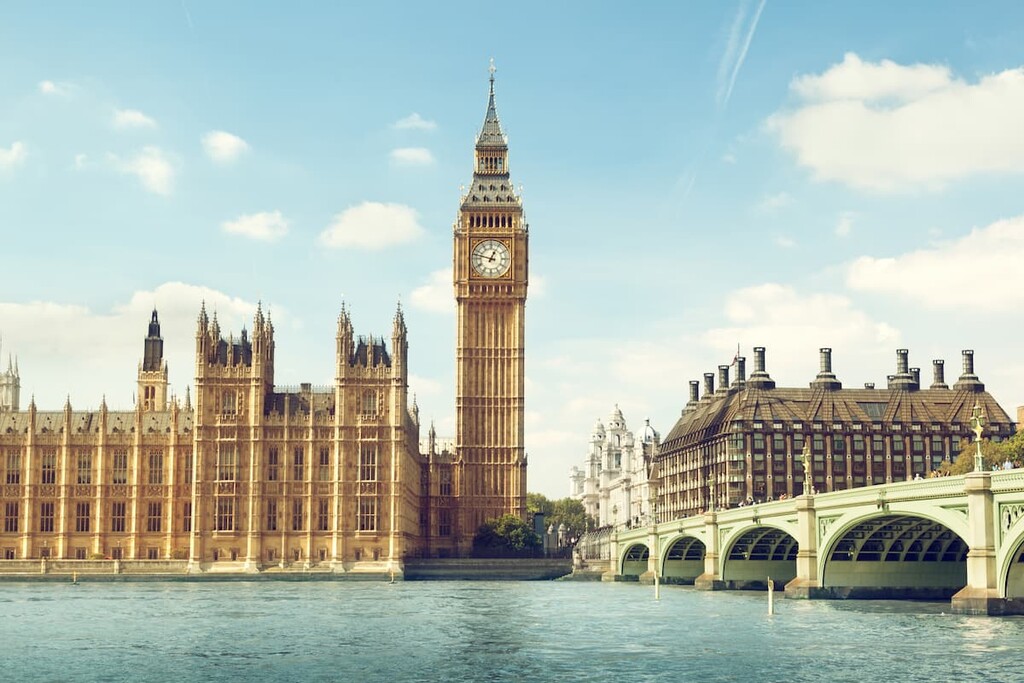
When you're not off scaling Leith Hill or the Devil's Punch Bowl, you'll have the opportunity to see some of the top sights in England, like Big Ben, the Tower of London, and Buckingham Palace. There's no shortage of places to stay in London either, with world-class hotels ranging from the Hilton Hyde Park to the Hard Rock Hotel.
The charming town of Guildford sits on the northwestern boundary of the Surrey Hills AONB. Despite having a population of well over 100,000 people, Guildford is surprisingly quaint and ideal for a relaxing getaway. Guildford is also only 20 miles (32 km) from the South Downs National Park, in case you wanted to explore more of southern England.
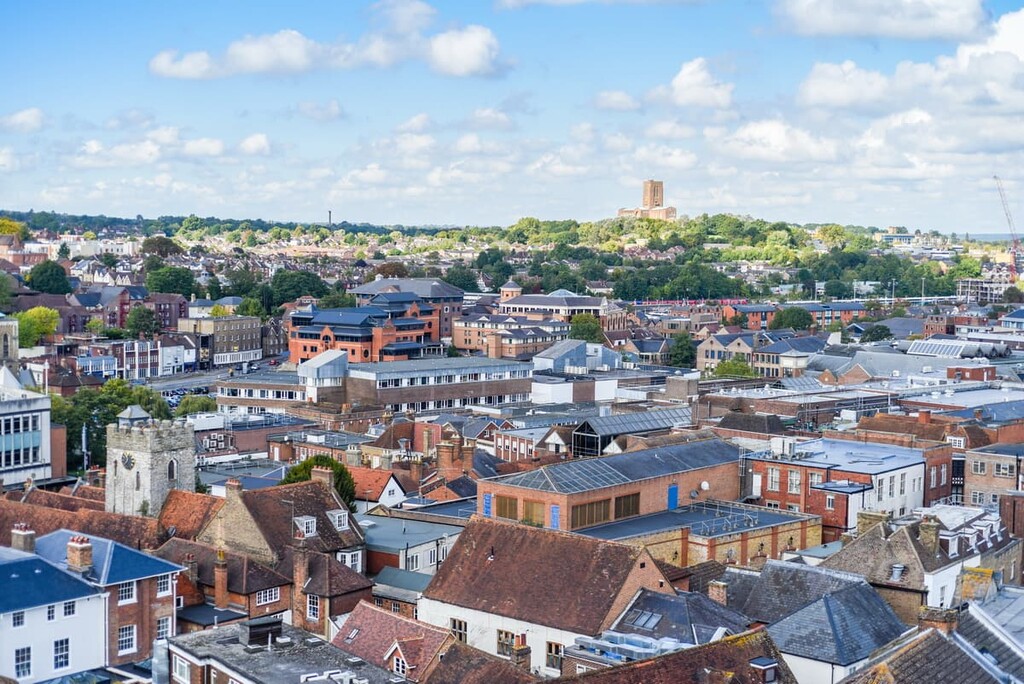
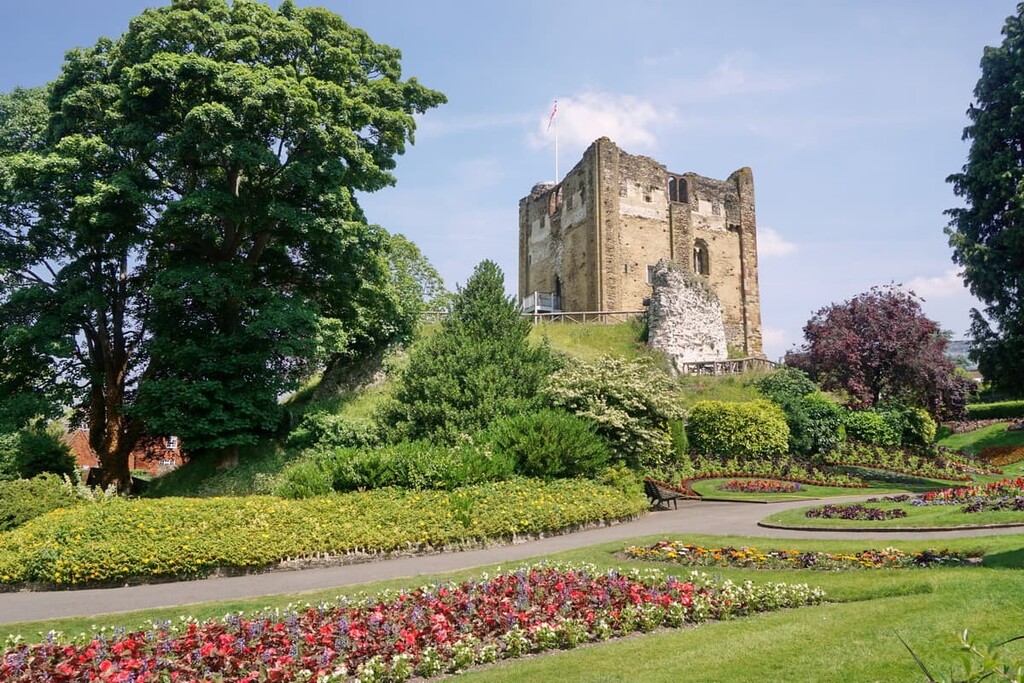
While in town, don't miss out on visiting the eleventh-century Guildford Castle built by William the Conqueror. You can also learn more about this historic town at the Guildford Museum. Popular hotels in Guildford include the Guildford Harbour Hotel, the Mandolay Hotel, and the Angel Hotel.
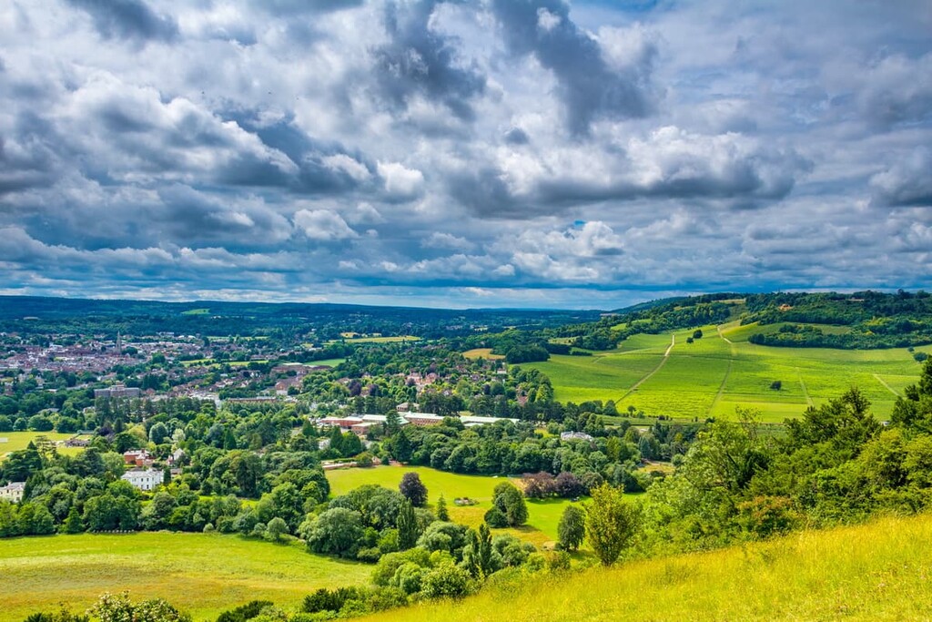
Perhaps the most convenient town to spend a night in is Dorking. Surrounded by the Surrey Hills AONB, Dorking is within 10 miles of Box Hill and Leith Hill, two of the Surrey Hills’ main hiking areas. Dorking has a long history, with evidence of settlements in the Neolithic and Mesolithic periods and several Bronze Age burial mounds nearby.
As well as being within driving distance of several major hiking areas, Dorking has some unique local attractions, like the Edwardian Polesden Lacey estate and the Dorking Museum & Heritage Centre. If you're staying in Dorking, consider booking a room at the White Horse or Wotton House.
The town of Reigate sits at the foot of the North Downs and is very popular with tourists. Reigate is a great stopping point on two of the South East's longest walking trails, the North Downs Way and The Greensand Way.
Reigate is less than 5 miles from the two of the main Surrey Hills, Colley Hill (236 m/774 ft) and Reigate Hill (243 m/797 ft). If you're looking for something to do in Reigate, spend a family day out at Priory Park or plan an underground adventure at the Reigate Caves. Hotels in Reigate include Reigate Manor and the Bridge House.
Hikers visiting the Surrey Hills should make a special visit to the hauntingly beautiful market town of Godalming. Ranked as one of the best places to live in the country, Godalming is within 5 miles (8 km) of popular hiking areas like Winkworth Arboretum and Chinthurst Hill (122 m/400 ft).
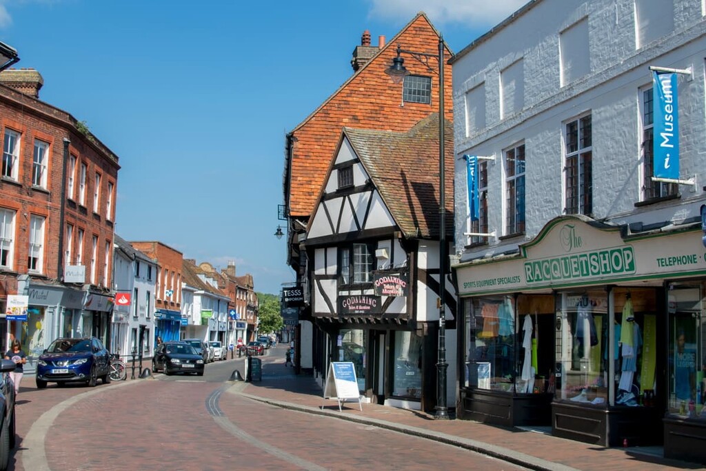
Godalming features some great attractions like the lavishly decorated eighteenth-century Watts Cemetery Chapel and the stately Loseley Park. Some of the top hotels in Godalming include the King's Arms & Royal Hotel and the Innkeeper's Lodge.


