
Scan the QR code and open PeakVisor on your phone
Surrey is a landlocked county in South East England covering an area of roughly 642 sq mi (1,663 sq km). Surrey's ancient and varied landscape has attracted hillwalkers nationwide for centuries, from the Devil's Punch Bowl to Box Hill (188 m / 620 ft). There are 279 named summits in Surrey. The highest and most prominent summit is Leith Hill (294 m / 964 ft).
Despite being located just south of London, Surrey is relatively rural given its position — it has a population of just over 1.2 million, and its largest town, Woking, has a population of around 103,000. This is especially true of southern Surrey, where its largest settlements, Horley and Goldalming, are home to just over 22,000 people.
Bordering Surrey are six other counties: Greater London to the north, Kent to the east, East Sussex and West Sussex to the south, Hampshire to the west, and Berkshire to the northwest.
Most of Surrey's landscape comprises low-lying heathlands and grasslands intersected by two hill ridges. The chalk North Downs span from east to west across northern Surrey between Farnham and Guildford.
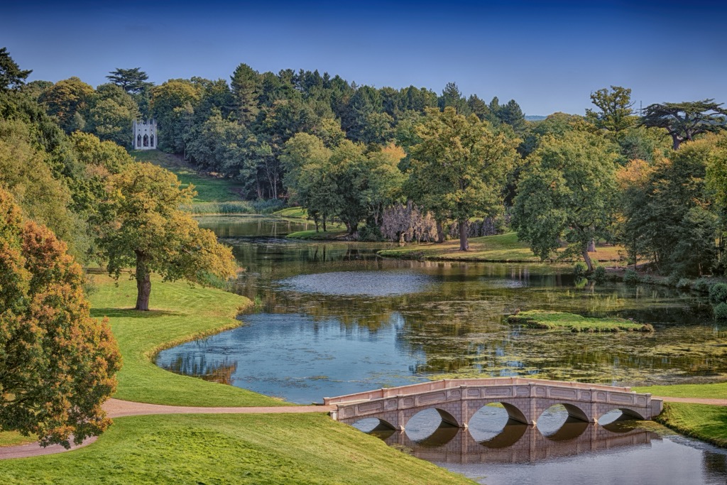
To the southwest are the smaller Surrey Hills, which include the Greensand Ridge, an escarpment home to Surrey's highest point, Leith Hill. Leith Hill Tower atop Leith Hill is the highest point in South East England. In the county's east is the Weald, a series of Chalk escarpments that crosses several counties, including Hampshire, Kent, and East Sussex.
Between the two North Downs and the Greensand Ridge is a vale crossed by the Wey and Mole, two tributaries of the Thames River.
The protected Surrey Hills National Landscape, with a total area of 163 sq mi (422 sq km), encompasses large sections of the North Downs and the Greensand Ridge.
Surrey is the most densely wooded county in England — surprising, given its proximity to London. Around 22.4% of Surrey is wooded, almost double the national average. Surrey doesn't have much agricultural land, with many commons across the county — ideal for hiking off the beaten path.
Surrey and the rest of South East England are home to some of the youngest rocks in the British and Irish Isles. Most sedimentary rocks in Surrey formed within the last 150 million years since the Early Cretaceous.
Surrey lay under a freshwater-brackish bay around 150 million years ago, where shale, sandstone, and mudstone were deposited. These rocks form part of the Wealden Supergroup, a sedimentary rock strata confined to southern England. Mudstone forms the top layer of the Wealden Supergroup, known as Wealden Clay.
Sandstones from the Lower Greensand Group are also present in Surrey. Near Dorking around Box Hill and Leith Hill, this sandstone is rich with limestone and chalk.
The chalk that forms the North Downs is about 90 million years old and is over 95% calcium carbonate with thin marl layers and flint nodules. The predominantly flat Thames basin is to the north of the North Downs, composed of London Clay and Bagshot Sands. London Clay is especially young and fossil-rich, having formed around 50 million years ago.
Surrey is among England's most ecologically rich counties, but many nationally significant species present in the county are in steep decline.
Several deer species reside in Surrey, including white-spotted, roe, muntjac, and fallow deer. The largest mammal species in Surrey is the red deer, which went extinct from the county over 200 years ago but was reintroduced in 2010. They graze on a reserve at Pirbright Ranges, which is closed to the public.
Other smaller, more common mammal species include grey squirrels, moles, rabbits, and hedgehogs. Predatory species include red foxes, polecats, and pine martens.
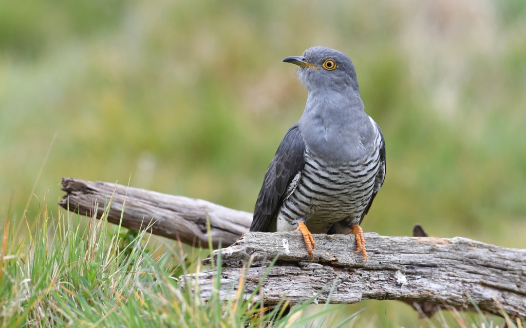
Over 100 bird species can be spotted in Surrey's skies, with nationally protected populations of Dartford warblers, skylarks, and nightjars. Numerous birds of prey predate the woodlands and heathlands of Surrey, notably goshawks, buzzards, tawny owls, sparrowhawks, and red kites.
Britain's only venomous snake, the European adder, inhabits Surrey, as well as several other reptiles and amphibians like grass snakes, palmate newts, common lizards, and common frogs.

The small blue, the smallest butterfly in the UK, can be spotted in Surrey, as well as silver-studded blues, peacocks, white admirals, and purple emperors.
Around a quarter of Surrey's extensive forests are ancient woodlands, with English oaks, hornbeams, yews, field maples, ashes, and hazels present. Banstead Woods, once thought to have been owned by Anne Boelyn, is among the most extensive forests in Surrey, covering 200 acres (81 hectares).
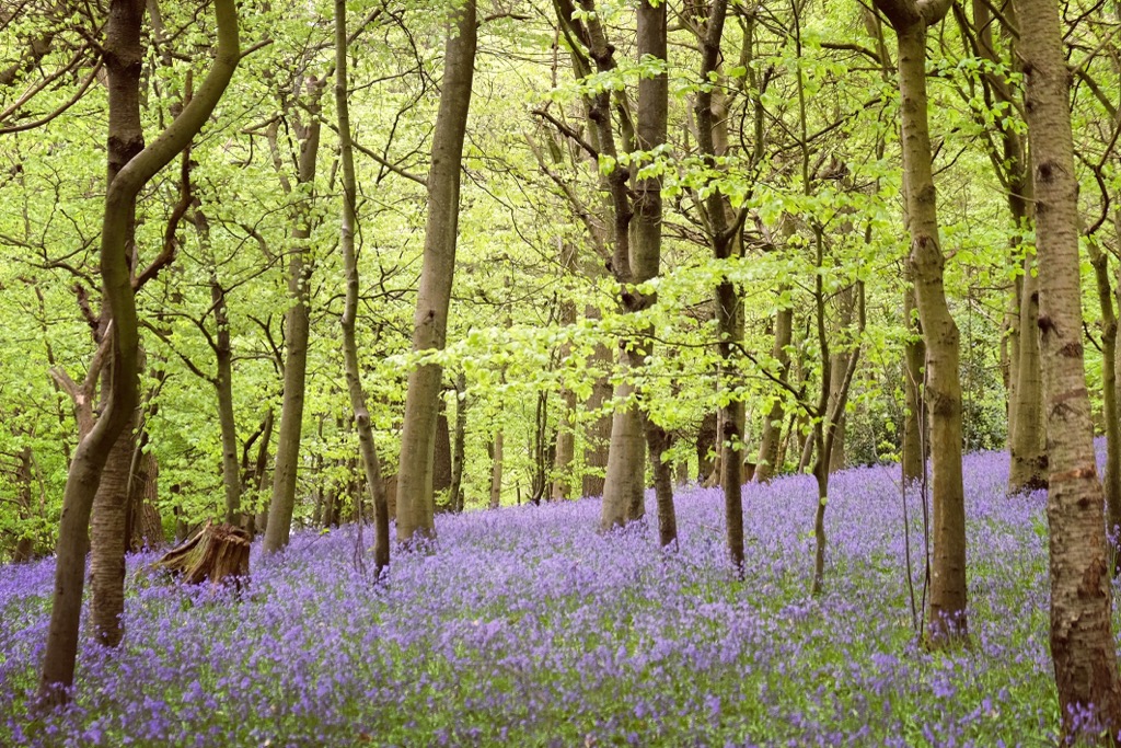
Bluebells carpet Surrey's forest floors between April and May and are a popular tourist attraction. Numerous other flowering plants can be seen between the trees, including broad-leaved helleborine orchids, wild daffodils, primroses, and wood anemones.
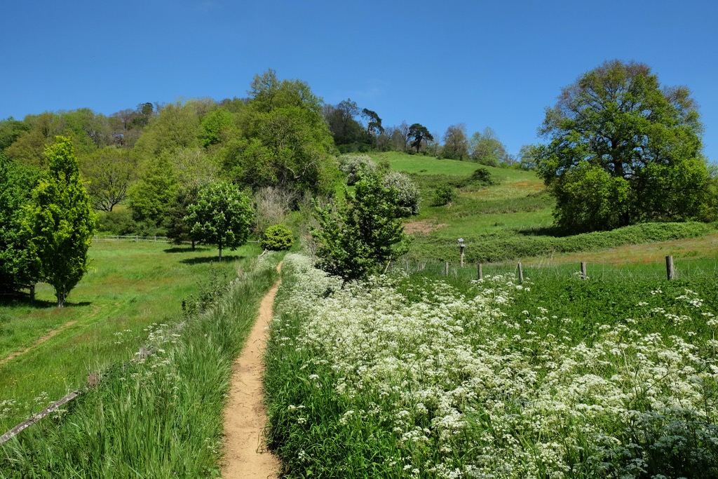
A wealth of grasses, sedges, and rushes grow across Surrey's grassland and heathlands. Surrey's open landscape is awash with field wood-rushes, common couches, common club-rushes, and cock's-foots. Wildflowers add a dash of color to Surrey's heathlands and grasslands, with cowslips, bee orchids, wild thyme, and frog orchids present.
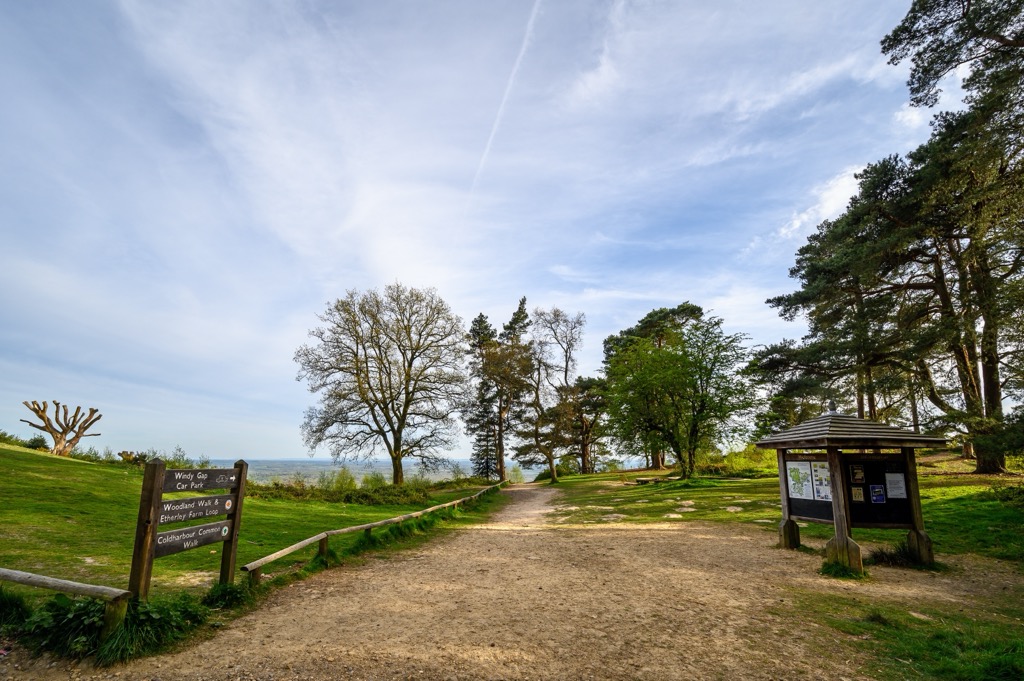
Surry has a long hiking history — some walking routes have been in use since prehistoric times. One such route is the Pilgrims' Way, which weaves 119 mi (192 km) from Winchester in Hampshire to the shrine of Thomas Becket in Canterbury, Kent.
The trail may take its name from a pilgrimage dating back to the 12th century, but its roots are deeper — archeological evidence suggests it's an ancient trackway that has been used since at least 450 BCE. It's believed to have been in continuous use for around 3,000 years, including throughout Roman times.
Surrey's modern hiking history dates to the early 1930s. A 2021 blog post by the British newspaper Archive titled Hiking in the 1930s – Exploring the 'Phenomenon of Post-War Youth' details the sudden increased popularity of hiking among young people in post-war Surrey.
British newspaper The Sphere published several articles in the early 1930s regarding the rise of hiking culture. In 1931, the Daily Mirror printed an article about it being a record year for hiking, with "three million people have gone on a trek to the beauty spots of Great Britain, Ireland and the Continent."
The reason for hiking's rise in popularity isn't entirely clear, but it's partly due to American influence following the First World War. People rarely used the term hiking before the First World War, with the term originating in the US. Hiking was a more formal and closely planned activity before the War, while Americans viewed it as less rigid and more adventurous, which likely inspired British youths.
A greater freedom for women and better infrastructure are also believed to have helped drive hiking's popularity.
In May 1958, the Surrey Hills became an Area of Outstanding Natural Beauty (AONB), drawing more attention to the region. Located just 35 minutes by train from London, it has long been a popular destination for Londoners looking to escape the city. The AONB also became known as Surry Hills National Landscape in 2023.
The Surrey Hills has long inspired artists and creatives — Pitch Hill (259 m / 850 ft) inspired George Harrison to write Here Comes the Sun, and the famous picnic scene in Jane Austen's Emma takes place on Box Hill.
Surrey offers a variety of long rambles and family-friendly hill walks, which are unlikely to challenge seasoned hikers. Still, you should map out your route carefully, wear appropriate footwear, and bring plenty of food and water when hiking in Surrey.
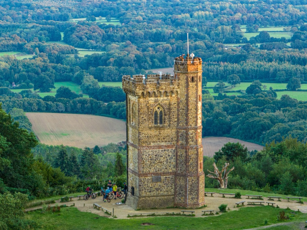
Leith Hill (294 m / 964 ft) is the county top of Surrey and the second-highest hill in South East England after Walbury Hill (301 m / 988 ft) in Berkshire.
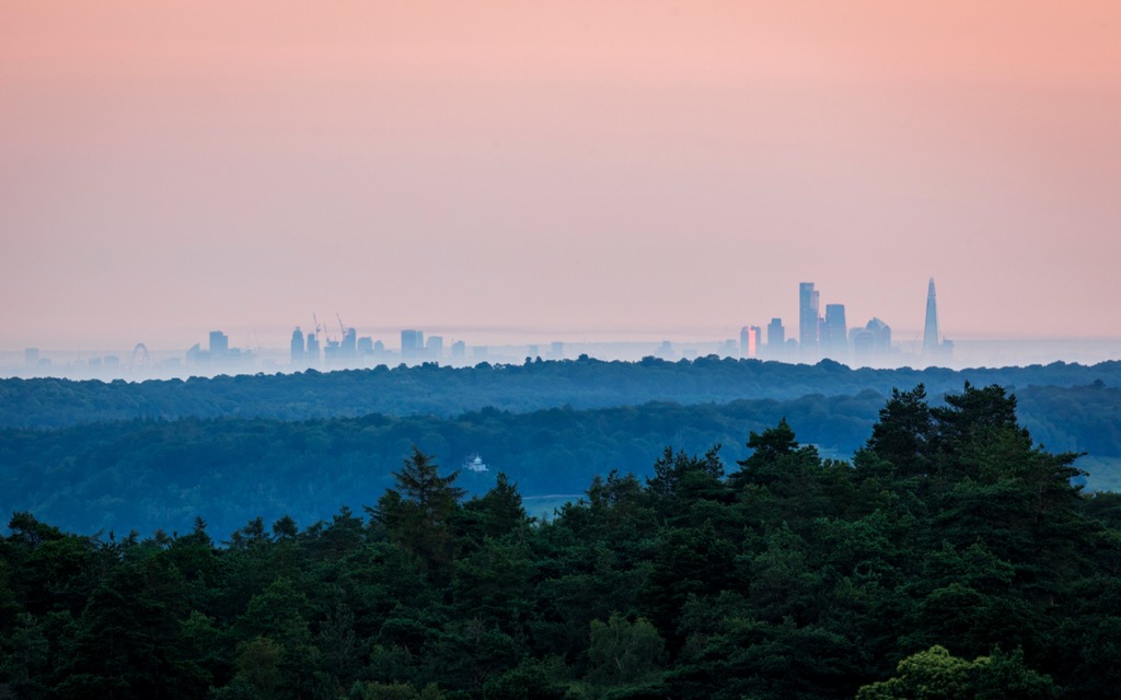
It's one of the finest viewpoints in the region — when on Leith Hill's summit, you're higher than the top of the Shard in London. As a result, the hill affords sweeping views spanning 13 counties from the South Downs to London's Big Ben to the English Channel. Adorning Leith Hill's summit is the 18th-century 19.5 m (64 ft) tall Gothic Leith Hill Tower, which is open to the public and further improves the views of the countryside.
Perhaps the best way to experience Leith Hill and the surrounding area is on the National Trust's circular Leith Hill woodland walk. The walk begins at Shoe Tree Car Park and leads south through woodlands to Leith Hill Place, the former home of Ralph Vaughan Williams, one of England's most celebrated composers.
The trail loops north through Rhododendron Wood, named for the rhododendron planted by botanist Caroline Wedgwood, the older sister of Charles Darwin and Williams' grandmother. You'll then join the Greensand Way to reach Leith Hill's summit.
There are steps on the hill's south side that lead back to your starting point. This Leith Hills circular hike is approximately 2.5 mi (4 km).
Named for its ancient box woodlands, Box Hill may not be one of the highest hills in Surrey, but it's easily one of its most popular. It's located in the North Down, just northeast of Dorking. Over 850,000 people annually climb Box Hill to enjoy its stunning views and natural beauty.
It's one of the best areas of Surrey for nature watchers, with its unique chalk downlands providing habitat for various rare wildflowers and butterfly species. From the slopes of Box Hill, you'll get to appreciate panoramas of the South Downs and Dorking.
One of the most popular hiking routes on Box Hill is the National Trust's Box Hill Hike. It's one of Surrey's most strenuous day hikes due to its length and incline changes. You can pick up this trail from the Box Hill Hiking Car Park atop Box Hill.
The trail starts by passing Broadwood's Folly, one of the best viewpoints on Box Hill. It then climbs Mickleham Downs, passing through Mickleham village, where you can stop off for a break at the Running Horses pub. From Mickleham Gallops, you'll dip in and out of valleys until you reach your starting point back on Box Hill. The Box Hill Hike is approximately 8 mi (12.8 km) long.
Gibbet Hill (274 m / 902 ft) is the second-highest hill in Surrey, situated near Hindhead village in the county's southwestern corner. It stands on the rim of one of Surrey's most fascinating natural features, the Devil's Punch Bowl.
This natural circular depression was formed by the collapse of a giant sandstone cavern and is filled with vibrant purple and green heathlands. It has featured in numerous literary works, including Nicholas Nickleby by Charles Dickens and The Listerdale Mystery and Other Stories by Agatha Christie.
One of the best ways to experience Gibbet Hill and the Devil's Punch Bowl is on the Hidden Hindhead Trail. The trail is less challenging than Box Hill and provides views of London's skyline on a clear day. The trail begins at the Devil's Punch Bowl Café Car Park, with pink discs marking the route.
One point of interest you'll pass on this route is The Sailor's Stone, commemorating the murder of an unknown sailor in 1786. Another is The Temple of the Four Winds, the remnants of a former lodge built in 1910 by Viscount Pirrie, the chairman of shipbuilders Harland & Wolff, who built the Titanic.

You'll follow a section of the Greensand Way to reach Gibbet Hill's summit, from which you can enjoy views of the South Downs and London. You'll then leave Hindhead Common and retrace your footsteps to the car park. This Devil's Punch Bowl hike is approximately 3 mi (5 km) long.
You'll find several lesser hills in Surrey that offer rewarding short climbs that provide a snapshot of Surrey's history and landscape, and one of them is Reigate Hill (243 m / 797 ft). This route has some steep descents, so bring hiking boots.
On the slopes of Reigate Hill is Reigate Fort, built in 1898 as part of the London Defence Scheme to defend Britain's huge ship-building programs. You'll have views of Box Hill, Leith Hill, and the South Downs from the slopes of Reigate Hill.
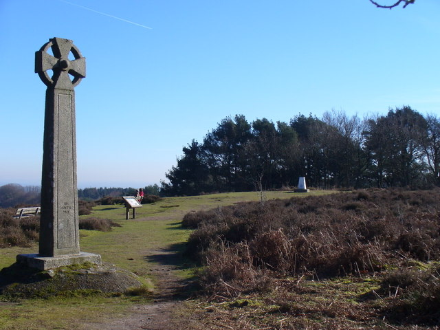
The National Trust's short Reigate Hill Walk starts from Wray Lane Car Park. It starts by crossing the Reigate Footbridge before passing Reigate Fort and the site of a US Second World War plane crash. The route also passes over Colley Hill (235 m / 774 ft), the site of the picturesque Inglis Memorial, one of the trail's best viewpoints. The Reigate Hill Walk is approximately 3.3 mi (km 5.3) long.
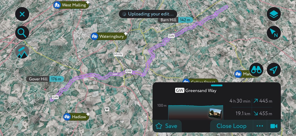
The Greensand Way is one of Surrey's most popular long-distance trails, starting in Haslemere in southeastern Surrey and meandering for 108 mi (174 km) to Hamstreet in Kent. The Greensand Way's Surrey section is roughly 57 mi (91 km) long and ends at the county line near Oxted.
The Greensand Way crosses the Surrey Hills National Landscape from Hindhead to Leith Hill. Along the way, you'll pass over some of the highest and most popular hills in Surrey, including Gibbet Hill, Pitch Hill, and Leith Hill.
Waymarkers are insufficient to follow the Greensand Way — you'll want to map out your route with PeakVisor to ensure you don't get lost. The route is already in stages on the app!
The 10 stages of the Greensand Way in Surrey are as follows:

All of Surrey's largest towns are in the north of the county — the largest settlements in southern Surrey are Horley and Godalming, with populations of around 22,000 people.
London Heathrow Airport is the nearest international airport to Surrey, located roughly 16 mi (25 km) north of Woking.
Woking is the largest settlement in Surrey, with a population of over 103,000 people. Woking is a metropolitan town located just 20 minutes by train from London, making it a good base if you want to explore the Surrey Hills and the nation's capital.
Despite being within a stone’s throw of London, there are some good riverside walking trails in and around Woking, like the Wey Navigations along the River Wey and the Saturn Trail along the Basingstoke Canal. Woking is just 18 mi (29 km) from the Surrey Hills National Landscape.
Woking Train Station connects the town to several major cities and towns across southern England, including Southampton, Portsmouth, Salisbury, and Basingstoke.
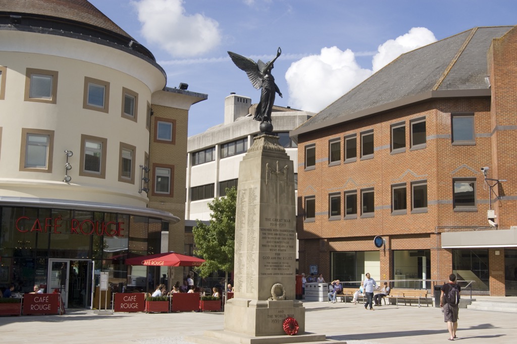
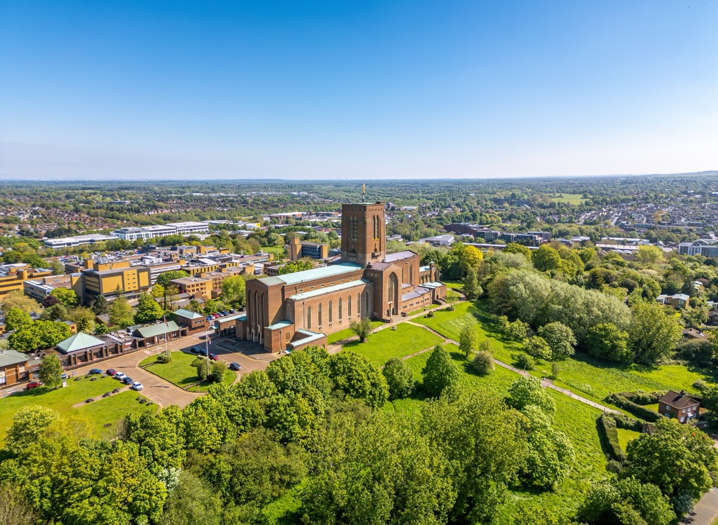
Guildford is Surrey's county town and its second-largest settlement, with a population of around 77,000 people. Located around 6 mi (9.5 km) south of Woking, Guildford has more of a laid-back old-town vibe than its larger neighbor, with Guildford Cathedral and the 11th-century Guildford Castle among its top attractions.
Trains run several times an hour from Guildford through Woking to London, and it's on the edge of the Surrey Hills National Landscape, with Gibbet Hill and Leith Hill within 15 mi (24 km).
While several settlements in Surrey are larger than Dorking, like Walton-on-Thames, few are better positioned for exploring the North Downs. Dorking is also a wonderful place to stay if you want to avoid the hustle and bustle of the London commuter belt. It has a population of over 16,000 people.
Known for its booming arts scene and wineries, Dorking is one of Surrey's most culturally significant towns. It's encircled by the Surrey Hills, with Box Hill situated 2 mi (3.2 km) to the north.
Dorking Train Station offers indirect services to London Victoria via Sutton, London Waterloo via Wimbledon, and Reading via Guildford.


