
Scan the QR code and open PeakVisor on your phone
Parco dei Colli di Bergamo (Bergamo Hills Regional Park) is one of northern Italy's regional parks. It is located in the region of Lombardy and in the city of Bergamo. The main feature of the park is its hilly landscape and extensive network of hiking and biking trails, including the famed "Road of the Benedictine Monasteries," which introduces visitors to the history and architectural beauty of the area. There are 14 named mountains in the park, the highest and most prominent of which is Canto Alto (1,146 m / 3,753 ft).
Bergamo Hills Regional Park gets its name from its main feature—a series of about a dozen hills and mountains in the vicinity of the city of Bergamo. In the local Bergamo dialect of Italian, the name is spelled as Parch di Còi de Bèrghem.
The park was founded in 1977 by the region of Lombardy with the goal of preserving the balance between the natural environment and human development.
Today, it is one of more than 30 natural areas in Lombardy that are called the Parchi regionali di cintura metropolitana (Regional Parks of Metropolitan Belt). The list also includes river, mountain and forest parks such as:
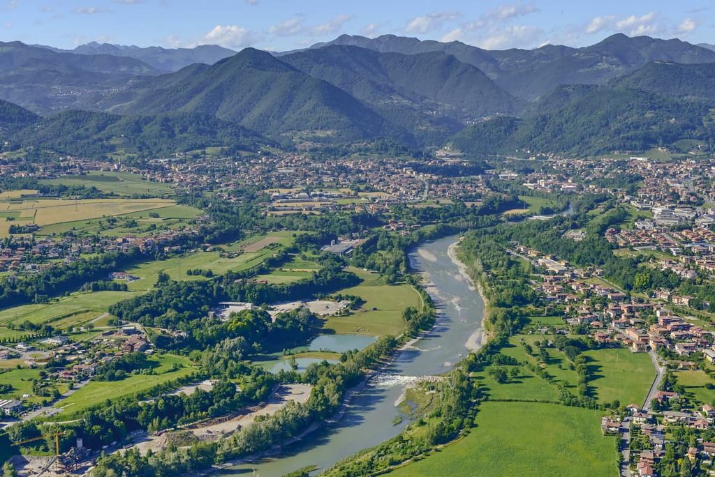
The total area of the park is 47 sq. km (18 sq. mi). The length of the park from south to north is about 13 km (8 mi). From west to east, the park is also about 13 km (8 mi) wide.
The park is located on the northern borders of the city of Bergamo and the other nine municipalities that form its borders (from south to north going counterclockwise): Mozzo, Valbrembo, Paladina, Alme, Villa di Alme, Sorisole, Ponteranica, Ranica, and Torre Boldone.
In the north, the border of the park runs along the Bergamasque Alps and Prealps, where the highest peak, Canto Alto, is located.
The park is also the northern border of the giant Po Valley, which was formed by the Po River. The river is the main geographical feature of Northern Italy and it is located between the Alps and the Apennines.
It is from here that the Alps literally begin to grow from low hills up to 1,000 m (3,280 ft) into high mountains. For example, from the park, it is possible to see well the most notable local peak, Monte Resegone di Lecco (1825 m / 6,151 ft).
This hilly area is also a part of the larger Valcalepio region, which stretches along the Alps from Como Lake to Iseo Lake. This region is famous for its red wine production.
The park is 60 km / 37.2 mi (1 hour) from Milan, 93 km / 57.7 mi (1 hour and 10 min) from Como, and 60 km / 37.2 mi (45 min) from Brescia by car.
You can also reach the park by public transport from any of these cities. To do so, first get on the train of the local main train company, Trenord, then by local city buses ATB Bergamo.
To get to the northernmost boundaries of the park you need to take the Arriva intercity bus going to the village of Piazza Brembana in the Brembana Valley or to the village of Sant'omobono Terme in the Imagna Valley.
The park is also incredibly convenient to get to by bicycle. There will be more information about this in the section on hiking and biking trails.
The main rock type in the park is sedimentary rock. The region is home to various types of limestones that formed between 200 and 70 million years ago, during the Triassic period.
The landscape of Bergamo Hills Regional Park is unique. It is different from anything else you can see in the region. These are the main features in the park:
The park consists of two unequal parts, separated by the large and lush Valmarina Valley:
The hills of Bergamo have long attracted people to their slopes. Indeed, the region is a beautiful and comfortable place to live with a good climate and opportunities for agriculture, animal husbandry, and other activities.
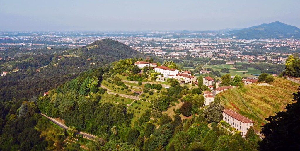
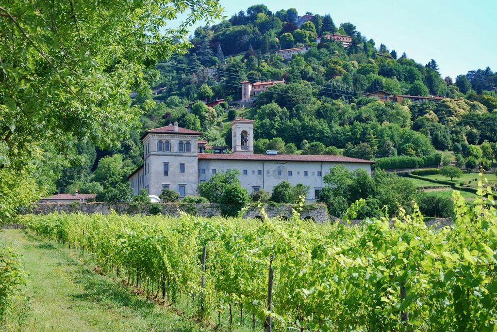
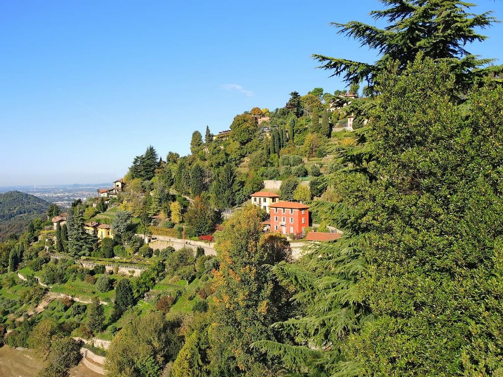
On the Bergamo park’s hills—especially on the western side of the park—you will also find many hamlets with different rural and residential buildings, amazing Venetian villas, farms, and monasteries of great historical, architectural, cultural, and religious importance.
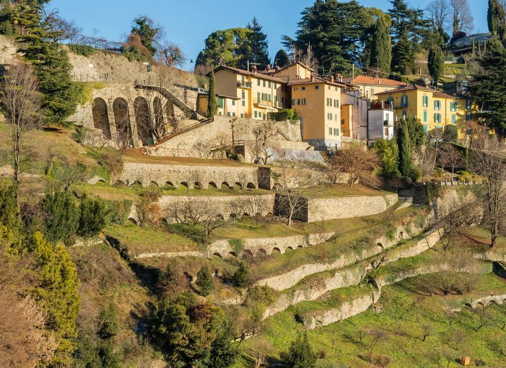
Another great thing about the region is that over the centuries, people also created numerous terraces on the hills that are now home to vineyards, orchards, and vegetable gardens, all of which make this area incredibly beautiful.
There are also ruins of Castello della Allegrezza or Torre dell’ Allegrezza (tower), which was used as a defensive fortress in the sixteenth century.
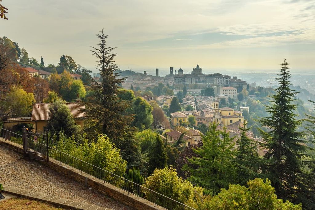
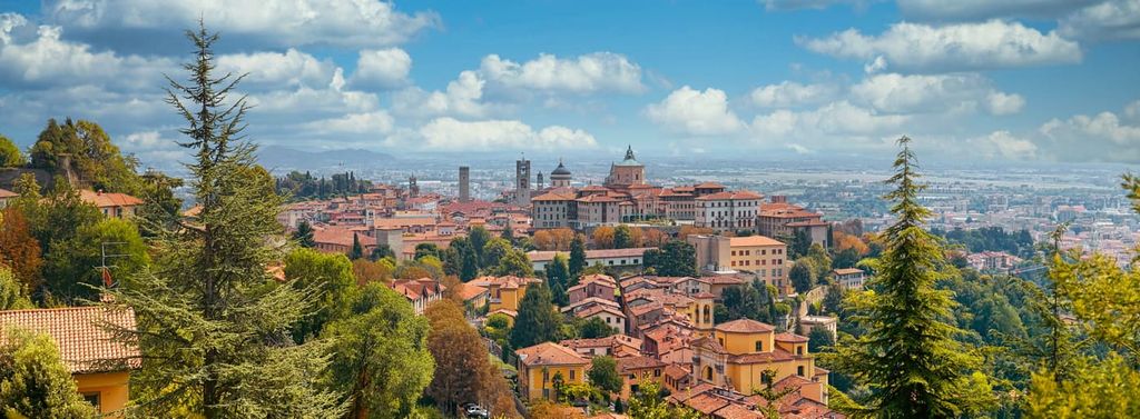
Bergamo Hills Park has many viewpoints with beautiful views everywhere you go—literally, starting from the walls of Bergamo’s Old City—so you don’t even have to climb the mountain peaks to enjoy the views.
For sunset photographers, I’ll just note that the best viewing area is on the west side of the park by the Chiesa Parrocchiale di San Rocco Confessore and all the way along with the Via Fontana, and on the east side of the park in Sorisole. The Sun Trail feature in PeakVisor will also help you to take great photographs in the region.
There are no large water resources within the park’s territory, but on its borders you will find two huge rivers—the Brembo River in the north and Serio River in the south.
However, within the park, the small Morla Creek flows along the entire Colle Roccolone. It is the main local attraction for those who love outdoor recreation, thanks to the bicycle and jogging path that runs along the creek and the hill. There are also many mountain streams, small waterfalls, and springs in the chestnut-filled woodlands of the park.
The outer boundaries of the park are also formed by large valleys. There are four in total: Valle di Astino and Valbrembo to the west, Val Brembana to the north, and Val Seriana to the south.
The Parco dei Colli di Bergamo is unique not only in terms of its landscape, but also because of its human history, architecture, and, above all, its natural diversity. There are 5,000 animal and plant species in the park, including more than 400 species of plants, 40 species of mammals, 160 species of birds, 10 species of reptiles, 11 species of amphibians, and 10 species of fish.
Much of the park is covered with mixed forests, which are dominated by beech, birch, aspen, and other trees. It also has some firs, pines, larches, cypresses, and some other species of conifers.
There are also many chestnut trees here, the fruits of which are usually harvested in October to be cooked for the Chestnut Festival (Festa della castagna).
Shrubs, flowers, and herbs in the park include many different species, such as the purple loosestrife, great willowherb, American pokeweed, hemp-nettle, Cornelian cherry, spring snowflake, Alpine squill, and yellow oxeye, among others.
The park’s main animal is the common hedgehog, which is depicted on its logo. There are also foxes, European badgers, and many other species.
However, I have yet to see even hedgehogs or many other species in the region. Perhaps these animals are afraid of people, of which there are always manyl in the park. I hope you will be luckier and that you will get to see all the wildlife during your travels.
Nevertheless, you can see and hear a lot of birds singing here. These birds are more active from February to May. You will most likely hear the European robin, which is the most widespread bird in the park.
In spring and summer, the meadows are also full of colorful butterflies that always want to land on your boots. It’s quite a wonder to behold.
Although it can snow in the park, it doesn’t happen often. In general, there is no snow on the park’s mountains. If it snows, it usually all melts on the same day as the snowfall, so you can go hiking and cycling all year long in the park.
For example, in 2020, a heavy snowfall occurred only once in Bergamo on December 1. Locals told me that they could not remember the last time they had seen snow in Bergamo. It must have been a very cold winter.
At my place in Selino Basso in Sant’Omobono Terme at the foot of Mount Resegone, it snowed for about a week from the same first day of the winner, and then only snowed 2 or 3 times all cold season—in other words, there wasn't much snow, either.
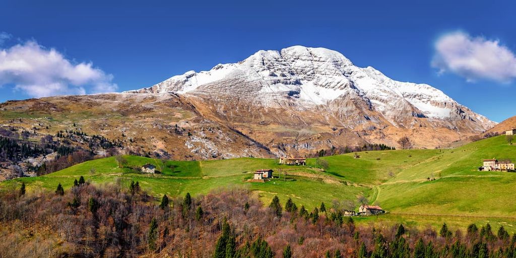
But, of course, Mount Resegone is covered in snow from about November to May, though the peak is not in the park. I tried to climb the mountain in early April one year, but I could not because of the snow on the trails. From May onward, you can hike the peak with relative ease.
The hills and mountains of Bergamo Regional Park belong to the Bergamo Alps, also known as the Bergamasque Alps or Orobic Alps (Alpi Orobie).
This is one of the large mountain groups of the Western Limestone Alps in the German-Austrian Alpine Club Classification of the Eastern Alps (AVE). It is also the westernmost mountain group in the Eastern Alps in this classification.
The Orobic Alps mountain group borders the Brescia and Garda Prealps and the Adamello-Presanella Alps to the southeast, and the Bernina Range and the Sobretta-Gavia Group to the north. The highest peak of the Bergamo Alps is Pizzo di Coca (3,052 m / 10,013ft).
Another common system of classification of the Alps, Italian SOIUSA, puts these hills within the Southeastern Alps.
In the park, you can climb almost all the region’s summits without ever climbing more than 900 m (2,952 ft). For example, from a starting elevation of 244 m (800 ft), you simply have to climb to the highest peak in the park, Canto Alto (1,146 m / 3,759 ft).
From the top of this peak, you will see all other major park’s mountains, including:
Simply put, Bergamo Hills Regional Park is a hiker’s and cyclist’s paradise with a 75 km (46.6 mi) network of marked paths, staircases, and old mule tracks that you can walk and ride. Below are some of the main hiking trails in the park:
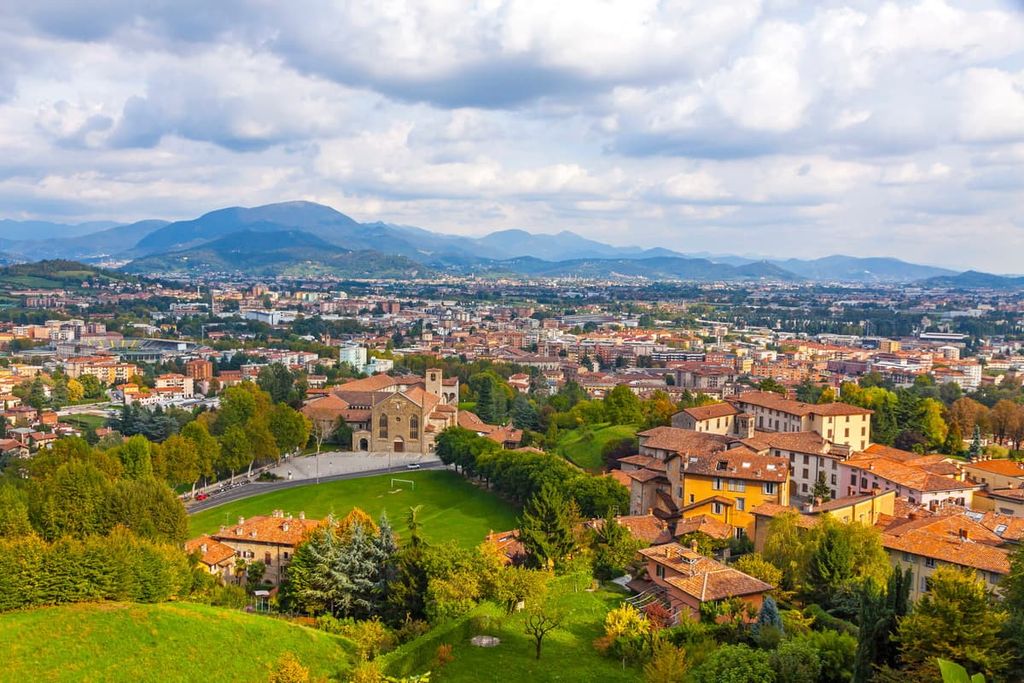
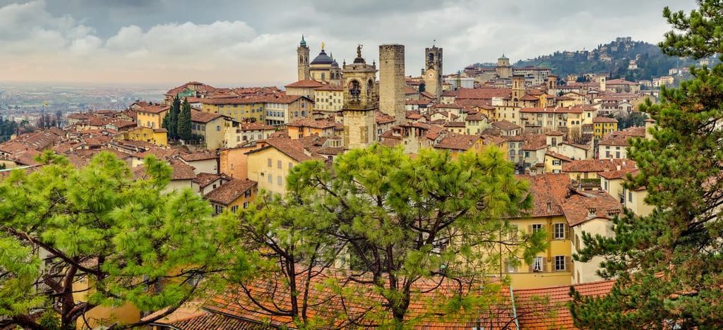
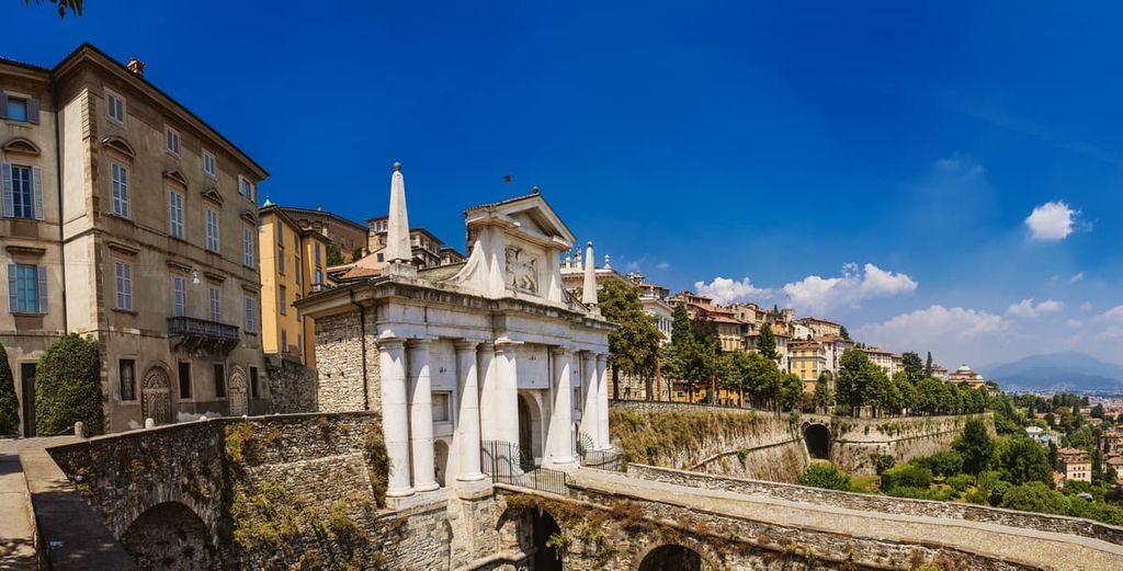
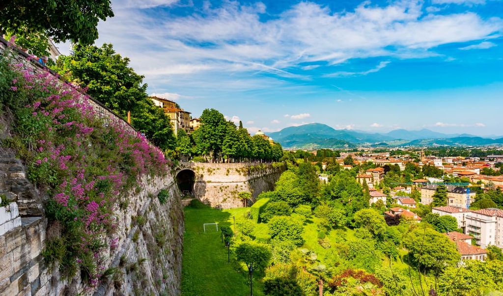
The Bergamo Citta Alta Loop is the easiest walking route in the park. It follows along Bergamo's main attraction—the fortress wall (Viale delle Mura di Bergamo) around the old city. It is a unique architectural site that was added to the UNESCO World Heritage Sites list in 2017.
The walls were built starting from the year 1561 by the Venetians as one of the defensive facilities on the borders of the Venetian Republic, which at that time included the region of Lombardy. Similar walls can also be found, for example, in Kotor in Montenegro and other cities.
My favorite place on the hike is located on the east side of the wall, where you have a great view of the dominant mountain of Bergamo—Resegone, as well as Canto Alto, and the whole Valmarina Valley.
This is a long but very beautiful route. It goes from the Bergamo Old Town and follows along the whole Colle Roccolone Hill to the Santuario della Madonna di Sombreno on the opposite side of the hill. This takes half a day or even a whole day to complete, especially if you are not in a hurry.
From the church, you have a magnificent view of the town of Alme. Here, you can see Monte Castra (518 m / 1,699 ft) and Monte Ubione (895 m / 2,936 ft), and the beginning of two valleys, Valle Imagna on the left and Val Brembana on the right. Colle Roccolone can also be climbed by separate routes from the villages of Petosino or Ossanesga on either side of the hill.
To get back to the starting point, you can take the city bus down from the church in Alme, or walk the route in the opposite direction.
The The Road of the Benedictine Monasteries is the main and longest route in the western part of the park. It travels around the entire Roccolone Hill through the four famous monasteries in the two valleys of Astino and Valmarina where the monks and nuns of the Benedictine order of the Catholic Church chose to settle around the year 1070.
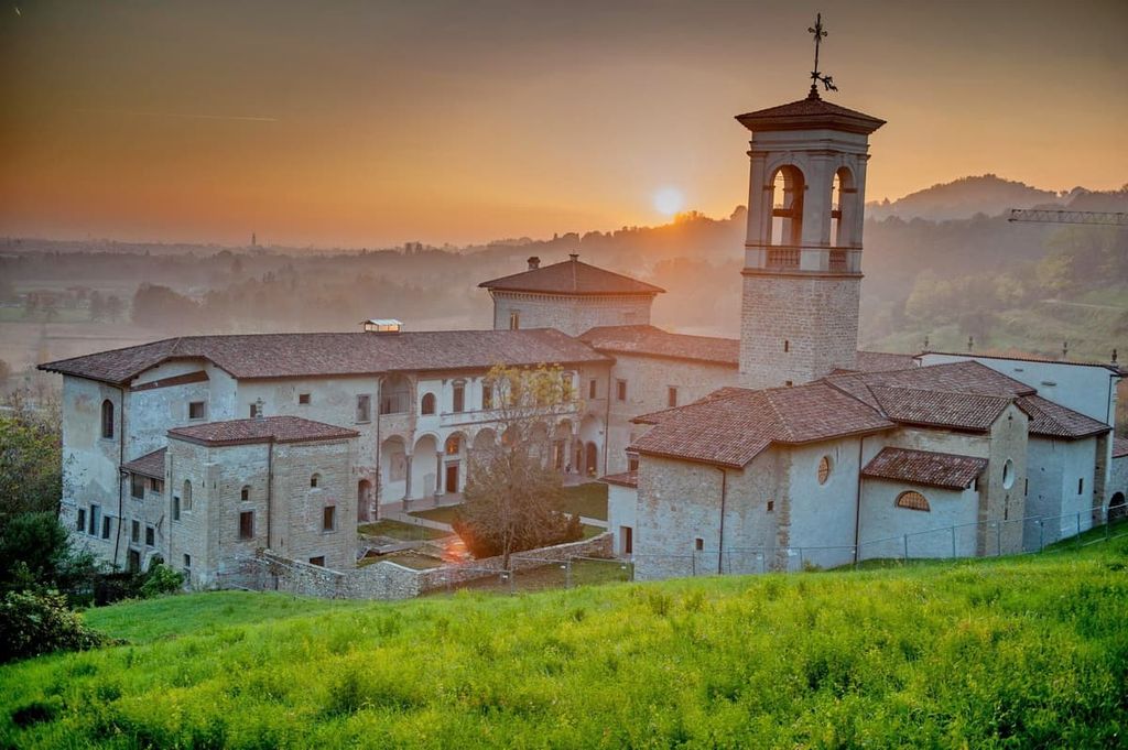
The route consists of two parts:
There are usually a lot of people on the route. This includes both hikers and trail runners, as well as cyclists and mountain bikers, so it’s also a good way to meet some of the locals.
This is the main and most popular trail in the eastern part of the park. It takes you to the park’s highest peak, Canto Alto. The trail is moderate but long, so plan to take at least 5 hours for the uphill portion of this hike. You might also want to allow an extra hour or two to get back from the summit.
From the top, you will see not only all the mountains of the park, but also the greater panorama of the Apennines, Monviso (3,841 m / 12,601 ft), Monte Rosa / Dufourspitze (4,633 m / 15,200 ft)—the second highest mountain in the Alps and western Europe, after the Mont Blanc massif, and Mischabel / Mischabelhörner or Dom (4,546 m / 14,914 ft) in Switzerland. So this is just a great place to enjoy the Alps and to test your PeakVisor app.
Right below the summit, there is the rifugio Canto Alto. There are no accommodations here, but it is a great place to get delicious and inexpensive food. For example, I ordered great homemade pasta for only €5 euros instead of the usual €7–20 that you would spend in the city restaurants.
This is another easy hike in the southeastern part of the park on Colle della Maresana (546 m / 1,791 ft), which is considered the main vacation spot of the locals. It became so popular because the hill offers a panoramic view of the city from trattoria La Maresana. You can also picnic in the large meadow next to it, which is surrounded by chestnut trees that were planted there.
The local attractions of the hill include the Saint Mark’s Church (Chiesa di San Marco, 1619) and the several houses that the wealthy people of Bergamo built all around the hill. In general, this is a very pleasant area to walk and to ride a bike.
This route can be done either as a point-to-point or as a loop by starting and finishing in Monterosso, Ponteranica, Torre Boldone, or Ranica, and continuing to the Colle di Ranica.
The main visitor center and headquarters of the park are located in the former Benedictine Monastery of Santa Maria in the Valmarina Valley:
Consorzio Parco dei Colli di Bergamo
25 Via Valmarina, 24123, Bergamo, BG, Italy
Hours: Monday to Thursday from 9 am to 1 pm
+390354530400
protocollo@pec.parcocollibergamo.it
If you are going to Maresana Hill, you can also visit the second visitor center of the park, which is named Cà Matta. The park’s staff also organizes environmental education activities here throughout the year:
Il Centro Parco Cà Matta
Via Maresana, 140, 24010, Ponteranica, BG, Italy
+390354530400
centroparco.camatta@parcocollibergamo.it
However, both visitor centers are located far away from the city center. So, in order to get more information about the park before, rather than during the hike or bike ride, it is better to go to one of the Visit Bergamo information points. These are located at Bergamo Airport and in the Lower and Upper (Old) Cities:
Info Point Aeroporto di Bergamo
Aeroporto Orio al Serio, via Aeroporto, 13, Bergamo, BG, Italy
+39035 320402
Hours: Monday to Saturday from 8 am to 10 pm, Sunday from 10 am to 6 pm
Ufficio I.A.T. Bergamo—Città Bassa
Piazzale Guglielmo Marconi (Bergamo train station square), 24122, Bergamo, BG, Italy
+39035210204
Hours: Daily from 9 am to 6 pm
Ufficio I.A.T. Bergamo—Citta Alta
13 Via Gombito, 24129, Bergamo, BG, Italy
Daily from 10 am to 7 pm
+39035242226
Before the trip, you can also visit the page of the park at the official Visitbergamo.net website.
You can also use Parks.it and In-lombardia.it sites for additional information.
The Parco dei Colli di Bergamo is an ideal destination for a weekend trip from the cities of Milan, Como or Lecco, or Brescia, so I recommend visiting the park for at least 2–3 days to see its three main regions. A sample itinerary would be to see the Old Town on Friday evening, Colle Roccolone on Saturday, and Canto Alto on Sunday.
Given the park’s general urban character, you can find almost every kind of lodging in the area, from chain hotels to charming family-run B&Bs to agritourism. I would choose the latter option—this way you not only find accommodation in nature, but you can also eat delicious food and buy local produce.
Here are some examples of agritourism in the Bergamo Hills Park:
Bergamo is one of the major cities in the Lombardy region. It is located 40 km (25 mi) to the northeast of Milan. It is the fourth most populous city in the province, with 119,826 inhabitants (2021). Bergamo is also one of the tourist capitals of the region.
Until a few years ago, Bergamo was a provincial town that few people knew about. The city became more popular as a great travel destination after the opening of Orio al Serio International Airport (Milan Bergamo Airport). This soon became the third busiest international airport in Italy and one of the main regional transport hubs in Europe, particularly for low-cost airlines.
This guide has talked a lot about the Upper Old Town of Bergamo and the park. However, the Lower Town of Bergamo (Bergamo Città Bassa) is just as interesting.
Here’s my favorite all-day itinerary, that, as a resident, I would recommend doing if you find yourself here:
For more information, check out the city’s official tourist site: Visitbergamo.net.


