
Scan the QR code and open PeakVisor on your phone
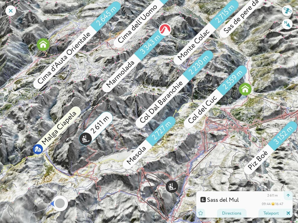
The Marmolada include 154 named peaks. The highest is Marmolada at 3,343 m. Other notable peaks include Punta Rocca, Gran Vernel and Piccolo Vernel.
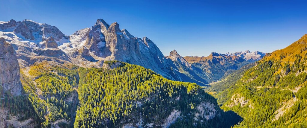
The Marmolada group, or "The Queen of the Dolomites", is the main mountain group in this spectacular region, and for good reason: It is the highest and one of the most beautiful in the range. The range is also heavily glaciated, which adds to the splendor of the region.
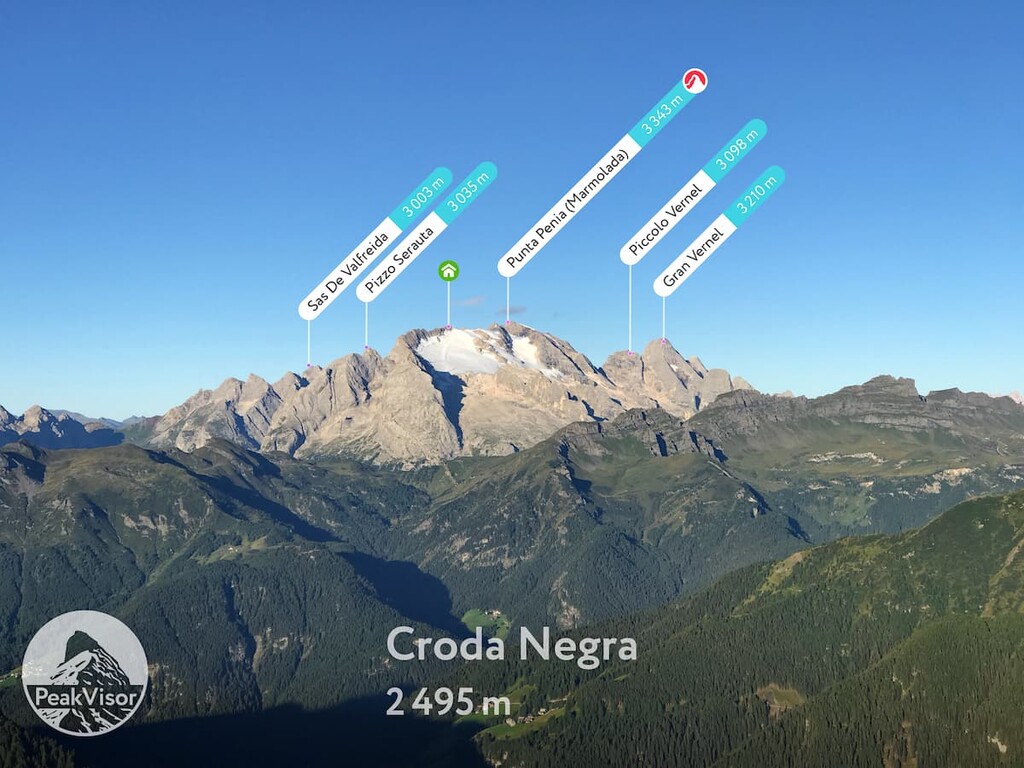
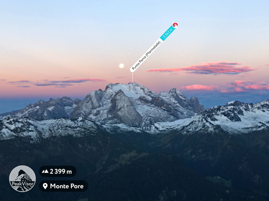
The highest and the most prominent peak is Punta Penia (3,343 m / 10,967 ft). In total, there are 156 named mountains in the group.
I've been to Marmolada twice, once as a regular tourist during a road trip and once as a hiker. In this article, I will tell you about this group, and my personal experience there.
Yes, the name of the Marmolada mountain group resembles the word "marmalade"—a preserve made from citrus fruits boiled with sugar and water. In fact, the name has Indo-European roots and comes from the Greek word "marmar," which means "to shine." Most likely, this is a reference to the glacier on top of the mountain.
By the way, in the language of the Ladins, the native people of the Dolomites, the name of the mountain is slightly different—Marmoleda. Meanwhile, in German it is called Marmolata.
The Marmolada group is located in the geographical center of the Dolomites. As a result it is at the center of the Ladin community, who live in five neighboring valleys: Gardena, Badia, Fassa, Livinallongo and Ampezzo. It is also conveniently accessible from both the south and the north of Italy, as well as from the south of either Austria or Germany.
The total area of the mountain group is 2,208 hectares (5,456 acres). The larger, western part of the territory is located in the Trentino region while the smaller, eastern part is in the Veneto region.
If we talk about the geographical, rather than a political division of the mountain group, Marmolada is commonly divided by the two other cardinal directions—the northern part, where the highest peaks are located, and the southern part which is slightly lower in elevation.
The two regions of the group are separated by the Ombretta Pass (2,700 m / 8,858 ft). However, Ombretta Pass is not accessible by car and it can only be traversed on foot (or on a bike by the brave and strong).
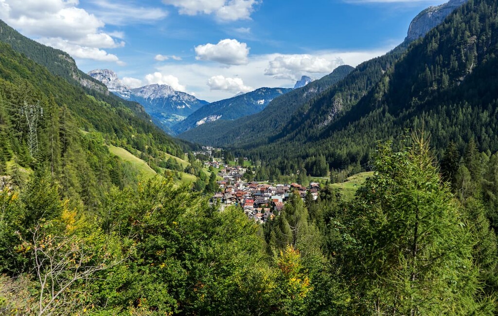
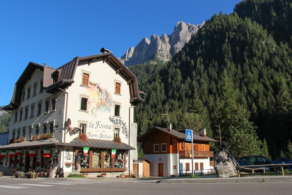
The nearest and the most famous town near the Marmolada is Malga Ciapela. But, actually, it's not a town or even a village. Rather the community has only a cable car, a campsite, and a few hotels. In fact, “malga” means a “cow farm” in Italian.
From the Marmolada group, it takes 2 hours and 30 minutes (170 km / 105 miles) by car to reach Venice or about 2 hours (95 km / 59 miles) to reach Bolzano.
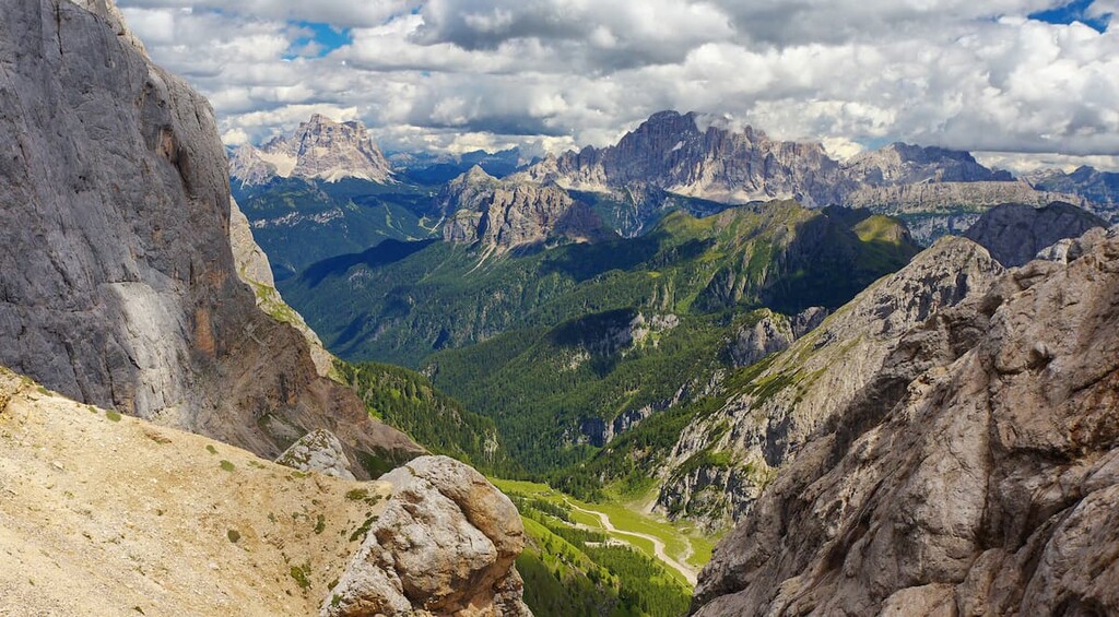
Marmolada group is surrounded by other equally famous mountain groups and peaks of the Dolomites: Sella to the north, Pale di San Martino to the south, Antelao, Civetta, and Pelmostock to the east, and Sassolungo / Langkofel to the west. If one climbs to the top of Marmolada, all these mountains are clearly visible on a good sunny day.
Despite its nickname, "The Queen of the Dolomite Alps" is made up mostly of limestone, and not the dolomite mineral for which all the Dolomites are named. However, I should note that the word “dolomite” can be used to refer to limestone.
During the Triassic, the Marmolada, like many other mountain groups in the Dolomites, was an atoll in a tropical sea. As a result of volcanic eruptions, it was covered with extensive layers of volcanic rock, including tuff and other ashes.
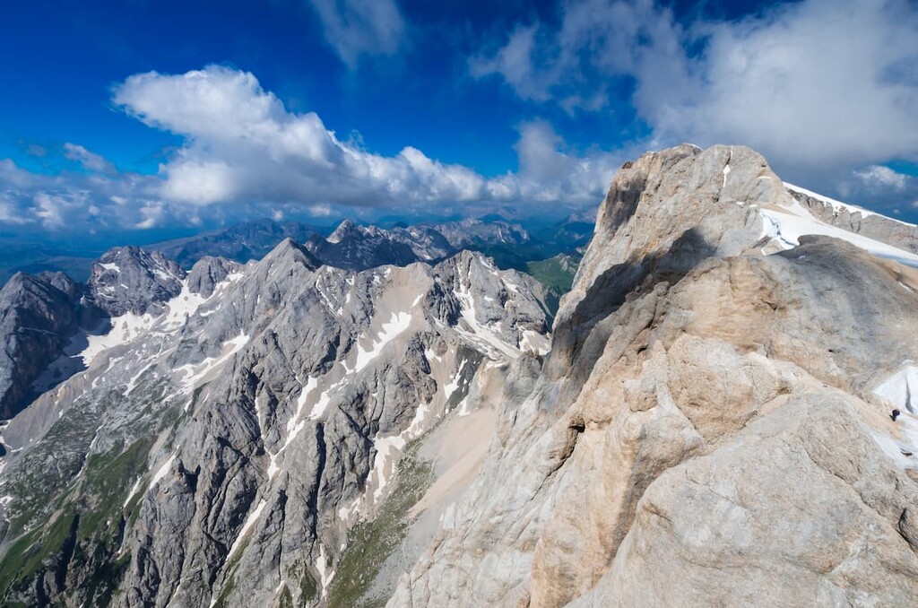
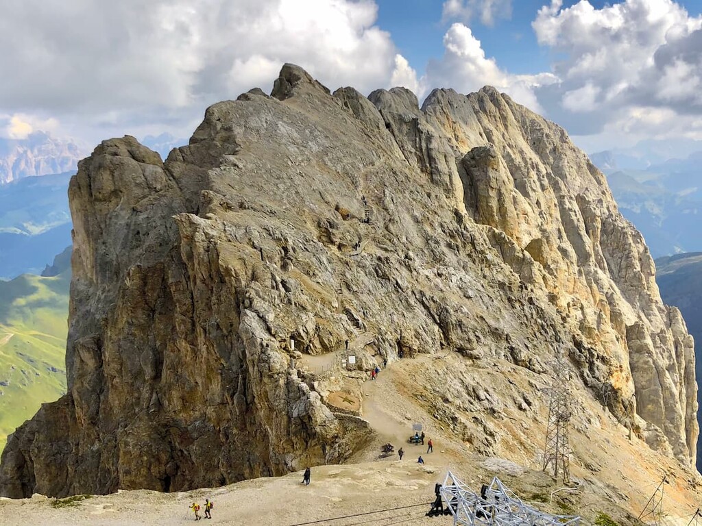
Being the highest mountain of the Dolomite, the Marmolada is not so high at first sight. Indeed, it does not stand out in the landscape as much as some of the other mountains of the Dolomites, like the neighboring Sella, Tre Cime di Lavaredo or Cimon della Pala.
Rather, the Marmolada is a very large and wide mountain group. But this appearance is somewhat deceptive because at the foot of the northern Marmolada is at an altitude of 2,000 meters (6,561 ft). (But don't forget that this is the highest mountain in the Dolomites.)
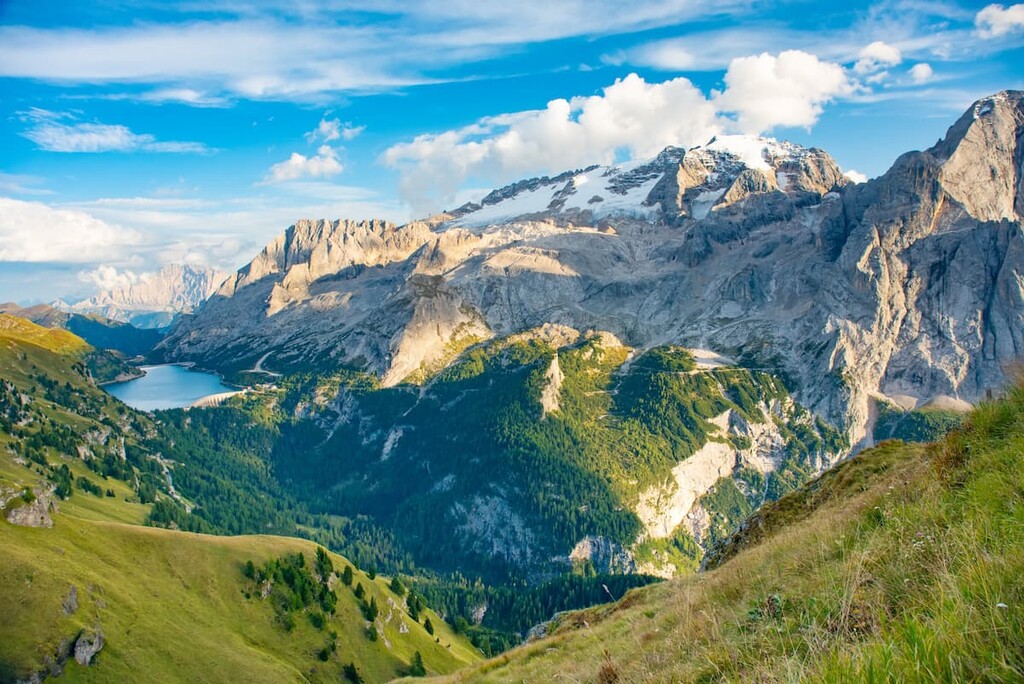
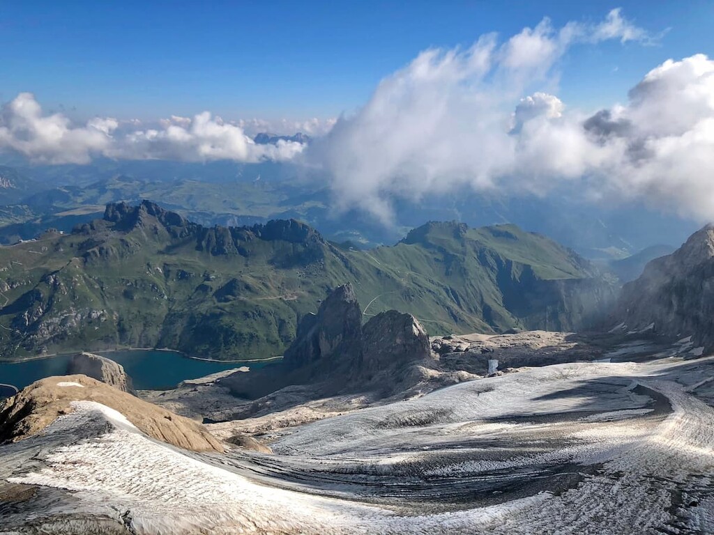
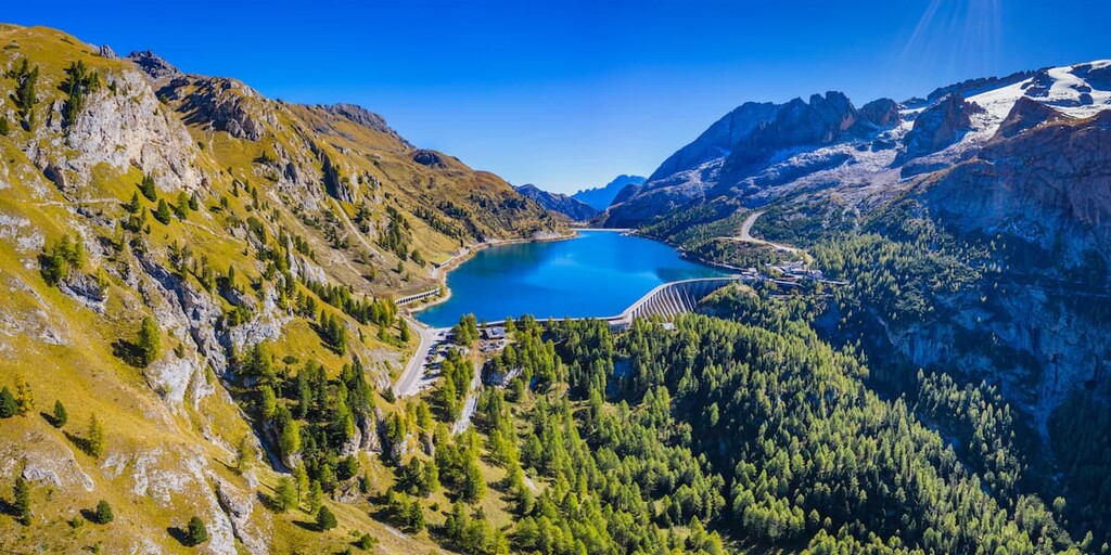
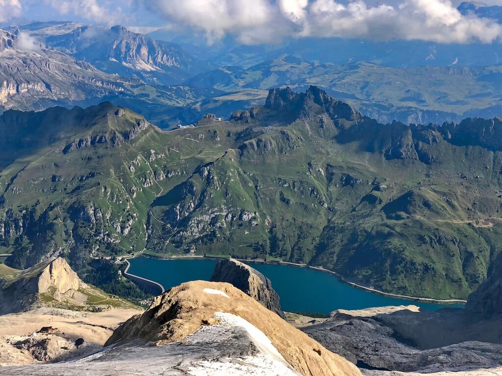
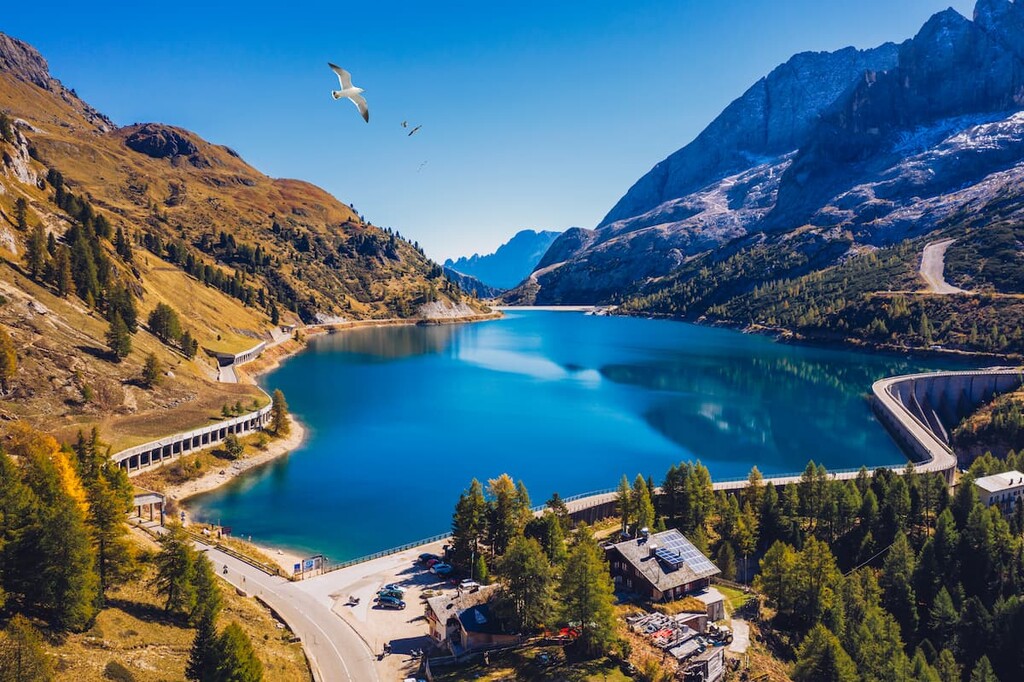
Furthermore, the north and south sides of the peak of Marmolada mountain are very different. The northern, or the most recognizable side of Marmolada is a huge, oval-shaped glaciated slope. There is also the magnificent alpine Fedaia Lake at an altitude of 2,030 m (6,660 ft), which is as integral to the overall landscape of Marmolada as its highest peaks or its famous glacier.
Meanwhile, the southern side of Marmolada is a vertical wall over 1,000 m (3,280 ft) high. It is widely known among climbers, and it is considered very difficult to climb. I've seen both sides, and, in my opinion, the south side is more impressive.
The southern wall also appears in one of the Ladin legends called "Conturina: The story of a foster-child" about a lovely young girl who was first turned into a statue by her stepmother and then placed forever in the rocks of the southern wall because of the stepmother's envy of her beauty compared to two other daughters.
It is believed that by passing the Ombretta Pass, one can hear the girl singing who did not wait for someone to rescue her from her imprisonment. Actually, a quite sad story. This story has been well illustrated by the Italian artist Luisa Rota Sperti, who has been painting the legends of the Dolomites since the 1980s.
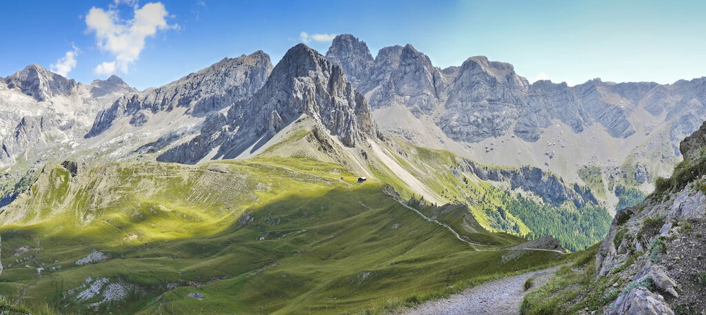
The overall landscape of the Marmolada is also impossible to imagine without several picturesque alpine passes, namely Fedaia Pass (2,057 m / 6,748 ft), Pordoi Pass (2,239 m / 7,346 ft), San Pellegrino Pass (1,918 m / 6,293 ft). In contrast to the Ombretta Pass, there are roadways that traverse these passes so cars, motorcycles, and cyclists can cross them with relative ease.
The Marmolada Glacier (Ghiacciaio della Marmolada in Italian) has an area of around 1.6 km² (0.6 mi²). This is the largest and the only glacier in the Dolomites. Therefore, it is a permanent sheet of ice that exists all year long, even in the summer.
There is also a legend about the origin of the glacier: It is said that the glacier formed as a result of a huge snowfall on August 5th, the day of the Dedication of the Basilica of Saint Mary Major feast or the Our Lady of the Snows (Madonna delle neve in Italian). According to the legend, it simply snowed so much that day that the snow has not yet melted.
However, due to global warming, the glacier is believed to be melting, and at a fast rate. Over the past 70 years, it has lost about 80 percent of its area. In August 2020 there was a study released by scientists at the University of Padua that the glacier will melt completely in just 15 years. In total, there are 31 glaciers in the region.
The Marmolada group is one of the 9 major systems that make up the Dolomites, along with the Pelmo—Croda da Lago, Puez-Odle, Brenta systems and others. Despite being the highest mountain in the range, Marmolada is one of the two smallest systems by total area.
At the same time, Marmolada is an ultra-prominent mountain peak, or just “ultra” for short, which means it is a summit with a prominence of 1,500 m (4,921 ft) or more. The peak's prominence is the total elevation of a summit when compared to the next highest point in the surrounding terrain. The actual prominence of Marmolada is 2,132 m (6,995 ft), which places it among the list of only 1,515 ultras on Earth, which includes 119 in Europe, inclusive of the Caucasus mountains.
The Marmolada mountain group is made up of the following main subgroups, according to the Italian SOIUSA classification:
The nine other highest peaks in the Marmolada group, other than Punta Penia, are Punta Rocca (3,310 m / 10,859 ft), Gran Vernel (3,210 m / 10,531 ft), Piccolo Vernel (3,176 m / 10,419 ft), Sasso Vernale (3,058 m / 10,032 ft), Ponta De Cornates (3, 036 m / 9,960 ft), Pizzo Serauta (3,018 m / 9,901 ft), Ombreta Orientale (3,011 m / 9,878 ft), Cima dell'Uomo (3,010 m / 9,875 ft), Sas De Valfreida (3,003 m / 9,852 ft).
The first climber who climbed to the top of Marmolada was an Austrian Paul Grohmann. He did it in 1864 along the route from the north side. On the south side, climbers did not successfully climb the mountain until 1901. They were the Italians Beatrice Tomasson, Michele Bettega and Bartolo Zagonel.
Marmolada group is a super popular tourist destination in the Dolomites, but don't be scared off by the crowds.
Yes, in the summer and winter tourist seasons there will be a lot of people, but closer to the beginning and end of the seasons, and on less popular trails, there will be almost no one besides the locals. This was the case for me when I hiked one of the trails described below on September 21st, 2013, the day the official hiking season ended.
From simple to complex, I recommend the following points and routes:
This is more of a tourist route. From Malga Ciapela at 1,450 m (4,757 ft), you go to Marmolada's second-highest point Punta Rocca by cable car, which will take you up in just 10 minutes. From the top, in good weather, you have a stunning view of all the surrounding mountains of the central Dolomites on the north side of the Marmolada: Sella, Civetta, Pelmo, and others.
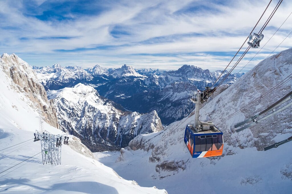
Around 300 m (984 ft) before the end of the ascent you will need to make a transfer at Serauta cable car station (2,950 m / 9,678 ft ), where you can get off to visit the Great War in Marmolada Museum if you enjoy history, especially military history.
In fact, before the end of World War I, the border between Austria-Hungary and Italy ran along Marmolada mountain. Later, during the war, it became the front line. Austrian soldiers even built a whole ice city to shelter them from the enemy right in the depths of the glacier. By the way, it also is the highest museum in Europe.
Also, an Important tip from my personal experience: It is a bad idea to attempt this hike in cloudy and foggy weather—you will find yourself right in the middle of the clouds or fog and you will not see anything. There is a video camera at the ticket booth that shows the weather conditions at the top. The ticket booth personnel themselves pay attention to it, and I suggest that you do, too.
The cable car ride up to Punta Rocco is great, but the hiking along the highest peak of the Dolomites is even better. Indeed, this is a classic route on Marmolada.
This route also starts in Marla Ciapela, where you will take the 610 trail to the Ombretta Valley. In the valley, there is a rifugio called Onorio Failer where you can spend the night on the first day. The whole trip takes no more than a couple of hours, so you can arrive at the start of the trail by lunch time. That's what I did: I started at 2 pm at the Malga Ciapela, at 4 pm I was at the rifugio.
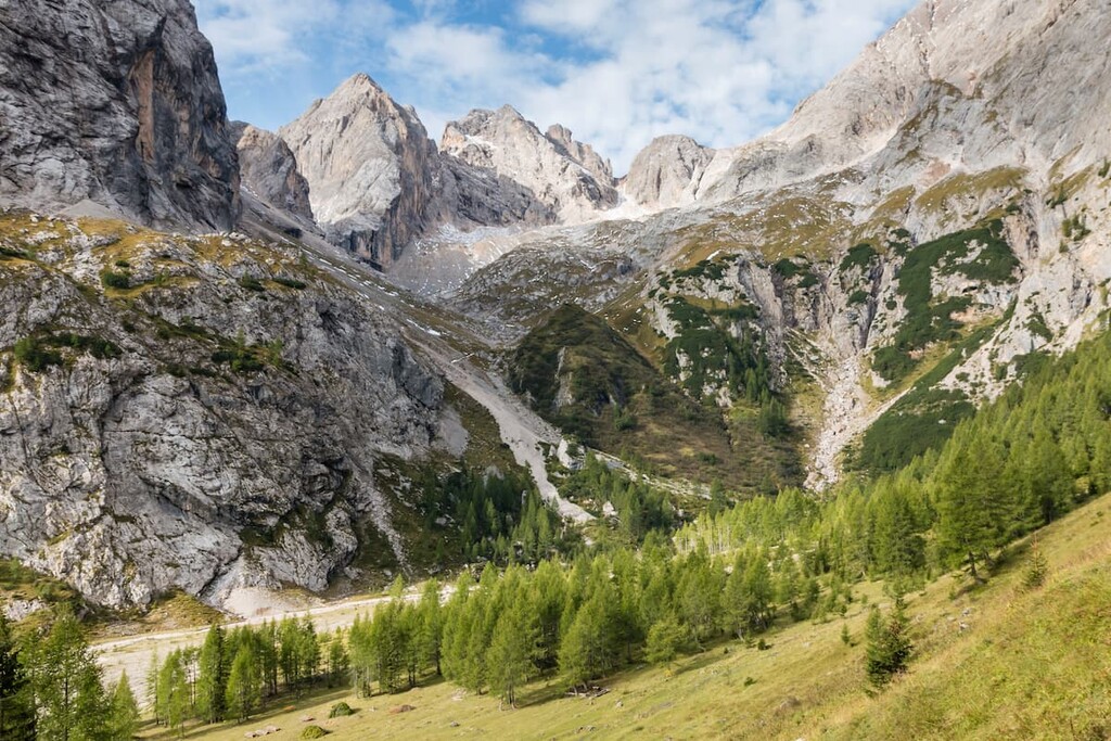
On the next day, you’ll go up to the Ombretta Pass. It is another 700 m (2,296 ft) of elevation gain. If you have the time and energy, I recommend climbing even higher on Cima Ombretta to 3,011 m (9,878 ft). The trail is challenging and will require a lot of effort, but the views from the mountain will be memorable for a lifetime.
If you leave the rifugio early in the morning, you will be at the top by around lunchtime. It is also important to note that there will be short but steep and almost vertical via ferrata (metal steps in the rock). Therefore, you will need equipment for the via ferrata to climb.
The descent from the summit is just as challenging because the path is intuitive and laid out over crumbling rocks. Therefore, allow the same amount of time or even more time for the descent than the ascent (usually the opposite is true as descending from the mountains in dry weather on moderate trails is almost always faster).
From Ombretta Pass, you descend into Contrin Valley on the opposite side of the pass in around 2 hours. Here is the rifugio of the same name, where you can spend the night. Another option is to continue to the village of Alba di Canazei. However, this is about 2 more hours of travel through the alpine forest.
The bottom line: in my opinion, the route along the southern wall of Marmolada is one of the most amazing adventures you can have for yourself in the Dolomites.
Learn more about hiking the Ombretta Pass from this photo report.
Alta Via 2 is one of the two longest alpine hiking trails in the Dolomites, on par with Alta Via 1, which is 160 km (99 mi) long and takes 11–14 days to complete. If you start from Bressanone (Brixen) in South Tyrol, you will arrive at rifugio Castiglioni alla Marmolada on the Fedaia Lake by day 5. It will take you two days to cross Marmolada, so it’s the perfect extended adventure..
In addition to the via ferrata on Cima Ombretta, the Marmolada has around 5–7 other via ferratas, which are longer, more difficult, and simply spectacular. They attract many climbers to this mountain group.
The main via ferrata, and the most famous one in the region, is called the “Marmolada West Ridge Via Ferrata” (Via ferrata della Marmolada Cresta Ovest in Italian). It is a classic route that leads to the top of the mountain group of Punta Penia. At the same time, it is one of the oldest via ferratas in the Dolomites as it dates back to 1903.
The route begins at the Fedaia Pass along the lake. From here, you’ll go to rifugio Pian dei Fiacconi by cable car or on foot along the 606 trail. The path on foot will take 1 hour 30 minutes and an additional 722 m (2,386 ft) of elevation gain (I would save time and power).
From rifugio, you descend into the glacier valley and then along the via ferrata to Forcella Marmolada, where it continues on to the summit.
The local climbing enthusiasts that have been here agree that the via ferrata is not particularly difficult as you can climb by the steel cable and the ladders fixed on the rocks, which will help you to pass the smooth and solid slabs. But the terrain all happens at a high altitude that requires extreme concentration and care.
On the summit, there is a small rifugio Capanna Punta Penia providing food and some facilities to the climbers.
To go back, you can go the same way to rifugio Pian dei Fiacconi.
You can also make a loop trail, going back across the Marmolada glacier. But for that, you will need crampons, a walking axe, a rope for glacier crossing, and other additional equipment. Such a route also requires special preparation and experience—it is dangerous to go down the glacier without it.
In any case, it is important to consider the weather. In rain, snow, or fog, this route will cause difficulties. For example, in 2017, two people on Marmolada were struck by lightning. So, this is a route that’s best avoided in inclement weather conditions.
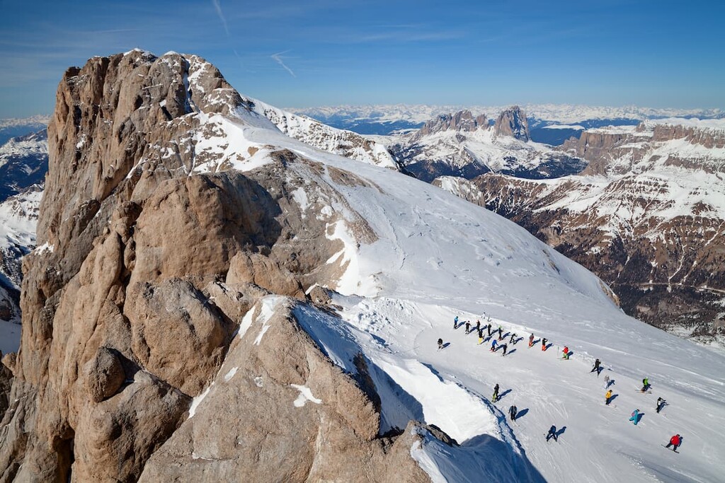
Marmolada is one of the 16 ski areas that make up the Dolomiti Superski system. There are 63 km (39.1 mi) of ski runs and 27 lifts in two ski areas, including Marmolada itself, as well as the neighboring Arabba ski area.
The longest run in the ski area is "La Bellunese", which is 12 km (7.4 mi) long with an elevation drop of 1,800 m (5,905 ft) from the 3,000 m (9,842 ft) level. It is also the longest in all the Dolomites.
In terms of difficulty, there are five red ski trails, two blue trails and one black run. In Arabba, there are many more options. Do note, however, that the red and black trails in the region are considered difficult, even for intermediate skiers. Check the map of the slopes.
In the Marmolada group, you will have no problem finding accommodation to suit your needs. Here are some of your options:
First of all, right at the foot of the Marmolada in Malga Ciapela, there is a campsite. As of the 2021 season, a night of accommodation costs anywhere from €6 to €11 for a site for your caravan or tent.
If you don’t have a caravan or tent, you can also rent a simple tent starting at €5 or a glamping tent for about €65. The campsite is open all year round, except in November when there is a mid-season in the Dolomites, and the family of the owners have a vacation. Please check the camping’s website for updated information about the opening time in the current year.
Caravan & Camping Resort "La Marmolada"
Localita Malga Ciapela, 116, 32020, Rocca Pietore (BL), Dolomiti, Italia
+39 0437 722 064
mia@marmolada.camp
Warning: do not confuse this camping site with another, Camping Marmolada, located in Canazei. You can stay there too, it's just further away.
There are also several hotels and apartments in Malga Ciapela: Hotel Tyrolia, Dolomites Dream Marmolada 2, Residence Regina Delle Dolomiti, Hotel Garni Roberta.
When hiking, you can stay at one of the rifugios. As I already said, there are two closest rifugios on the southern side of Marmolada: rifugio Onorio Failer and rifugio Contrin on either side of the Ombretta Pass. Both are at approximately the same elevation of 2,074 m (6,804 ft) and 2016 m (6,614 ft), respectively. The first has 44 beds, the latter has 100 beds.
Nevertheless, if you’re planning a trip to the other parts of the Marmolada group, worry not, you won’t be left without an overnight stay. In fact, there are many rifugios scattered throughout the region, including:
Within the Marmolada’s boundaries, you can also spend the night in one of the bivouacs — free alpine shelters. Usually, these are metallic cabins, but could be stone or wooden houses, as well. For example, while hiking along the southern wall of the Marmolada, I spent the night in the bivouac Marco dal Bianco on the Ombretta Pass. The bivouac has 9 beds, mattresses, warm blankets, and pillows. The bivouac is not new, but not too old either, so you should be quite comfortable.
The other two bivouacs, Zeni Donato "Vallacia" and Bontadini, are located in the southwestern and northern parts of the Marmolada group, respectively.
Finally, close to Marmolada in each of the villages you will also find several B&Bs, hotels, and other types of lodging to suit your needs.
The closest tourist offices to Marmolada, where you can get more information, are located in the Fassa Valley.
The tourist office in the valley’s main town, Canazei, is open all year round from Monday to Saturday from 8:30 am to 12:30 pm and from 2:20 pm to 6:30 pm at Piaz G. Marconi, 5, 38032, Canazei, Trentino, Italy. Call +39 0462 609600 or write to infcanazei@fassa.com if you have any questions about your trip.
On the official website of the Fassa Valley, you can also find the addresses of the offices in other villages: Alba, Vigo di Fassa, Moena. You can also visit the website of the village of Canazei if you’d like to learn more about the region.
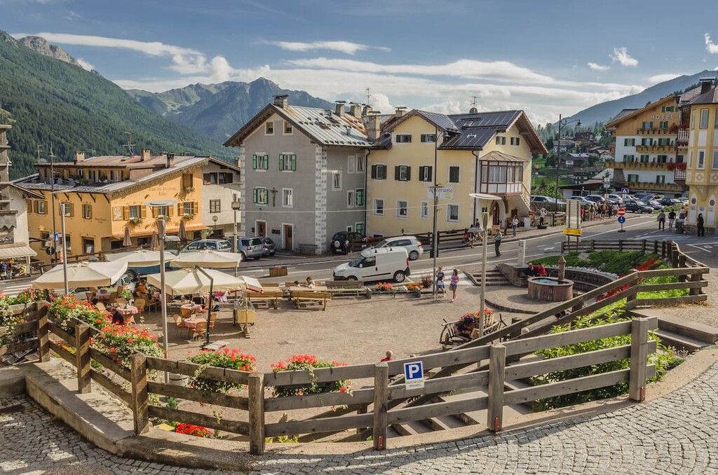
On the borders of the Marmolada group, there are several large tourist centers, including Moena, Falcade, Alleghe, Caprile, and Arabba, but we will keep our focus on the communities in the center of the group. In addition to Malga Ciapela, the following cities are worth visiting:
Rocca Pietore is a small village with 1193 inhabitants that’s located at 1,143 m (3,759 ft) in the Pettorina Valley, a few kilometers from Malga Ciapela. The municipality includes the settlements of Sottoguda, Pian, Palue, Bosco Verde, Col di Rocca, Rocca, Troi, Molin, Congiuo, Pezze, and Soraru.
The main attraction of the village is the Gothic church of Rocca Pietore, built in the 15th century. Inside there are works of art, including the sculpted altar, the wooden tabernacle, and wall paintings. The church is a designated national monument.
Since 2018, Rocca Pietore has also been recognized as an Orange Flag destination by the Italian Touring Club for its exceptional hospitality.
Sottoguda is a village that is part of Rocca Pietore. It has a population of just 98 people and it is located at an altitude of 1,250 m (4,101 ft) in the same valley. Since 2016, the village is among the most beautiful small medieval villages in Italy "I borghi più belli d'Italia."
The main attraction of the village is the Church of Saints Fabiano, Sebastiano, and Rocco. It is also a Gothic church that dates back to 1468.
Close to the village there is the Serrai di Sottoguda canyon, formed by the Pettorina River. The steep walls of the canyon reach a height of up to 100 m (328 ft). The length of the canyon is 12.5 km (7.7 mi). Unfortunately, as a result of the devastation caused by Storm Adrian, which hit northern Italy including the Dolomites in October 2018, the canyon is closed to tourists.
Part of the commune of Canazei, the village of Alba is located at an altitude of 1,517 m (4,977 ft) at the feet of the Colac (2,715 m / 8,907 ft) and the Gran Vernel mountains (3,210 m / 10,531 ft).
The name Alba means "rocky wall", which refers to the Doleda ridge which overlooks the town. There aren’t many attractions in the village, but there is a small parish church dedicated to Saint Antonio Abate.
From Alba, you can take the cable car to the Ciampac-Buffaure ski circuit. For winter sports, there is also an ice rink, ski mountaineering routes, and cross-country skiing trails.
The largest village in the Fassa Valley to the west of Marmolada group, Canazei has a population of 1,908 people and an altitude of 1,450 m (4,757 ft). Canazei, like the valley itself, is one of the centers of the Ladin community. For example, 82.4% of the population speaks the Ladino language.

Every first Sunday in September, the village hosts the Gran Festa da d'Istà (Great Summer Feast) with a traditional folk parade.
The main attraction of the village is the church Madonna della Neve located at Gries, one of the hamlets of Canazei, which was built in 1595. If you’re in the area, another interesting church to visit is San Floriano.
Canazei is also the local capital of outdoor sports tourism. In fact, from here, you can easily access the Marmolada group, as well as the Sella and Sassolungo groups.


The highest peak in the Marmolada is Marmolada, at 3,343 m.
The Marmolada have 154 named peaks.


