Scan the QR code and open PeakVisor on your phone
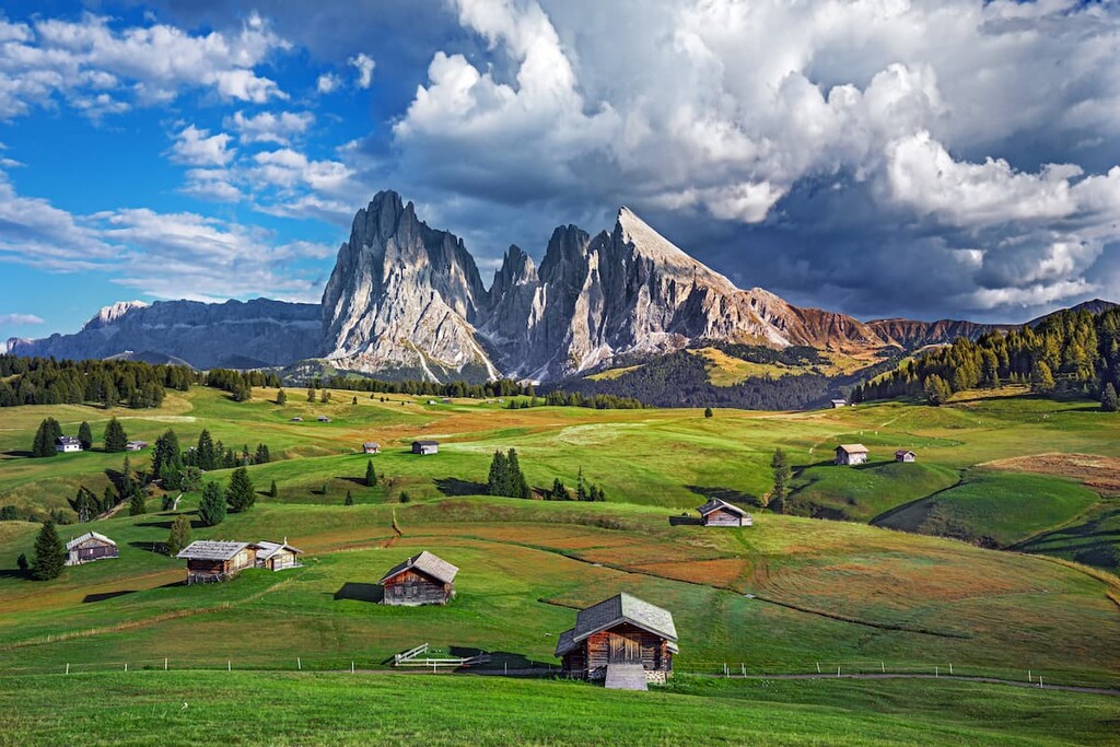
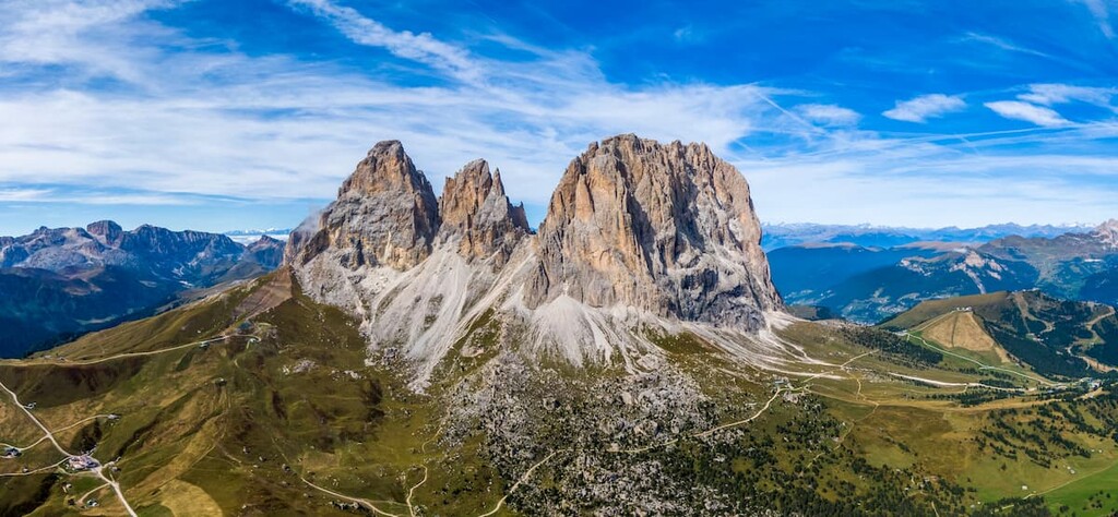
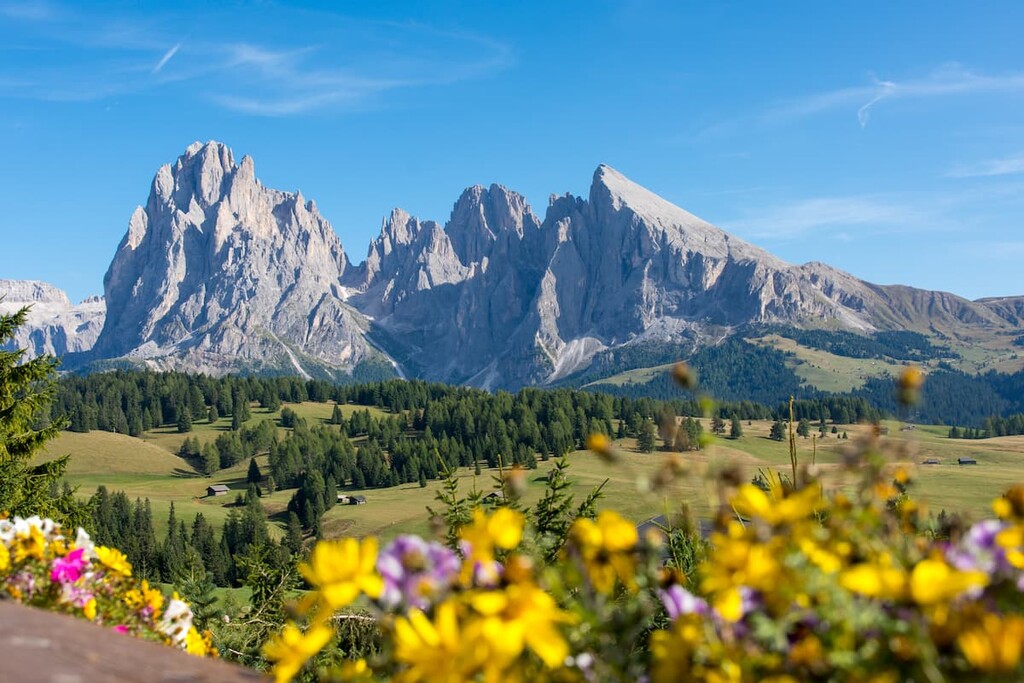
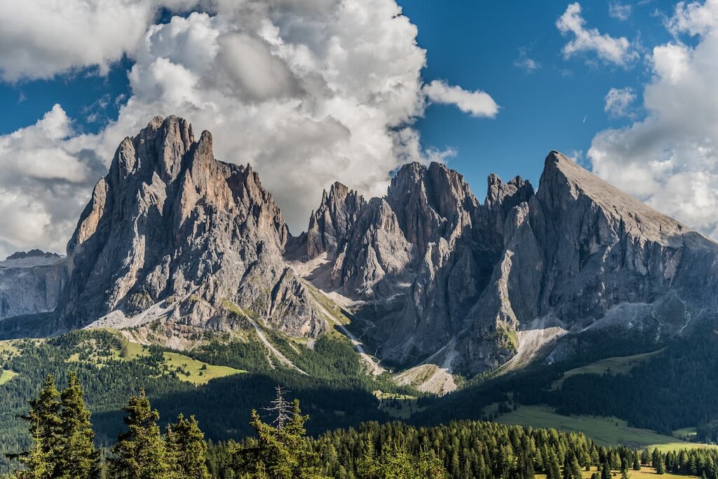
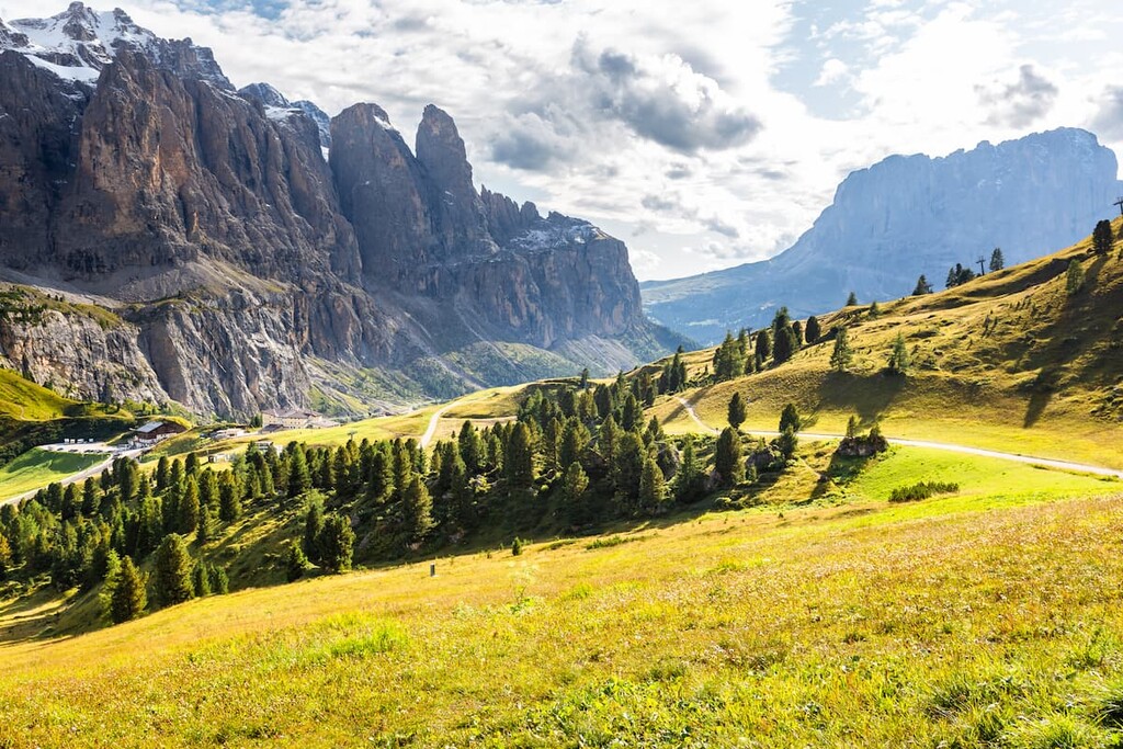
Langkofel is one of the most beautiful and popular mountain groups among travelers in the Dolomites of northern Italy. The main features of the group are the loop hiking trail that passes through the region with views of other neighboring mountains, as well as the extensive skiing area in the Fassa Valley, part of the Dolomiti Superski system. There are 25 named mountains in the group. The highest and the most prominent peak is Langkofel (3,181 m / 10,436 ft).
If you speak German, the name of the Langkofel group is easy to guess in its spelling: It translates to “long peak”.
However, the word is spelled differently in the three main languages in the region. Langkofel is the German word while in Italian, the group is called Sassolungo. Additionally, in Ladin, it is called Saslonch.
The Ladins are the native people of the Dolomites, and they have their unique history, culture, cuisine, and traditions. Read more about them in the general guide to the Dolomites.
The Langkofel Group is located in the center of the Dolomites on the border between the provinces of Bolzano and Trentino, which together make up the autonomous region of Trentino within Italy, which is also called Trentino — Alto Adige / South Tyrol. This is not a unique situation—the border runs through the middle of many other groups, including the famous Tre Cime di Lavaredo, Sella, and Marmolada, among others.
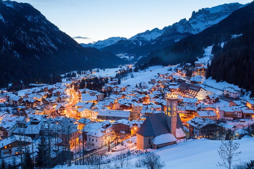
You can get to the Langkofel group quickly and easily from the capitals of the provinces. The largest nearest town in the vicinity of the group is Canazei in Trentino, south of Langkofel. From Bolzano, the trip takes 1 hour or 50 km (31 mi) and from Trento it’s about 1 hour 30 minutes or 105 km (65.2 mi).
Public transport is also an excellent option for traveling in the Dolomites. This is particularly true if you travel using the region’s comfortable buses, on which you can travel hundreds of kilometers, admiring the views from the windows along the way.
They go almost everywhere, even small villages. The only possible inconvenience is the small number of trips of the buses to some small non-tourist places. Tickets cost from €2–3 for a 20 km (12.4 mi) trip.
The two main bus companies in the region are Suedtirol Mobile and Trentino Trasporti. You can reach Bolzano and Trento from the flatlands of Italy by Trenitalia trains. The best airports to come to Italy are in Venice, Verona, Bergamo, or Milan.
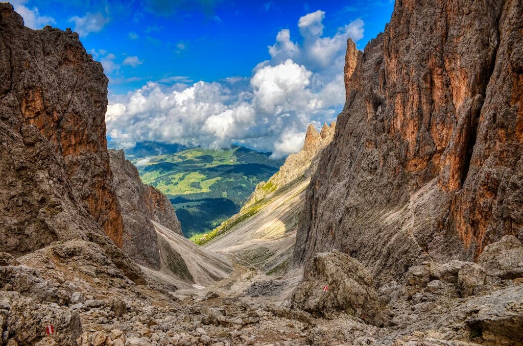
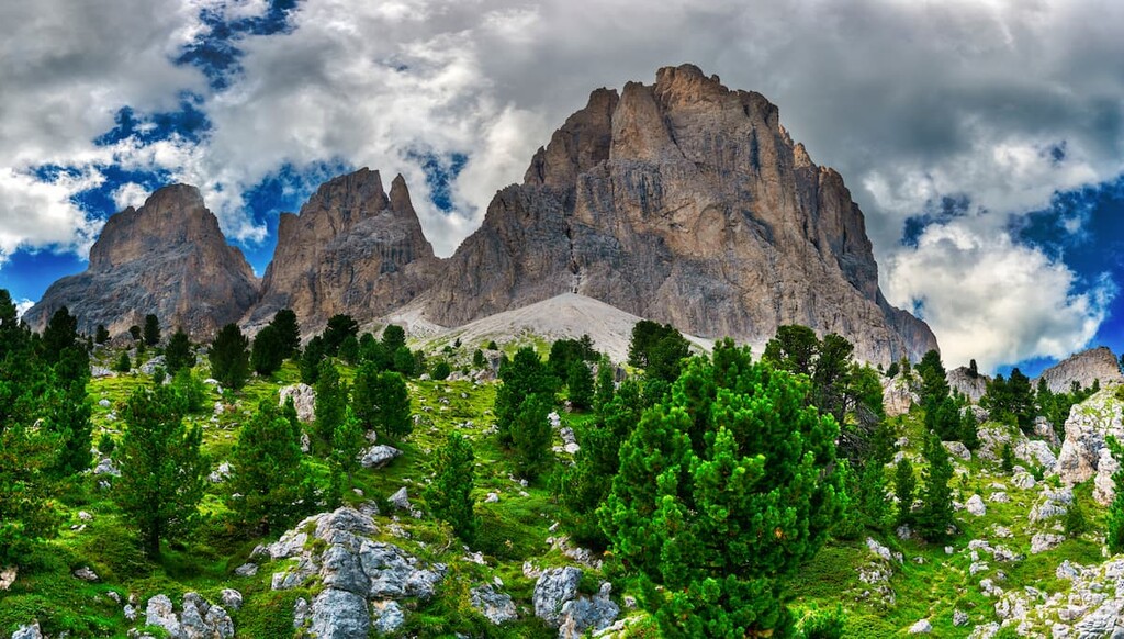
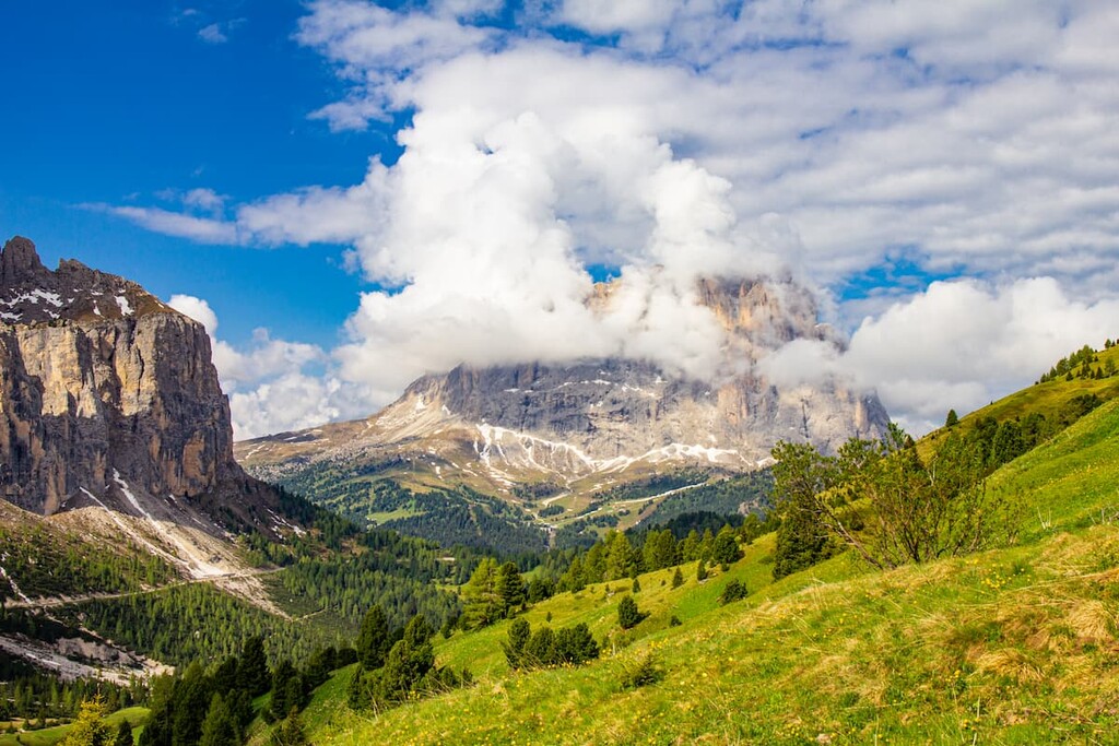
The rocks of the Langkofel Group, like most other mountains in the Dolomites, are composed of the rock dolomite, which is similar to limestone but differs slightly due to its harder composition, the thick rock layers, and—above all—its incredible ability to absorb sunlight.
Because of this, Dolomite is colored at sunset and sunrise in all warm hues from pale yellow to deep pink. The Dolomites are also known around the world for their incredible forms: towers, walls, cliffs and canyons. For both these reasons, Reinhold Messner, one of the most famous mountaineers in the world, called his native Dolomites the most beautiful mountains on the planet.
I also once noticed that the photos of the Dolomites are finalists in almost every major landscape photography contest in the world—for example, National Geographic Nature Photographer of the Year, Sony World Photography Awards, International Landscape Photographer of the Year, and many others.
Why am I mentioning this? If you are passionate about landscape photography and dream of winning one of these competitions, come to the Dolomites—it will greatly increase your chances of winning one day. Or, if anything, you’ll find plenty of adventures while traveling through the range.
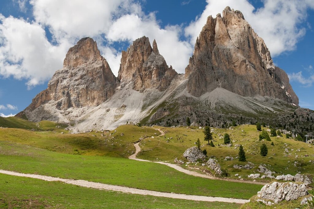
The landscape of the Langkofel is not just beautiful, but outstanding because of the high concentration of peaks found within its borders. I first saw the range from a spruce forest in the Contrin Valley, on the second day of a hike along the southern wall of Marmolada (read about the route in the guide for this group). I am still impressed by this first visit and I certainly want to go there again.
The group consists of two main parts and it looks, from above, like a horseshoe, similar to that of the Latemar Group. The arc of the horseshoe faces strictly to the southeast, while the middle section of the horseshoe faces northwest. But, also in contrast to the group of Latemar, inside the horseshoe we find another small peak, Langkofelkarspitz (2,820m / 9,252 ft), which is only 360 m (1,181 ft) lower than the highest peak.
Furthermore, Langkofel is located between three large valleys: Val di Fassa in the south, Val Duron in the southwest, and Val Gardena in the north. The first and the last are very famous because they are among the five Ladin valleys on a par with Badia, Livinallongo, and Ampezzo.
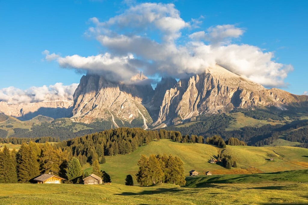
To the west of the group, there are even more extensive open areas called Seiser Alm (Alpe di Siusi in Italian, Mont Sëuc in Ladin). It is a plateau and the largest high-altitude alpine meadow in Europe of 52 sq. km (20 sq. mi) on an average elevation of 1,700 m (5,600 ft).
Finally, the Langkofel landscape is characterized by other mountain groups that surround it: the Geislergruppe in the northwest and the Puezgruppe in the northeast, the Sella group in the east, the Marmolada group in the south, Schlern and Rosengarten in the southwest.
There is also Puez Odle Nature Park and Schlern-Rosengarten Nature Park next to the group with richer flora and fauna, which are protected by the state.
According to the Italian SOIUSA classification of the Alps, the Langkofel group belongs to the Dolomites subdivision of the Gardena and Fassa section of the Dolomites. Then, according to the same classification, the group is divided into three subgroups:
Here are some brief notes about the highest peaks in each of the three subgroups:
Langkofel is the highest peak of the group and one of 52 mountains above 3,000 m (9,8442 ft) in the Dolomites, located in the north of the group. Most of the 25 peaks of the group are concentrated here. Individual faces of the peak reach a height of more than 1,000 m (3,280 m), and the width of the massif is more than 3000 m / 9,842 ft.
At the same time, the Langkofel is one of the largest single mountains in the Dolomites with a huge rock face, whose northern slope is among the 20 largest such slopes in the Alps. This north face is on par with the southern wall of Marmolada and the northwestern slope of the Civetta (3,330 m / 10,925 ft).
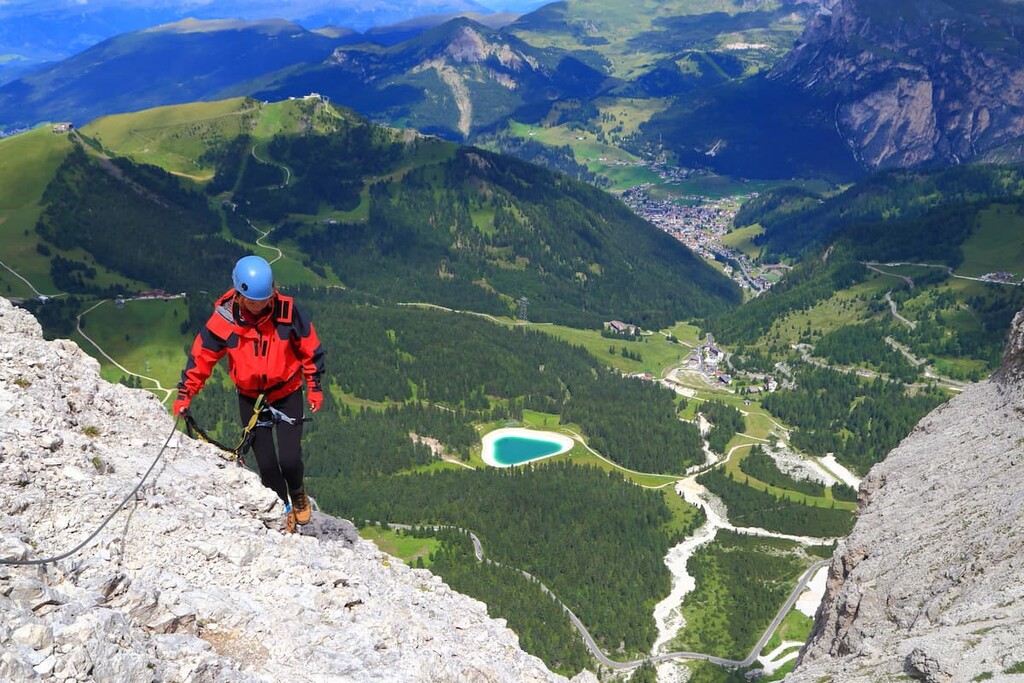
The first man to climb the Langkofel was the famous Austrian climber Paul Grohmann in 1869. Since then, a large number of climbing routes have been built up to this and other peaks. Most of them are quite difficult.
Plattkofel / Sassopiatto is the highest peak in the Plattkofel subgroup, located to the south of the Langkofel. It is also the only peak in the group to which a hiking trail leads. There is also a via ferrata on the high slopes of the peak. The rest of the Langkofel peaks are only accessible to climbers with special equipment and, more importantly, climbing experience.
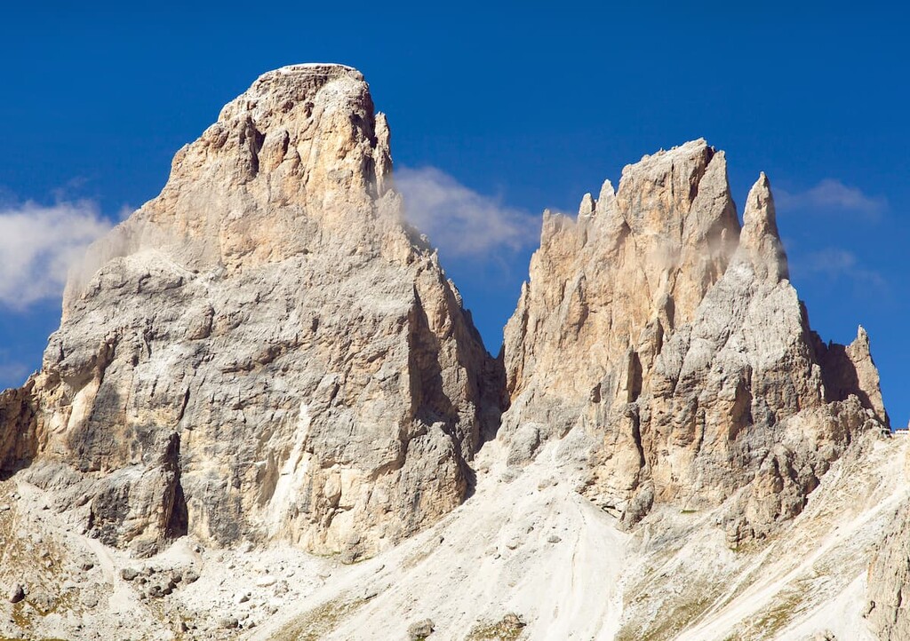
Grohmannspitze / Punta Grohmann is a peak named after Paul Grohmann. It is located right in the middle of the group and is connected by a ridge to the inner summit of the Langkofelkarspitz in the "courtyard" of Langkofel horseshoe. The ascent to the summit is considered very difficult (UIAA 4 for those who know rock climbing grades).
The highest peaks in the group after Langkofel are:
Langkofel is famous for its unusual cable car. It leads from the Sella Pass to the Forcella del Sassolungo right between Langkofel and the summit of Punta delle Cinque Dita / Fünffingerspitze (2,996 m (9,829 ft) in the Sasso Levante subgroup.
It is a 40 year old cable car with cabins that have a futuristic UFO-like design—they are vertical, white in color, with large windows. They look more like teleportation points. Although, in fact, they do, because they help you teleport hundreds of meters (feet) upwards, which, otherwise, you would have to walk.
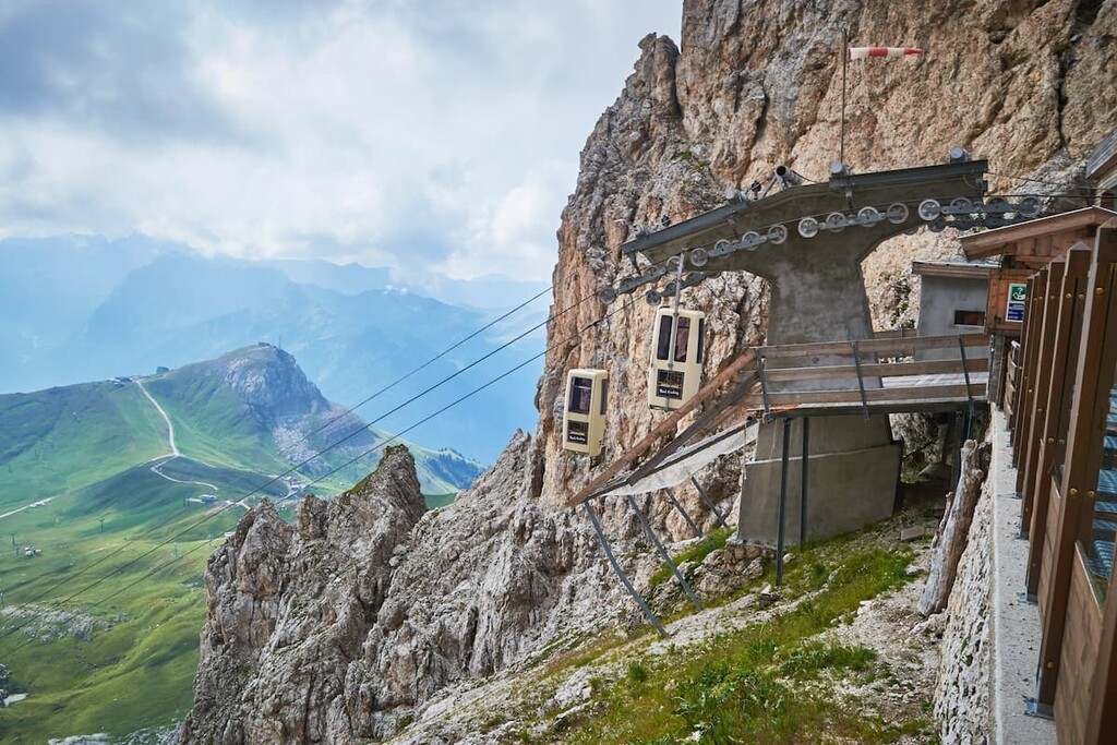
Only two people can fit in each cabin on the cable car and both passengers have to stand for the duration of the journey. Furthermore, the cabins don’t slow down at stations, which means you have to jump into and out of them as you go. According to some other travelers who have been here, it’s like trying to jump into a moving train car. I agree.
So, if the description of the cable car made you scared, or if you just don’t feel comfortable with this easy way to travel through the mountains of the group, choose one of the hiking routes below. There are plenty of them:
The Langkofel Ring Trail is the main trail around the whole Langkofel group (both Plattkofel and Langkofel), on which you will see all the sights, as well as neighboring groups, mountains and its peaks, all in one day. It begins and ends at the Sella Pass. You can, however, walk it in sections if you’re looking for a shorter hike.
This is a point-to-point trail from Sella Pass through Forcella del Sassolungo and both mountain shelters, which are located directly on the cliffs of Langkofel. You can spend the night in one of the nearby rifugios. Then, you have two choices: to hike around one of the two parts of the group the next day and return to the Sella Pass, or to descend into the Gardena Valley.
This is the route to the summit of the Plattkofel, and the only hiking trail that lets you reach one of the peaks of the whole Langkofel group because the other peaks are accessible only to climbers.
The trail is quite challenging because of the steep gradient of the slope. At the top, be prepared for some challenging footwork as the ridge is pyramid-shaped. But the views overpower the suffering of the difficult hiking.
This is a bigger loop trail in Langkofel—you won’t have to climb any high peaks but will need to cover more distance than the classic Langkofel loop option. The Four Valleys Loop option is suitable for those who want to stay longer and visit more mountain huts where you can stay overnight.
On this trail, you will go through all four valleys around the Langkofel group, including Piza di Uridl / Hochegge (2,100 m / 6,889 ft), Palacia / Palatsch (2,351 m / 7,713 ft) and Col Rodella (2,484 m / 8,149 ft) peaks on the way, and the Canazei town in Fassa.
The Grand Italian Trail is a trek along the edge of the entire Langkofel group on the side of Seiser Alm (Alpe di Siusi). It is part of a larger trail called the Grand Italian Trail, which has an incredible total length of 6,166 km (3,831 miles) that crosses the entire country from Trieste to Sicily.
However, the route does not end there in Sicily as it actually crosses over to the island of Sardinia. For example, Outside Online magazine calls it the "Appalachian Trail of Italy," which speaks to its popularity. The trail has been gaining popularity in recent years, thanks to a rebranding by the Italian Alpine Association. The trail is quite old and has been loved by hikers for years.
This is the via ferrata to the summit of Plattkofel. It is also the only via ferrata in the group. On it, you can combine hiking around this entire subgroup with uncomplicated climbing that’s accessible to nearly anyone. But you’ll need some courage and a set of helmet and carabiners to attach yourself to metal ropes and ladders in the rocks along the way.
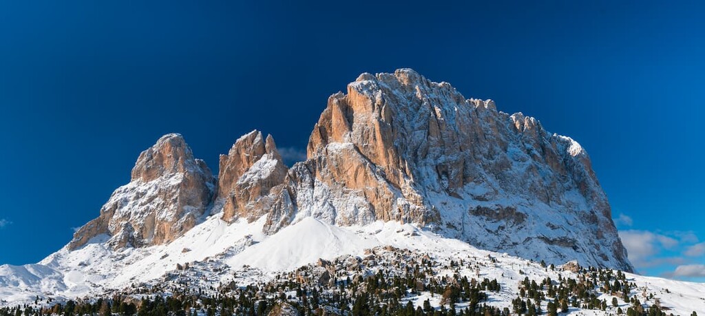
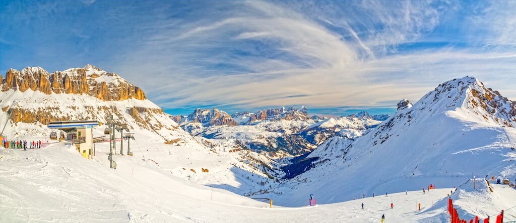
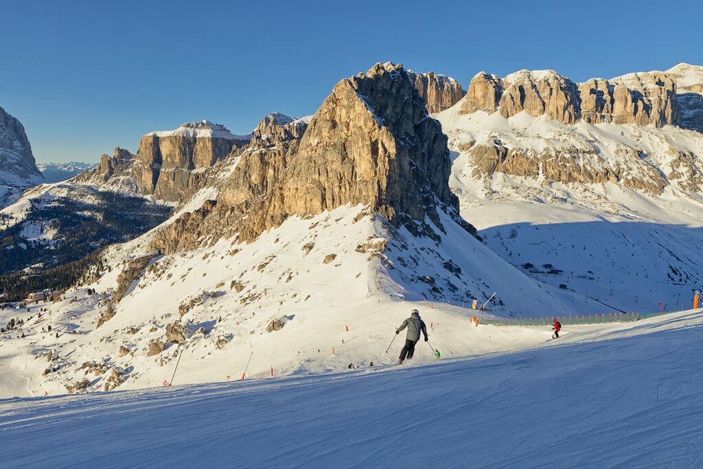
Langkofel is ideal not only for summer activities but also for winter sports, including all types of skiing as well as snowboarding.
All these resorts are part of a common Dolomiti Superski system with a single ski pass for 12 ski areas or 1,200 km of slopes in total.
Check the Langkofel ski map on the larger Trentino-Alto Adige/Südtirol and Italy ski maps in the World Mountain Lifts section of the site. It includes information about open ski lifts / slopes in the Langkofel Group of the Dolomites in real-time with opening dates and hours. There are also year-round cable cars, funiculars, cog railways, aerial tramways, and all other types of mountain lifts.
You can get more information about the Langkofel group at one of the official tourist offices, which are located in both of the range’s major valleys:
Tourist Information Office in Canazei in Val di Fassa
Piaz G. Marconi, 5, 38032, Canazei, Trentino, Italy
General opening times:
+390462609600
Tourist Office Selva Val Gardena in Val Gardena
Str. Mëisules 213, 39048, Selva Val Gardena, South Tyrol, Italy
General opening times:
+390471777900
It is amazing that in the Langkofel group, which is relatively small compared to some other groups in the Dolomites, you can find more than 10 mountain huts. In these huts, you can rent a place in a dormitory room for 4–12 people, and you can get both breakfast and dinner. These three huts are considered the main ones:
The rest of rifugios, from counterclockwise starting from the center of the Langkofel horseshoe, include:
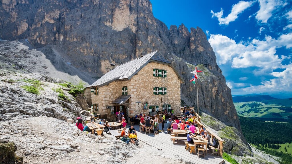
For those who love to have adventures in the mountains, there is one bivouac in the Langkofel — Giuliani al Sassolungo (3,100 m / 10,170 ft, 5 beds). This is a free alpine hut where anyone can sleep overnight, and whenever they want—it is always open.
There are also several campgrounds, hotels, and other types of lodging in the vicinity of Langkofel—again, in my experience, there are many times more here than in some other groups in the Dolomites.
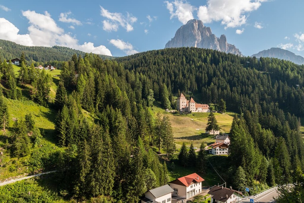
There are a couple of major settlements near Langkofel where you can start and finish your mountain hiking or any other outdoor activity whether it be biking, rock climbing, or trail-running in the summer and skiing in the winter. Each of the towns, which are actually small villages, are comfortable destinations for both living and recreation.
I will briefly tell you about two villages in both valleys:
Santa Cristina is one of the two main towns in the Gardena Valley on a par with Selva di Val Gardena in the province of Bolzano / South Tyrol. It is located about 30 km (19 mi) away from the provincial capital Bolzano at an elevation of 1,428 m (4,685 ft).
The town has a population of 1,900 people (2010), most of whom primarily speak the Ladin language. The area of the city is 31.8 sq km (12.3 sq mi) in size.
The three main cultural and architectural attractions of the town are the Chiesa di Santa Cristina e Sant’Antonio Abate (1343), Castel Gardena / Fischburg (17th century), Villa Anri (20th century). But there are some other sites to check out, too, for those who spend more time here.
Official tourist site: Valgardena.it.
Campitello is one of the several main settlements in the Fassa Valley alongside Canazei and others in the province of Trentino. It is located 102 km (mi) away from the provincial capital Trento at an elevation of 1,448 m (4,750 ft).
The town has a population of 702 people (2020), most of whom also primarily speak the Ladin language. The area of the city is 25,02 sq km (9.6 sq mi) in size.
The three main cultural and architectural attractions of the town are the Chiesa dei Santi Filippo e Giacomo (1245, rebuilt in 1525), the Monument of Soldiers of the WWI (Monumento ai Caduti), the Town Hall building (Casa del Comune). There are also more attractions you can visit in the community, but you will need 2 to 3 days to see everything.
Official tourist site: Fassa.com.