
Scan the QR code and open PeakVisor on your phone
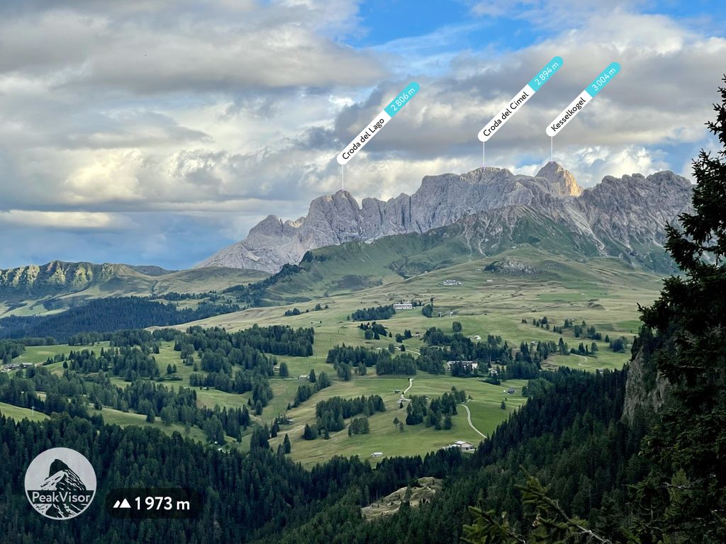
The Rosengarten group include 67 named peaks. The highest is Kesselkogel at 3,004 m. Other notable peaks include Rosengartenspitze, Seekogel - Croda del Cimel and Cima Scalieret.
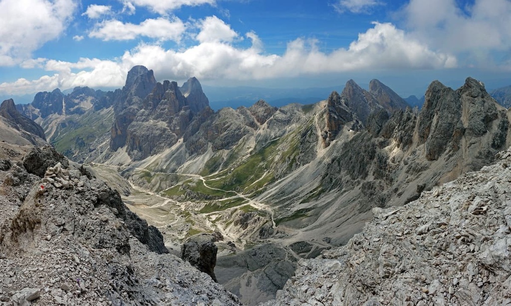
The Rosengarten Group, which is also known as Catinaccio in Italian, is one of more than 20 subranges in the Dolomites of northern Italy. The group features the Torri del Vajolet, a distinctive series of peaks. It is also a large subrange that is one of the main natural attractions of Bolzano, the capital of South Tyrol. There are 67 named mountains in the group, the highest and most prominent of which is Kesselkogel / Catinaccio d’Antermoia (3,004 m / 9,855 ft).
Like many other mountain groups and other places in the Dolomites, especially in the Trentino-Alto Adige / South Tyrol region, the Rosengarten Group goes by two names: Rosengarten and Catinaccio.
Rosengarten is short for Rosengartengruppe, the name of the group in German. Catinaccio or Gruppo del Catinaccio is an Italian phrase that comes from Ladin, the traditional language of the Ladins, which are the main ethnic group of the Dolomites. Catinaccio is believed to derive from either Ciadenac or Ciadenáze in Ladin.
The name Rosengarten means ‘Garden of Roses,’ and it refers to the color that dolomite makes at certain times of the day. Dolomite, which is found throughout the region, has a peculiar ability to produce an array of warm colors—particularly pink—around sunset.
This effect is also known as alpenglow or enrosadira in Ladin. Rosengarten / Catinaccio is not the only subrange that has this feature, but this is probably where it shows up the most vividly—hence the name.
Many centuries ago, the people of South Tyrol attempted to explain this phenomenon through the now-famous South Tyrolean saga of King Laurin.
It was said that King Laurin’s main source of pride, which he protected in every way possible, was the enormous rose garden at the entrance to his underground palace, which was made of sparkling crystal. This rose garden is also where we get the name Rosengarten for the mountain range.
The range’s name in Italian, Catinaccio, which derives from either Ciadenac or Ciadenáze in Ladin, is believed to have also originated as a reference to the range’s characteristic alpenglow.
The Rosengarten Group is located in the West Dolomites in northern Italy in the western part of the Dolomites. It is also one of a dozen subranges located in this part of the Dolomites, which themselves are a subsection of the Alps.
To the north, the Rosengarten Group borders the Schlern / Sciliar Group. Together, they form a single group of peaks that is part of a nature park of the same name: Parco Naturale Sciliar-Catinaccio in Italian or Naturpark Schlern-Rosengarten in German
This nature park encompasses the entire Schlern Group and the northwestern part of the Rosengarten Group. The park was founded in 1974, making it the oldest nature park in South Tyrol. It is also one of the 10 nature parks located in the Dolomites.
To the northeast of the Rosengarten / Catinaccio, there is the Langkofel / Sassolungo Group, and to the east, there is the Marmolada Group.
The western boundary of the range is dominated by the huge Eisacktal / Valle Isarco, which was formed by the river of the same name and is a bit smaller than the Eggental / Val d'Ega. On the other side of the valley, you can find the Sarntal Alps in the Eastern Rhaetian Alps.
To the south, there is the Latemar Group of the Dolomites and the Fiemme Mountains, which, according to some Alpine classification systems, are considered separate groups in the Alps. According to other classification systems, the Fiemme Mountains also belong to the Dolomites geographically, although, geologically, they consist primarily of granite and porphyry.
But the two valleys mentioned above are not the only ones that surround the Rosengarten.
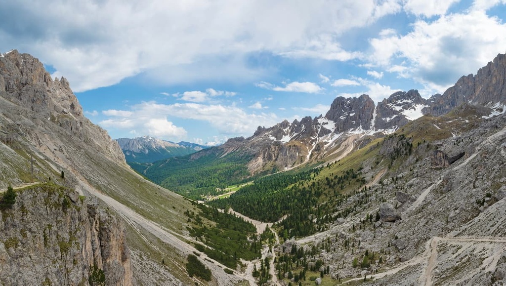
There are also the Tierser Alpl or Tierser Tal / Alpe di Tires and Tschamintal / Valle Ciamin to the north, which separate the group from the Schlern / Sciliar, and both the Durontal / Val Duron and Fassatal / Val di Fassa to the east between the group and Marmolada.
Fassatal / Val di Fassa is actually one of the five Ladin valleys of the Dolomites. There are also several valleys within the massif itself, including Vael, Val di Vajolet, Val di Udai and Val di Dona.
Finally, in terms of administrative geography, this Rosengarten Group is located between the Trentino and South Tyrol provinces of the Trentino-Alto Adige / South Tyrol region. It includes large municipalities like Tiers / Tires, Welschnofen / Nova Levante, Karersee / Carezza, and Moena, as well as a whole series of Fassa towns, such as Soraga di Fassa, Vigo di Fassa, Pozza di Fassa, and Campitello di Fassa.
The easiest and fastest way to get to Rosengarten / Catinaccio is from the west via Bolzano or through the Fiemme Valley from the east. In both cases, the nearest major cities are Trento and Verona in the south.
It takes much longer to get to the range from Venice as you have to go through Marmolada. However, if you have half a day, driving from Venice through Marmolada to the Rosengarten Group is a great idea because, that way, you will see a considerable part of the Dolomites.
Geologically, the Gruppo del Catinaccio, like many other subranges in the region, is composed of dolomite, which is a type of limestone.
The Rosengarten Group’s geology is considered to be very important for the study of the dolomites during the Triassic period because it features easily accessible outcrops that clearly show the connection between carbonaceous sediments and volcanic activity in the region. This area has also been subject to weak tectonic movements, so the geometric relationships between the sediments are particularly well preserved and can be easily seen.
For this reason, alongside the Schlern / Sciliar and Latemar groups, the Rosengarten Group is one of the nine major mountain groups in the Dolomites according to UNESCO. In fact, this part of the region is included in the Dolomites UNESCO World Heritage Site.
The landscape of the Rosengarten Group is characterized by a few key features.
First, this group is much larger in size than the neighboring Schlern / Sciliar and Latemar groups, with which it forms a single geological system.
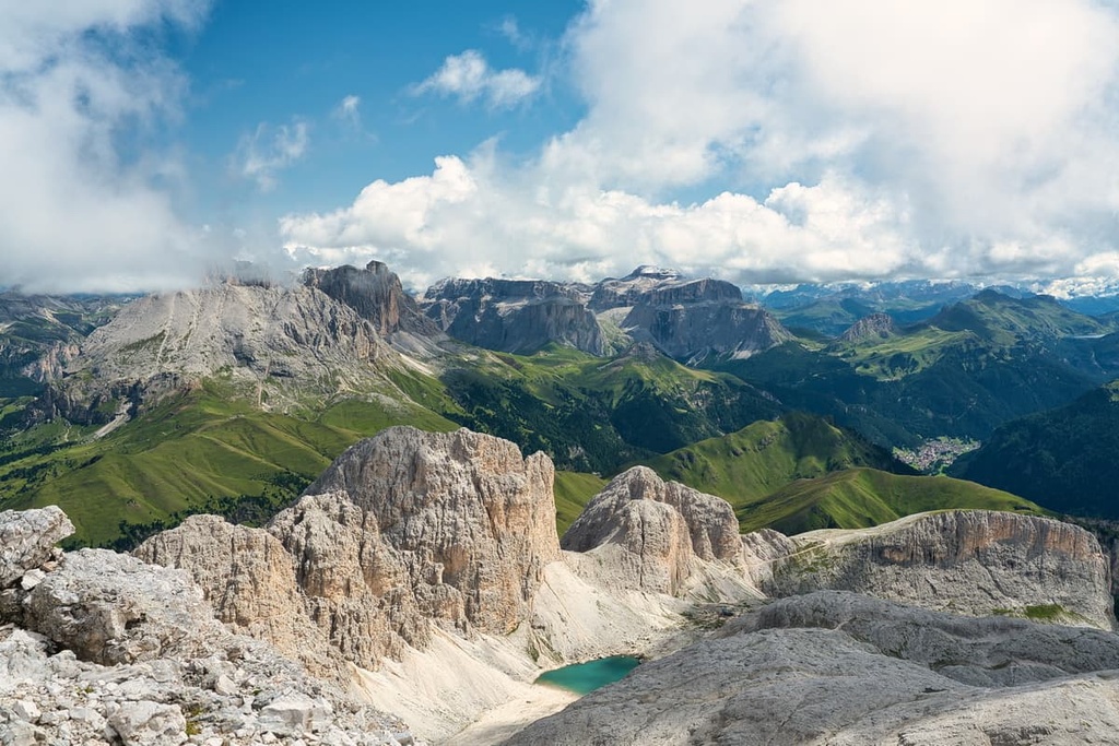
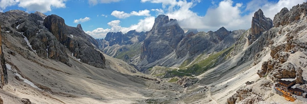
Second, the group consists of five main parts: the main massif in the northeast; the arc-shaped ridge in the south; the huge inner valley between them, the Val di Vajolet, which extends into the group from the Fassa valley in the east; and a long mountain plateau that goes from the main massif to the west.
Third, the group contains a large number of scenic hikable passes, the top 10 of which are all higher than 2,500 m (8,202 ft) in elevation, including:
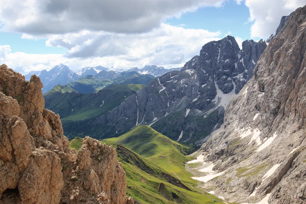
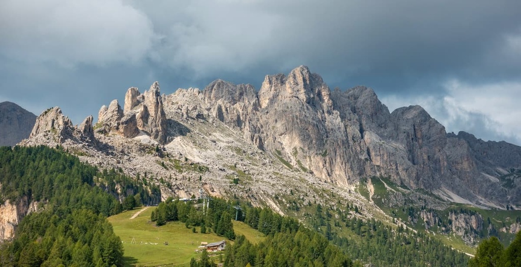
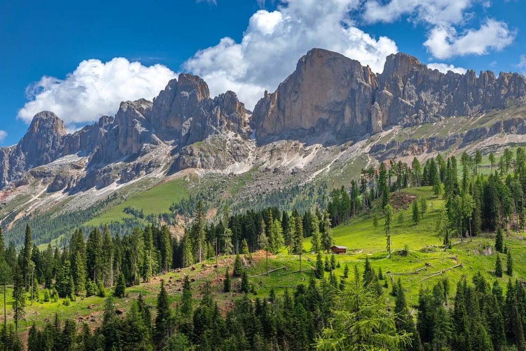
Fourth, and again in contrast to the neighboring Schlern / Sciliar Group, which is an almost perfectly flat plateau, the Rosengarten Group contains a huge number of high peaks of different shapes and sizes. The most famous of these peaks is the Vajolet Towers.
The Rosengarten Group is one of more than 20 mountain groups in the Eastern Alps according to the classification system of the German-Austrian Alpine Club. In this system, the Dolomites, which contain the Rosengarten Group, are listed as being part of the Southern Limestone Alps.
In the second most common classification of the Alps, the Italian SOIUSA, the Rosengarten Group is also considered to be its own subrange called Gruppo del Catinaccio in Italian.
Within the SIOUSA system, the Rosengarten is part of the Dolomiti di Fassa supergroup of the Dolomiti di Gardena e di Fassa subsection. This subsection is, in turn, part of the Alpi Sud-orientali (the Southeastern Alps) within the Eastern Alps. The Dolomiti di Fassa also includes the Schlern / Sciliar Group, Marmolada and Cima di Bocche.
According to the SIOUSA classification system, the Catinaccio Group is divided into the following subgroups. (Note that, for clarity’s sake, these groups' names are written in Italian. The term sottogruppo can be translated as ‘subgroup’ and cresta, catena and dorsale are different types of ridges.)
But, of course, the Rosengarten is best known for its incredible peaks. The most important of these peaks is the Torri del Vajolet. Other notable peaks include:
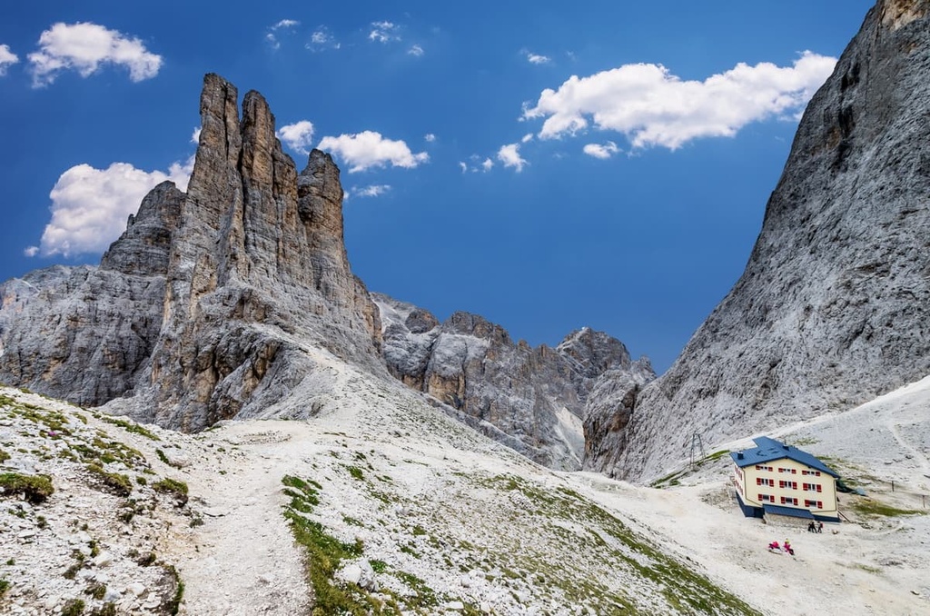
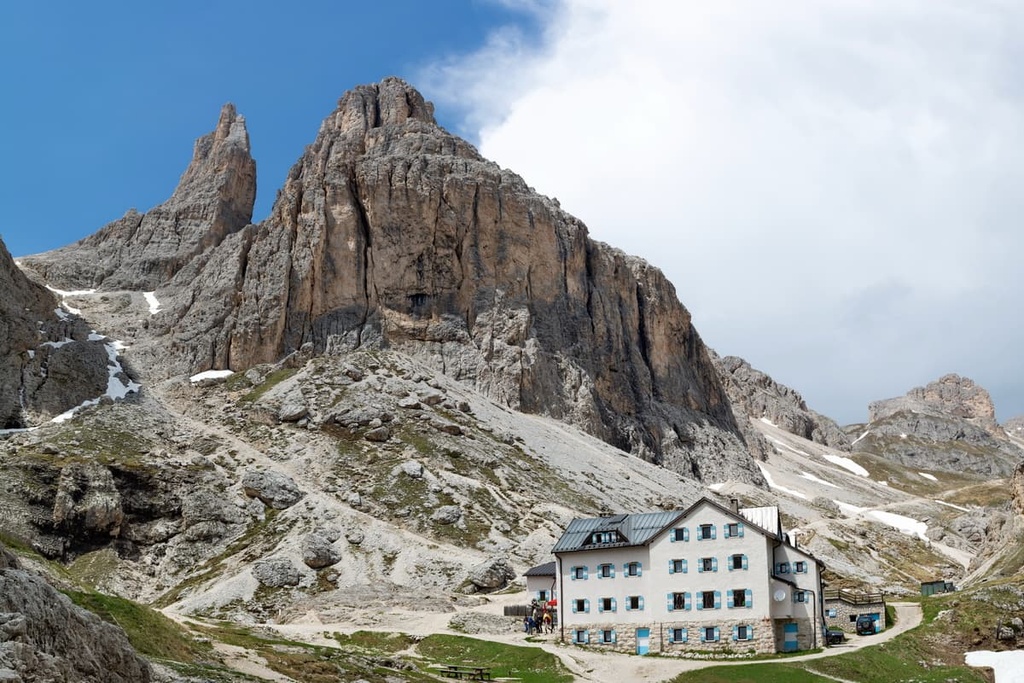
The Vajolet Towers (Torri del Vajolet in Italian, Vajolettürme in German) is a relatively small massif with a series of six or seven peaks (depending on who you ask).
In many respects, the massif looks like a huge open palm with jagged, rocky towers for fingers. Because of its unusual shape, as well as its location in the middle of the subrange, the Vajolet Towers are very popular among tourists.
The peaks in the massif are:
At the base of Delagoturm / Torre Delago, there is also a “small” peak called Torre Piaz (2,670 m / 8,759 ft), which is sometimes referred to as the seventh in the series.
Of course, all seven peaks are very popular among climbers because of their steep vertical walls. The first climbs were made on the peaks between 1882 and 1899. The final first ascent in the massif, on Torre Piaz, was completed from the north in 2002.
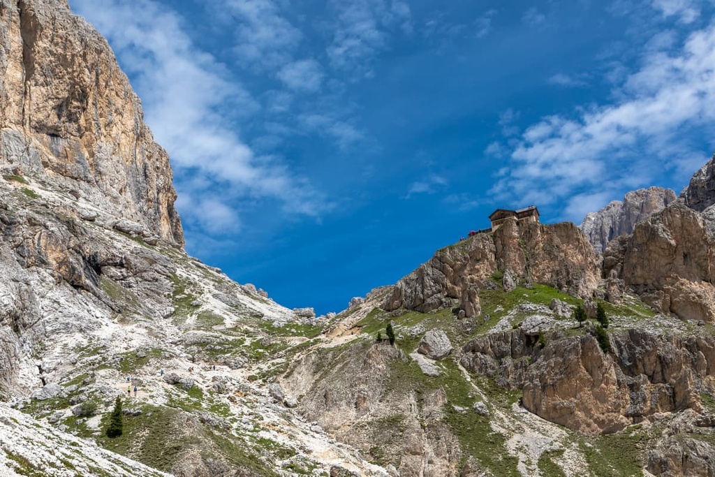
At the foot of the massif, there is also the famous rifugio Re Alberto / Gartlhütte, an integral part of the landscape of the valley. You can stay the night at the rifugio after a long hike and then spend the evening appreciating the incredible view of these amazing peaks at sunset.
The Rosengarten Group has four main hiking areas. In each hiking area, you can find a large number of easy and challenging trails. These hiking areas include:
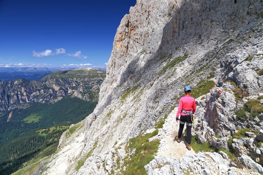
The most famous trail in the group is located in the Vajolet Valley in the heart of the Rosengarten. It offers a magnificent view of the Vajolet Towers, and it features the via ferrata Santner / Santner Klettersteig on the western ridge of the towers near the Santnerpasshütte (rifugio Passo Santner).
This via ferrata is named after the famous Tyrolean climber Johann Santner, who is also considered the father of Tyrolean mountaineering. He was the first person to climb Punta Santner / Santnerspitze (2,414 m / 7,919 ft), which is also named after him. Punta Santer is a relatively small but famous peak in the Schlern Group.
Keep in mind that this hike is considered to be difficult. It is 7.5 km (4.6 mi) long and it involves 1,018 m (3,339 ft) of elevation gain, so most people finish the hike in about 5 hours. The highest point on the route is at 2,750 m (9,022 ft) in elevation.
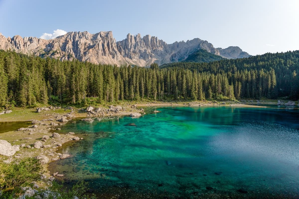
For those of us who want to walk the length of the entire Rosengarten Group, there is an excellent three-day long trek that takes you from Lake Carezza to the Sella Pass.
This hike requires some sections of via ferrata. You can complete it in the following stages:
You can start this route from either end, but it is better to follow the standard route from Carezza. That way, you will be climbing up the via ferrata rather than going down. In my experience, this is almost always easier and less intimidating.
There is also a way to avoid the via ferrata by going via Tschagerjoch / Passo delle Coronelle, rifugio Paul Preuss, and rifugio Vajolet instead of via the section between Santner Klettersteig and Santnerpasshütte.
If you’re looking for a relatively short and casual outing, one great option is the King Laurin Cableway, which opened in June 2021. The 1,807-meter (5,928 ft) long cableway from the Frommer Alm meadow near the Carezza Lake enables passengers to ascend 560 m (1,837 ft) of elevation in 6.5 minutes.
It brings you to the rifugio Fronza Alle Coronelle / Kölnerhütte at 2,337 m (7,667 ft) in elevation on the west side of the group. From here, you can venture out on a hike or simply sit back to enjoy the view.
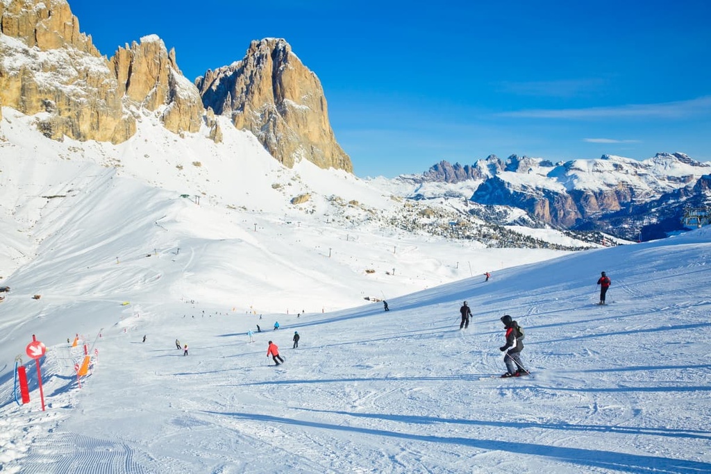
Val di Fassa and Carezza are the two main ski areas in the Rosengarten Group.
Val di Fassa has 210 km (130.4 mi) of slopes and 80 ski lifts while Carezza has 40 km (24.8 mi) of slopes and 13 ski lifts These two resorts are also part of the Dolomiti Superski system, so they are connected to other 10 resorts in the system by skiable pistes and bus lines.
You can find out more about what open slopes are open in the region in real-time on the World Mountain Lifts section of the PeakVisor website.
Head to the pages for Val di Fassa and Carezza for specific information on those two resorts or check out the pages for Trentino-Alto Adige / Südtirol and the rest of Italy to explore other ski areas in the region.
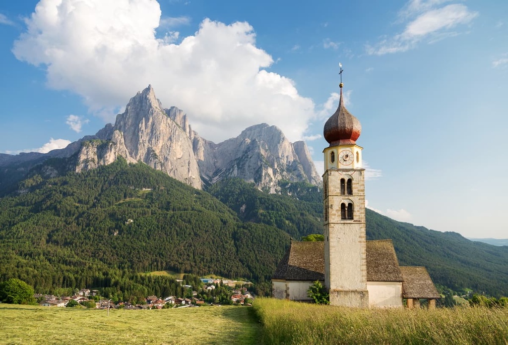
While hiking in the Catinaccio Group and Schlern-Rosengarten Nature Park, be sure to visit one of the region’s official tourist centers. They are primarily located in the big cities in the valleys surrounding the range. At these tourist offices, you can find out more information about the area, pick up a map and brochures, and get ideas for your adventures.
South Tyrol Information
Südtiroler Straße / Via Alto Adige, 60, 39100, Bolzano, BZ, Italy
+390471999 999
Tourist Info in Carezza in Val d'Ega
Via Carezza, 165, 39056, Carezza, BZ, Italy
+390471619530
Val di Fassa Tourist Information Office
Piazza de Comun, 2, 38036, Pozza di Fassa, TN, Italy
+390462609670
You can also visit Schlern-Rosengarten Nature Park’s visitor center, which is located to the north of the Schern Group. It has an incredibly beautiful exhibit that showcases the geology, ecology, and human history of the region.
Schlern-Rosengarten Nature Park Visitor Center
O. v. Wolkenstein Square, 6, 39040, Seis am Schlern, BZ, Italy
+390471708110
Nature-parks.provinz.bz.it/schlern-rosengarten
General opening times:
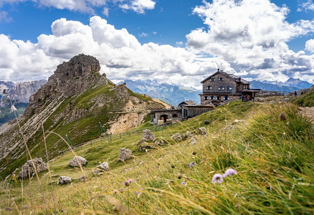
Thanks to the large size of the Gruppo del Catinaccio and its varied landscape, there are 17 mountain huts in the range. This is a lot of huts, especially when you compare the Rosengarten Group to other larger and even more popular subranges, many of which have fewer huts for visitors to choose from.
The highest elevation hut in the range is rifugio Re Alberto / Gartlhütte at 2,621 m (8,599 ft) in elevation. Meanwhile, the lowest elevation hut in the range is rifugio Duca di Pistoia (1,774 m / 5,820 ft). The rest are located at an elevation of about 2,000 m (3,280 ft).
Here is a list of the other 15 huts in the Rosengarten Group:
In addition to the many huts in the group, there are a number of other alternative accommodation options to choose from. For example, in the town of Pozza di Fassa, there is a large campground called Camping Park Catinaccio Rosengarten. It is suitable for families and for longer stays in the mountains.
One of the main towns on the borders of the Rosengarten Group is Tiers / Tires, which is located to the west of the range and is the capital of its namesake valley, the Tierser Tal / Val di Tires. If you’re traveling from Bolzano and the Eisacktal Valley, you’ll travel past Tiers / Tires on your way to the range.
Tiers / Tires is a small village located at an elevation of 1,028 m (3,373 ft). It has a population of around 1,000 people.
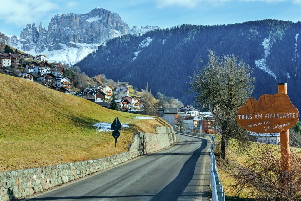
The name of the place derives from the Latin terra (‘land’). It is also known as Tires am Rosengarten or Tires al Catinaccio. Despite its small size, the town includes a number of smaller settlements (frazioni in Italian), such as Gemeier, Kantun, Lavina Bianca / Weißlahnbad, San Cipriano / St. Zyprian, Bria / Breien, and Villa di Mezzo / Mittelstrich.
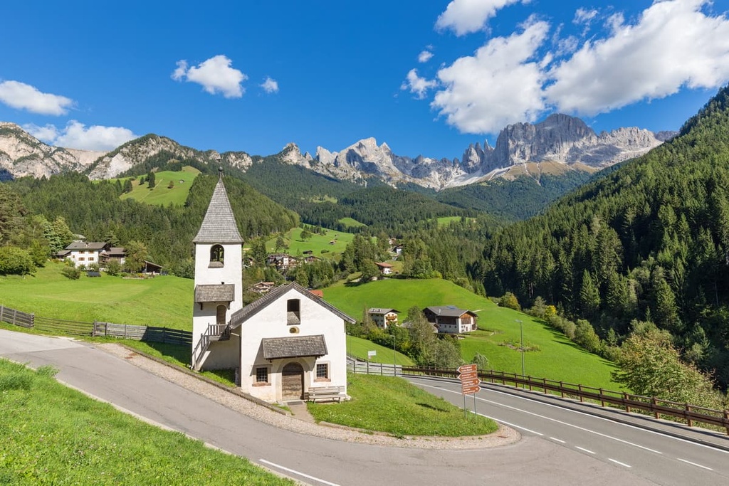
The main architectural and cultural attractions in Tiers / Tires are the town’s two churches:
The town of Tires is also a major part of the Dolomites region’s push toward encouraging more sustainable tourism. As a result, it is part of the Consortium of the Pearls of the Alps.


The highest peak in the Rosengarten group is Kesselkogel, at 3,004 m.
The Rosengarten group have 67 named peaks.


