
Scan the QR code and open PeakVisor on your phone
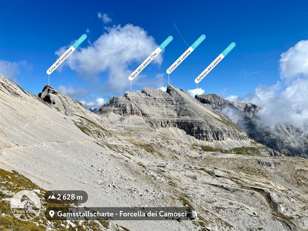
The Latemar include 31 named peaks. The highest is Cimon del Latemar at 2,842 m. Other notable peaks include Eggentaler Horn - Corno d'Ega, Schénon del Latemar and Torre del Latemar Ovest - Westlicher Latemarturm.
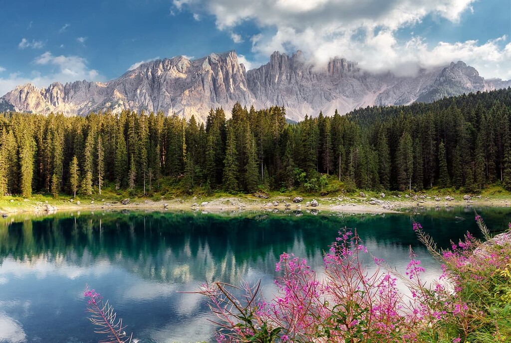
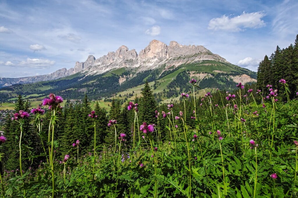
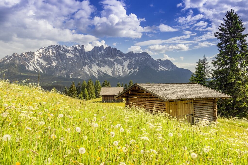
Latemar is a relatively small but well-known mountain group in the Dolomites in northern Italy. The main feature of the group is the view of its peaks from the shores of the beautiful Carezza Lake, which is surrounded by dense spruce forests. There are 31 named mountains in Latemar. The highest and most prominent peak is Cimon del Latemar (2,842 m / 9,324 ft) with 1,090 m (3,576 ft) of prominence.
The name of the Latemar group is a shortened version of the Ladin word “Lactemara.” The Ladin language is the native language of the people of the five valleys in the center of the Dolomites, where Latemar is also located. The word first appears in the twelfth century and it roughly translates to "mountain range above the lake in the cirque."
Later, this word was also the name of an Alpine farm (Latmarer or Latmarerhof), which used to be located nearby. This word was first mentioned in local Tyrolean written sources in 1723. By popular tradition in the Alps, farms are named simply after the names of their owners. As a result, we can presume that this farm was owned by a Tyrolean or Ladino family.
The Latemar mountain group is located in northern Italy between the provinces of Trentino and Bolzano / South Tyrol, which together form an autonomous region within Italy called Trentino–Alto Adige / South Tyrol.
The Latemar mountain group is not the only mountain group lucky enough to be on the border of these regions. Other groups in the area include the Tre Cime di Lavaredo between South Tyrol and the province of Belluno, which is part of the Veneto region. There is also the Marmolada mountain group that’s located between the same provinces as the Latemar group. Additionally, the nearby Adamello-Presanella Alps are located between Trentino and Lombardy.
The Latemar mountains are surrounded by other groups, including:
If you plan to stay in the region for a while, it’s worth making a side trip to Lagorai in the Fiemme Mountains, which is beautiful but not as heavily visited as other nearby ranges. You can then compare your experience in the relatively quiet Lagorai to your experiences in Latemar, where hundreds of thousands of tourists flock to each year.
The easiest and fastest way to get to Latemar is from the towns of Predazzo or Moena, both of which are located on the eastern borders of the group.
From Trento, the capital of the Trentino region, to Predazzo, it is a 78 km (48.4 mi) journey or about an hour by car. From Bolzano, the capital of South Tyrol, to Moena, the distance is 45 km (27.9 mi), which is also an hour’s drive. The fastest way to get to Trento is from Verona in the south. Meanwhile, the fastest way to get to Bolzano is from Innsbruck, Austria, in the north.
If you do not have a car or if you don’t plan to rent one, bookmark the websites of the two largest local bus companies: Trentinotrasporti.it and Südtirolmobil.info. Both of these websites offer great information about local transportation options for visitors that don’t have a personal vehicle.
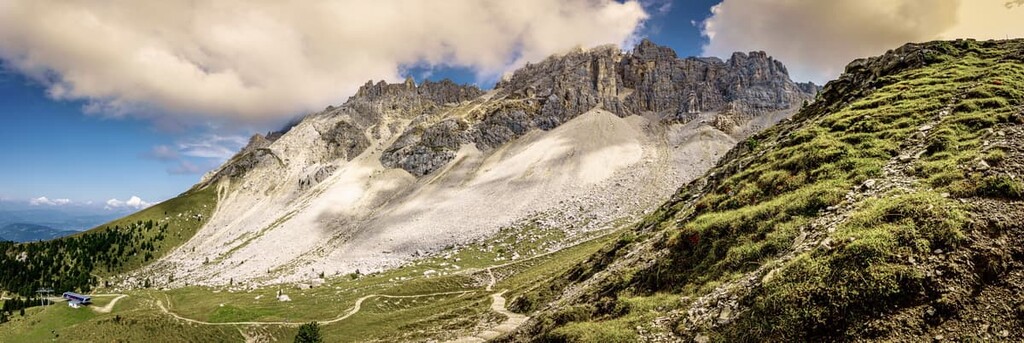
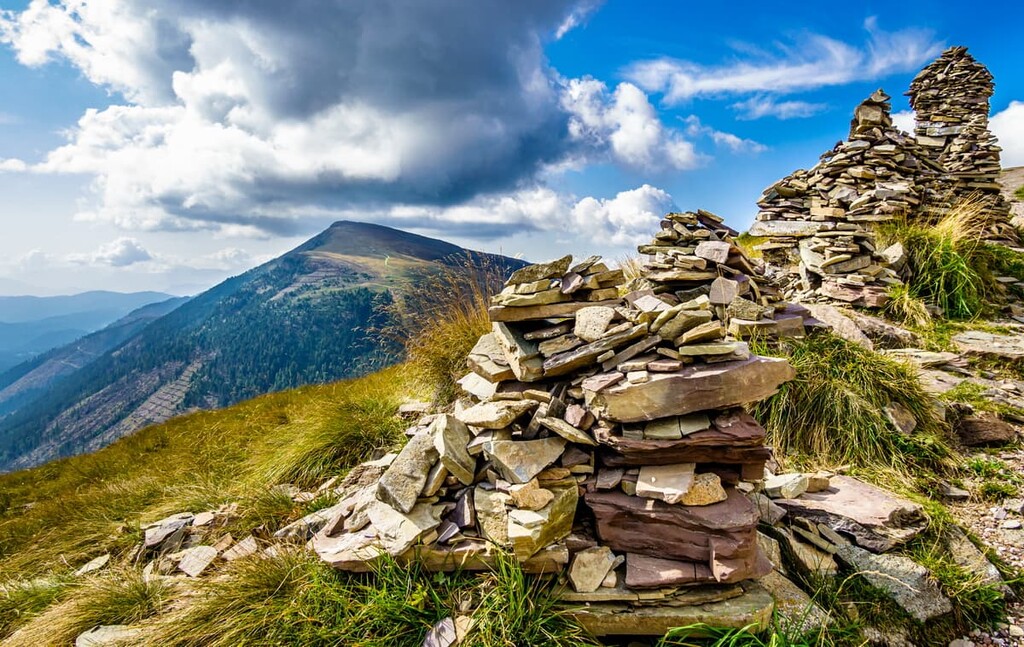
The cliffs of the Latemar Group consist of dolomites and limestones, both of which feature stunning arrays of colors at sunset and sunrise. However, in my opinion, these peaks are best known for the gray color they become at night. This is why they are also called the "Pale Mountains,” or “Monti Pallidi” in Italian.
The dolomite in the Latemar Group began to form about 230 to 250 million years ago during the Triassic period. Interestingly, the rocks in the Latemar are related in geological composition to the region's tallest mountain, Marmolada (3,342 m / 10,965 ft), in that they have less dolomite than the other groups.
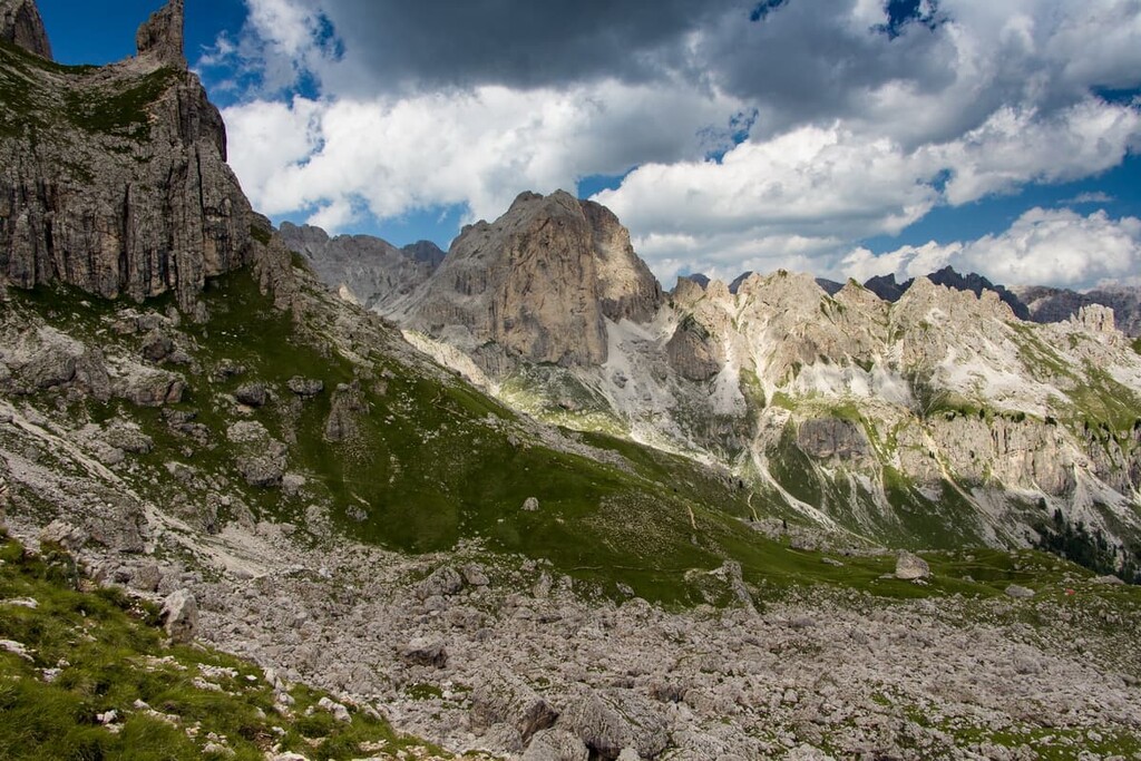
Therefore, these mountains are more fragile than others in the region, as evidenced by the extensive rock fall area that accumulates beneath the Latemar. For the same reason, the group is not considered good for climbing, as the range’s fragile rocks aren’t solid enough to support quality climbing routes.
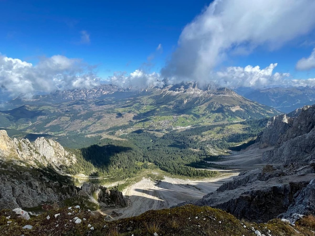
The Latemar Group is located to the southeast of the two neighboring large mountain plateaus: Nova Ponente (Deutschnofen) and Nova Levante (Welschnofen). It is covered with meadows and forests, and, as a result, the peaks in the range stand in great contrast to the surrounding landscape.
If you look at it from the top, the group forms a large horseshoe shape. Both ends of the horseshoe are located to the southeast of the range near Moena while the curved ridge of the mountain group is situated to the northwest.
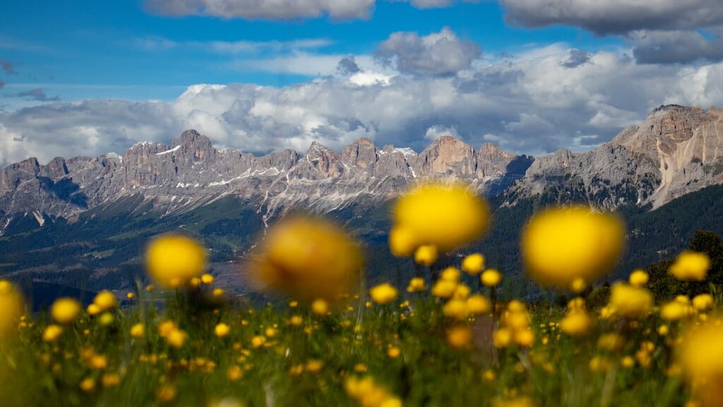
The neighboring Schlern group and Rosengarten group are also part of the Latemar landscape and they are visible from most of the routes in Latemar. These groups are separated from Latemar by Costalunga Pass (Passo di Costalunga / Karerpass), which is 1,745 m (5,725 ft) high.
Other significant passes in Latemar include Pampeago Pass (1,983 m / 6,506 ft) and Feudo Pass (2,221 m / 6,958 ft), which separate the group from Mount Agnello.
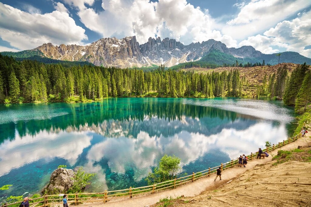
However, the main feature of Latemar's landscape is certainly not its passes, but rather Carezza Lake (Italian: Lago di Carezza, German: Karersee), which is located at an elevation of 1,519 m (4,984 ft). It is a small alpine lake, even though it looks huge in many photos.
Some quick facts about Carezza Lake: It is fed by underground streams from the Latemar and the lake is300 m (984 ft) long and 140 m (459 ft) wide. The depth of the lake varies from 6 to 17 m (19.6 to 56 ft) depending on the season. That’s because there’s generally more water in the lake during the winter and spring, and less during the summer and autumn.
The lake is also a popular topic in a number of Ladin legends, including one called The Colour Splendor of the Carezza Lake. This legend tells of the unsuccessful attempts of a sorcerer who lived in the forest at the foot of Latemar to kidnap a nymph named Ondina from the lake. The name of the legend refers to the multicolored rainbow that the sorcerer tried to use to attract the nymph's attention.
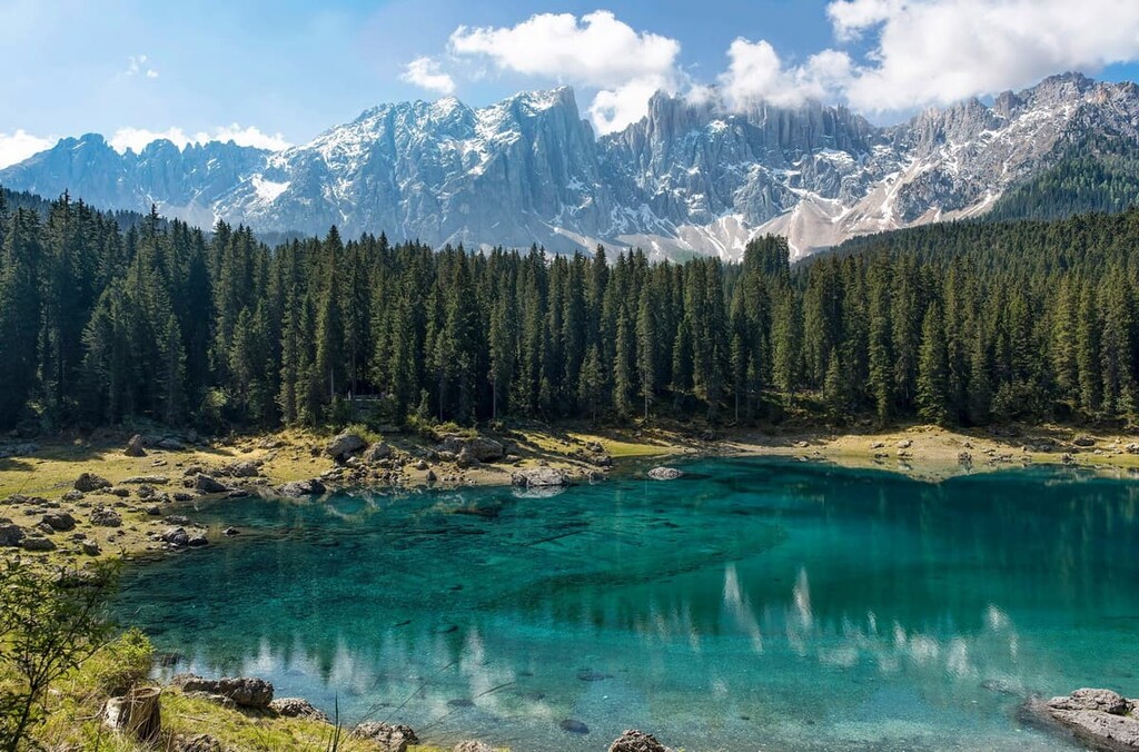
The lake, where the nymph used to live, is still surrounded by sprawling coniferous forests. Unfortunately, many of the trees in the forest were destroyed during Storm Adrian, also known as Vaia, which hit the Dolomites, northern Italy, and the Mediterranean on October 30, 2018. Winds during this storm reached 120 km/h (74.5 mph).
This storm forever changed the landscape of many places in the Dolomites. Also, in Dolomiti Bellunesi National Park, there are still trees lying around on individual trails: It will take decades to remove them and rebuild the infrastructure that was destroyed during the storm.
Finally, a few mountain valleys surround Latemar on all sides, including Val d'Ega in the northwest, Val di Vassa in the northeast (one of the five Ladin Valleys), Val Sorda in the southwest, and the huge Val di Fiemme to the southeast.
Latemar is a part of the Dolomites according to the commonly used Austrian-German Alpine Club classification system of the Eastern Alps. Here, the group is located at its westernmost tip of the Dolomites on the border with the Fiemme Mountains.
According to another common classification system, the Italian SOIUSA, Latemar is a part of the Dolomiti di Fiemme Range, which has slightly different borders than the range outlined by the Austrian-German Alpine Club classification system.
Additionally, alongside the Schlern group and Rosengarten group, Latemar makes up one of the nine large mountain systems of the Dolomites. This mountain system is called Sciliar-Catinaccio, Latemar and it has a total area of 93 sq. km (35.9 sq mi). It is the fourth-largest system in the Dolomites.
Further, the Latemar Group itself is divided into two subgroups: the Cresta del Latemar in the north and the Propaggini Meridionali del Latemar in the south. However, the bulk of the peaks in the Latemar Group are located in Propaggini Meriodonali de Latemar.
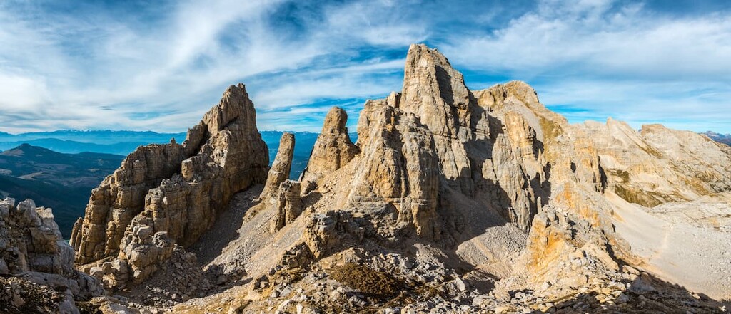
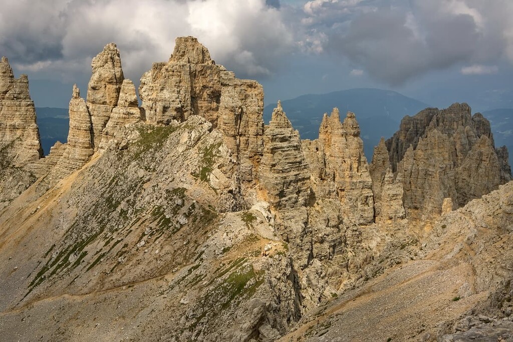
Nevertheless, the Cresta del Latemar subgroup contains all the highest peaks of the Latemar group, including the Torri del Latemar (Latemartürme/Towers of Latemar). In particular the Cresta del Latemar extends from Forcella dei Campanili (2,600 m / 8,530 ft) to the Forcella Grande (2,620 m). It can also be subdivided into massifs such as the Western Towers (Torri Occidentali/Westliche Latemarturme) and Eastern Towers (Torri Orientali/Östliche Latemarturme).
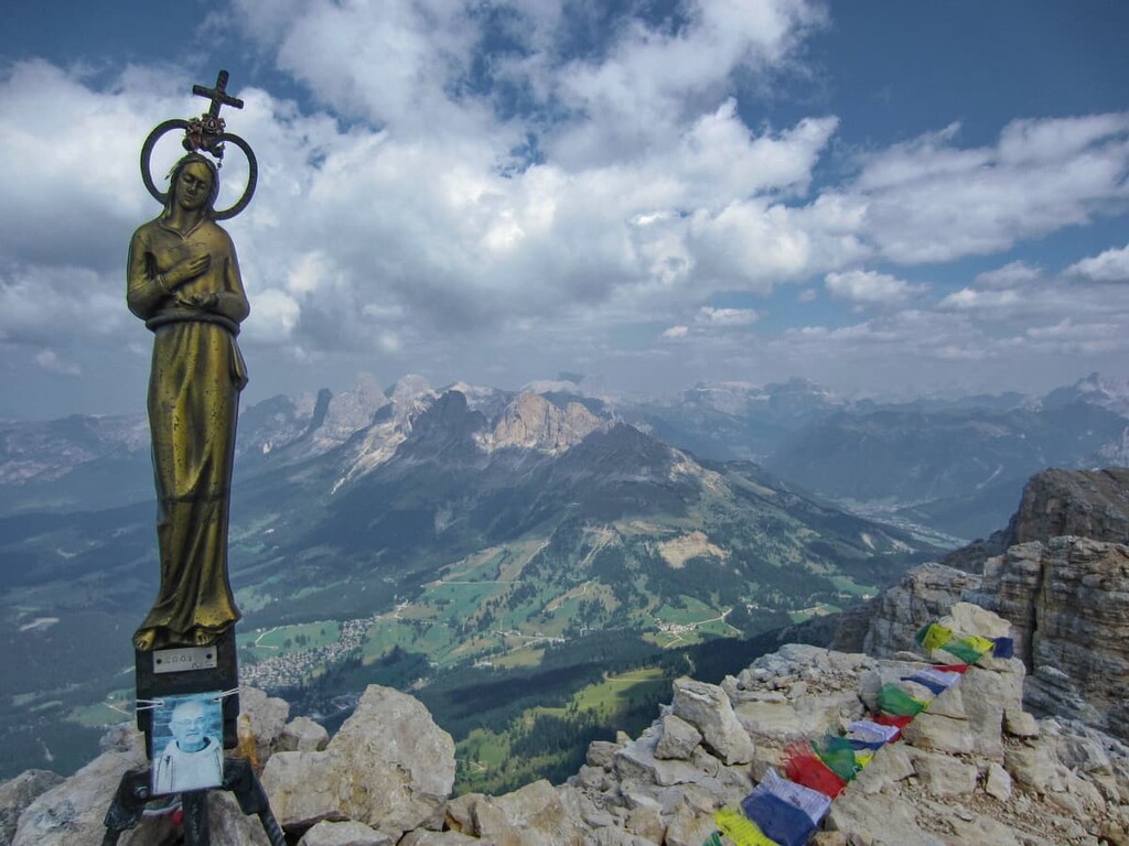
The highest peak of the Torri del Latemar and the whole Latemar group is Cimon del Latemar (2,842 m / 9,324 ft) or Torre Diamantidi. It is located in the middle of the Latemar group and it has a gentle slope of about 45 degrees. Because of this, from below, the peak looks a bit like a launching pad for a spaceship, at least from my point of view.
Either way, once you’re in Latemar, you definitely can’t overlook Torri del Latemar. In fact, you can even climb the mountain from the side of Forno, a hamlet of Moena, on a via ferrata.
Finally, the other nine highest peaks of the group are as follows:
If you just want to see Latemar from Carezza Lake, half a day will be enough, but to really explore these mountains, it’s best to spend at least 2–3 days in the range. Here are some of the best hikes and via ferratas to check out in the mountain group:
The Carezza Lake Loop is the most popular route in the Latemar Mountains. It offers a chance to hike around its namesake lake, Carezza Lake. On this route, you can also see a number of neighboring peaks, which add to the splendor of the region.
This trail has three options for hikers to choose from: a short route along the lakeshore, a medium length hike that follows a slightly longer loop, and a longer route that also takes you on a walk into the forest.
This trail is also unique when compared to other trails in the region by the fact that it is passable both in the summer and in the winter. In fact, this is one of the few trails in the region that you can hike without snowshoes during the winter months—unless, of course, 40 cm (11.8 in) of snow fell the day before, which has been known to happen on occasion.
The Labyrinth of Latemar Loop Trail is the second most popular trail in Latemar. However, do note that this route travels through the rockfall area at the foot of the Latemar group. Despite this, the Labyrinth of Latemar is a relatively casual route that makes for great walking with the whole family.
Along the way, you'll have to wade between huge rocks the size of small houses that are scattered throughout the forest. Don't worry too much about navigating through these boulder fields, however, as the trail is well marked. Moreover, the route is also suitable for both summer and winter hiking, though you will need snowshoes for winter adventures.
The route is also famous for the fact that Agatha Christie, the famous British detective novel author, once hiked it while she was in Latemar on vacation. Moreover, she made it the setting of her story The Crag in the Dolomites (1924), which later became a final part of the novel The Big Four (1927). There, it appears under the slightly altered name of Felsenlabyrinth. As a result of her local wanderings, this trail is sometimes called Agatha Christie Trail.
This route has several starting points, including Costalunga Pass to the north of the mountain group, which itself is a very scenic spot that’s worth checking out. Other starting points include Grand Hotel Carezza, which is located closer to the lake and the village, and Carezza Lake.
Finally, keep in mind that this route can be combined with a hike around Carezza Lake. This side trip is well worth the effort.
The Latemarium is a set of themed casual walking routes that’s located in the vicinity of Latemar. These hikes are maintained for use for families and other recreationalists by a number of local tourism agencies.
This set of hiking trails includes:
Each trail is named after its theme, so for example, on the Latemar.Meteo trail, you can learn about the weather in the region and its importance in planning hiking trips. Meanwhile, the Latemar.Art route contains contemporary art installations set up along the trail. There are also special informational boards located along all of these trails to help you learn more about the region.
The Latemar Towers Loop Trail is a relatively causal loop hike at the southern end of the group that allows you to get up close to the Towers of Latemar. From the top of the route, you can have a stunning view of all the surrounding peaks and other mountain groups. As a result, this trail is well worth the effort to climb up to 790 m (2,591 ft).
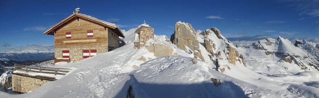
If you start this route on Passo Feudo, on the way you will pass rifugio Torre di Pisa (Tower of Pisa), Cima Valbona, Cima Valsorda, and Forcella dei Camosci.
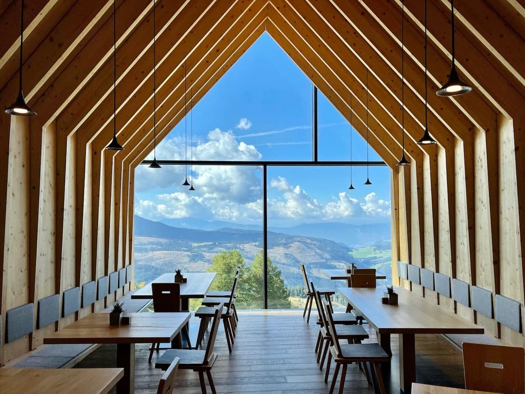
From there, you exit to the Oberholz Hut, which is a restaurant with an unusually modern design that’s built entirely in wood and glass. This design is very different from those of more traditional alpine shelters that are found throughout the range. Finally, you will reach Pampeago Pass and Obereggen Ski Resort, from where you will return to Feudo Pass.
Keep in mind that you can start this trail from a number of different points. So, if you wish, you can extend this hike over two days and stay overnight at the Torre di Pisa Hut. Doing so allows you to take your time on the trail and watch the sunset and sunrise at the summit. I highly recommend taking the longer route and enjoying yourself at Torre di Pisa.
The Via Ferrata Campanili del Latemar Loop Trail is a classic scenic via ferrata route. It travels through many of the peaks of Latemar to the highest peak of the entire group, Cimon del Latemar. Additionally, this route is only via ferrata in the Latemar group.
However, this via ferrata is quite challenging as it has steep sections and long vertical ladders that might frighten the untrained hiker or climber. But the via ferrata is only one part of the route (around 2 hours of climbing). So you will still need to hike for quite some distance on this route.
I would also recommend not rushing to complete this route in one day. Rather, consider spending the night in one of the alpine shelters (bivaccos) in the region.
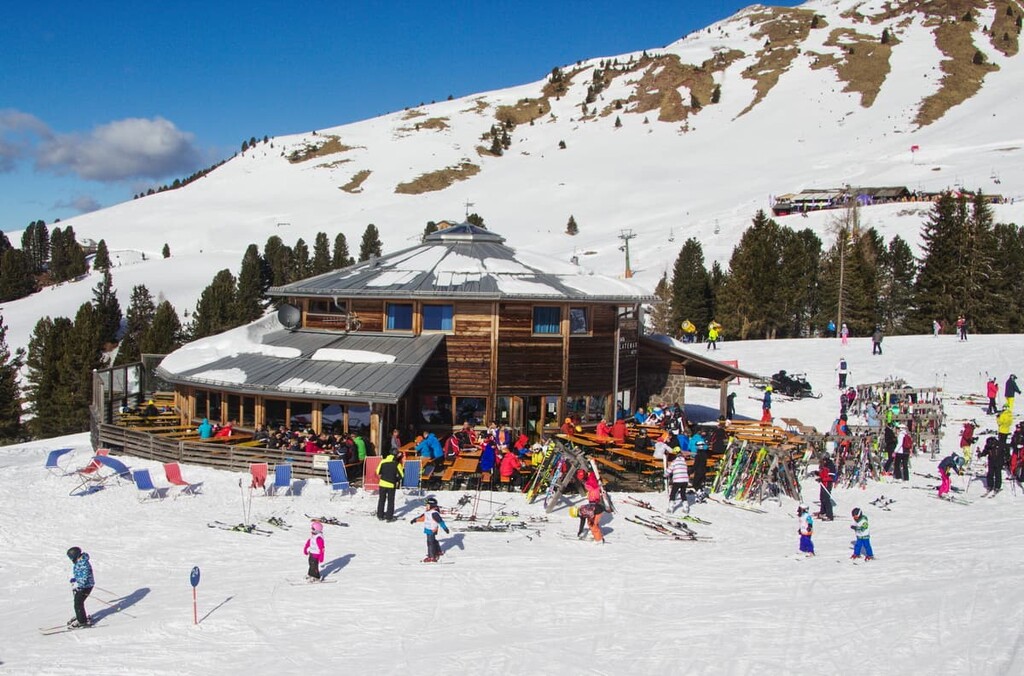
Like many mountain groups in the Dolomites, there are plenty of activities in Latemar, both during the summer and the winter, thanks to the ski resort that’s located in the region.
There are two local resorts in Latemar, both of which are part of the Dolomiti Superski system, one of the largest in the world:
So there are a lot of skiing options in such a relatively small mountain group as Latemar compared to other larger ones in the Dolomites, which makes it unique.
Check the Latemar ski map on the larger Trentino-Alto Adige/Südtirol and Italy ski maps in the World Mountain Lifts section of the site. It includes information about open ski lifts / slopes in the Latemar Group of the Carezza Dolomites in real-time with opening dates and hours. There are also year-round cable cars, funiculars, cog railways, aerial tramways, and all other types of mountain lifts.
Even in 2021, with the development of augmented reality apps like PeakVisor, not all local adventure information is available online and on your phone. Many interesting facts and useful tips from the locals can (and should) still be learned on the spot during your travels.
For example, I often like to look at various information boards at the beginning of hiking trails, because they present unique information about the region. Also, paper maps, which can only be picked up at the tourist point, are very useful in the Dolomites.
In the vicinity of Latemar Group, there are a couple of important tourist information points located in all three of the region’s valleys. Be sure to stop by one of them to pick up a couple of useful booklets, maps, or books. These documents also make for a great souvenir from your travels in the Dolomites.
Tourist Office in Predazzo in Val di Fiemme
Apt Valle di Fiemme, Via C. Battisti, 4, 38037, Predazzo (TN)
Opening times: Monday to Saturday from 9 am to 12 pm and 3:30 pm to 7 pm
+390462241111
Tourist Information Office in Moena in Val di Fassa
Piaz de Navalge, 4, 38035, Moena (TN)
+390462609770
Opening times: Monday to Sunday from 8:30 am to 12:30 pm and 2:30 am to 6:30 pm
Tourist Info in Carezza in Val d'Ega
Via Carezza, 165, 39056, Carezza, South Tyrol
Opening times: Monday to Sunday from 8:30 am to 12 pm (July to September)
+390471619530
When hiking in the Latemar, you can stay in the rifugio Torre di Pisa, which is also known as Latemar Hut (2,671 m / 8,763 ft, 35 beds) in the southern part of the mountain group. Here, you can get a shower, dinner, and breakfast.
Alternatively, there are two alpine shelters in Latemar: bivacco Latemar, which is also known as bivacco Sieff, (2,365 m / 7,759 ft, 8 beds) and bivacco Rigatti (2,620 m / 8,595 ft, 9 beds). Here, you can also get a bed, but food and showers are not provided.
Before and after your hike, you can stay in one of the many rifugios and hotels in Latemar. For example, in the immediate vicinity of Carezza Lake there are the following accommodation options:
You can begin your adventures in the Latemar Mountains and in the Dolomites in one of three mountain communities. Here’s what you need to know about each of them:
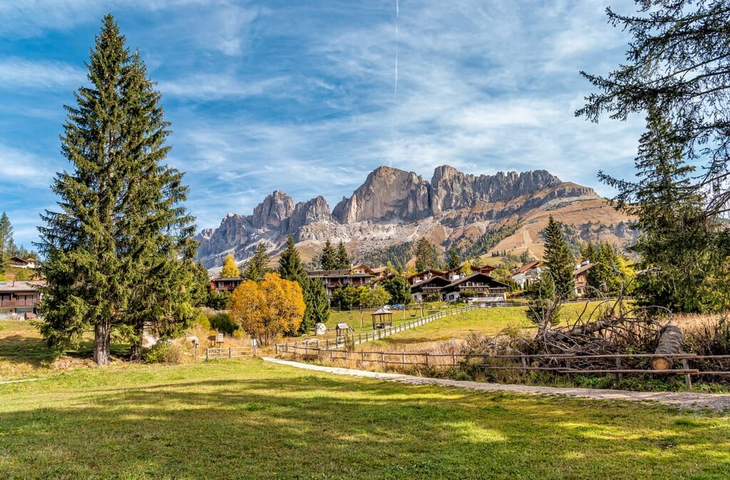
Carezza / Karersee is a small alpine village that’s located near Lake Carezza. The town and the lake are only 2 km (1.2 mi) apart, a distance that can be covered on foot in 25 minutes or less. The village is part of the municipality of Nova Levante (Welschnofen in German) and, as of 2020, approximately 1,910 people live in the village.
However, during your travels, take an English-German phrasebook with you, because around 94% of the population speaks German and only 5.5% speaks Italian. Additionally, despite their cultural ties to the region, the Ladins are a minority in Carezza and only 0.47% of the town’s population speaks the language.
The main cultural and architectural attractions of the village include:
Official tourist site: Carezza.it
Moena / Mön (Moyen) is the biggest town, tourist center, and resort in the Fassa Valley and in this part of the Dolomites. It is situated at an elevation of 1,184 m (3,884 ft) on the banks of the Avisio River (a tributary of the Adige River).

The town has 2,610 inhabitants who live in an area of 82.6 sq. km (31.9 sq mi). They also speak German first, Italian second, and English third. However, many people who work in the tourism industry in the community do speak English quite well.
The main cultural and architectural attractions of the village include:
Official tourist site: Moena.it.
Predazzo is the main settlement and tourist center of the Fiemme Valley. It is situated at an elevation of 1,018 m (3,340 ft) and it is just 58 km (36 mi) from the provincial capital of Trento.
The town is a home to 4,499 inhabitants in an area of 109.9 sq. km (42.4 sq mi). This community is a bit more culturally Italian than the Tyrolean part of the Dolomite Alps. You probably won't need to speak any German while you’re here, but a good portion of the population speaks the language, too.

The main cultural and architectural attractions in the town include:
Every year at the end of October, the village of Predazzo hosts the traditional Ladino festival of Desmontegada, which marks the end of the summer season when the animals (cows, goats, sheep, etc.) return to the valleys from the Alpine pastures.
Official tourist site: Visitfiemme.it.


The highest peak in the Latemar is Cimon del Latemar, at 2,842 m.
The Latemar have 31 named peaks.


