Scan the QR code and open PeakVisor on your phone
The Paneveggio — Pale di San Martino Nature Park is one of the eight nature parks in the Dolomites of northern Italy. The park was founded in 1967, its original territory was expanded in 1987. It contains 98 named mountains, the highest and most prominent of which is Cima della Vezzana (3,187 m/10,456 ft).
The park is different from other similar parks because of the interesting geographical location, unique geology for this region, very rich flora and fauna, and natural beauty, which you can admire and do nothing else (just kidding). Doing nothing in the park would be difficult.
The park has literally everything you need for tourism and outdoor activities—for example, an outdoor deer reserve where you can look at these wonderful animals. In general, the park is a great example of balance between nature and man in wild areas.
As a local living close to the park, I have been there several times, and I could say that if I had to choose one of the eight parks in the Dolomites for visiting for the first time, I would visit Paneveggio. In this article, I will explain exactly why.
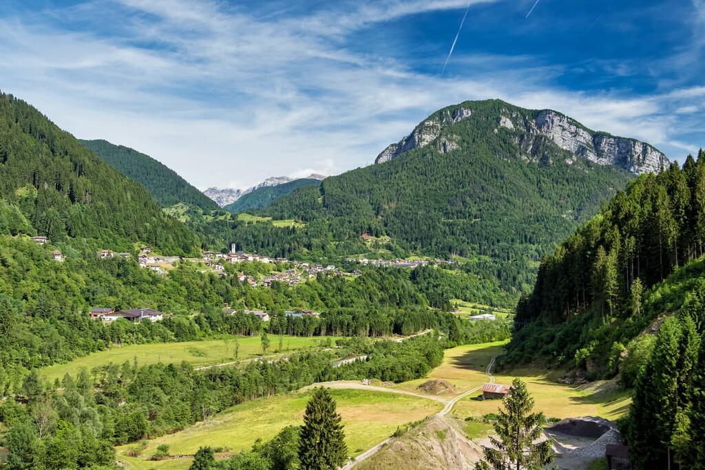
The name of the park refers to its two territories: the spruce forests of Paneveggio, where there is also a small village of the same name, and a part of one of the nine main mountain groups in the Dolomites, Pale di San Martino.

The park has two symbols, both of which I have already noted: the deer, and the spruce. Therefore, sometimes the Paneveggio Park is also called "The Park of Violins". Why? Read on to learn more!
The park is located in the south of the Dolomites in the Trentino — Alto Adige region, so the park is closer to the plain territories of Italy than other nature parks in the Dolomites and famous mountain groups like Tre Cime di Lavaredo, Marmoralada, and Sella. From the south of Italy (well, from the Dolomites, the north) it is much closer to go here.
From Venice to the deer reserve in the park, is 159 km / 99 mi (2 hours 44 minutes by car), from Verona—196 km / 121 mi (2 hours 55 minutes). To go here by public transport is also easy and not too long from each of these cities: first by Trenitalia trains, then by bus of the main local company Trentino Trasporti. Check websites for timetables and tickets cost.
As it has become clear before, the park consists of two parts—that's if we talk about the name. In fact, there are three parts: The park also includes the eastern part of the Lagorai mountain group in the Fiemme Mountains. The eastern part of the Pale di San Martino group, on the other hand, is not included in the park. Well, okay, it is better to show it—here are the exact boundaries of the park:
The park includes territories of the many beautiful valleys: Fiemme, Fassa, Primiero, Vanoi, Venegia, Pradidali, Canali and some others.
The total area of the park is 19,100 hectares (47,200 acres). It is difficult to visit such an area at once, you need at least 3–5 days.
The Paneveggio — Pale di San Martino Nature Park has unique geology. The Pale di San Martino mountains in the eastern part of the park consist of dolomite, while the main rock in the Lagorai mountains is porphyry, a purple-red mineral similar in composition and properties to granite.
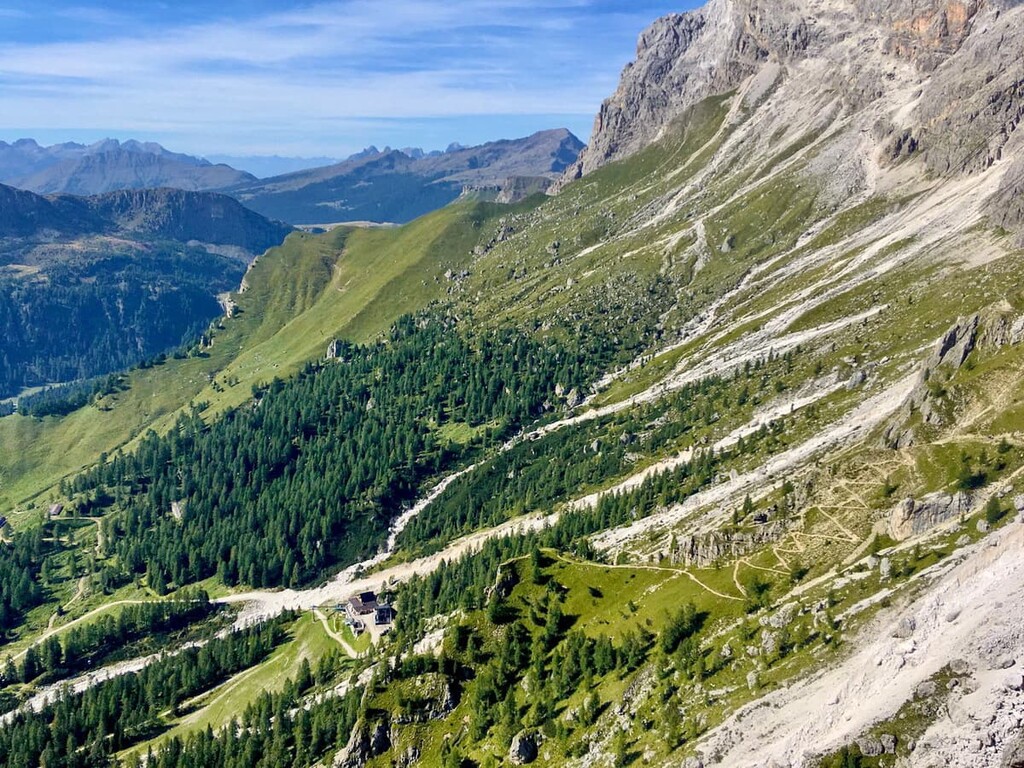
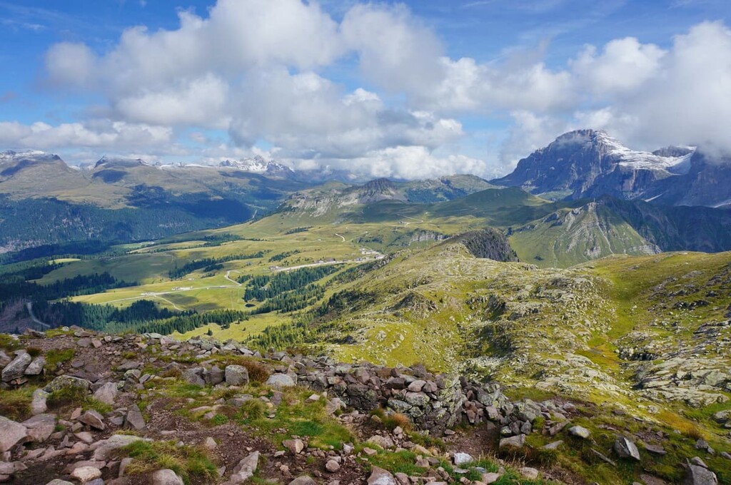
The landscape of the park has all natural formations for this area, which can only be imagined: the mountains higher than 3,000 meters (9,840 ft), permanent glaciers, deep canyons, deep woods, and of course the famous alpine meadows.
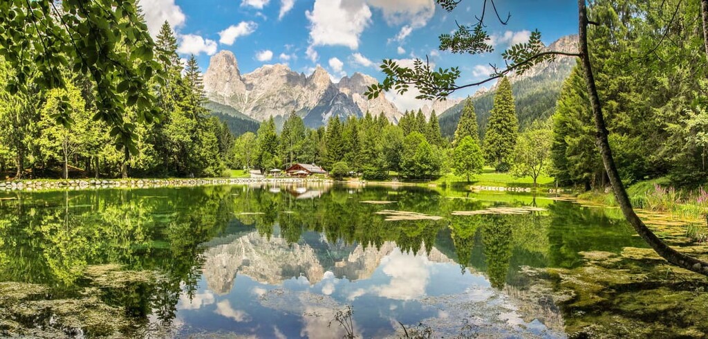
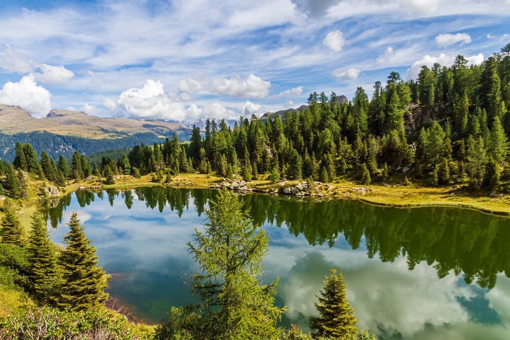
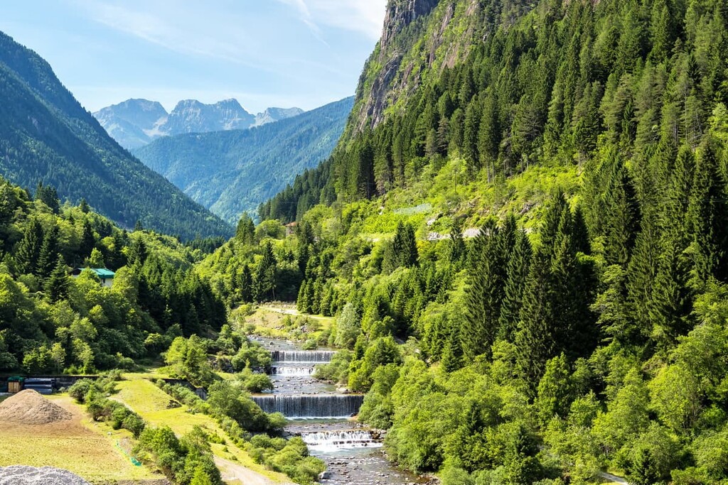
About rivers, streams and lakes should be said separately—there are a huge number of them in the park, so it is very rich in water resources. The most famous lakes include the large lake Paneveggio and two small lakes named Colbricon. They are relatively close to each other. The large rivers and streams named Vanoi and Cismon flow through the park, too.

I have done more than 10 long hiking and biking trips through the Dolomites and the neighboring Fiemme Mountains lasting from 1 to 5 days, but I have not seen such diversity anywhere else in the region. In other places something is always missing, such as a lack of swamps or spruce forests in the great numbers that we see at Paneveggio.
There are two major mountain ranges located partially within the park: Pale di San Martino, also known as Pala group, and Catena di Lagorai.
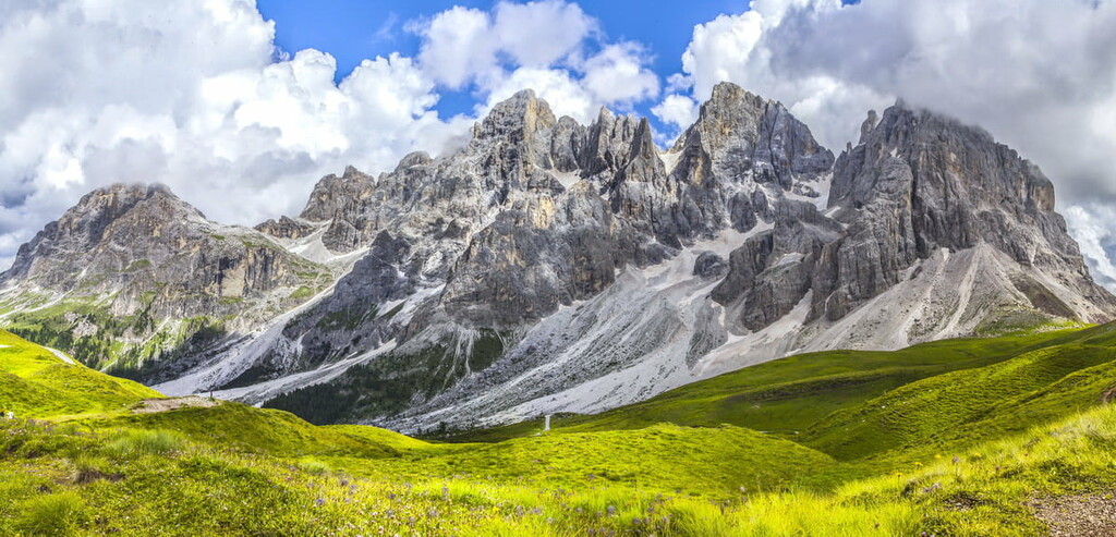
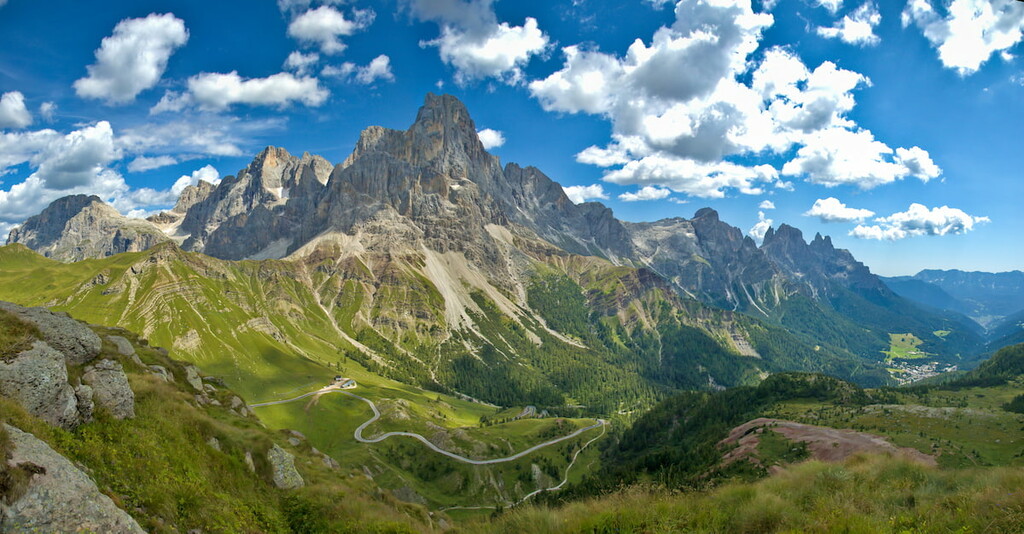
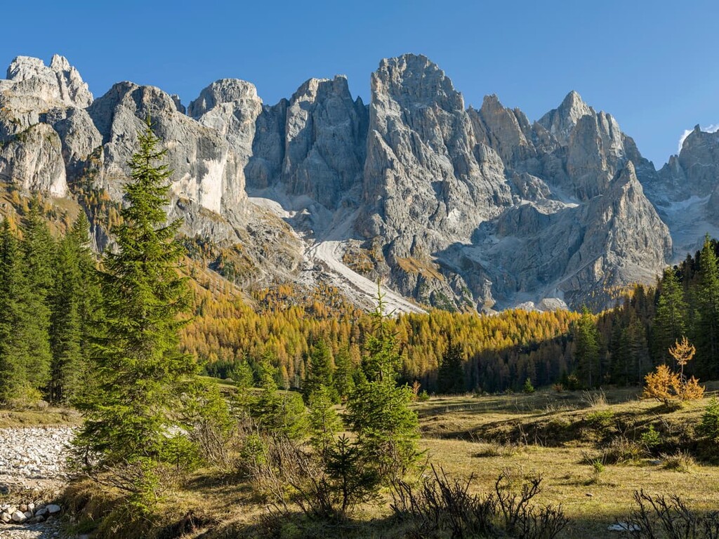
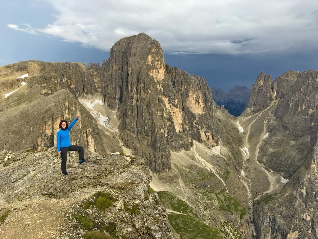
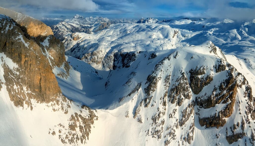
Pale di San Martino is a huge mountain plateau around 10 x 5 km (6 x 3 mi) in size, unique to the Dolomites, which somewhat resembles the surface of the Moon. But the scenery in general is still dominated by high mountain peaks of 2500–3200 m (8,200–10,500 ft). There, of course, many canyons and alpine meadows, too.
The highest and the most prominent mountain is Cima della Vezzana (3,187 m/10,456 ft). Other major summits: Cimon della Pala (3,167 m/10,390 ft), Cima dei Bureloni (3,117 m/10,226ft), Il Nuvolo (3,069 m/10,069 ft), Cima del Focobon (3,043 m/9,983 ft), Campanile di Val Strut (3,037m/9,963ft).
Lagorai is a quite long mountain range, with a total length of 90 km (56 mi). It takes at least 5–7 days to pass it. The Lagorai is very different from the Dolomites, also because of geology and scenery.
The highest and the most prominent mountain is Cima di Cece (2,754 m/9,035ft). Other major summits are: Cimon de le Sute (2,616 m/8,583 ft), Cima delle Stellune (2,597 m/8520 ft), Cima di Lagorai (2,585 m/8,480 ft), Cima delle Buse (2,574 m/8,444 ft), Cima Litegosa (2,548 m/8,360 ft), Castel di Bombasel (2,532 m/8,307 ft).
In total, there are 98 named mountains in Parco Naturale Paneveggio — Pale di San Martino. The lowest height of the park is 1,100 m (3,609 ft).
Finally, I need to mention here that the northern part of the park also includes a smaller group compared to the previous two, consisting of the Cima di Lusia (2,492 m/8,175 ft) and Cima di Bocche, 2,745 m (9,005 ft), mountains. There is a large skiing area here, the Ski Area Alpe Lusia. It is an important ski area offering 24 km (14.9 mi) downhill runs, a snow park with a halfpipe/ski jump, and trails for cross-country skiing.
Remember the phrase about violins at the beginning of the article? Well, spruce is the best material for making these musical instruments. There is speaking, that the world-famous Italian craftsman Antonio Stradivari himself picked the trees here for making his violins.
No, the forest was not cut down for violins (otherwise we wouldn't have the park... nor this article about it). On the contrary, the forest has been protected by the state of Italy for the past 200 years. The spruce trees cover 90% of the forest: silver fir at lower altitudes, and larch and stone pine at higher. Walking through the woods here is a pleasure!
The rest of the flora of Paneveggio Park is very diverse. In addition to spruces and larches, Swiss pines, beech trees, and maples grow here in large numbers. Yew, sessile oak, ash, European aspen, Scots pine, speckled alder, and mountain ash also grow here, but these are rarer.
The main types of shrubs and flowers in the park include whitebeam, hazelnut tree, honeysuckles, elderberry, cherry, hawthorn, barberry, willow. The flora includes some rare orchids, because of wetlands which have mostly disappeared in other places in the region. You can wander around the wetlands in Paneveggio at Colbricon Lakes.
Within the park, there are also alpine meadows in the Val Canali and other valleys. These valleys are advisable to visit first of all—they are mind-blowing picturesque.
In addition to deer, which, let me remind you, graze freely in a natural reserve right outside the Visitor Center in Paneveggio, the park is home to roe deer, ibex, hares, foxes, marmots, and squirrels, among other animals. Eagles, golden eagles, owls, woodpeckers, and other birds fly in the forests and over the mountains. Tritons and salamanders are found in lakes and streams.
All of these animals can be seen just walking through the park, including more wilder deer, if you don't make too much noise and instead listen more to the surrounding nature. For example, I saw them in the Dolomites three times. And some of my friends have told me how deer come to their houses in search of food.
But neither I, nor the other locals, would like to meet a wolf or a bear. However, I do have such examples. A couple of years ago, a bear wandered into one of my friend's houses, and in 2019, in the mountains of the neighboring Dolomiti Bellunesi National Park, a camera trap recorded wolves.
Of the other dangerous animals in mountain parks in the spring and summer, there may be a lot of snakes and ticks. Be careful and obey the safety rules.
The Paneveggio — Pale di San Martino Nature Park has a huge number of hiking trails of different levels, lengths, and types. I will list the main ones:
The classic and most popular (after visiting the deer reserve, of course!) route in the spruce forecast part of the park. From the beautiful Rolle Pass, you have to go up to Cima Cavallazza, 2,325 m (7,628 ft), where you have a great panoramic view of the entire Paneveggio — Pale di San Martino Nature Park.
From there you will go down to two lakes with the same name as the nearby dominating mountain, Colbricon Piccolo (2,509 m/8,231 ft). This place used to be a temporary camp of the hunters of the Neolithic age. Today there is a small rifugio with three beds for the modern hunters for the outdoor experience and impressions. From the lakes, we return to the pass.
The route is well marked and can be traversed even without a topographical map, navigating only by names of intermediate points. But I still recommend using the map.
Season: May–November
Start and finish: Malga Rolle at Passo Rolle
Type of trail: Loop
Length: 7.3 km (4.5 mi)
Travel time: 3:30 h
Level of difficulty: Easy
Uphill elevation gain: 411 m (1,348 ft)
The Vanoi Valley trail is part of the Eco Museum, I mentioned before. In fact, it is a small system of trails of different lengths and with different themes through alpine meadows and spruce and pine forests from the village Caoria. On the route you can see both nature and the traditional alpine settlements, to learn how the local people lived and still live here.
Learn more about the life of local people in this particular region from this photo project, which will change your look at the well-known Dolomites.
Season: May–November
Start and finish: Caoria
Type of trail: Loop
Length: 25 km (15.5 mi)
Travel time: 1-2 days
Level of difficulty: Easy to moderate
Uphill elevation gain: 1,034 m (3,392 ft)
A multi-day panoramic trek through the entire Pale di San Martino mountain group. (It also has a more difficult version, the Palaronda Ferrata, which lasts about 8 days. The via ferratas are routes with metal ropes and ladders, for which you must use special equipment, but it is possible for most active hikers).
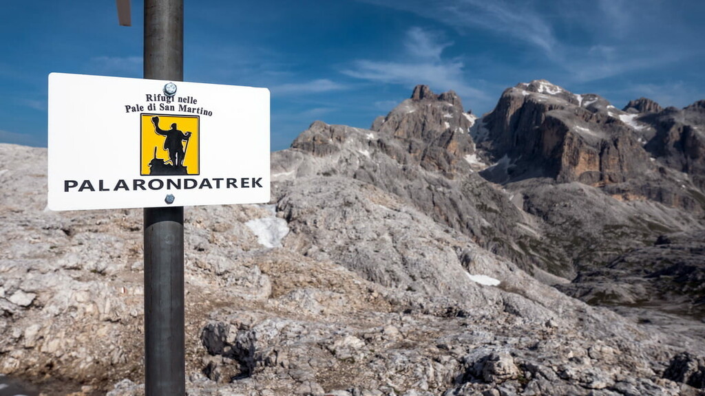
Season: June 21–September 21
Start and finish: San Martino di Castrozza
Type of trail: Loop
Length: 30+ km (18.6 mi)
Travel time: 4 days (3 nights)
Level of difficulty: Moderate
Uphill elevation gain: 2940 m/69,645 ft (1100 m/3,608 ft + 400 m/1,312ft + 340 m/1,115 ft + 1100 m/3,608 ft)
One of the two longest alpine hiking trails in the Dolomites, on par with Alta Via 1. Its total length is 160 km (99 mi) and travel time is 11–14 days. If you start from Bressanone (Brixen) in South Tyrol, you will arrive at Pale di San Martino by day 8. It will take you three days to cross it. The trek is almost the same as the Palaronda I described above.
Season: June 21–September 21
Start and finish: Rifugio Volpi al Mulaz — Passo Cereda via Rifugio Pedrotti alla Rosetta, Rifugio Pradidali and Rifugio Canali Treviso
Type of trail: Out-and-back
Length: 32 km (20 mi)
Travel time: 3 days
Level of difficulty: Moderate
Uphill elevation gain: 2,630 m/8,628 ft (760 m/2,493 ft + 720 m/2,362 ft + 1150 m/3,772 ft)
In winter, Paneveggio-Pale di San Martino Nature Park turns into one of the 12 major ski areas of the Dolomiti Superski system called San Martino di Castrozza-Rolle Pass. Two of its three areas are in the title, including the summits of Colbricon and Tognola. The third one is located on the opposite side of the Cismon River valley and leads to the rifugio Colverde below Cima Corona and Cima Rosetta.
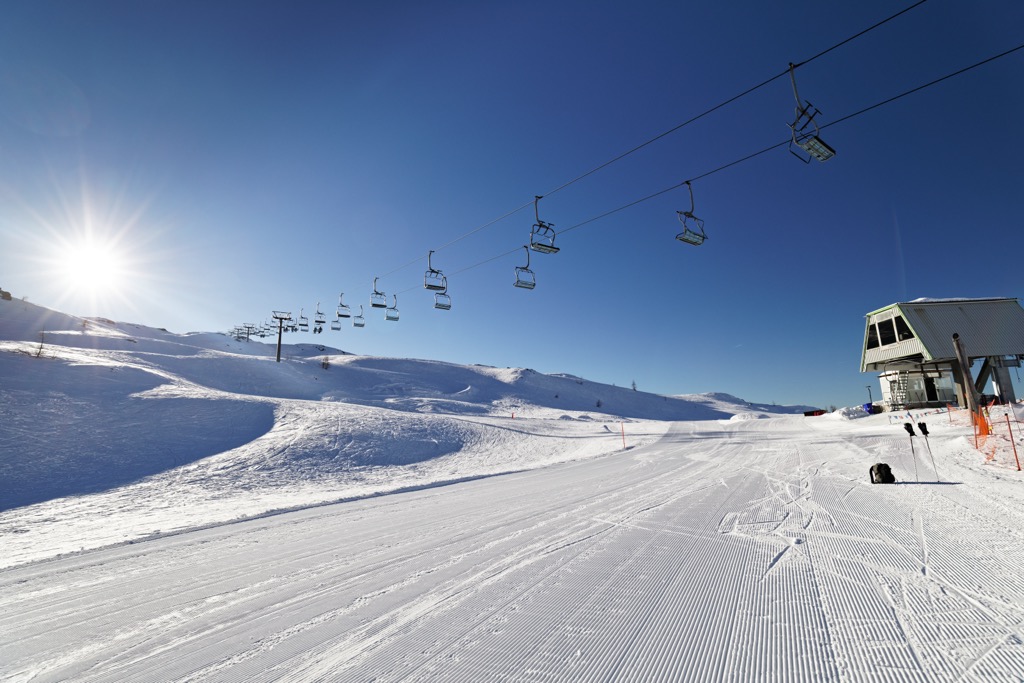
At the resort, in January 2022, they also began to build a new handicap gondola ski lift directly to Rolle Pass, which is scheduled to open by the start of the 2025–26 season. Now access to the pass is by bus.
In total, the resort has more than 60 km (37 mi) of slopes, most of which are intermediate, and more than 20 ski lifts. The difference in elevation is 953 m (3,126 ft) between 1,404 and 2,357 m (4,606 and 7,732 ft).
But that's not all skiing options in Paneveggio. Two other large ski areas of the same Dolomiti Superski system are located on the northern boundaries of the park: Alpe Lusia and San Pellegrino. These resorts have more than 25 and 65 km (15 and 40 mi) of slopes and more than 8 and 15 ski lifts, respectively.
Finally, to the south of the southern borders of the park at Brocon Pass, you will find a small ski area called Lagorai with more than 10 km (6 mi) of slopes and more than 3 ski lifts. Although it is not part of the park, it is located at the foot of the Cima di Asta range, which is often seen together with the Lagorai mountain range.
Check the Paneveggio ski map on the larger Trentino-Alto Adige/Südtirol and Italy ski maps in the World Mountain Lifts section of the site. It includes information about open ski lifts / slopes in Paneveggio-Pale di San Martino Nature Park in real-time with opening dates and hours. There are also year-round cable cars, funiculars, cog railways, aerial tramways, and all other types of mountain lifts.
The park has not one, but three visitor centers, where you can get a map and learn various useful information, visit temporary and permanent exhibitions, ask for advice, and so on. The first visitor center is on the southern borders, the second is about midway between the two parts of the park, and the third is on the north of the park.
If choosing just one, I'd pick the last one—it's located right by the deer reserve. There may not be any employees in the off-season, but there should be some in the summer and winter. Here are the exact addresses and other contacts:
Visitor Centre Villa Welsperg
Via Castelpietra, 2, 38054, Tonadico, Italy
+390439765973
Opening Hours: Monday to Friday; 9:00 am to 12:00 pm and 2:00 pm to 4:00 pm
Visitor Centre San Martino di Castrozza
Via Laghetto, 27, 38058, S. Martino di Castrozza, Italy
+390439768859
Visitor Centre Paneveggio
38037 Strada Statale n° 50 del Passo Rolle, Loc. Paneveggio, Predazzo, Italy
+390462576283
If you have questions, call one of these phone numbers or send an email to info@parcopan.org.
The park has an official website and a page on the official website of all parks in Italy.
The park is also home to the Vanoi Eco Museum, a large open-air museum named after the long mountain stream in the southwestern part of the park in the valley of the same name. It is a very beautiful and completely non-touristy place.
Ecomuseo del Vanoi
Piazza Vittorio Emanuele III, 9, 38050, Canal San Bovo (TN), Italia
+39 0439.719106
There are different types of accommodation in the Paneveggio — Pale di San Martino Nature Park.
If you like hiking, choose mountain huts or bivouacs, if you want to relax with more comfort in nature, a campsite will suit you, and for those who are not ready to sleep among the trees and rocks, there are hotels and B&Bs in the towns and villages.
In Paneveggio, stay at the rifugio Laghi di Colbricon or at Capanna Cervino on the Rolle Pass.
In Pale di San Martino you can easily sleep in one of the five main rifuges (from north to south): Giuseppe Volpi al Mulaz, Pedrotti alla Rosetta, Pradidali, Vello della Madonna, Canali Treviso.

I've been to three of the five refuges; in my experience they're all great and similar, but each has a unique environment and atmosphere. It’s also worth noting that there are always more people in Rosetta, because of its proximity to San Martino di Castrozza and the cable car that leads to it.
There is also Camping Castelpietra, not far from the southern borders of the park in the village of Tonadico in the comune Fiera di Primiero.
In the Lagorai Mountains section of the park, if you decide to go above the Colbricon Lakes, there is also the bivouac Aldo Moro at an altitude of 2,565 m (8,415 ft). It has 9 beds.
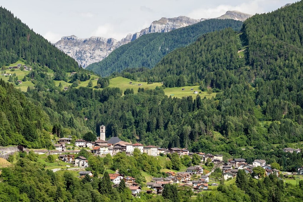
There are several major settlements in or near the borders of the park from which to start (and where to end) your journey:
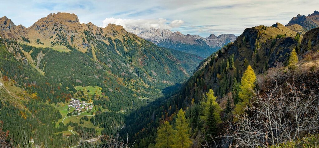
The typical alpine village, the main one in the Vanoi valley away from the tourist trails and roads located at 750 m (2,460 ft) above sea level. The village includes several localities: Caoria, Cicona, Gobbera, Prade, Ronco, and Zorte. Pasture farming and forestry are the main activities of local people. The main sports event in the village is Raduno sci alpinistico del Vanoi, a ski rally around Lake Calaita held in March.
The popular summer resort in the valley of the river Cismon. The town is surrounded by three mountain groups: Pale di San Martino, Lagorai, and Vette Veltrine. The community consists of many small villages like Tonadico, Siror, Transaqua, Sagron—Mis, and others. The resort has an ideal location—it’s just an hour's drive from the nearest town of Feltre, where Venice is another 1.5-2 hours away.
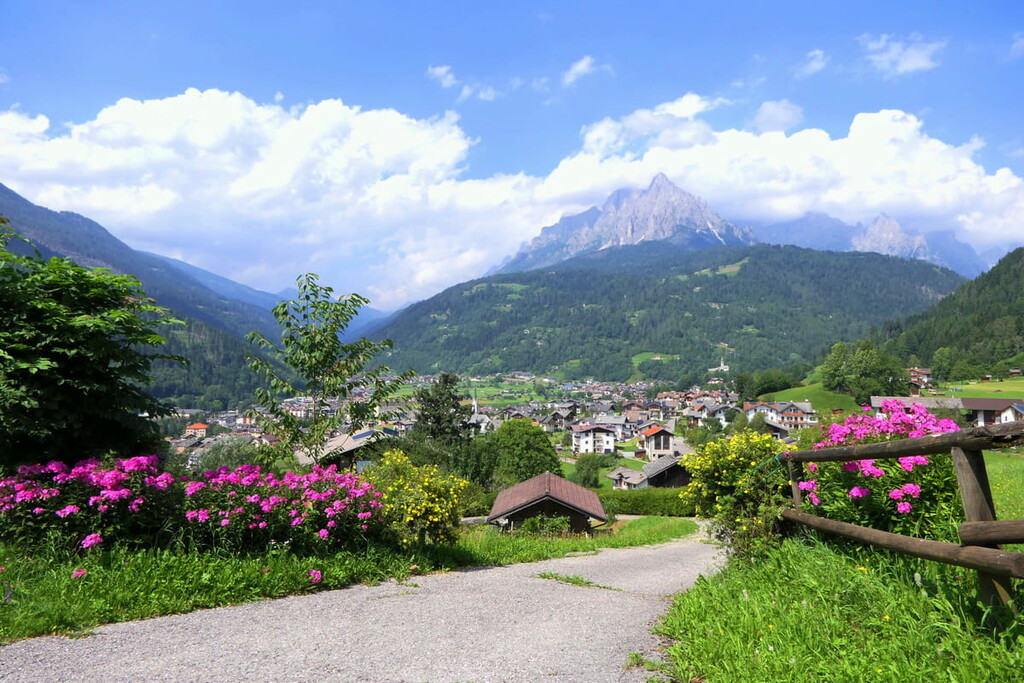
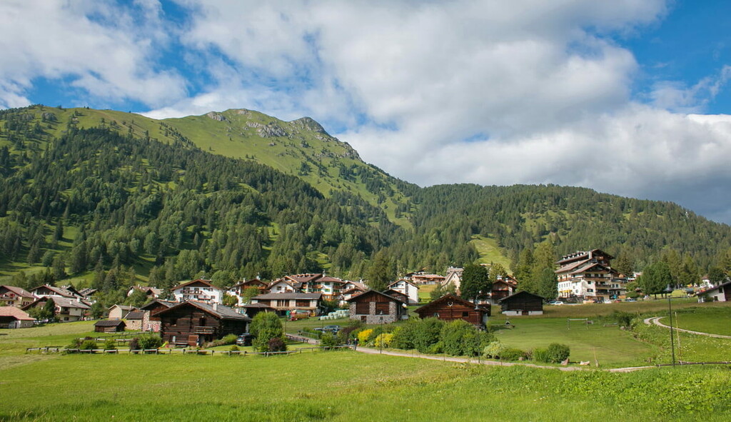
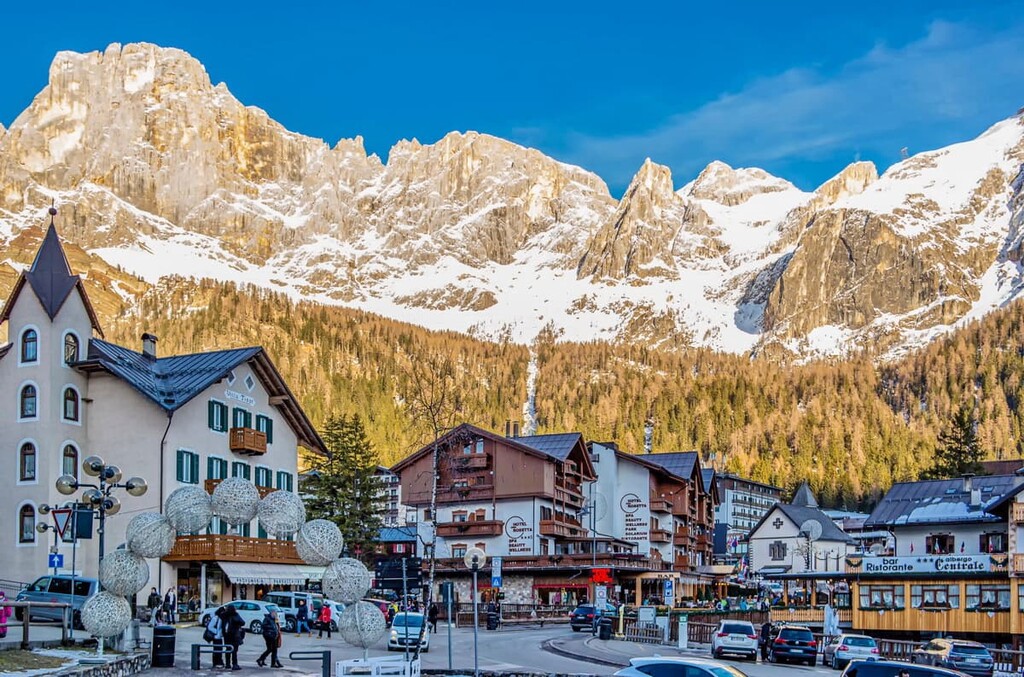
San Martino di Castrozza is a village and the ski resort at an altitude of 1,400 m (4,593 ft) and one of the 16 ski areas of the Dolomiti Superski system. It is interesting that the first alpine hotel in San Martino was built by the Irish traveler, John Ball in 1873. Today there are many hotels and different types of accommodation there, but the town is still small and charming. This is also a great starting point for both winter and summer outdoor trips.
Gares is a village in the valley of the same name in the northeast borders of the park. Here you can go down from the Pala di San Martino mountains on your way back to civilization, or vice versa—start your journey through the park.
The main attractions of Gares are the small church dedicated to the "Madonna della Neve", built in the 14th century, the Comelle Waterfall, and the Biotope of Gares. For a complete overview of the village, visit also the beautiful hamlets of Feder, Fregona, and Carfon.
A location formed of a few dozen alpine wooden houses scattered in the meadows, dominated by the peaks of Colbricòn, Cece, and Pale di San Martino, known also as "Tabià Bellamonte". Tabià is wooden barns that were used in the past for cattle and hay. It is also a good starting point for excursions to the top of the nearest Alpe di Lusia mountains and peaks of the Lagorai chain. Don’t miss this place on your way to Paneveggio Park.