Scan the QR code and open PeakVisor on your phone
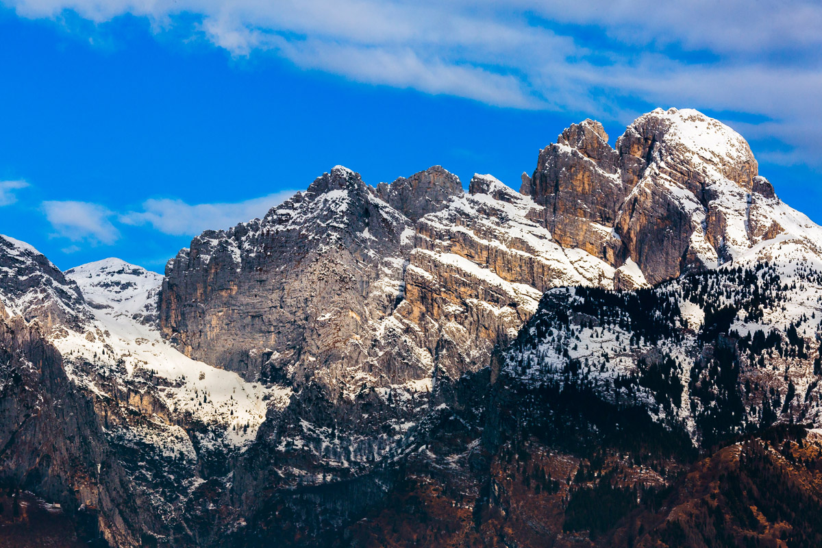
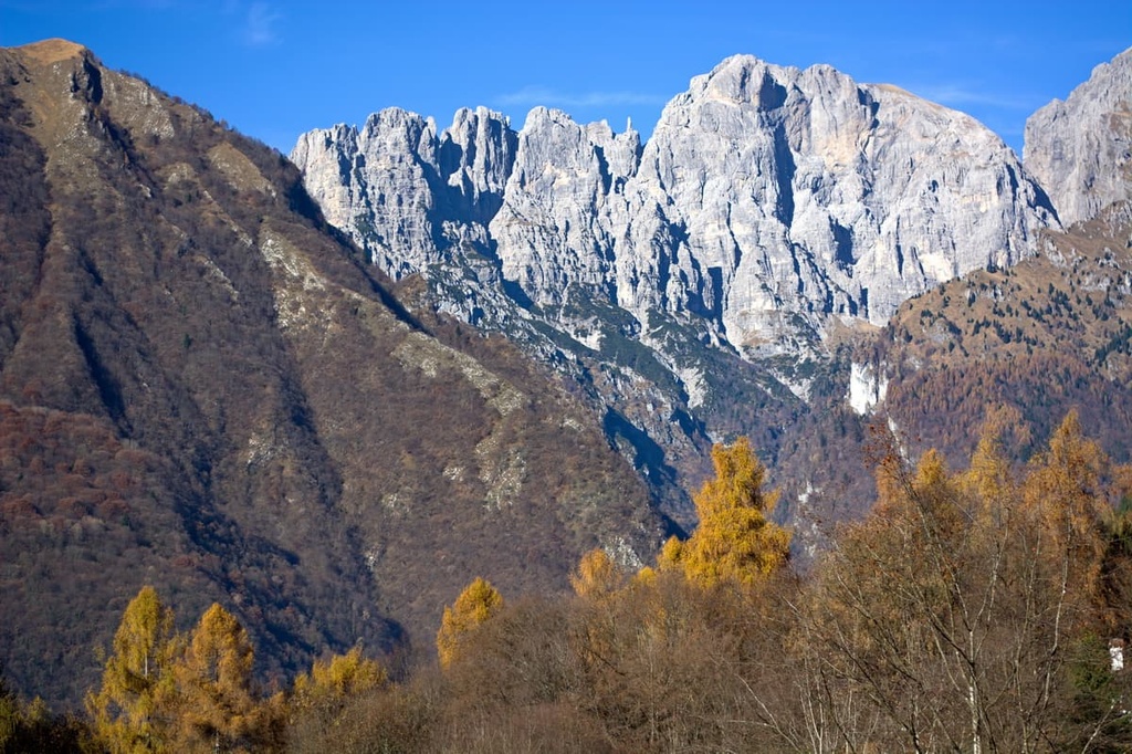
Dolomiti Bellunesi National Park is 1 of the 25 national parks of Italy. It’s located in the West Dolomites in the northern part of the country. It is the only national park in the Dolomites—a location of extraordinary landscape beauty and rich flora and fauna. There are 220 named mountains in the park. The highest and most impressive mountain in the park is Schiara (2,565 m / 8,415 ft), while the most prominent peak is Piz di Mezzodi (2,240 m / 7,349 ft).
Dolomiti Bellunesi National Park (Parco nazionale delle Dolomiti Bellunesi) was founded in 1988 in order to protect the unique landscape and ecosystems of this part of the Alps.
The name of the park comes from that of the city of Belluno, the capital of the province of Belluno. So the name of the park means “Mountains in the vicinity of Belluno” or “Mountains of the province of Belluno.”
According to local history, “Belluno” is a word of Celtic origin, where bel means “brilliant” (bello also means ‘beautiful’ in Italian) and dunum means ‘fortified center.’ So, Belluno is ‘the brilliant or sparkling city.’
In English, the name Dolomiti Bellunesi National Park is often used. This name is a mixture of Italian and English. A more correct name in English would be Belluno Dolomites National Park or the National Park of the Belluno Dolomites.
The full Italian name of the park is Parco nazionale delle Dolomiti Bellunesi. Meanwhile, the park’s German name is Nationalpark Belluneser Dolomiten. However, unlike in Trentino and South Tyrol, this part of the Dolomites is predominantly Italian-speaking.
The Dolomiti Bellunesi National Park is located in the south of the West Dolomites and the province of Belluno in the Veneto region. The park covers the territories of 15 municipalities within the province, including Belluno, Cesiomaggiore, Feltre, Forno di Zoldo, and Gosaldo, among others.
The total area of the park is 310 sq. km (119 sq mi). It is one of the smallest parks among the 25 national parks of Italy, which also includes famous parks like Cinque Terre National Park, Gran Paradiso National Park, Stelvio National Park, and Arcipelago Toscano National Park.
However, among the 10 nature parks in the Dolomites, Dolomiti Bellunesi is one of the third-largest areas after Adamello-Brenta Nature Park and Dolomiti Friulane Nature Park. Anyway, the territory of the park is huge if you walk it, cycle it, or even ride around it by car.
The territory of the park stretches strongly from southwest to northeast. The borders of the park are formed by several large valleys and rivers: Valbelluna (Pieve River) in the south and southeast; Val Cismon and Val Primiero (Cismon River) in the southwest and west; and Val Canzoi, Val dell’Ardo, and Val di Prampér (Maè River and others) in the north and northeast.
The entry points to the park are located in these valleys. I have traveled through the park many times on foot and around it on my bike. In my opinion, the best entry points are the following:
Most people travel to the park from the south of Italy. So, the nearest large town to the park, and, as such, one of the best places to visit in the region, is Feltre. Fittingly, Feltre is also considered the main gateway to the Dolomites from the south.
The easiest and fastest way to reach Feltre is to drive from Treviso, Venice (97 km / 60.2 mi, 1 h 40 min by car), or from Padua, Vicenza, and Verona (149 km / 92.5 mi, 2 h by car). If you’re going to use public transport, the Trenitalia train is the best option. The travel time from Venice is about 2 hours by train.
You can also get to Feltre from Trento, the capital city of Trentino province, by car (85 km / 52.8 mi, 1 h 10 min) or by bus by the main local bus company, Trentino Trasporti. The bus is also a suitable method for traveling around the park on the west side; on the east side of the park, take the Dolomiti Bus instead.
The main mineral in Dolomiti Bellunesi National Park is Principle Dolomite (Dolomia Principale). This is the main dolomite of the many subtypes of dolomite. In particular, the remote Monti del Sole range, which is located in the park, consists almost entirely of this type of dolomite.
I asked the founder of PeakVisor to tell you about the geology of the park as he has also been here many, many times. He notes:
“The geologic history of the Dolomiti Bellunesi began in the warm tropical seas (something similar to the Caribbean now) more than two hundred million years ago during the Mesozoic era (when the dinosaurs roamed the earth). Over the millennia, the accumulation of sediments formed the sedimentary rock strata that we see today.
Later, the collision between the European and African tectonic plates during the Tertiary period (66 to 2.6 m years ago) deformed and folded the sediments. That is how the whole Alps came into existence. Since then, water and wind erosion have been working away at the exposed rock.
Today in the national park, visitors can admire large meadow basins, deep and wide valleys, large and sunny mountain faces.”
Furthermore, the park has several geological features for this area, the most prominent of which is probably the presence of many cirques and moraines.
These many cirques and moraines are “ the great heritage of the most recent glacial maximum”, the PeakVisor founder continues, “frequently appearing in the toponyms ‘buse’ and ‘cadin,’ which mean ‘cirque’ in the local dialect. Shaped by small local glaciers, these cirques usually have the shape of a broad niche surrounded by steep slopes. They are also characterized by a large and almost flat bottom.
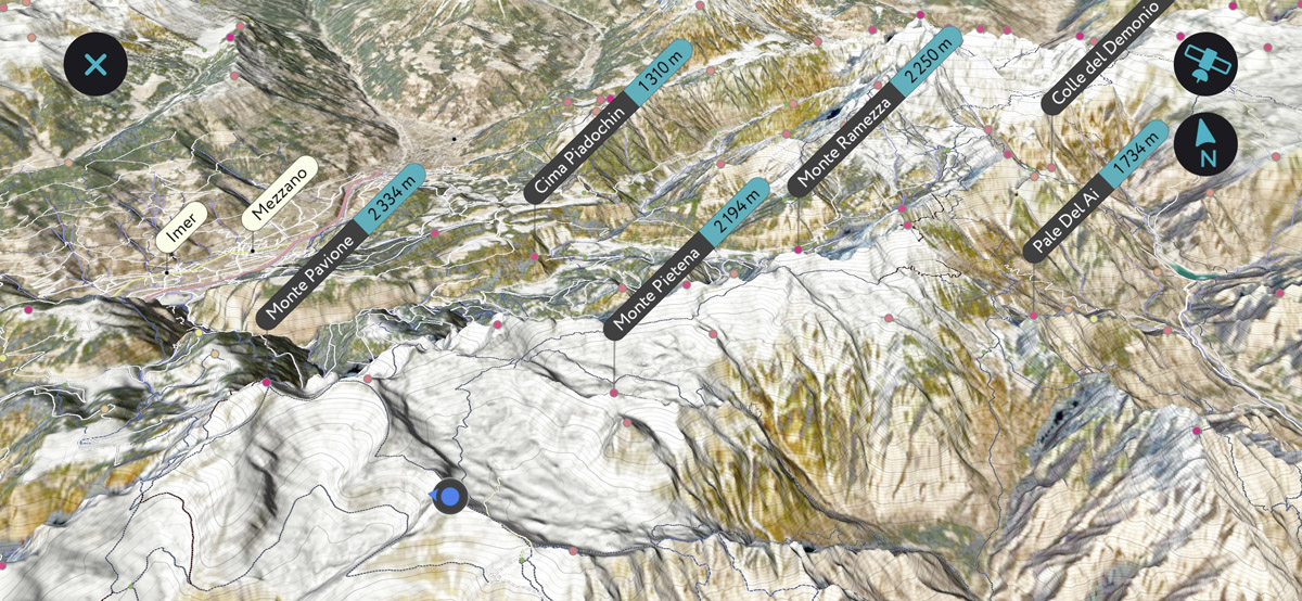
Monte Pavione (2,334 m / 7,657 ft) offers an unparalleled panorama of these features called The ‘Cirques of Vette Feltrine’ (‘La Busa delle Vette Feltrine’), which include Busa delle Vette, Busa di Pietena, Busa di Cavaren-Val Caneva, Busa di Monsampiano, Circo delle Sere, Circo dei Podoch, and Busa dell’Orso.”
It is because of the presence of Principle Dolomites and various geological features like this one the park was included in one of the nine great mountain systems of the region “Pale di San Martino-San Lucano-Dolomiti Bellunesi-Vette Feltrine” in the UNESCO classification system. This classification system was used when the Dolomites were designated as a World Heritage Site in 2009.
But there are other minerals in the park, too. This mainly includes different types of limestones, such as grey limestones and inferior red ammonite (reddish limestone).
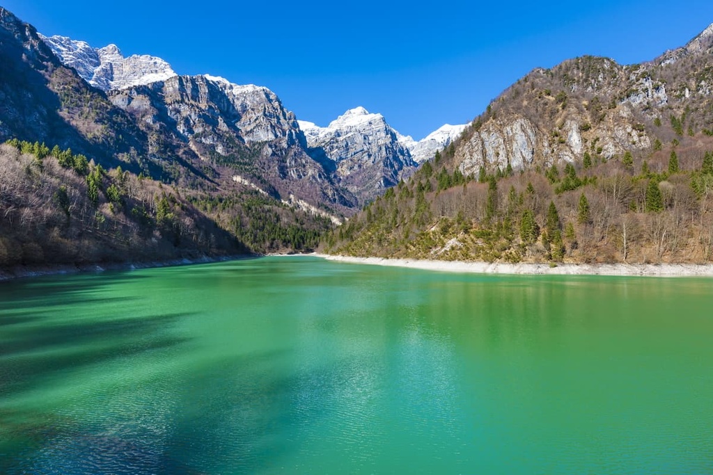
The landscape of the park is extremely rich and varied. In addition to the mountain groups and peaks that dominate the region and the valleys, which you already know about, the park differs from other natural areas in the Dolomites because of its rich water resources.
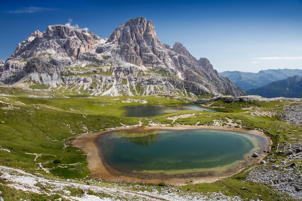
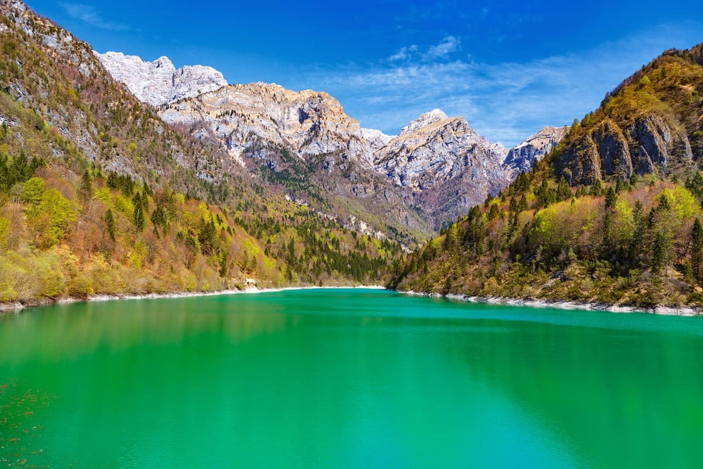
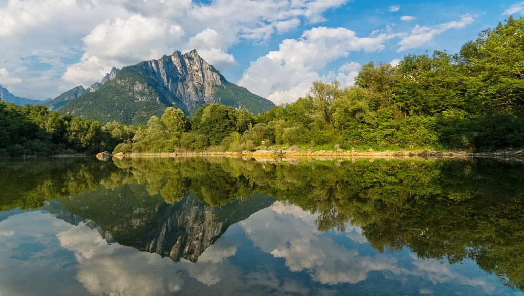
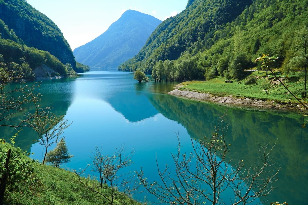
There are two lakes within the Dolomiti Bellunesi National Park, the small Stua Lake and the huge Mis Lake. Interestingly, Mis Lake also serves as a kind of natural boundary for the park, dividing it into roughly two equal parts between the Cimonega Group and the Schiara Group.
Another beautiful lake that I recommend visiting is Noana, which is just beyond the park’s northern boundaries. You can easily access it from the town of Imer in the Primiero Valley.
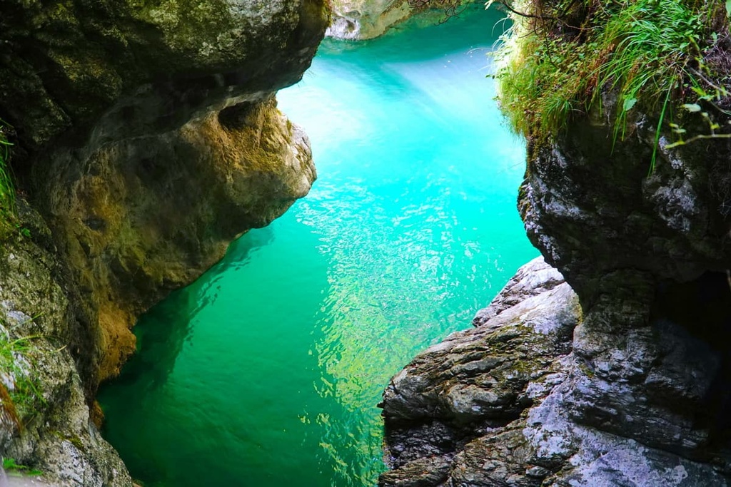
There are many mountain streams in the park, the main ones being Cordevole, Mis, Caorame, Stien, Falcina, Ardo, Vescovà , Prampera. Over millennia, these rivers have formed deep canyons and waterfalls, such as the Soffia Fall (Cascata della Soffia).
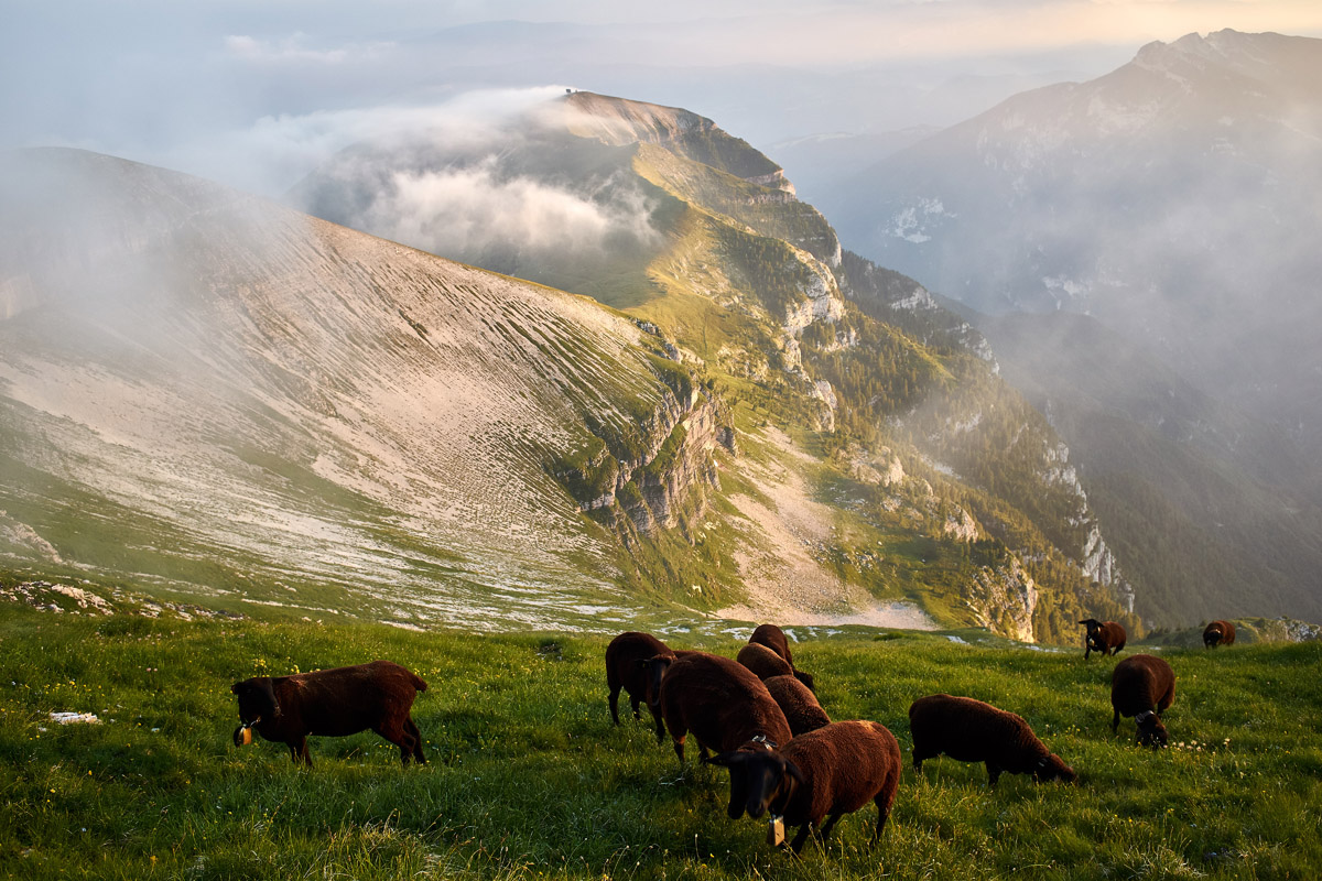
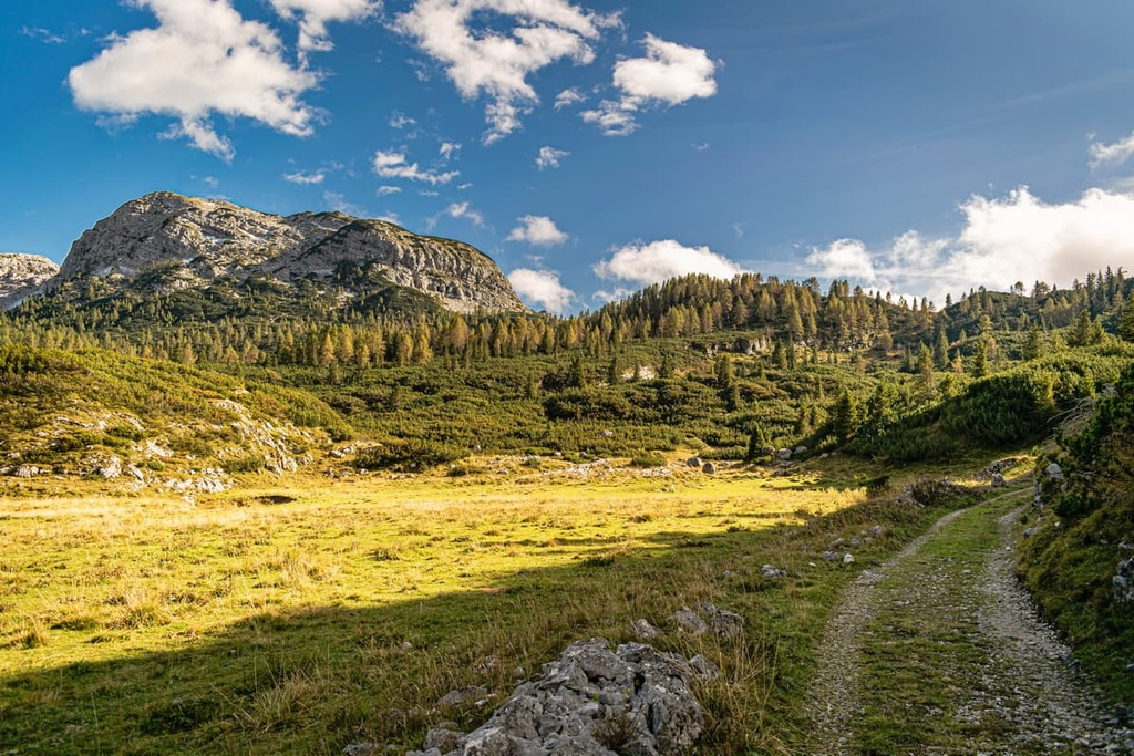
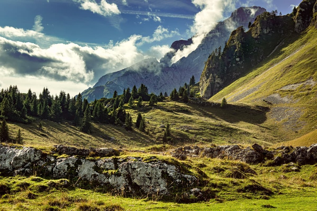
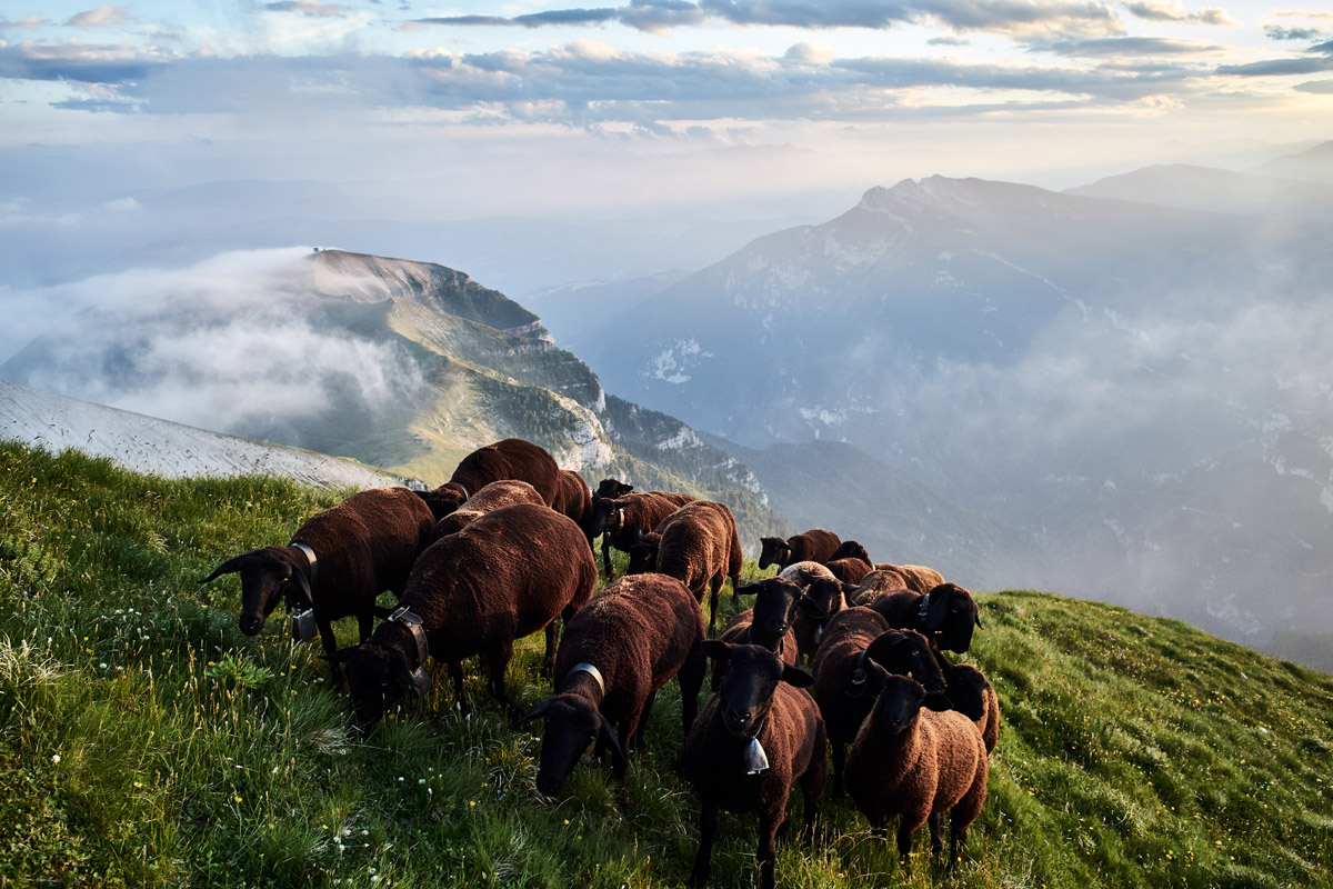
Other features of the park’s landscape include a large number of mountain meadows and high-mountain pastures. These are traditional places for herding cows, sheep, and other animals—a practice that’s still in existence to this day. For example, one such pasture can be found at the foot of mountains Pavionet and Coro.
Finally, we should mention that there are more than 200 connected karst caves in the park, the deepest of which reaches a length of 917 m (3,008 ft). Together they form an incredible gallery of more than 30 km (18.6 mi) long or the longest cave in the Veneto region.
The caves are located in the area of Erera-Piani Eterni Plateau (Altopiano di Erera e Brandol) between the peaks of Sass dionte Mura and Monte Mondo in the heart of the park.
The Belluno Dolomites National Park is famous for its rich biodiversity and its variety of natural landscapes. In fact, there are more than 1,400 species of plants in the park, which is about one quarter of the flora of the entire national territory of Italy. Simply put, the biodiversity in the park is just incredible.
Plants in the park can be found in high-mountain plateaus and meadows, as well as in the region’s many forests. In the forests, you can see pines and spruces, which cover the entire park to a height of about 2,000 m (6,561 ft).
Among the main plants and flowers that you are sure to see walking through the park in late spring and summer are the Alpine bell, black hellebore, carniola lily, mountain lovage, rock rampion, and of course the edelweiss which is the main flower of the Dolomites. In fact, the edelweiss is considered to be one of the main symbols of the range, along with deer and chamois.
Other large and medium-sized animals in the park include marmot, stoat, marten, mouflon, and others. A couple of years ago, a night camera trap recorded a pack of young wolves in the park, too, which is a rarity nowadays. There are also brown bears that roam the Dolomites.
There are also many bats in the caves of the park. But they fly everywhere, even in the streets of the villages at night. You can often see their silhouettes by the lampposts as you stroll down the road.
The birds in the park include black woodpecker, wallcreeper, northern goshawk, kestrel, golden eagle, Eurasian pygmy owl and other owls, hazel grouse, and many others. To hear them, all you have to do is listen. For example, I once heard the singing of about 5 or 7 birds at once, including cuckoos, hawks, owls, and roosters.
There are various reptiles and amphibians in the park’s rivers, lakes and streams. These include Alpine newt, yellow-bellied toad, and mountain frog, among others. The fire salamanders are my favorite amphibians in the park.
Some areas of the park are particularly suitable for wildlife watching because they are very rich in fauna. These ideal wildlife spotting destinations include:
However, the founder of PeakVisor offers a word of caution to anyone venturing to the park: “Please be aware of the ticks in this area. While present almost everywhere in the Alps, here due to untouched wilderness, there is a much higher concentration of ticks. Our advice is to stay away from high grass, wear full-length pants tucked into your shoes, and to wear bright or light color clothing so it’s easier to notice ticks on your body.”
Additionally, while hiking in the park, watch your feet carefully because there are many snakes in the spring and summer, which are mostly black and red vipers. Some of these snakes are quite large. You often see them when they crawl out onto trails in order to warm themselves in the sun.
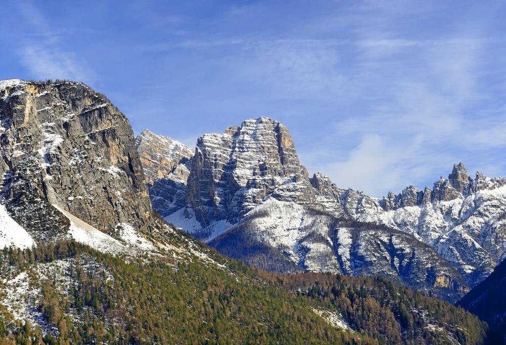
The boundaries of the national park almost entirely coincide with the Cimonega Group in the southwest and with the Schiara Group in the northeast. Together these two large mountain groups form the park’s territory.
However, the Cimonega Group is usually divided into two subgroups: Vette di Feltre or Alpi Feltrine, which contains Monte Pavione, and the inaccessible Monti del Sole Group in the center of the park.
Among other major peaks of the park, the Cimonega Group contains Monte Pizzocco, Mount Brendol, and Mount Agnelezze.
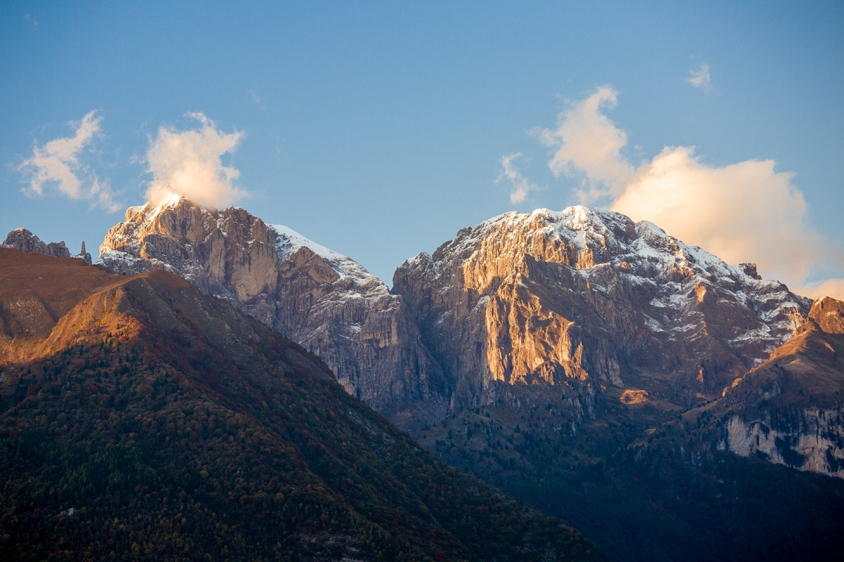
The Schiara Group includes the peak Schiara, as well as mountains Talvena (2,542 m / 8,339 ft), Cima di Pramper (2,409 m / 7,903 ft), and Spiz di Mezzodì Nord (2,305 m / 7,562 ft), which are often also designated as the main peaks of the park.
Ultimately, the park consists of three groups of mountains. Here’s what you need to know:
“Named after the small town of Feltre to the south, this section is much friendlier and easier to hike in than some of the other parts of the park. Some of the most interesting and scenic hikes in the region can be found here.
At an elevation of 2,547 m (8,356 ft), the majestic Sass di Mura is the highest peak in this section (and the second-highest in the park). Together with slightly lower Piz di Sagron (2,486 m / 8,156 ft) they make a spectacular composition. The best way to appreciate the grandeur of these peaks is from the trail around Cima Palughet, which is reachable by a short walk from Cereda Pass.
Monte Pizzocco also boasts a spectacular panorama of the Piani Eterni (Eternal Plains) and peaks of Monti del Sole.
The only remaining chain in this group is the Feltre Peaks (Vette Feltrine), which are famous for their scenic glacial cirques. The chain includes Monte Pavione in the southwestern end, the highest in Cima Dodici (2,264 m / 7,428 ft), as well as La Pietena (2,195 m / 7,201 ft), Cima del Diavolo (2,158 m / 7,080 ft), Monte Ramezza (2,250 m / 7,382 ft), and Sasso di Scarnia (2,266 m / 7.303 ft) in the northeast.
The most popular summit of the chain is Monte Pavione, which is easily reachable by a 2-hour trail from the Dal Piaz mountain hut. From the top of the mountain, visitors can enjoy sweeping views of Pale di San Martino. Weather permitting, this itinerary can be done also in snowshoes during winter.
Located in the central part of the Dolomiti Bellunesi National Park, the Sun Mountains (Monti del Sole) is its wildest section among three parts of the park. The main peak of this area is Piz di Mezzodi (2,240 m / 7,349 ft).
Despite the moderate elevations of the peaks, most of the trails here require a good level of hiking experience. In particular, the treks around the towers of Feruc are quite strenuous.
Compactly located to the north of Belluno, the Schiara Group encompasses the highest peaks of the National Park of Belluno Dolomites: Schiara itself, Talvena, Cima de Zita (2,540 m / 8,333 ft), and Pelf (2,502 m / 8,209 ft).
Cima de Zita is arguably the easiest of these peaks to climb, and it boasts a gorgeous panorama of the gems of Dolomites: Pelmo and Antelao. On a clear day, one can even see the curve of the Adriatic Sea from the summit.
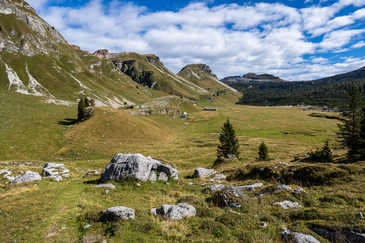
The Van di Citta are two glacial cirques located side by side (“van” is another local word for the cirque) in the region. A hike to these cirques leads to one of the most isolated and lonesome places in the Dolomites. As such, it gives visitors an opportunity to observe the pristine nature of this unspoiled glacial area.
There are two other spectacular summits in this section: Monte Sperone (1,262 m / 4,140 ft), which overlooks Lake Mis and the entrance into the Mis Valley, and Monte Serva (2,133 m / 6,998 ft), which towers high above the city of Belluno.
If you haven't yet planned an expedition to the Dolomiti Bellunesi then here's a video from there to get you inspired for your next adventure:
For outdoor enthusiasts, there are 52 CAI (Club Alpino Italiano—Italian Alpine Club) marked trails of more than 200 km (124.2 mi) in Dolomiti Bellunesi National Park. There are also many themed paths, nature paths, and loop hiking routes to check out. Here are the most interesting hikes in the park:
This is a series of easy trails called Two Steps from the Park’s Door (Due passi alle porte del Parco in Italian). These trails are located on the borders of the park and they are perfect for those who want to explore the nature of the park without climbing into the wilderness.
On these trails, you can find routes with poetic names such as “About Land and Love,” “The Path of the Lost Castles,” and “The Veses Water Way,” among others.
For example, the first route, About Land and Love, is a small trail along the stream of Caorame in the valley of Canzoi on the southern borders of the park, 9 km (mi) from the village of Soranzén in the commune of Cesiomaggiore. The trail offers the opportunity to find the animals and plants that inhabit the stream and the several ponds on it. It is also home to the Park’s Environmental Education Center.
The I Cadini del Brenton Trail is another short but very important thematic trail in the National Park of Belluno Dolomites. It’s located at the northern end of Mis Lake. Here’s what PeakVisor’s founder has to say about the route:
“It is an easy trail featuring a series of about 15 deep cavities that were created by the small waterfalls of the Brenton stream. These features are often referred to as a giant’s cauldron (Marmitte dei giganti).
The spectacular colors and perfect shapes of these features are amazing. On the other side of the parking area, there’s a boardwalk to the terrace overlooking the Soffia Waterfall (Cascata della Soffia).”
To get to the creek and waterfall you can walk 7 km (4.3 mi) from the village of Mis at the southern end of the lake. Or, you can drive the distance by car, which people do mostly.
The Cirques of Vette is a magnificent geology-focused route around the Buse delle Vette (glacier cirques), which allows you to experience the geology and landscape of one of the main places of the park.
This trail takes you past mountains like Vallazza (2,176 m / 7,139 ft), Pavione, Cima di Monsampiano (2,280 m / 7,480 ft), Col di Luna (2,295 m / 7,529 ft), Cima Dodici, and Vette Grandi (2,128 m / 6,981 ft). It also takes you past several passes, all while at an elevation above 2,000 m (6,561 ft).
I did part of this itinerary in September 2019. My conclusion: It is spectacular and very beautiful, but challenging. Some sections of the trail are poorly marked and the road is hard to find—I even got lost.
Also, to get to the trail you have to walk 2 hours all the way up from Passo Croce d’Aune, where the buses rarely go, with a 950 m (3,116 ft) climb before you start the trip. So spending a night in the rifugio before the trip is a good idea.
This is a relatively easy route along the CAI 505 trail. On this hike, you walk among the meadows, woods, and rocks of the Schiara Group in the northeastern part of the park to the main rifugio in this area called 7 Alpini, where you can spend the night.
It is a well-marked hiking itinerary, which begins in the valley of the Val Desedan torrent through the relatively low mountains.
Some of the peaks that you’ll pass on this trek include Col dei Gus (1,119 m / 3,671 ft), Col Torond (1,823 m / 5,980 ft), Cima Tanzon (1,923 m / 6,309 ft), Sas del Mel (2,075 m / 6,807 ft), Croda Lussato (2,265 m / 7,431 ft), Mount Pelf (2,502 m / 8,208 ft) and of course the main summit of the group, the magnificent Schiara (2,565 m / 8,415 ft).
After hiking this trail, you can return to Belluno on foot the next day along the Ardo valley where you’ll see the valley’s main attraction, the beautiful Ponte del Mariano.
The Alta Via delle Dolomiti Bellunesi is a grand, multi-day itinerary that travels through the entire park from northeast to southwest. It allows you to see all of the park’s major attractions and spend an entire week in the wilderness alone with it and yourself.
This is a new route that the National Park of Belluno Dolomites staff created in 2018–2019 with the support of three local outdoor companies as well as the Italian Alpine Club. As of the time of writing, as stated in the trail’s online Summit Book, only 20 or so people have completed the whole route.
The route consists of seven stages, though you can complete the trek in about six days:
Important: Please, do not confuse this route with the two famous long trekking routes in the Dolomites, which are called Alta Via 1 and Alta Via 2. These routes pass through the entire Dolomites, including the territory of the park. You can read more about them in the guides to the Cimonega Group and the Schiara Group. In my opinion, the Alta Via delle Dolomiti Bellunesi route can serve as a great alternative to these more heavily trafficked trails.
Check the Belluno Dolomites ski resorts map on the larger Veneto and Italy ski resorts maps in the World Mountain Lifts section of the site. It includes information about open ski lifts / slopes in the Belluno Dolomites in real-time with opening dates and hours. There are also year-round cable cars, funiculars, cog railways, aerial tramways, and all other types of mountain lifts.
There are no ski resorts in Belluno Dolomites National Park. But on its southwestern borders, there is a small ski area on Mount Avena, which is separated from the Vette Feltrine Mountains by the Croce d'Aune Pass. It is a very quiet, family-friendly and non-touristy place.
At Mount Avena (1,454 m / 4,770 ft), you can do Alpine skiing, free ride skiing, cross-country skiing, snowboarding, and snowshoeing.
There are four blue and three red ski trails, including FISI certified ski runs that host regional competitions. Additionally, there are three lifts that will take you to the top of Avena.
The opening and closing schedules of the resort vary and depend on the weather. For example, in the 2020–2021 season, the resort operated from 5 December to 5 April. However, these dates can change from year to year.
A day ticket to the resort generally costs around €23 for adults and €20 for children, but these are subject to change without notice.
The Dolomiti Bellunesi National Park has many amenities for visitors, including three visitor centers, a botanic garden, an environmental education center, and a nature museum. Each of them focus on a particular aspect of the park.
The main visitor center of the park, which is named Piero Rossi Cultural Center, is located in the provincial capital Belluno. It has exhibits that introduce the entirety of the park. In the city, there is also the nature museum that’s well worth checking out.
Piero Rossi Cultural Center
Piazza Piloni, 32100, Belluno (BL), Italy
Open most days from 7 am to 9 pm
Except Wednesdays (7 am to 2:30 pm) and Sundays (10:30 am to 7 pm)
+39043727030
centroculturale@dolomitipark.it
Museo Naturalistico Dolomiti Bellunesi
Piazza Piloni, 25, 32100 Belluno (BL), Italy
+3904393328
There are numerous Info Points around the park with information boards with maps. For example, one such information is located on Aune Pass:
Croce d’Aune Information Point
Passo Croce d’Aune, 32030, Sovramonte (BL), Italy.
+393311569888
The park’s official website is DolomitiPark.it.
While hiking in the park, you can stay overnight in one of the six rifugios. As is the case with all of the major refugios in the Dolomites, you can get a dorm-style bed in a common room, as well as dinner, breakfast, and shower in all of these rifugios. The rifugios in the park include:
If you follow the long trail through the whole National Park of Belluno Dolomites, you will probably have to spend the night in one of the bivouacs, too. These bivouacs include:
Before and after your hike, you should have no trouble finding lodging in Belluno and other towns within the park. The most popular types of accommodation here are agriturismos, B&Bs, and various houses and cottages in the mountains, which locals rent to tourists in the summer and winter seasons.
The southern section of the Dolomites is overshadowed by more renowned northern and western resorts such as Cortina d’Ampezzo, Ortisei, Moena and others that get most of the attention.
However, in this part of the region, there are just as many splendid towns and resorts. The national park, in particular, is literally surrounded by excellent towns, such as Feltre, Lamon, Imer, Mezzano, Fiera di Primiero, Sagron-Mis, Agordo, and Longarone.
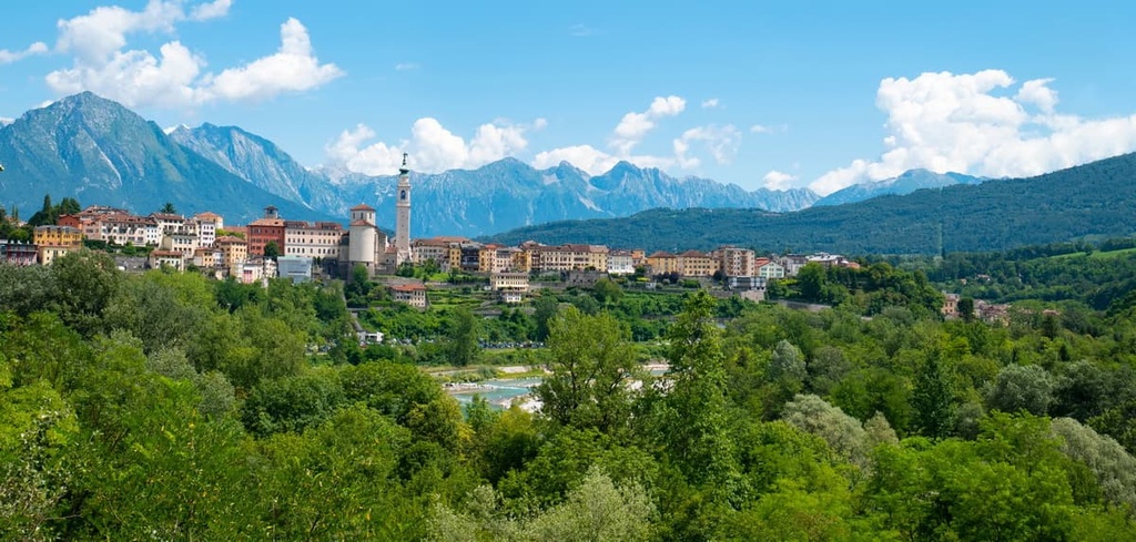
The main city, however, is the beautiful Belluno, which shares its name to the province, the park, and this part of the Dolomites in general. It is located about 10 km (6.2 mi) from the borders of the park, but it is definitely worth a visit.
The ancient city of Belluno is the capital of the namesake province in the Veneto region. Nestled between the imposing Schiara Group of the Dolomites and the Alpine foothills of the Venetian Prealps, the city is conveniently located for those planning to visit the national park.
With a population of roughly 36,000 citizens (2021), Belluno is one of the largest in the Dolomites. Founded around 220–200 BCE, the town played an important role in the Roman Republic. In the city, there are many remnants of the medieval grandeur of this time, too.
The main architectural and cultural attractions of the city include Piazza del Duomo; the Cathedral (Duomo) itself, which has an unusual onion-shaped dome with an angel on top that was created by the famous local artist Andrea Brustolone; Palazzo dei Rettori (built in 1491), a neo-gothic Palazzo Rosso, as well as numerous fountains.
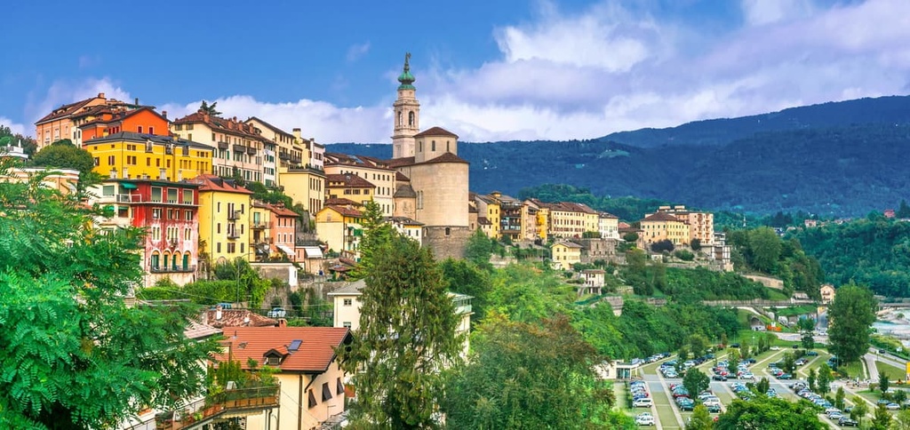
In general, the architecture of the town is a blend of northern alpine chalets and Venetian gothic.
The official tourist websites of Belluno and Valbelluna are Dolomiti.it and InfoDolomiti.it.