Scan the QR code and open PeakVisor on your phone
Vicenza is one of the seven provinces of the Veneto region in northern Italy. The main feature of Vicenza mountains are the low Berici Hills just behind its capital city of the same name and several large and diverse groups of Venetian Prealps range to the north of it. The highest mountain of the province is Cima Dodici (2,337 m / 7,339 ft), which is also the most prominent in the entire range and the 12th ultra-mountain of Italy (1,872 m / 6,141 ft). In total there are 639 named mountains in Vicenza.
The name of the province comes from its capital, Vicenza. This word is derived from earlier variants of Vicetia, Vincentia, and Vicentia, given to the city by the Romans. In turn, they go back to "vincent", which means "victorious". The city also has a second, or rather the first, pre-Roman name, Berga or Bitetia, given to it by the Venetians, from the Indo-European "weik", meaning an administrative unit the size of a large settlement or similar.
Vicenza is the third largest (2,723 sq km / 1,051 sq mi) and the fourth most populous (853,000+ inhabitants) of the seven provinces of the Veneto region. It borders Verona to the west, Padua to the south, and Treviso and Belluno to the east. To the north, it is the province of Trentino in the region of Trentino / South Tyrol.
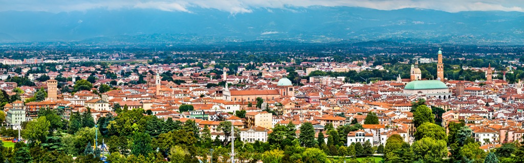
The city of Vicenza itself lies roughly in the middle between Verona and Venice, as one of about a dozen famous northern Italian major cities, also including Padua, Treviso, Brescia, Bergamo, Milan, and others.
The easiest and fastest way to get to Vicenza is by car or by Trenitalia train from one of the above-mentioned cities. The nearest international airports are also nearby—in Venice and Verona. In the province itself, you can travel by public transport on the SVT buses (Società Vicentina Trasporti, Vicenza Transport Society).
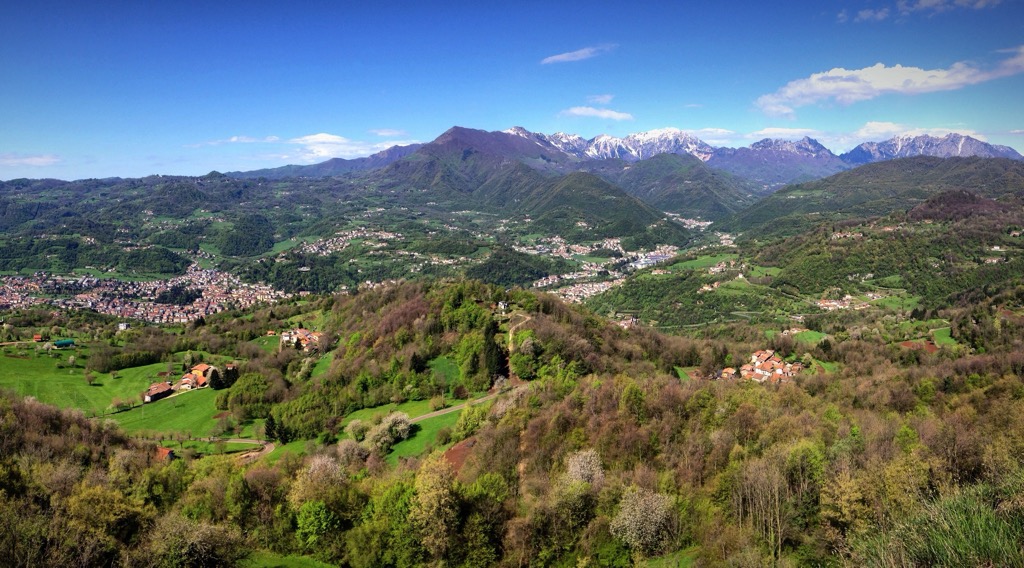
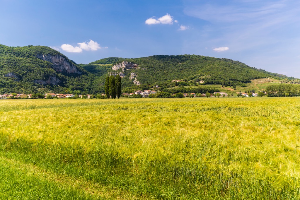
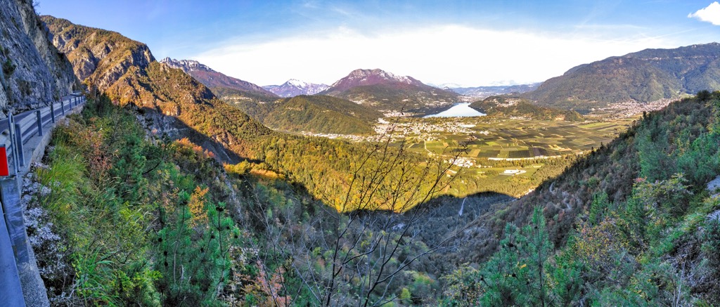
The main and unexpected feature of the Vicenza landscape, which not everyone knows, is that it is rather a mountainous province than a plain. From the city of Vicenza, lying on the western border of the Venetian Plain, it extends far north into the mountains, taking in many of the groups of the Venetian Prealps, which stretch all along the eastern part of northern Italy.
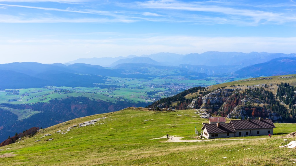
But it is not so simple: inside the mountains, there is a whole series of at least three main extensive high altitude plateaus, the culmination of which is Cima Dodici, but which also lose a lot of attention to the provincial capital.
However, there are some mountains also to the south of Vicenza—the Berici Hills (Colli Berici), as if especially “grown” by someone in the middle of a completely flat plain, shaped by the Pieve River, and others.
The biggest river in Vicenza itself is the Retrone, 12.5 km (7.7 mi) long. It originates at the town of Sovizzo in the west of the province and flows into the larger Bacchiglione in the east.
Other important body of water in the province is the small but beloved by locals Fimon Lake (Lago di Fimon) located in the northern part of the Berici Hills.
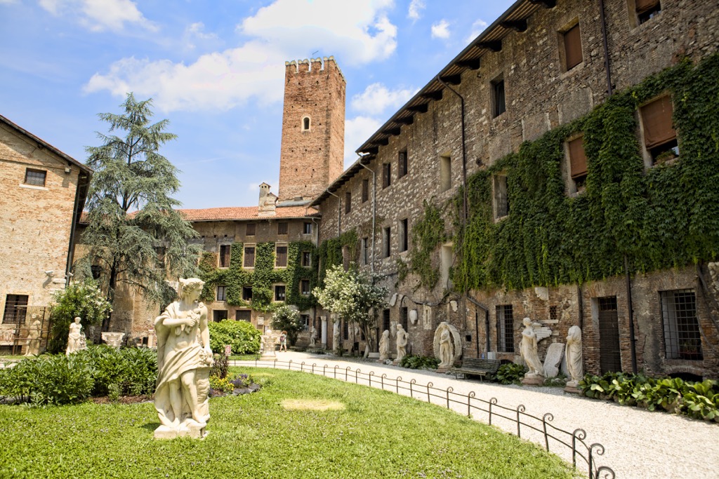
The province's landscape is primarily known for its main man-made feature—the numerous Palladian villas scattered all over it, as well as in many other places in the Veneto region. These are villas designed by Renaissance architect Andrea Palladio. They are, like the entire historic center of Vicenza, a UNESCO site under the precise name City of Vicenza and the Palladian Villas of the Veneto. In total there are 25 villas in the list throughout the Veneto region. In turn, their main characteristic feature is the columns that form the front of the building, which were then adopted by many other architects around the world in the construction of similar villas, as well as other much larger buildings—for example, in St. Petersburg in Russia and other cities around the world known for their palaces and man-made park complexes.
The mountains of Vicenza province consist of two distinct and very different parts — the Berici Hills immediately south of the center of its capital and the Venetian Prealps, which run along the entire western, northern, and northeastern border of the province.
Berici Hills is a compact series of more than a few dozen hills with a total length of 24 km (15 mi) and a total area of about 165 sq km (64 sq mi).
They are carbonate hills formed by the deposition of sand, mud, and marine animals and plants at the bottom of an ancient sea 100 million years ago. This distinguishes them not only from the Venetian Prealps but also from a similar series of hills to the east in the province of Padua, the Euganean Hills, which are of volcanic origin, that is, were formed by lava flows from the bottom of the same ancient sea.
The highest point of Berici Hills is Monte Lungo (445 m / 1,459 ft), located approximately in the geographical center of the area. Do not get confused: the famous Church of St. Mary of Mount Berico (Basilica di S. Maria di Monte Berico), on the Monte Berico overlooking the Vicenza, is at the very beginning of the hills, which increase as you move south of the city. Except for Monte Lungo, in the Berici Hills there are about a dozen more hills also above 400 m (1,312 ft) and several dozen more above 300 and 200 m (984 to 656 ft), that is, the average elevation of the area is quite high.
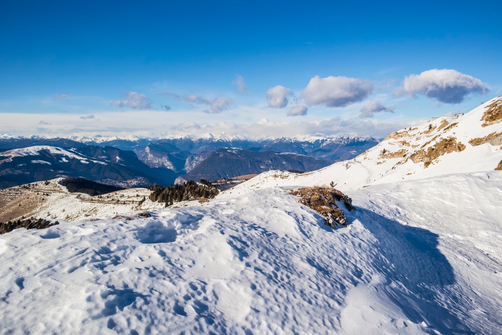
The Venetian Prealps are one of the main mountain ranges in the Southern Limestone Alps or Southeastern Alps (depending on the classification system used: AVE or SOIUSA) of the greater Alps.
If we use the Italian SOIUSA for the Alps, the Venetian Prealps are range number 32. Within this subrange, there are two major parts and more than 10 smaller groups with their own unique features, in total, many of which are partly in the province of Vicenza in one way or another, namely:
Vicentine Alps (Prealpi Vicentine)
Belluno Prealps (Prealpi Bellunesi)
That is, of all the huge Venetian Prealps, the province of Vicenza does not include only their easternmost part—Catena Cavallo-Visentin of the Belluno Prealps (Prealpi Bellunesi). That’s how mountainous this province is.
According to the classification of the Eastern Alps from the German-Austrian Alpine Club (AVE), the Venetian Prealps do not exist. But don't worry. On the AVE map, they are part of the Vicentine Alps (Italian: Prealpi Vicentine, German: Vizentiner Alpen), which is number 54 in this system, so it includes only the mountains in the western part of the range.
The main individual mountains of Vicenza are respectively the highest in each of the subgroups, often repeating the name or rather the opposite—the groups are named after the highest mountains. Following the classification above, these are
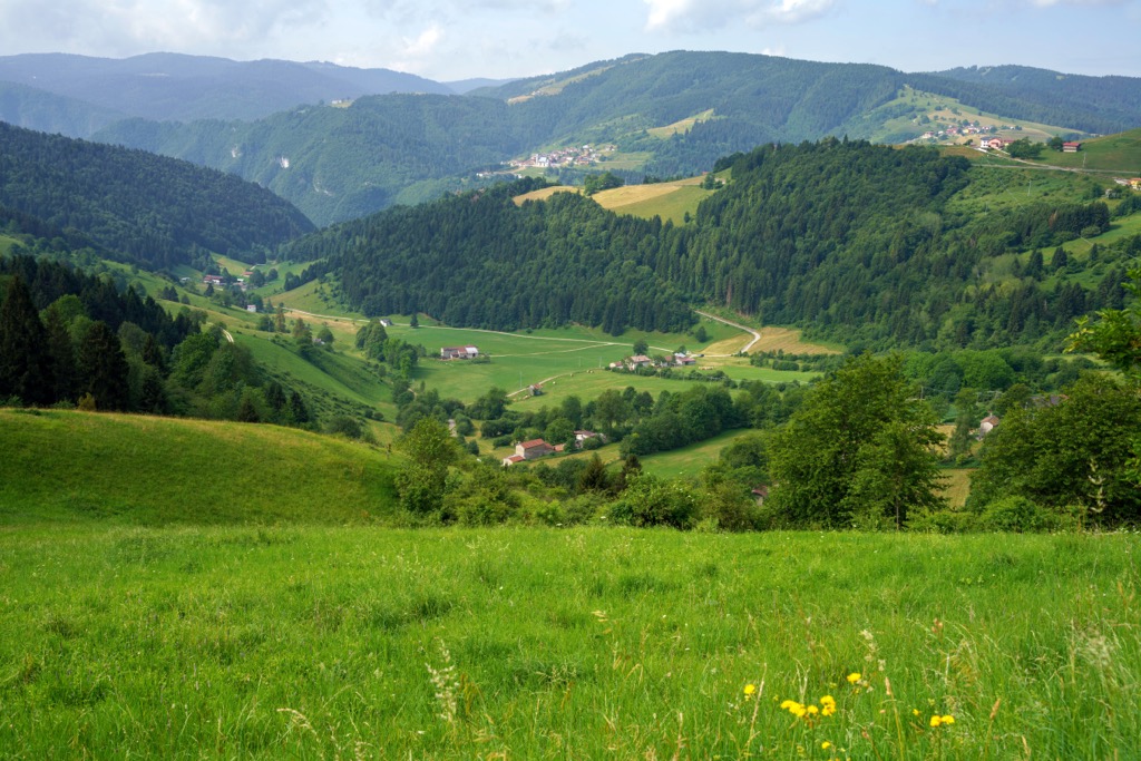
As a result, in the seemingly flat province of Vicenza, there are many high and interesting mountains with excellent opportunities for hiking, which will be discussed immediately below.
The main hiking areas in the Vicenza mountains correspond to its main ranges.
Firstly, around and through all the Berici Hills runs the long Alta Via dei Berici trail of the same name for 130 km (81 mi), divided into 27 sections. The start and finish points are on Fimon Lake. You are unlikely to walk them all, rather stages, for which it is also ideal. The name refers to the famous series of long trails at high altitude Alta Via 1–6 in the Dolomites.
Secondly, Monti Lessini in the north of the province is a regional nature park of the same name, also with many hiking trails. And it does not matter that most of it belongs to the neighboring province of Verona—who in the mountains sees that border?! For example, you can climb Monte Zevola, the highest peak of the entire range from the village of Giazza, one of the main starting points for hiking in the park, or Cima Carega, the highest peak of Piccole Dolomiti group, thanks also to their relative proximity.
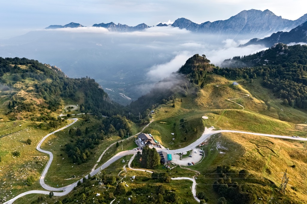
Third, all three vast plateaus in the north of the province—Folgaria, Lavarone, and Asiago—are also ideal for hiking, even if there were no marked trails (but they are) because you already know that orientation in open terrain is easier than in mountain or forest terrain. In particular, right from the center of the town of the same name Asiago, you can climb Cima Dodici itself, the highest in the entire province, on a relatively easy 17 km (11 mi) long trail with an elevation gain of 1,300 m (4,265 ft), but it is better to shortcut by driving to Malga Galmarara, the last point on the route accessible by road.
Fourth, the same can be said for Monte Grappa, the easternmost of the main peaks of the Vicenza mountains. The route to the top is also iconic among cyclists because many stages of the Giro d'Italia bicycle race have finished there.
Fifth, the famous long Sentiero della Pace (The Peace Trail) of 500 km (311 mi), which starts at Passo del Tonale between Lombardy and Trentino, and ends at Val di Fassa in the Dolomites, also passes through the province. The aforementioned Cima Carega is one of more than a dozen official main peaks on the route, which is another reason to hike it, even if you don't take the Peace Trail.
In the mountains of Vicenza there is one huge ski resort, one large, and several smaller ones:
Learn more about these and other ski resorts in the Veneto region and Italy in general in World Mountain Lifts, including open and closed ski slopes and lifts in real time.
Before or after your hike, visit the official tourist office in Vicenza, located in the city center, to learn more on the spot, ask for advice, pick up a map, and the like.
Vicenza Tourist Office
Piazza Matteotti, 12, Vicenza, Italy
+390444320854
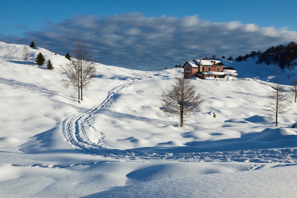
When hiking in the Vicenza mountains, you can stay overnight in the same basic types of accommodations as in other parts of the Alps, namely mountain huts, free shelters, campsites, and more.
For example, if you go to the highest peak of the province and the entire Venetian Prealps, Cima Dodici, at the very foot of the summit you will find the bivacco Busa delle Dodese, which has 6 beds. In this area, you can also find Baito di Bivio Italia and bivacco Bordignon, both of which are very rustic accommodation options for up to 3 hikers.
Among the nearest mountain huts, there is rifugio Larici da Alessio, which is located near the neighboring summit of Cima Portule (2,310 m / 7,578 ft).
As far as camping goes, some of the best campgrounds include Camping Valmalene, Camping Punta Indiani, Camping Valmalene, and Farms & Agricampeggio “Montibeller Valter” located mostly on the opposite side of the mountain in the province of Trentino where the main town is Borgo Valsugana.
Before and after your hike, you can also easily find a variety of accommodations in nearly any village that’s located within the province, including the Berici Hills area.
In addition to Vicenza (110,000+ inhabitants), the province's nine other largest cities and towns include Bassano del Grappa, Schio, Valdagno, Arzignano, Thiene, Montecchio Maggiore, Lonigo, Cassola, and Malo (14,000+). There are 116 communes in all in the province.
As you can see for yourself, there is no Asiago among them (6000+), which means it is a great reason to visit it in search of a less touristy and authentic experience.
In particular, the commune located right in the center of the eponymous vast plateau is known for the Asiago Astrophysical Observatory (Osservatorio astrofisico di Asiago) with 1.22-meter (in) telescope in the memory of Galileo Galilei and the affiliated Cima Ekar Observing Station (Stazione osservativa di Asiago Cima Ekar) on the namesake Cima Ekar (1363 m / ft) with a 67/92-cm (in) Bernhard Schmidt telescope (named after the Estonian optician, who invented it) and the 182-cm (in) telescope dedicated to Nicholas Copernicus, the largest in Italy. The observatory is managed by the University of Padua, which has a department of physics and astronomy.
The other six communes form the Altopiano dei Sette Comuni, as it is also known: Conco, Enego, Foza, Gallio, Lusiana, Roana, and Rotzo.