
Scan the QR code and open PeakVisor on your phone
Padova is home to 88 named mountains. The highest is Monte Venda at 603 m.
Padova is one of the seven provinces in the Veneto region of northern Italy. The main feature of Padova mountains is the Euganean Hills (Colli Euganei), a group of 88 volcanic peaks compactly located right outside the city, which not everyone who visits it knows, but it is the most famous city near Venice. The hills themselves are famous among others for their hot mineral springs and spa complexes based on them. They also make up the Euganean Hills Nature Park (Parco dei Colli Euganei). The highest and the most prominent peak of these hills and the entire Padua province is Monte Venda (603 m / 1,978 ft).
The name of the province of Padova is the English version of the Italian "provincia di Padua". Most likely, the word comes from "Padus", the ancient name of the Po River, the main one in all of northern Italy, forming the plain of the same name also known as Padan or Patavium in Latin (again from Padus). The name can further be divided into three parts: "pat"—a "flat open place" or "plain" (the Latin "patera" also means "flat"), "av"—a "river", and "ium"—an association of several villages in the area. As a result, the meaning of the name of the province of Padua is very simple—it describes its main natural features: the plain and the river, as well as the settlements on them.
Padua (2,141 sq km / 827 sq mi) is one of the seven approximately equal size provinces of the Veneto region in northeastern Italy, along with Venice, Rovigo, Vicenza, Verona, Treviso, and the northernmost Belluno in the Dolomites—the only one it does not border, therefore Padua is located in the heart of the Veneto, with the other provinces surrounding it from all sides.
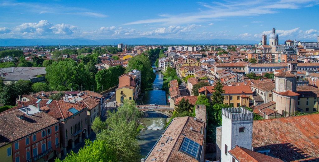
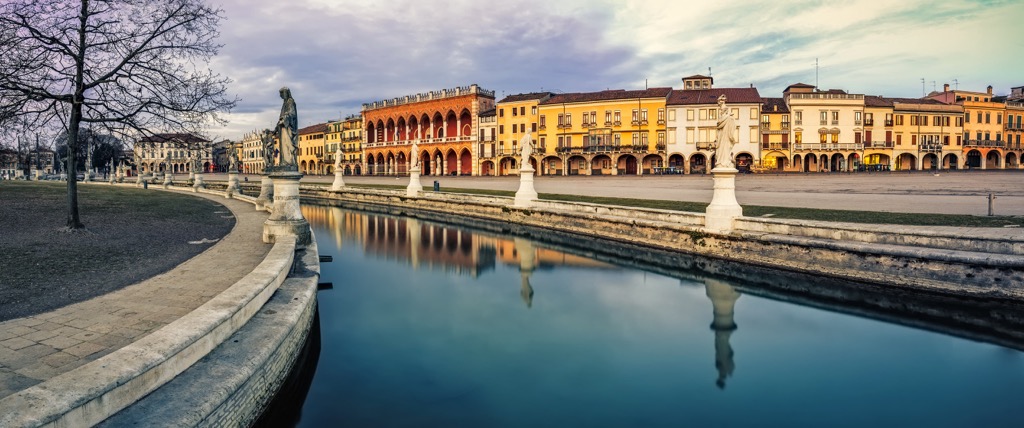
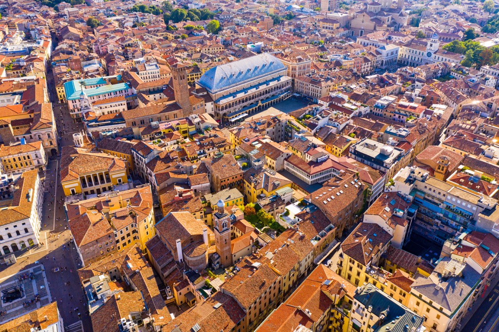
The largest city in the province is the eponymous Padova (Padua).
The easiest and fastest way to get to Padua is by train from Venice or Vicenza in about half an hour or, of course, by car (41 km / 25 mi, 40 minutes).
Within the province, you can travel by Fsbusitalia.it, and within the city of Padua itself on the magnificent Padova Tram of the French Translohr company. This is another feature of this city and the province because modern (and in general) trams are not found in all cities in Italy, which is more the good exception than the norm.
The main natural features of the Padua province other than the Euganean Hills (Colli Euganei), which will be discussed below, are the plain, the many rivers, the Adriatic Sea, and the hot thermal springs. I will briefly speak about each of them:
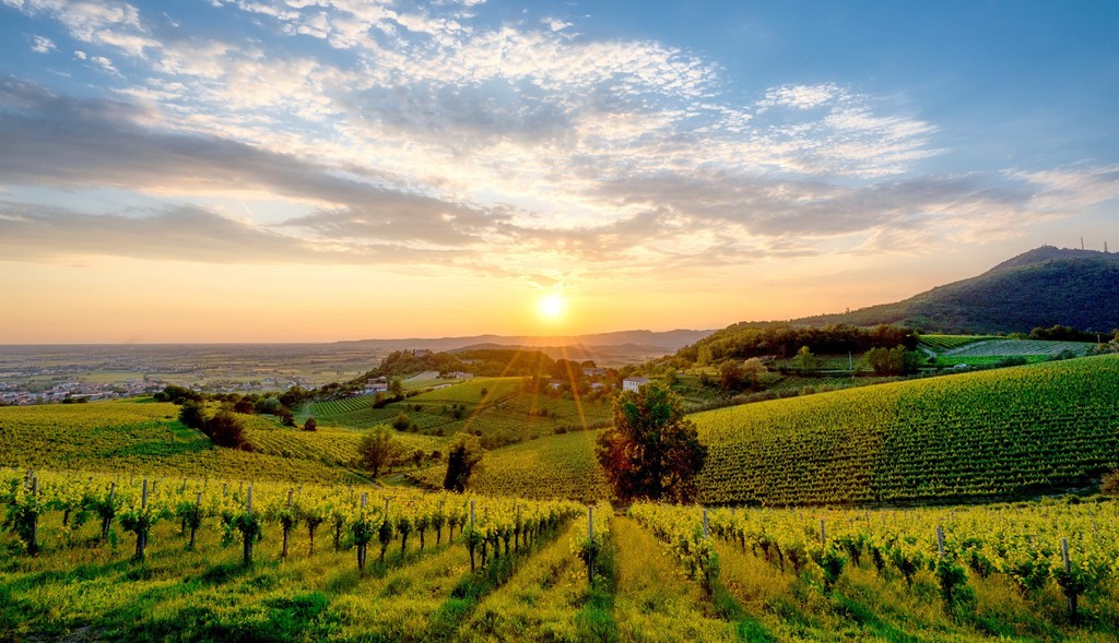
Po River Plain is the largest plain in all of Italy, which occupies almost the entire north of the country and on which all the above-mentioned world-renowned cities are located. Moreover, it is the largest in all of Southern Europe. It is also known as the Padan Plain (Pianura Padana in Italian) from its Latin name Patavium. It is formed by the largest river in this part of Europe, the Po, which flows through the plain directly from west to east from Monviso (3,841 m / 12,601 ft) in the Cottian Alps in Piemont on the Italian-French border to the Adriatic Sea near the town of Adria in the province of Rovigo south of Venice.
However, the Po bypasses the province of Padua to the south of its borders. But through the province flow several other of Italy’s longest rivers, which start in different places (further in parentheses) but also flow into the Adriatic Sea:
Just like about the hills in Padua with its thermal springs, not everyone knows that the eastern borders of the province touch the southwestern part of the Venice Lagoon of the Adriatic Sea with its unique ecosystem(s). Here is also the town of Chioggia, also called “Little Venice” or its good alternative without tourists. South of it is River Po Delta Nature Park (Parco naturale regionale Veneto del Delta del Po) at the mouth of the Po River, as the name implies.
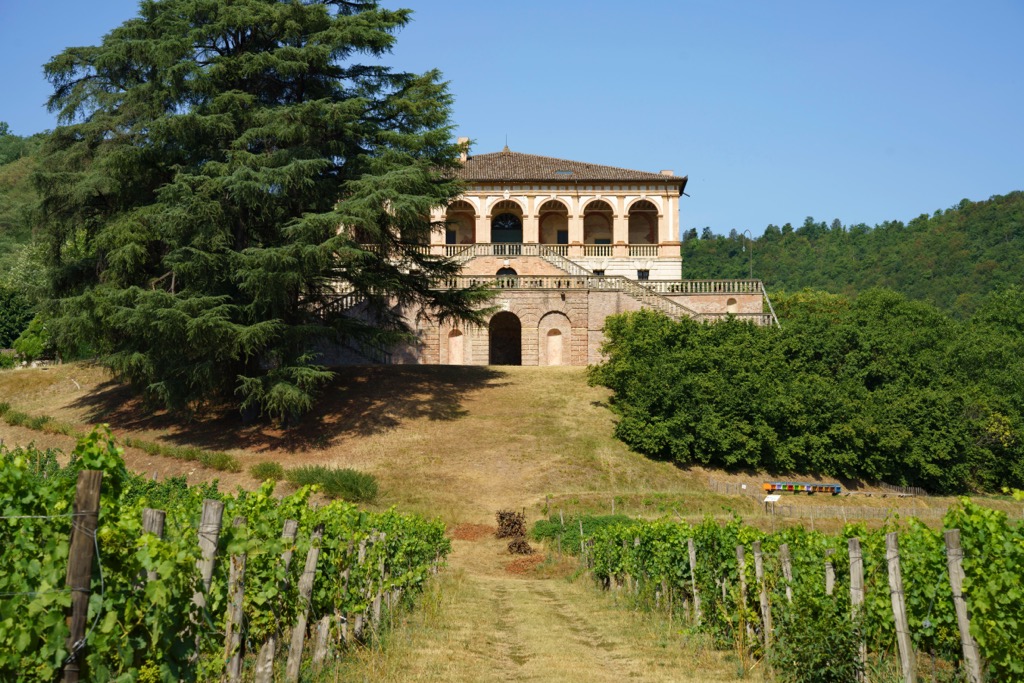
Euganean Thermal Baths (Terme Euganee) are more than 130 thermal spas and around 220 thermal baths with a maximum water temperature of about +80 °C (+176 °F) in Euganean Hills. There a few spa complexes established around them (you can recognize them by the word “therme”) in ten small villages with the same names: Abano Terme, Arquà Petrarca, Baone, Battaglia Terme, Due Carrare, Galzignano Terme, Monselice, Montegrotto Terme, Teolo, and Torreglia. Among all the springs two largest stand out: Abano Terme and Montegrotto Terme, also thanks to the various archaeological traces that are still visible on the sites, which is proof that Euganean thermalism has been known since at least the Roman Empire but probably even before. So the trip here from Padua is not only health tourism and outdoor activity but also historical and cultural ones at the same time.
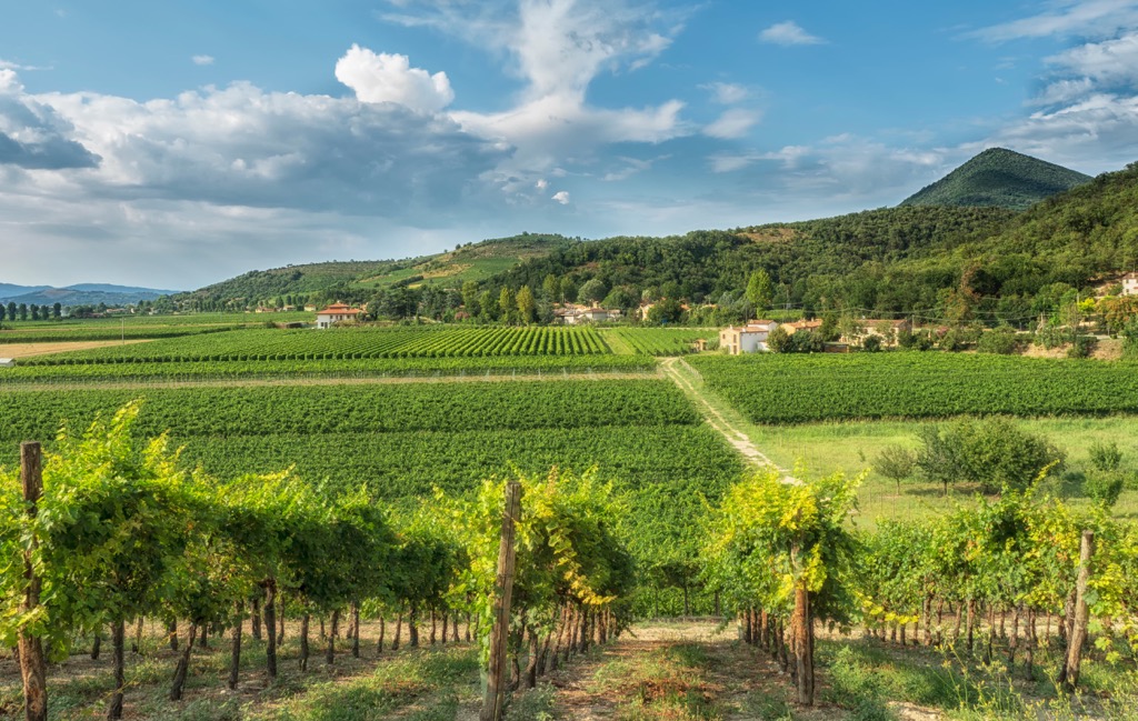
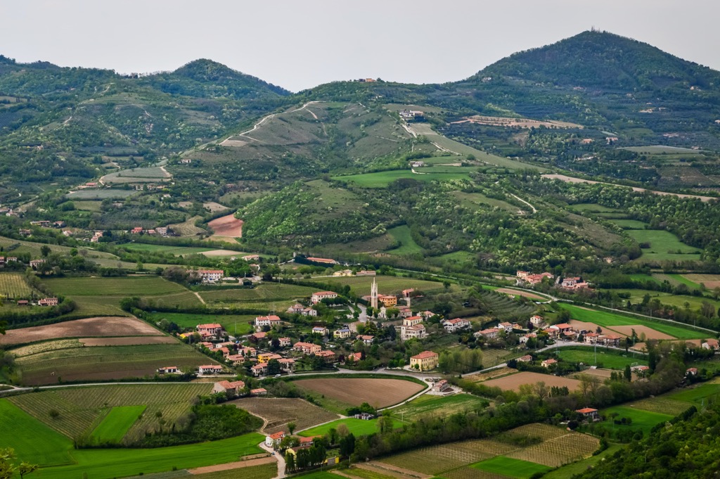
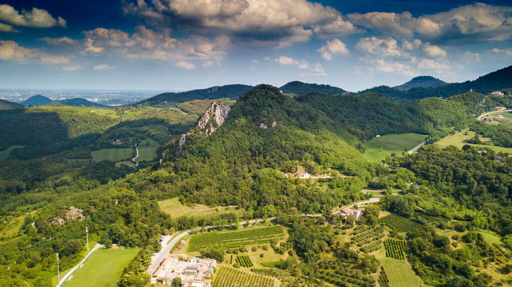
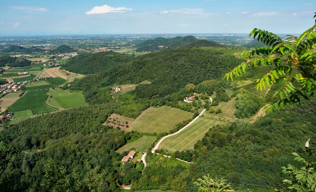
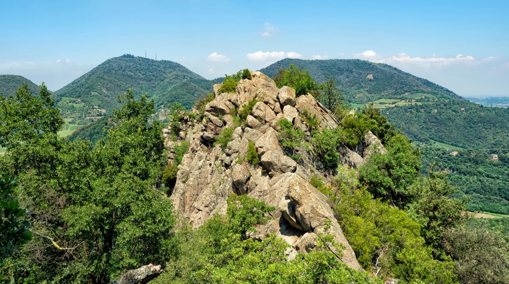
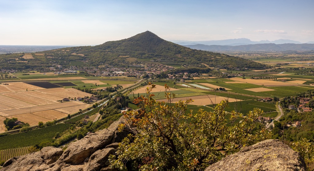
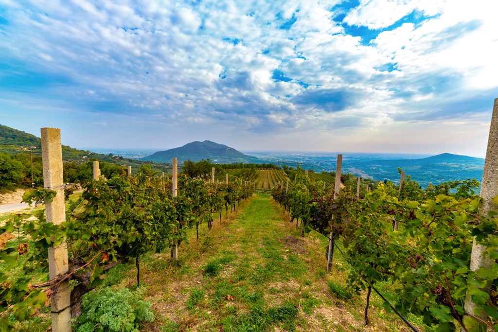
The Euganean Hills (Colli Euganei) or the Padova Mountains are a group of compactly spaced hills right in the middle of the absolutely flat Padana Plain just outside the city of Padua of 88 peaks 20 km (12 mi) long and 10 km (6 mi) wide and a total area of 186 sq km (72 sq mi). In fact, they would be hard to believe if they weren’t real.
The hills range in height from 18 m (59 ft) at Monte Scaiaro to 603 m (1,978 ft) at Monte Venda, which is predictably the most important and famous, it can also be recognized by the radio tower at the top. The second highest is Monte della Madonna (503 m / 1,650 ft) and the third is Monte Baiamonte (486 m / 1,594 ft). Other less high but also well-known peaks are Monte Rua (416 m / 1,365 ft), Monte Rusta (396 m / 1,299 ft)—they must not be confused with each other, Monte Cinto (282 m / 925 ft), Monte Ceva (225 m / 738 ft), Monte Cecilia (199 m / 653 ft).
Do not hurry to turn around if you are used to higher mountains. Although the lowest of Euganean Hills is only 18 m (ft), the third from the end is already three times higher than it is—60 m (197 ft), so the average height of the mountains of Padua is quite high—about 100–200 m (328–656 ft).
In terms of geology, the Euganean Hills are of volcanic origin and were formed around the time of the formation of the main range of the Alps. They were formed by lava flows that rose from submarine volcanoes to the surface in the Eocene (56 to 34 million years ago) and formed into characteristic deposits in the Oligocene (34 to 23 million years ago).
Finally, I guess, you are wondering where did the name come from? Like many other mountains in Italy in general (such as the Rhaetian Alps to the north closer to Austria or the Aurunci Mountains to the south between Rome and Naples), they are named after the ancient Euganeans (Euganei) people, who lived here before the assimilation by the Romans.
In addition to Euganean Hills, in the province of Padua there are about a dozen hiking areas and at least one interesting and scenic long hiking route that everyone who is going to come here should know about.
The best hiking trails of Padua are expectedly located in the Euganean Hills, which also form the eponymous Euganean Hills Nature Park (Parco dei Colli Euganei), the first regional nature park in the Veneto region that opened in 1989.
Today it is one of 11 such parks and nature reserves of the regional level in Veneto. Other famous areas besides the Po River Delta Nature Park, which I have already mentioned are Lessinia Nature Park (Parco naturale regionale della Lessinia), Ampezzo Dolomites Nature Park (Parco naturale regionale delle Dolomiti d’Ampezzo), Bosco Nordio Nature Reserve (Riserva naturale integrale Bosco Nordio), and others.
The whole Euganean Hills Nature Park is covered by trails, which form a network of more than a dozen hiking routes from the shortest, up to 10 km (6 mi), most often leading to the peaks, to multi-day routes up to 41.5 km (26 mi) and 2000 m (6,561 ft), such as the Alta Via dei Colli Euganei, which covers the central part of the park. You can hike it in two or three days with overnight stays in one of the villages or even spa complexes! The name refers to a series of famous trails in the Dolomites—Alta Via 1, Alta Via 2...—a total of six or even eight. Similar long trails also run in other mountain groups of the Alps such as Alta Via delle Adamello.
Learn more about this and other trails in the Euganean Hills in a separate guide to the park.
In the city of Padua itself, as well as in the rest of the Po River Plain of the province of Padua, there are also green areas for hiking:
The main long hiking route of the province of Padua is Il Cammino di Sant’Antonio or the Way of Saint Anthonio. It is a long itinerary named after saint Antonio of Padova, that goes through the territory of Padova province.
The route begins in Santuari Antoniani di Camposampiero in Camposampiero, just north of Padua, and ends in Santuario de La Verna, east of Florence, so it runs mainly through the famous hills of Apennines of the two regions: Emilia-Romagna and Tuscany. The length of the route is 430 km (267 mi), which can be covered in 22 days.
To complete the picture: recently a northern section was also added to the route, leading to the Santuario di Sant’Antonio di Gemona in the town of Gemona in the Friuli Venezia Giulia region. This section is 250 km (155 mi) long and can be completed in 11 days.
Padua sometimes gets snow in winter, but of course, there are no ski resorts in the province.
The nearest major resort, LeMelette-Gallio with 18.2 km (11 mi) of slopes and 4 ski lifts, is near Asiago in the neighboring province of Vicenza. To the west of it in Trentino, there is an even larger Folgaria/Fiorentini with 70 km (43 mi) of slopes and 19 ski lifts, enough to last you several days, if not a whole week.
You can also go to the east to the province of Belluno, where the nearest resorts are Croce d'Aune-Monte Avena with 7 km (4 mi) of slopes and 2 ski lifts, a small resort but with excellent views of the National Park of Belluno Dolomites, and the larger Alpe del Nevegal with 23 km (14 mi) of slopes and 5 ski lifts.
Learn more about these and other ski resorts in the Veneto region and Italy at World Mountains Lifts, including open and closed ski slopes and lifts in real-time.
Before or after the hike, visit one of the official tourist information offices of Padova, located at the train station (Piazzale della Stazione), Galleria Pedrocchi (Piazzetta Cappellato Pedrocchi, 9), and Basilica of Saint Anthony (Piazza del Santo, 11). Phone: +390495207415, email: info@turismopadova.it, site: Turismopadova.it.

For an overnight stay in the Euganean Hills you can easily find all kinds of accommodations from B&Bs and apartments to 5-stars hotels with spas. Perhaps in the case of this area, famous for its mineral springs, it is a very good chance not to miss. Where else can you relax in a natural hot bath after a hike, and at the same time improve your health? According to the same official tourist site of the region Visitabanomontegrotto.com, which is cited above, there are hundreds of accommodation options in Euganean Hills to choose from, which are very conveniently classified by type and city in the PDF-brochure available at the link.
Within the province of Padua, there are a total of 102 communes, of which the nine largest after the capital with a population of over 210,000 people are Albignasego (24,000+), Vigonza, Selvazzano Dentro, Abano Terme, Piove di Sacco, Cittadella, Monselice, Rubano, and Este (15,000+). The province is home to almost a million people in total—as many as in Verona, Venice, Padua, and Treviso separately (almost 5 million in Veneto).
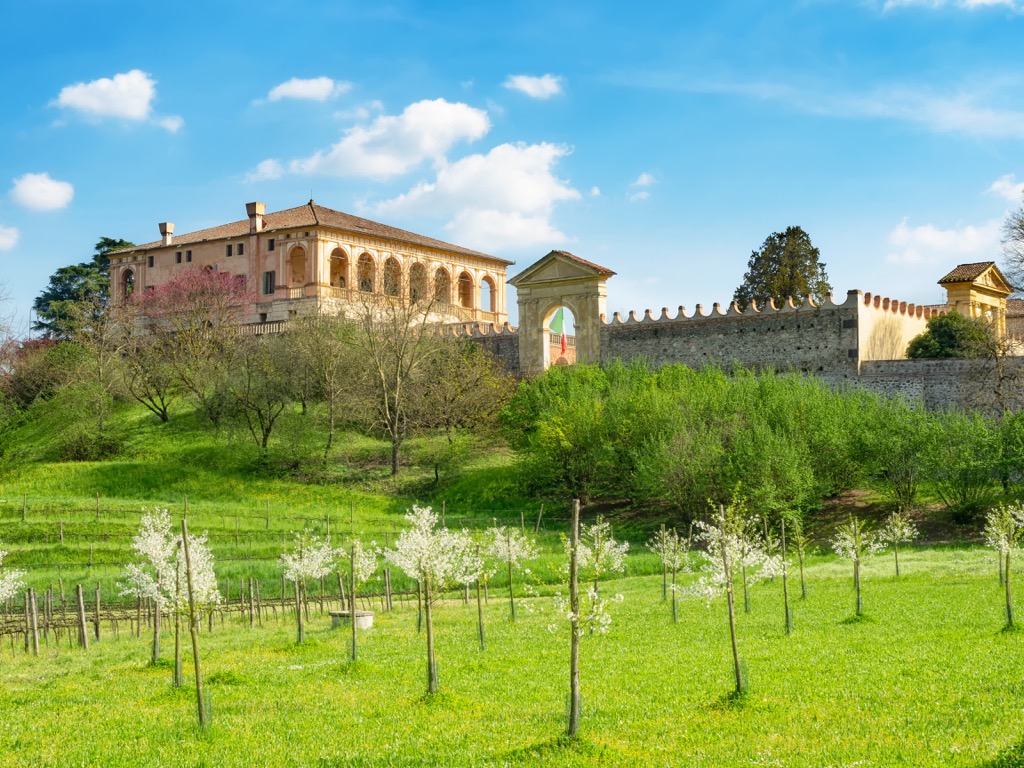
Of all the above-mentioned cities, I would recommend a visit to Cittadella, a small but unique medieval town north of Padua, whose name translates as Citadel. It is almost perfectly round town with a diameter of 450 m (1,480 ft) and is enclosed by a 1,461 m (4,793 ft) wall with high watchtowers, around which you can walk to see it from above. The town—excuse me—is just stuffed with old buildings, which it is better to see than to read/hear about it.
According to the town’s official tourist website, Visitcittadella.it, more than 80,000 people do it every year, so better choose mid-season and working days, because on a narrow wall where it is difficult to separate two people can be a real human traffic.


Yes. Padova has 88 named mountains. The highest is Monte Venda at 603 m.
The highest mountain in Padova is Monte Venda, at 603 m.
Padova has 88 named mountains.


