
Scan the QR code and open PeakVisor on your phone
Monti Aurunci Nature Park has 91 named peaks. The highest is Monte Petrella at 1,533 m. Other notable peaks include Monte Campetelle, Monte Sant'Angelo and Cima dello Stretto.
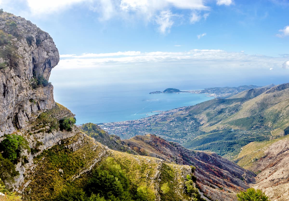
Monti Aurunci Nature Park is one of nearly two dozen natural areas in the Lazio region of Italy. The park’s main feature is its 91 named mountains as well as its highest and most prominent peak, Monte Petrella (1,533 m / 5,030 ft), which offers a magnificent panoramic view of the Tyrrhenian Sea coast and the Aurunci Mountains. The park is also famous because it is home to the Hermitage of St. Michael the Archangel.
Monti Aurunci Nature Park (Parco dei Monti Aurunci) takes its name from the ancient Aurunci tribe, who were an Italic people that inhabited the territories of central coastal Italy before the formation of the first Roman state.
The Aurunci also lived to the south of Volsci, an Italic Osco-Umbrian tribe. The Volsci were enemies of the Roman Republic for many years, though they, like most others on the peninsula, were eventually conquered by the Romans and integrated into the republic.
Monti Aurunci Nature Park, which was founded in 1997, is located in central Italy in the southern part of the Lazio region. The city of Rome is also located in Lazio, though Rome is situated well to the north of the nature park. The total area of the park is 193.74 sq. km (74.8 sq. mi).
Most of the park is located in the province of Latina in the municipalities of Campodimele, Fondi, Formia, Itri, Lenola, and Spigno Saturnia. The smaller, northern part of the park belongs to the municipalities of Ausonia, Esperia, Pico, Pontecorvo, and Cassino in the province of Frosinone.
The park's boundaries almost entirely coincide with those of its namesake mountain group. Both the park and the range are bounded to the south by the Tyrrhenian Sea near the town of Formia. On the other three sides, the park’s boundaries are defined by a large plain and two large mountain valleys:
To get to the park, you have to get from Rome to the towns of Fondi, Itri, or Formia. These towns serve as the three main entry points to the park from the south, as they are all located on the park's borders.
By car, it is about 170 km (105 mi) in distance (roughly a 2-hour drive) from Rome to any of these cities. If you want to travel by public transport, you can use the regional Trenitalia trains and then the local Cotral buses to get to the park.
The Aurunci Mountains are composed of soft limestones and some other rocks that date back to the Jurassic, Triassic, and Mesozoic eras. The limestone in these mountains is so friable that the area is characterized by a large number of rifts and cracks.
For this reason, these mountains hold almost no rainfall as water seeps very quickly through these rocks. Locals noticed this characteristic of the mountains long ago and, as a result, they began to create wells in the lower parts of the slopes, to collect water.
These wells were also particularly important to the development of communities in the region given the fact that most of the streams in the mountains in this area run dry for the majority of the year, except in the spring when the snow melts in the higher mountains.
Another geological peculiarity of the territory is the presence of a large number of karst caves. This type of karst topography is relatively common in areas such as this one where much of the bedrock consists of limestone and other water-soluble rocks.
The Aurunci Mountains are a compact mountain group with an almost perfect circular shape.
A long central ridge runs through the entire group from southwest to northeast or vice versa, separating the park into two almost equal parts. On both sides of the ridge, there are many large and small valleys.
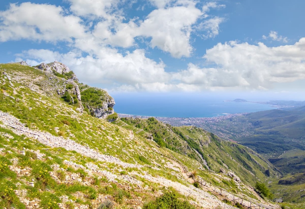
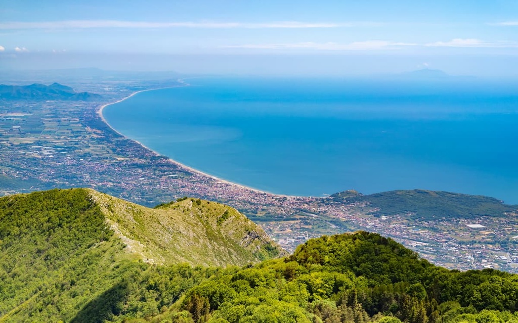
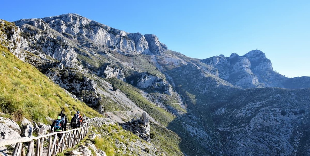
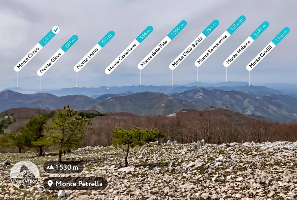
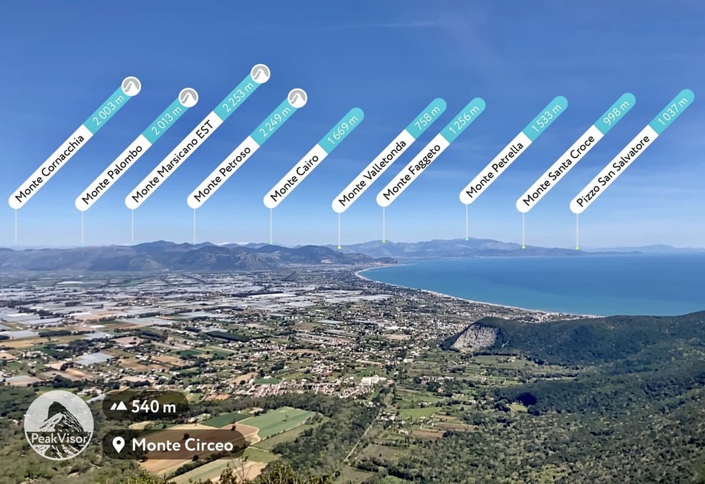
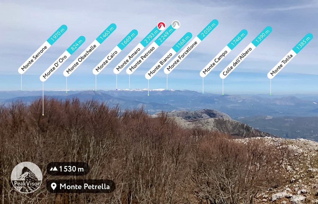
The highest peaks of the park are concentrated in the eastern part almost by the sea, which is the main feature of the landscape of these mountains and is what makes them so accessible. Due to the fact that the peaks are all clustered near the edge of the park, you do not need to travel far to climb them. This is the case, even for the park’s highest peak, Monte Petrella.
The proximity of the high mountains to the sea coast in this part of Italy also makes the view of the coastal towns even more beautiful. From the tops of the mountains, you can see the many towns and villages that dot the coast of the Tyrrhenian Sea.
In the northern part of the park, the mountains transition into hills and eventually the flatness of the Latin Valley.
Like all natural areas in Italy, Aurunci Mountains Nature Park is home to a variety of flora and fauna.
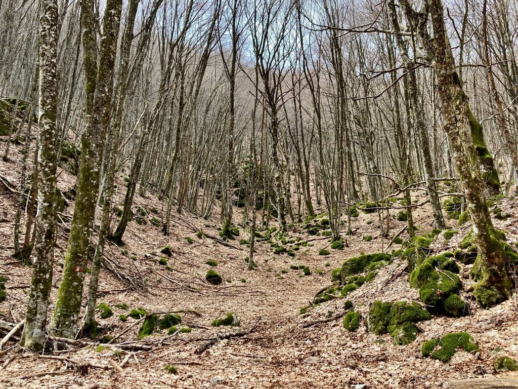
The mountains of the park are mostly covered with dense beech forests, especially on the northern slopes of Monte Petrella and Monte Faggeto.
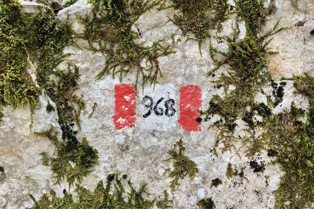
On a separate note, it’s worth mentioning the large interior beech forest canyon that you’ll travel through on your way to the highest peak of the park on Trail 968. This trail takes you between the Sella Strampaduro pass and the Fossa Juanna hollow, which looks amazing when in bloom during the spring months.
The park also has oaks, hornbeams, as well as apple, pear, and chestnut trees, among many others. In the Monte Le Pezze and Monte Trina areas, there are also mixed forests of oaks and maples.
In short, there is a great variety of trees in Monti Aurunci Nature Park. The park’s many different sections are each home to their own unique forest ecosystems.
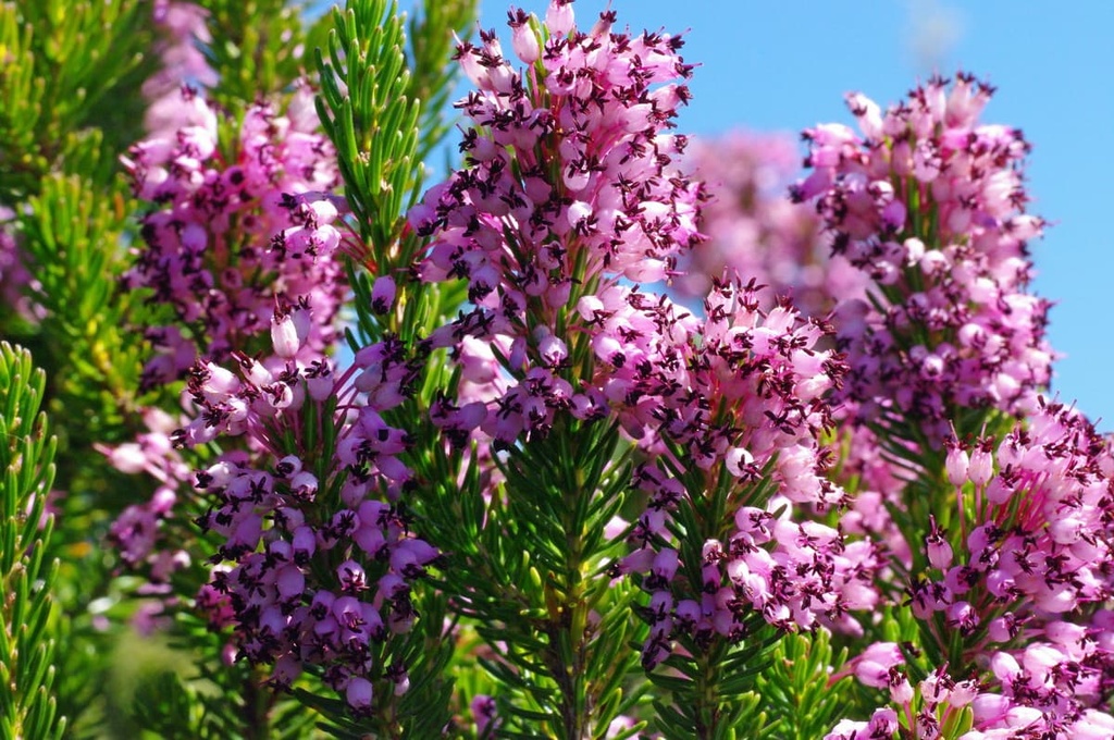
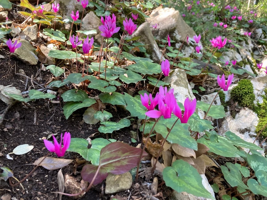
During the warm season, the forest is also covered with many flowers. For example, during a hike in mid-April, you’re likely to see crocuses in bloom. The Aurunci Mountains are also known for their more than 50 species of orchids.
The park’s diverse landscape and rich flora provide an ideal habitat for a variety of animal species. Among the main animals that you can hear and see in these woods are birds such as the harmless oriole, cuckoo, swallow, and nightingale, as well as predators such as the owl and peregrine falcon, among others.
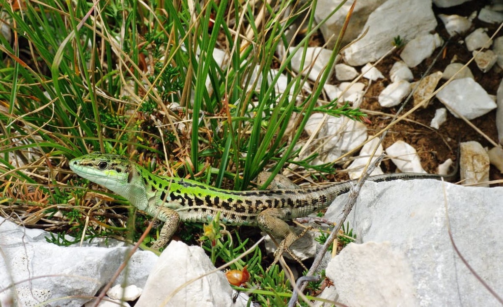
The park is also home to many reptiles, such as lizards and snakes. Thankfully, venomous species like the viper are rare. Salamanders, newts, and toads live in the park’s waterways, too.
In the caves of the park, there are 21 species of bats, some of which are considered rare. Among the larger mammals found in the park are hare, fox, marten, badger, and boar. According to the park’s official website, several wolves, which disappeared in large numbers long ago in these and other mountains, have returned to the Aurunci Mountains.
The Aurunci Mountains are one of three relatively small mountain groups that are part of a larger group called the Volsci Mountains (Monti Volsci) within the Apennines. The group also includes the Ausoni Mountains (Monti Ausoni) and the Lepini Mountains (Monti Lepini). All three groups are located almost along the coast of the Tyrrhenian Sea, one after the other. Together with several neighboring mountain groups to the west and east, these mountains cover about two-thirds of the area between Rome and Naples.
The Volsci Mountains in turn belong to the Antiapennines of Latium or Latium Antiapennines (Antiappennino laziale), which are the Antiapennines (Antiappennini) or foothills of the greater Apennines.
The word “anti” here is not negative at all but speaks only of the Antiapennies’ geological differences from the main system of the Apennines. In other parts of the long Apennine Peninsula, the foothills are also called Preapennines (Preappennini) and Subapennines (Subappennini).
All of these terms effectively mean the same thing. But, the residents and researchers in the area can’t agree as to which term to use so we have all three.
The Apennines of Latium are a continuation of the Apennines of Abruzzo (Appennino abruzzese), one of the two parts of the Central Apennines on par with the Umbria-Marche Apennines (Appennino umbro-marchigiano).
With regards to important summits in the region, the main and highest peaks of the park with elevations above 1,000 m (3,280 ft) are all located in the southeast of its territory in one large compact group. Meanwhile, the northwestern part of the park is mostly a hilly area where the height of the mountains does not exceed 1,000 m (3,280 ft).
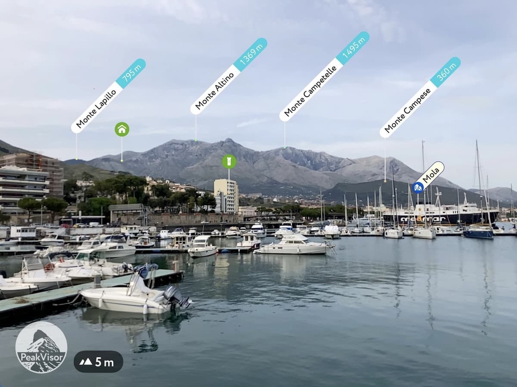
In addition to the highest summit of the park, Monte Petrella (1,533 m / 5,029 ft), which is also the highest in the province of Latina (another reason to climb it), it is also worth naming a few other notable peaks, such as:
Some of these peaks can be seen from the port of Formia, where you can get a bus transfer if you make your way to the park via public transport.
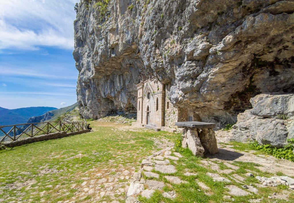
Another famous mountain in the same area is Cima del Redentore (1,253 m / 4,110 ft). Not far from it, there is the main human-made attraction of the park, the Hermitage of St. Michael the Archangel (Eremo di San Michele Arcangelo), a sanctuary built directly into the rock. It dates back to the year 830 CE, but the stone facade that covers the natural cave was rebuilt in the neo-Gothic style in 1893.
At some distance from these summits, you can also find the smaller Monte Fammera (1,163 m / 3,815 ft). From here, you can get a beautiful view of the Valley of the Saints and the surrounding landscape. Monte Petrella and its neighboring peaks are also visible from the valley.
The tops of most of these mountains have a dome shape that is rocky and free of vegetation. There are hiking trails that lead to the tops of most of these peaks, too.
This means that they are great viewpoints that you don’t have to pay to access, but that you have to make some effort to reach. Don’t be fooled by the relatively low elevation of these mountains, though. Remember that in this case, the elevation of a given peak is similar to that of its prominence and your ascent will begin at sea level.
From Monte Petrella, you can see many other mountains of the Central Apennines. For example, you can see Monte Amaro (2,793 m / ft), which is an ultra with a prominence of 1,813 m (5,948 ft) and one of the top 10 peaks in the whole Apennines. It is located in Majella National Park (Parco Nazionale della Majella).
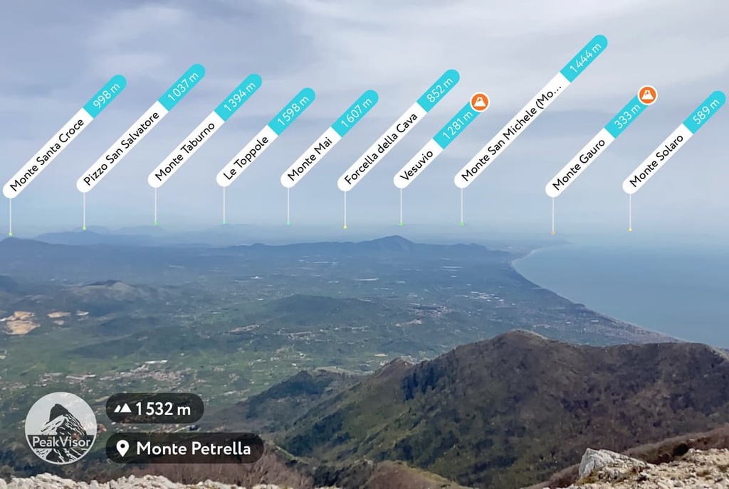
Another notable mountain that is easily identified by PeakVisor and which you can’t help but know is Vesuvio (1,281 m / 4,202 ft). Thanks to the app, you can also learn about the existence of Monte Gauro, also known as Mount Barbaro, another mountain of volcanic origin with a height of 331 m (1,085 ft).
Ultimately, the mountains within the park are incredibly beautiful and interesting in their own right. They are particularly fantastic places to test out the peak-identifying skills of your PeakVisor app and to snap some incredible photos from your adventures.
Aurunci Mountains Nature Park has many marked hiking trails of varying lengths and levels of difficulty However, given that the highest mountains in the park are located in its southeastern region and that you can see the sea from them, this part of the park can also be considered the main hiking area in the region.
With that in mind, here are some of the best hikes in Monti Aurunci Nature Park to check out during your next visit to the area.
Among the individual trails, of course, the loop route to Monte Petrella from the village of Spigno Saturnia in the Valley of the Saints is the first one to consider.
But be careful from the start: The village has two parts, the lower (Inferiore) and the upper, (Superiore or Vecchio). The distance from one to the other is 4 km (2.4 mi) and there is an elevation difference of 300 m (984 ft) between the two of them. There are almost no buses between the villages, so you have to walk the distance to the start of the route if you’re traveling by public transport.
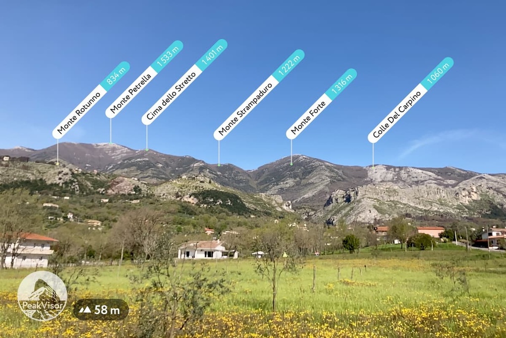
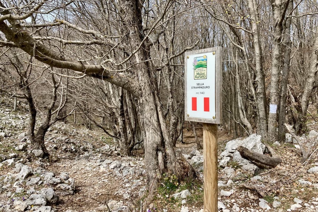
From Spigno Saturnia Superiore, a scenic and relatively easy trail follows to the pass of Sella Strampaduro (1,140 m / 3,740 ft). This is the second point of additional attention in the middle of the route.
Here many navigation tools, including PeakVisor, show two equivalent trails to Monte Petrella: one takes a short route through the Monte Strampaduro (1,222 m / 4,009 ft) of the same name as the pass, and the other bypasses it.
I could not find a direct trail to the peak as it doesn’t appear to be well-marked. It is, therefore, better to follow the marked Trail 968, which is longer but easier. It passes through dense beech forests, except for a stand of a spruce forest between Forcella Fossa Juanna and the summit itself.
The return trip can be done in several ways: via the short and direct paths 913b and 913, and the slightly longer one through Monte Sant’Angelo. On the descent, you should also take into account the fact that it is more difficult to walk downhill here than it is to walk uphill because of the thick forest and fallen trees.
But once you have passed through this difficult section (about one-third of your way back to the trailhead), you can cut over to a wide dirt road that runs parallel to the trail—it is much easier to walk on. In the beginning, this road has no markings, but these trail markers appear closer to the end of the hike when the path merges with the road.
This whole route is about 15–18 km (9.3–11.1 mi) long, not more, and it has an elevation gain of about 1,500 m (4,921 ft) from Spigno Saturnia Inferiore. The average travel time is at least 9–10 hours, but it is better to budget an extra hour or two, just in case.
For example, I started from the bottom of the village at 9 am and didn’t return until 5 pm (9 hours total). I was able to take one of the last buses back to Formia, though I spent exactly an hour for lunch at the top. But I walked fast and hardly ever stopped along the way, except for at the pass, where I searched for the trail for about 5–10 minutes.
The Cammino degli Aurunci is a long route that takes you through the entire southern part of the park, including through all its main natural and man-made attractions.
It consists of several stages, each of which is about 20 km 12.4 (mi) long, for a total distance of 100 km (62.1 mi). This long trail is suitable for those who want to spend more time in the park or for people who are interested in visiting some historic religious sites. The word "cammino" in the name also suggests that the trail takes you to the major religious landmarks of the area.
In this southern part of Monti Aurunci Nature Park, between Fondi, Formia, and Minturno, there is also the majestic Appian Way (Via Appia), which crosses the park and its surroundings. This route follows one of the earliest of the many famous Roman state roads. It leads from Rome to Brindisi, province of Apulia, on the Adriatic Sea.
The road is not hard to recognize—it’s paved with cobblestones that have been in place for thousands of years. It was built between 312 and 264 BCE. There are also Roman milestones on the road that used to be placed a mile apart (not all of which have survived) as well as modern markers that tell you that the road still exists.
In particular, there is a 2.5 km (1.5 mi) long section of the road that has been specially restored to showcase the importance of the Via Appia in the history of Rome. There are more than a dozen informational signs along this section.
The entrance to this section of the road is located exactly midway between the towns of Fondi and Itri. It is situated on the SS7 road near Fortino S. Andrea, just north of the small settlement of Vastomano.
You can also pick up a booklet about the road at the park’s visitor center or download it electronically from the park’s website.
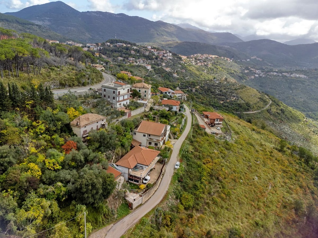
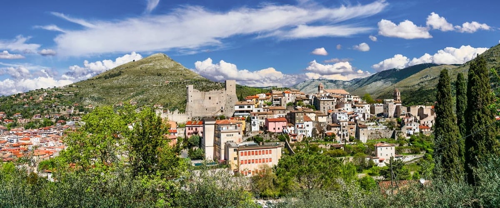
During your hiking adventures in Monti Aurunci Nature Park, be sure to visit its main visitor center, which is located in the town of Campodimele.
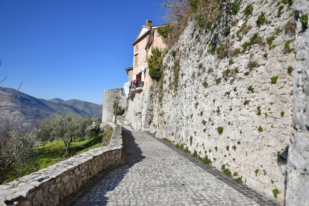
In fact, Campodimele is worthy of a visit in its own right. This incredibly picturesque medieval town, which is surrounded by a walled fortress, is situated on a high hill in the northwestern part of the park.
The town is also famous as a place of Italian longevity. The average lifespan of the town’s residents is over 90 years, as has been noted by many local and international media outlets.
In addition, there are other visitor's centers, museums, and educational centers in different parts of the park, a list of which you will find on the park's official website. Here is some basic information about the main visitor center to get you started.
Ente Regionale Parco dei Monti Aurunci
Viale Glorioso, 10, 04020, Campodimele, LT, Italy
+390771598114, +390771598130
There are no mountain huts in Monti Aurunci Nature Park, as travelers to the Alps are accustomed to. But there are free huts and shelters in the park that are also called rifugio in Italian.
First, there is rifugio di Pornito, which is located near the Hermitage of San Michele Arcangelo. However, it only operates as a restaurant. It is closed in winter and open only on the weekends during the shoulder seasons.
Second, there are the free huts at rifugio di Acquaviva, rifugio di Tozze (space must be reserved in advance by special application on the park's website), rifugio di Monte Appiolo, and rifugio La Valle.
But I wouldn't rely on these shelters as they can either fill up or be otherwise unavailable. Therefore, it’s best to find a more reliable source of shelter for the night during your travels to the park.
In some parts of the park and on its borders, you will find many other types of accommodation. For example, there are two hostels, Ostello Palazzo Spinelli and Ostello Ossigeno, in the park.
You can also find some apartments on Airbnb. Additionally, you can check out the I Giardini di Margius hotel as well as the three agrotourismos in the region: Agriturismo Campello, Agriturismo Dal Cacciatore, Agriturismo Valle Dei Pini.
For an even more exciting accommodation option, you can check out the SarAnd Relais Farmhouse Fondi, where you can taste locally-produced food and spend the night, all in one place.
You can also take your tent and other camping equipment to the park, but this is not officially allowed. There are no special places for independent camping in the park with a firepit, source of water, and so on.
However, in general, Italian regional laws allow you to camp as a means of overnight accommodation in an extreme situation if you have not managed to find a place to stay before sunset. In any case, it is not recommended to spend more than one night in one campsite in the park as it is only allowed in emergency situations.
There are six fairly large towns located on the borders of the park, from which you can begin your journey through the Aurunci Mountains:
All of these towns are great places to stay and visit. Each has a wealth of architectural and cultural attractions, one mention of which would take a separate article to describe. In particular, all of these towns, except Sperlonga, are known for their huge medieval fortifications.
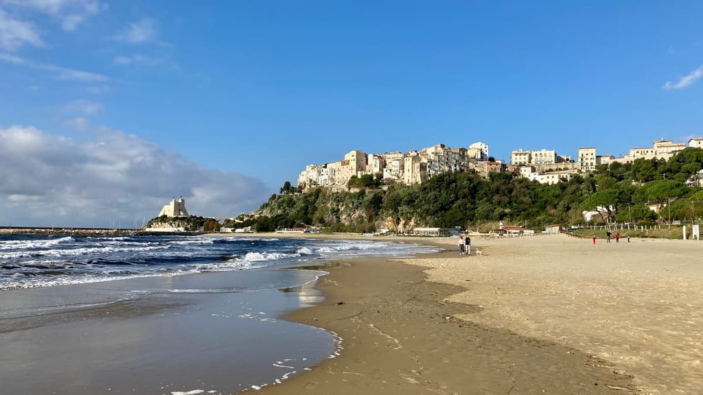
As for Sperlonga, its existence is just hard to believe. Thanks to its Old Upper Town, it looks literally like a postcard or a frame from an old black and white Italian movie. But its most famous individual attraction is the ruins of the villa of the second Roman Emperor Tiberius, which is located on the seashore next to the grotto.
So despite the larger distance between the city of Sperlonga and the park compared to the rest of the nearby towns, it is a great base for hiking in the region.
For more information, check out the official tourism site of Sperlonga: SperlongaTurismo.it.


The highest peak in Monti Aurunci Nature Park is Monte Petrella, at 1,533 m.
Notable peaks in Monti Aurunci Nature Park include Monte Petrella, Monte Campetelle, Monte Sant'Angelo, Cima dello Stretto and Monte Altino.


