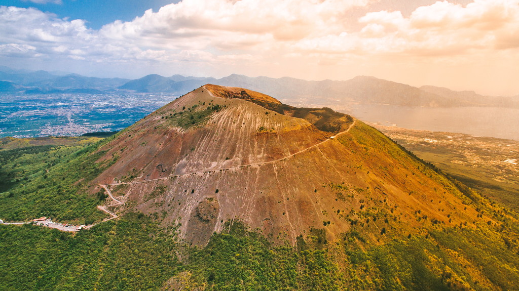
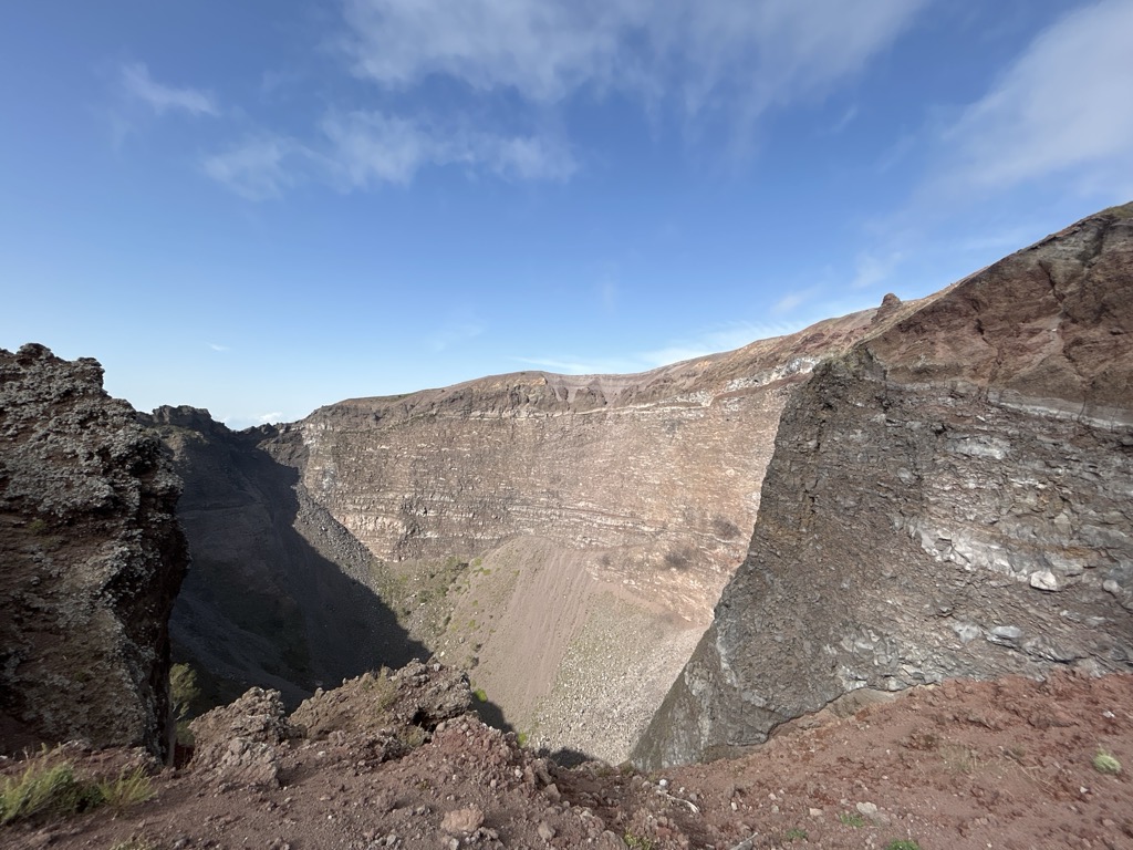
Mount Vesuvius ( viss-OO-vee-əs) is a somma–stratovolcano located on the Gulf of Naples in Campania, Italy, about 9 km (5.6 mi) east of Naples and a short distance from the shore. It is one of several volcanoes forming the Campanian volcanic arc. Vesuvius consists of a large cone partially encircled by the steep rim of a summit caldera, resulting from the collapse of an earlier, much higher structure.
The eruption of Mount Vesuvius in 79 AD destroyed the Roman cities of Pompeii, Herculaneum, Oplontis, Stabiae and other settlements. The eruption ejected a cloud of stones, ash and volcanic gases to a height of 33 km (21 mi), erupting molten rock and pulverized pumice at the rate of 6×10⁵ cubic metres (7.8×10⁵ cu yd) per second. More than 1,000 people are thought to have died in the eruption, though the exact toll is unknown. The only surviving witness account consists of two letters by Pliny the Younger to the historian Tacitus.
Vesuvius has erupted many times since. It is the only volcano on Europe's mainland to have erupted in the last hundred years. It is regarded as one of the most dangerous volcanoes in the world because 3,000,000 people live near enough to be affected by an eruption, with at least 600,000 in the danger zone. This is the most densely populated volcanic region in the world. Eruptions tend to be violent and explosive; these are known as Plinian eruptions.
We use GPS information embedded into the photo when it is available.
3D mountains overlay
Adjust mountain panorama to perfectly match your photos because recorded by camera photo position might be imprecise.
Move tool
Rotate tool
Zoom
More customization
Choose which peak labels should make into the final photo and what photo title should be.
Next
Photo Location
Satellitte
Flat map
Relief map
Latitude
Longitude
Altitude
OR
Latitude
°'''
Longitude
°'''
Apply
Register Peak
Peak Name
Latitude
Longitude
Altitude
Register
Teleport
PeakVisor
This 3D model of Sagarmatha National Park in Nepal was made using the PeakVisor app topographic data. The mobile app features higher precision models worldwide, more topographic details, and works offline. Download PeakVisor maps today.
Download OBJ model
PeakVisor
The download should start shortly. If you find it useful please consider supporting the PeakVisor app.
PeakVisor for iOS and Android
Be a superhero of outdoor navigation with state-of-the-art 3D maps and mountain identification in the palm of your hand!