
Scan the QR code and open PeakVisor on your phone
Majella National Park has 180 named peaks. The highest is Monte Amaro at 2,793 m. Other notable peaks include Monte Acquaviva, 2626 and Anticima Ovest Monte Acquaviva.
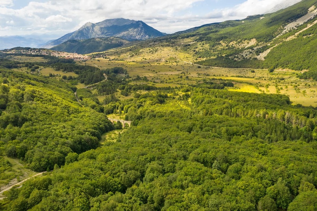
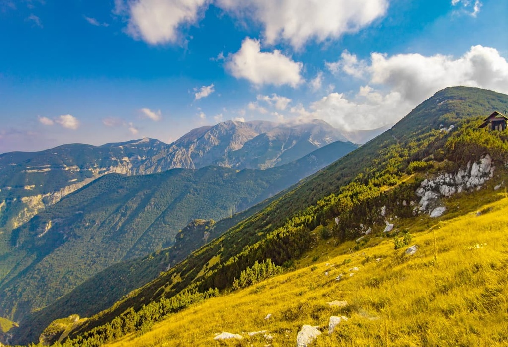
Scale some of the highest mountains in the Apennines and explore otherworldly karst landscapes at southern Italy's Majella National Park. There are 180 named mountains in Majella National Park. The highest and the most prominent mountain in the park is Monte Amaro (2,793 m/9,163 ft).
Located in the region of Abruzzo in southern Italy, Majella National Park (Parco Nazionale della Majella) covers an area of approximately 740 sq. km (286 sq. mi). The park was established in 1995 and is also a UNESCO Global Geopark.
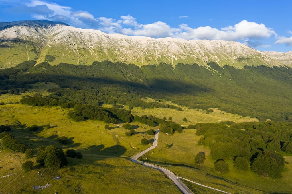
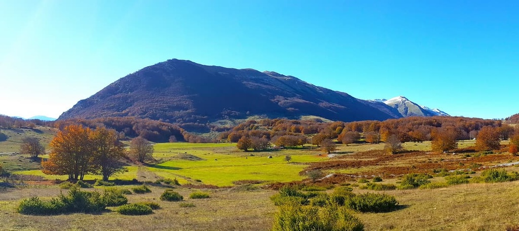
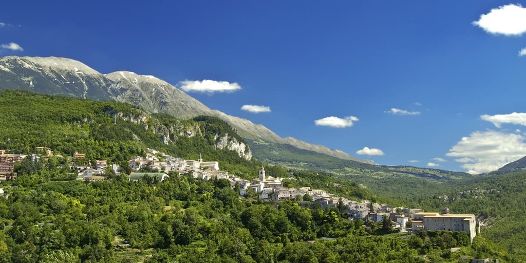
Majella National Park (sometimes spelled Maiella) centers around the Majella massif, a compact mountain group known for its rounded peaks. Majella National Park features a fairly high average elevation, as over half of the park exceeds 2,000 m (6,561 ft) above sea level. This makes the Majella the second-highest massif in the Apennines after the Gran Sasso d'Italia.
The park encompasses three other minor mountain massifs: Montagne del Morrone, Monti Pizzi, and Monte Porrara.
In the western part of the park is the Montagne del Morrone, the second-largest massif in the park, with an average elevation of 1,700 m (5,577 ft). The highest mountain in the Morrone massif is Monte Morrone (2,061 m/6,762 ft).
Meanwhile, Monti Pizzi is located in the southeastern part of the park and is lower in elevation than the other massifs. But it features extensive beech forests and rugged limestone reliefs, so it’s a wonder to behold nonetheless. Monte Porrara is a minor massif and a southern offshoot of the Majella massif.
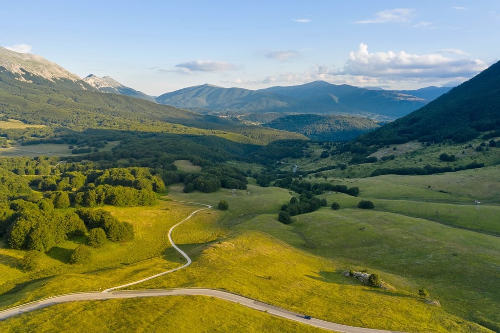
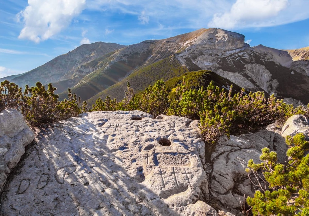
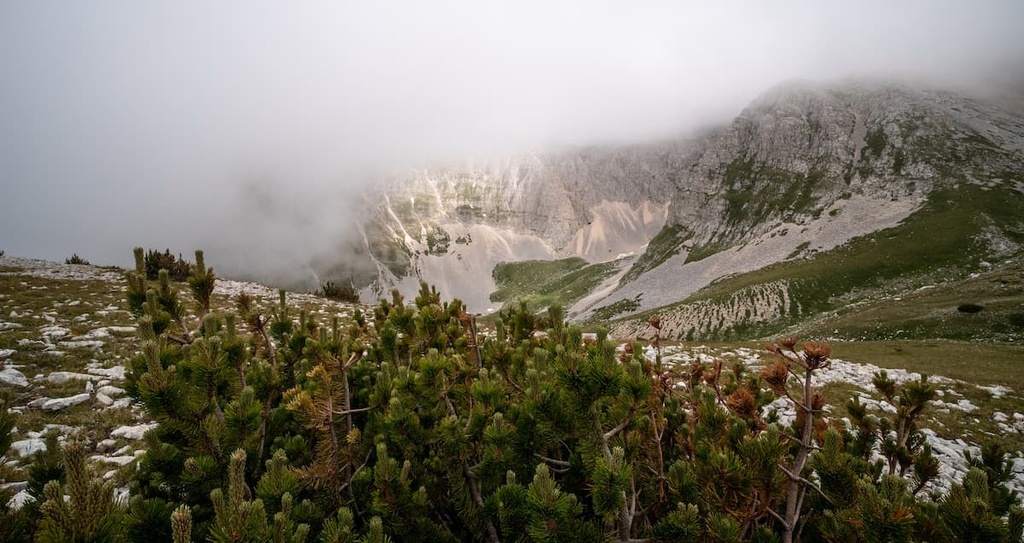
The high-elevation areas of Majella National Park are similar in appearance to alpine zones found elsewhere in the region, with boulder-strewn karst plateaus, scree cliffs, and snowy valleys. Forests and prairies cover approximately 39 percent and 29.5 percent of the park, respectively.
Several rivers flow through Majella National Park, including the Orta, Orfento, Aventine, and Vella. These rivers have carved from the limestone landscape several dramatic narrow canyons, the finest of which is the Orta Valley (Valle dell'Orta) near the park's center. The only permanent bodies of water within Majella National Park are two minor lakes: Ticino Lake and Battista Lake.
Since it is located within the 1,200 km (750 mi) long Apennines, Majella National Park is also situated close to two other mountainous national parks.
In particular, Gran Sasso and Monti della Laga National Park (Parco Nazionale del Gran Sasso e Monti della Laga) is located less than 30 km (18.5 mi) to the north of Majella, while the National Park of Abruzzo, Lazio and Molise (Parco Nazionale d'Abruzzo, Lazio e Molise) is located approximately 30 km (18.5 mi) to the west.
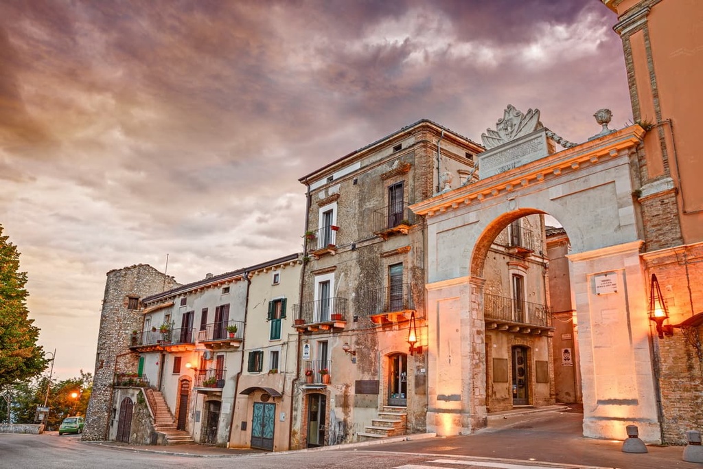
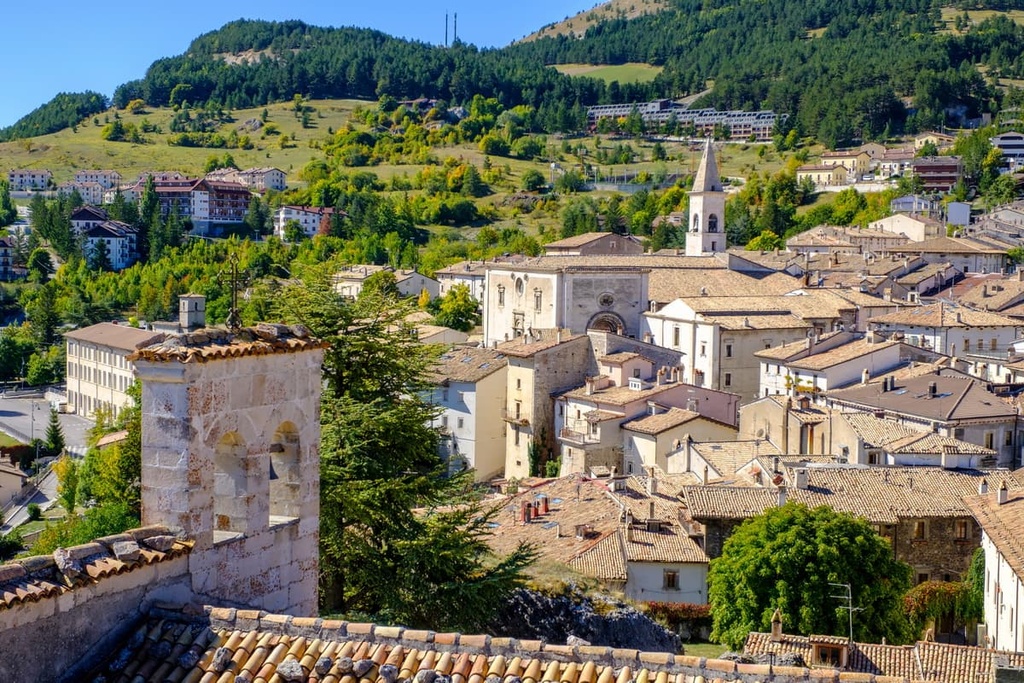
The heart of Majella National Park is rugged and untouched by humans, with no significant settlements within its interior. That said, several of the small towns and villages dotted around the edge of Majella National Park are popular tourist destinations, including Pacentro, Caramanico Terme, and Pescocostanzo.
The largest settlements on the park's borders include Sulmona and Guardiagrele. The biggest city in Abruzzo, Pescara, is located approximately 90 km (56 mi) to the northeast of Majella National Park.
Geologists consider the Majella massif to be one of the most intriguing areas in the Apennines. The massif consists primarily of limestone that was formed when dead sea creatures were deposited at the bottom of a tropical sea over 100 million years ago. As a result, the area is rich in fossils.
The mountains of Majella National Park were shaped during the Apennine orogeny, a mountain-building event that occurred approximately 5 million years ago during the Pliocene epoch.
In the park, the mountains have an anticlinal structure. Their rounded peaks, cirques, and high valleys formed as a result of glacial movement during the current Quaternary geological period. Across the northern and eastern boundaries of the massif, rivers have carved several deep valleys, such as Orfento Valley (Valle dell'Orfento) and Taranta Valley (Valle di Taranta).
Furthermore, the park's karstic topography and subterranean waterways mean there are over 100 caves in the Majella and Morrone massifs.
One notable example of such a cave is Grotta del Cavallone, which is famed for its numerous stalagmites, flowstones, and rimstone pools. Another famous cave is la Grotta Nera, or the Black Cave, known for its rare white tongue-shaped deposits that are known locally as ‘mountain milk.’
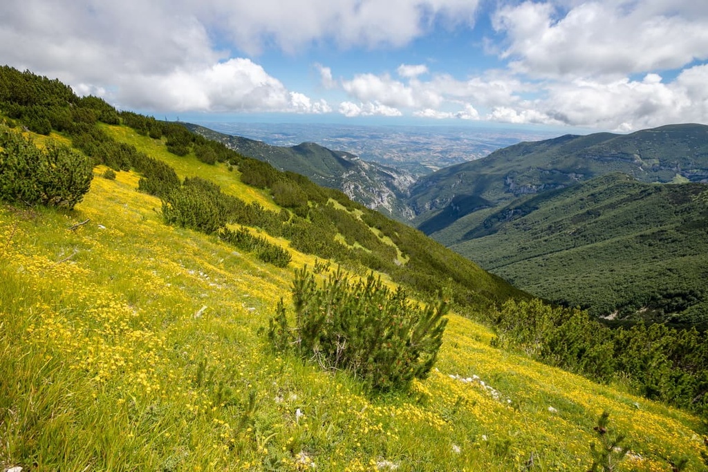
Due to the region’s karst topography and glacial past, Majella National Park has a varied landscape. It includes everything from the gently rounded peaks of the Majella massif to the east to the daunting slopes of the Marrone massif to the west, both of which are separated by karst valleys and plateaus.
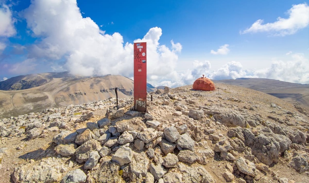
The park ranges in elevation from low points of 130 m (427 ft) up to the summit of Monte Amaro (2,793 m/9,163 ft). Over 20 summits across the park exceed 2,000 m (6,562 ft) in elevation, including Monte Acquaviva (2,737 m/8,980 ft), Monte Porrara (2,137 m/7,011 ft), and Monte Rotella (2,127 m/6,978 ft).
The rare unspoiled environments across Majella National Park are home to a wide variety of fauna and flora, some of which are found nowhere else in the world. Approximately 45 percent of all mammal species and 25 percent of plant species in Italy live within Majella National Park.
One of the most famous residents of Majella National Park is the Apennine wolf. Considered a symbol of the park, Apennine wolves live in packs in all areas of Majella. There are thought to be ten Apennine wolf packs and between 70 and 80 individuals in the park.
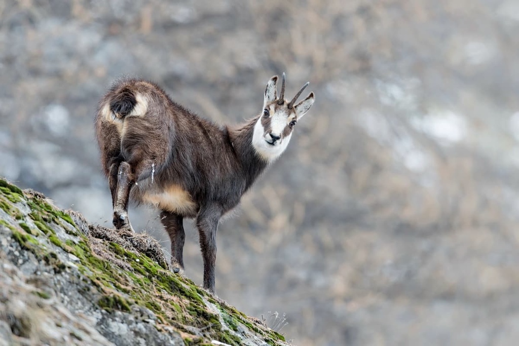
Apennine chamois also thrive in Majella National Park. In fact, the park is home to one of the healthiest populations of Apennine chamois across the entire Apennines. Since their reintroduction to the area in 1992, Apennine chamois numbers have been stable, and there are currently around 1,300 individuals. They are most prevalent around Monte Acquaviva (2,737 m/8,980 ft) and Cima delle Murelle (2,596 m/8,517 ft).
One of the most elusive and sought-after mammals in Majella National Park is the Marisican brown bear. Only 3 or 4 bears live within the park. They are most commonly seen in the forests of Monti Pizzi and the clearings around Monte Pizzalto (1,969 m/6,460 ft) and Monte Rotella (2,127 m/6,978 ft).
Over 130 bird species inhabit Majella National Park, including golden eagles, rock partridges, Alpine choughs, and Eurasian dotterels. Several rare reptile and amphibian species can be found across the park, notably Orsini's vipers, Apennine salamanders, and savi salamanders.
Majella National Park is rich in flora, with over 2,300 documented species and subspecies. Approximately 204 of these species are endemic to Italy.
Seventeen plant species can only be found within the park's boundaries. Notable examples of these endemic species include the Majella cornflower, the Soldanella del Limare, and the Radicchiella della Majella.
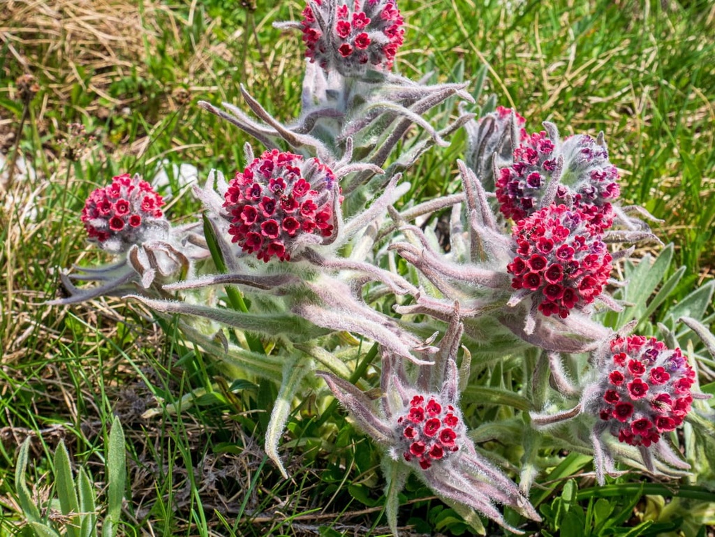
At high elevations, there are many plant relics from the last glacial maximum, including Alpine poppies, Alpine asters, and sedge capillaries. Other notable plant species found across the park include basket of golds, Marsica irises, Majella violets, and Widder's nigritella.
Forests dominate much of the park's landscape and their main tree species change with the elevation. Below 1,000 m (3,280 ft) in elevation, the forests consist primarily of broad-leaved trees, including Turkey oaks, downy oaks, and black hornbeams. Between 900 m (2952 ft) and 1,800 m (5,905 ft) in elevation, beech trees dominate most of the woodlands.
Archaic humans, and later, anatomically modern humans, have inhabited what is now Majella National Park since the Paleolithic period, over 800,000 years ago. Evidence uncovered at archeological sites at Valle Giumentina, Grotta degli Orsi, and Grotta del Colle, show that humans mined for flint and hunted large mammals during this time.
From the Paleolithic period through the Bronze Age and up to the formation of early civilizations in what is now Italy in the sixth century BCE, humans living in Majella National Park had an agro-silvopastoral farming economy. This system integrates livestock into wooded areas to conserve the environment.
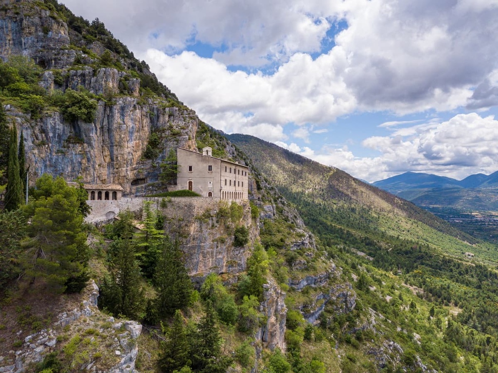
Monasticism and hermitages have also played a prominent role in shaping Majella National Park's landscape.
Following the arrival of the Lombards and Franks between the sixth century CE and eighth century CE, many Benedictine monasteries, such as San Clemente a Casauria, were established. These monasteries served as the frames of reference for the area's early history and culture.
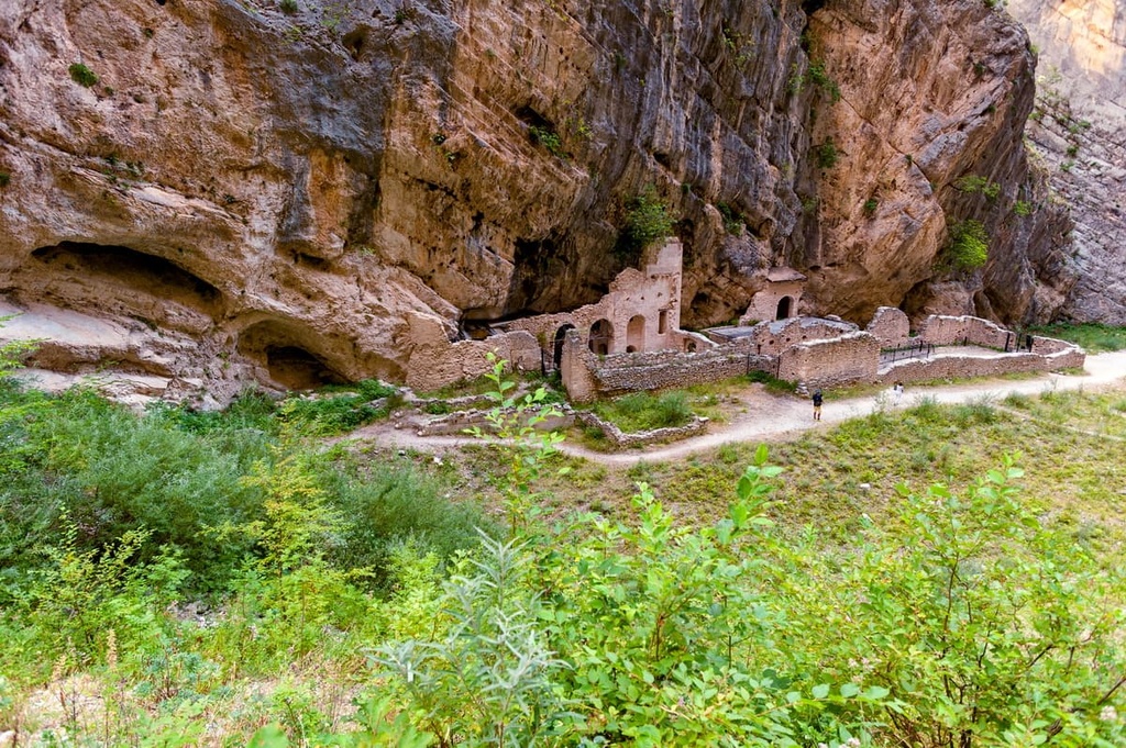
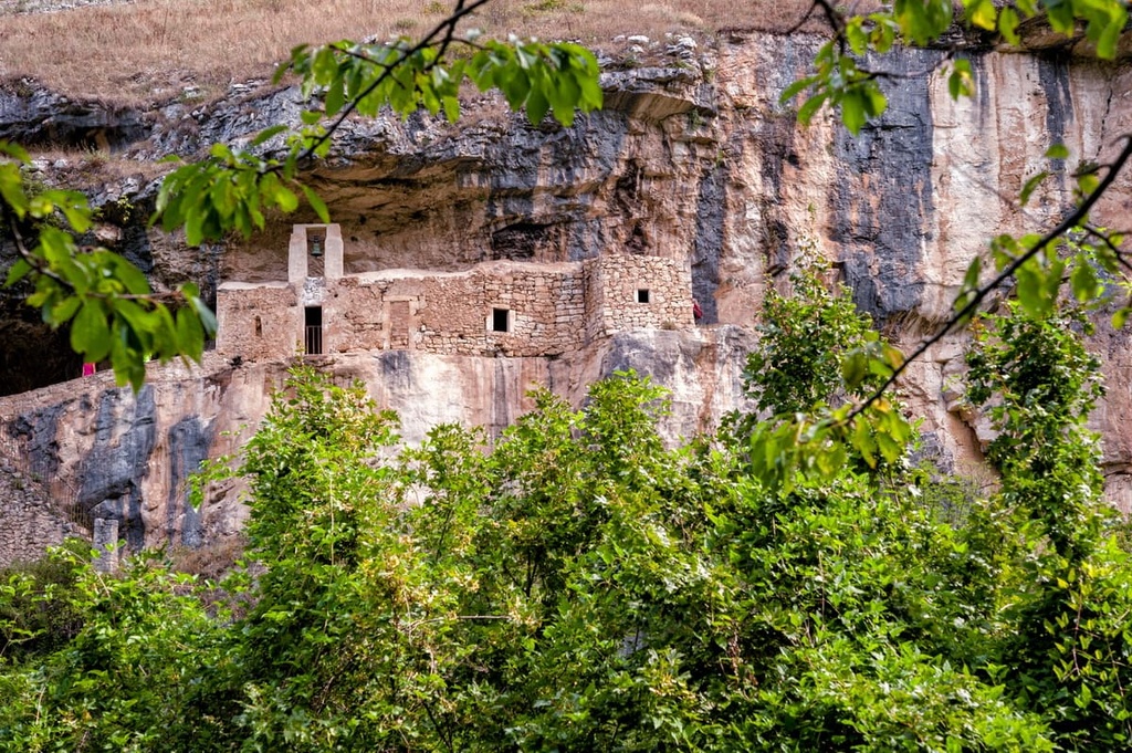
Many hermitages were set up in Majella National Park due to the area's harsh and isolated environment. Monks carved these hermitages into sheer rock faces, a practice that we can see today at San Bartolomeo in Legio and the Grotto of San Giovanni della Maiella. One of the most famous hermits to have lived in the Majella massif was Pope Celestine V, founder of the order of the Celestines.
The Majella massif also forms part of the historic Apennine ridge route, an essential trading corridor that helped establish the Kingdom of Sicily. During this period, the Majella massif was rich in trade and culture, and the route that crossed it helped transport raw materials to and from markets across the Italian peninsula.
From the sixteenth to the eighteenth centuries, the Majella massif attracted many wealthy and artistic residents. The result was a variety of architecture and sculptures, which is visible across towns in the massif, notably in Pescocostanzo.
The political unification of Italy led to significant changes across the Majella massif. A decline in agriculture, the departure of wealthy residents, and emigration all changed the cultural landscape of the region.
During the Second World War, the Majella massif was the site of a nine-month-long battle on the Gustav Line, which resulted in the deaths of thousands of civilians and further displacement of the local population.
Nowadays, the Majella massif is an important geological, archeological, and tourist area. Between 1998 and 2005, the region was part of an international geoscientific research project called TaskForceMajella. In April 2021, the massif became part of a UNESCO Global Geopark called the Majella Geopark.
Majella National Park has an extensive trail system known as the Sentiero del Parco (Park Paths), with over 120 marked trails and approximately 1,200 km (746 mi) of developed routes. All trails in the park are marked with red and white signs.
That said, Majella National Park is a remote and potentially dangerous hiking destination. The park's most challenging trails are exposed to the elements so they require high fitness levels and a head for heights.
Hikers in the park should come prepared with topographic maps, a GPS, hiking equipment, and warm/waterproof clothing. Speak with staff at a local Park Information Center before setting off to ensure a trail is open, and inform others of your itinerary. Hikers should also make a note of bivouacs and refuges along their proposed route.
Paths in the park are rated according to the CAI's (Italian Alpine Club) difficulty scale. An explanation of the CAI difficulty scale and other tips for hiking within Majella National Park can be found here. Hikers can find additional information on popular open trails at the park's website.
Read on to find out about some of the best and most popular hiking trails in Majella National Park.
Monte Amaro (2,793 m/9,163 ft) is the highest summit in Majella National Park and the second-highest mountain in the entire Apennine range after Corno Grande (2,912 m/9,554 ft).
As it features a long approach and heavy snow most of the year, the best time to climb Monte Amaro is May, June, or July. One of the most popular and longest routes up Monte Amaro is the H1 trail from the source of the Verde River near Fara San Martino.
The walk is approximately 13 km (8 mi) in length and takes 6 hours and 30 minutes to complete. It is rated EE, so it is best for experienced hikers.
Along this walk, you'll hike through several picturesque valleys, including the bottleneck Fara Valley (Val Fara). You'll also pass the ruins of the ninth-century Benedictine Abbey of San Martino.
The Grotta dei Diavoli can be reached on a short detour along the H8 path in the upper part of the Cannella Valley (Valle Cannella). Roughly an hour from the summit of Monte Amaro, you'll also pass the rifugio Ciro Manzini (2,513 m/8,245 ft).
Monte Acquaviva (2,737 m/8,980 ft) is Majella National Park's second-highest summit and the third-highest mountain in the Apennines. Despite having no signposted Sentiero del Parco trail, it's considered more popular than its higher neighbor, Monte Amaro (2,793 m/9,163 ft).
As the mountain's name suggests, snow frequently falls on the slopes of Monte Acquaviva, and the best time to hike to the summit is during late summer and early fall.
The north and south sides of the mountain are mostly inaccessible due to steep scree slopes and unclimbable cliffs. The best ways to climb Monte Acquaviva are along its eastern and western ridges.

Perhaps the most popular way of scaling Monte Acquaviva is via the northern approach, which follows sections of the park's signposted trail system.
The best place to start this hike is from the rifugio Bruno Pomilio (1,930 m/6,332 ft), which can be reached by car along the Passo Lanciano. Due to its high starting point, this is considered one of the easiest and shortest routes up Monte Acquaviva.
The route leads onto the crest of Monte Blockhaus (2,140 m/7,021 ft), then toward Monte Cavallo (2,171 m/7,123 ft). On the Sella Acquaviva col, there's a well where you can refill water bottles. You'll also have access to the bivacco Carlo Fusco (2,458 m/8,640 ft).
The final stage of this walk involves following the trail toward Monte Focalone (2,684 m/8,806 ft). Then, you'll turn east, following the ridge to the summit cross of Monte Acquaviva.
Monte Morrone (2,061 m/6,762 ft) is the highest mountain in the Montagna del Morrone, Majella National Park's second-largest massif.
Located in the northwestern part of the park, Montagna del Morrone has a more modest elevation than the Majella massif. That said, with a height difference of over 300 m (984 ft) from the valley floor, it offers equally challenging hikes and some exquisite views.
Monte Morrone boasts several signposted trails that snake through the mountain's beech forests and along its entire ridgeline. The Q3 Alta via del Morrone is arguably the finest of the marked trails that crosses Monte Morrone.
This walk is around 13.8 km (8.5 mi) in length, takes approximately 5 hours to complete, and is rated EE for experienced hikers. From Hotel Celidonio on the Passo San Leonardo, the trail also leads uphill through beech forests to the rifugio Capoposto (1,755 m/5,757 ft).
After reaching the Iaccio della Madonna basin, you'll climb steadily uphill to Monte Morrone's summit. The views from the summit are far-reaching, from Gran Sasso to Monte Sirente to the Adriatic Sea.
The descent from the mountain crosses the multi-day Sentiero dello Spirito several times, with stunning views of the Peligna Valley. On your descent, you'll also pass the rifugio Iaccio Grande.
Monte Pizzalto (1,969m/6,460 ft) is located in the southwestern part of Majella National Park, and it is a natural balcony that affords hikers panoramic views of Monte Rotella (2,127 m/6,978 ft) to the west and Monte Porrara (2,137 m/7,011 ft) to the east.
Monte Pizzalto is easily accessible from the resort town of Pescocostanzo, making it a popular mountain with hikers. The best way to scale Monte Pizzalto is on the O3 trail. The hike is approximately 13 km (8 mi) in length, takes around 4 hours to complete, and is rated EE for experienced hikers.
From Pescocostanzo, the trail weaves up the east side of the Serra Ciamaruchella, passing through pine forests and meadows. Eventually, the path leads onto Monte Pizzalto's ridge, from which the summit is easily reachable.
On the descent, the path will take you to the Piano Cerreto. From here, it's possible to take a detour to Cansano. On the way to Cansano, you'll pass the Fonte Ramarozzo, where you can fill up water bottles.
On the western edge of the Majella massif lies a 20 km (12.4 mi) long ridgeline featuring two mountains: Cima della Fossa (1,991 m/6,532 ft) and Monte Rotella (2,127 m/6,978 ft).
The ridgeline lacks trees meaning it provides unspoiled views. Its proximity to Sulmona and Pescocostanzo also makes it popular with tourists.
One of the best ways to scale Monte Rotella is on the T2 trail from near Cansano. The trail is 9.3 km (5.8 mi) in length, takes around 3 hours and 30 minutes to complete, and is rated EE for experienced hikers.
The path climbs steadily uphill across grasslands before intersecting the T4 trail. Here, the trail gets steeper. The surrounding pastures are home to various rare wildflowers, including Majella violets, magellensis violets, and fairy hair.
At the summit of the Monte Rotella, the entirety of the Central Apennines is visible on a clear day.
Cima delle Murelle (2,596 m/8,517 ft) is one of Majella National Park's least technical mountains to climb. Despite having one of the most challenging north faces in the entire Apennines, hikers with high levels of stamina and a head for heights will be able to scale Cima delle Murelle.
Arguably the easiest way to climb Cima delle Murelle is on the G4 trail, which leads up its east ridge. You can pick up this trail from the la Valle picnic area near Pennapiedimonte. The trail is 10.5 km (6.5 mi) in length, takes around 5 hours and 30 minutes to complete, and is rated EE for experienced hikers.
This forested track leads past several mountain huts. The first hut, rifugio D'Ugni (1,855 m/6,086 ft) is located close to a well, while the second hut, rifugio Martellese (2,038 m/6,686 ft), is situated just 500 m (1,640 ft) from the summit of Monte d'Ugno (2,093 m/6,866 ft).
The G4 trail will take you to a col on Cima delle Murelle that overlooks two stunning valleys, Valle del Forcone and Valle dell'Inferno. This col is also a great place to see herds of Apennine chamois.
The mountainside towns, ancient cities, and quaint villages of Majella National Park are well-worth discovering. Read on to find out about the park's best nearby settlements.
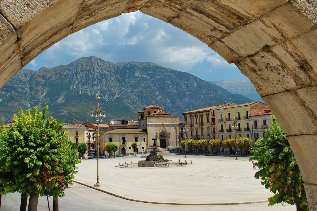
Located in the Valle Peligna, the city of Sulmona is the largest settlement located within the boundaries of Majella National Park. The city dates back to ancient times and was the hometown of the Roman poet Ovid.
Sulmona features several fascinating historical attractions, like the eleventh-century Cathedral of Sulmona and the thirteenth-century Acquedotto Medievale.
Hikers looking to spend the night in Sulmona should consider booking a room at Hotel Santacroce, Hotel Rojan, or Hotel Ovidius.
Guardiagrele is one of the principal towns of Majella National Park. Situated to the park’s northeast, Guardiagrele is part of the I Borghi più belli d'Italia, a club celebrating the most beautiful villages in Italy. Due to the incredible views of the surrounding nature that the town provides, poet Gabriele D'Annunzio gave Guardiagrele the nickname ‘Abruzzo's terrace.’
During your stay in Guardiagrele, ensure you visit the beautiful Church of San Maria Maggiore and the San Giovanni Waterfall. Popular hotels in Guardiagrele include Residenza La Majelletta and Villa Maiella.
Pescocostanzo is a beautiful town conveniently located close to several popular mountains, including Monte Rotella (2,127 m/6,978 ft) and Monte Pizzalto (1,969m/6,460 ft).
Plus, the town is a favorite winter sports destination due to its proximity to several resorts, such as Coppo dell'Orso, the Rivisondoli ski resort, and the Roccaraso ski resort.
Due to its popularity with tourists, Pescocostanzo is home to several hotels, including Hotel Pizzalto, Aqua Montis Resort & Spa, and Garnì Le Ortensie.
Sat where the Orfento and Orta rivers meet is the town of Caramanico Terme. This spa town dates back to Lombard times and is ideally placed for exploring the Montagne del Morrone and the remarkable Orfento Valley (Valle dell'Orfento).
During your excursion to the Montagne del Morrone, ensure you spend a day in Roccacaramanico. Located on the slopes of Monte Morrone (2,061 m/6,762 ft) at 1,100 m (3,280 ft) in elevation, Roccacaramanico is the highest settlement in the province of Pescara.
If you're looking to stay in Caramanico Terme, book a room at Hotel Arimannia, Hotel Ede, or Hotel Cercone.
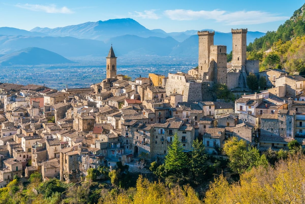
There’s no shortage of picturesque historic villages within Majella National Park, and you can find another fine example of such a town in Pacentro. Visiting this perfectly-preserved medieval village is like stepping back in time. Like Guardiagrele, Pacentro is part of the Borghi più belli d'Italia.
The finest structure in the village is the Castello Caldora. Built between the tenth and fifteenth centuries by the Orsinis, the castle looms over the rest of the village and gives it a distinct skyline.
Pacentro is located roughly 8 km (5 mi) away from Sulmona, making it easy to visit on a day trip, too. Popular accommodation options in Pacentro include Rocca Lorenizo and the B&B San Marco.


top10
ultra
apennine-2000
italy-ultras
top10
ultra
apennine-2000
italy-ultras
The highest peak in Majella National Park is Monte Amaro, at 2,793 m.
Notable peaks in Majella National Park include Monte Amaro, Monte Acquaviva, 2626, Anticima Ovest Monte Acquaviva and Monte Focalone.


