Scan the QR code and open PeakVisor on your phone
Hike through the heart of the Apennines and discover some of Italy's rarest wildlife at Abruzzo, Lazio and Molise National Park. There are 170 named mountains in Abruzzo, Lazio and Molise National Park. The tallest and most prominent mountain is Monte Petroso (2,249 m/7,378 ft).
Abruzzo, Lazio and Molise National Park (Parco Nazionale d'Abruzzo, Lazio e Molise) is a national park located in central Italy. The park covers approximately 496 sq. km (191 sq. mi) of land across the regions of Abruzzo, Lazio, and Molise.
Established in 1923, Abruzzo, Lazio and Molise National Park is the oldest park in the Apennines and the second-oldest in Italy after Gran Paradiso National Park (Parco Nazionale del Gran Paradiso). The park is often referred to by its former name, Abruzzo National Park.
The main feature of Abruzzo, Lazio, and Molise National Park is the Apennines, a mountain range that stretches for over 1,200 km (750 mi) and forms the backbone of Italy. Due to the height of the Apennines, Abruzzo, Lazio and Molise National Park mostly features mountains that are between 900 m (2,952 ft) and 2,000 m (6,561 ft) above sea level.
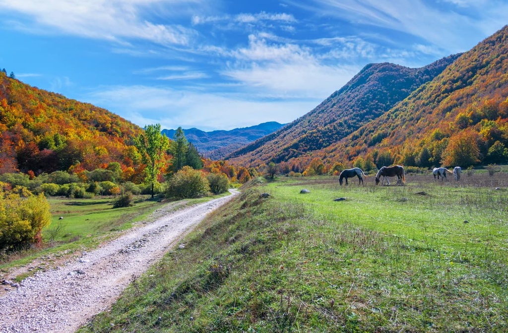
Approximately two-thirds of Abruzzo, Lazio and Molise National Park is covered in beech forests; however, many other trees grow across in the park including silver birch and pine.
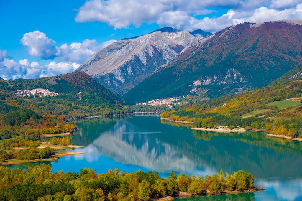
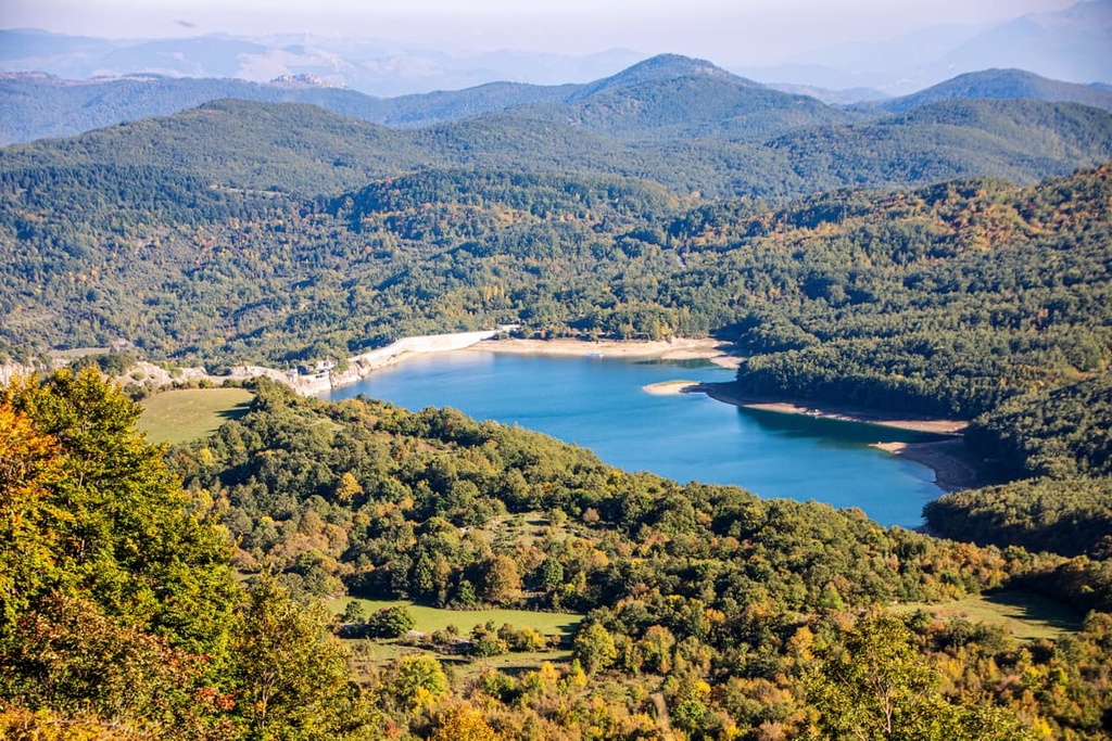
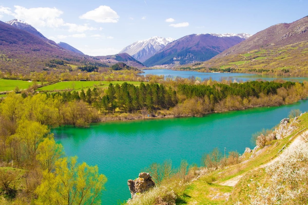
There are 4 main rivers in Abruzzo, Lazio and Molise National Park: Sangro, Giovenco, Volturno, and Melfa. The most significant river is the River Sangro, which springs from the middle of Abruzzo, Lazio, and Molise National Park near Pescasseroli.
The Sangro passes through the park's Lago di Barrea artificial lake before flowing in a northeasterly direction for 122 km (76 mi) to the Adriatic Sea. There are 8 significant lakes within the park. Notable examples include Lago Vivo, Lago Montagna Spaccata, and Lago di Scanno.
Abruzzo, Lazio and Molise National Park is split into 4 different zones:
These different zones are put in place to protect local wildlife and the landscape. Some of these zones are inaccessible, making it impossible to climb some of the park's mountains. For example, the park's highest peak, Monte Petroso, is located in the Integral Reserve, making it inaccessible year-round.
There are 24 municipalities within Abruzzo, Lazio and Molise National Park. In total, these municipalities are home to 25 towns and 24,000 people. The largest town is Pescasseroli, with a population of approximately 2,200 people. Pescasseroli is considered the capital of the park, and it is home to its headquarters.
Other notable settlements within Abruzzo, Lazio and Molise National Park include Barrea, Civitella Alfedena, and Opi. Abruzzo, Lazio, and Molise National Park is located approximately 100 km (62 mi) to the southeast of Italy’s capital city, Rome.
The mountains in Abruzzo, Lazio and Molise National Park are geologically young, having formed between the Mesozoic and Tertiary periods around 30 to 170 million years ago. Most of the park consists of sedimentary rocks, predominantly limestone. There are very few igneous or metamorphic rocks in Abruzzo, Lazio and Molise National Park.
The park’s sedimentary rocks formed when the area lay on the southern margins of the Tethys Sea. Dead marine animals were deposited on the seafloor during this time, such as corals, algae, and gastropods. Over millions of years, these deposits were compressed by the water pressure and turned into sedimentary rocks like limestone.
The most interesting geological feature of Abruzzo, Lazio and Molise National Park is that many of the mountains have different types of rocks from their neighbors. For example, the central area of the park features rock types with signs of low oxidation. These rocks formed mainly from algae that lived in muddy water.
To the east of the park, there's evidence that the water was much deeper with higher oxygen levels, supporting larger animals. As such, many of these rocks have visible fossil layers.
The park’s sedimentary rocks were transformed into mountains during the Apennine orogeny, a mountain-building event that occurred in phases between the Cenozoic era (65 million years ago) and the end of the Miocene and Pliocene epochs (23 to 2.6 million years ago.)
The geological youth of the Apennines is one of the reasons for their rugged appearance and height, as there has been less time for erosion to take effect in the range than in other older mountain systems.
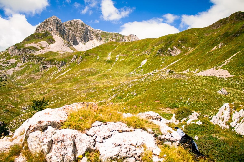
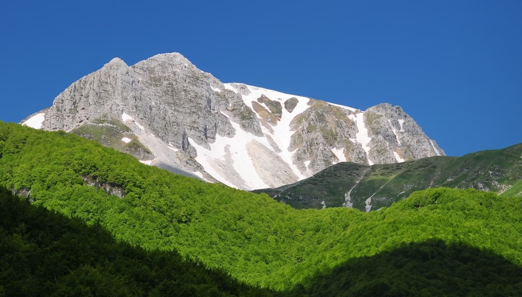
Today, Abruzzo, Lazio and Molise National Park is home to numerous mountains over 2,000 meters (6,561 ft) high. Some of the highest peaks in the Apennines are located within the park, including Monte Petroso (2,249 m/7,378 ft), Monte Meta (2,242 m/7,355 ft), and Monte Bellaveduta (2,061 m/6,761 ft).
Abruzzo, Lazio and Molise National Park is home to an incredible diversity of flora and fauna. In fact, this biodiversity was one of the primary reasons for establishing a national park in this area of the Apennines.
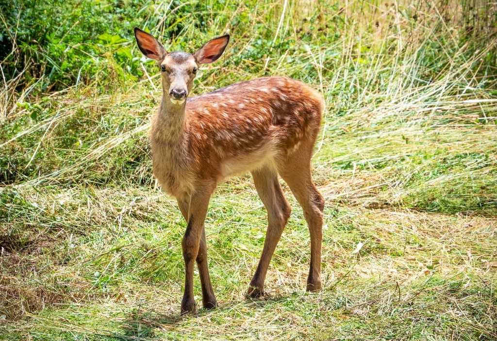
Abruzzo, Lazio and Molise National Park is an essential habitat for several iconic and rare mammals. Species in the park include the critically endangered Marsican brown bear and the vulnerable Italian wolf.
The Marsican brown bear is considered a symbol of Abruzzo, Lazio and Molise National Park. Recent studies estimate that as few as 40 Marsican brown bears are left in the park and the surrounding area.
Around 60 mammal species live in the Abruzzo, Lazio and Molise National Park. Other notable species include rare Abruzzo chamois, lynx, and wild boars.
Approximately 300 bird species live within Abruzzo, Lazio and Molise National Park, including many endangered species. Notable bird species include golden owls, golden eagles, and ravens.
You'll also find around 40 reptile, fish, and amphibian species in Abruzzo, Lazio and Molise National Park. Some interesting cold-blooded creatures to watch out for include meadow vipers, brown trout, and yellow-bellied toads.
The flora in Abruzzo, Lazio and Molise National Park is incredibly varied, with over 2,000 plant species, excluding fungi, lichen, algae, and musks.
There are a few species endemic to Abruzzo, Lazio, and Molise National Park, most notably the Iris marsica, which blooms in May and June and is easily recognizable thanks to its vibrant purple petals.
Another species endemic to the park is the Italian black pine, which is thought to have originated during the Tertiary period between 2.6 and 66 million years ago. Italian black pines are most commonly found in Camosciara and Fondillo valleys.
The most common trees in Abruzzo, Lazio and Molise National Park are beech trees. Beech forests cover over 60 percent of the park and typically grow at altitudes between 900 m (2,952 ft) and 1,800 m (5,905 ft).
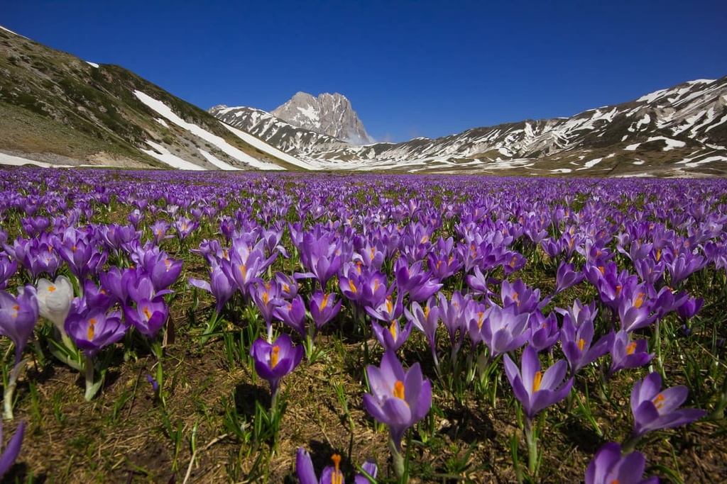
High grasslands, meadows, and clearings cover approximately 30 percent of the park. These environments are most common high up in the mountains at around 2,000 meters (6,561 ft). These grassy areas are home to various plant species, including orchids, lilies, buttercups, and violets.
Some of the most interesting flowers you'll see at Abruzzo, Lazio and Molise National Park include orange lilies, Turk's cap lilies, and Gentiana dinarica. One of the most famous plants in the park is the yellow lady's slipper, Europe’s largest orchid known for its black and yellow petals. The yellow lady's slipper is at risk of extinction due to vandalism by tourists.
Humans have inhabited the Abruzzo region of Italy since at least the Neolithic era between 7000 and 1700 BCE. The majority of early settlers in the Apennines were alpine cattle herdsmen who took their livestock to graze on the mountain slopes and lived in small hamlets.
The area that is now Abruzzo has been ruled by many civilizations over the centuries. Following the fall of the Roman Empire, Abruzzo was ruled by the Lombards, Byzantines, Normans, and the Kingdom of Sicily. The region gained greater stability following Italian unification in 1860.
Before the establishment of the park, King Vittorio Emanuele III wanted to create a hunting reserve in the area. While King Vittorio Emanuele III wished to establish this reserve to save the environment, it may have had unforeseen effects on local wildlife.
As rare species in the region, like the Italian wolf and the Marsican bear, had already been decimated by deforestation and hunting, such a hunting reserve may have driven them to extinction. Luckily, the park was established instead, which saved many endangered animals from the brink of extinction.
The establishment of Abruzzo, Lazio and Molise National Park was first considered in 1921. It exists thanks to the efforts of zoologist Professor Alessandro Ghigi and botanist Professor Romualdo Pirotta.
Following the end of World War I, the municipality of Opi leased 5 sq. km (2 sq mi) of land to a private organization set up by Ghigi and Pirotta. This organization aimed to preserve the flora and fauna in the area by turning it into a reserve.
The following year, local environmentalist and member of the Italian Parliament, Erminio Sipari, took 12,000 hectares (29,652 acres) from local municipalities and formed Abruzzo National Park. The park was established on September 9, 1922. It was decreed as law by the Italian State on January 11, 1923.
You won't be short of hiking opportunities in Abruzzo, Lazio, and Molise National Park, as the park is home to roughly 150 trails that provide over 750 km (466 mi) of trekking routes.
Every trail in the park is marked on the map with a letter and number, and the trails are marked in real life with red/white signs. However, ensure that you stop by one of the park's visitor centers to pick up a leaflet detailing the park hiking trails before you start your journey.
Read on to learn about some of the main trails and hiking areas in Abruzzo, Lazio and Molise National Park.
Monte Marsicano (2,245 m/7,365 ft) is the second-highest mountain in Abruzzo, Lazio and Molise National Park, and it is only 4 m (13 ft) shorter than Monte Petroso (2,249 m/7,378 ft). It is one of the three highest peaks in the Marsicano Mountains area of the Apennines.
It's worth noting that while topographic maps show the summit of Monte Marsicano as being at 2,245 m (7,365 ft) in elevation, it actually has two other higher peaks. The highest is called Cima del Monte Marsicano (2,253 m/7,391 ft), while the other is referred to simply as Monte Marsicano (2,252 m/7,388 ft). These summits were named recently by the local Club 2000 mountaineering organization.
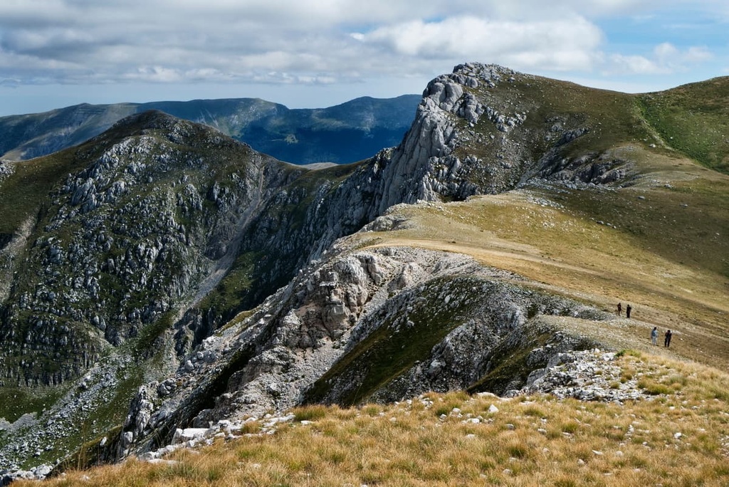
Unlike several of the other highest mountains in the park, Monte Marsicano has a scalable summit, unrestricted by endangered flora and fauna. The summit affords panoramas of the Maiella massif to the east and the Monti La Meta massif to the south. There are three paths in the park that lead up Monte Marsicano.
All routes up Monte Marsicano are technical and are only suitable for expert hikers. The A6 trail starts from Stazzo Prato Rosso to the south of the Rifugio Prato Rosso (1,536 m/5,039 ft). The trail leads south to the summit of Monte Marsicano. The A6 trail is 6 km (4 mi) long and takes 4 or 5 hours to complete.
Another way of scaling Monte Marsicano is along the E6 trail from Le Cassette to the north of Opi. This trail zigzags up the mountain from the southwest, passing the Stazzo di Monte Marsicano (1,572 m/5,157 ft) along the way. The E6 trail is approximately 5.5 km (3.5 mi) long and takes 5 hours to complete.
The final trail up Monte Marsicano is the F10 from Ponte Forcone to the south. The trail winds its way up the mountainside, passing the Stazzo di Monte Forcone shelter (1,580 m/5,183 ft) on the way. The F10 trail is 4.8 km (3 mi) long and takes 5 hours to complete.
Monte Meta (2,245 m/7365 ft) is the third-tallest mountain in Abruzzo, Lazio and Molise National Park. It forms part of the Monti della Meta massif, one of three main massifs in the park.
Monte Meta is very popular with hikers, even though access to the summit is prohibited. Access to the summit of Monte Meta is restricted as it's home to a population of rare Abruzzo chamois.
The most popular way of climbing Monte Meta is along the M1 trail from the Valle Fiorita (Flowery Valley) near the picturesque comune of Pizzone. The hike starts by following a provincial road until you reach the valley, where you begin to hike up Monte Meta.
The trail is around 8 km (5 mi) long, takes 5 or 6 hours to complete, and has elevation changes of 570 m (1,870 ft). The M1 path up Monte Meta is considered difficult and is only suitable for expert hikers.
Several paths lead up the mountain until you reach the Passo dei Monaci (Pass of the Monks) at 1,967 m (6,453 ft). This is a mountain pass that links Monte Metuccia (2,105 m/6,906 ft) and Monte Meta. The Passo dei Monaci signifies the end of this walk. Abruzzo chamois have been spotted along this hike, and you may even get lucky and see a Marsican bear or a golden eagle.
If you're looking for an alternative trail, consider the L1 trail from the southwest of Monte Meta.
The trail starts from Campitelli Refuge (1,445 m/4,740 ft) and leads along a section of the Passo dei Monaci towards Monte Meta, passing north of the summit of Monte Miele (1,942 m/6,371 ft). The L1 trail is around 6 km (3.7 mi) long, takes 4 hours to complete, and is considered easier than the M1 trail.
While hikers aren't allowed to scale the highest peak in the park, Monte Petroso (2,249 m/7,378 ft), they can take in spectacular views of the mountain and the surrounding massif. Monte Petroso is located within Zone A (Integral Reserve) and is therefore only accessible to permit-holders.
One of the best ways to appreciate the park's tallest peak is along the K4 path near Barrea to the northeast of the mountains. The best place to start the walk is from Fonte Sambuco, just south of the commune on the K6 path. This walk is considered moderately difficult and hikers should come well-prepared.
The walk is different lengths depending on your exact start and end point, but takes around 5 hours with elevation changes of approximately 460 m (1,509 ft). You'll start by walking uphill through beech forests in the Valle dell'Inferno before passing an effigy to Madonna delle Grazie along the Valico del Buon Passo.
After passing the effigy, you'll soon reach the highest point on the walk at 1,656 m (5,433 ft). You'll then descend down to Lago Vivo (Lake Alive) at 1,591 m (5,219 ft), which was named for the fact that its water levels change drastically throughout the year.
Lago Vivo is the highlight of the walk, with the lake surrounded by the breathtaking summits of Monte Petroso, Monte Tartaro (2,191 m/7,188 ft), and Monte Altare (2,174 m/ 7,132 ft). If you're hiking in the autumn, keep an eye out for rutting deer which regularly visit the lake.
As you return to your starting point, you'll pass through another beautiful beech forest. You'll also be treated to stunning vistas of Lago Montagna Spaccata.
The Val di Rose ranks as one of the most famous walks in Abruzzo, Lazio and Molise National Park. The walk takes hikers on a tour of the park’s finest landscapes and provides an opportunity to see one of the park's most iconic residents, the Abruzzo chamois.
The route is marked as the I1 park path. You can start the Val di Rose from the town of Civitella Alfedena. It takes around 3 hours one-way with elevation changes of 845 m (2,772 ft). The walk is moderately difficult, and hikers should come well-prepared.
The walk starts with panoramic views of Lago di Barrea before leading hikers through a beech forest.
After an hour, you'll exit the forest into the Monte Boccanera Valley. The rugged and sweeping Monte Boccanera Valley is one of the best places to spot herds of Abruzzo chamois. At 1,980 m (6,496 ft), you'll reach Cavuto Pass, where Abruzzo chamois are most common.
From the Cavuto Pass, take in views of the park's highest mountain, Monte Petroso (2,249 m/7,378 ft), as well as the Camosciara Valley and the Iannanghera Valley. Walk past the Forca Resuni shelter (1,951 m/6,400 ft) and begin your descent by walking down the long road into the Jannanghera Valley. You'll need to follow the K6 road into the valley.
At the Sorgente Jannanghera (1,305 m/4,281 ft), the source of the valley's river, you'll turn left onto the I4 trail, which leads back to Civitella Alfedena.
The Valico Passaggio dell'Orso (Passage of the Bear) is a beautiful walk through the Val Fondillo and is ideal for less-experienced hikers. Along the walk you'll get to see the park's River Sangro, beech forests, and several mountains.
The Valico Passaggio dell'Orso follows the F2 park path. You can pick up the trail from the Val Parcheggio Val Fondillo (Fondillo car park). The walk takes approximately 6 hours there and back with elevation changes of 600 m (1,968 ft).
From the car park, you'll walk up past the Old Sawmill, with vistas of the Serra delle Gravare valley, as well as Monte Marsciano (2,245 m/7,365 ft) and Monte Amaro (1,862 m/6,108 ft).
The trail follows the Fondillo stream, which empties into the River Sangro. The river is rich with trout, and willows draped over the banks make this a picturesque section of the walk.
Around halfway to the Passo dell'Orso (Pass of the Bear), you'll have a chance to stop by the Grotta delle Fate (Cave of the Fairies). The crystal clear spring water flowing from the cave is evidence of the park's karst landscape. The trail ends at the Passo dell'Orso, an ancient mountain pass used by shepherds and pilgrims for centuries.
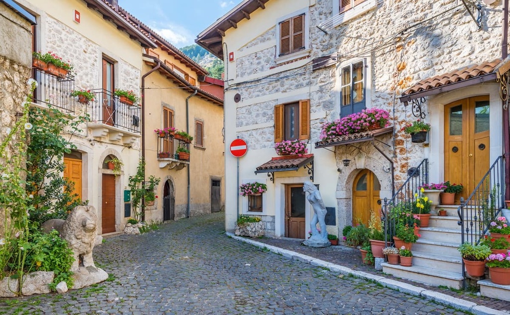
With many quaint communes and villages tucked away in the mountains, you won't have any trouble finding somewhere magical to stay in Abruzzo, Lazio and Molise National Park. Read on to find out about the park's main settlements and where to stay during your next visit to the region.
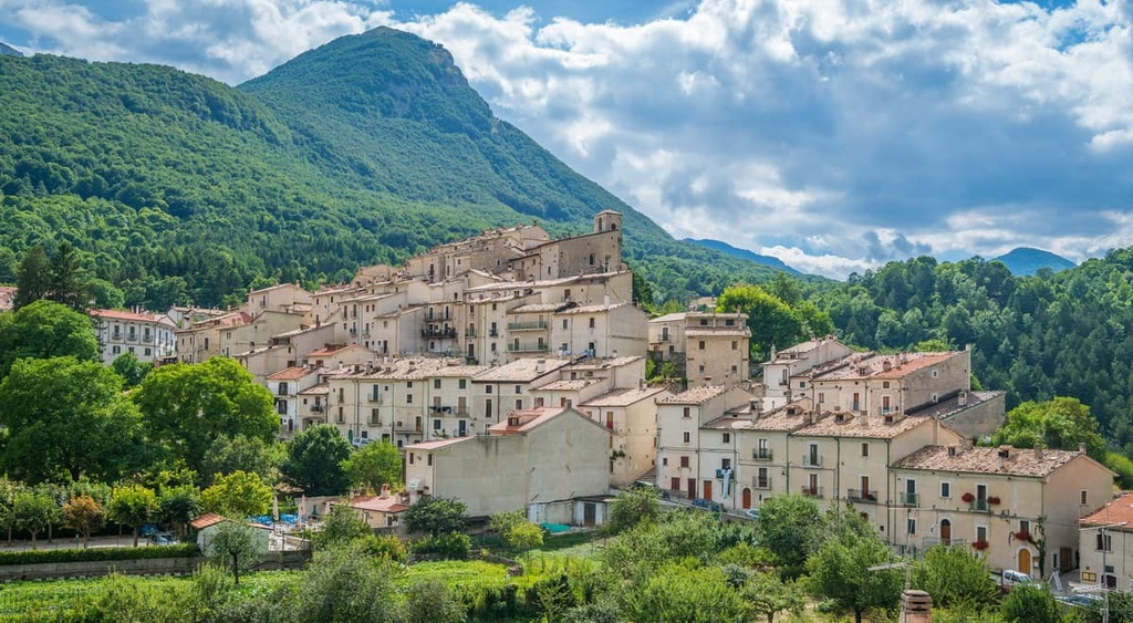
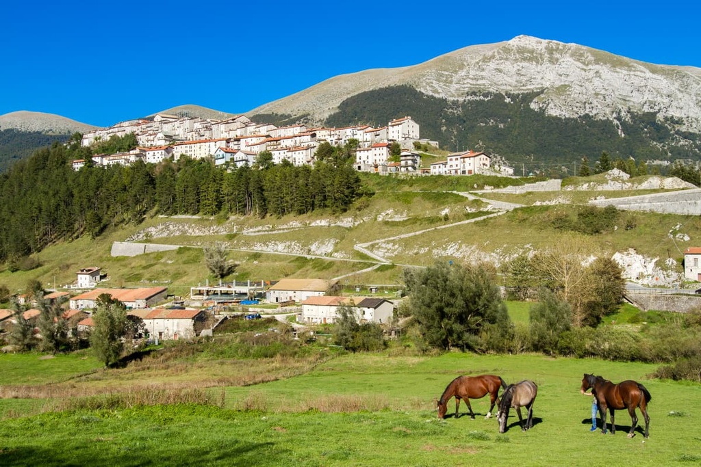
Located at the heart of the park, Pescasseroli is the administrative center and capital of Abruzzo, Lazio and Molise National Park. The town was founded in the eleventh century as a family estate by the Borrello Family and was subsequently passed between some of the wealthiest landowners in the region.
Today, Pescasseroli is a tourist hotspot with a visitors center for the park and several other attractions. During your stay, pay a visit to the zoo and see Marsican bears up close, or go skiing at the resort on Monte delle Vitelle (1,846 m/6,056 ft). Many of the best hotels in Abruzzo, Lazio and Molise National Park are in Pescasseroli, including Hotel Alle Vecchie Arcate, Hotel Daniel, and Albergo Paradiso.
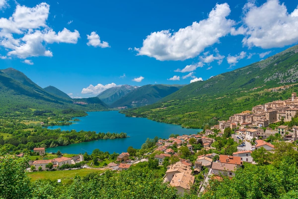
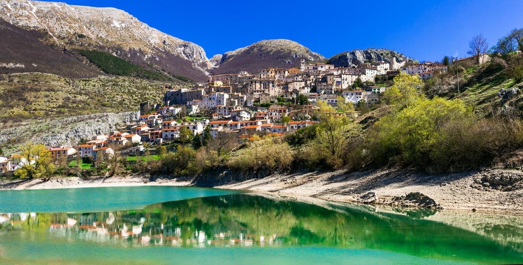
Resting on the Lago di Barrea in the southeast of the park is the comune of Barrea. This small town dates back to pre-Roman times as it was founded by Samnites who believed it was intrinsically linked to their destiny.
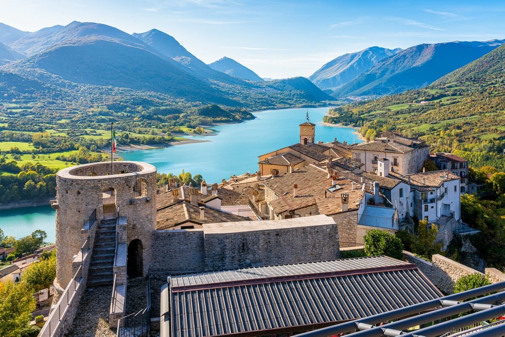
Aside from its fascinating history, Barrea is a charming settlement and convenient place for hikers to stay. You can hike to Lago Vivo, and you'll be within 10 km (6 mi) of the Riserva Naturale La Camosciara (The Natural Reserve Camosciara). Accommodation options in Barrea include Hotel Holidays, La Poiana, and Ostello dagli Elfi.
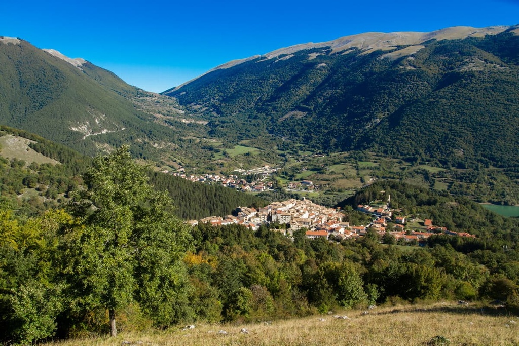
Perched on a hilltop surrounded by mountains is the medieval village of Opi. This remarkable community was founded in the twelfth century and provides unbelievable views of Monte Amaro (1,862 m/6,108 ft), Monte Marsciano (2,245 m/7,365 ft), and Monte Irto (1,960 m/6,430 ft).
While wandering around Opi, ensure you visit the old seventeenth-century palace, which is now the town hall and church of Santa Maria Assunta. Opi is also the perfect place to stay if you plan to follow the Valico Passaggio dell'Orso. Hotels in Opi include Club Hotel Du Park and Hotel La Pieja.
Another postcard-perfect settlement located near the center of the park is Civitella Alfedena. As with many of the area's settlements, Civitella Alfedena features narrow winding streets and a lengthy history, with some buildings dating back centuries.
The oldest building in Civitella Alfedena is the fourteenth-century medieval tower at the center of the town. Civitella Alfedena is one of the best places to stay if you're looking to follow the busy Val di Rose. Hotels include Albergo Ai Quattro Camosci and Hotel Valdirose.