
Scan the QR code and open PeakVisor on your phone
Parco Nazionale del Gran Sasso e Monti della Laga has 423 named peaks. The highest is Corno Grande - Vetta Occidentale at 2,912 m. Other notable peaks include Corno Grande - Vetta Orientale, Corno Grande - Vetta Centrale and Torrione Cambi.
Scale the highest peaks in the Apennines then unwind at a picturesque mountaintop village when you visit Italy’s Gran Sasso and Monti della Laga National Park. There are 423 named mountains in the park. The highest and the most prominent summit is Corno Grande - Western Peak (Vetta Occidentale) at 2,912 m (9,553 ft) in elevation.
Gran Sasso and Monti della Laga National Park (Parco Nazionale del Gran Sasso e Monti della Laga) is a national park located in southern and central Italy. It covers approximately 1,413 sq. km (545 sq. mi) of land across the regions of Abruzzo, Lazio, and Marche.
Established in 1991, Gran Sasso and Monti della Laga National Park is the third-largest national park in Italy after Cilento, Vallo di Diano and Alburni National Park (Parco Nazionale del Cilento, Vallo di Diano e Alburni) and Pollino National Park (Parco Nazionale del Pollino).
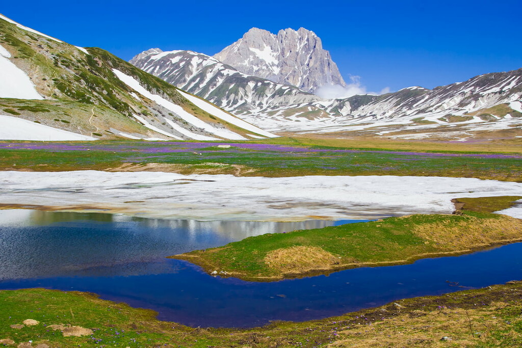
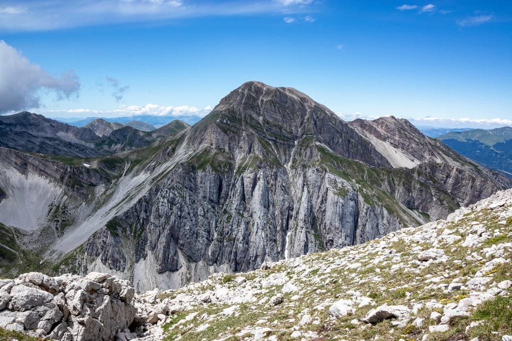
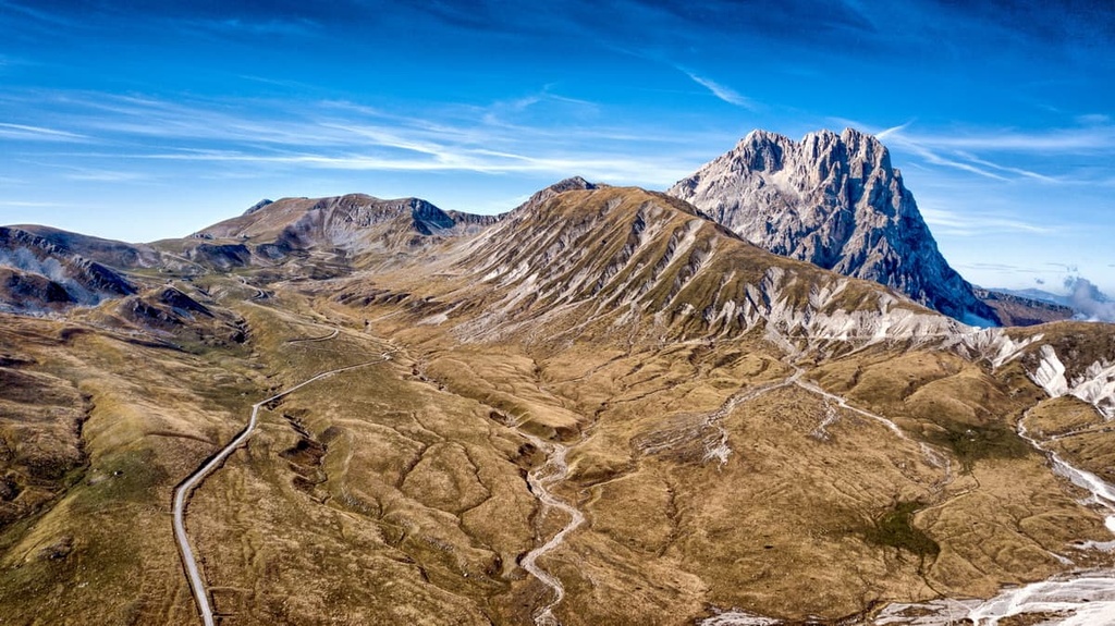
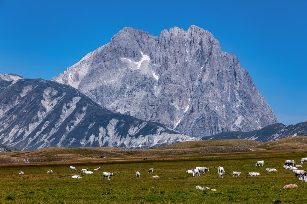
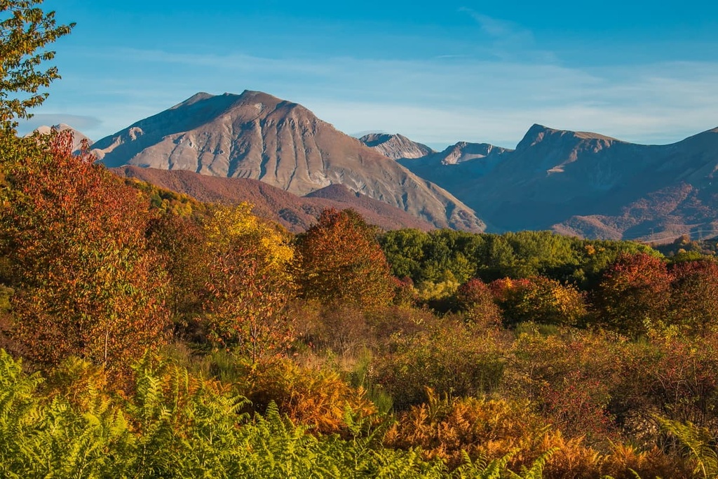
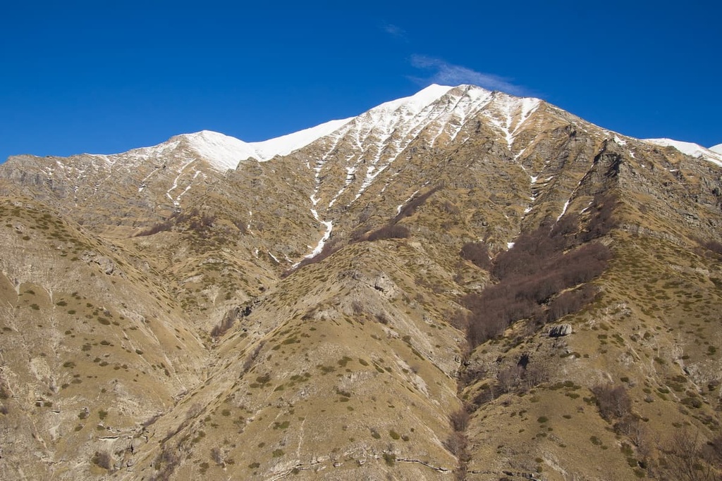
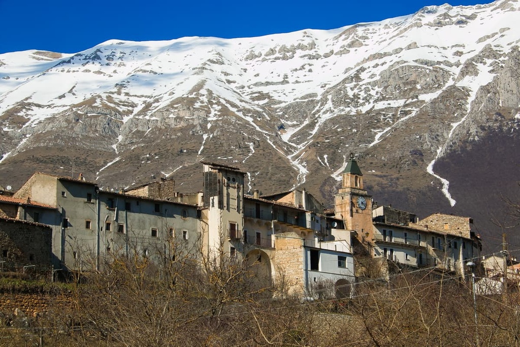
The main feature of Gran Sasso and Monti della Laga National Park is the Apennines, a range of mountains that stretches for 1,200 km (750 mi) along the spine of Italy. Specifically, the park centers around the Gran Sasso d'Italia massif, which dominates the park's skyline and contains the highest mountain in the Apennines, Corno Grande (2,912 m/9,553 ft).
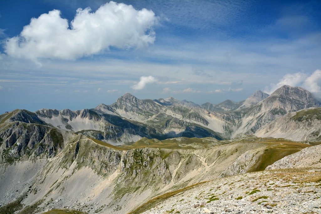
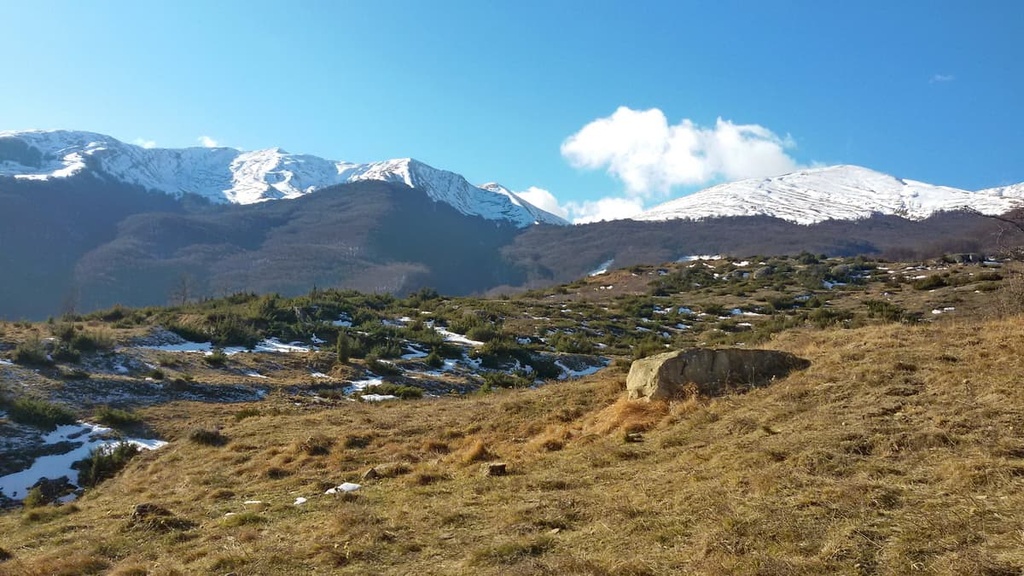
Another notable feature of Gran Sasso and Monti della Laga National Park is the Monti della Laga massif. Located in the northern part of the park, Monti della Laga is often considered to be inaccessible due to the area’s ruggedness. It’s one of the least hikable areas in the Apennines.
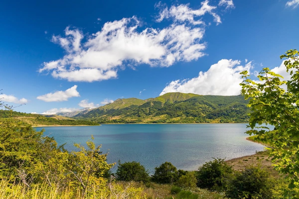
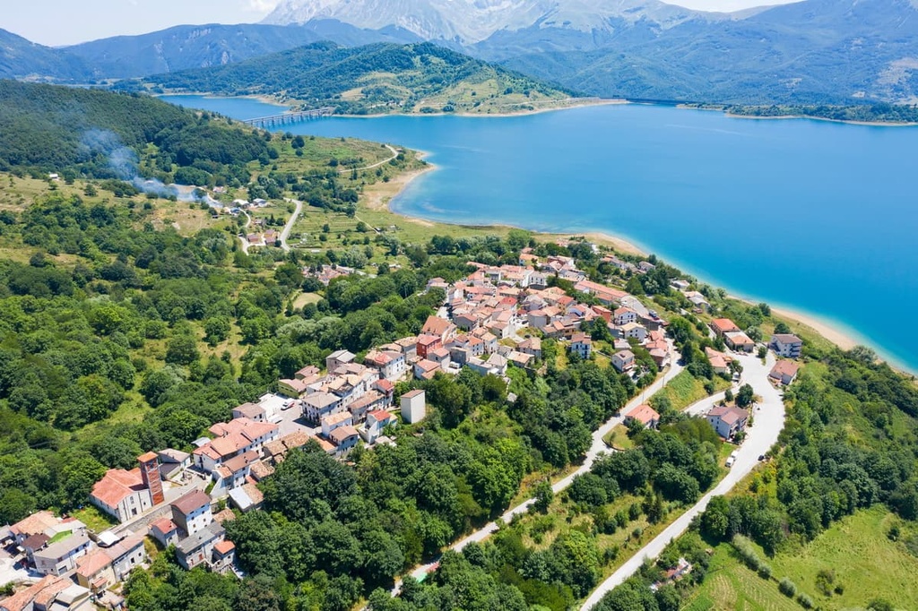
The majority of the park's landscape consists of alpine plains and rugged mountainsides. That said, the northern section of the park around Monti della Laga and Lago Campotosto, the largest lake in the park, is blanketed in woodlands.
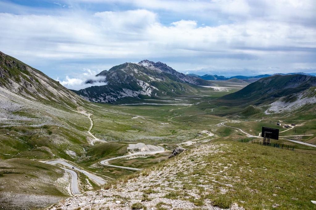
One famous feature of the park is the Grand Highway of the Gran Sasso and Monti della Laga National Park. This road weaves through the Apennines, connecting the town of Montorio al Vomano to the ancient city of Amiternum. The road is popular with cyclists and motorists, and it is one of the best ways to explore the park.
The park is also home to one of the southernmost glaciers in Europe, Il Calderone, which lies just beneath the summit of Corno Grande. The glacier is quickly receding and could disappear entirely over the next few years.
Within Gran Sasso and Monti della Laga National Park, there are 5 provinces that contain 44 municipalities. These provinces are Teramo, Pescara, L'Aquila, Rieti, and Ascoli Piceno.
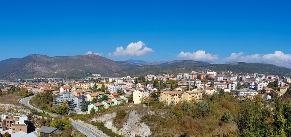
The largest settlement in the park is the city of L'Aquila. L'Aquila is the capital of the province of L'Aquila and the region of Abruzzo. It's also considered to be the capital of Gran Sasso and Monti della Laga National Park. The city sits on the southwestern border of the park. Meanwhile, the park's headquarters are located in Assergi.
Other notable settlements in and around Gran Sasso and Monti della Laga National Park include Teramo, Montorio al Vomano, Civitella del Tronto, Campli, and Castel del Monte. Italy's capital city, Rome, is located approximately 140 km (87 mi) to the southwest of Gran Sasso and Monti della Laga National Park.
The landscape of Gran Sasso and Monti della Laga National Park was primarily formed during the Mesozoic era between 65 to 250 million years ago.
During this period, the Apennines lay underwater on the southern edge of the Tethys Sea, between Paleo-European and Paleo-African tectonic plates. The area's rocks formed when mineral and organic sediment was compressed into sedimentary rocks like shales, sandstones, and limestones. There is very little igneous rock in the Apennines.
The Apennine orogeny, a mountain-building event that started during the Cenozoic era around 65 million years ago, helped form the Apennines. The Apennine orogeny was most active around 23 million years ago during the Miocene and Pliocene epochs.
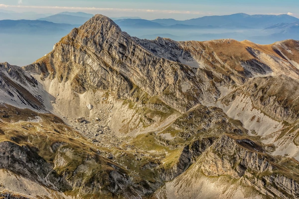
Compared to many mountains worldwide, the Apennines are geologically very young. Their age is one of the reasons they remain so rugged, as erosion has had less time to take effect and wear away at the landscape.
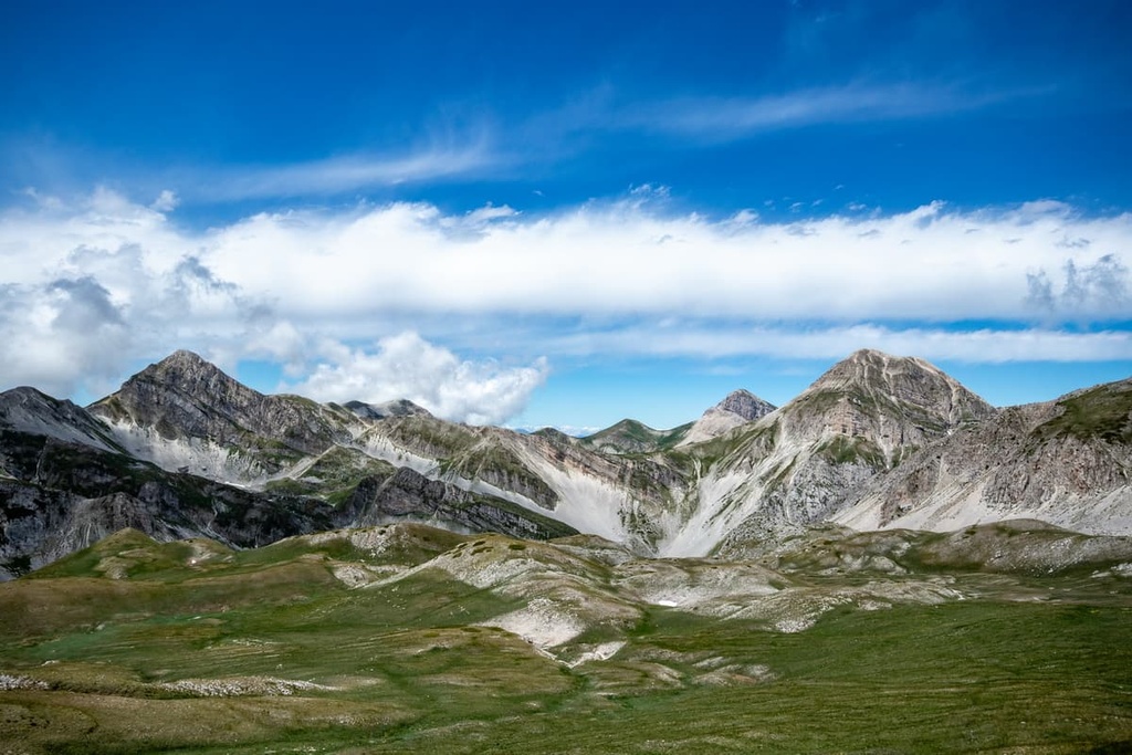
Another unique feature of the mountains is the fact that they consist of limestone and dolomite, which gives them their height and rugged vertical walls. These mountains are unlike anywhere else in the Apennines, and they are among the best in Italy for rock climbing.
The mountains within Gran Sasso and Monti della Laga National Park can be split into three groups:
The Monti della Laga massif has a slightly different composition compared to the other mountain groups. As well as limestone, these mountains contain marl, a carbonate-rich mudstone. The presence of softer marl means many of the mountains in Monti della Laga have rounded tops and are separated by deep valleys.
Today, Gran Sasso and Monti della Laga National Park is home to many of the highest peaks in the Apennines. Corno Grande - Western Peak (Vetta Occidentale) (2 912 m/9,553 ft) is the park's highest peak and the highest summit in the Apennines. Additionally, Corno Grande is the park's only Ultra (a mountain with a prominence over 1,500 m/4,900 ft).
The highest peak in the Monti della Laga massif is Monte Gorzano (2,458 m/8064 ft). Other notable mountains in the park include Corno Piccolo (2,655 m /8,710 ft), Pizzo d'Intermesoli (2,635 m/8,645 ft), and Monte Brancastello (2,385 m/7,824 ft).
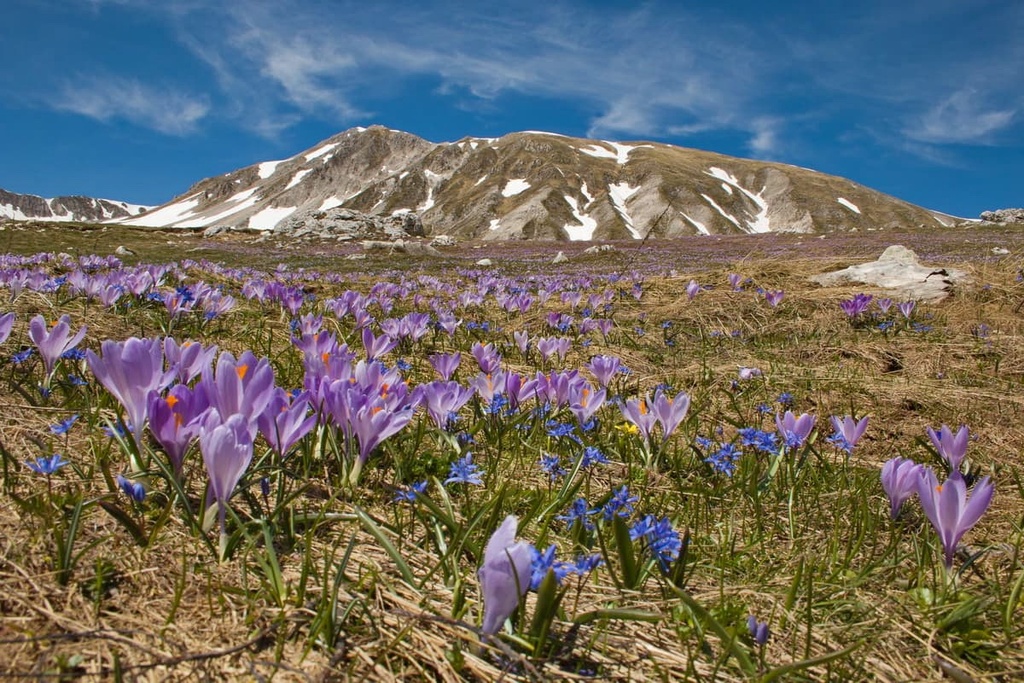
One of the main reasons Gran Sasso and Monti della Laga National Park is protected is due to the area's flora and fauna. The park is one of the most biodiverse regions in Europe, especially when it comes to plant life. It's also home to a number of endemic species.
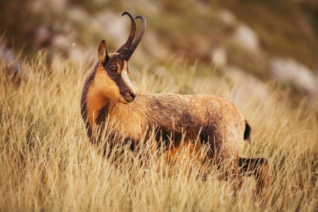
The Abruzzo chamois (or Apennine chamois), a subspecies of the Pyrenean chamois, are found only in the Apennines. They're considered a symbol of the park. Abruzzo chamois went extinct from Gran Sasso in the 1890s, but they have been slowly reintroduced to the area. There are now over 1,000 Abruzzo chamois in Gran Sasso and Monti della Laga National Park.
Another iconic mammal found around Gran Sasso is the Apennine wolf. Once common across Italy, their numbers were reduced to a handful of individuals during the 1970s. Conservation efforts mean there are now around 120 Apennine wolves and 20 breeding groups in the park.
Other notable mammals in Gran Sasso and Monti della Laga National Park include roe deer, wild boar, polecats, and porcupines. Critically endangered Marsican brown bears are also occasionally spotted in the area.
Gran Sasso and Monti della Laga National Park is home to around 200 bird species. Notable species include alpine citril finches, great spotted woodpeckers, and mountain swallows.
The area also supports a variety of birds of prey, including sparrowhawks, peregrine falcons, and goshawks. One of the rarest birds of prey in the park is the golden eagle. There are thought to be only 12 breeding pairs in the area.
A number of reptile and amphibian species inhabit Gran Sasso and Monti della Laga National Park, too, including alpine newts, common frogs, and Italian cave salamanders. The park is also home to the largest population of endangered meadow vipers in Italy.
Notable insect species include Apollo butterflies, Alpine longhorn beetles, and nine-spotted moths.
Gran Sasso and Monti della Laga National Park is home to approximately 2,651 plant species. Roughly 139 of these species are endemic to Italy, and 12 are endemic to the park.
Many of the plants that are endemic to the park are found at high elevations. For example, Abruzzo edelweiss is usually found growing out of limestone at elevations of 1,800–3,000 m (5,900–9,800 ft). However, several endemic species, like Goniolimon italicum, grow at lower elevations.
In the northern part of the park in the Monti della Laga massif, there are woodlands composed of beech, chestnut, fir, and turkey oak. Beechwoods are the most common type of woodland in the park. They grow at elevations between 1,000 and 1,800 m (3,280 ft and 5,905 ft).
Along the park's rivers, you'll find a range of plants and trees, including purple willows, honeysuckles, white poplars, maples, and European hazels. Other notable plant species found in the park include spring adonis, felty hornwort, and green shield-moss.
Humans have lived in the Abruzzo region of Italy and the Apennines since at least the Neolithic era over 5,000 years ago. There's evidence to suggest farming and agriculture were common in the Apennines during the Neolithic era. Farmers would herd livestock across the fertile hillsides and live in small villages in the valleys.
Transhumance was also a common farming method across the region. Transhumance is a nomadic form of farming that involves moving livestock between fixed pastures in summer and winter.
This practice of transhumance was well-documented in the area during Roman times and was at its height in the sixteenth and seventeenth centuries. The method is still used today, albeit with more modern modes of transportation.
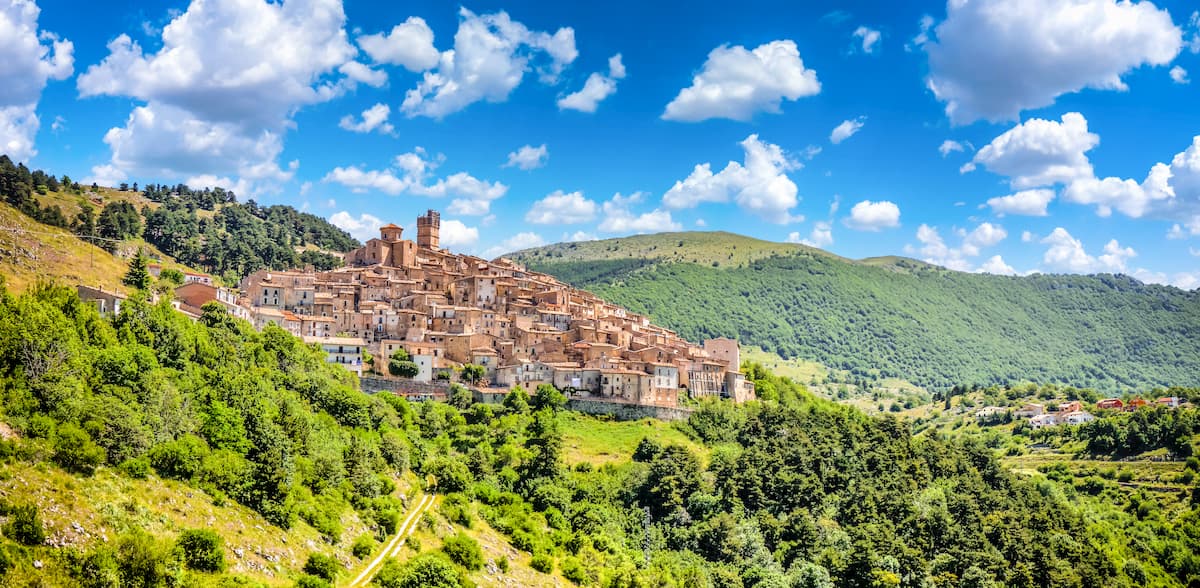
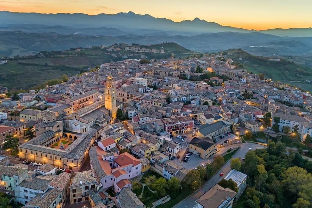
Many villages in Gran Sasso and Monti della Laga National Park have survived for centuries due to the area's isolation and self-sufficiency. For example, Castel del Monte, which has been dubbed "the capital of the shepherds," has been inhabited since at least the third century BCE.
Gran Sasso and Monti della Laga National Park was established in 1991 under Law No. 364 Framework Law on Protected Areas (Legge Quadro sulle Aree Protette).
Due to the park's size, defining the area was a challenge for local authorities. The park was initially intended to cover 2,200 sq. km (849 sq. mi) but was reduced to under 1,500 sq. km (579 sq. mi) in area. The park's headquarters are in Assergi. The Ente Parco Nazionale Gran Sasso e Monti della Laga manages the park.
Gran Sasso and Monti della Laga National Park features several hundred kilometers of trails that visitors can explore on foot, bicycle, or horseback. Many of these trails lead high into the Apennines and are dangerous for hikers who don't come prepared with the correct equipment.
Hikers are encouraged to stay on the paths to avoid damaging the park's fragile ecosystems. Always plan your route out before setting off, and let someone know about your itinerary and when you expect to return. If you encounter any difficulties or get into an accident, call Alpine Rescue (118).
Read on to find out about some of the main hiking areas and trails in Gran Sasso and Monti della Laga National Park.
Campo Imperatore (or "Emperor’s Field") is an area of alpine grasslands that's hugely popular with hikers. The grasslands form a basin-shaped plateau, the largest plateau in Gran Sasso and Monti della Laga National Park. It's nicknamed "Little Tibet" due to its altitude and appearance.
Campo Imperatore is 27 km (17 mi) long and 8 km (5 mi) wide. The plateau is between 1,500 m (4,921 ft) and 1,900 m (6,233 ft) in elevation. Several mountains surround the plateau, including Corno Grande (2 912 m/9,553 ft), Pizzo Cefalone (2,533 m/8,310 ft), and Monte Aquila (2,494 m/8,182 ft).
Many of the best trails in Campo Imperatore start from the Hotel Campo Imperatore. Also known as the Albergo di Campo Imperatore, this historic hotel once served as Benito Mussolini's prison from August 28, 1943 until his escape on September 12, 1943.
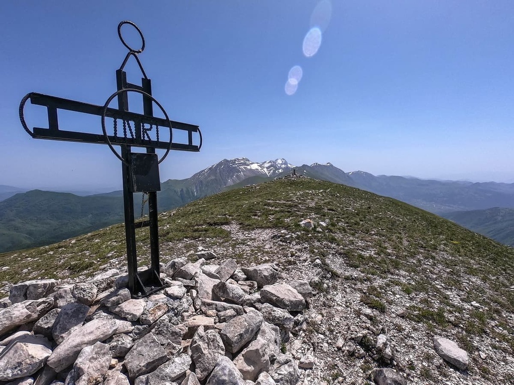
Corno Grande (2 912 m/9,553 ft) (or the "Great Horn") is the tallest mountain in Gran Sasso and Monti della Laga National Park. It is a must-visit for mountain climbers looking to summit the roof of the Apennines.
One of the best ways to climb Corno Grande is by first reaching the Fonte Cerrato tourist resort. You can take the cable car, which is one of the longest in Europe, from the resort to Campo Imperatore. You can also drive to Campo Imperatore. It's also possible to take a longer route up Corno Grande from either Santo Stefano di Sessanio, Farindola, and Castel del Monte.
The Corno Grande path from Campo Imperatore is an out-and-back trail that takes about 3 hours with an elevation difference of 920 m (3,018 ft). This is a T4 trail suitable only for experienced hikers. Scrambling is necessary in places.
The best time of year to complete this walk is from July to September. The nearest mountain hut is bivacco Bafile (2,669 m/8,756 ft). The route approaches from the south before following the western ridge to Corno Grande - Western Peak (Vetta Occidentale) (2 912 m/9,553 ft), the highest summit in the Apennines.
Located at the northwestern edge of Campo Imperatore is Monte Aquila (2,494 m/8,182 ft). It's the eighth-highest mountain in the Gran Sasso d'Italia massif.
Monte Aquila is very popular with hikers due to its position between Rifugio Duca degli Abruzzi (2,388 m/7,834 ft) and Rifugio Garibaldi (2,230 m/7,316 ft). The mountain also features a long saddle, which is excellent for long-distance hikes.
You'll want to take the cable car from Fonte Cerrato to Hotel Campo Imperatore, where you can begin this hike. This loop trail takes 2 or 3 hours to complete and it has an elevation gain of 400 m (1,312 ft). This is a T3 trail that’s only suitable for experienced hikers.
The trail skirts around the southern side of Monte Portella (2,385 m/7,824 ft), before looping around to Monte Aquila. This walk provides stunning views of Campo Imperatore and Campo Pericoli, with Corno Grande in the background.
Pizzo Cefalone (2,533 m/8,310 ft) is the seventh-tallest mountain in the Gran Sasso d'Italia massif. Often overlooked in favor of its taller neighbors, Pizzo Cefalone offers a short, rewarding hike.
This out-and-back trail to the summit of Pizzo Cefalone takes about 2 hours to complete with an elevation gain of 480 m (1,574 ft). This is a T3 trail that’s suitable for experienced hikers.
From the Rifugio Duca degli Abruzzi (2,388 m/7,834 ft), the trail cuts up a mountainside across the southern slopes of Monte Portella (2,385 m/7,824 ft). The trail then leads along a ridge to the summit of Pizzo Cefalone.
The town of Campotosto rests on the edge of Lago Campotosto, the largest lake in Gran Sasso and Monti della Laga National Park. Lago Campotosto is also the largest man-made lake in Italy. There are two popular trails that lead from Campotosto to nearby mountains.
The first trail in Campotosto leads to the summit of Monte Cardito (1,592 m/5,223 ft). This loop trail takes about an hour to complete and has an elevation gain of 220 m (721 ft).
The trail is suitable for intermediate hikers. You can pick up the trail from Campostosto's main square outside the town hall.
Note that the path isn't named, but it features old red and white markers. The best time of year to climb Monte Cardito is between April and November. From the mountain, you'll get to enjoy panoramas of Lago Campotosto.
Another popular trail from Campotosto leads up Monte di Mezzo (2,155 m/7,070 ft). This loop trail takes around 3 hours to complete and it has an elevation gain of 800 m (2,624 ft). The trail is suitable for intermediate hikers.
The walk starts around 700 m (2,296 ft) from the town. You find the starting point by following the Campanelle Pass to the Santa Maria Apparente Church.
The Capannelle Pass is a mountain pass and tourist route that stretches for approximately 10 km (6 mi) across the west side of Gran Sasso and Monti della Laga National Park.
The road likely takes its name from the pastoral huts ("capannelle") that are scattered across the mountainsides. These huts have been used for centuries by shepherds practicing transhumance.
The road sits at an elevation of over 1,300 m (4,265 ft), making it one of the highest paved roads in Italy. Several mountains surround the Capannelle Pass, most of which are popular with hikers.
Monte San Franco (2,132 m/6,994 ft) is a mountain located on the northwestern edge of the Gran Sasso d'Italia massif. The mountain is named after Franco da Assergi, a monk and saint who had a hermitage within the Gran Sasso d'Italia massif.
To climb Monte San Franco, you need to follow the SS 80 road downhill toward Teramo. At the 26 km (16 mi) mark, a road cuts up the mountain to the east, crossing the northern slopes of Monte San Franco.
At the signpost for the Rifugio Panepucci Alessandri (1,700 m/5,577 ft), follow the road for roughly 4 km (2.5 mi). At the junction after the picnic area, you'll follow the carriage road on your right up the mountain.
This loop trail takes about 2 hours to complete and it has an elevation gain of about 700 m (2,296 ft). It's a T2 hiking trail suitable for intermediate hikers.
Located approximately 15 km (9.5 mi) north of L'Aquila is Monte Stabiata (1,651 m/5,416 ft). Although it has a modest elevation when compared to some of its neighbors, Monte Stabiata is ideal for visitors looking to climb a mountain without much preparation.
To locate the start of this trail, drive north along the SS80 road for 14 km (8.7 mi) until you reach the ruins of the San Antonino Church. Follow the bumpy dirt road into Fonte del Cupo to find the trail. The trail heads straight for Monte Stabiata.
This out-and-back trail takes about an hour to complete and it has an elevation gain of 220 m (721 ft). It is a suitable trek for most hikers.
Monte Corvo (2,623 m/8,605 ft) is the fourth-highest mountain in the Gran Sasso d'Italia massif. It's also one of the ten tallest mountains in the Apennines. It's a challenging climb, as the final stretch to the summit is steep and rugged.
From Ortolano, which is located to the northwest of the mountain, follow the SS80 road south until you reach the dam at Lago di Provvidenza. Cross the dam and follow the road past the picturesque Molino Cappelli, an old renovated mill. The trail markers for this trail are visible as soon as you leave SS80.
The best time to climb Monte Corvo is from June to October. This out-and-back trail takes around 4 hours to complete and it has an elevation gain of 1,130 m (3,707 ft). This is a T3 trail that's only suitable for expert hikers.
Capricchia is a small hamlet located in the province of Rieti in Lazio. It's situated in the north of Gran Sasso and Monti della Laga National Park in the municipality of Amatrice.
Due to its location high up in the mountains in the north of the park, Capricchia offers some of the best access to the often-inaccessible Monti della Laga massif. In particular, Capricchia provides excellent access to Monte Gorzano (2,458 m/8,064 ft), the highest mountain in Monti della Laga.
The Barche Waterfall is well worth seeing during your visit to Monti della Laga. This trail also forms part of the longer trail that ascends Monte Gorzano.
After reaching Capricchia, follow the narrow dirt road into a ravine and then follow the trail that buts up the mountainside. Around 3 km (2 mi) from Capricchia, you'll reach a signposted pass near the Sacred Heart monument. Follow this path to the waterfall.
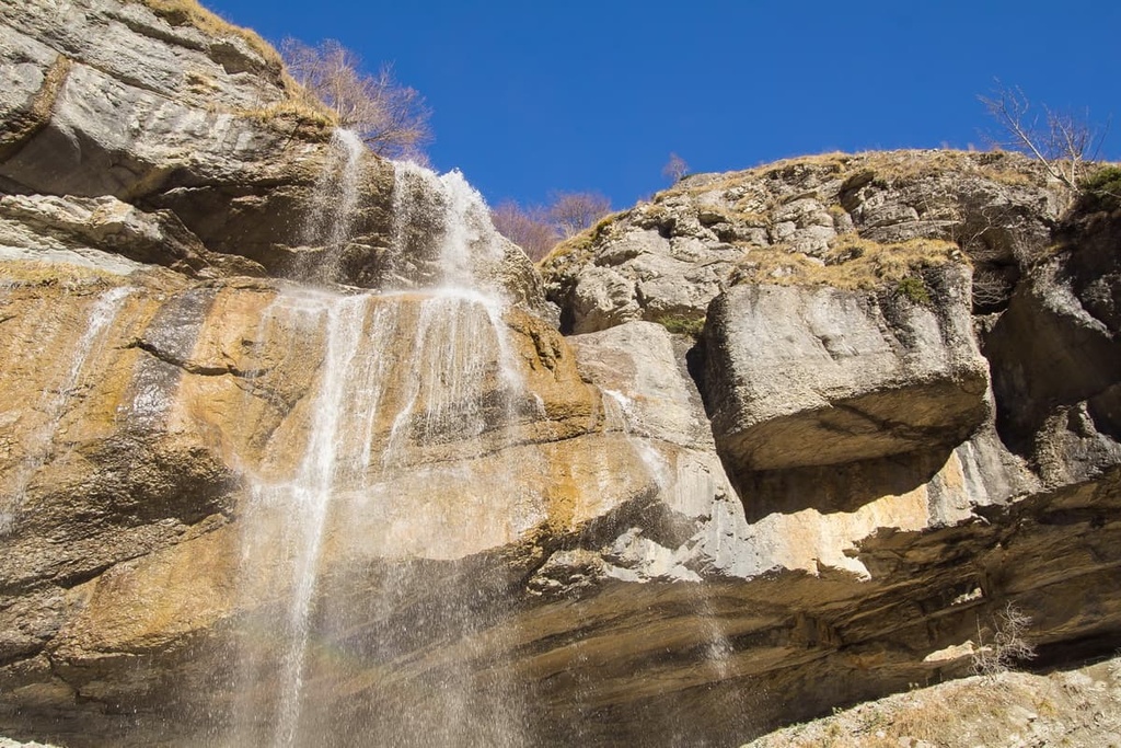
This loop trail takes roughly 3 hours to complete and it has an elevation gain of 320 m (1,049 ft). The trail is suitable for experienced hikers only.
Monte Gorzano (2,458 m/8,064 ft) is the tallest mountain in Lazio and in the Monti della Laga massif. It is one of the most accessible and frequently-climbed mountains in the Monti della Laga massif.
To start this hike, follow the trail up to Barche Waterfall. At the junction at 1,599 m (5,246 ft) in elevation, follow the signposts for Monte Gorzano and the Sella della Solagna.
This out-and-back trail takes 3 to 4 hours to complete and it has an elevation gain of 1,100 m (3,608 ft). It is a T2 trail that’s suitable for experienced hikers who are comfortable with exposed heights.
Sleep soundly surrounded by some of the highest mountains in Italy when you spend the night at one of the settlements in Gran Sasso and Monti Della Laga National Park. Here are some of the area's main towns and cities to check out:
L'Aquila (meaning "The Eagle) is the capital of the Abruzzo region of Italy. It is one of the best places to stay near Gran Sasso and Monti Della Laga National Park. Perched on the southwestern edge of the park, L'Aquila is situated within the Valley of the Aterno-Pescara, over 700 m (2,300 ft) above sea level.
This historic capital is home to some great attractions, like the medieval Santa Maria di Collemaggio and the National Museum of Abruzzo. Popular hotels in L'Aquila include Hotel L'Aquila, Hotel San Michele, and Hotel La Compagnia Del Viaggiatore.
Sandwiched between the Gran Sasso d'Italia massif and the Adriatic Sea is the city of Teramo. Located 20 km (12 mi) west of Gran Sasso and Monti Della Laga National Park, Teramo is known for its Mediterranean climate, numerous vineyards, and its long history dating back to pre-Roman times.
During your stay, visit the eleventh-century Teramo Cathedral and take a tour of the Museo Civico di Teramo. Popular hotels in Teramo include Hotel Gran Sasso, Hotel Sporting, and Abruzzi Hotel Teramo.
Located 11 km (7 mi) to the northeast of L'Aquila is the town of Assergi. Assergi serves as the headquarters for Gran Sasso and Monti Della Laga National Park. Assergi is the perfect place to stay if you're looking to explore the Gran Sasso d'Italia massif and Campo Imperatore, which are within 10 km (6 mi) of the town.
Despite having a population of only 500 people, Assergi is a popular resort destination. The town is home to interesting attractions like the twelfth-century Church of Saint Mary of the Assumption and the Gran Sasso Adventure Park. Popular hotels in Assergi include Hotel Giampy and Le Pagliare del Gran Sasso.
Hikers looking for somewhere to stay high up in the Apennines won't want to miss Castel del Monte. Translated literally as "the fortress of the mountain," Castel del Monte is located 1,346 m (4,416 ft) above sea level and it faces Monte Sirente (2,348 m/7,703 ft).
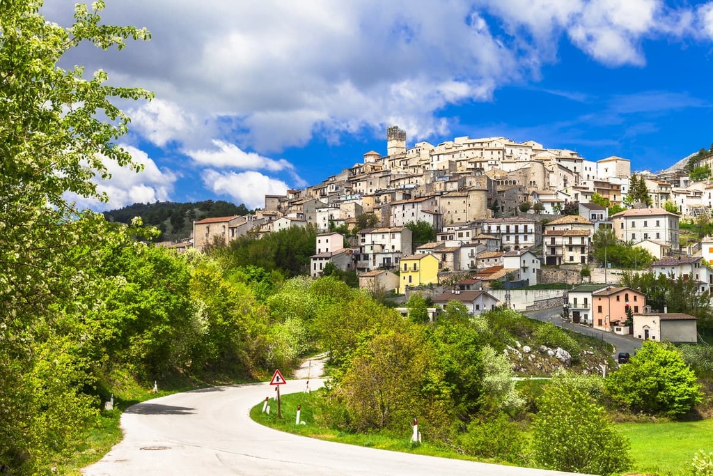
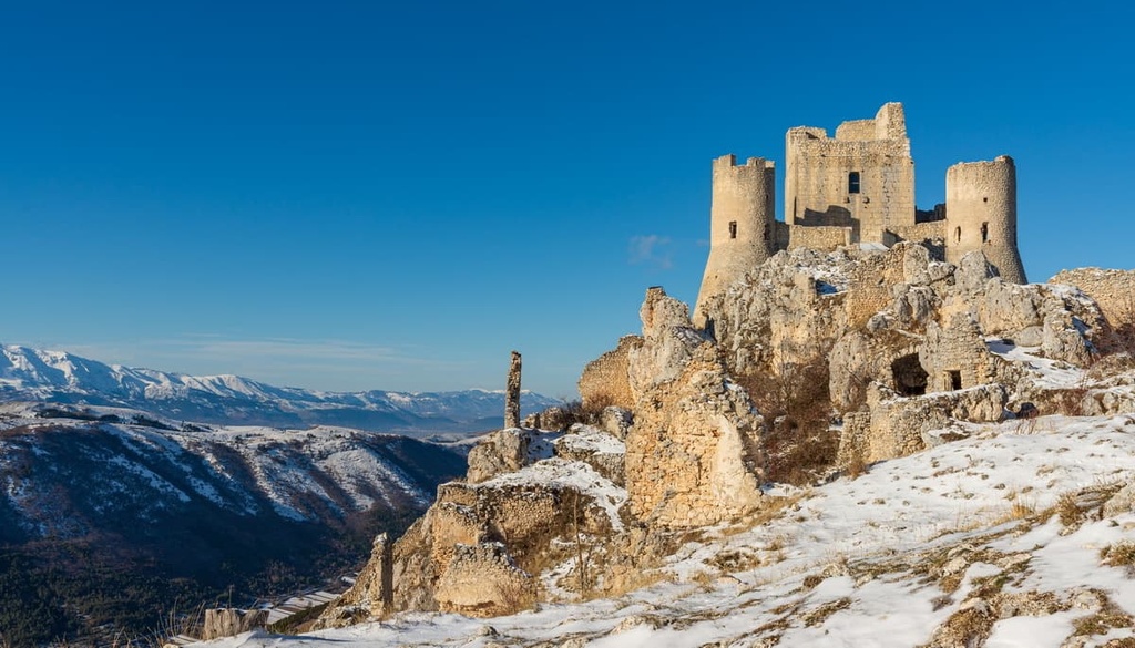
This medieval settlement has been voted the most beautiful village in Italy and was the main filming location of the Hollywood movie The American starring George Clooney. During your stay, ensure you visit the nearby ruins of Rocca Calascio, the highest fortress in the Apennines at 1,460 m (4,790 ft) in elevation. Hotels in Castel del Monte include Miramonti and Residenza Storica Le Civette.
Resting on the edge of Lago Campotosto is the small town of Campotosto. This sleepy settlement is ideal for an overnight stay, as the popular Monte di Mezzo (2,155 m/7,070 ft) and Monte Cardito (1,592 m/5,223 ft) are just a short walk from the town center.
When you're not off hiking up the nearby mountains, plan a lakeside stroll around Lago Campotosto. Popular hotels near Campotosto include Villa sul Lago di Campotosto and B&B La Villa Di Capitignano.


top10
ultra
apennine-2000
italy-ultras
top10
ultra
apennine-2000
italy-ultras
The highest peak in Parco Nazionale del Gran Sasso e Monti della Laga is Corno Grande - Vetta Occidentale, at 2,912 m.
Notable peaks in Parco Nazionale del Gran Sasso e Monti della Laga include Corno Grande - Vetta Occidentale, Corno Grande - Vetta Orientale, Corno Grande - Vetta Centrale, Torrione Cambi and Corno Piccolo.


