
Scan the QR code and open PeakVisor on your phone
Verona is home to 211 named mountains. The highest is Monte Baldo - Cima Valdritta at 2,218 m.
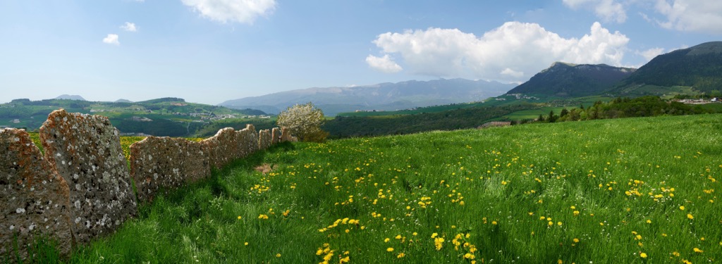
Verona is one of the seven provinces of the Veneto region in northern Italy. The main feature of Verona mountains is its highest peak Cima Valdritta (2,218 m / 7,276 ft) of Monte Baldo, which occupies the entire eastern shore of Garda Lake as part of the larger Brescia and Garda Prealps range. It is also one of the most prominent mountains in all of Italy (1,947 m / 6,387 ft). There is the second largest mountain range in the province, the Venetian Prealps, one of the groups of which, Monti Lessini with the namesake regional nature park, is overlooking the city of Romeo and Juliet. In total there are 211 named mountains in Verona province.
The exact origin and meaning of the name of the province of Verona has not yet been established. The two most common versions link it to the two mythical founders of the city, which are also unknown. The first says that it comes from the older name of the city Vae Roma, which translates as "Woe to you, Rome". So the city was named by the Gallic leader Brennus, after a military campaign against Rome. The second version refers to the name of the famous emperor Marcus Antonius Verus, or Marcus Aurelius, who may also have been the founder of the city. In any case, the word most likely has Celtic roots, as do many toponyms in northern Italy.
Verona province is the second largest by territory (3,121 sq km / 1,205 sq mi) after Belluno, and the third largest by population (927,000+ inhabitants) after Padua, in the Veneto region in northeastern Italy.
The latter, as well as Vicenza, borders Verona to the east. To the north of the province is Trentino in the Trentino / South Tyrol region, and to the west via Garda Lake and to the south are Brescia and Mantua in the Lombardy region, respectively.
In a broader view, the province of Verona is located roughly in the center of the northern part of all northern Italy on the way from Turin and Milan to Venice and Udine or Trieste.
There is an international airport in Verona. By land the easiest and fastest way to get to Verona is by car or by Trenitalia train from one of the above-mentioned cities. The largest city to the north of Verona is Trento, and to the south — Bologna. The main transport company within the province — ATV Verona (Azienda Trasporti Verona, Verona Transport Company) offers an extensive network of bus routes.
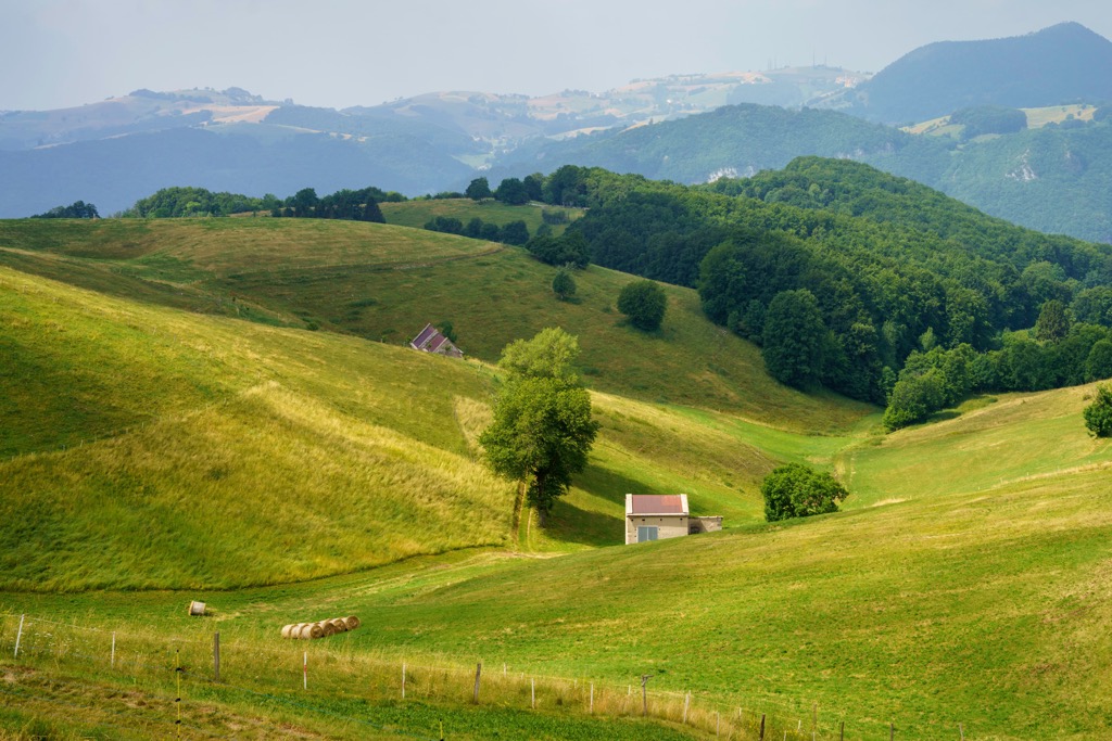
Besides the mountains, which will be discussed immediately below, the two main features of the landscape of the province of Verona are, in turn, the two large bodies of water and the two plains. There is also one major man-made landscape feature.
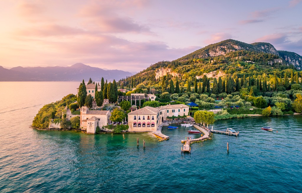
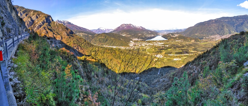
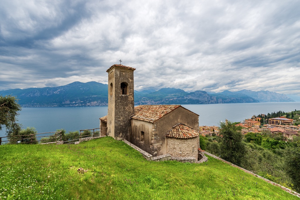
The province covers the eastern half of Garda Lake, the largest of the famous five lakes of northern Italy (the others to the west are Iseo, Como, Lugano, and Maggiore). Besides its size, the lake is famous for its pleasant Mediterranean climate, which allows to grow olives, wine, lemons, etc., as well as to fish, and gives incredible opportunities for all kinds of recreation and tourism. It is 51.6 km (32.1 mi) long, and 16.7 km (10.4 mi) wide at the southern end, where it looks like a sea.
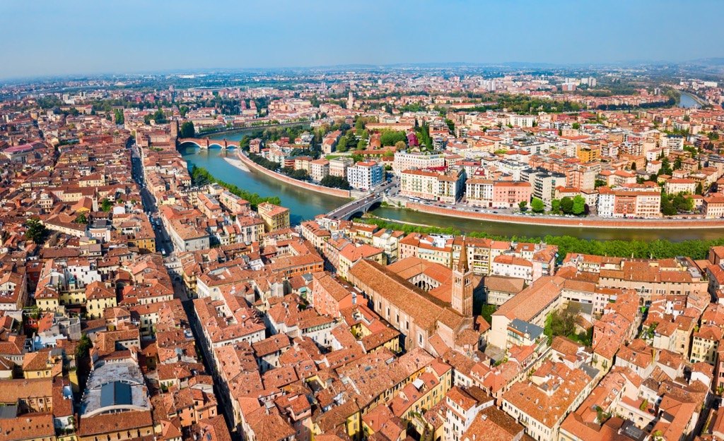
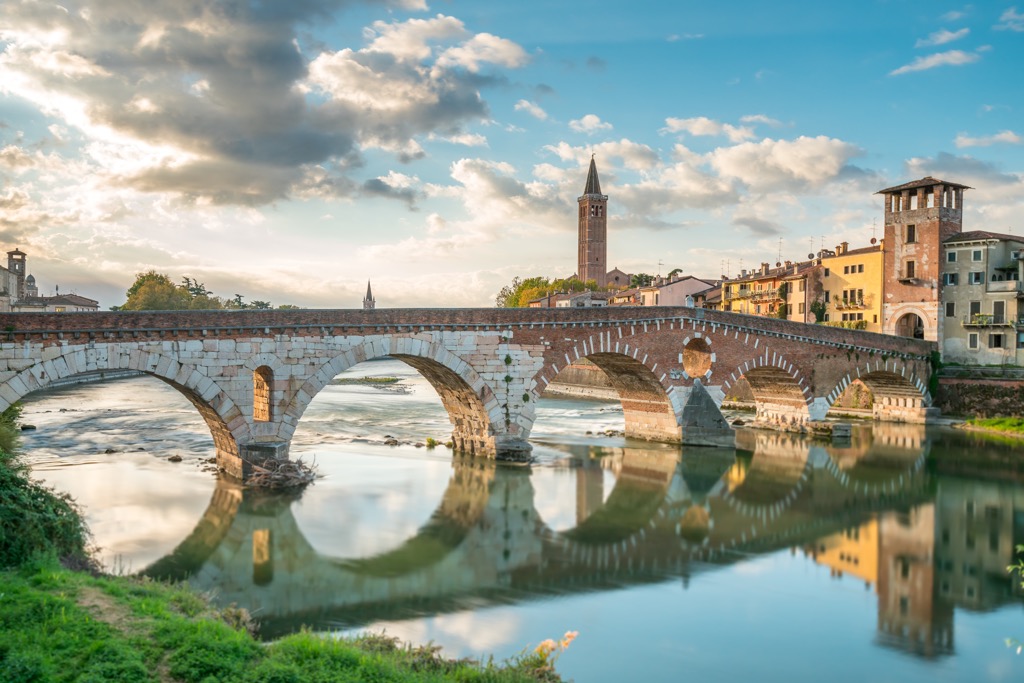
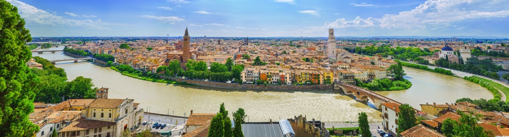
From north to southeast through the province, including the city of Verona itself, runs the Adige River, the second-longest river in Italy, after the Po River, which runs parallel to the southern borders of the province. The Adige River has its source in the Reschen Pass (1,504 m / 4,934 ft) between the Sesvenna Range and the Nauderer Berge mountains in the province of Bolzano / South Tyrol and flows into the Adriatic between the small towns of Bacucco and Rosolina Mare in the province of Padua south of the larger Chioggia on its coast. The river is 410 km (250 mi) long.
The Verona province is also situated on the confluence of the two largest plains of all Northern Italy — the Po River Plain to the west of the city and the Venetian Plain or Venetian-Friulian Plain, formed by the Pieve River and other smaller ones, to the east.
The landscape of Verona also cannot be imagined without its main man-made feature — the numerous Venetian medieval fortresses both in the city of Verona itself and in the smaller ones, such as the Peschiera del Garda. The latter is one-sixth of the UNESCO site under the precise title "Venetian Works of Defense Between the 16th and 17th Centuries: Stato da Terra—Western Stato da Mar", a large system of defensive structure made by the Venetians to defend the Venetian Republic. The other five sites are in Bergamo, Lombardy, and Palmanova in Udine, Friuli Venezia Giulia; Kotor, Montenegro; Zadar and Šibenik-Knin, Croatia.
The mountains of Verona are represented by two main mountain ranges — Mount Baldo (Monte Baldo) and Lessini Mountains (Monti Lessini), separated by the southern tip of the wide and long Val d’Adige (Etschtal in German), which begins near Merano in South Tyrol.
Monte Baldo is a mountain range that stretches along the entire eastern shore of Garda Lake for 40 km (25 mi), partially entering the neighboring province of Trentino.
Its highest peak, Cima Valdritta (2,218 m / 7,276 ft), is not the only one. The mountain is literally “dotted” with peaks following one another from north to south or vice versa, including Cima Prà della Baziva (2,207 m / 7,240 ft), Cima Telegrafo (2,200 m / 7,217 ft) as the second and third ones in height, and others. Cima Valdritta is also the most prominent mountain of Monte Baldo (1,947 m / 6,387 ft of prominence) and the entire province of Verona, as well as the second after Marmolada (2,132 m / 6,994 ft of prominence) in the Dolomites in the entire Veneto region and the ninth among the 23 ultra mountains of Italy.
The second and slightly detached subrange of the Monte Baldo is the equally impressive Monte Altissimo di Nago (2,079 m / 6820 ft in height and 660 m / 2,165 ft of prominence).
In the bigger picture, Monte Baldo is one of two subgroups on par with Bondone-Stivo of the greater Eastern Gardesane Prealps (Prealpi Gardesane Orientale) of the Brescia and Garda Prealps (Prealpi Bresciane e Gardesane) of the Southeastern Alps (Alpi Sud-orientali) of the Eastern Alps (Alpi orientali) in the Italian SOIUSA classification of Alps.
According to the Eastern Alps classification of the German-Austrian Alpine Club (AVE), these mountains are part of the Garda Mountains (Gardaseeberge) of the Southern Limestone Alps (Südliche Kalkalpen).
Monti Lessini is the second main mountain range in the province of Verona, and if not taking the altitude, the first in size, being much more extensive. They occupy the entire northern part of the province above the city of Verona.
Specifically, the mountain range is a series of long ranges, separated by inner valleys, stretching also from north to south. Looking at the map, these mountains are very reminiscent of an open palm, where the ridges are fingers spread apart, the longest of which touches the city of Verona as the hills that begin on the north bank of the Adige River just behind the Old Town. They are also clearly visible from the train window when approaching the city from Brescia or Vicenza.
The three highest peaks of the Monti Lessini range are Monte Zevola (1,976 m / 6,482 ft), Cima Trappola (1,866 m / 6,122 ft), and Monte Tomba (1,766 m / 5,793 ft).
By analogy, in the broader picture, Monti Lessini is one of three groups on par with Piccole Dolomiti (Small Dolomites) and Gruppo degli Altipiani (Group of Plateaus) to the north of them of the larger Vicentine Alps (Prealpi Vicentine) of the Venetian Prealps (Prealpi Venete) of the Southeastern Alps (Alpi Sud-orientali) of the Eastern Alps (Alpi orientali) in the same SOIUSA classification.
The AVE places these mountains within the Vicentine Alps (Vizentiner Alpen) of the Southern Limestone Alps (Südliche Kalkalpen).
The two main hiking areas in the province of Verona correspond to its two mountain ranges. Both are also protected areas: Monte Baldo Local Nature Park (Parco naturale Locale del Monte Baldo) and Lessinia Nature Park (Parco naturale regionale della Lessinia).
Each of the parks has a network of marked hiking trails for one to several days:
In addition, the province has many more hiking trails to less high mountains directly from the shores of Garda Lake and in other parts of the vast Lessinia Mountains.
There is also the famous long hiking route Sentiero della Pace (The Peace Trail) of 500 km (311 mi), which starts at Passo del Tonale between Lombardy and Trentino, and ends at Val di Fassa in the Dolomites, also passes through the Verona province. The aforementioned Monte Altissimo di Nago is one of more than a dozen official main peaks on the route, which is another reason to hike it, even if you don't take the Peace Trail.
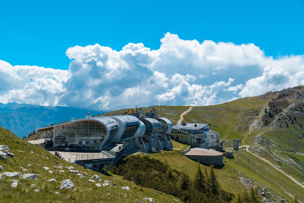
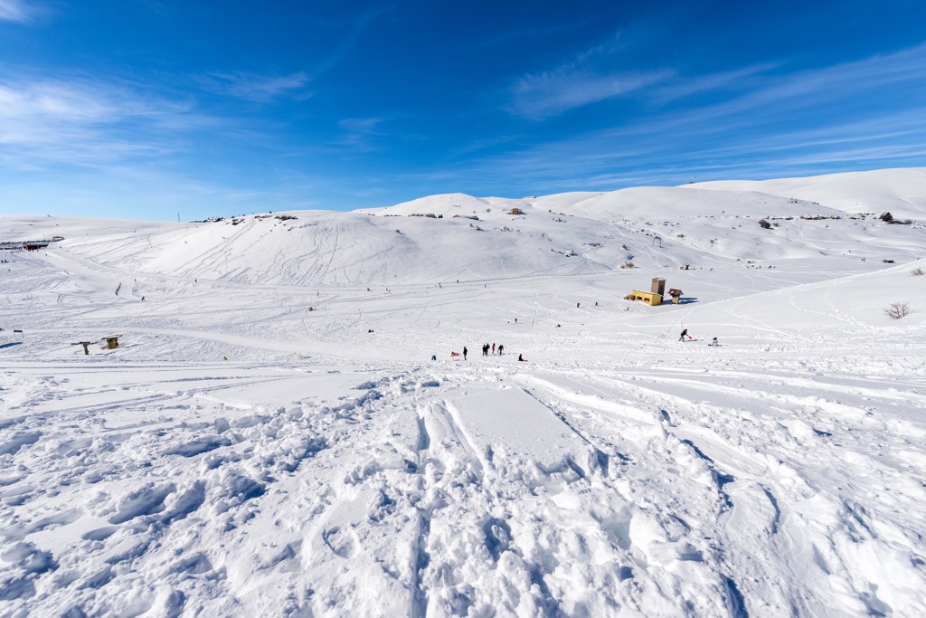
For those, who will come to Verona province in winter and who like snow sports, there is a small ski resort Prà Alpesina with right at the same Malcesine cable car top station with 3.2 km (1.9 mi) of slopes and 3 ski lifts. But you can continue skiing to the nearest a bit larger resort right after it, Brentonico, with 17 km (11 mi) of slopes and 5 ski lifts.
The nearest major ski resort, Alpecimbra-Folgaria-Fiorentini, including Alpecimbra-Lavarone with more than 50 km (31 mi) of ski slopes and 40 ski lifts in total, is located not far away in Trentino province to the north of Verona.
Learn more about these and other ski resorts in the Veneto region and Italy in the World Mountain Lifts section of the site, including information about open and closed ski slopes and lifts in real-time.
Before or after hiking in the Verona mountains, visit the province's main official tourist office, located in the center of its capital to get more information on the spot, ask for advice, pick up a map, etc.
Verona Tourist Information Office
(IAT Verona, Informazioni e Accoglienza Turistiche Verona)
Via Leoncino, 61 (Palazzo Barbieri, Piazza Bra), 37121, Verona, VR, Italy
+390458068680
As in other parts of the Italian Alps, the main type of accommodation during the hikes at high altitude of the province of Verona is the mountain huts (rifugio).
On Monte Baldo, there are at least four of them: three in the southern part of the range—Rifugio Fiori del Baldo, Rifugio Chierego, and Rifugio Telegrafo Gaetano Barana, and one in the northern part—Rifugio Altissimo Damiano Chiesa. But on the slopes of the mountain on both sides there is much more housing options than on the top, including at least another major hut—the namesake Rifugio Monte Baldo—and other types: farms (malga in Italian), chalets, hotels (albergo), among others.
The same can be said about the Lessinia Mountains. On the plateau, you can stay in Rifugio Monte Tomba, Rifugio Podestaria, Rifugio Castelberto, Rifugio Baita Maso, Rifugio Dosso Alto Srl, Rifugio Lausen, and many others. Separately, I would like to mention Rifugio Campogrosso on the opposite side of Lessinia, even though it is in the Vicenza province, situated in a very picturesque place in front of Pasubio Chain, one of the three Piccole Dolomiti subgroups in the same Vicentine Alps as Monti Lessini.
There is a lot of advice on how to live in rifugio, but the first and the main one is this: before deciding on accommodation, check that it really has a place to sleep. Sometimes this word also refers only to restaurants, and much more rarely they are not mountain huts, but free shelters (bivacco). The latter are often found on high plateaus like Lessinia, where there are many abandoned farms.
Before and after the hike you can easily find all kinds of accommodation in Verona, as well as in smaller towns in the province.
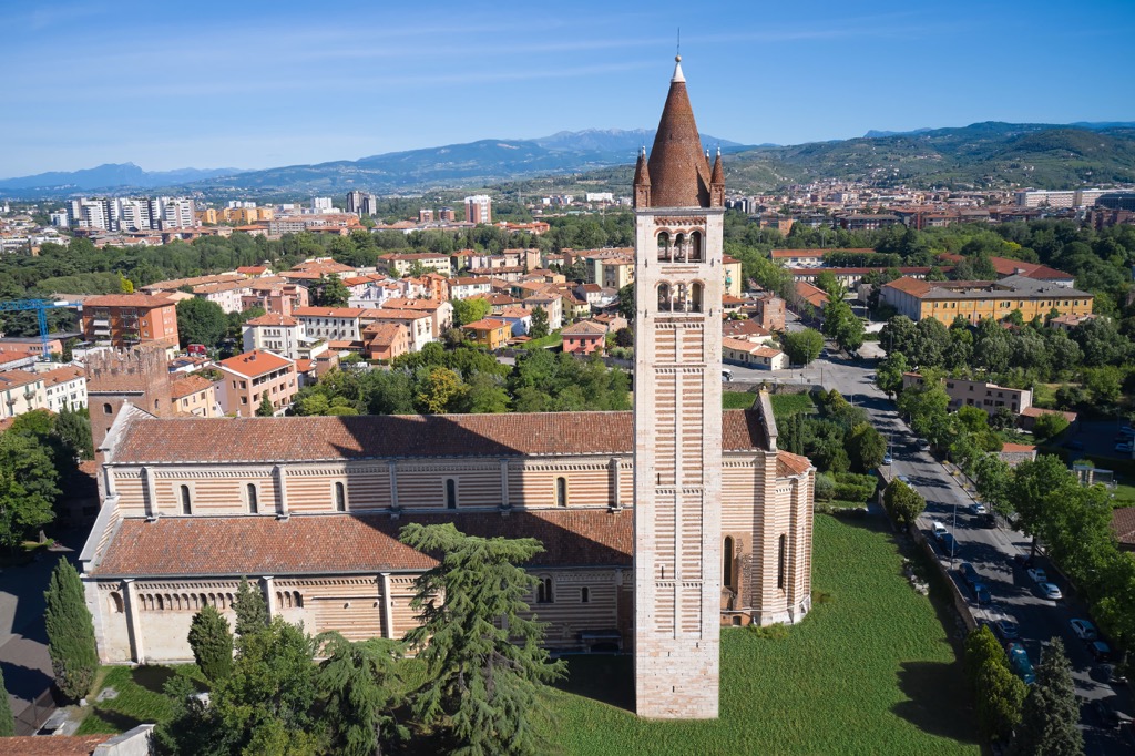
After the city of Verona (257,000+ inhabitants), the province's nine other major towns include Villafranca di Verona (33,000+), Legnago, San Giovanni Lupatoto, San Bonifacio, Bussolengo, Sona, Pescantina, Negrar di Valpolicella, and Cerea (16,000+). I bet you haven't heard of any of them before this paragraph (that's how famous Verona is!), which means it's a great excuse to explore them to get less touristy and more authentic experience.
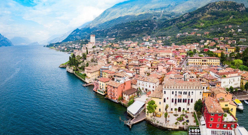
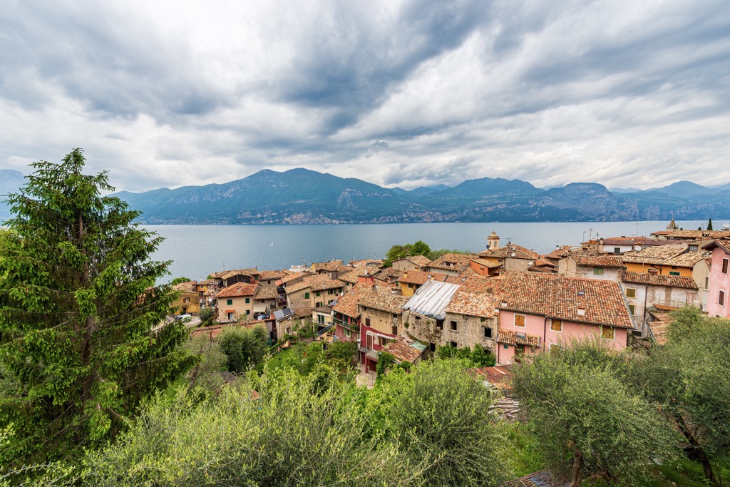
The main towns on the eastern side of Garda Lake can easily be found simply by traveling along it (from south to north): Lazise, Bardolino, Torri del Benaco, Castelletto, Brenzone sul Garda, and Navene.
Tip: I would skip the first two towns closer to the plain because of their proximity to the Gardaland amusement park and focus on the later ones. In the summer, there are more Germans than Italians in this part of Garda, for whom it has been (and it seems it will continue to be) the major vacation destination for centuries. And of course Italians themselves also like to relax on their lake, as well as other tourists from around the world.
The nearest largest town to Lessinia is Bosco Chiesanuova, from where you can start your hike to the nature park and return after.


Yes. Verona has 211 named mountains. The highest is Monte Baldo - Cima Valdritta at 2,218 m.
The highest mountain in Verona is Monte Baldo - Cima Valdritta, at 2,218 m.
Verona has 211 named mountains.


