Scan the QR code and open PeakVisor on your phone
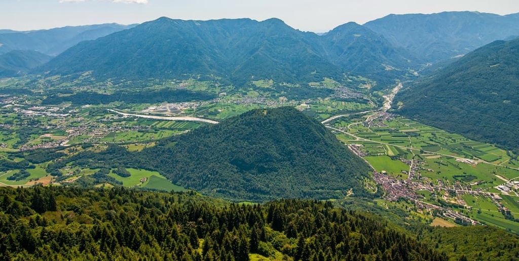
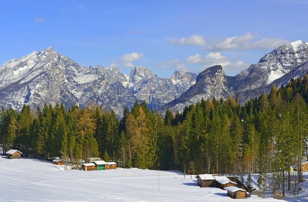
The Cimonega Group is one of the largest mountain groups in the Dolomites of northern Italy. The main features of the group are the remarkable peaks of Vette Feltrine and the Dolomiti Bellunesi National Park. It is also one of the most wild places in the Dolomites. There are 176 named mountains in Gruppo del Cimonega, the highest of which is Sass di Mura (2,547 m / 8,356 ft) and the most prominent of which is Piz di Mezzodi (2,240 m / 7,349 ft).
The Cimonega Group is located in the province of Belluno in the Veneto region in northern Italy on the border with the Trentino-Alto Adige/South Tyrol region. Cimonega is also located in the municipalities of Feltre, Primiero, and Agordo.
In many ways, Cimonega feels like the last corner of the "real" Italy in the Dolomites. That's because, the further north you go, the more you feel like you are in Austria and Germany.
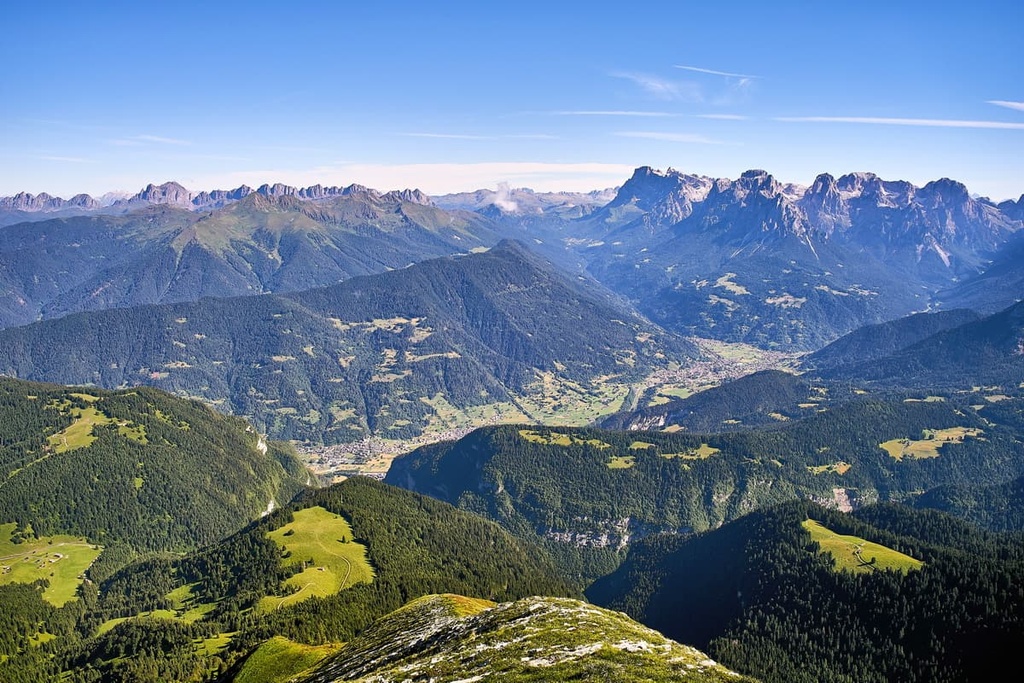
The Gruppo del Cimonega runs from southwest to northeast. The borders of the group are the Valbelluna in the south (Piave River); the Cortella Valley (Cismon River), Valle Schenner (Schenner River) and Val di Primiero in the west and northwest; Val Cordevole in the north; and Valle Agordina (Cordevole River) in the east.
Around Cimonega, there are many other large and famous mountain groups. This includes the Venetian Prealps to the south and southwest, including, for example, the famous Mount Grappa (1,775 m / 2,587 ft); the Fiemme Mountains along with Lagorai and Cima d'Asta to the west; Pala and Civetta to the north; and Schiara to the west.
Finally, the boundaries of the group almost entirely encompass the territory of the Dolomiti Bellunesi National Park. Cimonega makes up about two-thirds of the territory of the park while the remaining third belongs to Schiara.
The quickest and easiest way to get to Cimonega is to drive to Feltre, which is located around the southern borders of the group near Belluno.
From Venice, the drive is 97 km (60.2 mi) long, or about 1 hour and 40 minutes by car. From Treviso, Padua, Vicenza, or Verona, the drive is about 149 km (92.5 mi), or about 2 hours by car.
If you are traveling by public transport, take the Trenitalia trains (about 2 h on the way from Venice).
Feltre can also be reached by car from Trento, the capital of Trentino province (85 km / 52.8 mi, 1 h 10 min) or by bus of the local bus company Trentino Trasporti. To get to Belluno, take the Dolomiti Bus from Feltre.
The geology of the Cimonega Group is similar to that of the neighboring Schiara Group and almost all the groups in the Dolomites. These mountains consist primarily of the rock dolomite, which was named for French scientist DieudonnГ© Sylvain Guy TancrГЁde de Gratet de Dolomieu.
Additionally, the Cimonega is considered a UNESCO World Heritage Site for its geological wonders. It is included as part of the largest of the nine main mountain systems in the Dolomites called "Pale di San Martino, San Lucano, Dolomiti Bellunesi, Vette Feltrine." This mountain system covers an area of about 316 sq km (122 sq mi).
This large geological group is divided into two parts ”north and south” which are separated by the prominent fault lines, Valsugana. This fault is named after the valley to the west of the Cimonega Group, where various minerals from the Permian to the Cretaceous periods are found.
One of the particular geological features of this group is the numerous finds of graptolites, which are the oldest macrofossils in the Dolomites. These fossils date back 430 million years and can be found near the Cereda Pass on the border of Pala Group.
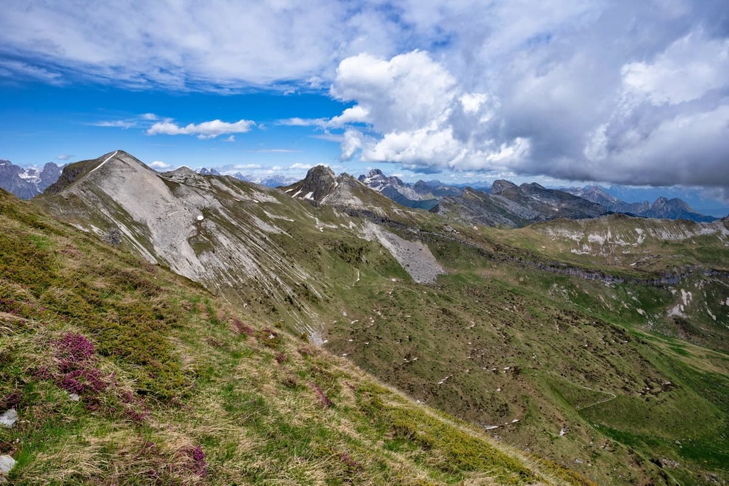
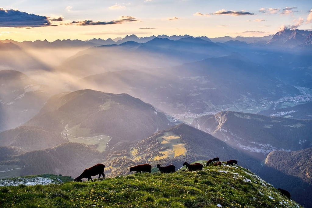
The landscape of the Gruppo del Cimonega is varied and it can be described in one short phrase: "It is a mixture of everything you expect to see in the Dolomites, and more."
Here are its most important features:
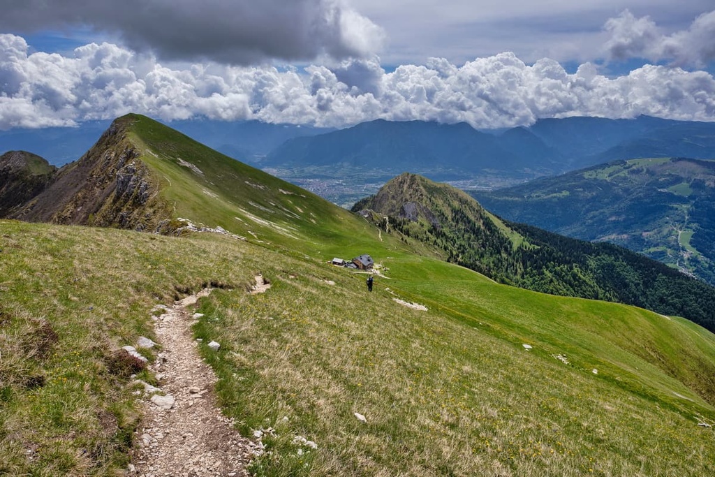
The main peaks of the group, which include Monte Pavione (2,334 m / 7,657 ft), Sass di Mura (2,547 m / 8,356 ft), and Piz di Mezzodi (2,271 m / 7,450 ft), are evenly spaced throughout its territory. Therefore, you can start your journey from anywhere in the group and get stunning views.
There are at least three large inner valleys in the group that were formed by rivers of the same names: Val Noana, Valle di Canzoi, and Valle del Mis, the latter of which is the largest among them.
The two main passes of the group are:
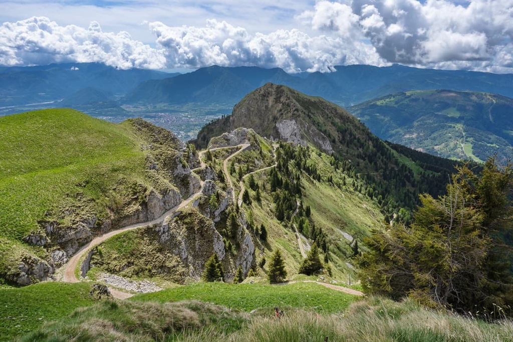
These passes are great locations for cycling enthusiasts. This has been particularly true ever since the Aune Pass and Avena hosted the twentieth and final mountain stage of the Giro d'Italia in 2019.
There are three artificial lakes within the group: Noana, Stua, and Mis, the latter of which is the largest. These lakes were formed by dams, so they have steep rocky shores and you can't swim in them. But they look very beautiful with azure-colored water in spring and winter months.
There are many more features in the Cimonegagruppe, including high plateaus, glacial cirques, and karst caves. Read about them in the guide to Dolomiti Bellunesi National Park.
The group belongs to the large Western Dolomites region, which includes famous mountain groups such as Pala, Marmolada, and Sella.
According to one of the most common classifications of the Eastern Alps, the German-Austrian AVE, the Cimonega is a separate group within the Dolomites. The Dolomites, in turn, are one of the 68 large mountain groups in the Eastern Alps.
The group can be roughly divided into three large parts (from west to east):
The last of the groups is the most remote as it is separated from the other subgroups by the valley of the Mis.
According to the second most popular classification system, the Italian SOIUSA, the Cimonega Group belongs to the supergroup Alpi Feltrine, which is part of the Dolomiti di Feltre e delle Pale di San Martino subsection of the Dolomites.
According to the same classification, the Cimonega is also divided into several distinct subgroups:
As you can see, the mountains Pizzocco and Vette Feltrine are not part of the group in this classification system. Along with Cimonega, they are considered two other separate subgroups in the Alpi Feltrine group.
Here is some information about the four highest peaks in the range:
Monte Pavione (2,335 m / 7,660 ft) is the highest peak of the Vette Feltrine subgroup. It is a constant feature of the skyline of Feltre, on par with the city's cathedrals and churches.
The name of the mountain is a modification of the word "pavilion," which refers to the outline of this relatively gentle peak. The summit is accessed by an easy hiking trail.
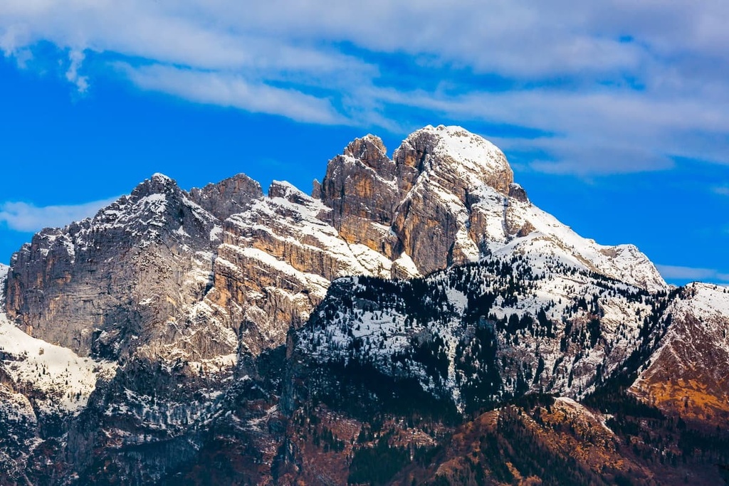
Sass di Mura (2,547 m / 8,356 ft) is the highest peak of the entire Cimonega. It is located on the north-central border of the group. It was first climbed by three Italian mountaineers, Luigi Cesaletti, Mariano Bernardin, and Demeter Diamantidi, in 1881.
A very beautiful view of the summit (and the Primiero Valley) opens from the neighboring Fiemme Mountains from the Church of San Silvestro, which is located above the town of Imer. An easy path leads from the town to the church.
Monte Pizzocco (2,186 m / 7,171 ft) is one of the major peaks in the south-central part of the group. It is visible from the valley of Valbelluna.
The mountain became known among climbers in 1934 when it was first climbed by Italians Ettore Castiglioni and Bruno Detassis. The summit is also accessible on foot from the Roncoi at 850 m (2,788 ft), the nearest town is San Giustina.
Piz di Mezzodì (2,271 m / 7,450 ft) is the highest peak of the Monti del Sole subgroup. It is also the most prominent peak in the Cimonega Group.
There is a hiking and climbing route (via normal) from Forcella Franche to the summit that takes about 5:30 hours to complete. Non-climbers can enjoy a beautiful panoramic view of this and other nearby peaks from the village of Colvignas in the municipality of Agordo.
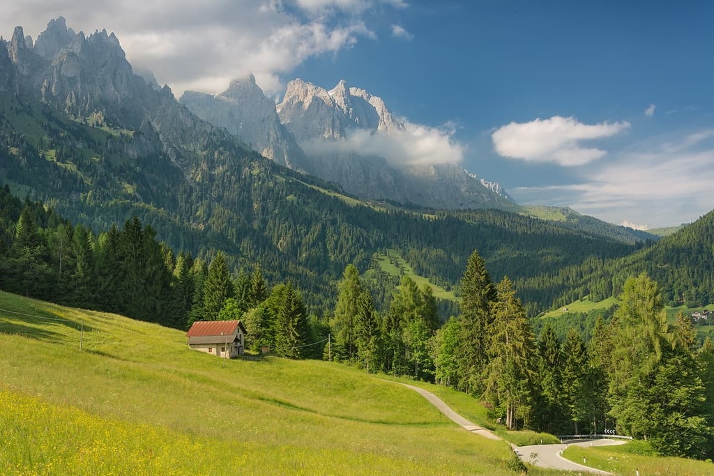
A huge mountain group like Cimonega has many hiking trails, so it can be difficult to choose just one for your adventures. Here are some of the best hikes to consider in the range:
The hike to Aune–Imer via Monte Pavione is difficult and long. But it is a magnificent trek from the mountain village of Aune to the town of Imer via Monte Pavione.
There are very few buses to Aune, so try hitchhiking your way there if you don't have another mode of transportation. Locals are usually happy to give tourists a lift.
From here, continue all the way up toward the settlement of Le Val and Baita Toni Ponte and on to Mount Front (1,995 m / 6,545 ft). Then, take the Sentiero di San Antonio until you reach Malga Monsampiano. This is the most difficult part of the route as the trail is steep and sometimes difficult to find.
From this point, through the high valley Busa di Monsapiano near the Cima di Monsapiano (2,280 m / 7,480 ft), follow the trail to the top of Mount Pavione. This part of the trail follows the The Cirques of Vette (I Circhi delle Vette) Trail, a magnificent geology-focused route around the Buse delle Vette (glacier cirques).
From Pavione, descend back down to the pass and then across the valley to the rifugio Vederna. From there, follow the trail to the town of Imer along the Rio Vederna and the Noana Creek Valley. The main attraction of the second part of the route is the huge waterfall called Cascata del Salton de la Coara.
As a reminder, from Imer you can go to San Silvestro Church to see the peaks of Sass de Mura and the entire Primiero Valley. To go back you can take the bus to Feltre or go north to the mountains of Pale di San Martino—it's only about 45 minutes away.
Alta Via 2 is one of the most popular long-distance alpine hiking trails in the Dolomites on par with the Alta Via 1. The total distance of the Alta Via 2 is 180 km (111.8 mi), and it takes 13 days to complete.
If you start in the very beginning, at Bressanone in South Tyrol, you will arrive at rifugio Passo Cereda on the northern border of the group from rifugio Treviso by day 10. It will take you the next three days to cross Cimonega to come to Feltre via bivacco Feltre Walter Bodo, rifugio Bruno Boz, rifugio Dal Piaz, and Passo Crode d'Aune.

The Cammino delle Dolomiti is another long hiking route that creates a huge loop through the entire province of Belluno. It includes 30 stages. On each of them, you can see almost all the mountains of the province, as well as many towns and villages, and important landmarks.
Locals promote the Cammino delle Dolomiti as the equivalent of the Dolomites equivalent of the Camino de Santiago in Spain. For example, here's a quote from the route's website:
"Some will think that this is a way of trekking. But it is not. The Path of the Dolomites goes far beyond. It covers the desire to find oneself, in daily fatigue, in the silence, in the rhythm of one's own steps, in the sharing and confrontation with people, in reliving the history, spirituality, and culture of the past—all aspects that are fundamental to our lives."
Given that this is a guide for the Gruppo del Cimonega, we are interested in the first seven stages of Cammino delle Dolomiti. This is actually the original route of the trail, as the other 23 stages were added later. The 7 stages of the Cammino delle Dolomiti in the Cimonega are:
The route is characterized by a relatively small amount of elevation gain. It runs mainly along the Cimonega from west to east and then to the north, without reaching the high passes and peaks. The one exception to this rule is the third stage, which takes you to Aune Pass.
That said, some sections of the trail are quite long. For example, on the seventh day, you will have to walk 21 km (13 mi).
In my opinion, this is an excellent route for exploring the province for those who are not ready for more technical climbing, but who nevertheless have a lot of stamina for multi-day hikes.
If you're visiting the Cimonegagruppe and you love skiing, we have good news for you: There is a small ski area on Mount Avena (1,454 m / 4,770 ft) on the southwestern border of the group.
This is a very quiet, family-friendly and non-touristy place compared to the famous Dolomiti Superski area. Here is all important information about Avena:
If this resort seems small to you from my description, the nearest major ski resort is located only an hour away from Mount Avena. This resort is called San Martino di Castrozza / Passo Rolle and it is one of the 12 large areas that make up the Dolomiti Superski system.
Check the Cimonega ski map on the larger Veneto and Italy ski maps in the World Mountain Lifts section of the site. It includes information about open ski lifts / slopes in the Cimonega in real-time with opening dates and hours. There are also year-round cable cars, funiculars, cog railways, aerial tramways, and all other types of mountain lifts.
While hiking in the Cimonega Group, you can stay in one of several mountain huts. Each of these huts offers a similar type of accommodation, including a bed in a common room, dinner, and a shower. The average price for a night in one of these rifugios is about €50–60, not including the cost of a shower.
The rifugios in the Cimonega group include:
If you're traveling throughout the entire Cimonega Group along the Alta Via delle Dolomiti, you might also want to stay in one of the bivouacs in the range. The bivaccos, as they're called in Italian, include:
The word "malga" means that the bivacco belongs to a former alpine farm that is no longer in operation. From my experience, the farms may be very old, colder, and less cozy to sleep in than the metal cabins, which are managed by the local Italian Alpine Club. But they may have a stove and even firewood.
Separately, I'll also note the bivacco Le Mandre (The Mother), which is located on the northern borders of the group at this address:
localitГ Zenich 751
32020
Rivamonte
Agordino, BL
Italy
This new bivouac is like a small comfortable house with a tile floor. You can even stay there for a few days if you're looking for a little escape in the mountains.
Before and after your hike, you should have no trouble finding lodging in Feltre and other towns on the group's borders. The only time you may have an issue is during the peak tourist season of July and August when all Italians go on vacation, too.
The most popular types of accommodation here are agriturismos, B&Bs, and various houses and cottages in the mountains that locals rent to tourists in the summer and winter seasons.
Before you hike, be sure to visit the region's official tourist center, located in the main square of Feltre. Here, you can learn more about the Cimonegagruppe, the Dolomiti Bellunesi National Park, Feltre, and the Veneto region in general:
Ufficio Turistico Feltre
Piazza Vittorio Emanuele (Piazza Maggiore), 21
32032
Feltre (BL)
Italy
The tourist office is open every day from 9 am to 1 pm and from 2:30 pm to 5 pm. The only exceptions are afternoons on Tuesdays, Thursdays, and Fridays. It is also closed on Wednesdays
Contact information for the tourist office is as follows:
+3904392540
The other thing that I like about the Cimonega Group is that it is literally surrounded by various small towns and villages that serve as convenient places to start or end a hike. Moreover, these are very interesting cities in terms of architecture and culture. So, visiting them will greatly diversify your trip and make it quite exciting.
For example, there are four towns that are good starting or ending points on your journey:
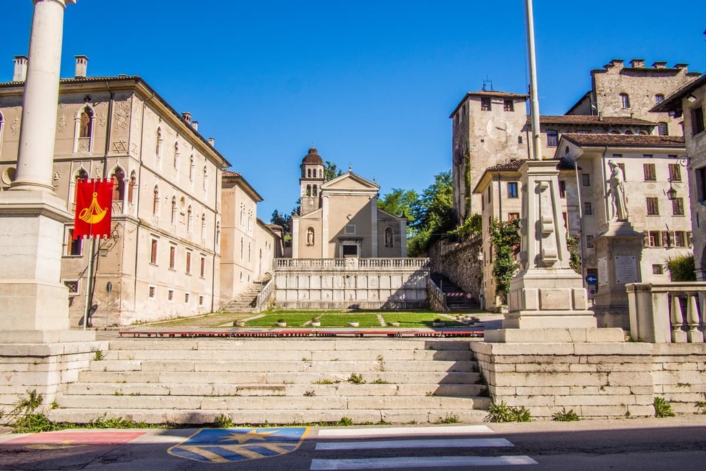
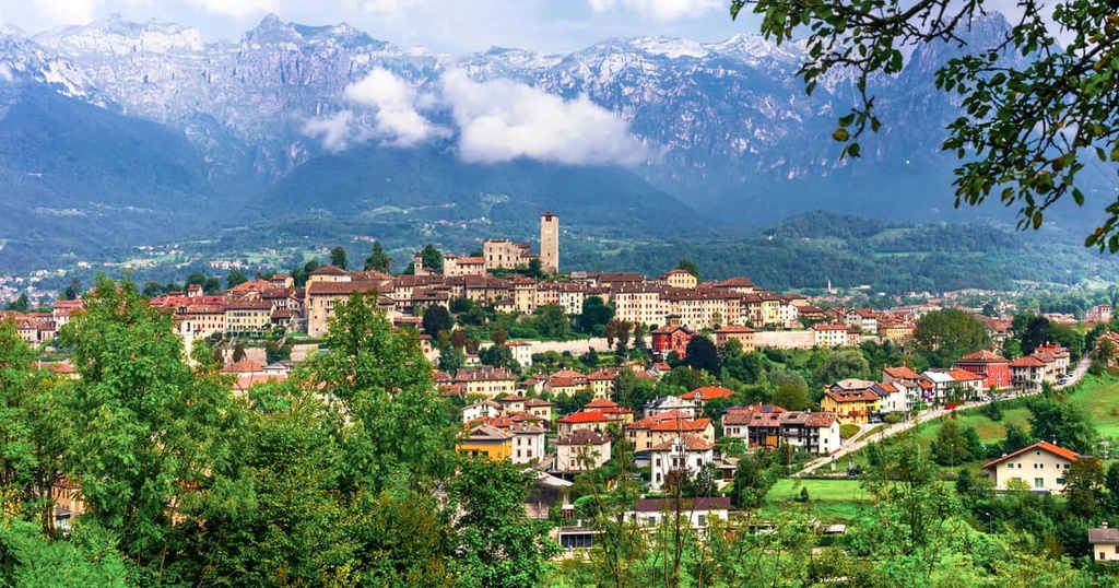
Feltre is the largest city in the province of Belluno, alongside the city of Belluno. It is an ancient Italian town that was known during Roman times as Feltria. The city is located on the southern borders of the Cimonega group at the entrance of the Dolomites on the Stizzon River.
Today it has a population of over 20,000 (2021) people, only 10,000 less than the capital of the province, Belluno.
However, the town center or Old Town of Feltre is quite small and you can walk the whole thing in two hours. But, the area of the municipality, which includes 12 communes, is impressively large (99.7 sq km / 38.5 sq mi).
The city is located on a hill that's some 325 m (1,066 ft) high, so it is seen from almost any point of the city, as well as the wall of the Dolomites, located just behind it.
The ideal route in Feltre for half of a day is to go from the train station through the lower center of town to the Via Tezze and the river, where you will have the best view of the Dolomites. Then, you can venture along the city walls and through a small park to the Old Town and return to the train station.
Here are the main architectural and cultural attractions of the city are the many medieval buildings, streets, and squares:
Visit the official tourist site of Feltre for more information: VisitFeltre.info.