
Scan the QR code and open PeakVisor on your phone
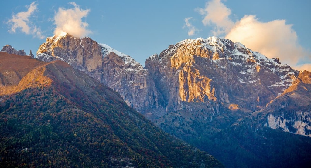
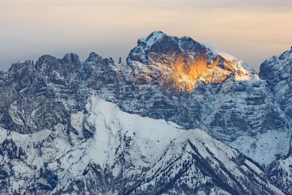
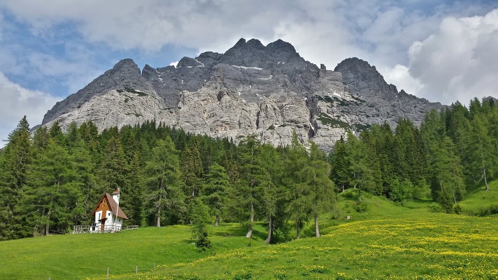
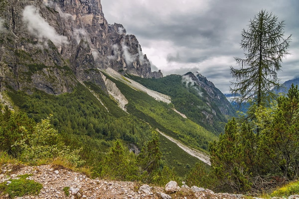
The Schiara Group is a collection of peaks located in the Dolomites of northern Italy. The major feature of the group is its location near the town of Belluno, one of the three capitals of the Dolomites. Among local climbers, it’s also known for its exceptional via ferratas. There are 133 named mountains in the Schiara group, the highest and most prominent of which is Schiara (2,565 m / 8,415 ft).
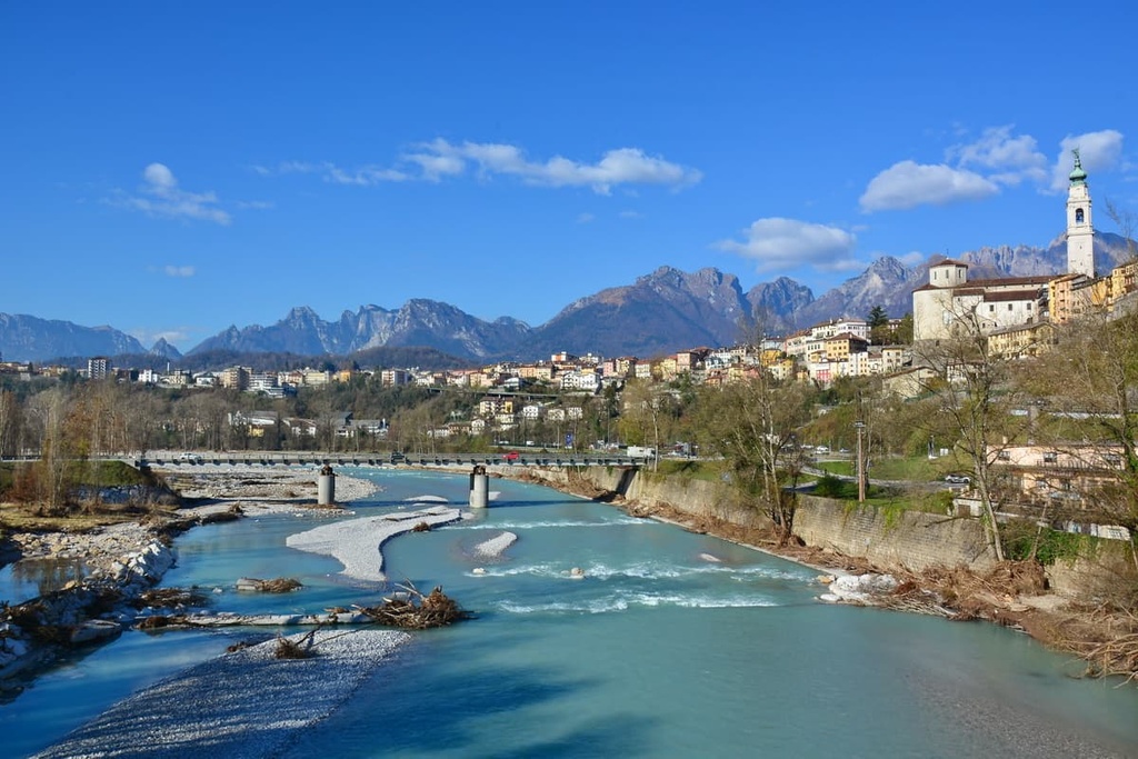
The Schiara Group is located in the province of Belluno in the Veneto region of northern Italy. It is sandwiched between three large geographical and cultural regions: Belluno in the south, Agordo in the west, and Cadore in the east. The main cities of these three regions are Belluno, Agordo, and Piave di Cadore, respectively.
The Gruppo del Schiara stretches from the south to the north. The borders of the group run through the valley of the Valbelluna (Piave River) in the south and southeast, Valle Agordina (Cordevole River) in the west, Val di Zoldo (Maè River), and Val di Cadore (Piave River) in the north.
Many other large and famous groups are located around Schiara. These include the Venetian Prealps in the south, the Cimonega group in the west, the Pala group in the northwest, Civetta, and Pelmo in the north, and Bosconero in the east.
Finally, together with Cimonega, Schiara is partly located in the famous Dolomiti Bellunesi National Park.
The fastest and easiest way to reach the Schiara Group is to take the direct Trenitalia train to Belluno from Venice or to take the train via the nearby town of Feltre (2 or 3 hours). You can also get to Feltre from Trento on the Trentino Trasporti and Dolomiti Bus.
The distances and travel time by car are as follows:
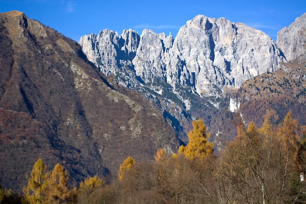
Like many other mountains in the Dolomites, the Schiara group consists mainly of principal dolomite. This is the main type of dolomite and the type of dolomite that’s found throughout the region.
Dolomite began to form in the Triassic period, some 230–200 million years ago, when the landscape of the Earth was totally different than it is today.
At that time, the ancient tropical Tethys Ocean was located near what is now the Dolomites. Accordingly, dolomite was originally the deposits of corals and other sea creatures on the seafloor.
Over time, this deposition formed sea lagoons similar to those we can still see today, for example in the Caribbean Sea. As a result, one of the particular geological features of this group is the large number of fossils of calcareous and siliceous sponges that you can find throughout the range.
Additionally, as a result of its geologic beauty, UNESCO included the Schiaragruppe (and the entire Dolomites region) as a World Heritage Site. Furthermore, the Schiara group is also part one of nine named groups in the UNESCO classification system of the Dolomites.
In the system, the Schiara group is numbered as group three, which is called the “Pale of San Martino, San Lucano, Dolomiti Bellunesi, Vette Feltrine.” This is the largest such group in the range.
The main peaks of the group are located so close to each other that sometimes they are designated as pairs in various mountain classifications.
For example, Schiara and Pelf (2,502 m / 8,208 ft), which are in the geographical center of the group, are often grouped together. Located just slightly farther apart, there are Talvena (2,542 m / 8,389 ft) and Serva (2,133 m / 6,998 ft) to the south, and Pramper (2,409 m / 7,903 ft) and Tamer Grande (2,547 m / 8,356 ft) to the north.
Unlike the neighboring Cimonega Group, where you can travel from either side for beautiful views, in the Schiara I would recommend primarily visiting the southern part of the range.
Additionally, while Belluno’s downtown has a stunning view of the mountains, it’s better to go down to the Piave River below to see the city against the backdrop of the peaks.
Besides the Piave, the Schiara is surrounded by rivers (clockwise): Cordevole, Rova, Duran, and Maè. On the latter stream is a small lake, Lago di Pontesei.
Many mountain streams within the group have formed magnificent interior valleys. Of the most beautiful I will mention two—Val Desedan, including the huge alpine meadow Conca di Cajada, which is surrounded by spruce forests, and Val Pramper, a popular place for cross-country skiing and ski alpinism, and ice climbing.
Another peculiarity of this group is the great number of very deep gorges, such as in Val Vescovà, Val di Piero, Val Ru de Mulin, Val del Grisol, and Val Maè, that have formed in areas where the region’s rock strata have been lifted up in a near-vertical orientation.
The most important pass of the group, Passo Duran, separates it from the Civetta group to the north. It is an excellent destination for a bicycle trip.
The Gruppo del Schiara belongs to the large region of the East Dolomites, which includes other famous groups like the Marmarole, Tre Cime di Lavaredo, and all the Sexten Dolomites, among others.
According to one of the two most common classifications of the Eastern Alps, the German-Austrian AVE, the Schiara Group is a group within the Dolomites, which in turn is one of the 68 big mountain groups of the Eastern Alps.
The group can be divided into two large parts:

According to the second most popular classification system in the Alps, the Italian SOIUSA, the Schiara group belongs to the supergroup Dolomiti Meridionali di Zoldo, which is part of the Dolomiti di Zoldo subsection of the Dolomites.
According to the SOIUSA, the Cimonega is also divided into several distinct subgroups, including:
As you can see, the mountains Tamer Grande and Pramper are not part of the Schiara group in this classification. Along with Schiara, they have considered two other separate subgroups in the supergroup Dolomiti Meridionali di Zoldo (three supergroups in total).
Next, I will briefly talk about the three main peaks in Schiara Group
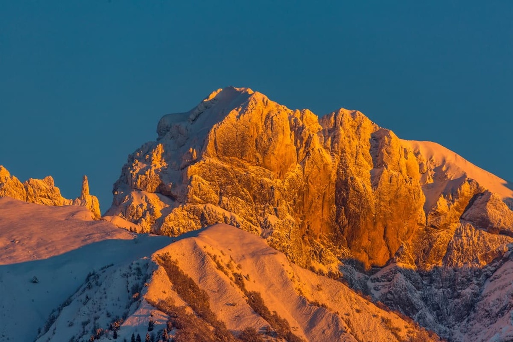
Schiara (2,565 m / 8,415 ft) is the highest peak of the group. The peak’s first ascent was made by Gottfried Merzbachel, a German alpinist, explorer and geographer with two local Italian guides, Cesare Tomè and Santo Siorpaes, in 1878.
There are no hiking routes to the summit, but you can climb it using one of the region’s famous via ferratas.
Monte Serva (2,133 m / 6б998 ft) is a huge peak located to the south of Schiara. It is well-known due to its proximity to Belluno.
It is as much the city's dominant feature as the Belluno Cathedral (Duomo di Belluno), which features an unusual onion-shaped dome. It is believed that on a clear day from the top of Serva and other mountains of the group, one can see Venice (I have not been able to confirm this, but maybe you will be luckier with the weather).
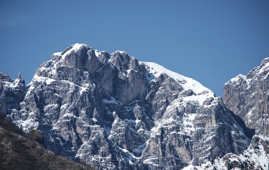
La Talvena (2,542 m / 8,339 ft) is one of several major peaks in the northern part of the group and the third-highest after Schiara and Tamer Grande, which are both located nearby.
It is a long mountain with many peaks, including Cima de la Giàza (2,416 m / 7,926 ft), Pale Bèle (2,380 m / 7,808 ft), Zèst del Vescovà (2,379 m / 7,805 ft).
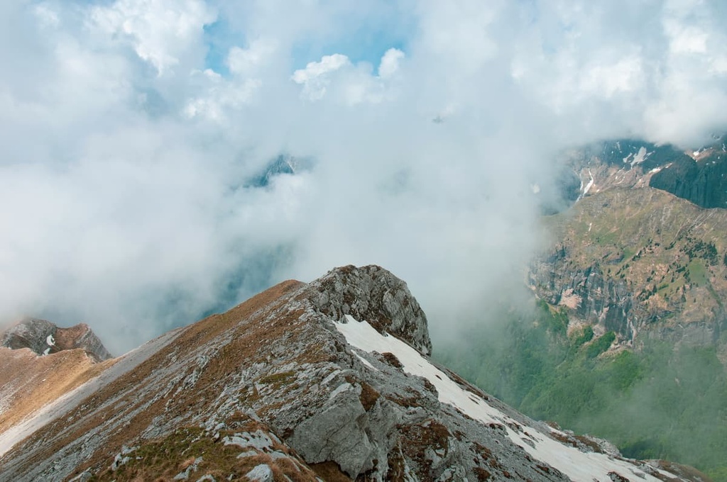
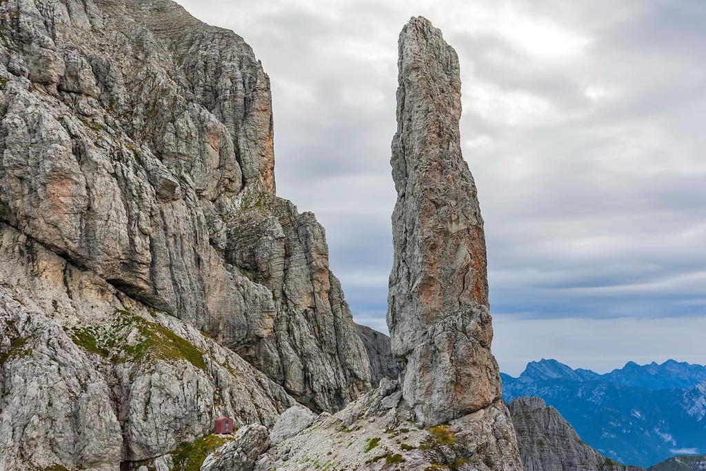
Gusela del Vescovà (2,365 m / 7,759 ft) is maybe the most famous peak in the group, one of the so-called “pinnacle mountains” or a 40 m (231 ft) spire. It owes its form to the network of vertical fractures cutting into the Schiara strata.
Compared to the larger peaks, it looks tiny, but is as popular as they come, thanks to its unusual shape. If your camera has a good zoom, you can see it even from Belluno, Alpago, and from many points in Agordino.
The Gruppo del Schiara has more than a dozen hiking and climbing routes of all kinds, none of which will leave you disappointed if you are lucky with the weather.
The hiking season in the Dolomites begins in May and ends with the first snow in November, but the best time is from late June to late September. During this period, all the mountain huts are open, as are the cable cars you can find out more about in PeakVisor.
The group has day trails, multi-day trails, and a small network of via ferratas, which are believed to be the most incredible (read: challenging) in all the Dolomites. Here’s what you need to know.
This is a two-day hike in the northern part of the group from the Duran Pass to one of the main peaks in the group, Cima Pramper. This is a well-marked CAI (Club Alpino Italiano) hiking trail that’s denoted as trail number 543.
At the foot of the mountain, you can spend the night in the rifugio Sommariva al Pramperet. The next day, you can continue through the valley to civilization at the settlement of Dont, which is located to the north of the pass.
Along the way, you will pass through areas such as Forcella Dagarei, Malga Moschesin, Pra della Vedova, Malga Pramper, and Casera del Pian, among. Be sure to carry and use the local Tobacco or Kompass paper maps as well as your PeakVisor app.
During this hike, you will likely have a wonderful view of the peaks in the region, including Tamer Grande, Cime de la Balanzole (2,080 m / 6,824 ft), and Cima di Pramper (2,409 m / 7,903 ft). But don’t confuse Cima di Pramper with the neighboring Cima di Pramperet (2,337 m / 7,667 ft)—these are two different peaks.
Alta Via 1 is one of two of the most popular long alpine hiking trails in the Dolomites on par with Alta Via 2. The first one is 125 km (77.6 mi) long and takes 12 days to complete.
If you start in the beginning, at Lago di Braies in South Tyrol, you will arrive at the rifugio Sommariva al Pramperét from the rifugio Carestiato to the west of Passo Duran by day 9.
It will take you the next three days to cross Schiara to come to Belluno by foot via rifugio Pian de Fontana, bivacco del Marmol (including via ferrata) and rifugio 7 Alpini.
The Schiara Group is very-well known among local outdoor enthusiasts as the location of the most difficult and at the same time the most amazing via ferratas in all the Dolomites.
These via ferrata travel through gorges, gullies, and chimneys, though they are all equipped with metal cables and ladders mounted on high cliffs. Throughout the range, there is a small series of four connected routes:
Here is a quote from the official website of the Bellunesi National Park in reference to these via ferrata:
"They are extremely difficult equipped routes, with exposed passages which need suitable equipment, technical and psychophysical training.”
So, if you’re afraid of heights and have never tried via ferrata, it’s best to start with the easier routes in other groups.
The classic loop route on three of the four ferratas begins at the rifugio 7 Alpini. It can be completed in one day, but is better to divide it into two days:
Of course, you don’t have to complete all three or four of the via ferratas. You can limit yourself to one or two of them. Note also that the way to the rifugio from the nearest parking in a place called Case Bortot, 7 km (4.3 mi) from the center of Belluno, will take you at least 6 km (mi) and 4:30 hours with an elevation gain of 800 m (2,624 ft).
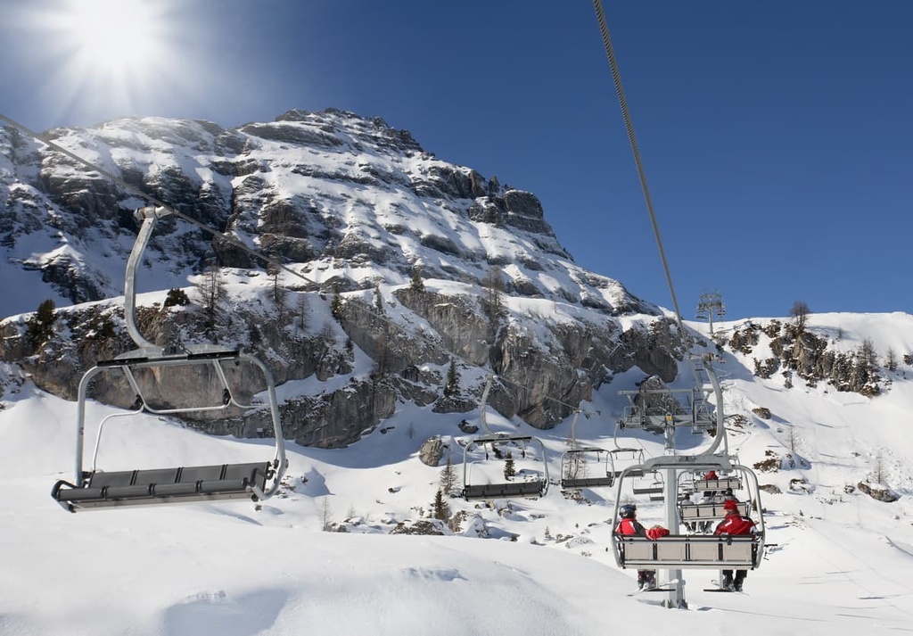
There are no ski resorts in the Schiaragruppe, but there are two popular ski centers to the north and south of it:
Check the Schiara ski resorts map on the larger Veneto and Italy ski maps in the World Mountain Lifts section of the site. It includes information about open ski lifts / slopes in the Schiara Group of the Dolomites in real-time with opening dates and hours. There are also year-round cable cars, funiculars, cog railways, aerial tramways, and all other types of mountain lifts.
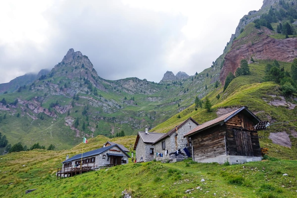
While hiking in the Schiara Group, you can stay in one of the six main mountain huts, where you will be offered a bed in a common room, dinner, and breakfast for approximately €50–60 per person. The main huts in the region are:
There are also at least five bivouacs in the group that are free to use. But, if you stay in one of these huts you should be prepared for rustic living conditions. However, after a day of hiking and climbing, even a bed with a mattress, pillow, and blanket can seem like a luxury. The bivaccos in the region include:
Of all the bivouacs I will separately mention again Ugo della Bernardina, which is located directly opposite the peak of Gusela del Vescovà, which attracts most of the climbers.
On weekends during the tourist season from late June to late September, and especially in July and August, the bivouac might be totally occupied, which means you have to look for other places to sleep.
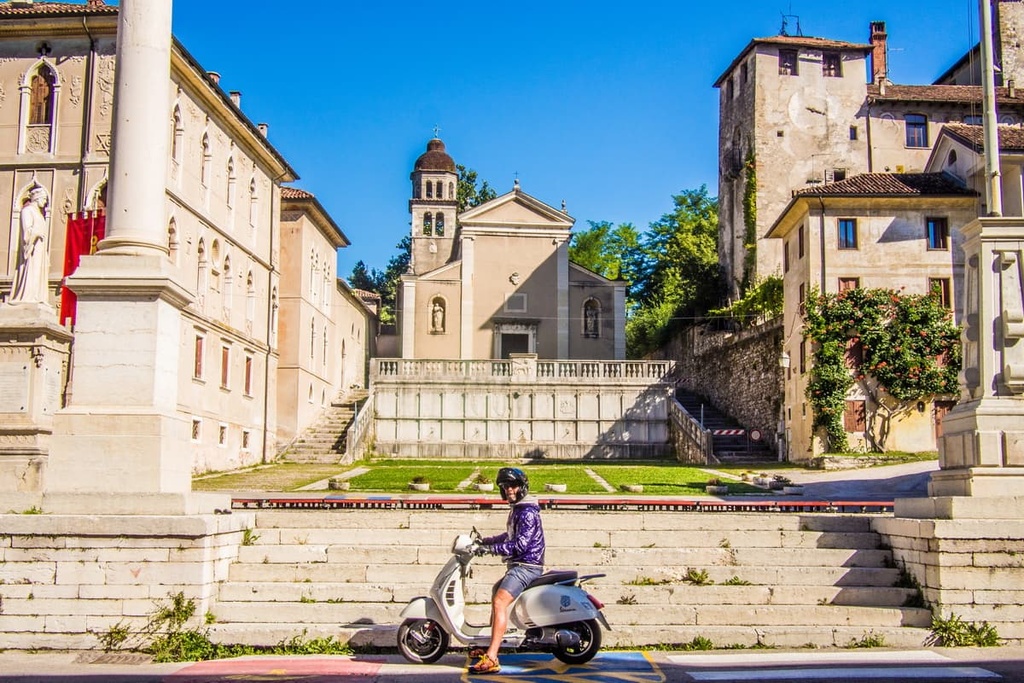
Before and after your hike, you should have no trouble finding lodging in Belluno and other towns within the group. The most popular types of accommodation here are agriturismos, B&Bs, and various houses and cottages in the mountains that locals rent to tourists in the summer and winter seasons.
Before hiking and climbing through the Schiara Group, visit the official tourist center of the Dolomiti Bellunesi National Park and the entire province of Belluno. It is called the Piero Rossi Cultural Center and it is located in the capital of Belluno.
The center itself is very unusual because it is located at the former fire station situated in Piazza Piloni, in the heart of the city. This is also a great meeting place for both tourists and residents, alike. There, you can find information on the Cimonega Group and the park, or you can simply enjoy some local cuisine.
Cultural Center “Piero Rossi”
Piazza Piloni
32100
Belluno (BL)
Italy
Open most days from 7 am to 9 pm, except:
+39043727030
centroculturale@dolomitipark.it
The major town that is most often associated with the Schiaragruppe is Belluno. However, another town worth pointing out is Ponte Nelle Alpi.
Ponte Nelle Alpi can be considered a great starting/finishing point for hikes in the Schiara group. It is located at an elevation of 397 m (1,302 ft) and it is situated approximately 7.8 km (4.8 mi) to the northeast of Belluno.
The beautiful name of the town translates as "Bridge Into the Alps" and it is indeed one of the main "bridges" into the mountains from the south of Italy, on par with Belluno and Feltre. The city is conveniently connected by direct rail to Venice as it is located just 80 km (49.7 mi) from the Adriatic coast.
Like Belluno, since ancient times, Ponte nelle Alpi has been a place of human settlement of important geographical value. The city has 7,901 (2021) inhabitants but the municipality also includes Polpet, Soccher, Cadola, Canevoi, Casan, and about a dozen other villages.
The main architectural and cultural attractions of the city include:
Visit the official tourist sites of Ponte Nelle Alpi for more information: InfoDolomiti.it and PonteNelleAlpi.eu.


