
Scan the QR code and open PeakVisor on your phone
The Bosconero Group is a relatively small mountain group in the Dolomites in northern Italy that’s relatively visited by tourists, making it a great place to visit if you’re looking for solitude. Gruppo del Bosconero (Bosconerogruppe) contains 44 named mountains, the highest and most prominent of which is Sasso di Bosconero (2,469 m / 8,100 ft).
The name of the Bosconero Group comes from the Italian nero bosco, which means black forest. It was given its name due to the dense spruce forests that cover its slopes in the Tovanella Valley.
Nowadays, much of the range is a state nature reserve called Val Tovanella Nature Reserve (Riserva naturale Val Tovanella). This is one of the 14 nature reserves in the Veneto region.
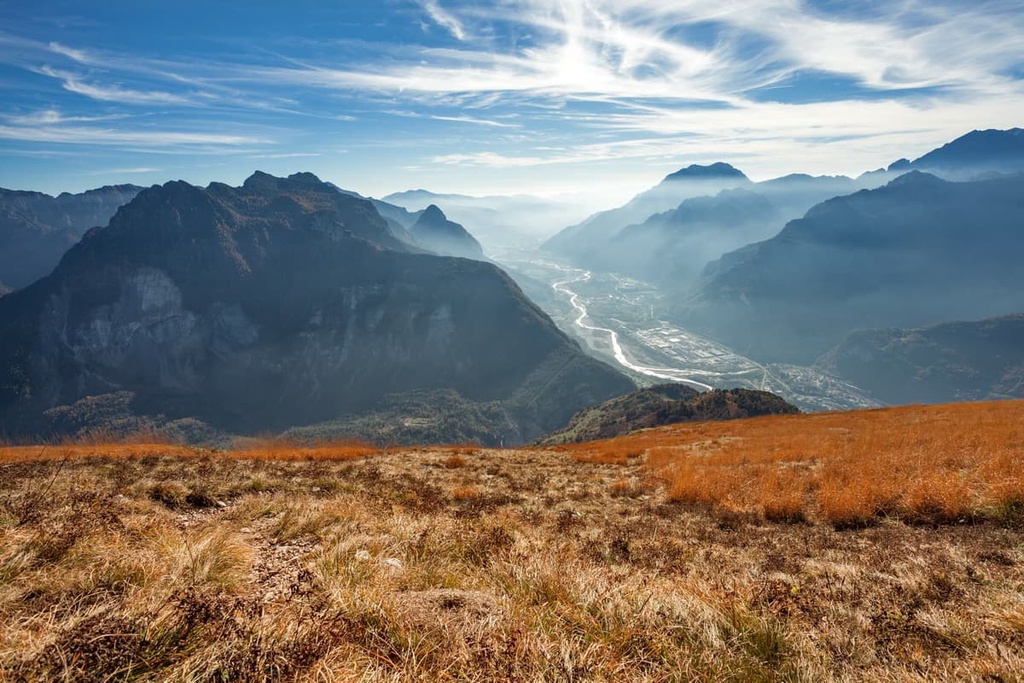
The Bosconero Group is located in the East Dolomites in the province of Belluno in the Veneto region. The group belongs to three relatively large municipalities: Longarone, Piave di Cadore and Zoldo (Forno di Zoldo), which are located on its southern, western, and northern borders, respectively.
The shape of the group is that of a triangle or pyramid, and its highest peaks are located in its geographical center. Spiz de San Piero (2,084 m / 6,837 ft), Cima dell'Albero (2,018 m / 6,620 ft) and Croda Cuz (2,202 m / 7,224 ft) are the highest peaks in the group and they are located at the corners of the group in the west, south, and northeast, respectively.
The eastern border of the group is the valley of the Piave River or Val di Cadore, beyond which lies the somewhat isolated Friulian Dolomites Group and the Friulian Dolomites Nature Park (Parco Naturale Dolomiti Friulane). To the southwest, the group borders the Schiara Group and the Dolomiti Bellunesi National Park.
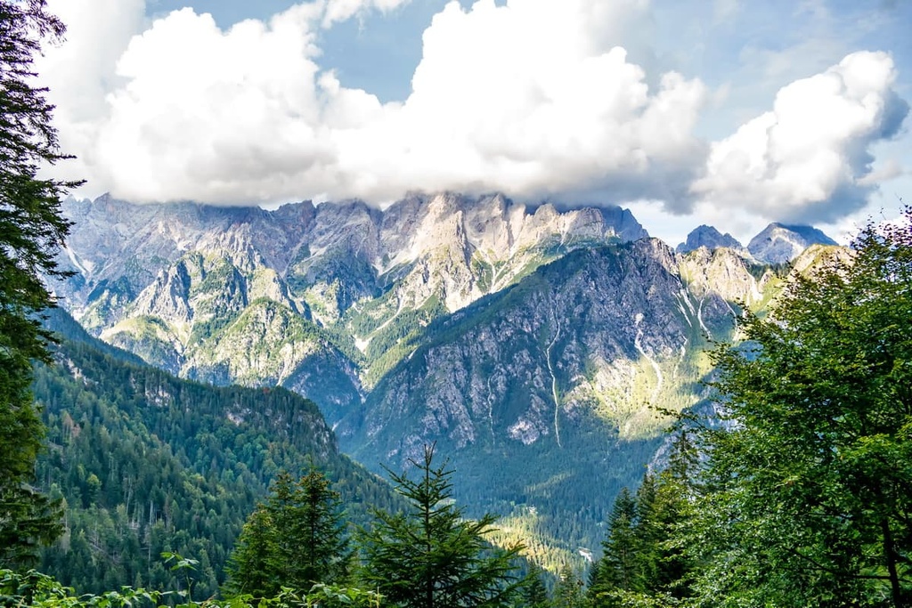
The nearest large mountains to the north of Bosconero Group are Pelmo (3,172 m / 10,406 ft), Antelao (3,264 m / 10,708 ft), and Monte Zucco (1,191 m / 3,907 ft). There’s also the vast region of Cadore, which includes, among others, another little-known Dolomites’ group, Marmarole.
However, if we define the boundaries of the group by its nearby valleys, in addition to the Cadore Valley, there are the Valle de Boite, Val Cervegan, and Val di Zoldo in the north. Within the latter, the Bosconero is separated by Cibiana Pass (1,350 m / 4,429 ft), behind which is Monte Rite (2,183 m / ft), which is famous for being the site of one of the six Messner Museums.
Here at the museum, you will also find one of the special panoramic balconies of the Dolomites, or observation decks, which offer a magnificent view of the Bosconero Group from the north.
The easiest and fastest way to get to the group is via its southern borders from the town of Belluno, which in turn can be reached from Venice.
You can do this either by car or by Trenitalia train. The distance is 128 km (79.5 mi) or about two hours. The railway line continues to the town of Calalzo di Cadore.
From Belluno to Longarone, you can also take the Dolomiti Bus.
It is interesting that in terms of geology, the group is not formally part of the Dolomites because it is not part of one of the nine great mountain systems in the region according to the UNESCO classification system. However, the neighboring mountains of the Cimonega, Pelmo, and Friulian Dolomites are part of the UNESCO list.
But this is only one of the classifications. Of course, the Bosconero Group is part of the Dolomites, because, from the same geological point of view, it is geologically the same as the rest of the range. It consists mostly of dolomite, marls, and limestones, like the rest of the Dolomites.
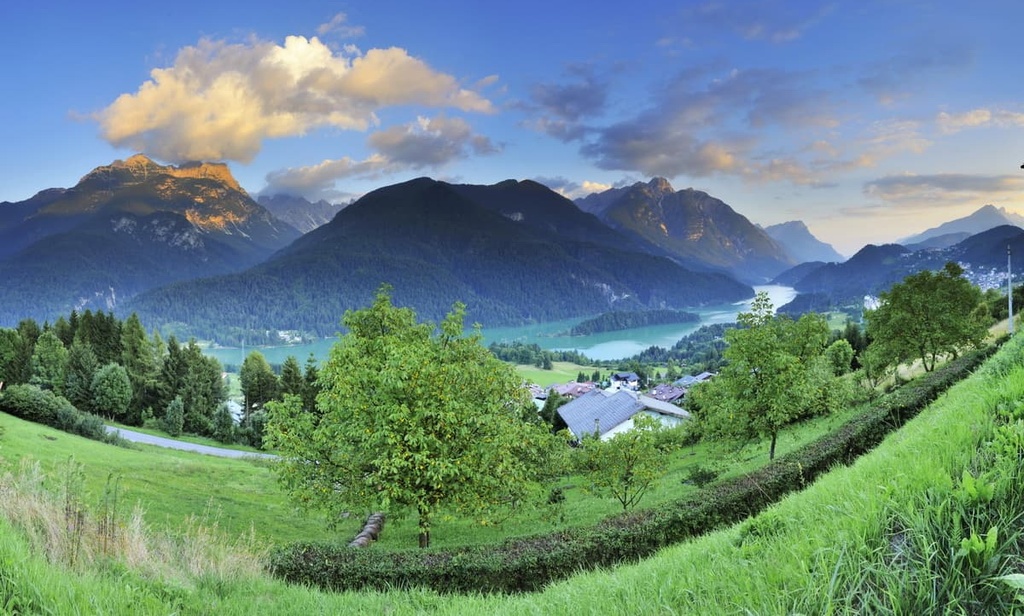
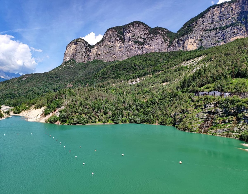
In addition to the range’s mountains, the other major features of the Bosconero Group include Pontesei Lake (Lago di Pontesei), which is located on the western borders of the group. Like many lakes in the province of Belluno, it was formed artificially by the construction of a hydroelectric dam.
The lake, unfortunately, is not known for its beauty, but because on the morning of March 22, 1959 a huge landslide fell from the slopes of the nearest mountains Castellin (1,577 m / 5,173 ft) and Spiz de San Piero. This caused a huge wave over 13 meters (43 feet), which crossed the dam and flooded the surrounding area.
An even worse disaster due to a landslide occurred at the dam on the Vajont River near the town of Longarone.
The Tovanella Valley Nature Reserve (Riserva naturale Val Tovanella) was founded in 1971 to protect the region’s local flora and fauna. The reserve covers an area of 1,040 hectares (2,570 acres).
In the reserve, there’s a diversity of plant life, including beech trees, spruce, larch, black pine, Scots pine, maple, ash, mountain elm, and linden. The area that is now the reserve has been known for its dense forests for centuries. In fact, it was heavily logged in the fourteenth centuries and there are many paths, remnants of coal stoves, dams and other artifacts that harken back to this time.
Among the flowers in the reserve, you can find edelweiss, which is considered the main wildflower of the Alps.
Some of the many animals in the group include the eagle, grouse, partridge, black woodpecker, wood grouse,, chamois, deer, and roe deer. In 1995, a brown bear was seen here, too, but there haven’t been any recent bear sightings in the reserve since.
The Bosconero Group belongs to the Dolomites in both of the two most common classifications of the Alps: the Austrian German Alpine Club (AVE), where it is one of the easternmost groups on the border of the whole region, and the Italian SOIUSA.
In the latter classification, the group is part of the supergroup Dolomiti Settentrionali di Zoldo. This supergroup, in turn, is part of the subgroup Dolomiti di Zoldo in the Dolomiti section of the greater Alpi Sud-orientali sector of the greater Alpi Orientali.
According to the same classification, inside the group is divided into two subgroups that feature the following peaks:
Some of the main peaks in the Bosconero Group include:
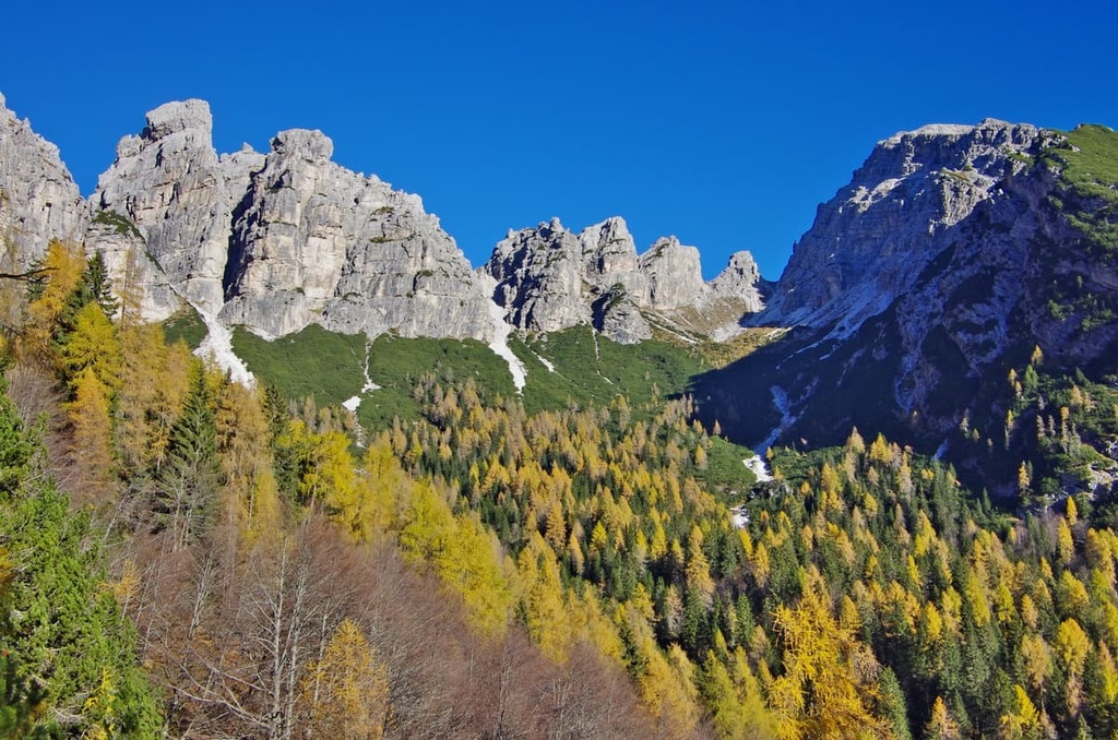
All of the main peaks of the Bosconero Group can be climbed by various climbing routes.
However, these peaks weren’t climbed until the 1960s, while most of the other peaks in the Dolomites were climbed as early as the nineteenth century. The first climbers who were here include the Italians Albino Michielli and Pietro Sommavilla as well as the Polish climbers Andrzey Mirga and Krzysztof Zureks.
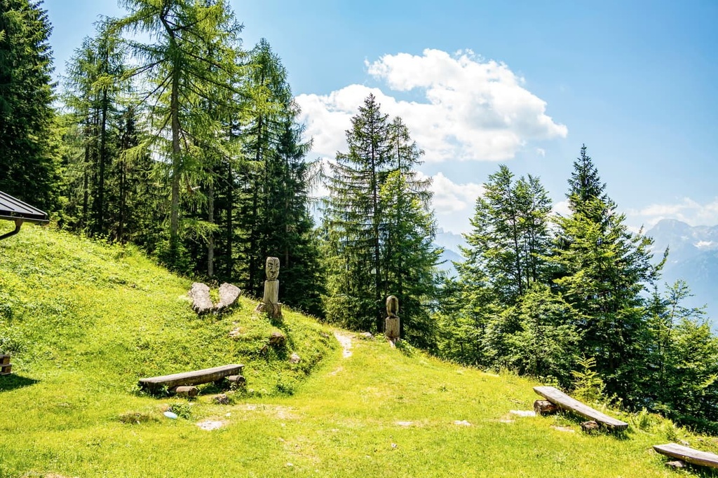
The Bosconero Group is saturated with hiking trails of varying degrees of difficulty on all sides. Wherever you come from in these mountains, you’ll find wildlife, stunning views, and solitude.
However, these trails do not lead to the famous main peaks of the group, including Sasso di Bosconero, Sasso di Toanella, Sfornioi and Sassolungo di Cibiana. You can get to the foot of each of these, but to climb them you will need climbing equipment, skills ,and experience. There are also no via ferratas to these peaks like in many other groups in the Dolomites.
That said, here are some of the most popular hiking trails in the Bosconero Group:
The Cima dell’Albero Loop from Longarone is an easy to moderate hike around the summit of Cima dell’Albero (2,018 m / 6,620 ft).
This route is best enjoyed in late fall or late spring when there is snow on the higher peaks. Hiking the route during these times of year aso lets you enjoy the fall or spring colors and panoramic views of the Piave Valley. From the trail, you can also see the neighboring Schiara Group, Dolomiti Bellunesi National Park, and Pelmo.
The route itself is easy to follow: From Podenzoi, a hamlet of Longarone, take the CAI 482 trail and then the 484 trail until you make a loop.
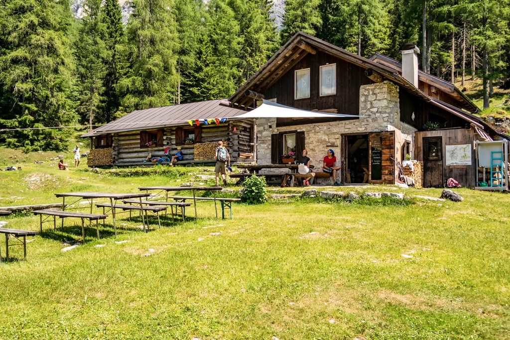
The Pontesei Lake to Rifugio Bosconero hike is a popular trail that takes you to the group’s only mountain hut, rifugio Casera di Bosconero. It is located at the foot of the group’s highest peak, Sasso di Bosconero, so it is a great route to walk and admire the high peaks of the range.
The CAI 490 trail begins at Pontesei Lake and goes to the rifugio via Fontana dell’Eterna Giovinezza and Laghetto delle Streghe . Other landmarks on the trail are the signs of Alta Via 7, which is one of the eight long trails in the Dolomites.
Some advice for your journey: From the rifugio, climb another 250 m (820 ft) closer to the foot of the Sasso di Bosconero to look at the rifugio from above. Usually small huts like this one in the middle of the wilderness look very beautiful when viewed from a vantage point.
Alta Via 3 is one of the eight long hiking trails in the Dolomites. It is 100 km (62.1 mi) long and takes 8 days to complete. It is also called “Via dei Camosci” (The Chamois Trail) because it follows well-traveled chamois herd paths.
If you start from the very beginning of the Alta Via 3 in Villabassa / Niederdorf in Pusteria Valley in South Tyrol, you will arrive at rifugio Remauro on the Cibiana Pass from the rifugio Venezia in Pelmostock by the end of day 5.
It also will take you the next three days to cross the whole Bosconero Group, or rather, go around its western border, via Spiz de San Piero, Pontesei Lake, Solagnot, Col Colon (1,914 m / 6,280 ft), and Torondol (1,456 m / 4,777 ft) until you reach Longarone at the end of the day 8. Longarone is the terminus of the Alta Via 3.
Along the way, you can spend two nights at rifugio Casera di Bosconero and bivacco Tovanella.
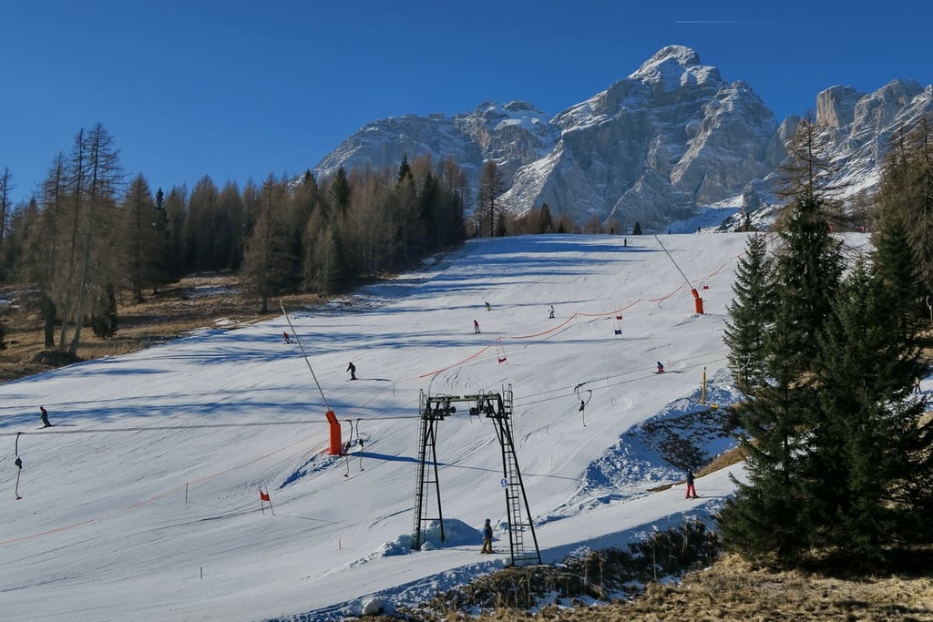
There are no ski resorts in the Bosconero Group, but there are two popular ski centers to the north and south of it:
While traveling through the Bosconero Group, you can visit one of the official tourist centers located on its borders in Belluno, San Vito di Cadore, and Forno di Zoldo:
Cultural Center “Piero Rossi”
Piazza Piloni, 32100, Belluno (BL), Italy
+39043727030
centroculturale@dolomitipark.it
Opening Hours:
Ufficio Turistico di San Vito di Cadore
Corso Italia, 92, 32046, San Vito di Cadore, BL, Italy
+3904369238
Opening Hours:
Tourist Office Forno di Zoldo
Via Monte Civetta, 4b, 32012, Val di Zoldo BL, Italy
+390437789145
Opening Hours:
Due to the relatively small size of the Bosconero and its lack of popularity among tourists, three is only one mountain hut—rifugio Casera di Bosconero—in the group. It is located at 1,457 m (ft) at the foot of the highest peak of the group, Sasso di Bosconero.
Like the other mountain huts in the Dolomites, it is open from June 20 to September 20. Inside there are 28 beds, as well as a winter bivouac with four beds.
It’s quicker and easier to get to rifugio from the west side of Pontesei Lake on the CAI 485 trail. The travel time is about two hours. You can also travel there from Passo Cibiana in two hours, where there is another mountain hut, rifugio Remauro, as well as Baita Deona, where you can also sleep and eat.
In addition to rifugio Casera Bosconero, the group has several similar small buildings with the same name "casera." However, these are bivouacs where you can stay for free, not houses or rifugios. These bivouacs include:
Each hut has between 8 and 12 beds as well as a fireplace. Many of these caseras used to be intended as temporary housing for shepherds, hunters, and foresters, as well as for their animals and staff.
Some of these bivouacs may occasionally be locked by their owners, so you should always bring a tent with you, just in case your destination isn’t open for the night.
Before and after your hike, you can find lodging around Longarone, Piave di Cadore and Forno di Zoldo.
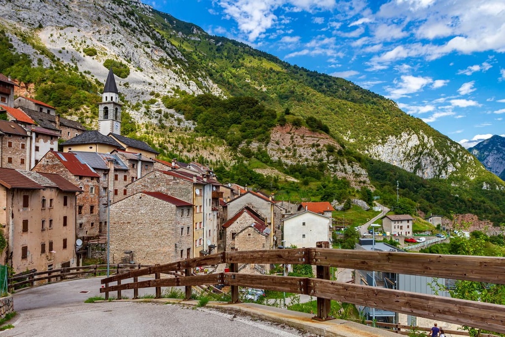
The town of Longarone in the Piave Valley will be the first major town on your way to the Bosconero Group if you’re traveling from the south. It’s still a relatively small settlement, though, like most in the Dolomites.
Longarone has long been an important transfer point between the provincial capital Belluno and the large town of Ponte Nelle Alpi. The municipality of Longarone lies directly on the banks of the river at an altitude of 473 m (1,552 ft). Today it is home to 5,101 (2021) people.
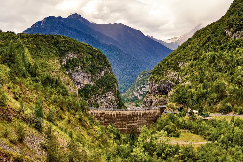
The town is best known for Vajont Dam—the seventh highest dam in the world with a height of 262 m (860 feet). Vajont Dam is located on the Vajont torrent—one of four tributaries of the Piave River.
However, on October 9, 1963, a huge landslide fell from one of the nearby mountains, Monte Toc (1,921 m / 6,302 ft) and fell into the reservoir created by the Vajont Dam, causing a giant wave that swept over the dam and destroyed the village. It was one of the most terrible moments in the history of Dolomites.
The dam has since been closed, Longarone was rebuilt and is now a thriving community. The town’s Longarone Fiere Dolomiti Exhibition Center is now a popular destination as it hosts several large annual exhibitions for manufacturers of outdoor gear, like the Expo Dolomiti—Outdoor, Hunting, Fishing and Nature.
Other important places in the village include the Vajont Dam itself, which was built between June 1940 and September 1960. There’s also the “Museum Longarone Vajont Moments of History” (Museo Longarone Vajont Attimi di Storia).
In addition, there are three notable churches in the town:
For more information, check out the official tourist site of Longarone: ProlocoLongarone.it.


