
Scan the QR code and open PeakVisor on your phone
The Marmarole include 87 named peaks. The highest is Cimon del Froppa at 2,932 m. Other notable peaks include Cima Bastioni, Cima Belprà and Punta Teresa.
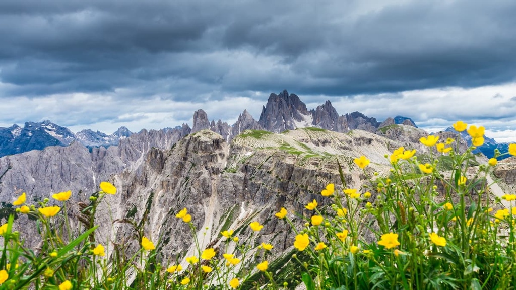
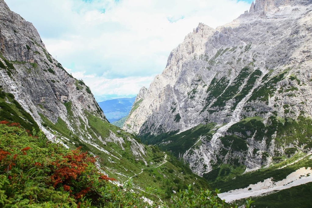
Marmarole is one of the two dozen major mountain groups in the Dolomites of northern Italy. It’s often considered to be one of the wildest groups in the Dolomites, due to the ruggedness of most of its peaks. The Marmarole is the crossroads of three famous hiking routes: Alta Via 3, Alta Via 4 and Alta Via 5. There are 87 named mountains in Marmarole. The highest and the most prominent mountain in the group is Cimon del Froppa (2,932 m / 9,619 ft).
The first thing to know about the name of the Marmarole group is that it should not be confused with Marmolada. In fact, Marmolada is the name of one of the highest mountain groups in the Dolomites. Its highest peak is Marmolada (3,342 m / 10,964 ft).
However, the name of both groups probably comes from the Greek word marmar. Some other linguists say the word has Celtic origins. But either way, the meaning is more or less the same as it means "to shine" or "to sparkle".
Therefore, the name of both groups can be translated as something along the lines of ‘Shining Mountain.’ The meaning could be explained by the fact that the northern side of Marmarole used to be covered by many glaciers, which have disappeared over time. The glacier on Marmalada has not yet melted and remains the only true glacier in the Dolomites.
Finally, the name of the group is the same in both Italian and German. This makes it different from other groups like, say, the Braies Dolomites, which translates to Pragser Dolomiten in German.
Dealing with the geography of the Dolomites is as challenging as with the origins of the names of individual groups and peaks. More or less every mountain group or nature park in the Dolomites can be grouped either according to administrative, geographical, or cultural regions. The same is true of the Marmarole Group.
The exact boundaries of the Marmarole are formed by the four huge valleys: Val d'Ansiei, Val del Piave, Val d'Oten, and Val di San Vito. As is the case with almost everywhere else in the Alps, the names of the valleys are the names of the rivers that formed them.
In the northwest, Marmarole is adjacent to the Sorapiss Group. In the south, it is located close to Mount Antelao (3,264 m / 10,709 ft), the second highest peak after Marmolada. These peaks are so close to each other that they are often combined into one mountain system with no boundaries between them. However, the groups are separated by two passes, Forcella Grande and Forcella Piccola, which are located close to each other.
All three groups are part of a Site of Community Importance (SCI) and Special Protection Area (SPA) called “Sorapiss-Marmarole-Antelao.”
To the north, the group is bordered by the large Sexten Dolomites Group, which includes Cima Cadin di San Lucano (2,839 m / 9,314 ft), Monte Agnello (2,361 m / 7,746 ft), and Tre Cime di Lavaredo, among others.
Additionally, to the north of the group, there are also two nature parks: Tre Cime Nature Park and Ampezzo Dolomites Nature Park.
If you are as much a fan of trains and beautiful rail routes (especially those that travel through the mountains!) as I am, then I have great news for you: the Marmorole is one of the few places in the Dolomites that can be reached by train.
The main one of the two main towns in the Cadore region, Calalzo di Cadore, on the southern borders of the Marmorole group, is the final trail station of one of the two main railroads in the Dolomites (the other runs between Trento and Bolzano). You can get here directly from Venice, in 2 hours and 45 minutes with one change in the town of Ponte Nelle Alpi-Polpet near the provincial capital of Belluno.
As of the time of writing, a one-way ticket to Calalzo di Cadore costs €11.35. Over the years, the total cost of a trip to the Marmarole hasn’t changed much, so traveling by train is a superb option.
Alternatively, if you’d rather travel by car, the travel time is about the same as by train. The distance is 133 km (82.6 mi).
The main type of the rock in the Marmarole Group is the same as in the other groups in the center of the Dolomites. These mountains are composed of the mineral of the same name, dolomite. This rock is very similar to other limestones, but it differs in its harder composition.
Among travelers and photography enthusiasts, dolomite is known primarily for its ability to absorb sunlight. Because of this, the tops of the mountains are colored at sunset in all the warm shades of the rainbow, and at night they take on colder shades, such as blue, purple and gray. That's why these mountains, including Marmarole, are also called the Pale Mountains.
Read more about the geology of the dolomites in a general guide to the region.
In terms of landscape, the Marmarole Group is probably the only really long mountain range in the Dolomites. It stretches for about 13 km (mi) from east to west from Forcella Grande at the base of Cima Belpra (2,917 m / 9,570 ft) to Monte Ciarido (2,504 m / 8215, ft), towering over the Buoi Plateau (Pian dei Buoi) below.
In addition to the two above-mentioned passes, there are about two dozen of them in Marmarole, including:
The group can be divided into three main parts: western, central, and eastern:
There’s more to Marmarole than the mountains. Its southern boundaries are formed by the Piave, one of the longest (220 km / 140 mi) rivers in northern Italy, which originates at Monte Peralba (2,694 m / 8,838 ft) in the Carnic and Gailtal Alps and flows into the Adriatic Sea near Venice.
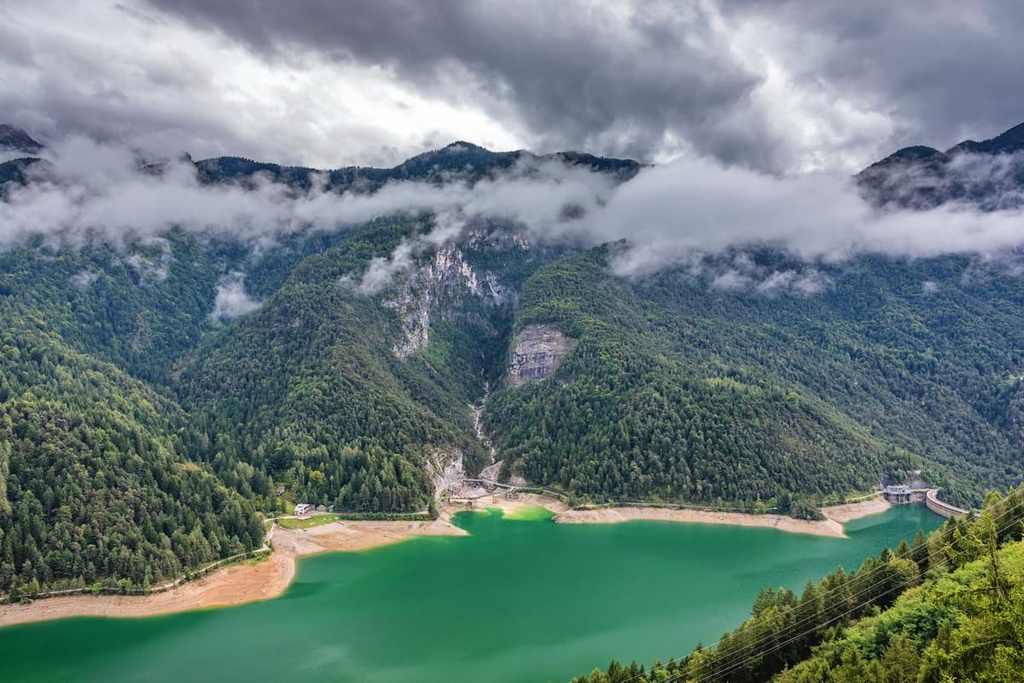
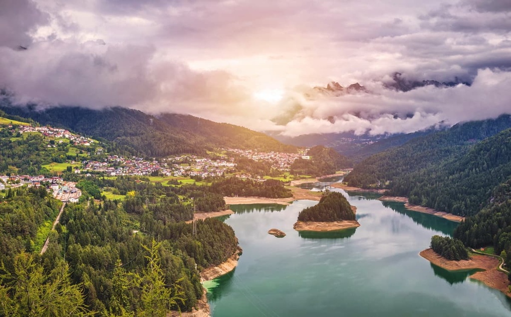
Meanwhile, throughout the Cadore region, the Piave di Cadore turns into the large and beautiful azure-colored Cadore Lake (Lago di Centro Cadore), which measures 2.3 sq. km (0.89 sq. mi). It is an artificial lake, and it was formed after the construction of the dam as part of a neighboring hydroelectric power plant.
However, the lake is now being emptied during the winter as part of a multi-year effort to remove accumulated silt and rocks from its bottom. This effort will probably last until 2029. Overall, the lake’s water volume has shrunk considerably over the last few years.
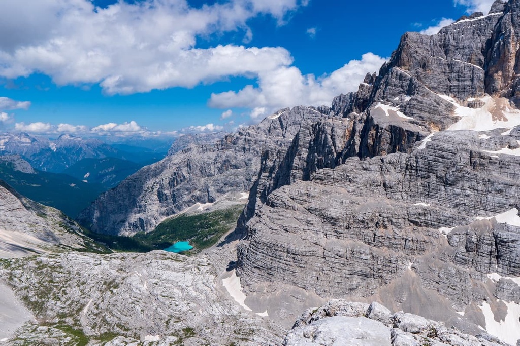
Alternatively, on the northeastern borders of the group, you have the equally impressive Auronzo Lake (Lago di Auronzo). This lake is also known as Santa Caterina Lake (Lago di Santa Caterina), and it is situated between the villages of Auronzo di Cadore and Santa Caterina.
Another notable feature in the Marmarole is the Cascata delle Pile, which is located at the very end of the Val d’Oten on the banks of the Molina. One of the famous hiking trails in the region actually leads to the Cascata delle Pile.
Finally, no discussion of the Marmole would be complete without mentioning the Somadida Forest. This is the largest spruce, fir, and beech forest in the Cadore region or the Somadida Controlled Nature Reserve (Riserva Statale Naturale Somadida). It is located in the Val d’Ansiei between the Sorapiss and the Marmorole groups.
The reserve, which was founded in 1972, extends over 16.7 sq. km (6.4 sq. mi) from a height of 1,100 m (3,608 ft) in the valley to a height of 2,970 m (9,744 ft) at the Vanedel (2,797 m / 9,176 ft) peak in the central part of Marmarole. Above an elevation of about 1,400 m (4,593 ft), spruces give way to larch and mugo pine, as well as the other flora of the harsher alpine climate.
There is also a visitor center in the reserve that is located near the Palus San Marco village. It’s situated between Auronzo di Cadore and Misurina Lake.
Together with the Sorapiss and Antelao groups, Marmarole belongs to one of the nine large mountain systems in the Dolomites classified by UNESCO on a geological basis. UNESCO also included the region on its List of World Heritage Sites in 2009.
The group, which is called Northern Dolomites (Dolomiti Settentrionali), also includes the Sexten, Braies, Fanes, Tofane, and Cristallo groups. It is the largest of the nine groups with a territory of 535 sq. km (206 sq. mi).
According to one of the two common international mountain classifications, the Italian SOIUSA, Marmarole belongs to the Cadore Dolomites (Dolomiti Cadorine) supergroup, which in turn is part of the Sexten, Braies, and Ampezzo Dolomites (Dolomiti di Sesto, di Braies e d'Ampezzo) subsection in the Dolomites section (Dolomiti).
The group itself is divided into the three parts or sections, including:
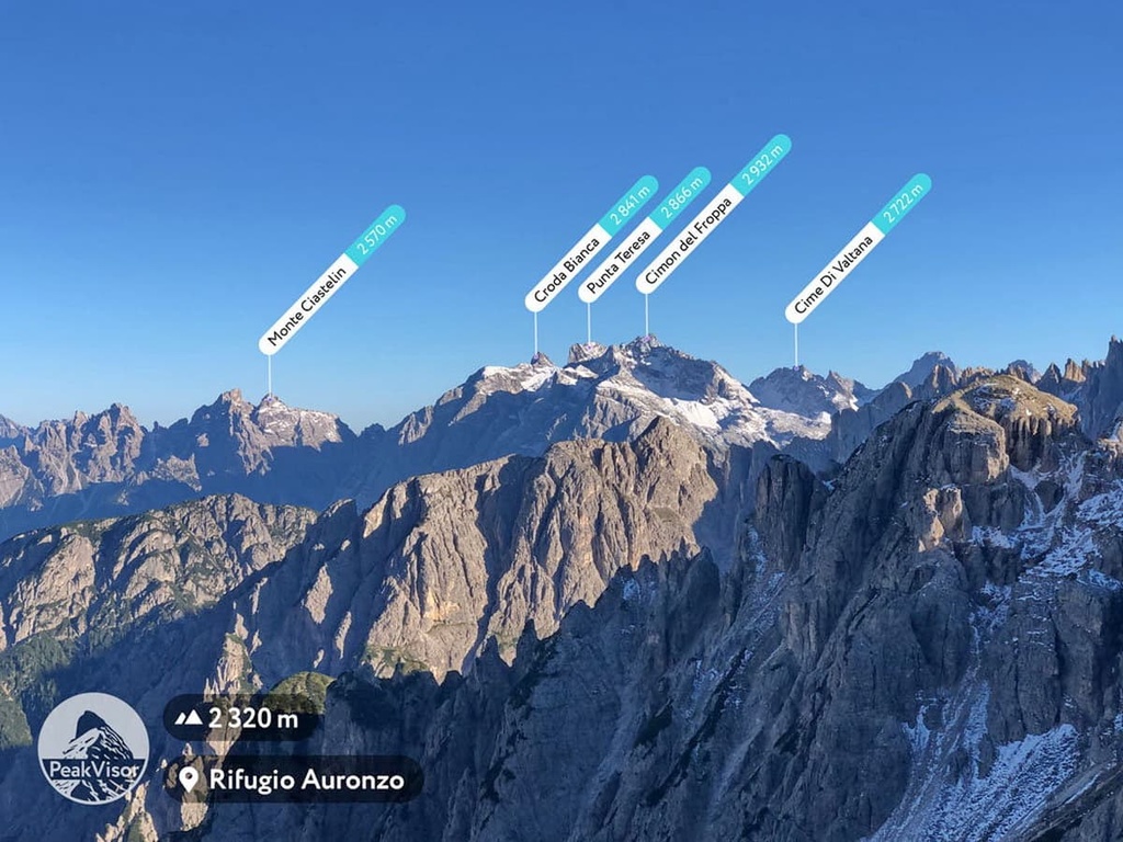
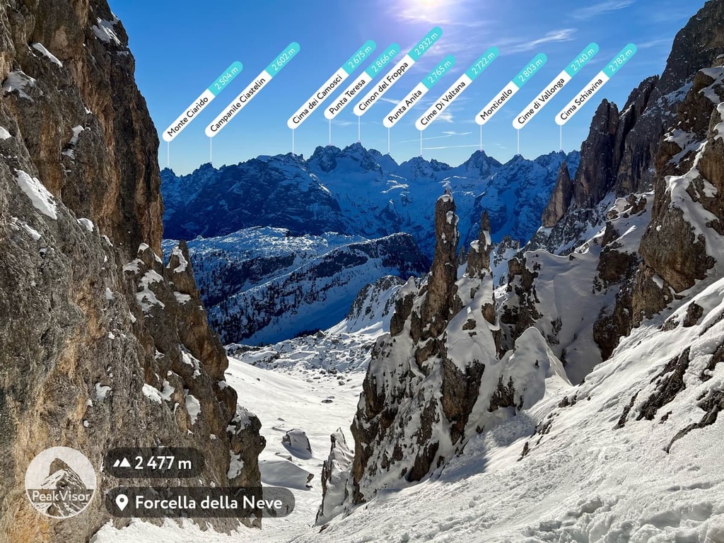
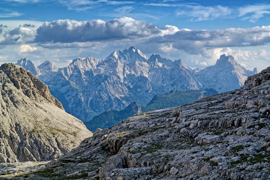
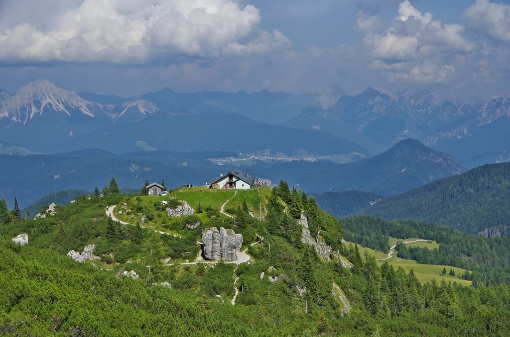
Above, you can see a panoramic view of Marmarole from rifugio Auronzo (2,340 m / 7,677 ft) at the foot of Tre Cime di Lavaredo. In this photo, which was taken by PeakVisor’s founder, you can see almost the entire group, including Cimon del Froppa, and several other summits.
Here’s a bit more information about the two tallest peaks in the group and about a few of the most unusual peaks in the Marmarole.
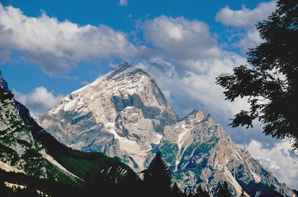
Cimon del Froppa is the highest peak in Marmarole. It has a pyramid-like shape, and it is located in the group’s geographical center.
The first ascent of the peak was made by a local guide from Cadore named Giovan Battista Toffoli in 1867. Even today, it is possible to climb the mountain from the southwestern side (difficulty: UIAA II/III), using climbing equipment.
However, the mountain is not popular for climbing when compared to other places across the Dolomites. It loses in popularity to other more famous peaks, such as Cima Grande (2,999 m / 9,839 ft) in Tre Cime di Lavaredo Group, or Punta Penia in Marmolada Group. For the most part, only local climbers from the Сadore region climb the mountain.
Cima Belprà is the second-highest mountain in Marmarole and one of the three westernmost peaks in the group. It is located between the Sorapiss and Antelao groups.
There is a climbing route to the summit from the northwest (difficulty: UIAA II). However, it is only really popular among local climbers.
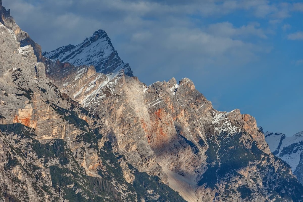
Torre San Lorenzo is perhaps the most unusual peak of the group. It is situated in the eastern part of the group, and it resembles a spire.
The name of the peak refers to the medieval tower in the town of San Lorenzo in the municipality of Ardea, some 35 km to the (22 mi) south of Rome. It is also known as "Il Pupo di San Lorenzo" and "Il Pupo delle Marmarole".
Toree San Lorenzo is much more popular with climbers because of its unusual shape. There are several climbing routes to the top.
If this summit doesn't seem enough to you, check other tower-like peaks in the group, most notably Torre dei Sabbioni (2,531 m / 8,304 ft). It was first climbed by another guide from the town of Cadore, L. Cesaletti. He did it solo and without ropes. Today you can climb it from the southwest (difficulty: UIAA IV).
Other similar summits are Torre Laura, Torre Artù, Torre Pian dei Buoi. There are also climbing routes to all of these peaks.
There are two main things to know about hiking and climbing in Marmarole: First, the most popular routes in the group are located in its western region on the border with the Sorapiss and Antelao groups.
Second, there is a long hiking route going through the whole group, which will suit those who want to spend more time here. This route is a major part of the Alta Via 5, which is one of eight hut-to-hut hiking routes in the Dolomites.
Next, I will briefly explain these main routes:
This is a relatively easy hike from Calalzo di Cadore along the Val d'Oten to the magnificent Cascata delle Pile.
The route is quite long, but it offers two great resting points: after hiking about two-thirds of the way, you can have lunch at the Alla Pineta restaurant (it can also be reached by car to shorten the way). After lunch, near the waterfall, there is the rifugio Capanna degli Alpini, where you can spend the night after a long day of hiking.
It is difficult to get lost on this trail. In fact, you will find signs pointing to the waterfall in nearby towns.
This is an easy hike without much elevation gain in Somadida Controlled Nature Reserve on the northwestern borders of the Marmarole Group.
The Somadida Forest is one of 130 such protected areas in Italy of varying degrees of popularity. We can safely say that Somadida Forest is a completely non-tourist place, as it is known mostly only to locals (and now you). So it is a great place to find peace and tranquility.

There are several marked hiking trails in the forest on which, if you're lucky, you may see many animals (chamois, deer, squirrels, dormice, foxes, stoats), birds (golden eagles, peregrine falcons, goshawks, buzzards, owls, capercaillie, and grouse), or some local butterflies.
The Croda Rotta Loop is an extended hike in the Somadida Forest along the loop trail in the upper part of the park around Mount Croda Rotta (2,632 m / 8,635 ft). It travels through four hidden inner valleys: Val Meduce di Dentro, Val del Fuoco, Val Granda, and Valle Valle di San Vito.
The exact route goes like this:
However, do note that there are short sections of via ferrata on this trail.
Along the way, you will also enjoy views of Monte Meduce (2,402 m / 7,880 ft), Campanile di San Marco (2,772 m / 9,094 ft), Cima Vanedel (2,797 m / 9,176 ft), Cima de Marchi (2,767 m / 9,078 ft), and Croda del Banco (2,150 m / 7,053 ft) in the Sorapiss Group.
The Alta Via 3, Alta Via 4 and Alta Via 5 are three of the eight long hut-to-hut hiking trails in the Dolomites that pass through the Marmarole.
Moreover, the routes merge into a single trail in Valle di San Vito. They merge through Forcella Grande between the peaks of Monte della Caccia Grande (3,002 m / 9,850 ft) and Punte Tre Sorelle (3,005 m / 9,859 ft) in the Sorapiss Group and Torre dei Sabbioni (8,304 ft) and Cima Belpra 2917 m (9,571 ft) in the Marmarole.
Then, the trails diverge as Alta Via 3 goes to San Vito di Cadore and Alta Via 4 and 5 go through Antelao to Piave di Cadore.
Among the three routes, we are more interested in the fifth. It is the main route for Marmarole because, of the seven stages of the Alta Via 5, five go through the mountain group.
The trail begins in the South Tyrolean town of Sexten / Sesto on the border with Austria and continues through the summit of Zwölferkofel / Croda dei Toni (3,095 m / 10,151 ft) in the Sexten Dolomites to Auronzo di Cadore. After that, the trail makes a steep “unexpected” turn to the west toward Marmarole.
The exact route of Alta Via 5 is as follows:
The Alta Via 5 is also known by the name Alta Via “Tiziano Vecellio.” It was given this name in honor of the Italian world-famous Renaissance painter Titian (born Tiziano Vecelli), who was originally from Piave di Cadore.
Titian lived most of his life in Venice, so he painted mostly Venetian and other city landscapes. But, you can find the Marmarole in some of his paintings, too.
For example, you can see the Marmarole in “The Presentation of the Virgin at the Temple,” which was created for the Accademia Gallery of Venice, where the painting was restored a couple of years ago and is still preserved today. The Marmarole inspired Titian throughout his work.
In other words, Alta Via 5 is a great natural and cultural route to see the entire Marmarole Group. It is worth noting only that it is a quite demanding route with many sections secured with iron ropes (via ferratas).
Alta Via 5
The Via Ferrata “Amalio da Prà al Ciareido” is the most famous of the several via ferratas in the Marmarole, which will appeal to fans of this type of "easy" climbing that does not require special skills but requires a basic set of equipment consisting of helmet, carabiners, and gloves.
This via ferrata extends from the eastern part of the group along the northern wall of Mount Ciareido to Lozzo di Cadore through Pian dei Buoi, rifugio Ciareido, Forcella San Lorenzo and Forcella S. Piero back to rifugio Ciareido and Lozzo. On the trail, there is also the famous “Il Pupo delle Marmarole” peak.
The route is considered to be realtively easy, but some parts of the trail may be a bit scary for less-experienced climbers.

Cadore Dolomiti is a beautiful place for both Alpine skiing and cross-country skiing. On the western and eastern borders of Cadore region, there are two ski resorts that are part of one of the 12 large ski areas of the Dolomiti Superski system called Cortina d’Ampezzo.
Cross-country skiing enthusiasts will also not be disappointed if they visit the village of Palus San Marco near Somadida Forest. This is the center of this kind of skiing activity in the Cadore region. There are many loop ski trails here with varying degrees of difficulty with the possibility of night skiing.
Here are some more specific options in other parts of the region:
Check the Cadore ski map on the larger Veneto and Italy ski maps in the World Mountain Lifts section of the site. It includes information about open ski lifts / slopes in the Marmarole Group of the Cadore Dolomites in real-time with opening dates and hours. There are also year-round cable cars, funiculars, cog railways, aerial tramways, and all other types of mountain lifts.
For more useful and inspiring information about traveling in the Marmarole Group and the Cadore region, including invaluable paper maps, guides, and booklets, go to one of the official tourist centers. These are located in almost every one of the region’s dozen villages.
The main visitor center is located in one of the region's capitals, San Vito di Cadore, on the way to Cortina d’Ampezzo from Belluno:
Ufficio turistico di San Vito
Corso Italia, 92, 32046, San Vito di Cadore, BL, Italy
Monday—Saturday, 9 am to 12:30 pm
+3904369238
Consorzio Proloco Cadore
Piazza Municipio, 13, 32044, Pieve di Cadore, BL, Italy
Daily, 9 am to 1 pm, 3:30 pm to 7:30 pm
Associazione Turistica Pro Loco Calalzo di Cadore
Piazza IV Novembre, 1, 32042, Calalzo di Cadore, BL, Italy
Daily, 10 am to 12:30 pm, 7 pm to 7 pm (except Sundays evenings)
Tourist Office Valle Di Cadore
Via XX Settembre, 79/A, 32040, Valle di Cadore, BL, Italy
Saturdays, 9:30 am to 12:30 pm
+390435501527
valledicadoredolomiti@gmail.com
The official tourist site of the Cadore Dolomites is Dolomiti.org.
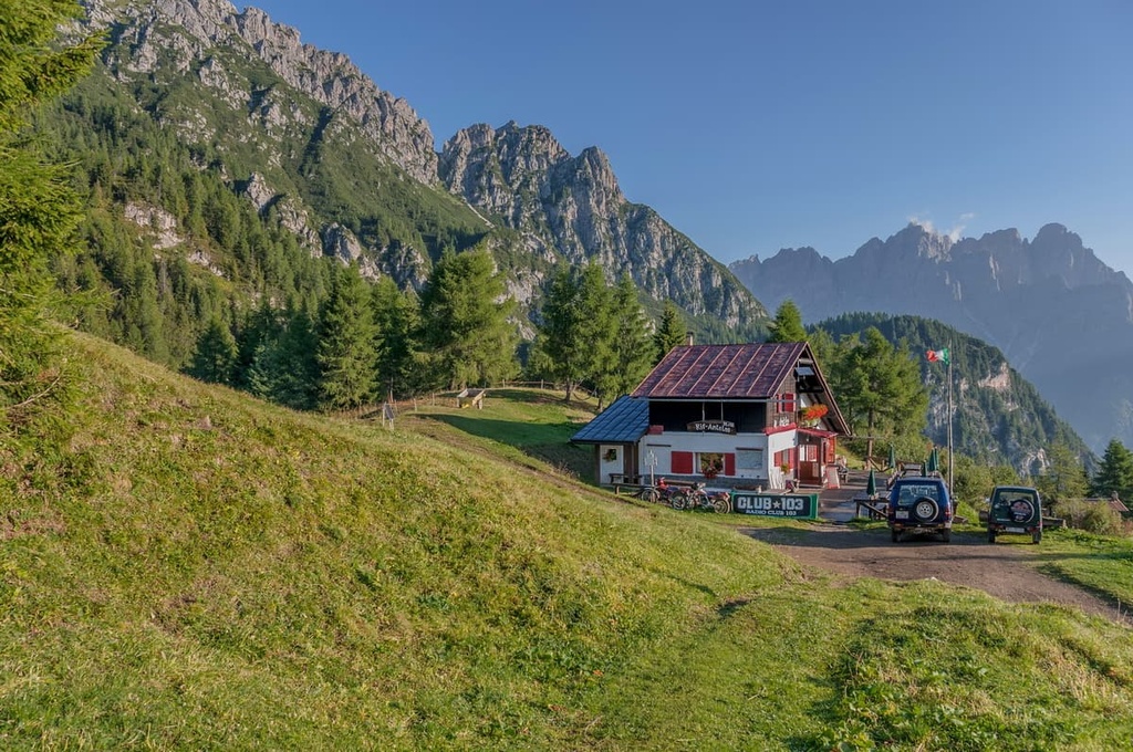
The Marmarole Group has 7 main mountain huts and 4 bivouacs where you can stay overnight.
At a mountain hut, you’ll find a bed in a common room that has space for 4–20 people. You’ll also get dinner and breakfast for a total of about €50–60 per person, and a shower for a fee of about €4–6.
Meanwhile, at a bivouac, you can spend the night in a small hut or cabin with a total of 4 to 10 beds. You do not have to pay to stay in the bivouacs, and they are always open.
The most important and largest mountain hut in the group, rifugio Pietro Galassi (2,018 m / 6,620 ft), has as many as 99 beds in 11 rooms. It is located below Forcella Piccola between Mount Scotter in Marmarole and Antelao at the intersection of Alta Via 4 and Alta Via 5.
The refuge is named after the Italian Alpine lieutenant, Pietro Galassi, and is managed by the Italian Alpine Club (CAI in Italian) of Mestre. It is also a Centre of Alpine Activities of the CAI. Within just a 10 minute walk from the rifugio, there is a “natural gym,” as it is called by the CAI, on Mount Beckett with over a dozen routes for learning climbing.
The other six rifugios in the Marmarole include:
The list of bivouacs, includes the following cabins:
Before and after the hike, you can easily find accommodation in one of the villages on the borders of the group.
The main settlements in the Cadore Dolomites are a series of small towns with similar names. From west to east, these include:
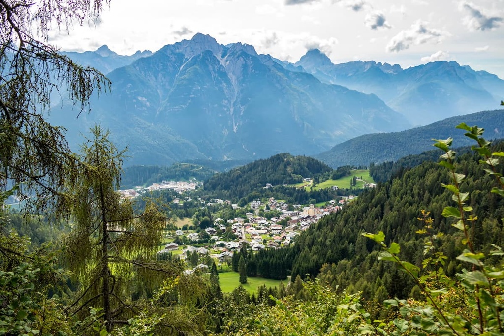
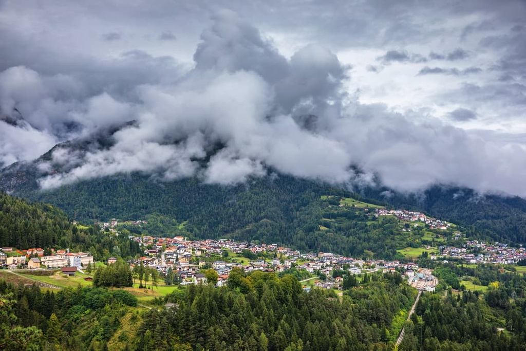
The capital of the region is Piave di Cadore. This small charming town is located at an elevation of 878 m (2,881 ft),and is one of the former capitals of the Roman and then Venetian Republics in the Dolomites. Today the city has 3,709 inhabitants (2021).
The town is conveniently located between the valleys of the Pieve and Boite rivers, making it an excellent starting point for travel in the Cadore and neighboring groups in the Dolomites. Additionally, it is directly accessible by rail from Venice, which is a rare thing in the Dolomites.
The five main architectural and cultural attractions of Pieve di Cadore include:
The official tourist site is Dolomiti.org.


The highest peak in the Marmarole is Cimon del Froppa, at 2,932 m.
The Marmarole have 87 named peaks.


