
Scan the QR code and open PeakVisor on your phone
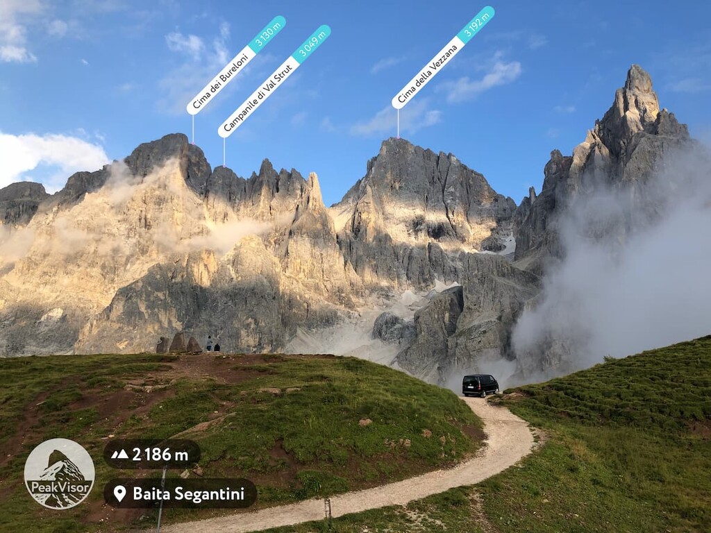
The Pala group include 141 named peaks. The highest is Cima della Vezzana at 3,192 m. Other notable peaks include Cimon della Pala, Cima dei Bureloni and Il Nuvolo.
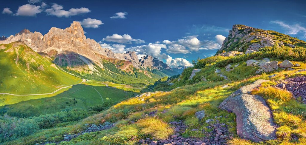
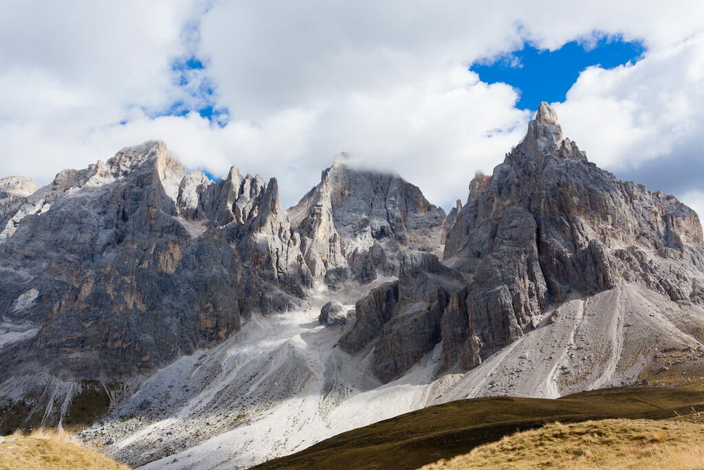
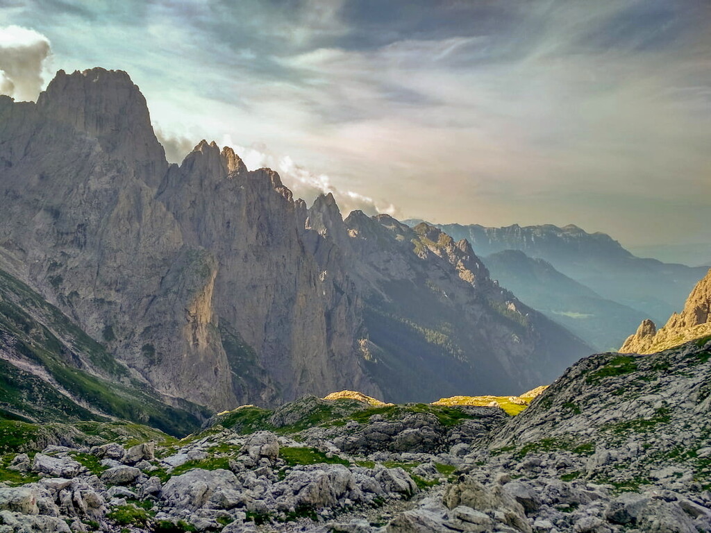
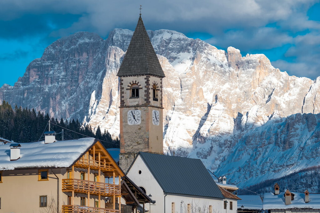
The Pala group, or the Pale di San Martino, is the largest mountain group in the Dolomites in northern Italy. It has a total area of 240 km² / 92 mi², or about 34,285 soccer (football) fields.
There are 141 named mountains in the group. The highest and the most prominent of them is Cima della Vezzana (3,192 m / 10,472 ft).
Two years ago, on a mountain hike in the Pala group, some friends asked me, as a local, where the names of the mountains came from.
Here's what I answered: "The first part of the name, “pala”, is a local word used to refer to the grassy slopes at the base of the range. The second, “San Martino” is the ski village and the largest settlement next to it together with the village of Fiera di Primiero (which has a population of 5,327 people as of April 30, 2020)."
So, the Pale di San Martino is the established name for these mountains. They are also called Gruppo delle Pale in Italian, the Palagruppe in German, and the Pala group in English.
The Pala group is located in the southern part of the Dolomites. However, there are a number of more southerly mountains in the region, including the Feltre and Belluno Dolomites, and the isolated Brenta group near the Lake Garda.
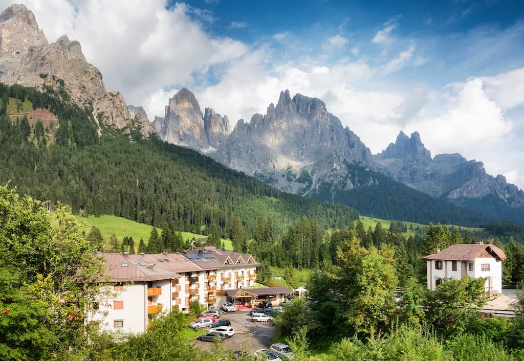
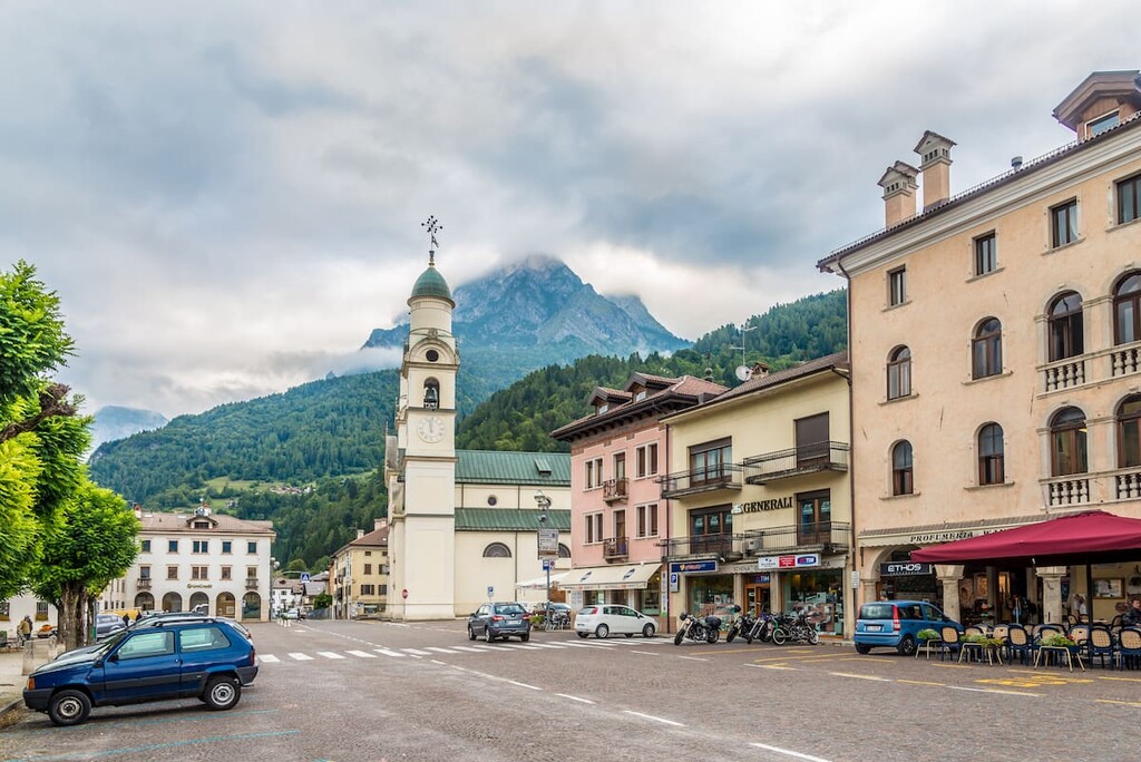
From Venice to Fiera di Primiero, one of the two main towns near the Pala group, it is only 132 km / 82 mi (2 hours by car, a bit longer by public transportation). You can also reach the range from Trento, Belluno, Cortina d'Ampezzo and Bolzano as the Pala is about midway between these cities.
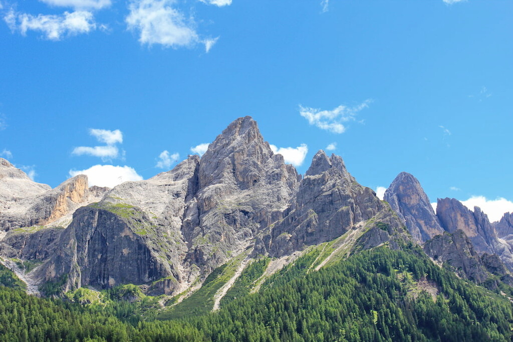
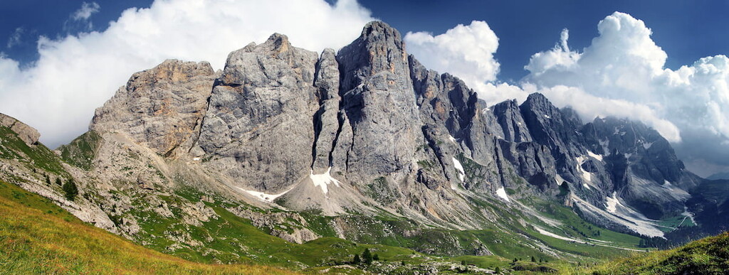
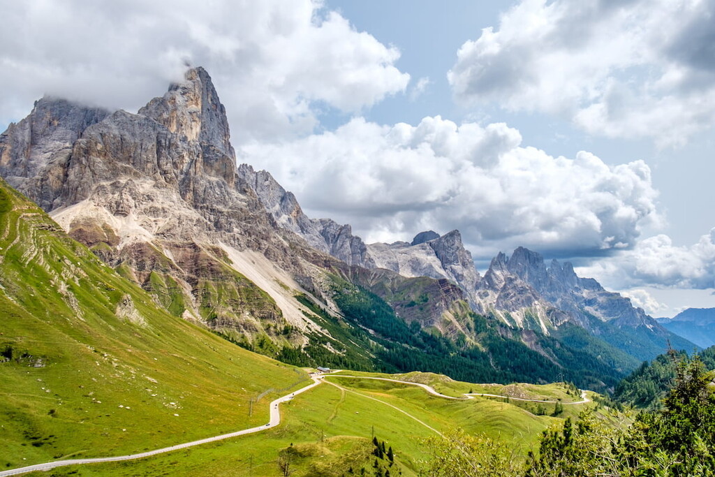
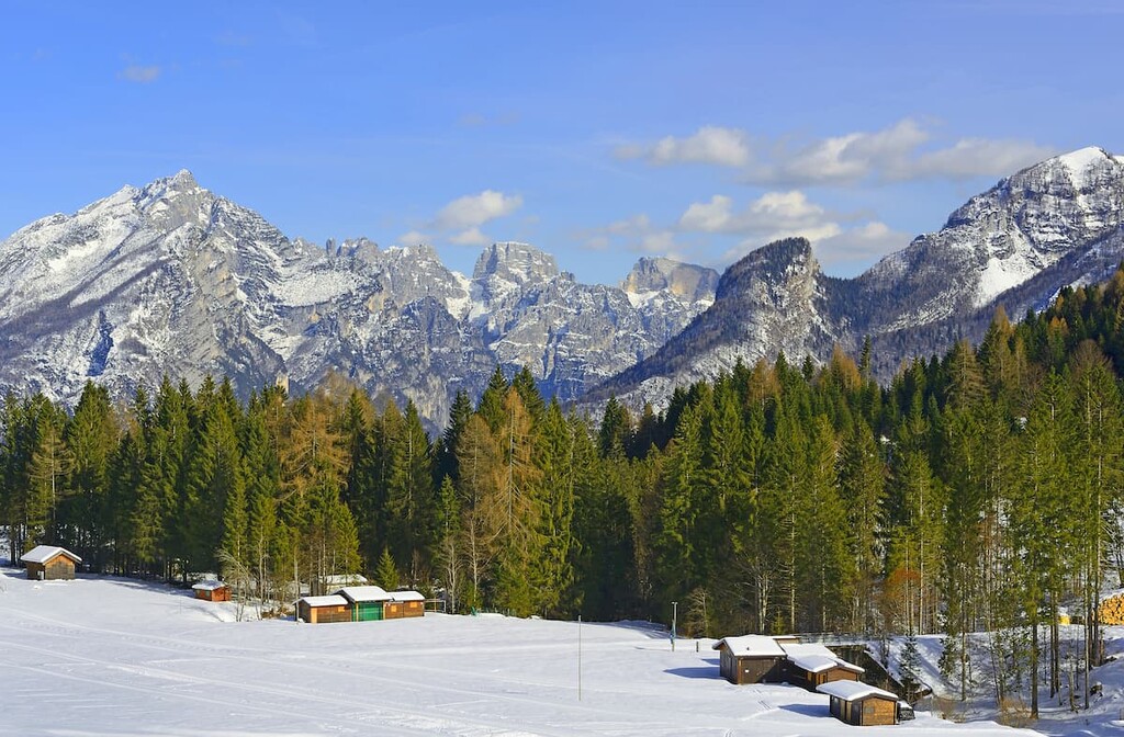
The first thing you see when you get here is not a “moon like plateau”, but alpine meadows and mixed pine/spruce forests, from which the mountain peaks grow high up into the sky above—like everywhere in the Dolomites. Additionally, the higher you get up to the mountains, the bigger and more majestic they become.
At the same time, the Pala is a part of one of the nine large mountain systems of the Dolomites, alongside the Mount Civetta and the National park of Belluno Dolomites. Overall, this one mountain system has a total area of 316 km² / 122 mi², which makes it one of the largest collections of peaks in northern Italy.
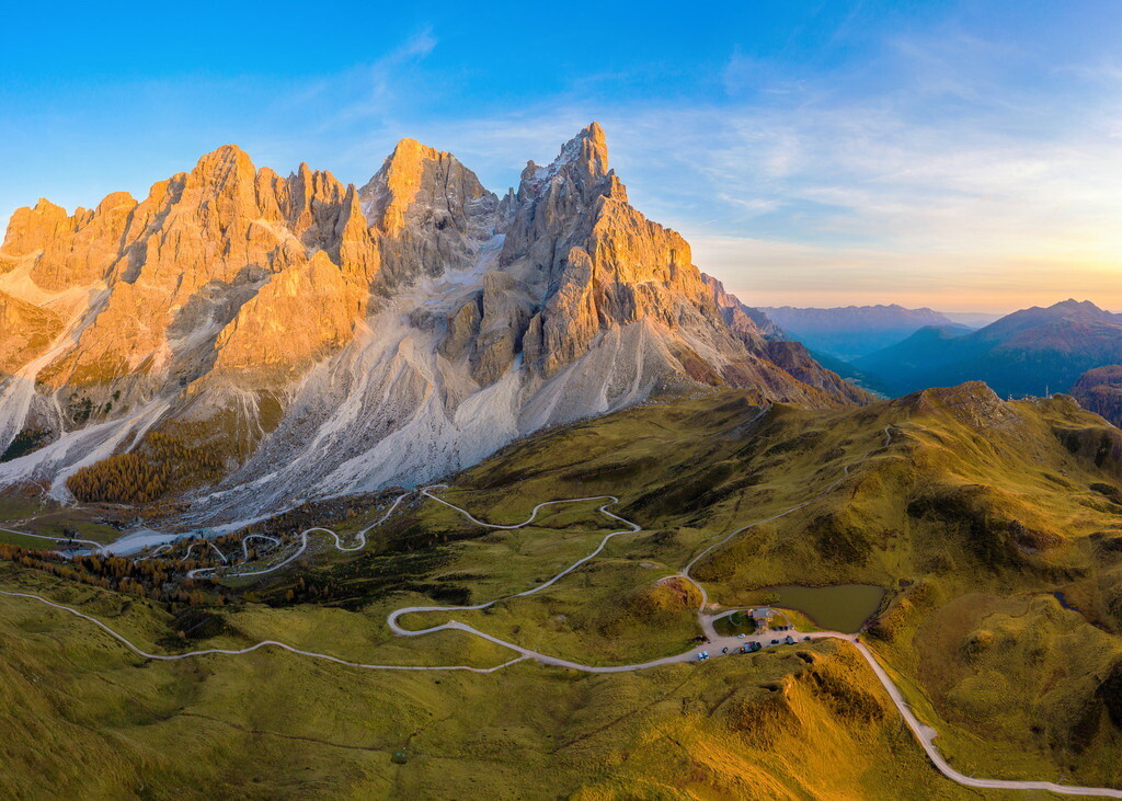
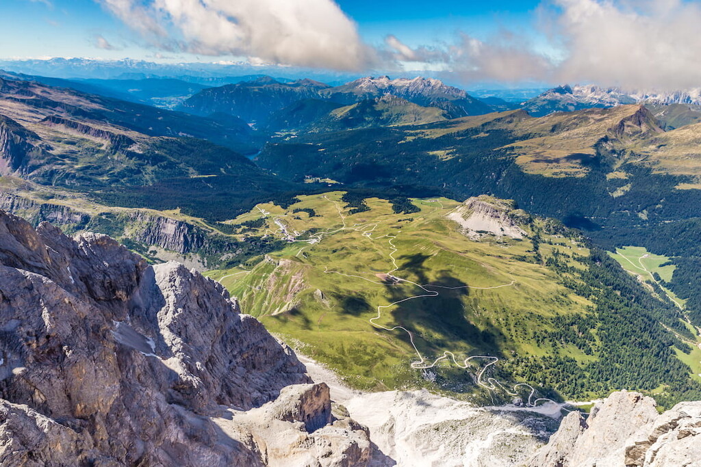
Approximately 50 km² / 19 mi² of Pala group, or one-fifth of it, is a majestic and vast high-mountain plateau at altitudes above 2,500 m / 8,202 ft. This plateau, which is located in its geographical center is one of the main highlights of the mountain system.
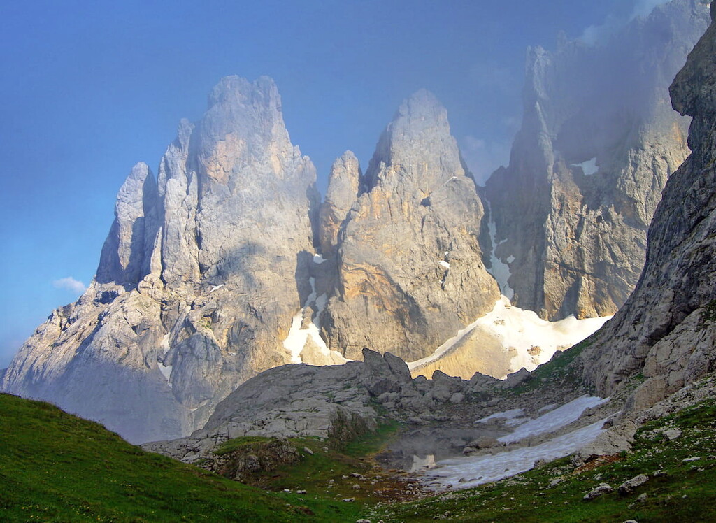
The Pala group is composed entirely of light gray and white dolomite rocks. Everyone who has been to the Pala, including me, agrees that the landscape resembles the surface of the moon.
The third most important feature that distinguishes the Pala group from the other mountain systems in the Dolomites, besides its size and distinctive plateau, is that it is also part of a nature park called Paneveggio — Pale di San Martino. Paneveggio — Pale di San Martino is one of the largest and most diverse nature parks in the country, making it an ideal place for outdoor activities.
The features of this stunning mountain group don't end here, though. Indeed, I will use the words “large” or the "most" more than once in this article to describe the Pala group’s scenic beauty.
Now let's go back to the plateau. It was discovered by Déodat Gratet de Dolomieu, a French geologist and explorer, after whom the whitish-colored mineral, dolomite, was named in 1788. So, the name of all the Dolomites came from here, the Pala group, as well as an unofficial name—the "Pale Mountains".
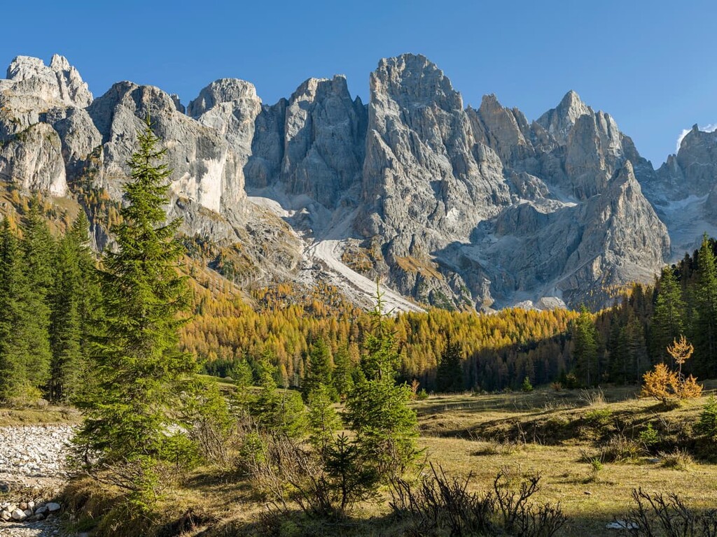
The Pala is also an example of what the Dolomites looked like about 250 million years ago during the Triassic period. They were atolls—ring-shaped uplands or coral reefs at the bottom of a calm and warm tropical sea—like some of the islands found in the Bahamas. After the water receded, the reefs weathered, forming the mountains that exist to this day.
How do we know that? Here, and in other parts of the Dolomites, these corals, shells and other fossilized remains of various sea creatures have been found in big quantities. Another example of such an atoll is the Sella group, which formed from a single coral reef.
Or, if we go into the Bletterbach Gorge, a 400 m / 1,312 ft deep canyon in Val di Fiemme, we can see the tens of millions years of the Dolomites’ geological history simply looking at the rock layers of these mountains.
Also, the pink and red color on peaks at dawn or sunset called "enrosadira" or an "alpenglow" proves the coral origin of the Dolomites. It happens because the dolomite rock is composed primarily of calcium and magnesium carbonate, like what is found in coral reefs around the world.
Now, millions of years later, the landscape of the plateau in Pale di San Martino is different and, indeed, very similar to that of the moon. On the plateau, you feel more like an astronaut than a hiker, but certainly not a scuba diver. In fact, if you do not look between the rocks, it might seem like there isn’t a single blade of grass or flowers on the plateau (but they are).
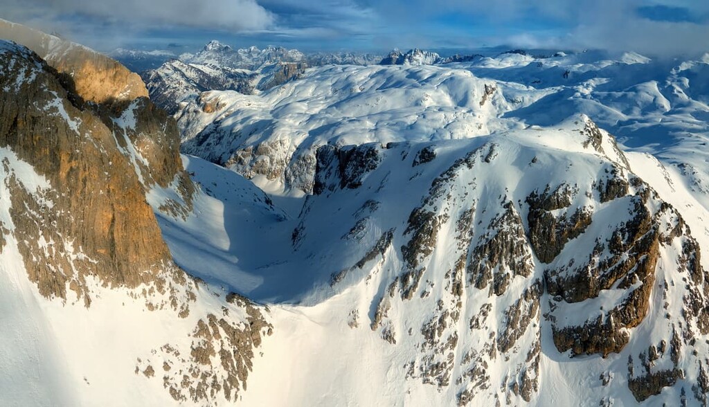
This is because there is also no water on the plateau, besides a handful of tiny lakes. Furthermore, the Fradusta glacier located on the Cima Fradusta (2,939 m / 9,642 ft) in the center of the plateau over the last 50 years has almost disappeared, as a result of global warming.
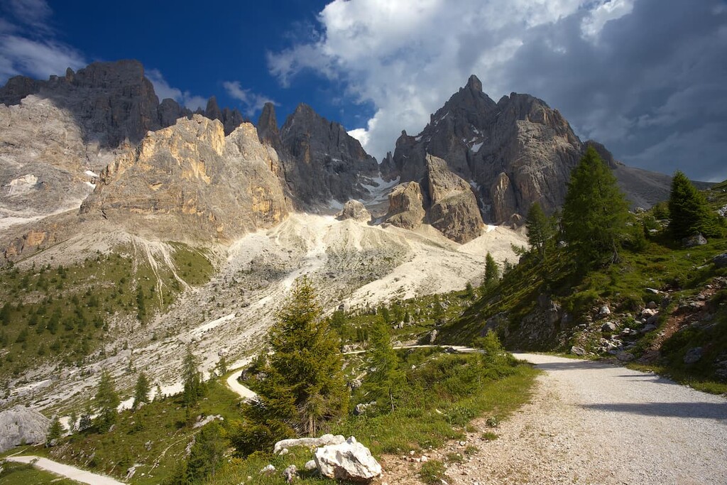
In any case, to climb the plateau, you will first have to walk through one of the valleys that surround the Pale di San Martino peaks, such as Canali, Pradidali, Venegia, Gares.
Each of these valleys is magnificent, but, in the south, the most famous valley is the Canali Valley; and in the north—the Venegia Valley, which is less touristy compared to the first, in my opinion.
The largest group in the Dolomites is not a single unit. It is divided into several subgroups. According to the Italian SOIUSA classification, there are:
All of these mountain peaks stand out quite a bit in contrast to the surrounding landscape. In fact, it’s impossible to miss them if you’re traveling around the mountains of Pale di San Martino.
But, of course, you can't see the northern part of the group from the southern part or even the central part of the range, unless you climb to the tops of the towering peaks. Thankfully, PeakVisor can help you visualize the range from any part of the mountain group.
Speaking of heights, after Cima Vezzana, the highest peaks of Pala group are:
To sum up: Unlike smaller mountain groups like Tre Cime di Lavaredo, Pelmo or even the Marmolada, which look like one big mountain, visiting the Pala does not create the impression that you have seen everything in one hike. On the contrary, there is a feeling that you have seen very little.
The mountain group is not only the largest, but also very diverse. In order to get a complete picture of it, you need to visit every sector in at least 2–3 days hike, 10–14 days in total.
For the very first trip to the Pala group I would choose the San Martino sector, the Central sector and the Southern sector. They are popular for a reason—because they are very beautiful. And for the second trip, it’s worth visiting the northern sector or the Pale di San Lucano mountains. However, while these mountains aren’t less beautiful, there will certainly be fewer people on their slopes.
From my very first time in the Pala group, I call it the "Adventure Park”. That's exactly how it always seems to me and, I guess, to every outdoor enthusiast, who has been here or is about to be here.
It is a ready-made attraction with many hiking and trail running trails, and via ferratas—you just have to choose the type of activity and the trail.
To help you out, I’ve organized this list of trails in order from short to long and from easy to hard so you can find your next adventure:
This is the most famous hike in Pale. You have to climb from the village of San Martino di Castrozza at 1,450 m / 4757 ft to the main and most famous rifugio of the Pale di San Martino — Rosetta, which is located at 2,581 m / 8,476 ft (+1,131 m / 3,710 ft).
To save energy and spend more time at the top, trekkers usually take a shortcut and climb halfway up the elevator to the rifugio Colverde at 2,000 m / 6,561 ft, which they are quite right to do as the second part of the route is more scenic than the first.
Also, on the plateau, if you have the energy left, you can climb even higher up to Cima Rosetta (2743 m / 8999 ft). This side trip adds only an additional 20 minutes to your journey, and the climb is well worth the effort. From the Rosetta, you can see not only the surrounding mountains but also the rifugio itself. From here, it seems very small.
As a result, the route can be completed without an overnight stay if you do not start from the village, but from the elevator Colverde. If you are in no hurry, meet the sunset on the plateau, spend the night in the mountain hut, and then meet the dawn—I highly recommend it.
To come back to the town you can either hike the same way or go all the way down on the cable car. Or, you can continue your adventure and head further along the Pala group.
Start and finish: San Martino di Castrozza
Type of trail: Out-and-back
Length: 4.5 km / 2.7 mi
Travel time: 2 h
Level of difficulty: Moderate
Uphill elevation gain: 743 m / 2,437 ft (Colverde — rifugio Rosetta — Cima Rosetta)
This is the same same route as above, as a run instead of as a hike. You do it on your own at any time, or you can participate in the Rosetta Verticale trail run competition. In 2021 it will be held on September 19, for the 5th time in a row.
Distance: 6.9 km / 4.2 mi
Height: 1,279 m / 4,196 ft
Participation fee: 30 €
Sign up for the race on the official page.
This is a panoramic trek through the central and southern parts of the Pala group, which can be completed in four days with three overnight stays in huts.
The hiking or trail running route San Martino di Castrozza — rifugio Rosetta is the first day of the Palaronda trek. On the second day, you will hike to rifugio Pradidali via the Fradusta glacier with an ascent to Cima Fradusta. From here you have an even more stunning view of the entire plateau. (By the way, in addition to the Frasusta glacier there are four other glaciers in the Pale.)
On the third day, you will descend to the Pradidali valley, from where you will go through the Canali valley to the rifugio Treviso. From there, on the fourth day, you will return to the rifugio Rosetta.
The Palaronda trek is not easy, but it is suitable for less-experienced travelers and hikers—the main thing is to be mentally tough and prepared for the challenge.
Start and finish: San Martino di Castrozza
Type of trail: Loop
Length: 30+ km / 18.6+ mi
Travel time: 4 days (3 nights)
Level of difficulty: Moderate
Uphill elevation gain: 2,940 m / 9,645 ft (1,100 m / 3,608 ft + 400 m / 1,312 ft + 340 m / 1,115 ft + 1,100 m / 3,608 ft)
The Pala group differs from other groups in the Dolomites also because there are many via ferratas—both in the southern and northern parts of the group.
The most famous and popular among climbers are via Ferrata Bolver-Lugli, via ferrata Gabitta d'Ignotti, via ferrata del Velo, via ferrata Stella Alpina. They are also combined in a route with overnight stays in mountain huts or alpine bivouacs.
It takes 8 days to walk the entire Pala group using this via ferrata, and you’ll complete an impressive altitude gain of 6,915 m / 22,687 ft along the way. But of course, no one is forcing you to walk the mountains for a week and you can choose to walk certain parts of the route.
Start and finish: San Martino di Castrozza
Type of trail: Loop
Travel time: 8 days (7 nights)
Level of difficulty: Difficult
Uphill elevation gain: 6,915 m / 22,687 ft
This is one of the two longest alpine hiking trails in the Dolomites, on par with Alta Via 1. Its total length is 160 km (99 mi) and travel time is 11–14 days.
If you start from Bressanone (Brixen) in South Tyrol, you will arrive at Pale di San Martino by day 8. It will take you three days to cross it. The trek is almost the same as the Palaronda as described above.
Season: June 21-September 21
Start and finish: Rifugio Volpi al Mulaz - Passo Cereda via Rifugio Pedrotti alla Rosetta, Rifugio Pradidali and Rifugio Canali Treviso
Type of trail: Out-and-back
Length: 32 km / 20 mi
Travel time: 3 days
Level of difficulty: Moderate
Uphill elevation gain: 2,630 m / 8,628 ft (760 m / 2,493 ft + 720 m / 2,362 ft + 1,150 m / 3,772 ft)
The Pala group, as a part of Paneveggio Nature Park, has two visitor centers: one is located on the southern borders of the group (the nearest town is Fiera di Primiero); the other on the western, in the village of San Martino di Castrozza.
Via Castelpietra, 2, 38054, Tonadico, Italy
+390439765973
Monday to Friday; 9:00 am to 12:00 pm and 2:00 pm to 4:00 pm
Visitor Centre San Martino di Castrozza
Via Laghetto, 27, 38058, S. Martino di Castrozza, Italy
+390439768859
Email of the park: info@parcopan.org, official website: https://www.parcopan.org.
Official website of San Martino di Castrozza: https://www.sanmartino.com.

There are a total of eight rifugios in the Pala group. They all open during the summer season from June 20 to September 20. Sometimes they are also open on weekends in October, if the weather is good and some of them are also open in winter or they have winter bivouacs.
Check official websites for exact schedules.
Here is a list of mountain rifugios in San Martino from south to north:
Rifugio Scarpa — Gurekian
Beds: 30
Rifugio Canali Treviso
Beds: 42, 4 in winter
Rifugio Vello della Madonna
Beds: 54
http://www.rifugiovelodellamadonna.it
Rifugio Pradidali
Beds: 66, 4 in winter
https://www.rifugiopradidali.com
Rifugio Pedrotti alla Rosetta
Beds: 80, 12 in winter
Rifugio Capanna Cervino
Beds: 15
Rifugio Giuseppe Volpi al Mulaz
Beds: 52, 12 in winter
https://www.caiveneto.it/rifugio/volpi-al-mulaz
Rifugio Lorenzo Bottari
Beds: 12

In Pale di San Martino you can also sleep in one of the eight bivouacs.
These are free and always open alpine huts that usually have 3 to 10 beds with mattresses, blankets and pillows. Sometimes outdoor enthusiasts leave food in them that doesn't spoil like pasta, as well as various necessities like candles, matches, and gas canisters.
Here is an exact list with the names of the bivouacs in Pale di San Martino:

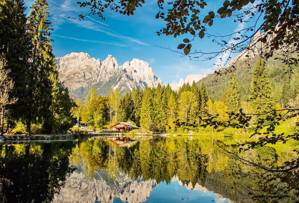
Before and/or after the hike, you can also stay in a hotel in one of the towns scattered around the borders of the Pala group, such as Hotel Centrale, Albergo Cant del Gal and Ski Residence, as recommended by the Pala official website.
If you want to choose something that’s a bit in between a bivouac and a hotel, Camping Castelpietra on the southern borders of the park is the right choice.
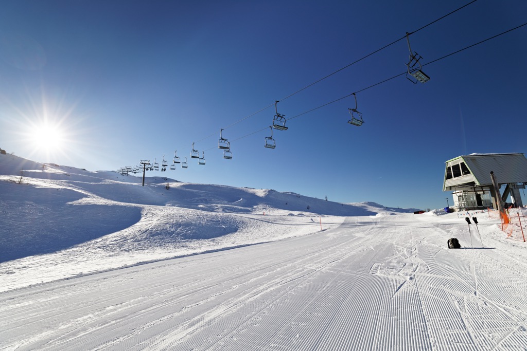
In winter, Paneveggio-Pale di San Martino Nature Park turns into one of the 12 major ski areas of the Dolomiti Superski system called San Martino di Castrozza-Rolle Pass. Two of its three areas are in the title, including the summits of Colbricon and Tognola. The third one is located on the opposite side of the Cismon River valley and leads to the rifugio Colverde below Cima Corona and Cima Rosetta.
At the resort, in January 2022, they also began to build a new handicap gondola ski lift directly to Rolle Pass, which is scheduled to open by the start of the 2025–26 season. Now access to the pass is by bus.
In total, the resort has more than 60 km (37 mi) of slopes, most of which are intermediate, and more than 20 ski lifts. The difference in elevation is 953 m (3,126 ft) between 1,404 and 2,357 m (4,606 and 7,732 ft).
But that's not all skiing options in Paneveggio. Two other large ski areas of the same Dolomiti Superski system are located on the northern boundaries of the park: Alpe Lusia and San Pellegrino. These resorts have more than 25 and 65 km (15 and 40 mi) of slopes and more than 8 and 15 ski lifts, respectively.
Finally, to the south of the southern borders of the park at Brocon Pass, you will find a small ski area called Lagorai with more than 10 km (6 mi) of slopes and more than 3 ski lifts. Although it is not part of the park, it is located at the foot of the Cima di Asta range, which is often seen together with the Lagorai mountain range.
Check the Paneveggio ski map on the larger Trentino-Alto Adige/Südtirol and Italy ski maps in the World Mountain Lifts section of the site. It includes information about open ski lifts / slopes in Paneveggio-Pale di San Martino Nature Park in real-time with opening dates and hours. There are also year-round cable cars, funiculars, cog railways, aerial tramways, and all other types of mountain lifts.
Besides the famous tourist centers of San Martino di Castrozza and Fiera di Primiero, which are usually associated with Pala group, there are three other settlements around the Pala worth talking about. These include:
Sargon Mis is one of the villages in the commune of Fiero di Primiero, consisting of the two smaller villages that make up its name. I mention it because it is located at a distance from the center of the commune, so it’s not the type of place you accidentally stumble across.
Interestingly, one of the peaks in the Cimonega mountain group, Piz de Sargon, is named after the village.
The settlement is located at the Cereda pass and it is considered to be one of the gateways to the Pale di San Martino from the south. From here, it is easiest and fastest to get to the Canali valley. There is also an Alta Via 2 route going through the pass.
There are three smaller settlements in Sagron Mis: Matiuz, Pante (Penns), and Vori. Only 200 people live in the village, but there are quite a few hotels with approximately 2,050 beds available to tourists each night.
There are no famous architectural sights, but there are two churches—Madonna di Loreto and Our Lady of Grace, built in 1901.
Agordo is a town in the province of Belluno, which is considered to be the local cultural, tourist, and industrial center of the Dolomites.
For example, it was the origin of the world's largest eyewear company, the Luxottica Group S.p.A., which is now headquartered in Milan. It was also once a major mining center for the region.
Agordo is located in the Cordevole valley, exactly midway between the Pala group, the National Park of Belluno Dolomites, and Mount Civetta. The town consists of about 15 smaller settlements, such as Brugnach, Colvignas/Coldegnas, Crostolin, and Farenzena.
The city has a population of about 5000 people. In addition to Italians, they are also the Ladins, the native peoples of the Dolomites.
There are a few ancient monuments in the town including the archidiaconal church, the Lion of San Marco, the ancient fountain, and the town hall, but also several Venetian villas like Crotta Palace and Villa Fiore. There is also the Mineral Museum and the Museum of Optics, made because of Luxottica.
A village in the north of the Pala group, located 35 km (22 mi) from the capital of the Belluno province, in the Biois Valley.
Falcade is famous for the Trevalli Ski Area, which includes 100 km (62 mi) of slopes—a part of the Dolomite Super Ski area. It is also popular in the summer among walkers and hikers, cyclists, and mountain bikers.
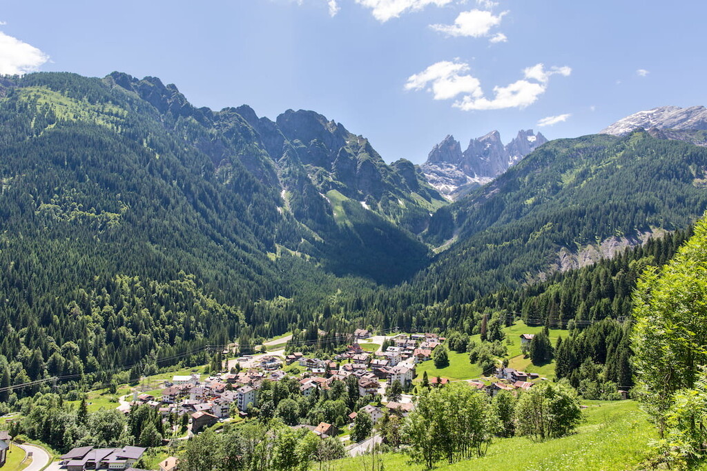
The dominant nearby mountains are the Focobon and Mulaz. From the valley, you can also see Marmolada, Civetta, as well as Pelmo.
The village includes the settlements of Falcade Alto, Sappade, Valt e Somor, located higher on sunnier slopes in relation to the center of the village. Falcade also actually merges with the neighboring village of Caviola to create a larger community.
The village has about 2000 inhabitants. It is also one of the villages where Ladin history, culture, art, and language are best preserved.
The main architectural landmarks of Falcade are the church of San Sebastiano, the church of Beata Vergine, and several tabià, which are typical alpine barns.


The highest peak in the Pala group is Cima della Vezzana, at 3,192 m.
The Pala group have 141 named peaks.


