
Scan the QR code and open PeakVisor on your phone
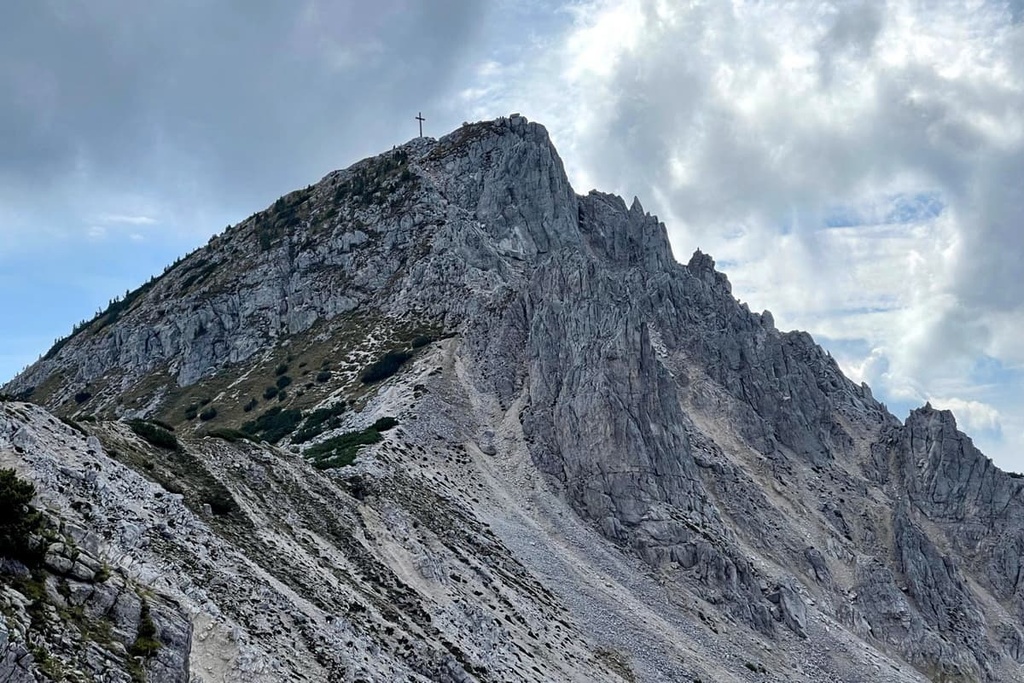
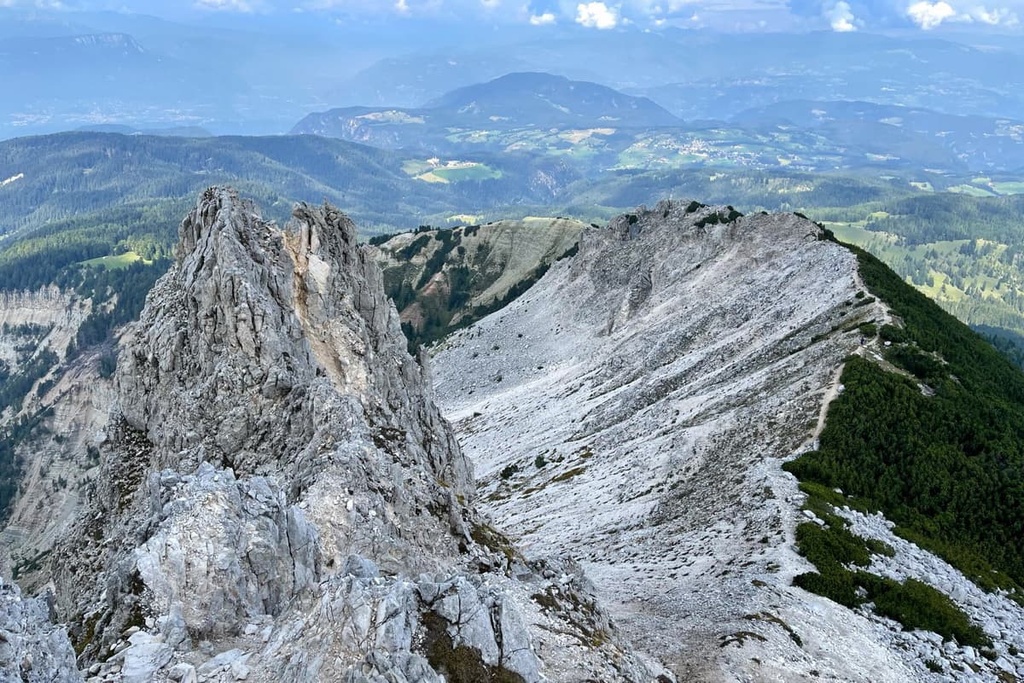
The Bletterbach Geopark (Geoparc Bletterbach) is one of the 10 nature parks in the Dolomites of northern Italy. It is the smallest of the parks, but it is both scientifically and recreationally unique and important. The park's main feature is a deep gorge that showcases a large rocky outcropping where the entire geological history of the Dolomites can be seen with the naked eye. The gorge is located under the slope of the only named mountain in the park-Corno Bianco / WeiГџhorn (2,316 m / 7,598 ft).
Bletterbach Geopark (Geoparc Bletterbach) is named after the creek Bletterbach, which created the gorge that the park is known for. Its headwaters begin on Corno Bianco / WeiГџhorn and the creek flows in a southwestern direction.
The stream is also called Rio delle Foglie in Italian, so the geopark also has a second name-Geoparc Rio delle Foglie.
However, the word "geopark" in the park's name is also important. It speaks to its second main feature of the park and its primary difference from other parks in both the West Dolomites and the East Dolomites.
A geopark is a special type of park with a focus on geology. It is part of the UNESCO Global Geoparks Network. The system was created to preserve the geological heritage of the Earth. In total, there are just 75 such parks in Europe in 26 countries, and 161 parks in 44 countries worldwide (as of 2021). In comparison, there are 63 national parks in the US alone, 40 in Finland, more than 50 in Russia, and so on.
In the Dolomites, there is only one other such park-Adamello-Brenta Geopark-which is also designated as a regional nature park.
The Bletterbach Geopark is also considered a natural monument. It was established in 2005 at the initiative of the local municipality. Just four years later, in 2009, it also received the status of UNESCO World Heritage Site, after Dolomites was added to the list.
The locals also often call Bletterbach the "Grand Canyon of South Tyrol" as it is the largest canyon in the province of South Tyrol. In my opinion, this is a very good advertising slogan that attracts plenty of tourists.
Geoparc Bletterbach is located in the municipality of Aldino / Aldein in the province of Bolzano / South Tyrol, which is part of the autonomous region of Trentino-Alto Adige / South Tyrol. Aldino / Aldein borders the municipalities of Bronzolo, Carano, Daiano, Montan, Deutschnofen, Auer, Truden, and Varena.
The total area of the park is 2.71 sq km (1 sq mi). It is really small compared to such large parks in the Dolomites as, for example, Paneveggio-Pale di San Martino Nature Park which has an area of 191 sq km (73.7 sq mi).
The easiest and fastest way to get to the geopark is from the provincial capital, the city of Bolzano. Because of the mountains, you can't get here via a direct route, so you have to go around the mountains and valleys.
By car, it takes you approximately 51 min (41.3 km / 25.6 mi) from the south through Aldino. From the north, through the neighboring municipality of Nova Ponente / Deutschnofen, it takes about 51 min (40.4 km / 25.1 mi), too.
The choice of route depends on where you are coming from in Bolzano. If you're coming from Trento and Verona in the south, choose the route via Nova Ponente / Deutschnofen. If you're coming from Innsbruck, Austria, and Munich, Germany, in the north, it's better to go via Aldino. In both cases, you will see more beautiful scenery.
The geopark is also a good place to visit on your way from Austria or Germany to northern Italy, but it's better to have one full day available to you in the park for hiking in the canyon.
For those who don't have or don't plan to rent a car, I recommend taking bus number 146, which runs from Aldino to the park (a 20-minute trip). Check the schedule at Suedtirolmobil.info, as well as other information about local transportation throughout the province.
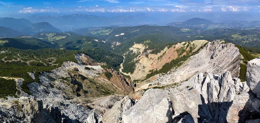
The Bletterbach Gorge is "only" about 15,000 to 18,000 years old, even though the rocks that form it are several hundred million years old (they date back from the Permian to the Triassic). Throughout the millennia, the rocks in the gorge have been subjected to strong weathering and erosion. But ,today you can see the formation of the primary rock strata of the Dolomites in the gorge.
A brief summary of what you'll see once you're in the canyon on the hiking trail:
In other words, Bletterbach Gorge is a fantastic place to study geology outside. It is really a unique geological and natural landscape-the only one in the entire Alps.
The landscape of the Bletterbach Geopark features the pyramidal Corno Bianco mountain and its namesake canyon (Bletterbachschlucht), which runs from it northwestwards towards Seiser Alm / Alpe di Siusi-a Dolomite plateau and the largest high elevation Alpine meadow in Europe.
Here are some of the exact characteristics of the canyon:
There are at least four high waterfalls in the park, too. At the same time, around the gorge, there are glacial deposits from the last glacial maximum that are full of clay, pebbles, and rounded boulders.
Some other places of interest in and around the park include:
In addition to rocks and minerals, you can better learn about the flora and fauna of the past while traveling through Geoparc Bletterbach.
Exploration of the canyon began in 1891, but only in the 1930s did Leo Perwanger, an engineer from Redagno, provide a description of the canyon's geological structure and its ancient flora and fauna.
Since that time, there were numerous geological discoveries in the gorge, including those of well-preserved imprints of parts of plants and wood, primitive marine animals, corals, and Claraia shells, and fossilized imprints of dinosaurs-for example, a short reptile Phalangichnus perwangeri.
In particular, within these geological layers, there are also many traces of an ancient lizard species. It is represented on the Bletterbach Geopark's logo.

However, we cannot say that we know everything about the canyon. To this day, the local scientists from the Aldino area continue to research the flora and fauna of the canyon, together with specialists from the Museum of Nature South Tyrol in Bolzano, the MUSE Science Museum in Trento, and other museums and universities.
You can see these and other traces of ancient animals and plants on the rocks and learn more about them in the two geological museums in the area-read more about them later in the guide.
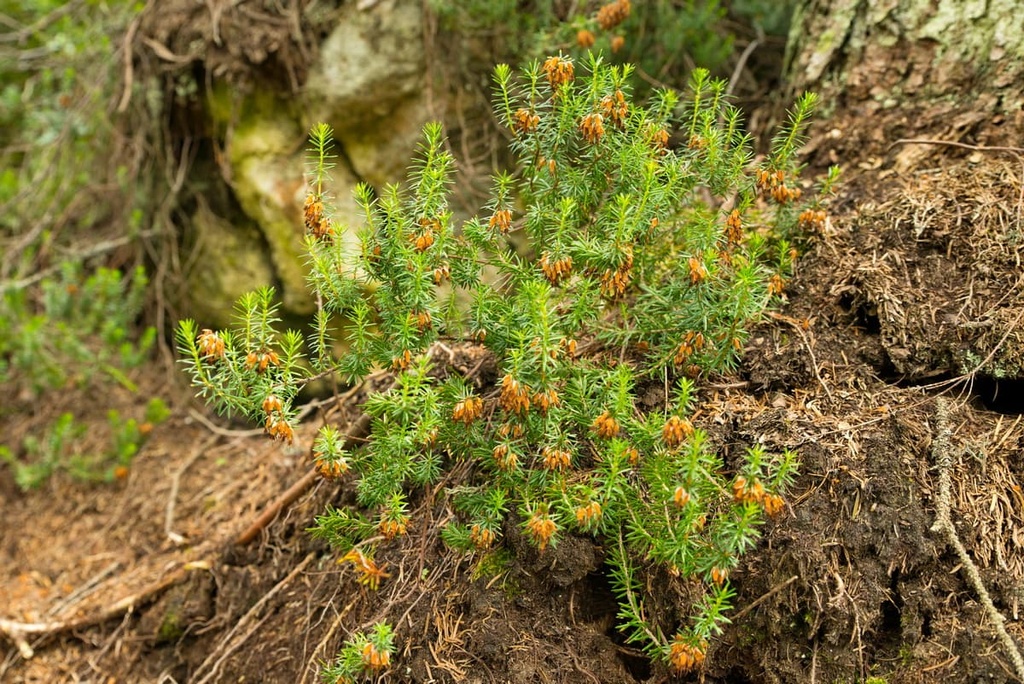
The flora of the Permian period, during which geological processes took place in the Bletterbach Gorge, was very different. For example, hundreds of species of alpine flowers and other plants, which we can enjoy in the meadows of South Tyrol today, did not grow here then. There were mostly ancestors of today's conifers, horsetails, and tree ferns.
But, in general, scientists have found that the flora of the past in this region was richer than today's. Plants were also much larger in size. For example, the Permian horsetails were not small shrubs, but trees several meters (tens of feet) high. The same can be said of the tree ferns, which today are found only in tropical areas.
How do we know this? These and other plants were found in large quantities well preserved in the form of fossil plants in various layers of the earth in the gorge. Usually, it's just plant fragments - leaves, cones, bark, and so on - that they lose during their lives. The fragments then are carried away by winds and preserved in the muddy layers of different water bodies. Scientists then reconstruct their general appearance.
All these findings are also one of the reasons why the gorge is famous throughout the region.
There were no modern mammals and birds in the Early and Middle Permian. The fauna was represented only by different amphibians and reptiles. In particular, in the Val Gardena sandstone, the second major geological layer of this area, scientists found many prints of all the major species of reptiles - herbivores, carnivores, and with a mixed diet.
So, let's talk about dinosaurs a little bit:
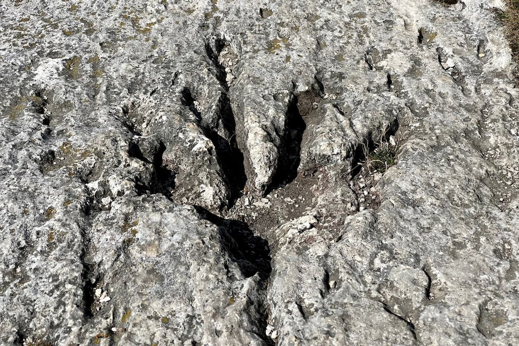
In the Upper Permian, some of the reptiles evolved to animals similar to modern small mammals-such as dycinodontipus, which were predators up to half a meter long (39.3 inches). Their prints can also be seen in the Bletterbach Gorge geological museums, including the oldest prints in the world.
Finally, among the small mouse-sized animals, a species called chelichnus tazelwГјrmi was found here. Scientists named them after Tatzelwurm, a lizard-like creature with a face of a cat in the folklore of the Dolomites and the Alps.
Geology is the main feature of the Bletterbach Geopark. For this reason, based on the choice of UNESCO experts, it was also included among the nine major mountain systems in the Dolomites at number 8, which refers to the Bletterbach system. It is also the smallest of the mountain systems in the region and the most distant from the central part of the Dolomites, if we take Mount Pelmo as the center.
The geopark is also located in the Fiemme Mountains or Fleimstal Alps, which are considered a separate group in the German-Austrian classification of the Eastern Alps (AVE). According to this classification, the system is number 53 in the range. According to another popular classification, the Italian SOIUSA, these mountains are called Dolomiti di Fiemme.
The fact is that these mountains, which consist mainly of granite and porphyry, also include the mineral dolomite, so they are often classified as Dolomites (number 52) for both geological and geographical reasons.
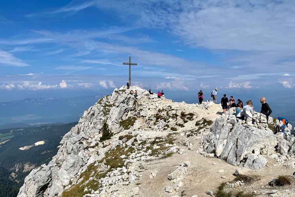
The only mountain in the park, Corno Bianco / WeiГџhorn, is just such an example-as I already told you about, its summit is made of dolomite. At the same time, and again as opposed to the Dolomites, the rocks on neighboring Corno Nero are reddish-brown quartz porphyry.
Hiking in Bletterbach Geopark is an impressive walk of several hours, during which you can both go down into the gorge and walk along the peaks of the surrounding mountains. You will see very old geological layers, dinosaur footprints, 360-degree views on the Dolomites, and more:
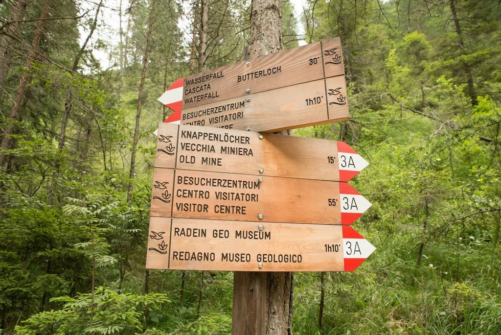
There are several hiking trails of varying lengths and levels of difficulty available within the park and nearby. These are suitable for experienced hikers, new hikers, and the whole family. Here are the major hikes to check out in the region:
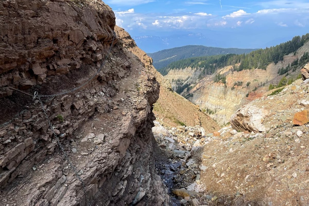
The Bletterbach Gorge Geological Trail is the main trail in the park. The trail runs throughout the canyon and while descending into it from the park's visitor center, you'll find yourself on a path along the stream Bletterbach. The stream is surrounded by 20 m (65 ft) canyon walls that overhang both sides of the trail.
There are several observation points on the trail from which you can view the canyon from different angles and take incredible photos of the surrounding peaks in the PeakVisor app.
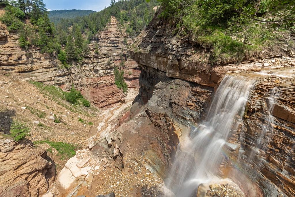
One of the main surprises of the trail is the Butterloch Waterfall, which is less frequently written about in the guidebooks. By the way, all the major waterfalls are also marked in the app.
The route may have several alternatives and longer options, such as from the historic Zirmerhof Hotel in Redagno-the only hamlet of Aldino.
In the latter, and in any case, be sure to take good hiking boots for this trail, because the path is often rocky and rugged.
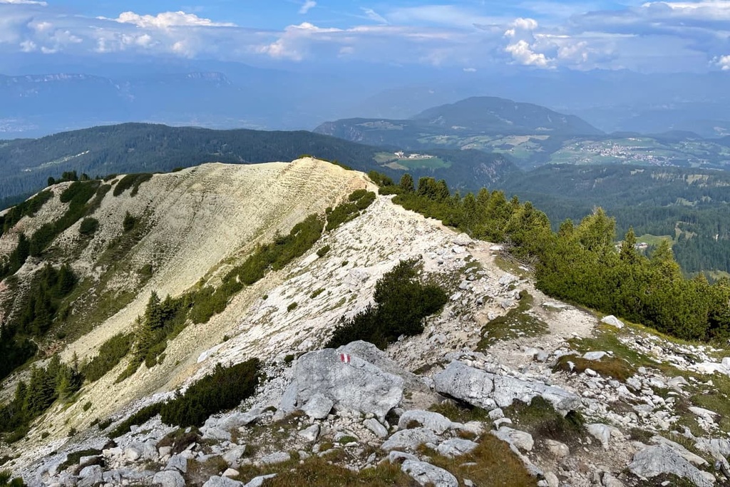
The Malga Laner-Malga Gurndin via Corno Bianco trek is a long enough route for those who have already descended the canyon but who also want to see its beautiful surroundings. These summits and destinations are just as worthy of your attention as the gorge.
On this particular route, you will pass between the two alpine farms: Malga Laner and Malga Gurndin via the main summit of the geopark. It is a loop trail, so it allows you to return to the starting point, which is great if you're traveling by car.

From the summit of Corno Bianco, you will have panoramic views of the surrounding mountains and valleys: Monte Pausabella / Kaltherber (1,719 m / 5,639 ft), Ortles Alps (3,905 m / 12,812 ft) and Г–tztal Alps (3,774 m / 12,381 ft), Schlern / Sciliar, Rosengarten / Catinaccio and Latemar groups in the Dolomites, Pala di Santa (2,488 m / 8,031 ft) across the LavazГЁ Pass (1,808 m / 5,931 ft), Brenta Dolomites, and other mountains.
This is an alternative route to Corno Bianco from Oclini Pass (Passo di Oclini). The route is suitable for those who are traveling to the pass from the Fiemme and Fassa Valleys and want to climb the mountain to get a closer look at the neighboring Corno Nero.

The climb of 330 m (984 ft) is suitable for families and new hikers. Additionally, you can return to the starting point by the same route, or continue to the canyon itself.
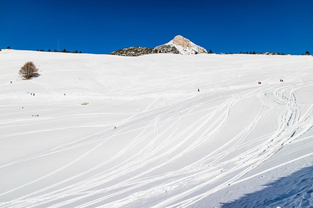
There is an option to increase the length of the route, too, going to Oclini Pass from the neighboring LavazГЁ Pass (1,808 m /5,931 ft) and LavazГЁ Plateau. In winter, this is also a popular cross-country skiing and snowshoeing route. Venturing to Oclini Pass is an additional 4.1 km (2.5 mi) in length, 1:30 hours of travel time, and 190 m (623 ft) of ascent.
In winter, Passo Oclini / Jochgrimm turns into a small ski resort. There are ski slopes on both peaks: Corno Bianco and Corno Nero.
There are 4 ski slopes (two red: Doladizza and WeiГџhorn, and two blue: Schwarzhorn 1 and Schwarzhorn 2) with a total length of 7 km (4.3 mi) and 4 ski lifts. The elevations are between 1,850 and 2,250 m (6,069 and 7,381 ft) with a difference of 400 m (1,312 ft).
There is also a lot of space for cross-country skiing with trails of 3, 5, and 8 km (1.8, 3.1 and 4.9 mi) in length connecting Aldino / Aldein with Monte S. Pietro / Petersberg and Nova Ponente / Deutschnofen areas.
The Jochgrimm (Passo Oclini) Ski Resort is part of the larger Val di Fiemme / Obereggen ski area, one of 12 in the Dolomiti Superski system.
Check the Bletterbach ski resorts map on the larger Trentino-Alto Adige/Südtirol and Italy ski maps in the World Mountain Lifts section of the site. It includes information about open ski lifts / slopes in Bletterbach Geopark in real-time with opening dates and hours. There are also year-round cable cars, funiculars, cog railways, aerial tramways, and all other types of mountain lifts.
The Geoparc Bletterbach Visitor Center and GEOMuseum is the main starting point for your journey through the canyon. It is located just below Malga Lahner at the entrance of the Geological Trail of the Rio delle Foglie Gorge.
In particular, there are 16 information panels at the visitor center that tell about the different rock layers and other features of the gorge. If there is not enough information, or if you like to listen rather than read, ask one of the center's staff for more information. You can also ask them for advice about hiking trails through and near the canyon.
Geoparc Bletterbach Visitor Centre and GEOMuseum
Lerch 40, 39040, Aldino, BZ, Italy
Opening hours: May 1 to November 1, daily from 9:30 am to 6:00 pm
Admission: €6 for adults and children over 14 years old (the price includes a visit to both museums and a free helmet rental for hiking in the canyon)
+390471886946
On your way back, you can also stop in Redagno, where the second museum of this kind is located. It contains all the important discoveries from the gorge that I listed above, as well as information about the region's characteristic rocks.
Redagno GEOMuseum (Museo Geologico di Redagno)
Peter Rosegger Haus, 39040, Aldein / Radein, BZ, Italy
Opening hours: May 1 to November 1, daily from 9:30 am to 5:00 pm
+390471886946
If you like interactive excursions, the geopark also offers guided walking tours of the canyon with local guides who will explain the geology, flora, and fauna of the area. Tours can be booked at the park visitor's center or the museum in Redagno, or via email or a phone call. Information about the tours is as follows:
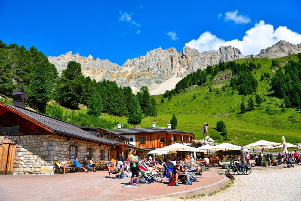
There are not many mountain huts (rifugios) in the UNESCO World Heritage Geoparc Bletterbach, but you can find at least one on the Passo Oclini / Jochgrimm. It is a typical alpine hut run by a local family where you can have a half-board for about €38:
Rifugio Gurndin (1,989 m / ft)
Jochgrimm, 4, 39040, Aldino, BZ, Italy
+39330765083
On the same pass, there are a lot of other accommodation options such as other alpine huts, hotels, farms, and so on. For example: Hotel Schwarzhorn, Berghotel, Malga Isi / Doladizza Mountain Lodge, and others. There are many hotels in Aldino, too, and in the surrounding areas.
Aldino / Aldein, a small Tyrolean village, located at an elevation of 1,225 m (4,019 ft), is the nearest settlement to the Bletterbach Geopark. It is only 20 minutes away, and it is located only 15 km (9 mi) to the south of the city of Bolzano.
The village is also often called Aldein-Radein / Aldino-Redagno. The second word in the name (Radein/Redagno) is that of the only hamlet in the municipality.
Aldino is home to 1,648 inhabitants (2020) in an area of 62.69 sq. km (24.2 sq. mi). It is one of the oldest and most important settlements in South Tyrol, and it was first mentioned in written texts in 1175.
However, according to the 2011 census, 98% of residents speak German, 1.7% Italian, and 0.1% Ladin, so it is mostly a German-speaking place. However, you shouldn't have communication problems with locals, at least if the purpose of your visit is hiking in the park-there will be someone who knows some English.
The main architectural and cultural attraction of the town is the Parish Church of Aldein (Chiesa dell'Invenzione della Santa Croce), which was built before the twelfth century. The church is the main feature of the village because it is set amongst gorgeous meadows.
Inside the church, there are two important local works of art: the life-size statue of the Sacred Heart of Jesus, and the image of Moses with the Tablets of the Law.
Other attractions near the village you can visit during the day-trip:
Official tourist site of Aldino / Aldein: Suedtirols-sueden.info.


