
Scan the QR code and open PeakVisor on your phone
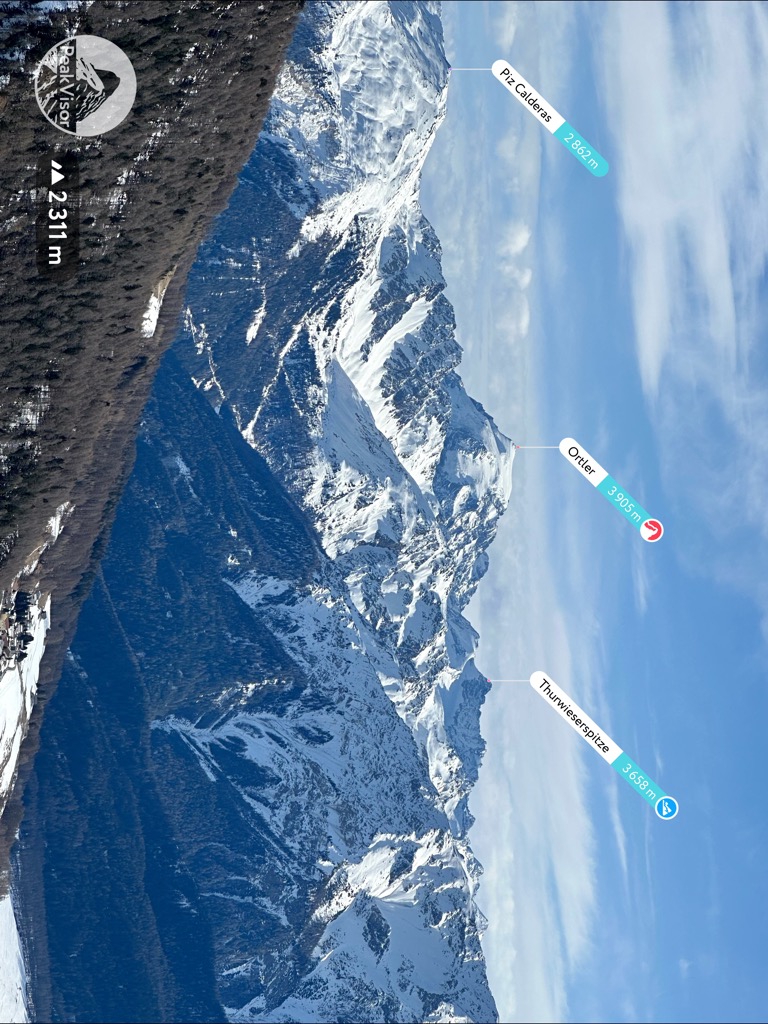
The Ortler Alps include 425 named peaks. The highest is Ortler at 3,905 m. Other notable peaks include Ortler Vorgipfel - Ortles Anticima, Gran Zebrù and Monte Cevedale.
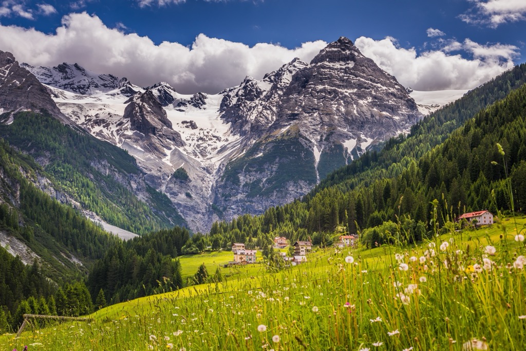
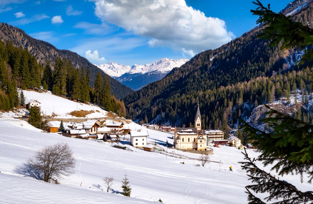
The Ortler Alps are located primarily in South Tyrol, Italy, and extend slightly into Switzerland. The mountains are part of the Southern Rhaetian Alps and lie partially within Stelvio National Park. The eponymous peak Ortler (3,905 m / 12,812 ft) is the highest point in the Southern Limestone Alps and the highest point in the Eastern Alps outside of the Bernina Range. The cascading Ghiacciaio di Ortles, or Ortler Glacier, dominates the peak’s upper flanks. Many other of the range’s high summits also feature glaciers. Of the 425 mountains in the Ortler Alps, Ortler (3,905 m / 12,812 ft) is the highest and most prominent (1,952 m / 6,404 ft).
The Ortler Alps mainly lie within South Tyrol, Italy, with a small portion crossing the border into Switzerland. The tallest peak, Ortler, holds several distinctions among the sub-ranges of the Alps. At 3,905 m (12,812 ft) and towering over its surroundings with a prominence of 1,952 m (6,404 ft), it’s the highest point in the Southern Limestone Alps, the Tyrol region, and the Eastern Alps outside of the Bernina Range.
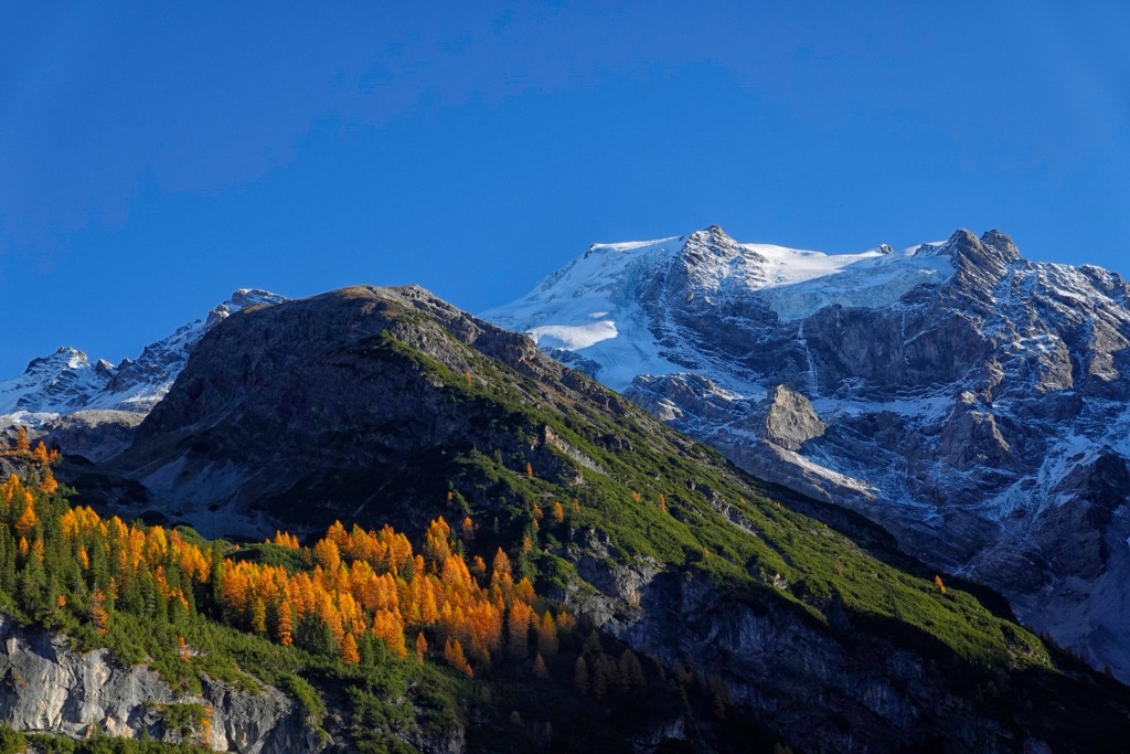
The Ortler Alps are part of the greater Southern Rhaetian Alps and lie within Stelvio National Park. Ortler and Cevedale (3,769 m / 12,365 ft) are two well-known glaciated peaks comprising the center of the range. The area receives abundant snowfall and is home to several ski resorts, as well as vast ski touring options. The eastern and southern parts of the range are great for hiking.
The mountains are in both German and Italian-speaking zones, and many areas have names in both languages. The Bernina Group of St. Moritz neighbors the range to the west, while the Dolomites lie to the east.
The Ortler Alps are part of the Alps. The Alps formed during the Alpine Orogeny, a mountain-building event that occurred as the African and Eurasian plates collided and which has been ongoing since Cretaceous times. Most mountain building occurred between 65 and 2.5 million years ago, although the mountains continue to be uplifted. However, the uplift rate no longer outpaces erosion, and the Alps are not considered a growing range. Additionally, geologists have attributed the recent uplift to a rebounding effect as the Alps spring back after the weight of the last ice age’s ice sheet melts away.
The geology of the Ortler Alps is shaped significantly by the Periadriatic Fault that runs around the group. The fault divides the Italian peninsula from the Central European tectonic plate. The collision of the plates has resulted in the area’s non-uniform geology.
Most of the Ortler Alps, including the glacier-covered summits around Ortler, are made up of dolomite and limestone, which form deep spires and canyons. The glacier covering Ortler’s north face is considered the largest ice face in the Eastern Alps and is a popular ice climbing objective. The range’s eastern portion tends to be composed of gneiss with slabs of schist-like rock. To the south, Val Venosta has a prominent marble mining operation.
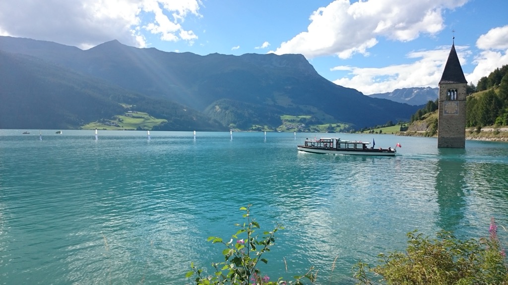
Lake Resia is an artificial lake in Val Venosta, famous for its submerged bell tower. The lake was born in 1950 when the Adige River was damned to generate electricity; in addition to the bell tower, about 160 homes were submerged.
The last Ice Age left its mark on the region. Glacial erosion carved out valleys and carried rocky debris down valleys and waterways. The deposits created fertile areas like those in the Vinschgau/Val Venosta Valley. Landslides and floods have also shaped the landscape, shifting large soil deposits when they occur.
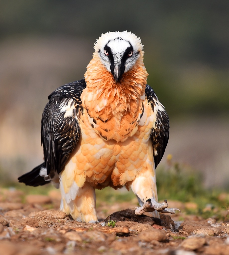
The Ortler Range supports a variety of habitats, from floodplains to meadows, forests, and alpine zones. Stelvio National Park encompasses much of the range, allowing visitors a greater chance to encounter wildlife. The national park has large concentrations of golden eagles and marmots and supports healthy populations of ibex, chamois, and red deer.
The reintroduction of 11 bearded vulture chicks in 2008 proved successful, and over two dozen adults now live in the Ortler Alps and surrounding ranges. There are occasional sightings of lynx, brown bears, and wolves within Stelvio National Park.
Several medicinal plants grow in the Ortler Alps, including barberry, comfrey, arnica, mugwort, brownwort, monkshood, lady’s mantle, coltsfoot, and liverwort.
At lower elevations, floodplain habitats support white willow, black poplar, gray alder, and shrub willow while providing homes to red deer, orioles, hawfinches, spinning moths, and zebra spiders. Spruce forests grow between 800 and 1,400 meters (2,625 - 4,595 ft), and larch-yew forests appear at higher elevations. Yew grows slowly, and some can live for up to 1,000 years. These forests provide a home to spotted nutcrackers that favor yew nuts, ring ouzel, and black grouse.
Dwarf heath and alpine grasslands dominate the landscape above 2,200 m (7,215 ft). As trees cease to grow, patches of gray alder bushes, dwarf heath, alpine grasses, and meadows take over. At the highest elevations, the rocky terrain necessitates that plants have adapted to survive intense conditions. Examples are the alpine poppy with a strong taproot that can secure it around rocks and the glacier buttercup that survives under snow before blooming.
Until 1919, when geopolitical boundaries shifted, Ortler was the tallest point in the Austrian-Hungarian empire. Before World War I, the northern part of the Ortler Alps belonged to Austria. Austrian and Italian forces fought over Stilfser Joch/Stelvio Pass during the war, vying to be as near as possible to the Swiss border.
The highest position in mountain battlefronts was held at Ortler's summit. After the Peace Treaty of St. Germain in 1918, South Tyrol, including the northern part of the Ortler Range, was granted to Italy. Visitors to the mountain can still find old trenches, structures, and relics from the war.
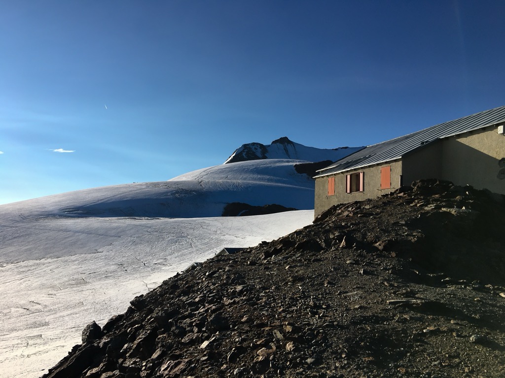
The first ascent took place in 1804 at the request of Archduke John of Austria. Josef Pichler from Val Passiria Valley was the first to summit. He approached from the northwest flank; the ascent is marked in history as one of the Eastern Alps’ mountaineering marvels. There are multiple routes up Ortler; the most common routes begin at Payer Mountain Hut, following the north route, or tracing the East Ridge.
The Ortler Alps are host to ski touring, ice climbing, and multi-day hiking routes, to mention just a few of the possible activities.
Ortler, the regional prize, is a popular destination but not for the faint of heart, as the climbing routes are challenging. Mountain huts can be used for ski touring in winter and multi-day hikes in summer. The Ortler Alps are less frequented than other parts of the Alps, so if you want to avoid the crowds, here are a few options for making the most of the range.
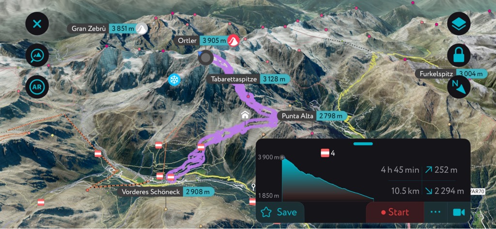
The easiest approach to Ortler’s summit is from the north ridge. Although the most common route, it is still challenging and graded PD+/AD- on the French Alpine Scale (UIAA III-). Meanwhile, the north face contains the largest ice wall in the Eastern Alps and draws many climbers.
The route begins in Solda and passes the Tabaretta Refuge, Payer Refuge, and Tschierfeck Bivouac along the way. At nearly 21 km (13 mi) out-and-back and with over 2,135 m (7,000 ft) of elevation gain, it demands a high level of fitness, with experience roping up on rock and ice.
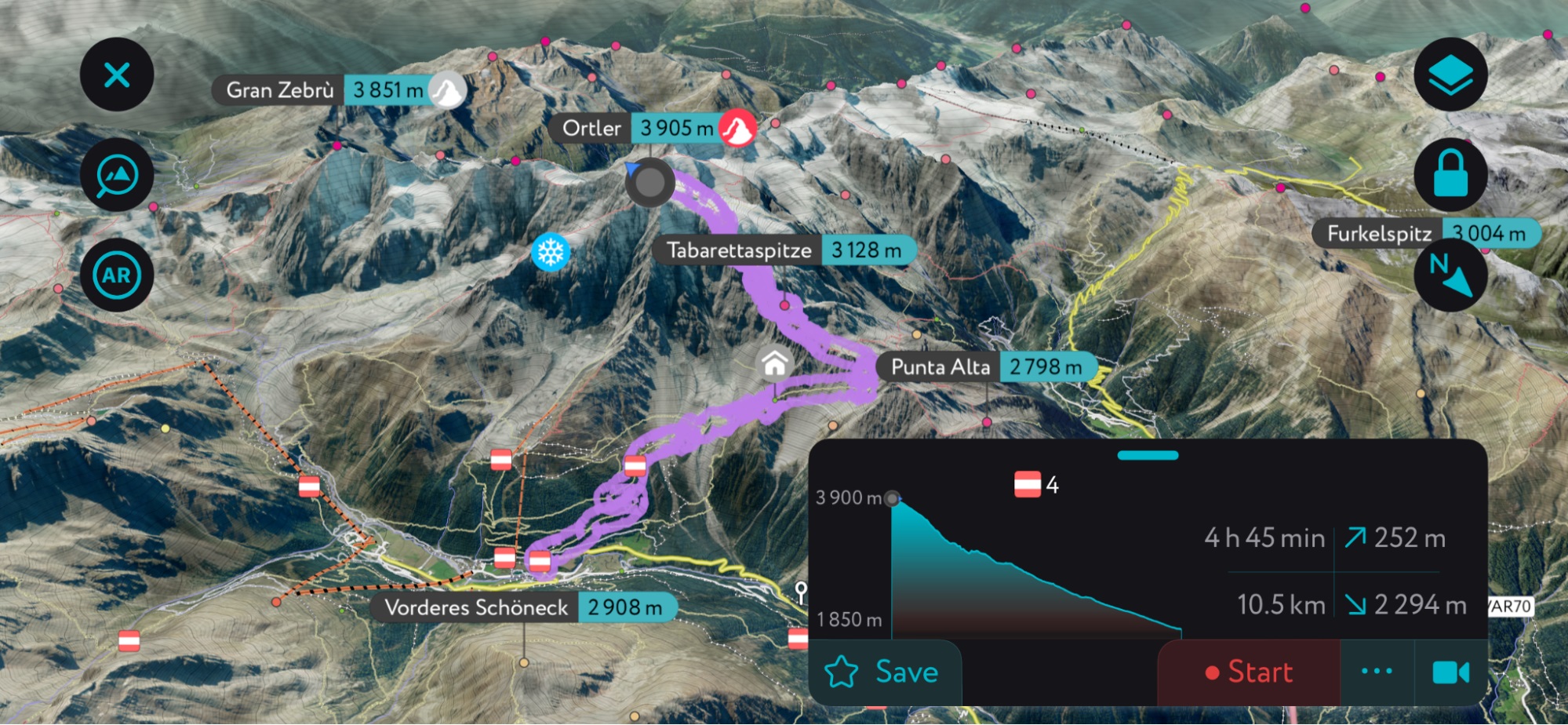
A generation of Ortler’s North Ridge route using PeakVisor’s mobile app. Check out the app to find thousands of routes, trails, peaks, cabins, and even parking areas worldwide. It’s all on here. You can also upload .gpx files if we don't already have a trail on our servers. The PeakVisor app is available for iOS and Android; give it a shot and discover our visually stunning 3D Maps, adding a new dimension to your alpine adventures.
The seven-day Ortler High Mountain Trail forms a 120 km (75 mi) loop starting and ending at Stelvio Pass. The trail opened in 2018 and, still somewhat unknown, lets hikers enjoy solitude in the mountains. The trail is mainly self-guided except for the fourth day. In this section, the route goes from Zufallhütte to Pizzini Refuge, crossing a glacier. It is necessary to hire a guide to cross the glacier. Each night is spent in a hut or hotel, as camping is prohibited within Stelvio National Park.
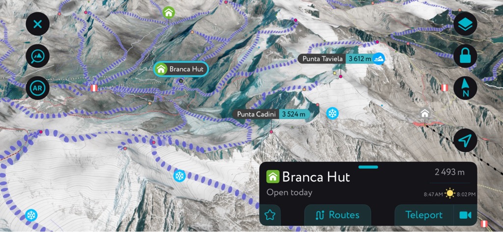
The Ortler Circuit lasts six to eight days, and skiers stay in cozy and well-serviced mountain huts each night. The route crosses some of the region’s best skiing terrain, crossing glaciers and summiting peaks with face-meltingly long descents. Skiers can modify the route to their liking to allow layovers near some of the best ski spots, such as spending an extra night at Branca Hut.

The Branca Hut sits at the nexus of dozens of unforgettable ski tours. The app includes tens of thousands of backcountry ski routes in winter mode. It also offers a detailed information panel with schedules, pictures, and contact information for most of the popular refuges in the Alps.
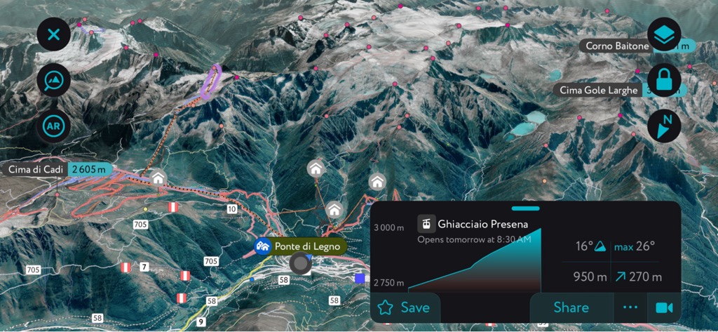
One of the best-known ski resorts in the Ortler Alps is the Ponte di Legno-Tonale ski area. Located between Trentino and Lombardy at elevations between 1,120 and 3,000 m (3,675 - 9,840 ft), the resort connects four ski areas – Ponte di Legno, Tonale, Temu, and the Presena Glacier – and offers something for beginners to advanced skiers alike. Each zone provides something different: trails through pine and spruce forests, along open snowy meadows, or down glaciers bordered by enormous rocks and with sweeping views of the surrounding mountains and valleys.
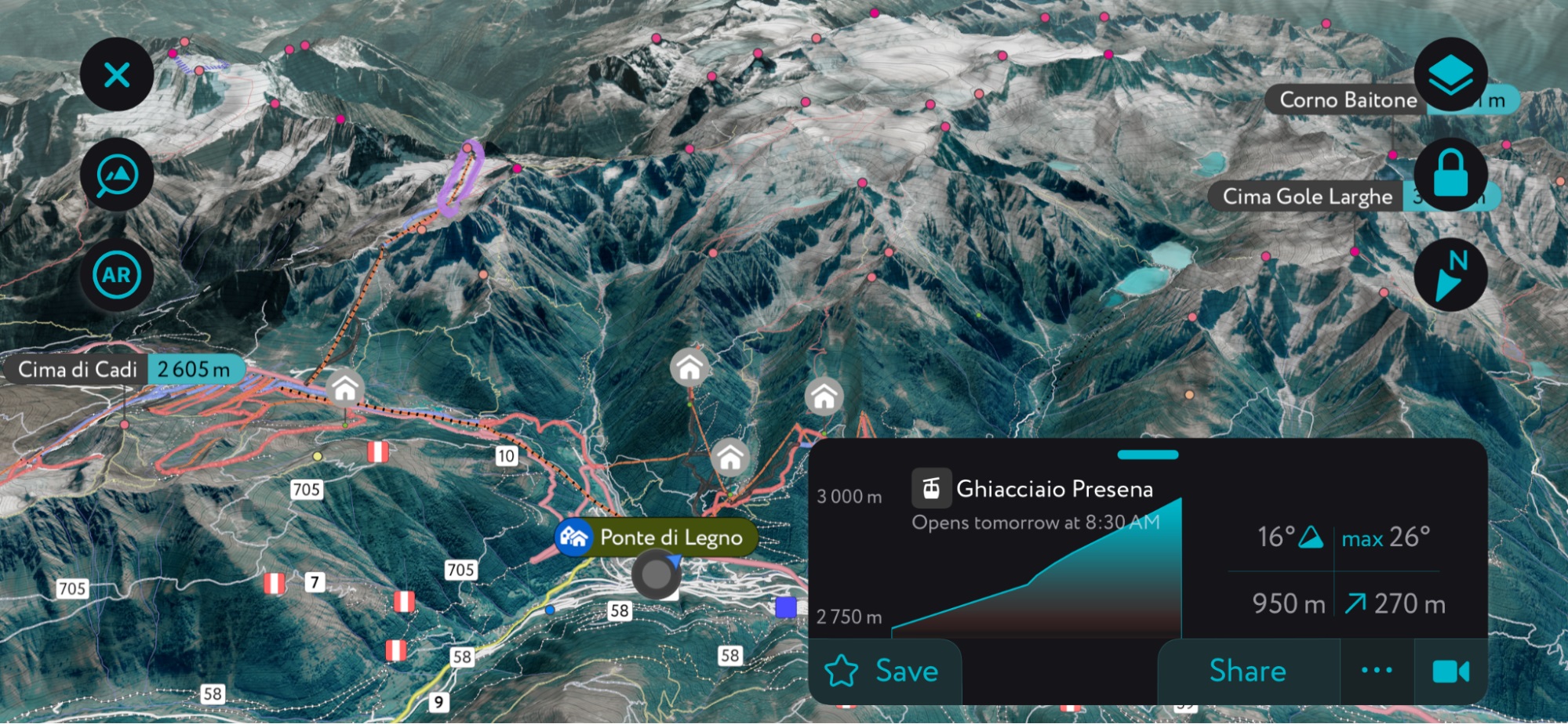
Presna Glacier Ski Resort on the PeakVisor App
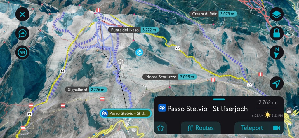
Passo Stelvio is a little gem near the village of Sulden, in the valley below Ortler. It is only open during the summer and offers an entire ski season from June to November. Its glaciated north face reaches about 3,500 meters (11,500 ft), so it holds snow. At 47 euros, Passo Stelvio boasts one of Europe's more affordable lift tickets for summer skiing.
If you get bored of the mellow, open-faced slopes, just be thankful you’re not pedaling your bike up the sinister Stelvio Pass road leading to the resort's base.
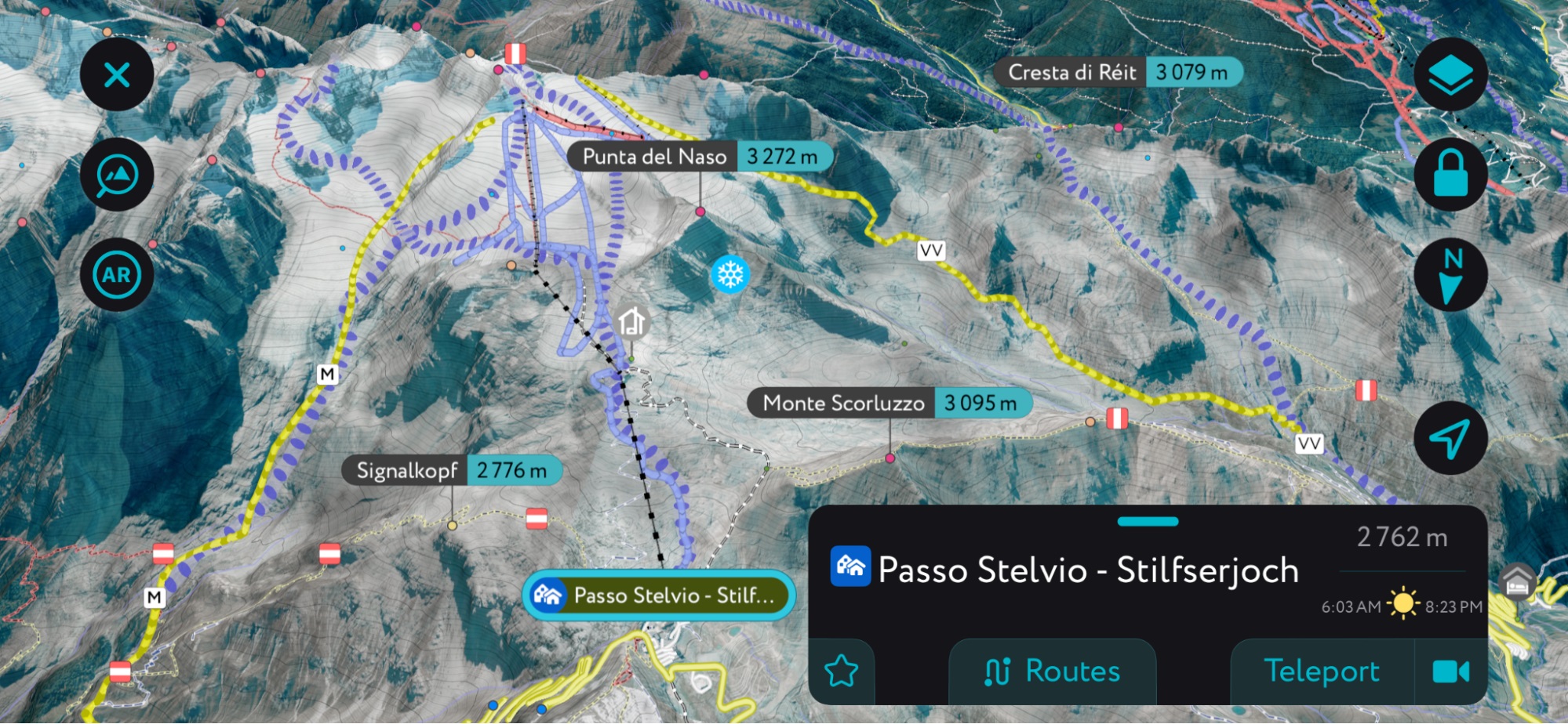
Passo Stelvio Ski Area on the PeakVisor App
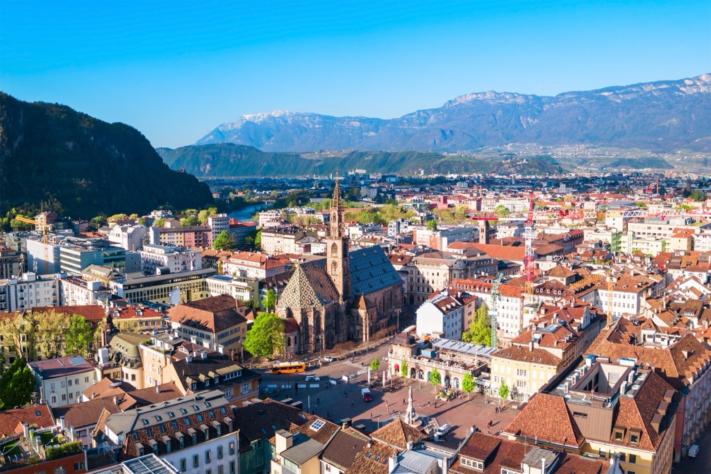
Bolzano is the largest city in South Tyrol, with a population just shy of 110,000. The city is sometimes called the gateway to the Dolomites and has lots to offer in terms of mountain access and culture. The city is more multicultural than other parts of Italy, with blended German, Italian, and Austrian influences.
There’s impressive architecture, such as the largest Gothic church in South Tyrol and the Franciscan Friary. In winter, the city’s historic center houses Italy’s largest Christmas market. The Archeological Museum in town details the region's history dating back to the Stone Age.
Surrounded by mountains, the Funivia Colle-Bolzano cable car takes you up to Colle dei Contadini, a village about an hour’s walk from the city. The Dolomites are nearby, offering everything from easy hikes around Lake Garda to more challenging summits.
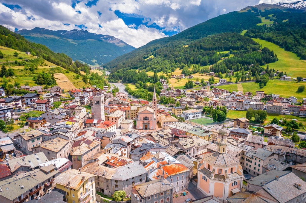
Bormio has a population of 4,000 people and lies west of the range. It’s part of Valtellina in Lombardy, the Italian-speaking part of the park, and is one of the most famous resorts in Stelvio National Park. Skiing in winter, trekking in summer, spas in all seasons, and with a historic center – there’s plenty to do while staying here.
In winter, visitors have access to over 50 km (30 mi) of slopes and a snowpark. They buy a single pass that is valid at Bormio ski resort and the nearby Santa Caterina and Oga San Colombano resorts.
Summer opens a world of hiking opportunities. Easy trails wind around town while strenuous treks ascend towards Ortler and Stelvio Pass. In cycling, Stelvio Pass is one of the most challenging parts of the Giro d’Italia.
If you’re taking a break from the mountains, wander through town past the Alberti Tower, the Church of Sant’Ignazio, and the PIazza Cavour. Nine springs feed the thermal baths of Bormio; check out Bagni Vecchi with its Roman baths and panoramic pool, or Bagni Nuovi with a more modern feel.
Trafoi, located north of Ortler, is home to only around 120 people, but it’s a popular starting point for the Stelvio Pass Road and ski touring. The village is in Venosta Valley – a picturesque valley with plenty of local cuisine and cultural tradition. Explore beyond Trafoi to other villages; Val Venosta offers scenic walks, bike routes, and local restaurants.


top50
ultra
glacier
italy-ultras
top50
ultra
glacier
italy-ultras
The highest peak in the Ortler Alps is Ortler, at 3,905 m.
The Ortler Alps have 425 named peaks.


