
Scan the QR code and open PeakVisor on your phone
The Pelmostock include 30 named peaks. The highest is Pelmo at 3,172 m. Other notable peaks include Spalla Sud, Spalla Est and Monte Pelmetto.
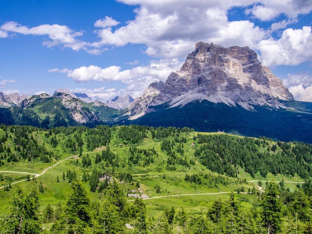
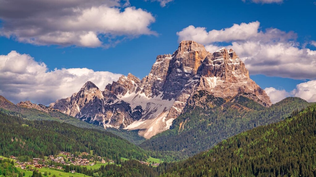
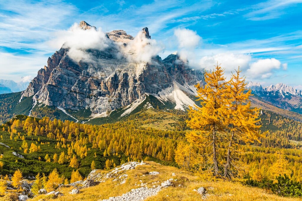
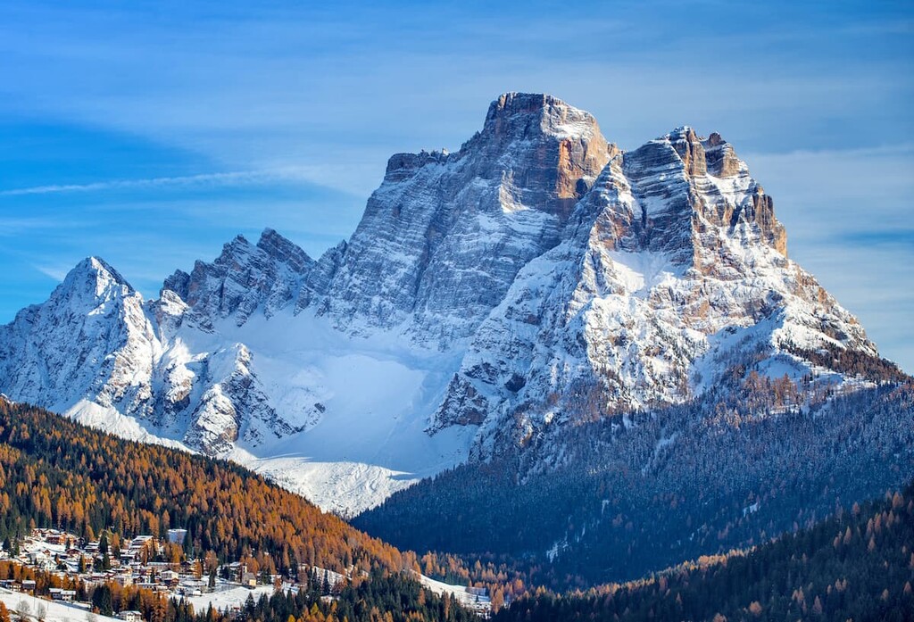
The Pelmo or Pelmostock is one of the most popular places among tourists in the Dolomites in northern Italy because of its central location, fortress-like shape, and rich climbing history, as well as the dinosaur footprints you can see hiking one of the trails. In total, there are 30 named mountains in Pelmo. The highest and the most prominent mountain is Pelmo (3,172 m / 10,406 ft).

The name “Pelmo” is the Italian version of the Ladin word pelf, which means “large and compact rock.” In fact, this name describes the shape of this mountain group with great accuracy. Ladin is the language of the native people of the Dolomites, who live in the five valleys in the central part of the range.
In the local dialect of the Cadore region, where Pelmo is located, the mountains are also called Pelego, which means the same thing.
The Pelmo Group is located entirely in the Italian province of Belluno in the Veneto region. This makes it different from many other Dolomite mountain groups that are located on the border with the Trentino / South Tyrol region.
From an administrative point of view, the boundaries of the Pelmo are defined by the four large valleys that surround it: The Zoldo Valley to the south, the Cadore Valley to the east, the Boite Valley to the northeast, and the Fiorentina Valley to the west.
The valleys are connected by two passes, Cibiana Pass (1,530 m / 5,019 ft) in the east and Staulanza Pass (1,773 m / 5,816 ft) in the west.
Reaching the Pelmo group from the city of Belluno, which is the capital of the Belluno province, by car takes about an hour (53 km / 32.9 mi). The closest way to Belluno, in turn, is from Venice. This journey from Venice to Belluno takes another hour and 15 minutes (107 km / 66.4 mi), giving the entire journey a total distance of about two and a half hours and 160 km (99.4 mi).
What is unusual for the Dolomites is that you can also get here by train, taking the route Venice—Feltre—Belluno—Calalzo di Cadore. From there you must take the bus to ride 22.5 km (13.9 mi) or 30 min to San Vito di Cadore, at the foot of Pelmo.
From Belluno, the main local transport company, Dolomiti Bus, runs buses all over the province.
All things considered, it is not too far of a journey to see and hike in one of the major mountain groups in the Dolomites. This is the case even if you are not already in Venice and you have to travel from London, Paris or Moscow, like I did 10 times before moving here.
The geology of the Pelmo Group has many features in common with other groups in the Dolomites. These mountains are composed of the mineral dolomite, which, in turn, was named after the French scholar Déodat Gratet de Dolomieu. Dolomieu was the first to study and describe the structure of dolomite in detail in an article for a French academic journal.
Dolomite is a mineral that belongs to the limestone group. However, it differs from other limestones insofar as it has a more solid composition. It also has a different thickness of layers, and other unique characteristics.
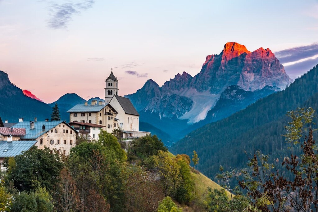
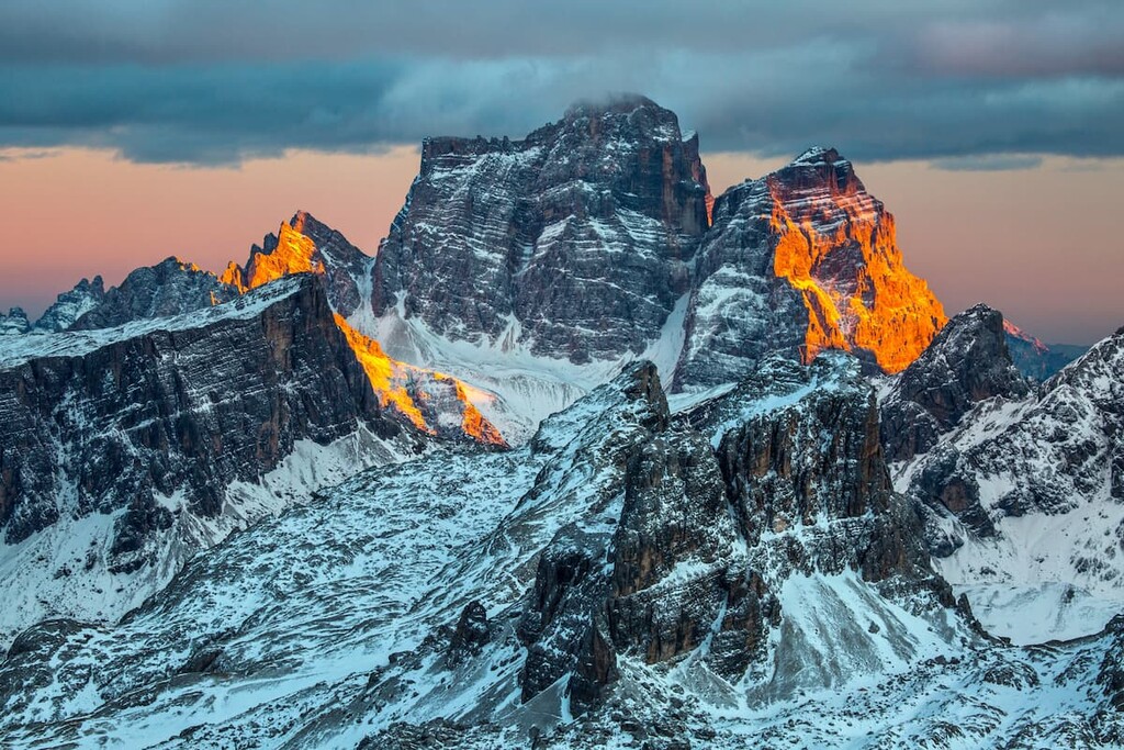
But among tourists, dolomite is known for its ability to absorb the sunlight, turning it into different shades of orange and pink at sunset. This attracts millions of tourists a year, as do the unusual shape of mountains like Pelmo and, of course, the endless possibilities for outdoor activities in the region.
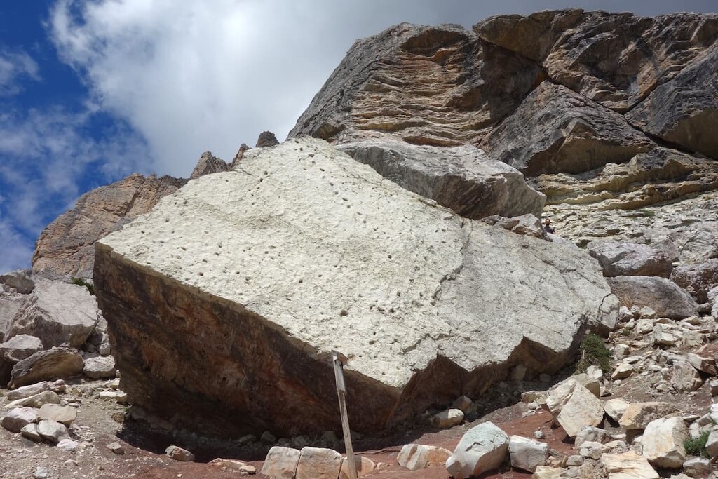
Like all the rocks on earth, the dolomite in the Pelmo group is very old. It began to form around 220–250 million years ago, in the Triassic period, when the dinosaurs walked the earth. The most interesting thing is that it is right here in Pelmo that there is clear evidence of this—a series of dinosaur footprints in the Pelmo rock you can see on one of the trails that will be discussed later in this guide.
If you don’t get a chance to hike Pelmo, but you are in the area and want to see these footprints, a fragment of this rock, as well as other exhibitions dedicated to the geology and human history of these places, can be seen in the Museo Vittorino Cazzetta in the village of Selva di Cadore, northwest of Pelmo. The stone was found by local scientist Vittorino Cazzetta di Pescul at an elevation of 2,050 m (6,725 ft), not far from the rifugio Passo Staulanza.
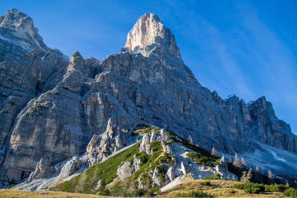
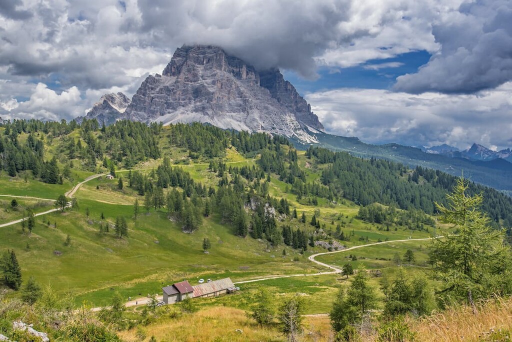
The landscape of the Pelmo group consists of its main summit, Pelmo, which is located in the very center of the group.
This is a monolithic mountain, which looks like a lonely tower separated from the other mountain groups by the five valleys I mentioned before.
But if you look at the mountain from above on the map, you can see that at the top of the tower is not flat—there is a glacial cirque, which even contains some snow and ice in the summer. So in the end, the mountain looks more like a chair. Because of its size (we’re still talking about a 3,000-meter / 9,842-foot high mountain), Pelmo is also unofficially often called “God’s Armchair.”
There is even a legend among the locals about this, that God created all the other surrounding mountains first and Pelmo last so he could have a place to rest before further creations. That’s why he created the mountain in the form of an armchair.
The majestic landscape of Pelmo is also complemented by several other large and high peaks, including Pelmetto (2,990 m / 9,809 ft) or Little Pelmo in English, and Cime di Forca Rossa (2,724 m / 8,937 ft), respectively.

Like other parts of the Dolomites, this mountain group cannot be imagined without the neighboring groups and peaks that surround it.
In the case of Pelmo, these are Civetta (3,220 m / 10,564 ft) to the southwest, Antelao (3,264 m / 10,709 ft) to the east, and Sorapiss (3,204 m / 10,515 ft) to the southeast. Finally, Cima Ambrizzola (2,715 m / 8,904 ft) of the Croda da Lago group is located to the north and Schiara Group (2,564 m / 8,415 ft) and Bosconero (2,464 m / 8,100 ft) is situated to the south and southeast.
The Pelmo belongs to the Dolomites according to both of the common classifications of the Alps: the Austrian-German AVE and the Italian SOIUSA. The group is also one of the nine major systems of the Dolomites according to the UNESCO classification where it has number 1 along with the Croda da Lago.
The mountain group can be divided into two main parts:
Here’s what you need to know about the main peaks in the Pelmo group:
Pelmo is the tallest and most massive, and, therefore, the main mountain of the group. In addition to its unique shape, Pelmo is also widely known for being the first climbed mountain in all the Dolomites.
Yes, the first notable peak ascent in the Dolomites was achieved on Pelmo, and only afterward did climbers venture higher and more famous peaks, like Marmolada (3,343 m / 10,968 ft), Tre Cime di Lavoredo (2,999 m / 9,839 ft), Sella (3,152 m / 10,338 ft), and others.
The climber who achieved this first ascent, which took place on September 19, 1857, was the Irish naturalist and mountaineer John Ball. Ball was also known as the author of the first cartographic guide book in the Dolomites, Dolomite Alps (1873), thanks to which, among others, these mountains became popular with tourists.
Today, Pelmo continues to attract climbers who take the classic southwest route Via Normale, which was opened in 1977 by Italians Franco Miotto, Riccardo Bee, and Giovanni Groaz.
Pelmetto is the second most important (but not the highest) peak in the Pelmo Group. It is located to the southwest of the higher peak.
The mountain was first climbed by a group of three climbers, Clemente Callegari, Angelo Panciera, and Angelo Panciera, in 1896. The mountain impressed them with its 1,100 m (3,608 ft) high north face.
Pelmetto is a solitary and uncommonly frequented peak, although there are numerous routes on its walls. Furthermore, it is also a classic climb of medium difficulty with a total wall height of 850 m (2,788 ft).
The other highest peaks among the top 10 summits in the Pelmo group include Col Alto (2,145 m / 7,037 ft) and Monte Sopra Tiera (2,143 m / 7,031 ft), which are number 9 and 10 in the list.
There are about a dozen of great trails and routes of different distances and levels of difficulty in the Pelmo Group. This includes the climbing route to the top of its highest mountain—Pelmo. Here’s a quick look at the best routes in the mountain group:
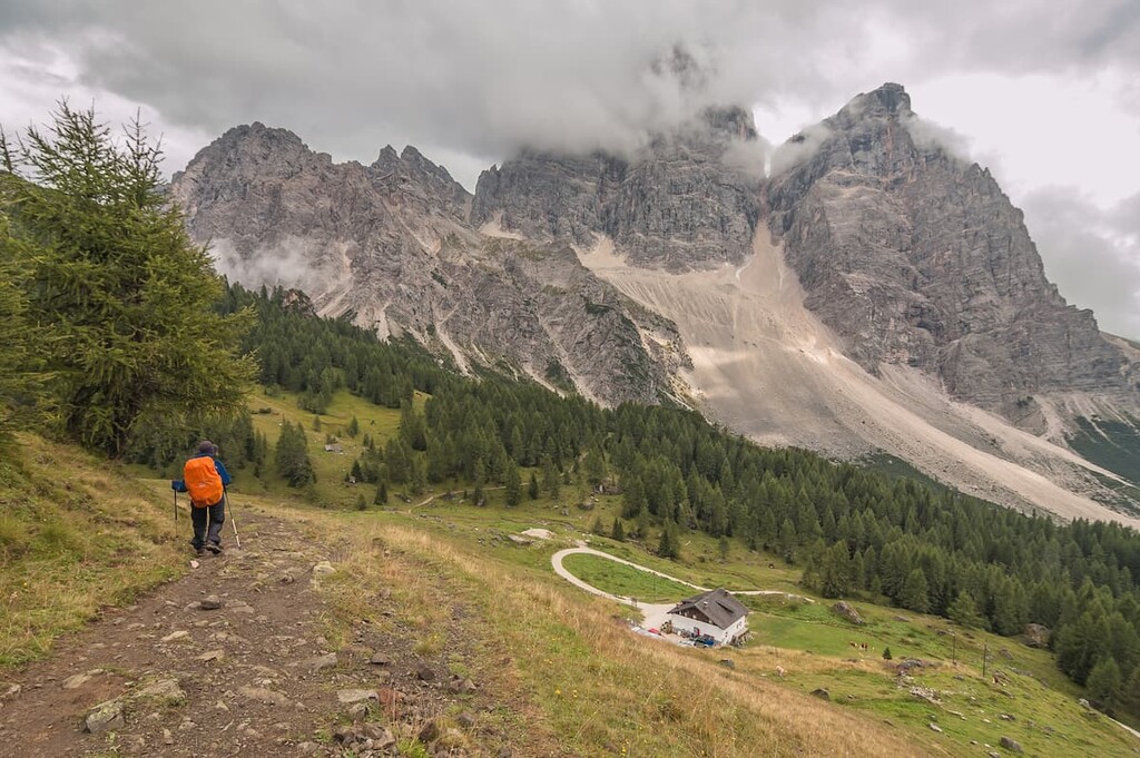
The Mount Pelmo Loop Trail is the best-known and most popular route in the Pelmo Group, which encircles both Pelmo and Pelmetto. The route can be done in either direction, clockwise or counterclockwise, in one day or in two days. In the latter case, you can spend the night in one of the rifugios in the group.
The Dinosaurs Footprints on the Pelmo Trail is an easy route to a huge rock at the foot of Pelmetto, where you can see real dinosaur footprints. The route starts in the same place as the trek around the entire Pelmo Group, at the Staulanza Pass.
From there, take Trail #472 (part of the long Alta Via 1 trail), following the signs to the southern tip of Pelmetto until you take the steep uphill path to reach the rock. Do not be afraid, you will not miss it, because it stands out in the landscape very much as a result of rockfall in this area.
The Hike to "Museum in the Clouds" on the Monte Rite is an easy route to the museum created and named after one of the most famous mountain climbers in the world: Reinhold Messner.
This is one of the six branches of the larger Messner Mountain Museum, which was built in 2020 on Monte Rite on the southeastern border of the Pelmo Group. This museum is considered to be the highest elevation museum in the country and therefore, it is only open during the summer, when it is accessible without snow. Its other official name is the “Dolomites Museum.”
The museum is housed in a former small defensive building called Fort Monte Rite. Messner found the fort in 1998 while traveling through the region. During WWI, it was an ideal position from which the Italians could defend their territory and fight against the Austro-Hungarians.
However, the main theme of the museum is not war history, but the history of climbing discoveries, first ascents, and new routes made by Michael Innerhofer, Angelo Dibona, Emilio Comici, and other famous climbers in the Dolomites.
This theme is revealed through the museum’s collections of various items of mountaineering equipment, fragments of rocks, and installations, as well as its gallery that features a collection of paintings of the Dolomites from the Romantic era.

Also, at the top of the mountain, there is a special viewing platform called “Balcone Panoramico Dolomiti Unesco — Monte Rite” in Italian. It is one of the several such platforms, where you can have a 360-degree view of many mountains in one place.
Alta Via 1 is one of the two longest alpine hiking trails in the Dolomites, on par with Alta Via 2, which is 125 km (77.6 mi) long and takes 12 days to complete.
If you start from Lago di Braies in South Tyrol, you will arrive at the rifugio Città di Fiume from the rifugio Nuvolau by day 5. It will take you the next day to cross Pelmo to come to rifugio Palafavera via rifugio Venezia, so it’s the perfect extended adventure.

Another option is to hike a less popular route—Alta Via 3. It is 100 km (62.1 mi) long and takes 8 days to complete. Similarly, if you start from Villabassa / Niederdorf in Pusterìa Valley in South Tyrol, you will arrive at the same rifugio Venezia from the rifugio Vandelli in the town of the San Vito di Cadore by day 5.
It also will take you the next day to cross the whole Pelmo group until you reach rifugio Remauro at the Forcella Cibiana at the southeastern end of the group of Pelmo.

The Via Normale is a classic climbing route to the summit of Mount Pelmo in the footsteps of its discoverer, John Ball. The route crosses diagonally the south face along with the Cengia di Ball (John Ball Ledge) with climbing that’s graded at about UIAA II (5.2 in the Yosemite Decimal System).
It is long and difficult due to the remarkable length and vertical height gain. It is recommended to hire a local alpine guide in the Zoldo Valley if you are not already a confident and accomplished mountaineer.
Spending a night in a mountain hut is as important a part of the Dolomite experience as the hike itself. At the base of the Pelmo there are at least four refuges, where you can stay overnight and have a place (bed) in a dormitory room for around €20–25. Or you can get a half-board (stay plus dinner and breakfast) rate for around €50–60 per person per night.
Rifugio Venezia—Alba Maria de Luca at Pelmo (1,947 m / 6,387 ft)
74 beds, including 6 beds in a winter bivouac
Prati di Rutorto, 32040 Vodo di Cadore BL, Italy
+3904369684
Rifugio Città di Fiume (1,918 m / 6,292 ft)
25 beds, including 2 beds in a winter bivouac
Localita Malga Durona, 32040 Borca di Cadore BL, Italy
+393200377432
Rifugio Passo Staulanza (1,766 m / 5,793 ft)
33 beds in double, triple, and dormitory rooms
Localita Passo Staulanza, 1 Val di, 32012 Zoldo alto BL, Italy
+393387900120
Rifugio Palafavera (1,525 m / 5,003 ft)
Double, triple, and family rooms
Localita Palafavera 1, 32012, Val di Zoldo, BL, Italy
+390437789133
There are some other huts in the Pelmo group in its southern part: rifugio Aquileia, rifugio Remauro, rifugio Dolomites—Monte Rite, and rifugio Giampietro Talamini.
For those who are looking for some alternatives, there are also several campsites on the western side of the Pelmo in the Fiorentina Valley. These are a great alternative to mountain huts for those who travel with their own car, those who want to save money, or those who simply enjoy campsites. These include Campeggio Cadore, Campeggio Palafavera, and Camping Civetta.
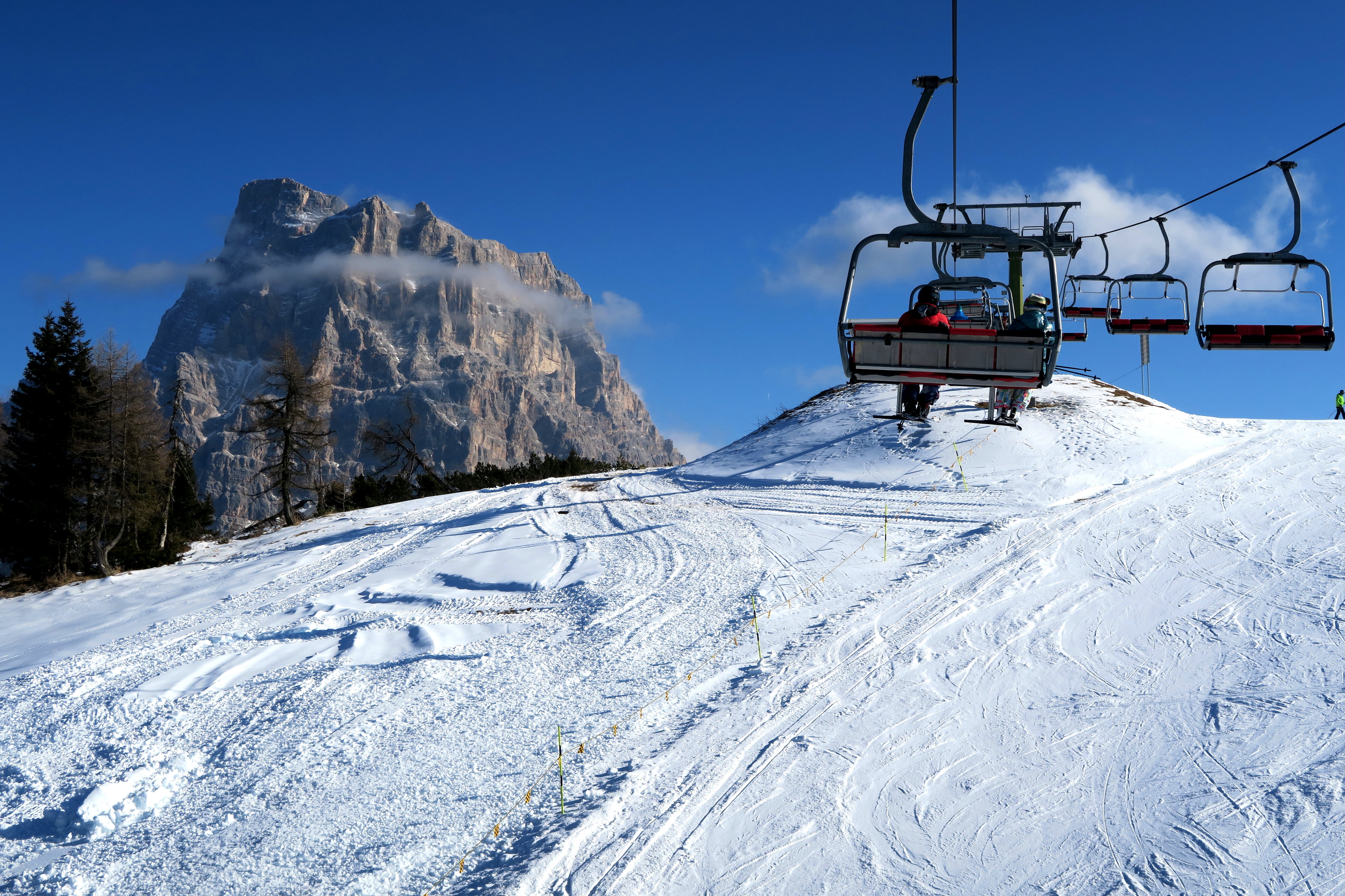
Mount Pelmo itself does not offer ski runs, but the nearby Civetta Group is the eponymous Civetta Ski Resort, one of 12 in the Dolomiti Superski system. It is also the largest ski area in the entire Veneto region. It has more than 45 km (28 mi) of slopes and more than 20 ski lifts in total. You'll have a great view of Pelmo, which is even better than if you could ski down the mountain itself.
Check the Pelmo ski resorts map on the larger Veneto and Italy ski maps in the World Mountain Lifts section of the site. It includes information about open ski lifts / slopes in the Pelmo Group of the Dolomites in real-time with opening dates and hours. There are also year-round cable cars, funiculars, cog railways, aerial tramways, and all other types of mountain lifts.
If you need more information during your visit to Pelmo, visit one of the tourist centers in one of the valleys around the group—Fiorentina or Zoldo, for example. In any case, it is useful to go into them to take a paper map as not only a means of navigation but also as a memorable souvenir, or to ask the center staff for advice for your journey.
Here are some of the best info points in the region:
Val Fiorentina Tourist Office
Piazza S. Lorenzo, 3, 32020, Selva di Cadore BL, Italy
+390437720243
General opening hours: daily 9:00–12:00 and 15:30–18:30
Tourist Office Forno di Zoldo in the Val di Zoldo
Via Monte Civetta, 4b, 32012, Val di Zoldo BL, Italy
General opening hours: daily 9:00–12:00 and 15:30–19:00, closed on Wed.
+390437789145
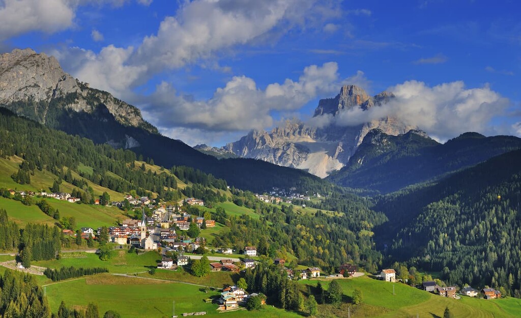
The nearest village to the Pelmo Group can be found in the Fiorentina Valley. It is called Mareson–Pecol. However, it is a small village without many attractions, so for the night before and after the hike and to explore other places it is better to choose a larger settlement, such as Val di Zoldo in the valley of the same name in the south of the group.
This is a new Italian commune that was formed in 2016 by the merger of the villages Zoldo Alto and Forno di Zoldo. The commune also includes smaller settlements (frazione in Italian): Astragal, Bragarezza, Calchera, Dont, Dozza and others, Foppa, Fornesighe, Pieve, Pra, Pradel, Pralongo, and Sommariva, among others.
Val di Zoldo is located at an elevation of 848 m (2,782 ft). It is located about 25 km (16 mi) north of Belluno and about 100 km (62 mi) north of Venice. The city has 2,784 inhabitants (2004) in an area of 79.9 sq km (30.8 sq mi).
The name Zoldo Oven refers to the main specialization of the village in the past: The local blacksmiths were actively mining and making iron. For example, the Republic of Venice used the nails produced in Zoldo to build its ships and wharfs. Today, however, the village survives largely on tourism.
The main cultural and architectural attractions of Zoldo are many churches including Sant'Antonio (1454), San Francesco (1570), Santi Fabiano e Sebastiano (1595), San Rocco (1633), Santi Ermagora e Fortunato (1739).
Additionally, the Capitanito Palace (Palazzo del Capitanito), belonged to a noble family from the capital of the province Belluno. The community is also home to various "tabia"—traditional Alpine barns for livestock and tools, which you can see all throughout the Dolomites.
In general, the Zoldo is an example of the presence of the Republic of Venice in the Dolomites and of course of the way of life of the local inhabitants of this part of the Italian Alps.
The official tourist site of the town is Valdizoldo.net.


The highest peak in the Pelmostock is Pelmo, at 3,172 m.
The Pelmostock have 30 named peaks.


