Scan the QR code and open PeakVisor on your phone
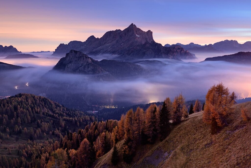
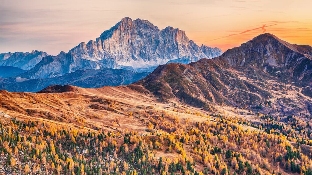
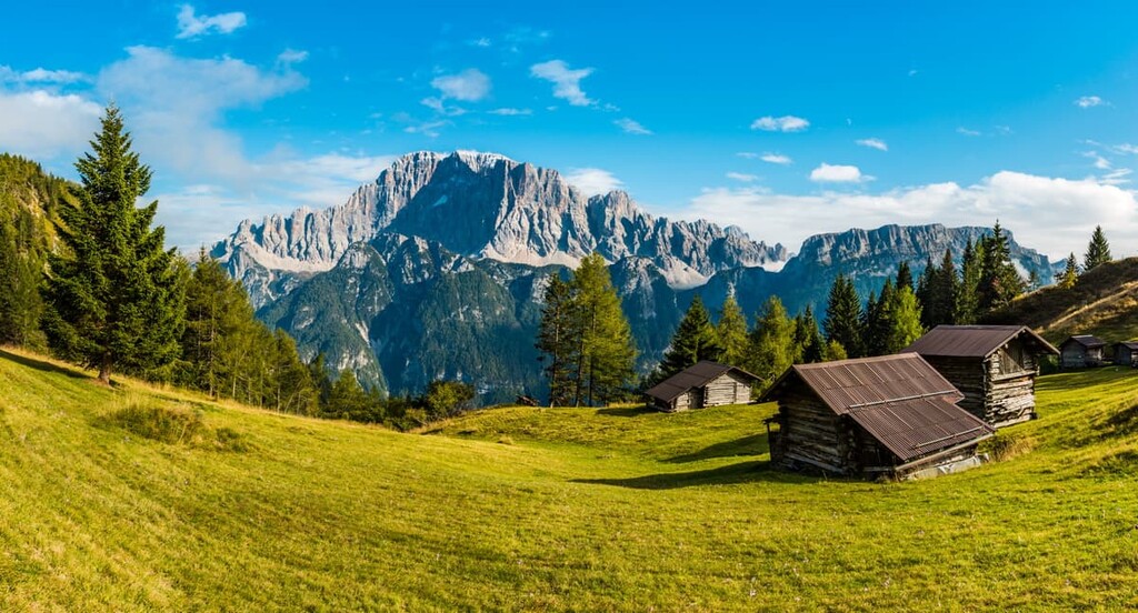
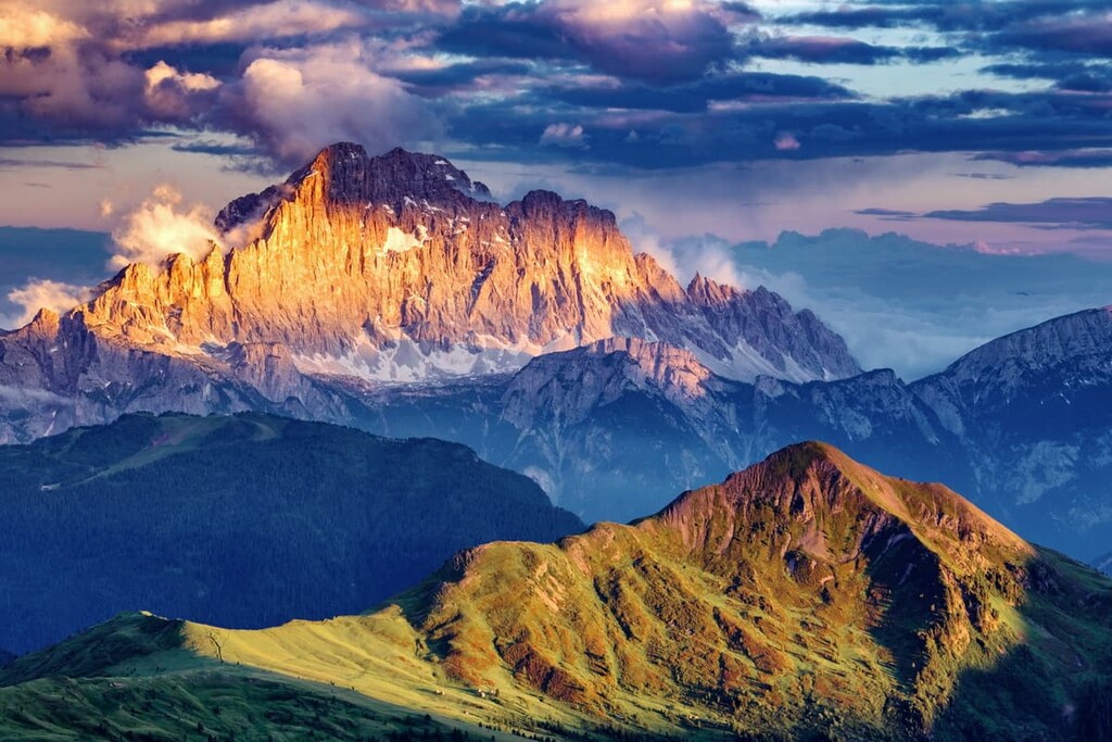
Monte Civetta stands out among other groups in the Dolomites in the north of Italy both because of its shape and its size. It is a huge group with an amazing northwest face that’s 1,200 m (3,937 ft) high. For this reason, it is called “The Wall of All Walls” of the Dolomites and it has attracted climbers and hikers from all over the world for centuries. In the winter, it’s also a major ski resort. In total, there are 78 named mountains in the Civetta Group. The highest and most prominent peak is Monte Civetta (3,220 m / 10,564 ft).
As the author of this guide, and as someone who is in love with the Dolomites, I always have an English-Italian dictionary with me. Perhaps you do, too. Type the word “civetta” and you get the translation—“owl”. That's exactly how the name of the mountain is translated.
Most likely, it came from the fact that the northwest face of the mountain resembles an owl in flight with its wings open. But I think it is an owl’s head with sharp eyebrows, which extend from the beak around the huge eyes (which we are missing on Civetta but one could just as easily imagine them). Anyway, the mismatch is only in size. It is a “small owl” (Athene noctua), at the time Mount Civetta is one of the largest in the Dolomites.
The mountain was also historically called Zuita in the Ladin language, which is spoken in the valleys on both sides of it, including on maps from 1774. It is no longer known where this word came from but possibly from the Latin word “civitas”, which means “city with towers”, with which you can also find similarities in this mountain.
Note: there is no typo in the paragraph above. The Ladin language is spoken by the natives of the five valleys in the Dolomites. Meanwhile Latin (rather than Ladin) is a classical language that is the root of both Italian and Ladin, among other languages.
The entire Civetta Group is located in the province of Belluno in the Veneto region, making it truly Italian. Meanwhile, many other groups in the Dolomites are located on the border with Trentino—Alto Adige / South Tyrol—an autonomous region within the territory of Italy. Before World War I was part of Austria. It was also the independent Kingdom of Tyrol.
It seems to me that Italians are more proud of Civetta than of other groups like Tre Cime di Lavaredo or even Marmolada, which is located on the border. But that's just my feeling after almost two year of living here. In general, locals love home mountains more, even if they are smaller and less famous than some of the more distant ones.
You can get to Civetta from the nearest large town, Belluno, which is the capital of the province of Belluno. The route covers just 46 km (28.5 mi) and takes about 48 minutes by car. The faster and easier way to come to Belluno, in turn, is from Venice—108 km (67.1 mi) or 1 hour and 20 minutes by car. In total, the trip is around 155 km (96.3 mi) in length and 2 hours long.
In addition to renting a car at Marco Polo International Airport in Venice or International Airport Treviso A. Canova in Treviso, or Verona Villafranca Airport in Verona (another option just nearby), it is also convenient to travel to Civetta from Belluno by bus. The main local company is Dolomiti Bus, which connects all the region’s towns. On the Venice—Treviso—Belluno route you can also use Trenitalia trains.
Small advice for cycling fans: You can take bikes to any train, but keep in mind that according to the new rule of the Dolomiti Bus company, you can't put your bicycle in the luggage compartment of the bus. Before, I used to do this trick to get to some high altitude pass easier and only to ride down from it (an amazing experience, isn't it?!).
The new rule was just explained to me in July 2021, and it is a result of the fact that bus drivers are afraid to damage the bike while driving because then they would have to pay for the damage, and many bikes now cost at least €2,000–3,000. There is some truth in it, but it is a strange rule, in my opinion.
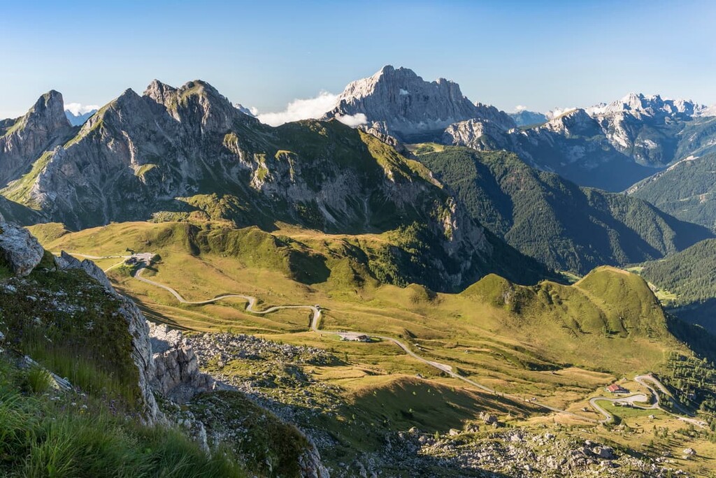
By the way, the two major passes around the Civetta Group are Duran Pass (1,601 m / 5,252 ft) on the southeast and Staulanza Pass (1,773 m / 5,816 ft) on the northeast.
In 2009, the Dolomites, including Mount Civetta, were recognized as a World Heritage Site by UNESCO. During that time, UNESCO identified nine major groups of different sizes in the Dolomites, based on one criterion: The geological uniqueness.
According to this classification system, Civetta belongs to one of the two largest groups called Pale di San Martino, San Lucano, Dolomiti Bellunesi, Vette Feltrine, whose total area is 316.6 sq km (122.2 sq mi). From the name of the group, it is easy to identify the other nearby mountain groups.
UNESCO also calls this group “The Largest Island in the Dolomite Archipelago.” Why? Because in the Triassic period, the Dolomites were atolls or coral reefs in the ancient tropical ocean Tethys. That’s how, 220–250 million years ago, the mineral dolomite began to form, which gave these mountains their name.
Over millions of years, the water went away and the islands turned into mountains by a series of changes that resulted from volcanoes, wind, and other natural phenomena, and then—by man, who later became part of the landscapes that we see today.
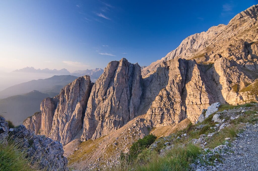
I have already mentioned the main landscape feature of the Civetta—the peak of the same name and the northwest wall, for which it is primarily known. It is also a very long wall as it is approximately 4 km (2.3 mi) in length. On one flight over the Dolomites from Verona to the north, I even managed to see it from the plane—it was a very clear day.
By studying the 3D map of this region in the PeakVisor, you can also see that Сivetta is surrounded by three large valleys: Valle Agordina in the south, Valle Cordevole along the western border of the group, and Val di Zoldo in the southwest.
The valleys, in turn, are formed by wide and full-flowing mountain rivers: Cordevole, Rova, Duran, Fiorentina, and several smaller ones.
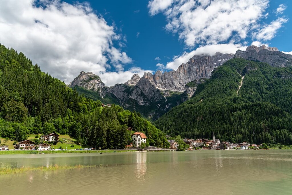
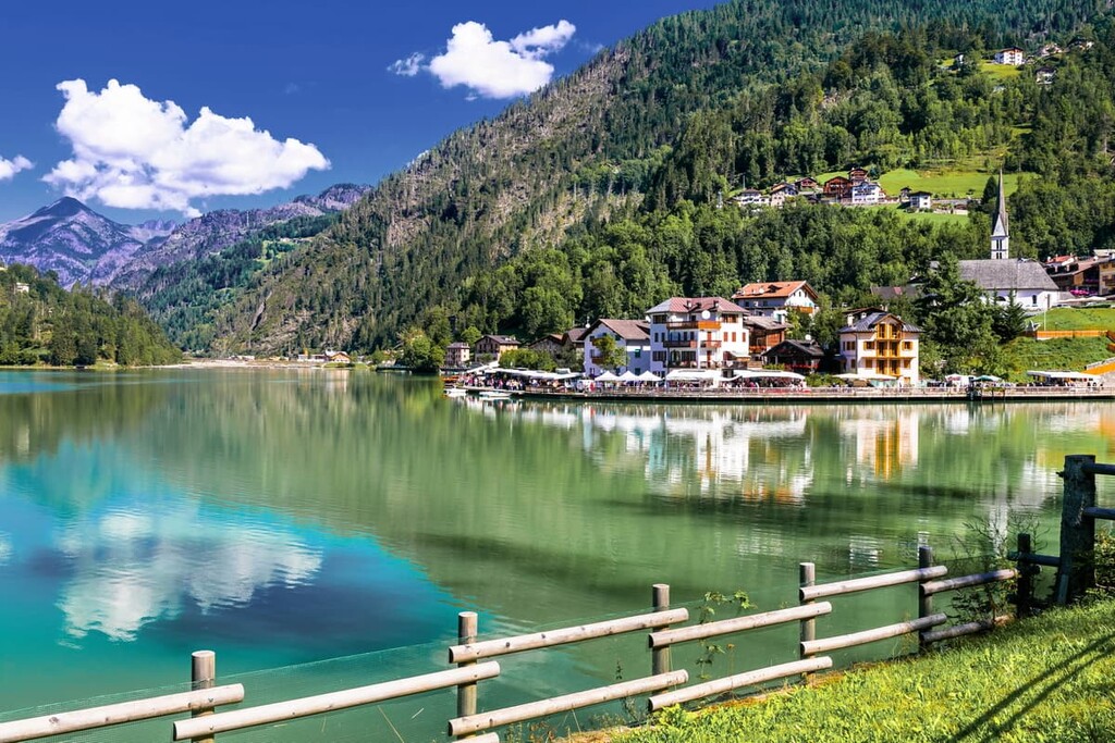
In the north of the Cordevole Valley, there is a large and very beautiful lake called Alleghe Lake. It is the second major feature of Civetta's landscape after its namesake peak.
Unlike many other lakes in the Dolomites, which are of artificial origin as a result of hydroelectric dams, this lake was formed in 1771 by a landslide from the surrounding mountains, which blocked the course of the river.
However, it is not only a beautiful story, but also a tragic one: The landslide was so violent that it destroyed several nearby settlements all at once. Some villages were literally swallowed up by the lake as the water accumulated in it in the next few days.
Since that time, Alleghe Lake is also one of the largest lakes in the Dolomites (0.5 sq km / 0.1 sq mi). Later, the lake was also used for electricity production.
The Civetta Group also borders other peaks and groups:
In other words, traveling to the unique Civetta, you will see many more beautiful and different mountains. This is one of the main reasons I’m in love with the Dolomites.
The Civetta Group belongs to the Dolomites, which is one of the 68 major ranges of the Eastern Alps according to the Austrian-German AVE classification that has been universally accepted since 1984.
In the Civetta itself, there is a central massif with the highest mountain of the same name and an incredible wall, and a few ranges going from it in all four cardinal directions.
The Civetta wall is one of the most outstanding walls of its kind in all the Dolomites, on a par with the southern wall of the Marmolada or the wall of Cima Grande (2,999 m / 9,839 ft) in Tre Cime di Lavaredo, which, incidentally, is one of the six Great North Faces of the Alps. (The north face is a vertical or sloping side of a mountain or cliff.)
If you look at the wall of Civetta from the Alleghe, on the left you find the following peaks:

Meanwhile, on the right, there are Piccola Civetta (3,198 m / 10,495 ft) and Punta de Gasperi (2,994 m / 9,823 m / ft), among others.
There are climbing routes to almost all of the peaks in the central massif, but they are considered difficult. As such, they have attracted climbers for centuries, starting with the first ascent made by the Italian climber Simeone di Silvestro in 1885. It was one of the first major climbs in the Dolomites in tandem with the first ascent of Pelmo.
The first ascent of the famous northwestern wall was made in 1925 by two climbers: Emil Solleder and Gustl Lettenbauer. Another important historical fact is that this is actually the first climb in UIAA grade VI of difficulty in the entire Alps.
There are four long ranges departing from the main massif of the Civetta, or central hub as it is also called. This includes subranges to the southwest, south, and southeast, and one to the north, which includes the above-mentioned peaks around the central hub as well as several others.
Among the ranges, the large Moiazza subgroup in the southeast, makes Civetta an even longer range. In some sources, it is considered a separate group, but in others, including PeakVisor, it is a part of Civetta because of its nearby location.

To understand the structure and the boundaries of the group even better consider though: The southernmost peak of the Civetta is Col Di Foglia (7,49 m / 2,457 ft), the northernmost is Col Della Montagna (1,821 m / 5,974 ft), the easternmost is Col Asinera (1,144 m / 3,753 ft) and the westernmost is Palazza Alta (2,255 m / 7,398 ft).
Among the ten highest peaks of the group we also find on the PeakVisor 3D map:
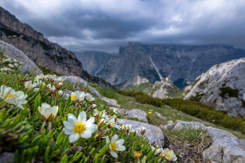
The Civetta Group is also one of the best groups in the Dolomites for hiking, although the word “best” is certainly not an accurate one. I like to say that there are no "worst" mountains in the Dolomites but there are larger groups with a larger variety of routes, including via ferratas. Here are the main routes in Civetta:
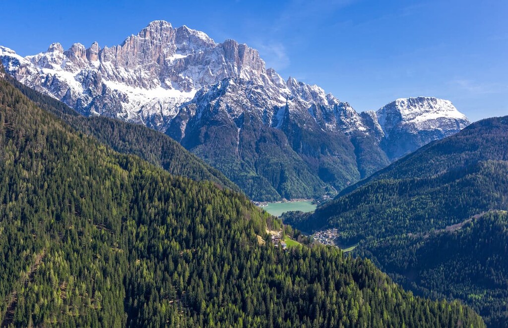
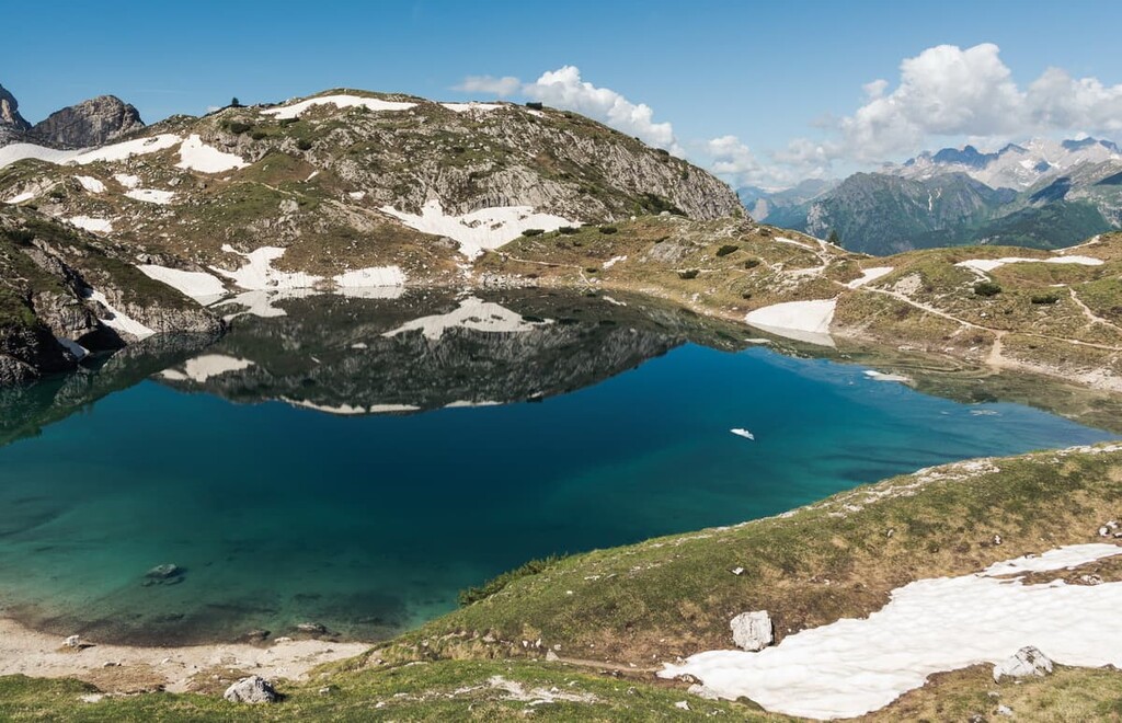
This is an easy hike to another lake in Civetta: Coldai Lake. Unlike Alleghe, this is a small glacial lake located at the northern end of the group in the high altitude Civetta Valley.
It is famous thanks to the Dragon of Coldai, which appears in several Ladina legends. It is about a dragon who flies to this lake to drink from, taking a couple of cows, sheeps or goats on the way back. If you know or study Italian, you can read about this and other Ladin legends in a wonderful book Inside the Mountain The Dolomites Between Legend and Geology (Dentro la montagna. Le Dolomiti tra leggenda e geologia).
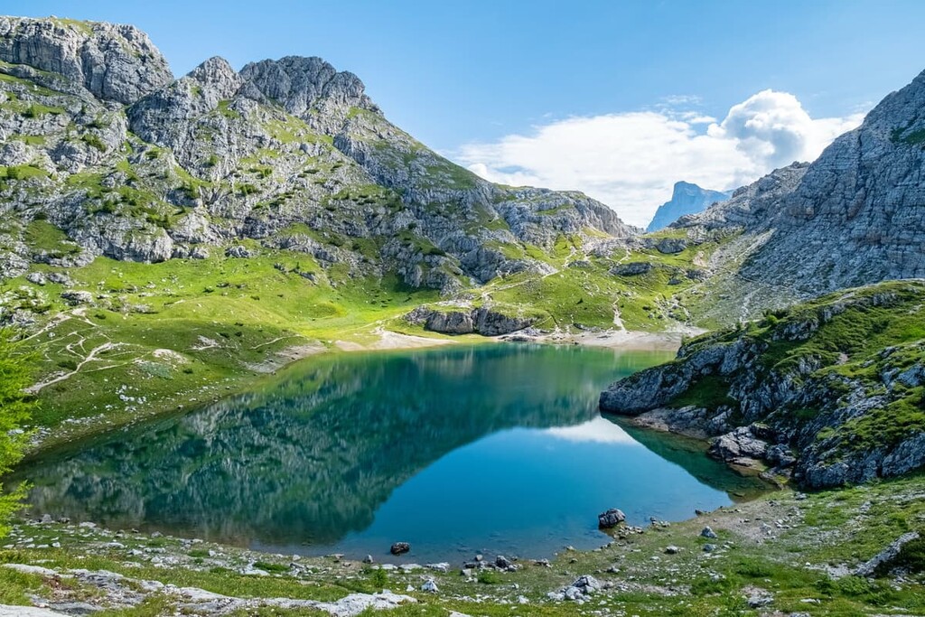
The lake could be easily and quickly reached thanks, among other things, to the Alleghe cable car, which takes you to Col Dei Baldi (1,918 m / 6,293 ft). From here it is only about an hour and a half walk to the lake along the paved road and a trail through Malga Pioda farm and rifugio Sonino al Coldai.
The whole way from Alleghe to the lake without taking a cable car is about 2 hours and 30 minutes or 4.8 km (2.9 mi). You can return the same way or stay overnight in a hut to continue your hiking in the Civetta the next day.
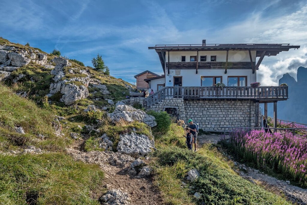
This is the second most popular route in the group to the famous rifugio at 2,250 m (7,381 ft), which offers an amazing frontal view of the northwestern wall of Civetta. You can literally see the mountain right out of the dining room through the large panoramic windows.
You should definitely stay overnight in this rifugio to see the famous enrosadira effect that makes the Dolomites world-famous. Before your eyes, within an hour, Civetta will change color from light gray to deep orange and pink, until it will become purple in the dark.
The same is in the morning, but the colors change in reverse. On my first hike in the Dolomites, in fact, I did just that: I got up at 5 AM., despite the dreadful cold, and waited an hour outside for the sun to appear.
This route can be taken from Alleghe through Coldai Lake to combine the two routes or from the south through the village Masare, the Ru de Rialt waterfall, and the Crep di Casamatta (2,110m / 6,923 ft) and Bec di Mezzodì (2,108 m / 6,916 ft) peaks. It is also possible to do a loop using these two routes.
Transcivetta, as it is called Italian, is the classic route in the group from north to south or vice versa, and one of the longest trails in the Dolomites.
The name doesn’t quite reflect reality. First, you cross the group in its northern part from Palafavera camping in Val di Zoldo to Coldai Lake or refuge, but then walk along the western side through rifugio Tissi and rifugio Vazzoler until you reach Listolade town. So, in my opinion, it’s more of a mixture of two types of routes: the point-to-point and the loop, which makes this track even more unusual.
In theory, then it can be completed in one full day of hiking if you walk very fast and are not intimidated by the climb of about 700 m (2,296 ft) and the total elevation gain of 1,540 m (5.052 ft), not counting the long descent at the end of the trail. But better separate it into two or more days.
The Transchivetta is also a famous fun-filled trail running race that was held in 2021 for the 40th time. It follows almost the same route as the hiking route, though race participants start it at Piani di Pezzè halfway from Alleghe to Lake Coldai rather than in the Zoldo Valley.
Another feature of the race is that you have to take part in it in pairs to support each other while running in case of overwork (or rather say, overrun). It is made like this, because the total length of the race is 23.5 km (14.6 mi) and the elevation gain is an incredible 1,950 m (6,397 ft). That’s why it is considered a very hard race for a general human being.
Alta Via 1 (“The High Route”) is one of the two longest alpine hiking trails in the Dolomites, on par with Alta Via 2. It is 125 km (77.6 mi) long and takes 12 days to complete.
If you start at the very beginning of the route at the Braies Lake in South Tyrol, you will arrive at the rifugio Venezia and/or the Palafavera camping area, which is between Pelmostock and Civetta, from rifugio Città di Fiume between Pelmo and Croda da Lago Group by day 7.

It will take you the next two days to cross the Civetta Group via all the major mountain huts in the group including rifugio Coldai, rifugio Tissi, and rifugio Vazzoler, until you arrive to rifugio Bruto Carestiato at the southeast border of the Moizza subgroup of Civetta.
So, if you hike the entire Alta Via 1, you will not miss Civetta.
This is the most important of several via ferratas in the group leading to Cima Civetta, the highest mountain of the entire group. It is considered a challenging route that will require great physical conditioning and courage in traversing steep sections of rock.
But from the top of the mountain, you will have a great view of the group itself, as well as all the surrounding mountains, including neighboring Pelmo, Croda da Lago, and many others. Also, you can spend the night here at the rifugio Maria Vittoria Torrani right at the foot of the peak to see the sunset and sunrise, which is likely to be magical.
You can start the route at Palafavera camping area, but also at Piani di Pezzè in Alleghe or Coldai Lake, where you can come by cable car from the town.
Other popular via ferratas in Civetta include via ferrata Attilio Tissi, via ferrata Fiamme Gialle, and via ferrata Costantini alla Moiazza.
Civetta is considered a very popular destination for active recreation not only in summer but also in winter. In fact, more people come here to ski than to hike or climb.
The ski resort is located on both sides of the group. In fact, It is the largest ski resort in the whole Veneto region. The Civetta Ski Resort called the same “Civetta” includes four ski areas: Alleghe, Selva di Cadore, Palafavera, and Zoldo.
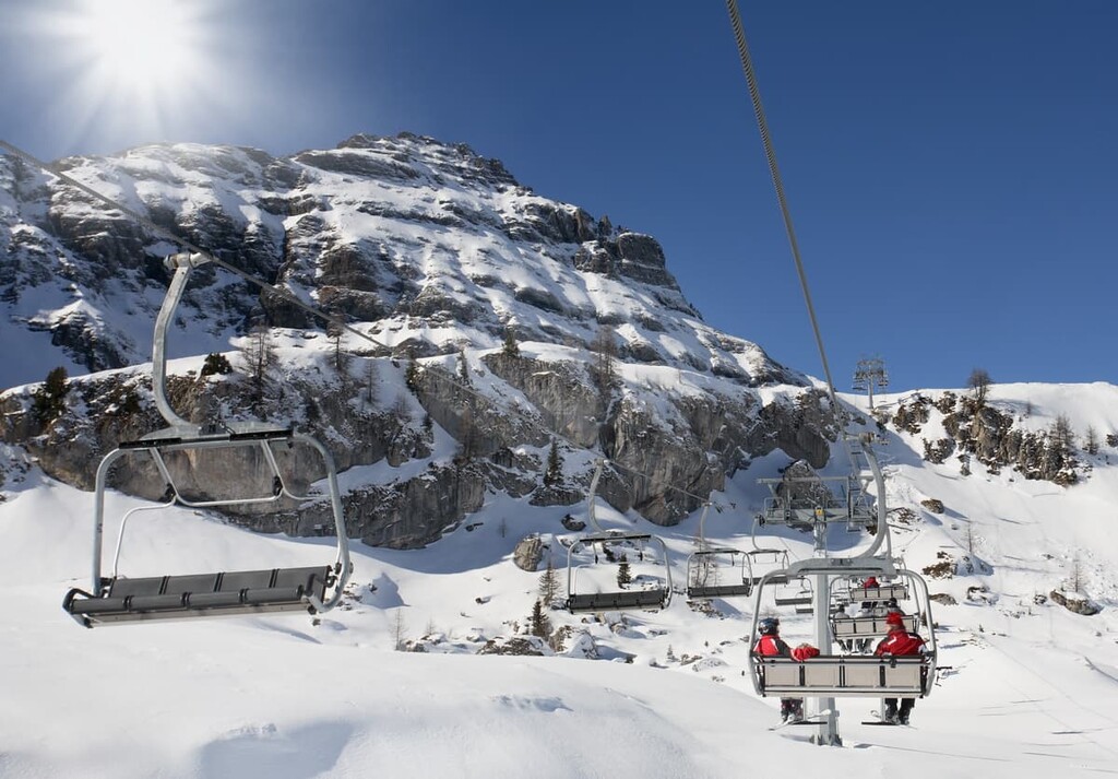
In total, there are 48 slopes of all difficulty levels (blue, red, black, kids trails, as well) with a total length of 73 km (45.3 mi) and 23 lifts of all kinds. The highest point of the resort is 2,100 m (6,889 ft), the lowest is 1,000 m (3,280 ft).
In other words, if you like skiing, Civetta is the best destination in the Italian part of the Dolomites. But it's also one of the 16 resorts in the Dolomiti Superski system, which means you can use a single ski pass at other resorts.
If you arrive to Civetta, but still need some travel information, you can easily get more about hiking in the region and other summer and winter activities in one of the tourist centers on the western and eastern sides of the group, in the two largest resorts, Alleghe and Val di Zoldo:
Tourist Office Alleghe
Piazza Kennedy, 17, 32022, Alleghe BL, Italy
+390437523333
General opening hours: daily 9:00–12:00 and 15:30–18:30, closed on Wednesdays and
Sundays in the afternoon
Tourist Office Forno di Zoldo
Via Monte Civetta, 4b, 32012, Val di Zoldo BL, Italy
General opening hours: daily 9:00–12:00 and 15:30–19:00, closed on Wednesdays
+390437789145
You can also use the extremely informative Agordino Dolomiti website for more information about the region of Agordo.
There are eight major mountain huts in the Civetta Group, many of which I have already mentioned in this guide. Mountain huts are places where you can stay overnight while hiking.
These are usually two-three-story buildings that rent beds in large dormitories for 4 to 12 people, but there may also be double and triple rooms available, too. Showers are charged separately at about €1 per 1 liter (5 to 6 liters is enough if you wash up very quickly).
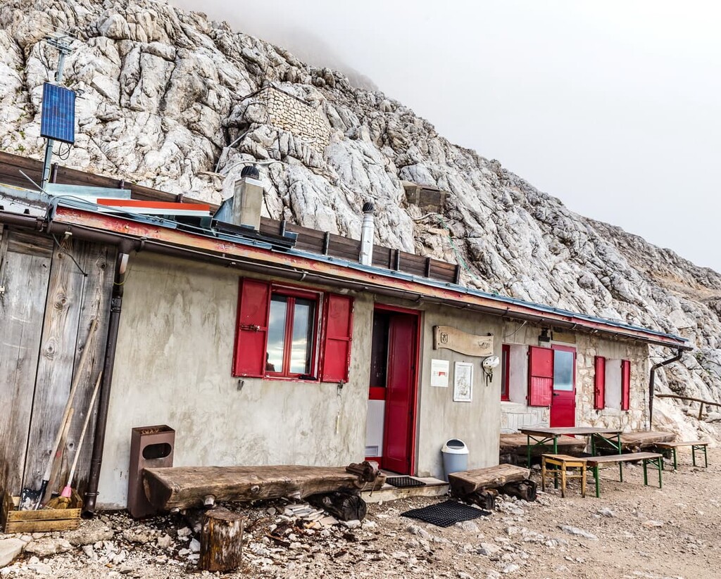
The general price is around €60 per night including dinner and breakfast, but you can also book just a bed for €25–30. You can’t cook in the rifugio, but I’ve taken a gas burner with me several times to heat up food near the rifugio. However, above 2,000 m (6,561 ft) it can be problematic because of the constant wind, with nowhere to shelter from, and it’s cold outside even in July.
Rifugio Adolfo Sonino al Coldai (2,132 m / 6,994 ft)
88 beds, including 8 beds in the winter bivouac
Località Coldai, 32022, Zoldo Alto, BL, Italy
+390437789160
Rifugio Attilio Tissi (2,262 m / 7,421 ft)
64 beds, including 6 beds in the winter bivouac
Località Col Reàn, 32022, Alleghe, BL, Italy
+393475931833
Rifugio Mario Vazzoler (1,713 m / 5,620 ft)
87 beds
Località Col Negro Di Pelsa, 32027, Taibon Agordino, BL, Italy
+3904371956619
Rifugio Capanna Trieste (1,135 m / 3,723 ft)
18 beds
Localita' Valcorpassa, 2, 32027, Taibon Agordino, BL, Italy
+390437660122
rifugiocapannatrieste@gmail.com
Rifugio Maria Vittoria Torrani (2,984 m / 9,790 ft)
18 beds, including 14 beds in the winter bivouac
Località Pian de la Tenda, 32010, Zoldo Alto, BL, Italy
+390437789150
Rifugio Bruto Carestiato (1,843 m / 6,046 ft)
44 beds including 9 beds in the winter bivouac
Località Col dei Pas, 32021, Agordo, BL, Italy
+39 3929746984
There are also two mountains hus located on the Duran Pass, so you have a lot of accommodation on the area:
Rifugio San Sebastiano (1,605 m / 5,265 ft)
30 beds
Località Passo Duran, 32010, Val di Zoldo, BL, Italy
+39043762360
Rifugio Passo Duran "C. Tomè” (1,605 m m / 5,265 ft)
25 beds
Località Passo Duran, 32010, Val di Zoldo, BL, Italy
+393464165461
There are three bivouacs in the Civetta Group, where you can have a simple shelter during all-year-round: bivacco Cesare Tomè (2,860 m / 9,383 ft) with 6 beds, bivacco Giuseppe Ghedini (2,601 m / 8,533 ft) also with 6 beds, bivacco Giovannino Grisetti (2,050 m / 6,725 ft) with 9 beds. All of these bivouacs are managed by Italian Alpine Club (Club Alpino Italiano, CAI).
Finally, the largest campsite in the area is Palafavera, which is located on the eastern side of the Civetta. It could be good for those who are looking for a mix of civilization and wild accommodation in nature. There are also the Cadore and Civetta camping areas, as well as Area Sosta Camper Alleghe near town, where you can park your caravan.
The Civetta Group is surrounded by various settlements. Among all the towns, I would focus on two—Alleghe and Agordo—on the western border of the group. Also, read about the main towns on the eastern side in the guide to the neighboring Pelmo Group in the Zoldo Valley.
Alleghe is a small resort town located on the lake in the Cordevole Valley, 47 km (29.2 mi) from Belluno at 1,000 m (3,280 ft). The town has a total area of 29 sq km (11.1 sq mi).
The commune includes the smaller villages of Caprile, Colondel, Sora Stabiel, Masarè, and Sala.
The town is home to 1,150 inhabitants (2021), most of whom speak the Ladin language. Throughout its history, control of the town has passed from Italy to Tyrol, Austria and back again, which has affected its architecture, cuisine, and the general way of life.
The city’s main cultural and architectural landmarks are the following:
Official tourist site: Dolomiti.org.
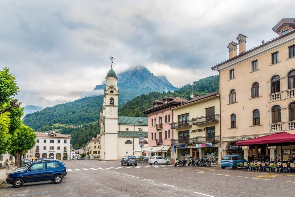
Agordo is also a small town, but it is considered to be the capital of the cultural region of the same name. It is located just 29 km (18.1 mi) from Belluno at an elevation of 611 m (2,005 ft). The total area of the city is 23.67 sq km (9.14 sq mi).
The commune include smaller settlements, such as Brugnach, Colvignas, Crostolin, Farenzena, Giove, Le Grave, Mozzach, Parech, Piasent, Ponte Alto, Rif, Toccol, Valcozzena, Val di Frela, and Veran.
Agordo is home to 4,078 people (2021), many of whom are of Ladin descent, too. At the same time, Agordo is the last large and important town of the Republic of Venice (now—Veneto region) in the Dolomites on the border with Tyrol.
Unlike neighboring Alleghe, it is one of Veneto's industrial centers in the mountains. Speaking of the latter, Agordo is famous as the birthplace and former headquarters of the world’s largest eyewear factory Luxottica, which owns such brands as Ray-Ban and Oakley.
The main architectural landmarks of the town are:
Official tourist site: Agordinodolomiti.it.