
Scan the QR code and open PeakVisor on your phone
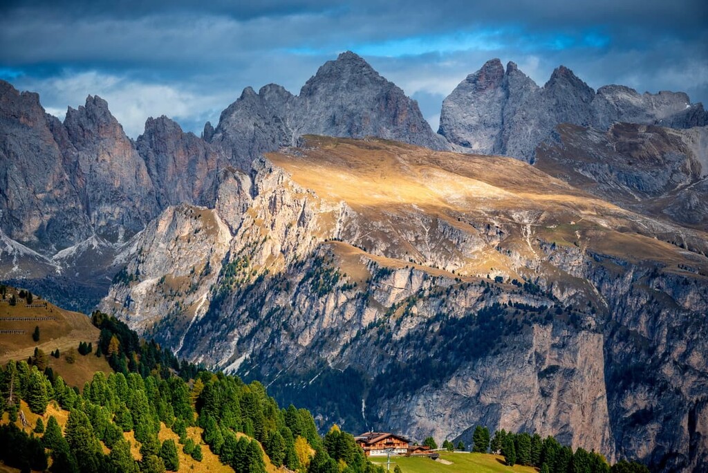
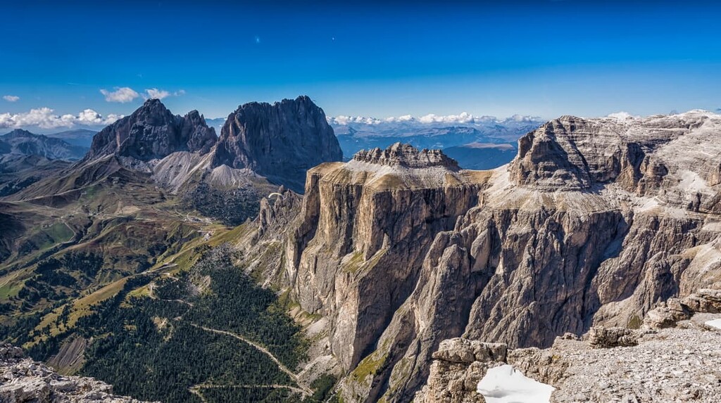
The Sella Group is a mountain group in the Dolomites of northern Italy that looks like a huge hand-built rock fortress in the middle of the Alpine meadows. At the same time, it is one of the major centers of outdoor activities in the Alps, as it is home to one of the longest ski circuits in the world, Sellaronda. There are 52 named mountains in the Sella Group. The highest and the most prominent mountain is Piz Boè (3,152 m / 10,338 ft).
The name of the Sella Group is easy to explain: It comes from the name, Sela, of one of the four passes that surround it. It is a word from the language of the native people of the Dolomites, the Ladins, which literally translates to “saddle”.
However, this name is not used universally to refer to the Sella group. For example, in the Atlas of Tyrol (L’Atlas Tyrolensis) from 1760–1970, the area is called Sallei.
Additionally, the Ladins historically used two other names to refer to the northern part of the group: Mëisules on the Val Gardena side, and Mësores on the Val Badia side. These words come from the word mensa or mesula and they mean “table” and “rock terrace,” respectively. This terminology refers to the geology and landscape of the group. It is also a very common unofficial name for the Sella—“The Terrace of the Dolomites.”
Two other common names you may see are Gruppo Sella in Italian, and Sellagruppe in German. It is the same as many other groups in the region, which usually have two or three names due to the diversity of languages spoken in the region.
The Sella Group has a unique location in the geographical center of the Dolomites. It is situated on the border of the Trentino, Bolzano, and Belluno provinces of the Trentino — Alto Adige / South Tyrol and Veneto regions. The two (of course) imaginary lines that form the border of each region intersect right at the highest point of the group, Piz Boè.
You can get here from one of the so-called capitals of the Dolomites:
There is also a city of Feltre in the south (1 hour 30 minutes, 87 km / 54 mi), which is around 1 hour by road from Belluno. The times and distances listed here are to the village of Arabba, one of the four closest communities to the Sella group.
To get to one of the four Dolomites capitals, in turn, choose one of the following cities as your starting point:
All major international airlines fly to these cities, including local Alitalia and Air Austria national airlines.
The geology of the Sella Group is similar to that of other mountain groups in the Dolomites.
These mountains are composed of dolomite rock or limestone. This rock began to form as early as the Triassic period, some 230 to 250 million years ago as accumulations of corals and other sea creatures at the bottom of the ancient Tethys Ocean, which separated the two continents of Eurasia (modern-day Eurasia and North America) and Gondwana (the other continents).
The main feature of dolomite rock, which is visible to any traveler and peak identification enthusiast, is its ability to absorb sunlight. Because of this, at sunset and sunrise, the mountains are colored in all the colors of the rainbow. This effect is called enrosadira in Ladin.
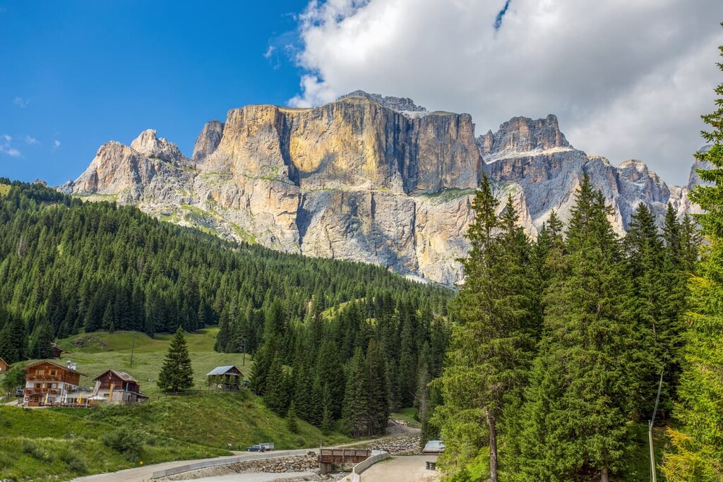
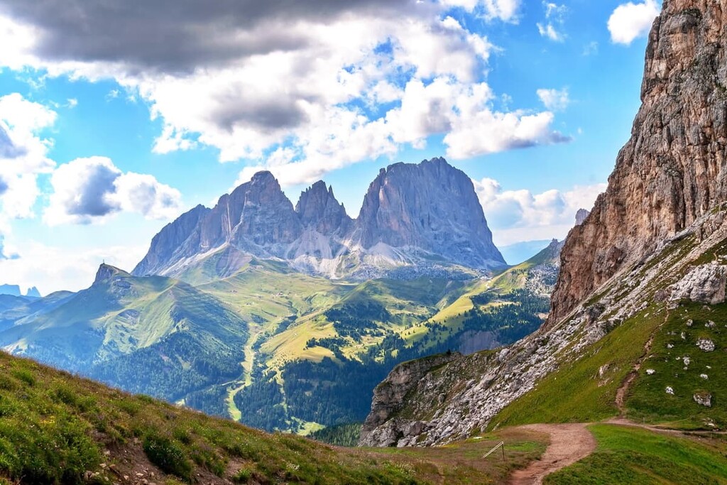
In turn, the landscape of the Sella Group has several differences from other groups in the Dolomites. This includes mountains that reach elevations of up to 3,342 m (10,964 ft), as well as alpine meadows and spruce forests at an elevation of about 1,000–2,000 m (3,280–6,561 ft).
With that in mind, here the main features of the Sella landscape:
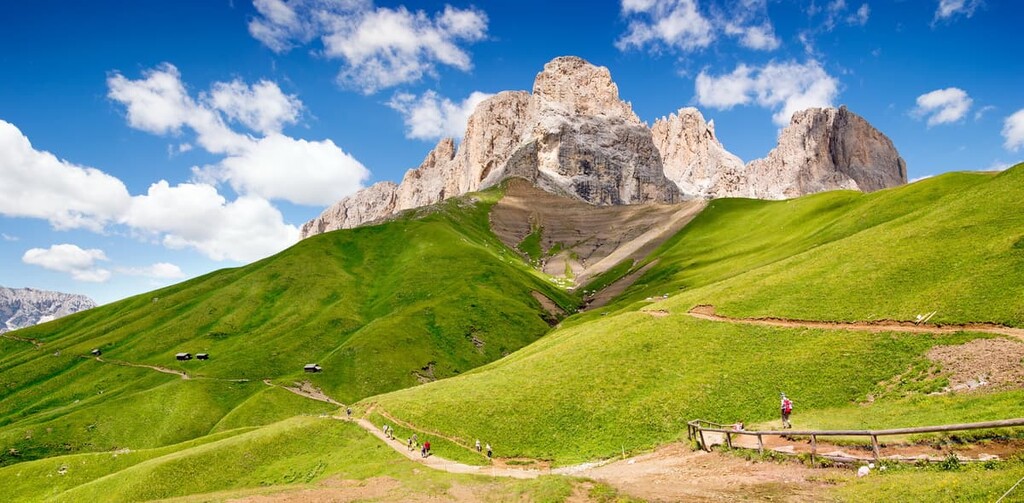
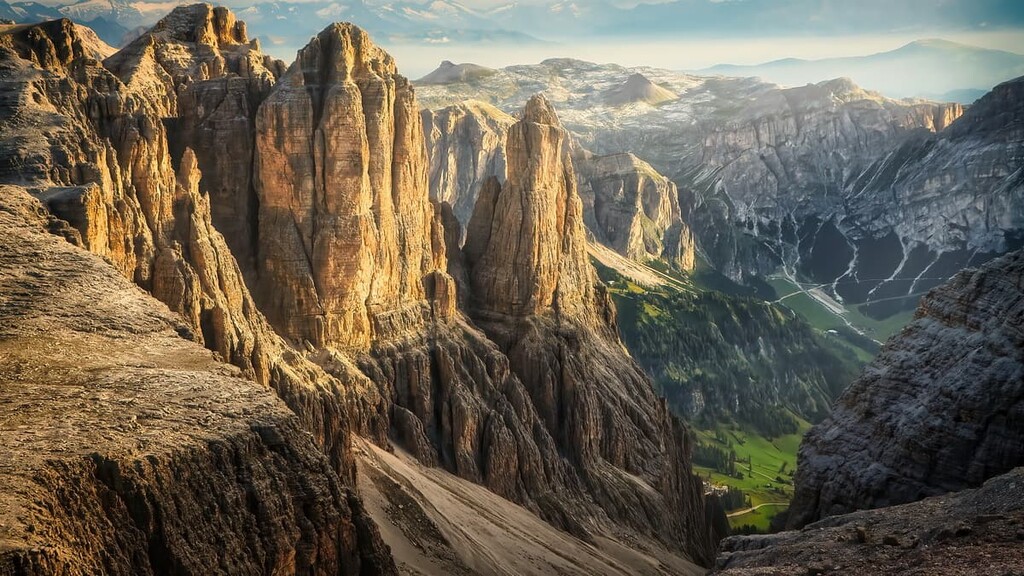
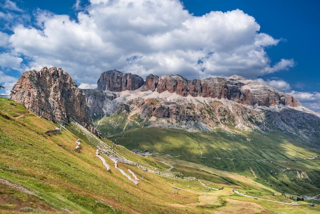
The Sella is a huge mountain plateau with an average elevation of 2,500 m (8,202 ft) that was once an atoll in the same tropical Tethys Ocean. A typical atoll is a lagoon surrounded by a coral reef. Such atolls can be seen all over the world today—for example, in the Caribbean Sea.
From the side, such as from one of the passes at the foot of the Sella, however, the plateau is not visible. From here, Sella looks like a huge man-made fortress with defensive towers around its perimeter—as if someone built it on purpose as a place to watch the surrounding mountains every day.
I visited Sella in 2013 on a bike trip between two of its passes. The group impressed me even more than Tre Cime di Lavaredo, which is considered the most unusually shaped mountain in the Dolomites in the form of three pyramidal peaks close to each other. “The Towers of Sella” is a common way to refer to the Sella Group, too.
Another great feature of the Sella Group is a geological formation called the Raibl Formation. This horizontal rock layer divides the massif of Sella into layers, forming peculiar rock terraces (hence one of the names of the group). You can see the strata of the Raibl Formation very well as this lightly-colored rock seemingly divides the darker colored rocks of the Sella group into two “floors.”
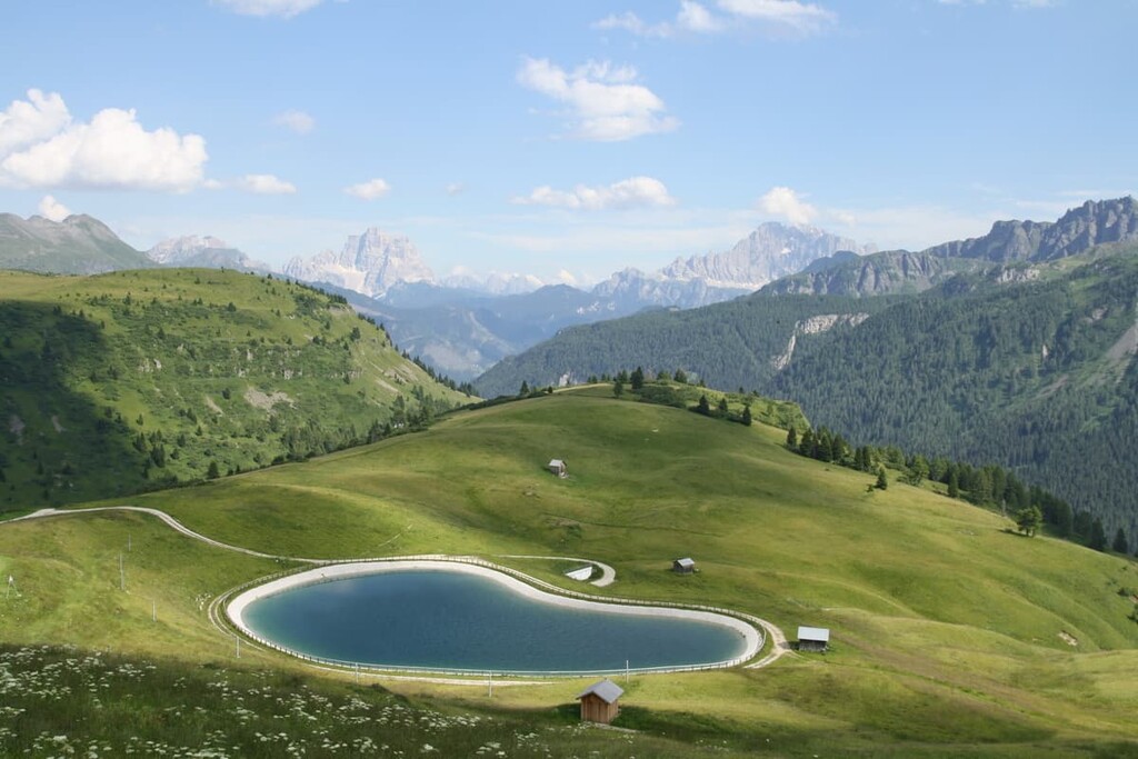
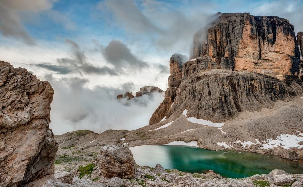
While hiking in the Sella Group, you can find several small glacial lakes. All of these lakes make the otherwise lifeless mountain plateau, which has almost no vegetation, seemingly more alive.
There are four primary glacial lakes in the region: To the north of the group, there is the Lago Pisciadù and Lago del Drago (Lech dl Dragon) next to it. To the south, there is the Lago Boè and Lago Ghiacciato (lech Dlace).
Additionally, there are several smaller lakes scattered throughout the group you can find and enjoy during your hiking adventures.
The Sella Group is surrounded by four world-famous mountain passes that connect the four valleys around it. These include:
Each pass is the perfect scenic viewpoint for any visitor as each offers a stunning new view of the Sella Group for any cyclist, motorcyclist or car driving enthusiast. In addition, from the passes, you can see other neighboring mountain groups.
All four passes together are called Sellaronda or The Road Around Sella. We'll talk about this road later in the article.
Last but not least, the final feature of the Sella is the valley's landscape. It is also surrounded by four of the five famous Ladin Valleys: Val di Fassa (Val de Fascia) in the southwest, Val Gardena (Gherdëina) in the northwest, Valle di Livinallongo (Val de Fodom) in the southwest, and Val Badia (Alta Badia) in the north. The last fifth valley is the Valle d’Ampezzo (Val de Ampezo).

In each valley, visitors get even more impressive panoramic views of Ladinia, as the Ladins call their country. The region also has a second name, The Kingdom of Fanes, which comes from the name of the neighboring mountain group.
So who are Ladins? They are descendants of the Rhaetians, a tribe that lived in the Alps before the arrival of the Romans. Ladins are known for their culture, traditions, language, and hospitality. You can read more about the Ladins and their unique culture in PeakVisor’s guide to the Dolomites.
According to one of the two most common classification of the Alps—the Italian SOIUSA—the Sella Group belongs to the Dolomiti di Gardena Subgroup. This is in turn is part of the Dolomiti di Gardena e di Fassa Subgroup, which is part of the Dolomiti Group.
As you can see, the classification of the Sella itself is rather confusing, so we’ll focus here on some of the major peaks in the range:
Piz Boè, or Boespitze, is located to the southeast of the geographical center of the group. It is one of the few peaks in the Dolomites above 3,000 m (9,842 ft) in elevation that can be easily and quickly reached from the nearest summit, which in turn is accessible by cable car.
The summit offers spectacular views of the surrounding mountains: Cunturines Group to the east, Marmolada to the south, Puez to the north, and Sassolungo / Langkofel to the west. The latter is the closest neighbor to Sella.
The first ascent to the top of Piz Boè was made by the world-famous Austrian climber Paul Grohmann on July 30, 1864, who was also the first climber on many other mountains in the Dolomites such as Pelmo, Tofane, Sorapiss, and Langkofel. However, it is believed that local hunters from Ladinia had climbed in the Sella before Grohmann.
If you want to follow their steps and climb the mountain on foot to earn the views from the summit of Piz Boè as a reward for hours of walking, you can do it on one of several trails. There is more information about these trails below.
The other nine highest peaks of the Sella Group are:
Sass Pordoi is the eleventh highest peak of the group. It is also a huge tower with a plateau-like surface in the western part of the Sella, where the cableway from the Pordoi Pass, built back in 1962, leads. Thus, you can "climb" the Sella and gain approximately 700 m (2,296 ft) in elevation with no effort in just around 10 minutes.
Although this lack of hiking might be disappointing for some, it does save you energy for a fantastic meal at the top of the Sass Pordoi. Here, you can find a restaurant called Rifugio Maria, named after Maria Piaz, a pioneer of tourism in this area. There you can taste a number of traditional Alpine, Ladin, and Italian dishes.
Finally, we came to the famous Towers of Sella. This is a group of peaks located also in the western part of the group. In general, the “towers” are a reference to the mountain peaks, which is a common naming convention of groups of peaks in the Dolomites. For example, there are Latemar Towers (Torri di Latemar).
In total, there are five peaks simply named by the numbers, but it is interesting that the first one is not the highest.
The highest is the Terza Torre di Sella (Third Tower of Sella)—2,696 m (8,845 ft). Then, we have Prima and Seconda Torre di Sella (First and Second), which are 2,533 m (8,310 ft) and 2,598 m (8,523 ft) in elevation, respectively. Finally, there are Quarta and Quinta Torre di Sella (Fourth and Fifth), which are 2,605 m (8,546 ft) and 2,500 m (8,202 ft) in elevation, respectively.
All five peaks are popular among the via ferratas fans and alpinists. The most difficult route is considered to be a trek that goes straight through the peaks from the first to the third summits.

Of course, thanks to its unique landscape, mountain peaks, and surrounding scenery, the Sella Group attracts thousands of people every year, it is one of the most visited groups in the Dolomites, about which it is often written that it is “crowded.” I’ve been there. It’s true what they say about the crowds.
However, most visitors do not go further than the main peak, and even fewer cross the entire group. Here’s a quick look at some of the main routes in the group:
This is a relatively easy one-day hike to one of the three main peaks in the Sella Group. Generally, the cable car from the Pordoi Pass leads up here, so the trail is for those who want a bit of a challenge. But, do keep in mind that it is a 700 m (2,269 ft) climb to the top.
Once you reach the top of the mountain, you will find yourself on one of the Sella observation towers or a mountain plateau with 360-degree views. Be sure to take the time to enjoy the vistas while you’re up there.
At the cable car, there is also a good restaurant—Rifugio Maria al Sass Pordoi—with local food, where you can eat to have energy before returning down the same path. The restaurant is usually open from 9 am to 5 pm.
An important note: Despite the word "rifugio" in its name, Maria al Sass Pordoi is only a restaurant and there are no accommodation options available.
This is the main route in the whole Sella Group. It is not very difficult and leads to the main summit of the group, Piz Boè.
It begins at the end of the last route we discussed—from the cable car at the top of Sass Pordoi. From there you have to walk 4 km (2.4 mi) to the top on relatively easy rocky trails. You can see all four Ladin valleys and other mountain groups from above.
Because this is the main trail in Sella, which starts from the cable car, it is very popular. So I recommend starting as early as possible, perhaps even on the first-morning cableway and returning on the last cable car for the evening.
However, if you don’t mind a dozen other hikers and you even like to socialize, any time is fine for a hike to the summit.
This is a slightly longer variant of the previous route. Following the same route from Sass Pordoi to the summit of Piz Boè, you will continue to the eastern part of the group and cross it until you reach the Vallon Cable Car at 2,357 m (7,732 ft) .From here, you can descend to Corvara village in the valley below.
This is one of the two longest alpine hiking trails in the Dolomites, on par with Alta Via 1. Its total length is 160 km (99 mi) and travel time is 11–14 days.
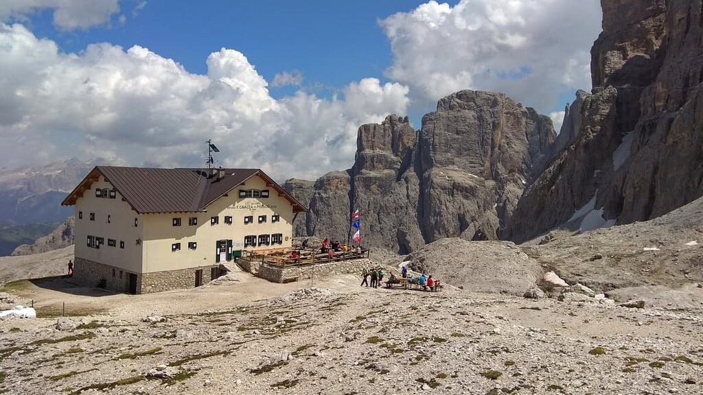
If you start from Bressanone (Brixen) in South Tyrol, you will arrive at rifugio Franco Cavazza al Pisciadù in the northern part of the Sella Group by the end of the fourth day coming from the rifugio Puez in Puez group.
It will take you the next day to cross the group from the north to the south until you arrive at rifugio Castiglioni alla Marmolada in the Marmolada group.
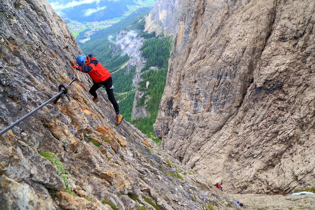
In the Sella Group, there are several great via ferratas for those who love this type of uncomplicated climbing, which is a mix between hiking and alpinism.
The most famous and, at the same time, the most difficult, via ferrata is the Via Ferrata Brigata Tridentina in the northern part of the group. It has many vertical sections and an impressive suspension bridge on the way over a deep rocky cleft that leads from Exner peak (2,496 m / 8,188 ft) to the Pisciadù plateau.
It begins at the chapel of the Gardena Pass and runs along the main local peak, the Brunecker Turm (Torre Brunico / Tur Bornech) (2,495 m / 8,186 ft), to the Pisciadù Waterfall that flows next to the path of the ferrata. It also leads to Pisciadù Lake, and rifugio Cavazza al Pisciadù as well as Campidel mountain (2,568 m / 8,425 ft) on the way back.
Do note, however, that the highest point of the whole route is 2,585 m (8,480 ft) and the lowest is 1,956 m (6,417 ft). Due to the difficult nature of the terrain, the route is not recommended in rainy or snowy weather.
Other famous via ferratas in the Sella Group include:
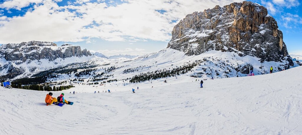
Sellaronda (Sellarunde in German) is the general name for the circuit route around the entire Sella Group. This route is known primarily as a place for outdoor activities—including not only hiking and climbing, but a whole set of different activities, such as skiing, cycling, trail running, and motorcycling.
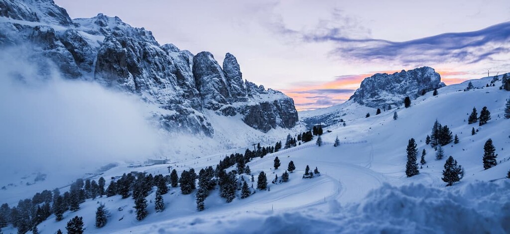
First of all, the famous Sellaronda is a long circular ski route with a total length of 42 km (26.1 mi). This is easily the most famous part of the Sellaronda. The ski trails comprise 26 km (16.1 mi) of the route, which makes it one of the longest continuous ski trails in the world. The rest of the distance includes ski lifts and a bit of walking between certain points.
The entire route can be covered in one day, but you will need at least six hours of continuous skiing with short breaks to get back to the starting point before the ski lifts close.
The elevation difference on the route is 2,800 m (9,186 ft). The route refers mainly to Alta Badia Ski Resort, one of the 12 ski areas in the Dolomiti Superski system.
In March, a spectacular race, the Sellaronda Skimarathon, is held on the Sellaronda circuit for teams of top athletes. The main feature of this international ski touring marathon is that it is held at night from around 5–7 pm until 10-11 pm. This is an amazing competition that’s well worth checking out if you’re in the area at that time.
Check the Sellaronda ski map on the larger Trentino-Alto Adige/Südtirol and Italy ski maps in the World Mountain Lifts section of the site. It includes information about open ski lifts / slopes in the Sella Group of the Dolomites in real-time with opening dates and hours. There are also year-round cable cars, funiculars, cog railways, aerial tramways, and all other types of mountain lifts.
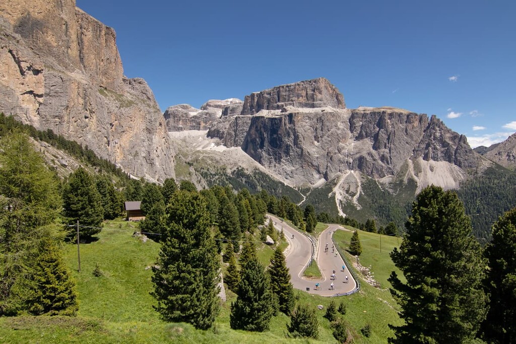
The Sellaronda is also a legendary road cycling route that travels through four mountain passes. Its total length is 58 km (36 mi) with an elevation difference of 1,800 m (5,905 ft). For example, the UK's The Telegraph writes about it as the most beautiful cycling route in the world. Despite the difficulty of the route, it is every cyclist’s dream to ride.
Every year, in mid-July, there is also the Maratona dles Dolomites (in the Ladin language) cycling event through these and three other mountain passes. Actually, it is the largest cycling race in the world, too, with more than 10,000 riders from over 70 nations each year. It is open to anyone that wants to race it, but you need to book your place well in advance because of the popularity of the race.
If you don't want to race, try the similar event called Sellaronda Bike Day, which is held two times a year in June and September. You can ride it even on a children’s bike for fun, but it’s still a tough route to complete, even for professional cyclists.
Additionally, in the summer you can travel the original Sellaronda ski route by mountain bike. This route is 63 km (39.1 mi) long, the elevation gain is even greater than the road version—3,843 m (2,387 mi) with the highest point of the route 2,464 m (1,531 ft). It’s possible to do most of the climbing using ski lifts.
Trail runners can enjoy the Sellaronda, too, because it is also a running route with a very tough trail running race, the DoloMyths Sellaronda Ultra Trail. It is 61.5 km (38.2 mi) long with an elevation gain of 3,378 m (11,082 ft). The race has been held annually since the 1990s.
Last, but not least, Sellaronda is a car and motorcycle route. In summer, it is a traditional gathering point for car and motorcycle enthusiasts who come here specifically to travel this route or to pass it as part of a larger trip through the Dolomites.
Wealthy people from Austria, German, and Italy particularly like to ride around the Sella in vintage or brand new convertibles. Even if you're not one of them, it is fun to watch these cars travel through the mountains.

You can get more information about the Sella Group and Sellaronda events at one of the official tourist offices, which are located in the larger villages in each of the valleys:
Tourist Information Office in Canazei in Val di Fassa
Piaz G. Marconi, 5, 38032, Canazei, Trentino, Italy
General opening times:
+390462609600
Tourist Office Selva Val Gardena in Val Gardena
Str. Mëisules 213, 39048, Selva Val Gardena, South Tyrol, Italy
General opening times
+390471777900
Arabba Fodom Turismo in Valle di Livinallongo
Via Mesdi, 66/A-B, Arabba, 32020, Livinallongo del Col di Lana, Italy
General opening times
+39043679130
Corvara Tourist Office in Val Badia
Str. Col Alt, 36 I, 39033, Corvara in Badia, Italy
General opening times:
+39 0471/836176
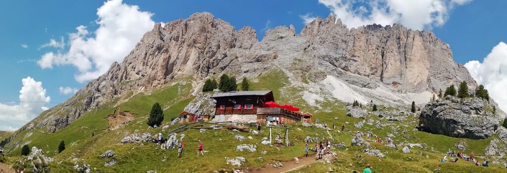
While hiking in the Sella Group, you can stay in one of the five main rifugios. A rifugio is a type of hotel where you will be offered a place in a shared room for 4–12 people, a delicious three-course dinner, and a simple Italian breakfast.
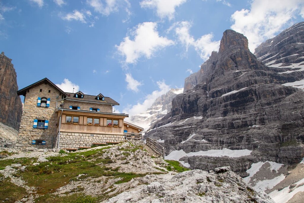
Rifugios also offer a shower for an additional cost and drinks at the bar. The normal cost for half board (room and food) is €50–60. But here, in a popular place like the Sella, it can be around €80, which is a bit pricey
You can find out the exact cost on the website of each rifugio, as well as the rules. For example, there is usually no Wi-Fi in the rifugio and bad mobile Internet, which is why, among other things, all payments can only be made in cash. If you go hiking in a group of more than 2–3 people, it is better to book an overnight stay in advance by mail or phone.
To our true hiker’s regret, there are no free alpine huts (bivacco in Italian) within the group, and it is officially forbidden to camp overnight unless you have brought your tent. In this case, you should set it up late at night and put it away early in the morning.
Before and after your hike, you should have no trouble finding a hotel, B&Bs, and other types of accommodation in any of the four Ladin valleys.
There are no large cities around the Sella Group like Trento or Bolzano, but there are many small settlements—towns, villages, and hamlets—where you can start your journey. Here’s what you need to know about the major towns in each valley:
Canazei is the main town in the Fassa Valley. It is approximately 110 km (68.3 mi) from the provincial capital of Trento and it is located at an altitude of 1,465 m (4,806 ft). The commune consists of three smaller settlements: Alba, Gries, and Penia.

The town has 1,882 inhabitants (2020) in an area of 67.3 sq km (26 sq mi). Most of the population knows and speaks the Ladin language.
The main cultural and architectural attractions are the two medieval churches: the Church of San Floriano (Chiesetta di San Floriano) in the very center of Canazei built in 1592; and the Church of the Our Lady of the Snow (Chiesetta della Madonna della Neve) which was built in 1595 and is located in the Gries, one of the Canazei's hamlets.
Official tourist site: Canazei.com
Selva di Val Gardena is the main settlement in the Gardena Valley in the province of South Tyrol. It is located 30 km (19 mi) away from the provincial capital Bolzano at an elevation of 1,563 m (5,127 ft).
The town has a population of 2,554 (2020), 80% of whom primarily speak the Ladin language. The area of the city is 56.24 sq km (21.7 sq mi) in size.

The main cultural and architectural attractions of the town are Gardena Castel (Castel Gardena), which was built in the seventeenth century and the remains of Wolkenstein Castle built right on the rocks of the mountain in the thirteenth century.
There are also several villas in the town that were built in different architectural styles: Villa Gardena (1899), Villa Fossi (1930), Villa Dolomiti (1899) and others;. Additionally, there are several churches, including Santa Maria Assunta Church (1869–1871) and San Silvestro Chapel (1880).
Official tourist site: Valgardena.it
Arabba is a village and a very popular ski resort in the center of the valley and the commune of the same name—Livinallongo del Col di Lana or the Fodom Valley (in Ladin language. It was named after the Col di Lana mountain in the Fanes Group right to Sella, located at 1,602 m (5,255 ft) in elevation, some 70 km (43.4 mi) from the provincial capital of Belluno in the Veneto region.

The town has 275 inhabitants (2001), while the municipality has a total of 1,286 people (2021) in a total area of 100 sq km (38.6 sq mi).
The main cultural and architectural attractions of the town are the famous fairy-tale-like Andraz Fortress (Il Castello di Andraz), which is located 18 km (11.1 mi) east of the village on the way to the Falzarego Pass. The fortress was built in the eleventh century to control trade in the province of Agordino. In Arabba itself, you will find yourself among several hundred houses, hotels, and other buildings in traditional Alpine and Ladin styles.
Official tourist site: Arabba.it
Corvara is the main settlement in the Badia Valley at an elevation of 1,568 m (5,144 ft) and a distance of approximately 40 km (25 mi) from Bolzano. The municipality of Corvara in Badia contains the hamlets Calfosch (Italian: Colfosco, German: Kolfuschg) and Pescosta.
There are 1,367 (2020) inhabitants in the town in an area of 38.9 sq. km (15 sq mi). The main language is also Ladin.
The main cultural and architectural attractions of Corvara, including the “man-made-like Dolomites” peaks are the monolithic Sassongher mountain (2,665 m / 8,743 ft) in the Puez Group, which, in my opinion, looks like a local Matterhorn.

There is also the San Vigilio Parish Church in Colfosco (eighteenth century), the Gothic style Church of Santa Caterina (1498); and several other medieval civil buildings of various purposes, including Plan d’Sura, Pedecorvara, Zecca da Ruatsch, Plaza d’Sura, and Plaza d’Sott, and Sorà, among others.
Official tourist site: Altabadia.org.


