Scan the QR code and open PeakVisor on your phone
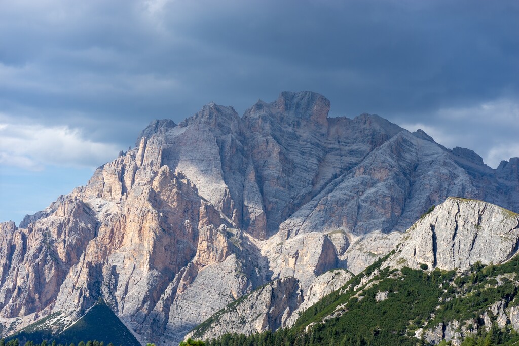
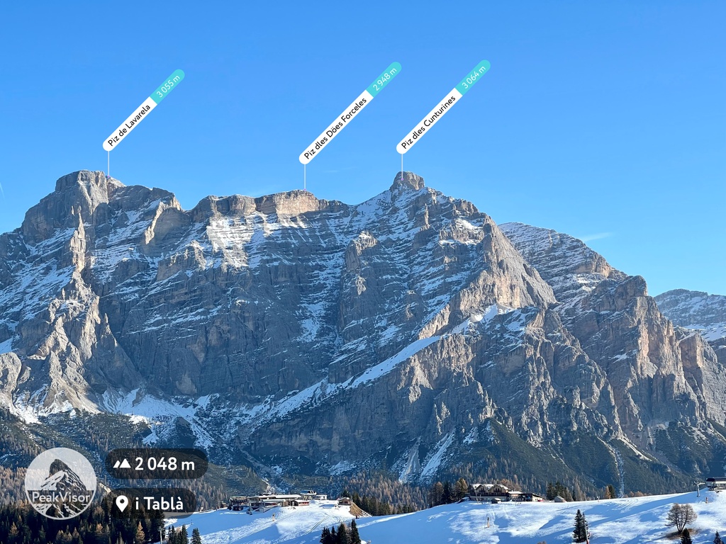
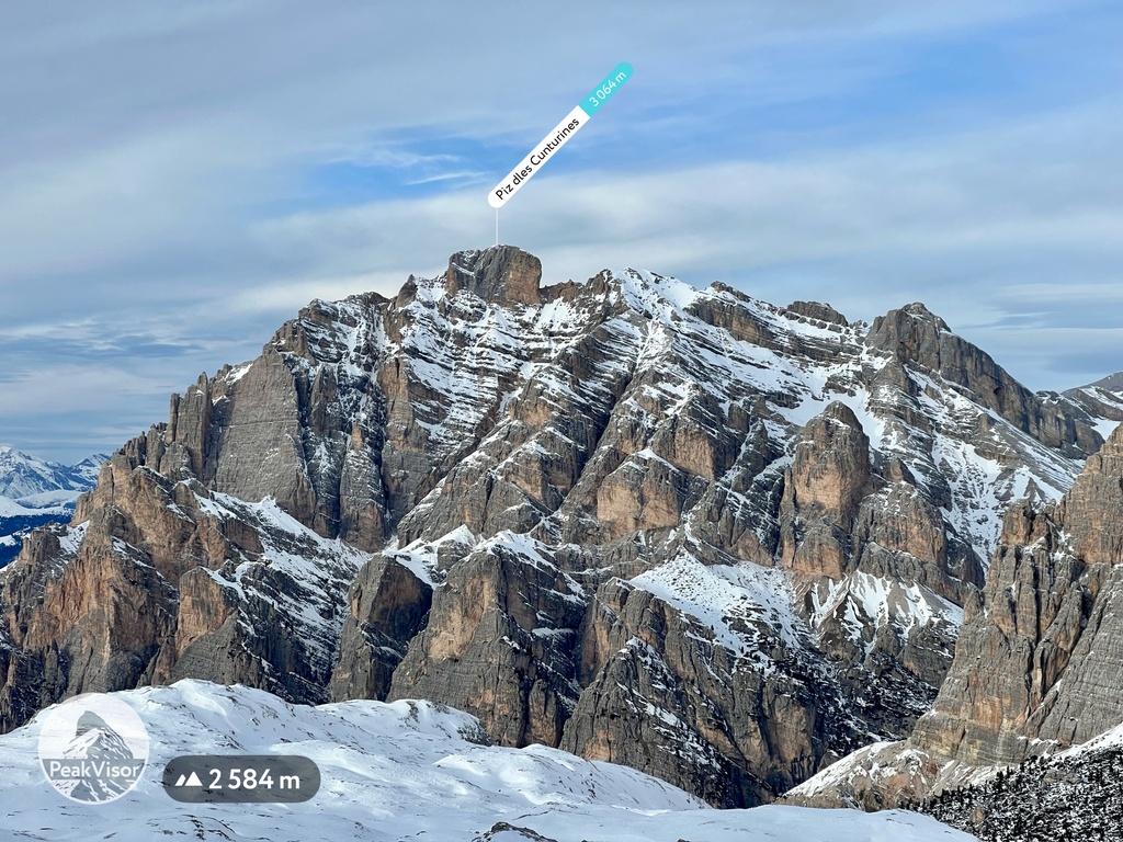
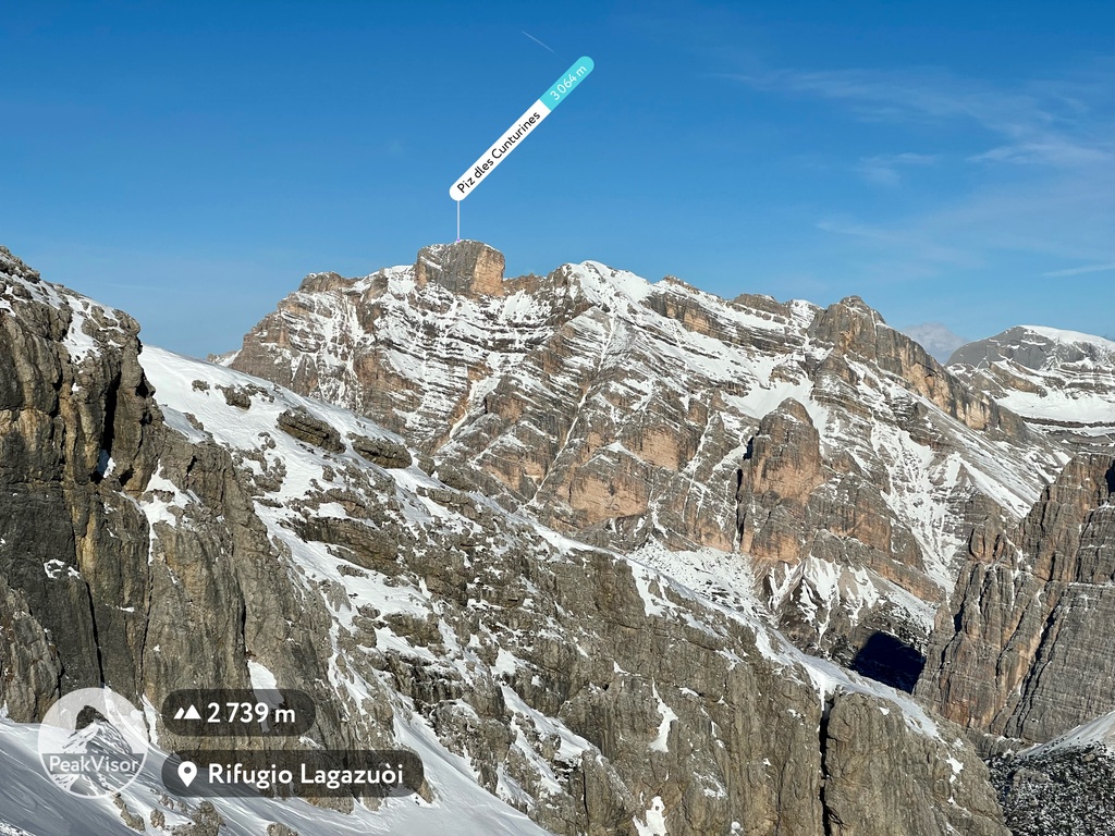
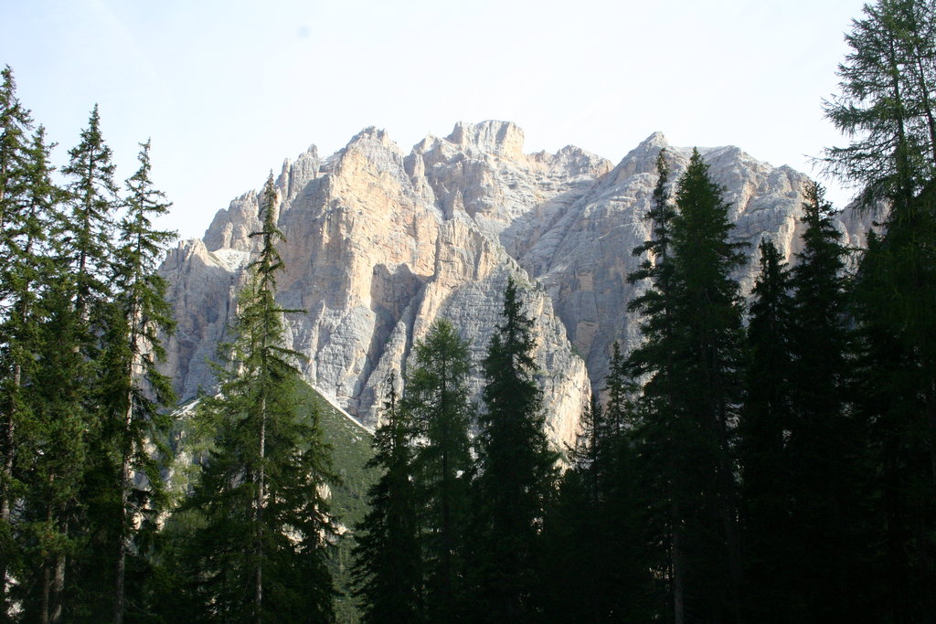
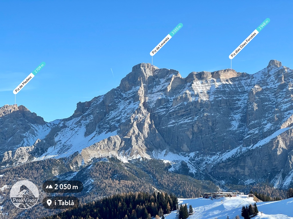
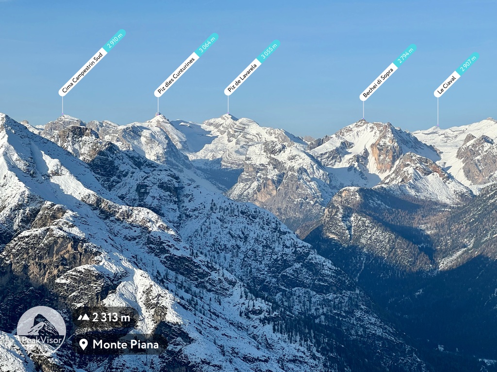
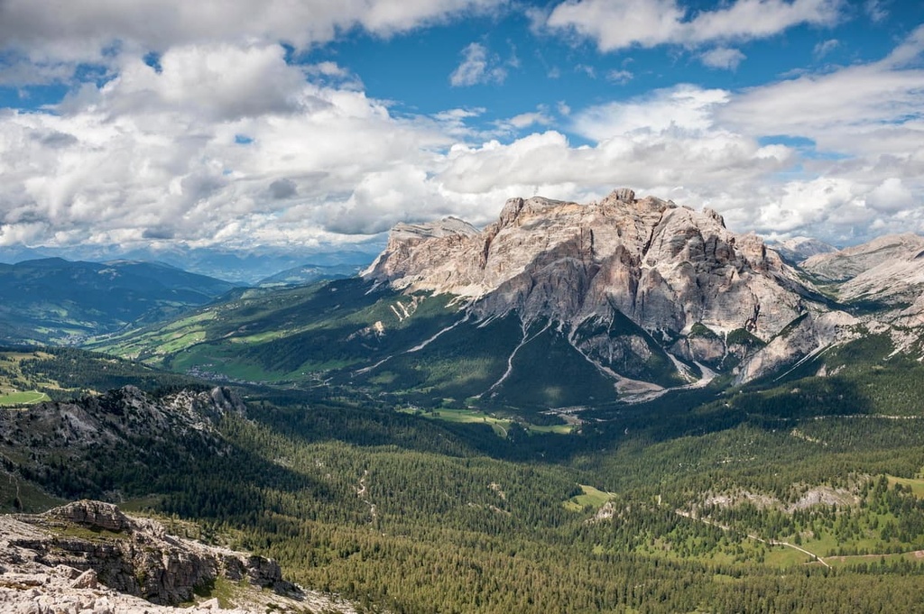
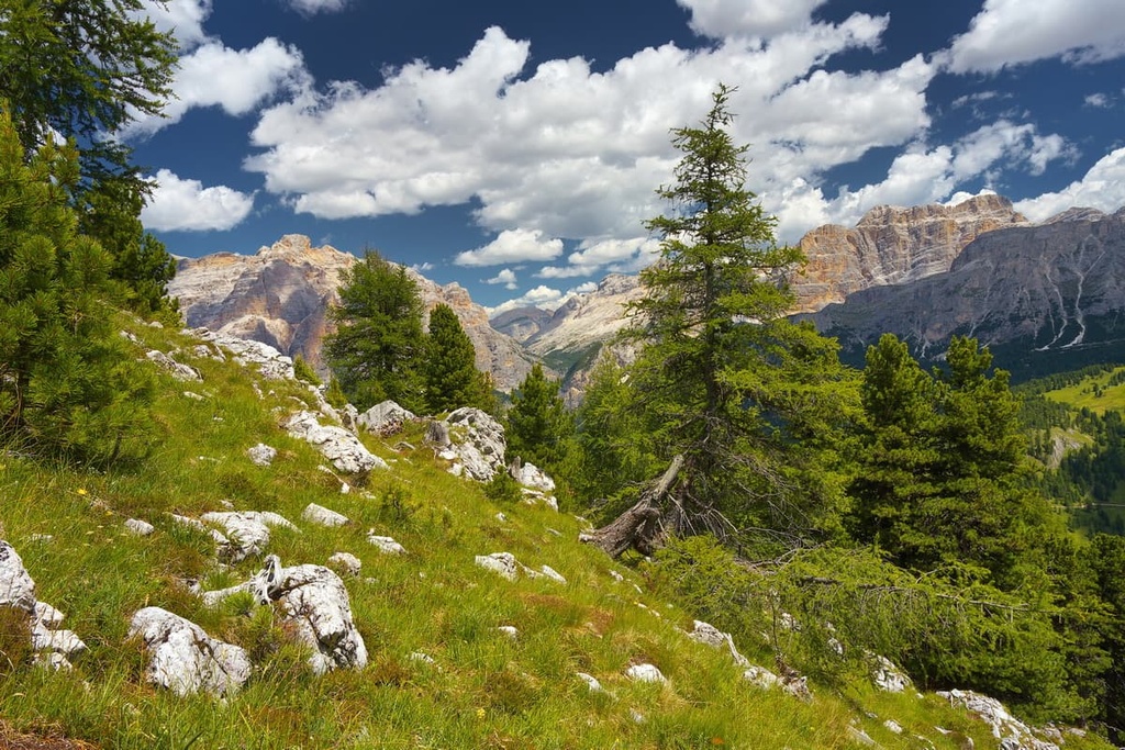
The Fanes Group is one of the main mountain groups in the Dolomites of northern Italy. The main feature of the group, in addition to unique peaks, is its historical importance due to its location in the homelands of the Ladin people. There are 81 named peaks in the Fanes Group. The highest and the most prominent mountain is Piz dles Cunturines (3,064 m / 10,052 ft).
The name of the Fanes Group (Grouppo di Fanes/Fanesgruppe) refers to the historic area in the heart of the Dolomites known as the Kingdom of Fanes or Reign of Fanes (Regno dei Fanes/Reich der Fanes/Rëgn de Fanes). This was the name given to this part of their homelands by the Ladins, one of the major ethnic groups of the Dolomites.
However, the Kingdom of Fanes is only one part of the slightly larger Ladinia, or Land of Ladins. Ladina contains the five valleys that neighbor the Fanes Group: Badia, Gardena, Fassa, Livinallongo and Ampezzo.
The kingdom is known for being the site of the Ladin legend of the same name. Originally, this legend was a cycle of stories, which in turn formed part of a larger corpus of legends or sagas of South Tyrol. There are several dozen stories in total, but it is the legend of the Kingdom of Fanes that is considered the national epic of this nation that captures its history, traditions, and beliefs.
The legend recounts the birth and decline of the kingdom through a series of dramatic events, believed to have taken place at the end of the Iron Age, or 900 BCE. The site of the events in this and other legends were the Fanes Plateau, as well as Plan de Corones (Kronplatz), the Lake Braies, the Nuvolau Group, the Falzarego Pass, and several others.
The legends were recorded from the words of the Ladins themselves by the Austrian journalist and anthropologist Karl Felix Wolf around the 1930s. Before that, the Ladins simply passed it on by word of mouth. Wolf later published these legends in several books under different titles. The primary book you can find in English today is "The Dolomites and Their Legends" (Raetia, Bolzano, 2013). There are 15 stories in the book, including the Fanes epic.
To better understand the significance of this book with the collection of Ladin legends, a parallel can be drawn with such works as Elias Lönnrot's Kalevala (Penguin Classics, UK, 2021) in Finland or the Tibetan Folk Tales by Frederick Hyde-Chambers and Audrey Hyde-Chambers (Shambhala Publications, US, 2001).
The Fanes Group is located in the East Dolomites between the province of Bolzano / South Tyrol in the Trentino-South Tyrol region and the province of Belluno in the Veneto region.
The exact boundaries of the Fanes mountains can be marked by the following locations (from south-west counterclockwise):
In addition to the Tofane Group, which the Fanes group borders in the east (they are even combined into one group in some classifications), the group is surrounded by other well-known chains of peaks such as Marmolada to the south, Nuvolau in the Ampezzo Dolomites to the southwest, Cristallo to the northeast, Braies and Peitlerkofel to the north and Puez and Sella to the west and southwest.
The Fanes Group’s area is part of Fanes-Sennes-Braies Nature Park, which encompasses about one-third to half of its territory. In turn, the park borders Ampezzo Dolomites Nature Park, and the latter with Tre Cime Nature Park. These three (out of ten parks in the Dolomites) form one of the largest natural areas in the region for hiking and other activities.
Getting to the group is fairly straightforward from one of the nearby towns and resorts: Caprile to the south and Cortina d’Ampezzo to the west (from Belluno), San Vigilio di Marebbe / St. Vigil in Enneberg to the north (from Brixen) and Arabba (from Bolzano).
If you wish to travel by public transport, the three main bus companies are Dolomiti Bus in the Veneto region and Trentino Trasporti and Suedtirol Mobil in Trentino-South Tyrol.
The closest major cities to the group with international airports are Venice and Verona in the south and Innsbruck and Munich in the north.
The geology of the Fanes Group is generally the same as for all the Dolomites. They are composed of a mineral of the same name, dolomite, which belongs to a group of limestones. The dolomite in the region is about 230–250 million years old and it formed out of sediments that were deposited at the bottom of the ancient Tethys Ocean.
But the mountains in the Fanes have some peculiarities. In the central part of the group, there is a large plateau with the same name, Fanes Plateau, which was formed in the period of the late Triassic period and in the Jurassic and Cretaceous periods, so it represent the final part of the Dolomite's "marine" history.
At that time, as a result of the collision of the African and Eurasian tectonic plates, the Dolomites, as part of the Alps, began to rise from the water, and the sea began to dry up.
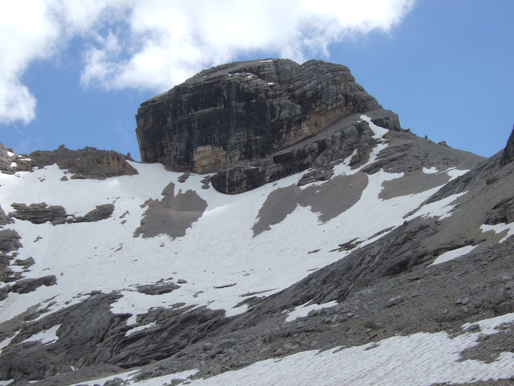
In other words, the Fanes Group contains the youngest dolomite rocks in the region as it contains layers that are only about 25 million years old. These young rocks can be found on the peaks of Monte Parei (2,735 m / 8,973 ft) and Bechei di Sopra (2,794 m / 9,166 ft).
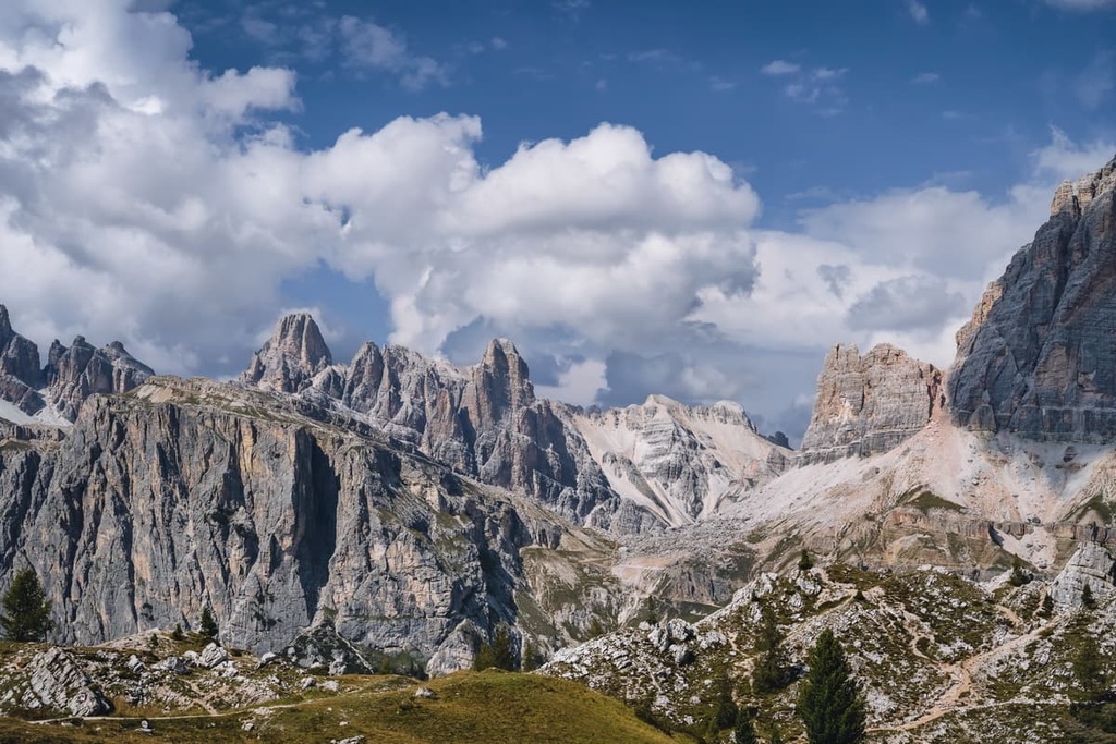
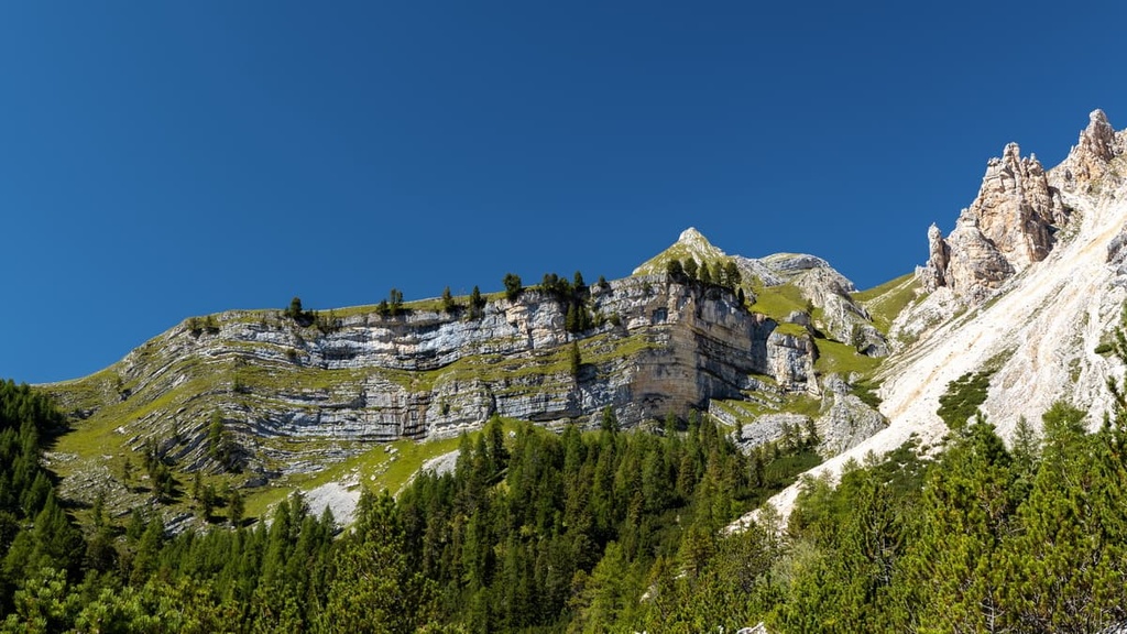
The landscape of the Fanes Group is extremely varied and is characterized by the presence of several mountain ranges or subgroups separated by valleys, the largest of which stretches from south to north and divides the group into approximately two equal parts.
These mountains are crossed by several large and extended rivers or torrents, namely, the Rio de la Val, Vigilbach, Rio di Fanes, Travenanzes. The many smaller streams disappear into the underground going through the funnel-shaped sinkholes in the karst topography of this area, which is another great feature of Fanes you can’t find in other places in the Dolomites.
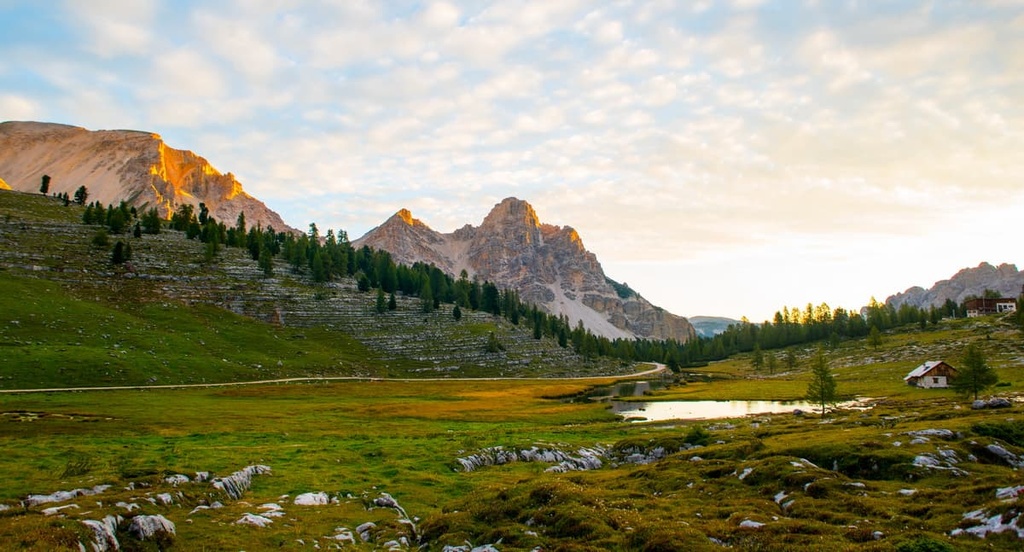
However, the water resources are not limited to streams, there are also several small mountain glacial lakes, which are almost unknown to the tourists, in particular Lago di Limo and Lé Vert. You can reach them on foot or a mountain bike.
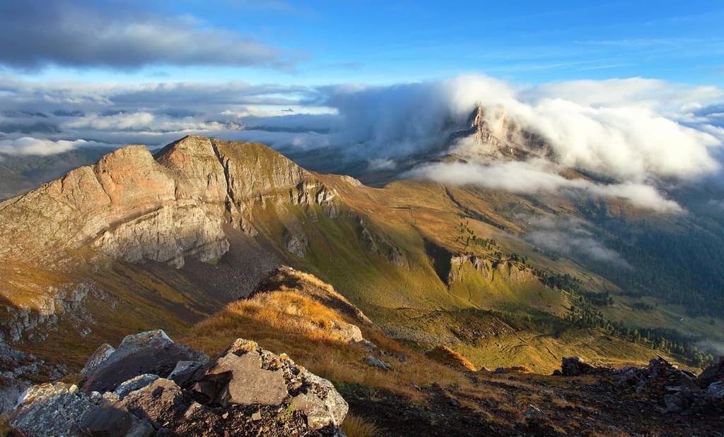
Another fantastic feature of the group's landscape is Falzarego Pass, which boasts a magnificent panorama of the Lagazuoi peaks, the neighboring Tofane, and Nuvolau groups, and a small group of peaks called Cinque Torri. But not only hikers, this place attracts literally everyone from climbers and cyclists to motorists, motorcyclists, and skiers.
Of course, the features of the group’s terrain do not stop there—there are too many to fit into one guide. You can read more about the group’s main features in the guide to Fanes-Sennes-Braies Nature Park.
The Fanes Group belongs to one of the nine mountain systems in the Dolomites in the UNESCO classification system, which helped designate the region as a world heritage site 2009.
Under this system, the Fanes Group is listed as part of the group number 5, which is also known as the Dolomiti settentrionali (Eastern Dolomites). This group also includes other mountains and groups such as the Antelao, Cristallo, Tre Cime di Lavaredo, and Braies.
The group is also part of the Dolomites according to the classification of the German-Austrian Alpine Club and of the Italian SOIUSA. In the latter it belongs to the supergroup Dolomiti Orientali di Badia (Dolomiti Orientali di Badia) of the Dolomiti di Sesto, di Braies e d’Ampezzo (Dolomites of Sesto, Braies and Ampezzo) subsection.
According to this classification system, the group is divided internally into two main sub-ranges: Fanes and Lagazuoi. Other classification systems also separate the peaks of Cunturines and Monte Parei as a separate sub-group.
To sum up, in the Fanes Group, there are at least four sub-ranges centered around the following peaks:
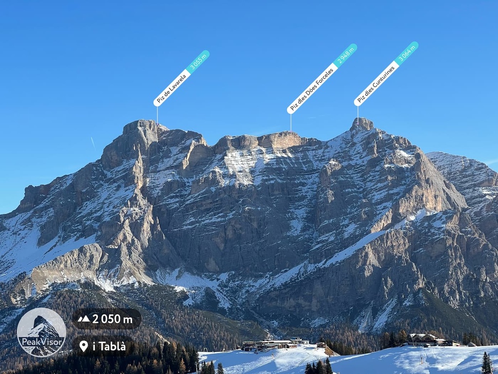
Additionally, the ten highest peaks of the group are as follows:
Here’s a quick look at the five most important mountains in the group:
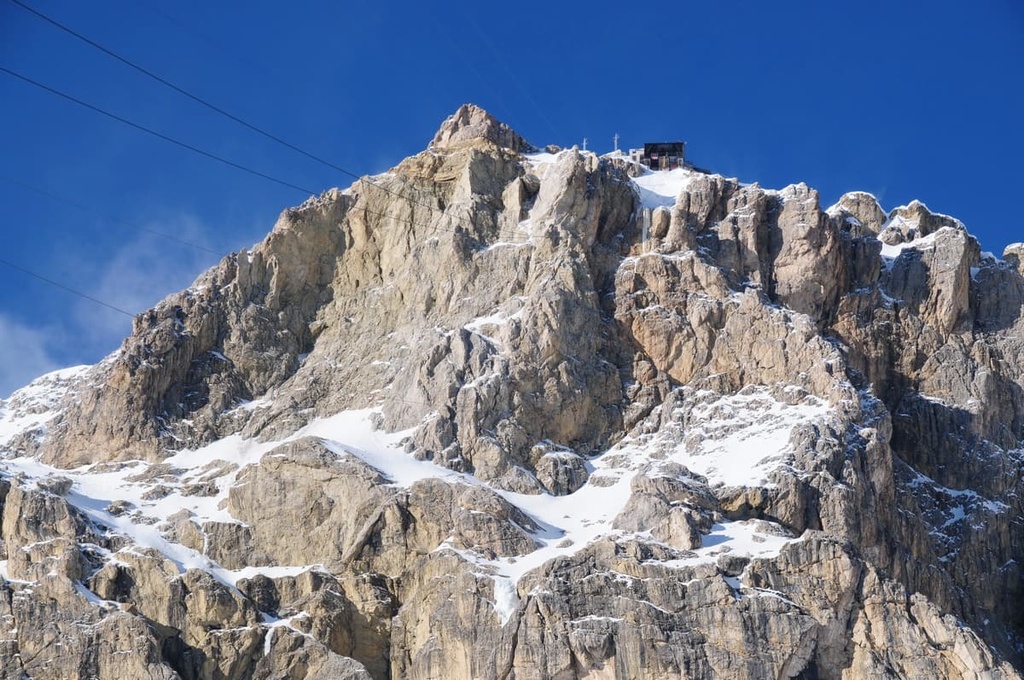
Bechei di Sopra (2,794 m / 9,166 ft) is a mountain located in the northeastern part of the Fanes group. It is situated at the end of the Rautal Valley on the border between the provinces of South Tyrol and Belluno. It is also known as Monte Parei, Col Bechei, and Pareispitze in German.
This peak features the only large deposit of Tertiary sedimentary rocks in the Dolomites. These rocks cover an area of 2 kilometers (1.2 miles) and they have a maximum layer thickness of 90 meters (295 feet).
The summit of Bechei di Sopra is easy to reach by a marked hiking trail starting from the pasture of Fanes. It offers a great view over the whole Fanes Group, the Braies Dolomites, and Ampezzo Dolomites.
Cima Dieci / Sasso delle Dieci / Zehnerspitze / Sas dles Diesc (3,026 m / 9,927 ft) is a remarkable peak located in the northwestern part of the group, not far from the village of La Val. Furthermore, Cima Dieci is located among a number of other important mountains, including the tower of Monte Cavallo (2,907 m / 9,537 ft) and the pyramid of Cima Nove (2,968 m / 9,737 ft).
In general, the mountains in this group are known by a number of names in the different languages used in the region. The name of this peak translates as "Tenth Peak" or "Peak Ten".
This comes from the fact that when looking at the mountain from the village of La Valle / Wengen / La Val, the sun is above its summit at exactly ten o'clock, which allows the locals to determine the time without clocks. There are many other peaks in the Dolomites with a similar naming pattern.
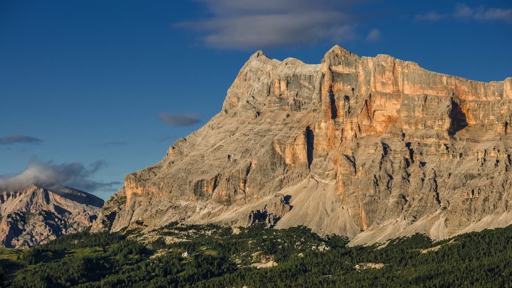
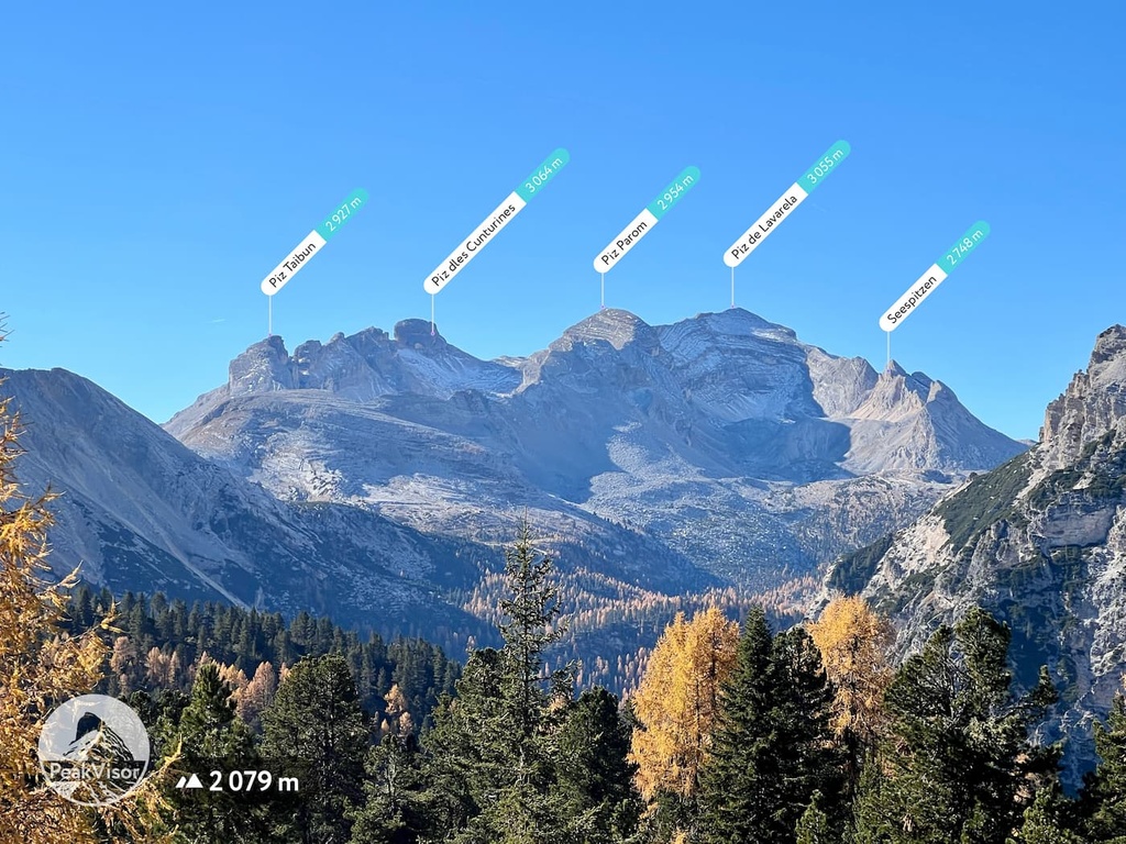
Piz dles Cunturines (3,064 m / 10,052 ft), also sometimes called Conturines, is the highest peak in the whole Fanes Group. It is located in the geographical center of the group.
The shape of the mountain is an elongated chain of several peaks that’s easy to recognize. For a great view of the mountain, take the road to Pordoi Pass. Here, you can also see Marmolada and Sella.
The first documented ascent to the summit was made by the Austrian climber Albrecht Grünwald with the local Italian guide Santo Siorpaes on August 4, 1880.
The Piz Cunturines is also locally famous because in 1987 the remains of an ancient cave bear and other animals that are over 50,000 years old were found in its southern slope. The discovery is so important that there is a whole museum dedicated to it, Museum Ladin Ursus ladinicus, in the town of San Cassiano / St. Kassian / San Ćiascian in the province of South Tyrol.
Lagazuoi Piccolo (2,778 m / 9,114 ft) is one of the most famous peaks of the group. It is located in the southern part of the group. Lagazuoi Grande (2,804 m / 9,199 ft) is located right next to Lagazuoi Piccolo, too.
There are many different ways to get to the summit, including by a simple hiking trail, through a set of World War I-era tunnels, along a via ferrata, or by cable car.
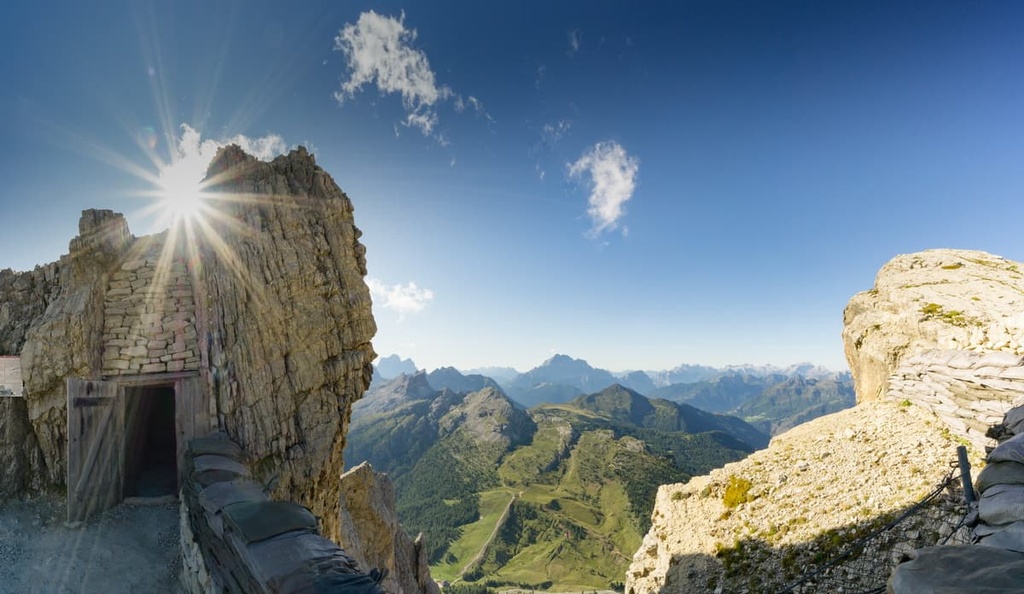
The mountain is particularly well known for housing a series of old tunnels from the First World War. The tunnels were built by the Italian troops who were trying to defend these mountains from Austro-Hungarians. Nowadays, the whole area is an open-air museum called the Museum of the Great War (Museo della Grande Guerra).
Col di Lana (2,452 m / 8,044 ft) is the southernmost peak of the group. It got its name from the village Livinallongo del Col di Lana / Buchenstein, which is the main settlement of the Fodom Valley (Valle di Fodom).
This peak is a relatively low mountain without any major rocky outcrops. Nevertheless, it is a notable point on the map of this part of Dolomites. In particular, the peak was the site of some skirmishes between Italians and Austrians during the First World War.
You can reach the top of Col di Lana along a marked hiking trail from Pieve di Livinallongo. There, you will find a chapel, which stands as a memorial to the soldiers that died in battle, a small museum dedicated to these war events, and of course, the great panoramic views of the surrounding areas.
The Fanes Group features a number of excellent hiking trails that let you enjoy anything from a short day hike to a longer trekking trip. Here are some of the most popular trails in the region:
This is not one but a whole series of historic routes that take you to one of the most famous peaks of the park, Lagazuoi Piccolo. It also lets you see the Open-Air Museum on Lagazuoi Piccolo. These routes are located in the southern part of the Fanes Group near the border with the Tofane and Nuvolau groups in the Ampezzo Dolomites.
There are four routes that let you climb to the summit, all of which start and end at Falzarego Pass (2,105 m / 6,906 ft):
Additionally, at the foot of Lagazuoi Piccolo, you will find the Rifugio Lagazuòi, where you can grab a bite to eat before heading back. You can also spend a night at the rifugio and enjoy what may be the best sunset and sunrise of your life (if you're lucky with the weather, of course).
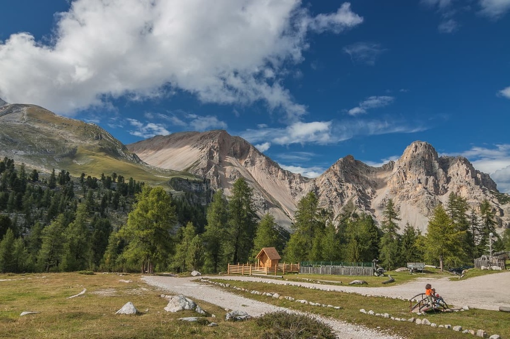
This is an easy but long hiking route in the western part of the Fanes group. It starts in the town of San Cassiano / San Ciascian and takes you to the “Parliament of Marmots” through the Fanes Plateau—the two main attractions of the group.
From the town, the trail goes past Capanna Alpina (1,729 m / 5,672 ft) and Col de Loćia (2,069 m / 6,788 ft) to the Gran Plan and Tadega Pass. Then, it continues toward the peaks of Lavarella and Piz Conturines until it reaches Fanes pastures and Malga Gran Fanes (2,110 m / 6,922 ft).
But that is not all. From the farm, the trail goes towards Limo Lake (2,159 m / 7,083 ft)—the highest point of the route—and both rifugio Fanes and rifugio Lavarella. Between these two rifugios, you will find another lake, Vërt, and the Parliament of Marmots.
On the way back, you can return down the same path. Or, you can continue further down the trail to rifugio Pederü and pick up the bus at the nearby bus stop.
The Alta Via 1 (“The High Route”) is one of the two longest alpine hiking trails in the Dolomites, on par with Alta Via 2. It is 125 km (77.6 mi) long and takes 12 days to complete.
If you start at the very beginning of the route at Braies Lake, you will arrive at the rifugio Biella on the eastern borders of the Fanes Group on the same day. It will take you the next two days to cross the group via rifugio Fanes until you arrive at the rifugio Lagazuoi on the southern border of the group at the end of day 3.
So Alta Via 1 is a great three days trail to see both Fanes and Braies parts of the Dolomites before you continue on to other parts of the region.
Because of its central location and large size, the Fanes Group is home to a number of ski resorts. The group contains a handful of ski areas that are part of the Dolomiti Superski resort: Alta Badia, Arabba, Cortina d’Ampezzo and Plan de Corones/ Kronplatz. In each of them, you will find many kilometers of slopes of all levels of difficulty as well as a lot of ski lifts.
The largest number of pistes are located in the Alta Badia resort near the village of Corvara. The most interesting piste (and lift), in my opinion, is the red "Lagazuoi" ski trail from the foot of Lagazuoi Piccolo in the resort of Cortina d’Ampezzo. It features an elevation drop of 685 meters (2,247 ft).
Check the Fanes ski map on the larger Trentino-Alto Adige/Südtirol and Veneto regions of Italy ski maps in the World Mountain Lifts section of the site. It includes information about open ski lifts / slopes in the Fanes Group of the Dolomites in real-time with opening dates and hours. There are also year-round cable cars, funiculars, cog railways, aerial tramways, and all other types of mountain lifts.
Before hiking and doing other activities in the Fanes Group, be sure to visit one of the official tourist offices or info points that are located in all of the major resorts. Here are the three main visitors centers that are found on the northern, western, and eastern borders of the group:
Tourist Office San Vigilio / San Martin
Str. Catarina Lanz, 14, 39030, San Vigilio, BZ, Italy
+390474501037
Info Point Cortina
Corso Italia, 81, 32043, Cortina d'Ampezzo, BL, Italy
+390436869086
Corvara Tourist Office
Str. Col Alt, 36, 39033, Corvara in Badia, BZ, Italy
+390471836176

For an overnight stay in Fanes, you will easily find about a dozen alpine huts, which in Italy are called rifugios. At these rifugios, you can normally get a place in a shared or private room plus breakfast and dinner for €50 to €70.
The most famous of these rifugios is rifugio Lagazuoi / Lagazuoihütte. It is located at the foot of the summit of Lagazuoi Piccolo (2,752 m / ft). The rifugio has fantastic views of Falzarego Pass and the entire central Dolomites. It is run by a local Italian family who decided to build a hut in one of the most beautiful places in the Dolomites in 1965.
The rifugio Lagazuoi has several private rooms, one with a double bed, and several shared rooms for a total of 56 beds. That said, the rifugio is very popular, so be sure to book your stay well in advance. Credit cards are also accepted for payment, which is not common in the Dolomites.
One of the unique features of the Lagazuoi hut is that it has a Finnish-style sauna that can fit 8 people. It is not the only sauna in the Dolomites, but it is certainly the highest in elevation. The cost is €20 per person and it includes 45-minute access, a bathrobe, and a shower token.
You can reach rifugio on foot on the trail or via the famous cable car from Falzarego Pass.
Other similar mountain huts in the Fanes Group include:
There are also several free alpine bivouacs in the group. For example, bivacco dalla Chiesa (2,652 m / 8,700 ft) is located on the west side of Forcella Grande. (Note that this bivacco is just designed as a daytime resting place and there are no beds in it.)
For those who prefer campsites, consider staying at camping Al Plan near San Vigilio di Marebbe village on the northwestern border of the group. There are also other campsites in other parts of the group.
The Fanes Group is literally surrounded by notable towns and resorts, each worthy of being a starting point for your mountain travels: Arabba, Corvara, Cortina d’Ampezzo, and others.
That said, one unique place to visit in the Fanes Group is the town of San Vigilio di Marebbe (St. Vigil in Enneberg / Al Plan de Mareo).
The town is a typical South Tyrolean and Ladin village located on the northwestern borders of the group in the Marebbe Valley of the larger Badia Valley, at 1,285 m (4,215 ft). It’s easy to get there by car from Bolzano (84 km / 52.1 mi, 1 h 10 minutes by car).
The village has 1,200 inhabitants, which include a mix of different nationalities and ethnic groups, including Ladins, South Tyroleans, Italians, Germans, and Austrians. The main languages spoken are German and Italian, but you can usually also communicate in English.
The main thing about San Vigilio is that it contains a small ski resort, Ski Area Miara, which is also connected to Kronplatz Ski Resort. It is also part of the larger town of San Martino in Badia (St. Martin in Thurn / San Martin de Tor) in the Badia Valley.
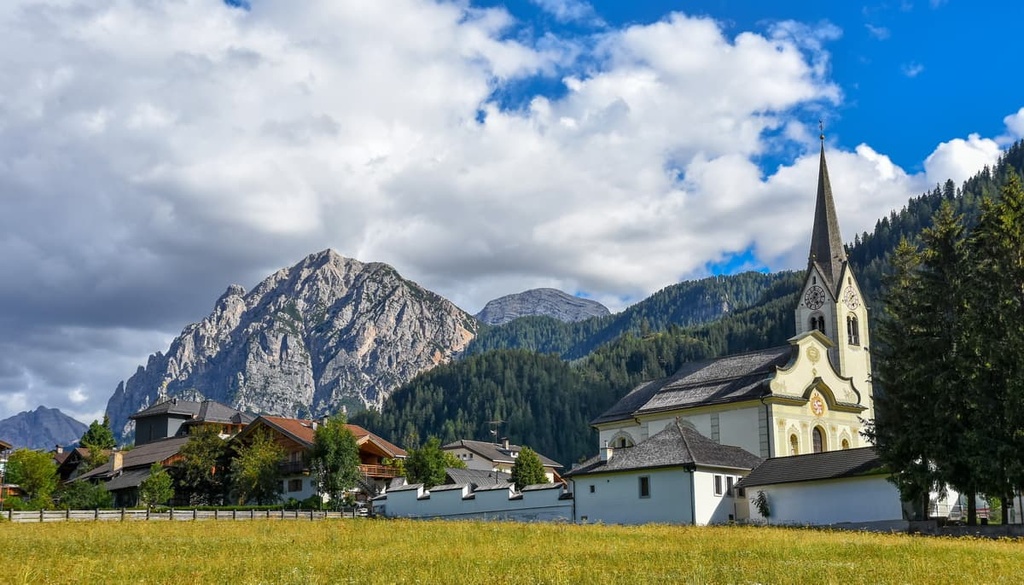
There are a few architectural and cultural attractions in the village. One of the most important is San Vigilio Church (Chiesa di San Vigilio), a parish church in Rococo style built in 1781–82. It is located on the site of an original Gothic church that dates back to 1512.
Check out the official tourist site of San Vigilio / Enneberg for more information: Sanvigilio.com.