Scan the QR code and open PeakVisor on your phone
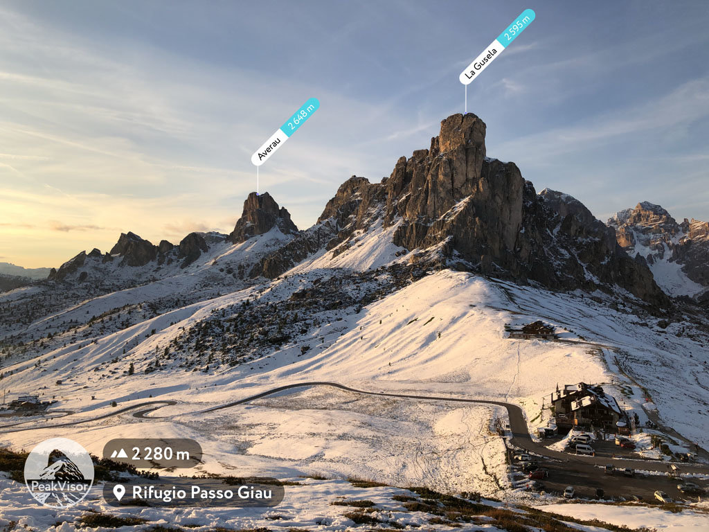
The Nuvolau is a small group of 15 named mountains in the East Dolomites in northern Italy that’s known for its super-central location in the region. If I had only one day in these mountains and wanted to see all the major peaks, I would go to Gruppo di Nuvolau. In particular, you can see the famous majestic scenery of the Dolomites from the highest and the most prominent mountain of the group, Averau (2,649 m / 8,690 ft), by climbing the via ferrata to its summit.
The Nuvolau Group is located in the province of Belluno in the Veneto region in the north of Italy, almost on the border with the Trentino—Alto Adige / South Tyrol region. The group is also divided among the four municipalities: Livinallongo del Col di Lana, Cortina d’Ampezzo, San Vito di Cadore and Colle Santa Lucia.
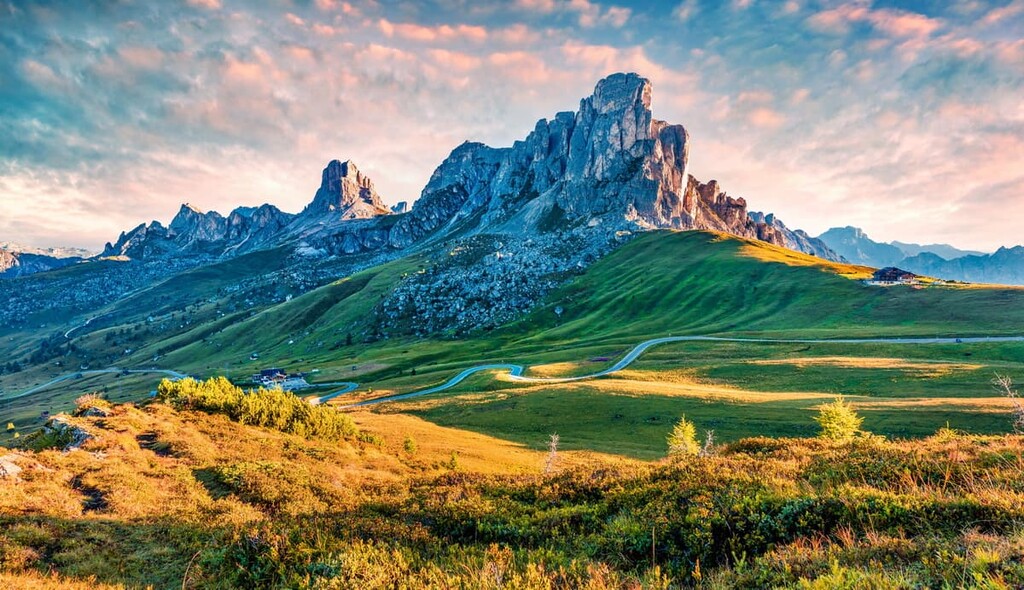
Geographically, the group is located at the Falzarego Pass (2,105 m / 6,906 ft) nearly equidistant from the three other much larger groups: the neighboring Tofane, the Fanes to the north, and the Croda da Lago to the southeast. To the south and southwest there are also the notable peaks of Col di Lana (2,457 m / 8,061 ft) and Colle di Santa Lucia, respectively.
In addition to Falzarego Pass, the boundaries of the group are also defined by two very famous passes in the Dolomites: Giau Pass (2,236 m / 7,335 ft) and Valparola Pass (2,168 m
/ 7,171 ft).
Every year in mid-July the Dolomites Marathon (Maratona dles Dolomites in the local Ladin language) takes place on these passes. It is the biggest cycling race in the world with some 90,000 participants. The passes attract a lot of cyclists, motorcyclists, car drivers, and, of course, hikers during the other 364 days of the year.
The easiest and fastest way to get to Falzarego Pass is from Bolzano in the west or Belluno in the south. The distance is almost the same—83 km (mi) and 94 km (mi), respectively.
Bolzano can be reached from Verona (163 km / 101 mi) in the south or Innsbruck, Austria, in the north (122 km / 75.8 mi). Belluno can be reached from Venice in the south (107–126 km (66.4–78.2 mi) depending on the road you choose. The travel time between all cities is almost the same—about 2 hours.
If you don’t have a vehicle, the local company Dolomiti Bus runs a shuttle bus from Belluno to the Falzarego Pass during the summer season from mid-June to mid-September. Keep in mind, however, that it usually leaves at 6:55 AM (and arrives at the pass at 9 AM) which means you’ll need to arrive in advance to Belluno from Venice.
You can return the same day at 4 PM on the bus that travels in the opposite direction (you’ll be in Belluno at 6:20 PM). This is also why the Nuvolau Group is an ideal option for a day trip to the Dolomites for those who don't have a car.
In fact, when I visited it in early August 2013, I didn’t have a car, so I took the bus for the day. I had approximately 7 hours to do a nice hike on one of the loop trails in the group, which I’ll talk about next in this guide.
Finally, note that between Belluno and Venice, as well as between Verona and Bolzano, you can travel by Trenitalia trains.
The geology of the mountains of the Nuvolau Group does not differ from the rest of the main groups in the Dolomites. These mountains are composed of the mineral dolomite that gave them their name, which, in turn, was named after the French explorer Déodat Gratet de Dolomieu, who discovered the mineral in the late eighteenth century.
This mineral is similar to true limestones and it is a predominantly light stone of white, light gray, or yellowish color. It began to form 220–250 million years ago during the Triassic Period on the bottom of the ancient tropical ocean Tethys, as accumulations of corals and other sea creatures on the seabed.
Dolomite is known throughout the world for its unique ability to absorb sunlight. Due to this feature, at sunset, the rocks are colored in all warm colors of the rainbow—yellow, orange, and pink—and after sunset they become gray or slightly purple. Therefore, the main unofficial name of Dolomite is the “Pale Mountains.”
On the basis of geology, in the Dolomites, there are also nine major mountain systems, which were recognized as World Heritage Sites by UNESCO in 2009. Technically, the Nuvolau Group does not belong to any of them, but it is in close proximity to group number 5 called Dolomiti settentrionali, which includes the neighboring groups Tofane and Fanes, Sorapiss, Antelao, and others.
But there is one exception in the Nuvolau mountains: The Monte Pore (2,405 m / 7,890 ft) differs from the rest of the peaks in the group. It has a volcanic origin. Its upper parts consist of tuff, which makes it different from the rest of the group's peaks, which consist of Principle Dolomite and Cassian Dolomite rocks—of the main types of this mineral.
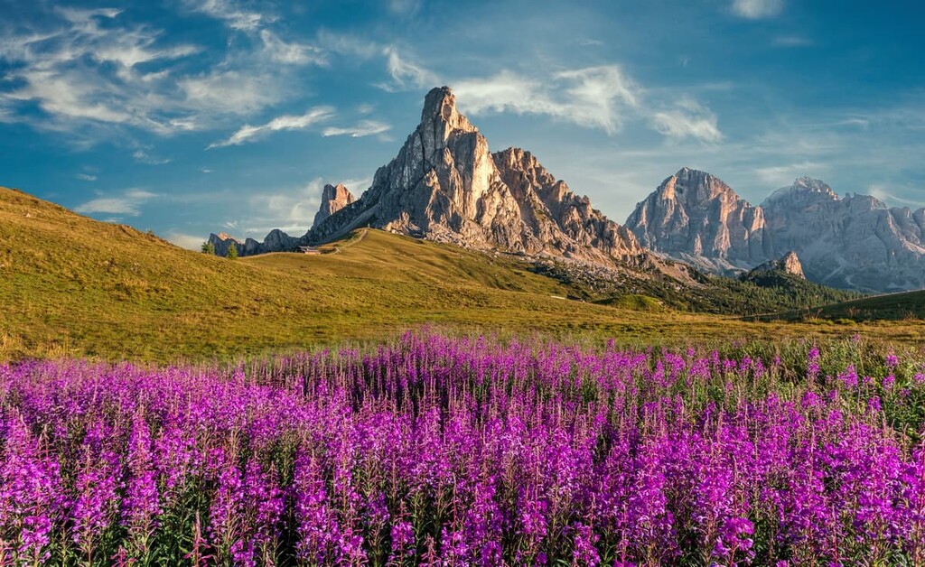
The Nuvolau Group is a distinctly long mountain range that begins (or ends) at the Falzarego Pass and extends from northwest to southeast. In the center of the ridge is the highest peak of the group, Averau, which looks like a huge man-made tower or even a castle, as well as the neighboring Croda Negra (2,518 m / 8,261 ft).
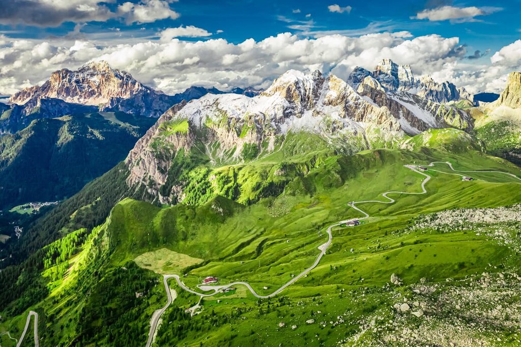
There are two large plateaus with Alpine meadows on both sides of the group, but the northern side, still, is much rockier.
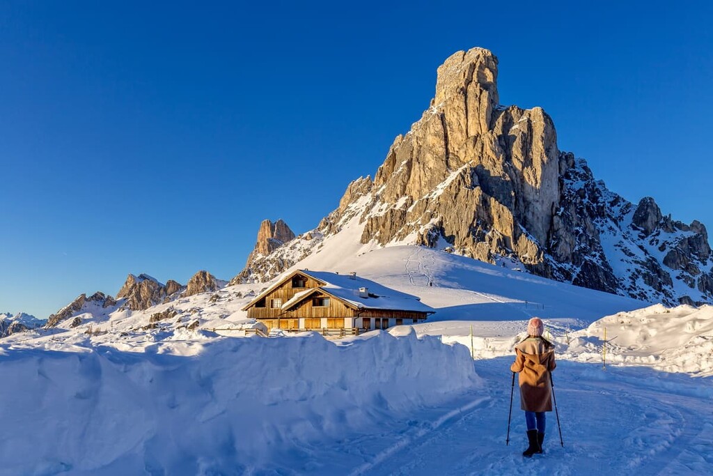
The aforementioned Monte Pore is located separately from the main range in the south. The same with Sas de Stria (2,477 m / 8,126 ft) in the north at the Falzarego Pass. The latter has an interesting form of a pyramid with a 45 degrees ski similar slope.
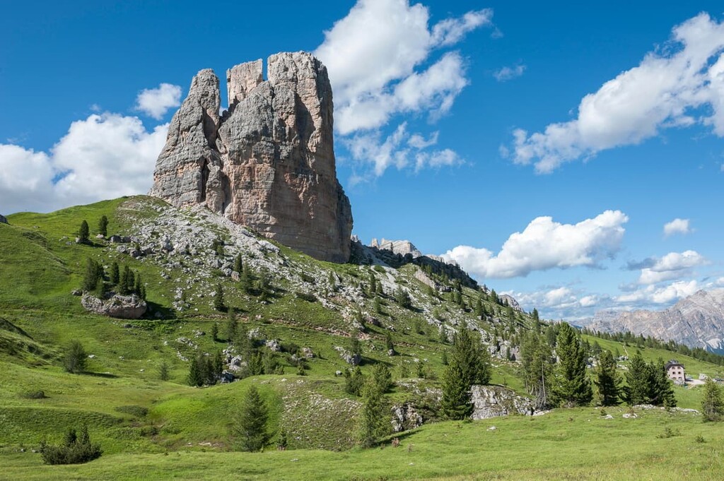
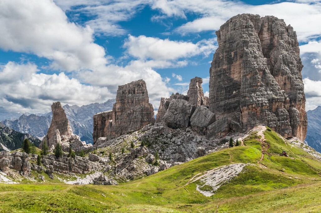
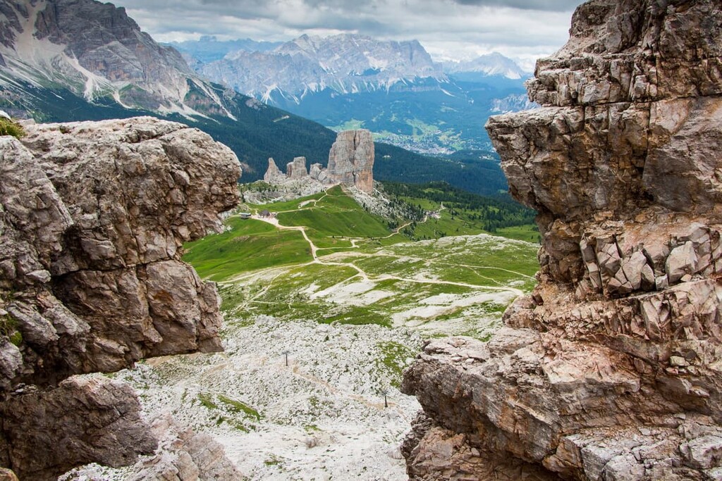
However, the main feature of the Nuvolau's landscape is a group of five, also separate mountains to the north of the main ridge called Cinque Torri with the highest peak called Torre Grande (2,361 m / 7,746 ft). Because of its location and its unusual form, this group is considered even more famous than the rest of the range.
The Nuvolau Group is surrounded by several valleys: Val Boite in the east, Val d’Andraz and Val Cordevole in the west, Val Fiorentina and Val Cernera in the south, and Val Codalunga in the north, without which the landscape of this group cannot be imagined. Going to these mountains, you will definitely pass through at least one of these major valleys.
The Nuvolau Group belongs to the larger Dolomiti di Ampezzo Group, one of the main subranges in this part of the region. In turn, it is part of the Dolomiti di Sesto, di Braies e d’Ampezzo Group in the Italian SOIUSA classification. According to the same classification, we can divide the Nuvolau itself to the three following subgroups:
Next, I will provide a bit more information about the three main peaks of the Nuvolau:
Averau is the highest peak of the group and it is located in the center of the range. In many ways, it looks very similar to a man-made tower, although, as with all mountains in the Dolomites, its appearance changes if you look at it from a different angle.
The first ascent of the mountain from the east was made by the Englishman Richard Issler with the local guide Santo Siorpaes in 1874, after the more famous Austrian climber Paul Grohmann climbed the more impressive and higher Tofana di Mezzo (3,244 m / 10,643 ft), also located here, years earlier.
The name of the peak is often confused with the name of the group itself—and for good reason, they are very similar: Averau—Nuvolau. Therefore, the peak has a second name—Nuvolau Alto.
Nuvolau is the second most important peak in the group that bears its name.
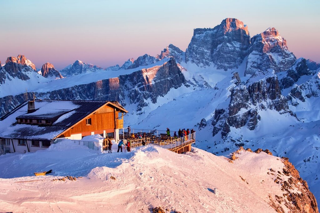
This peak does not stand out in the landscape as much as the first, because it is only a “low” peak on the mountain range, but attracts no less attention from tourists, thanks to the famous mountain hut of the same name that is located on it.
Going to the rifugio Nuvolau, in addition to the mountains I mentioned before, you can also see many other mountains: Marmolada with its famous glacier, Sella Group, Monte Cristallo, and Sorapiss. Behind them, you can even see the Austrian Alps. So the main reason for hiking to Nuvolau is to get a great view of all the major peaks in the Dolomites.
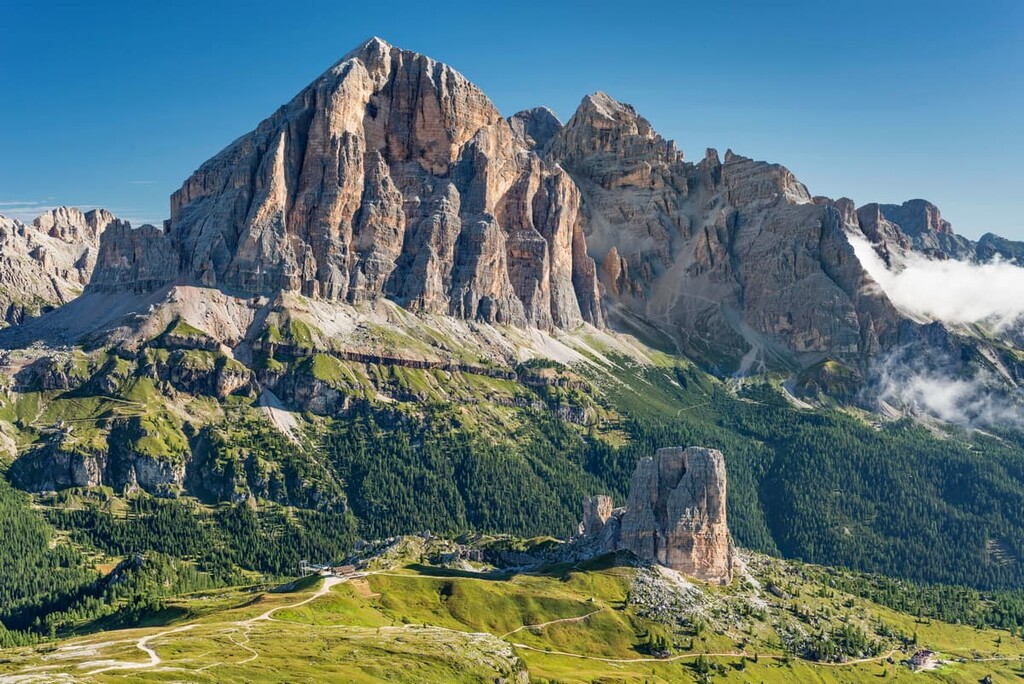
Torre Grande is the highest peak in a separate group of five peaks called Cinque Torri (5 Torri), the main symbol of the entire Nuvolau Group. The name translates as “Five Fingers”, as I already said, because it looks exactly like this. It should not be confused with the name of Cinque Terre National Park (“Five Lands”) on the coast of the Ligurian Sea in Italy.
The Torre Grande peak was first climbed by the Brit G.C. Wall and the local guide Giuseppe Ghedina in 1880. Since that time, it is one of the most climbed peaks in the Cortina d’Ampezzo area with about a dozen routes of various difficulty.
The four other peaks of this small group are
Due to the small size of the group and the relatively low peaks in the region, there are no long or challenging hiking trails in Nuvolau. At the same time, one can view this as an advantage of the group: You can easily hike the main trails in one day without an overnight stay, and if you do spend the night in one of the mountain huts here, you will see even more of the range.
The hike to rifugio Nuvolau is the main route in the group that takes you from Falzarego Pass to the rifugio Nuvolau on the summit of the peak of the same name. From there you’ll see all the surrounding mountains, as well as the more distant ones I’ve already mentioned in this guide.
In particular, the best view is of the Marmolada from its northern part, where the famous and largest glacier in the Dolomites is located.
If you are lucky with the weather, the sunset and sunrise can be magical, on the peak. Usually, the best time is between the end of Italian summer, which is counted according to the astronomical calendar, not the civil calendar, and lasts until September 21. Huts are also open until this date, as are the cable cars.
This is an easy trail around the symbol of Nuvolau, the five peaks of the Cinque Torri. It can be successfully combined with the first route to Mount Nuvolau if you continue to the Cinque Torri rifugio, pass around "Five Fingers" from the east along the big circle in the direction of Rio Bianco Bus Stop (Parcheggio Rio Bianco), and only then return to Falzarego Pass.
I also liked this route for the ever-changing scenery you get along the way: at the beginning—up to Nuvolau—you go up all the time on rocks and cliffs, then descend to a plateau with alpine meadows, and at the end, you pass through a small spruce forest along a mountain stream. There will also be a small lake called Bain de Dones on the way.
The whole route will take you just about 7 hours, giving you just enough time to catch the bus from Falzarego Pass to Belluno at 4 PM. This is the perfect walk for the whole family, too. For example, I’ve even seen parents with infants on this route. Italians don’t leave children bored at home even at such an early age.
The hike to Sass di Stria and The Tre Sassi Fort Museum is another route to another major peak in the Nuvolau Group. One way or another, you will pass it on the first two routes. You should go to this mountain separately if you want to spend a few days on the pass and if you are fond of military history.
The Nuvolau Group was the main battleground between the Italian and Austro-Hungarian armies during World War I. The mountain Sass di Stria was the most important defensive point for the Austrians after the Italians destroyed The Tre Sassi Fort (built between 1897 and 1901) on the Valparola Pass as a result of heavy artillery fire from the Lagazuou cliff. The Austrians then established via ferrata and built a gallery, trenches, and fortifications, many of which are still present today on the Sass di Stria, to make it their next fort of natural origin.
At the end of the hiking route, you will reach the fort whose remains, reconstructed in 2000–2001, are still part of The Museum of Great War (Museo della Grande Guerra), an open-air museum of many other forts, trenches, barracks, and artillery positions at Cinque Torri, Nuvolau and Lagaruoi. There you can learn more about these events.
The Alta Via 1 is one of the two longest alpine hiking trails in the Dolomites, on par with Alta Via 2. Its total length is 125 km (78 mi) and its average travel time is 12 days.
If you start from the very beginning of the trail at the Braies Lake in Val Pusteria in the province of Bolzano / South Tyrol, you will arrive at rifugio Nuvolau from rifugio Lagazuoi in the Fanes Mountains by day 4, already crossing half of Nuvolau Group.
On the next day, you will cross the second part on your way to the next Città di Fiume in the Pelmo Group.
Nuvolau is also perfect for those who adore climbing and hiking at the same time. There are three main via ferratas in the group, where you can test your courage in the mountains.
The most important route is Via Ferrata Averau (15 minutes of climbing from the rifugio Averau, elevation gain: 60 m / 196 ft). It leads to the highest mountain in the group, which cannot be reached by a regular hiking route.
Two other famous via ferratas in Nuvolau are:
What all three ferratas have in common is that they are fairly short and uncomplicated, and thus suitable for those who just want to try this type of climbing. It is also possible to combine the ferratas with the hiking routes or to do two or all three ferratas in one day.
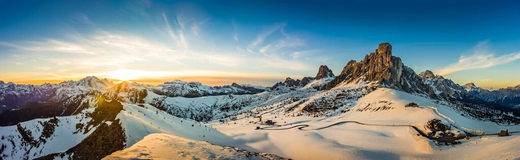
In winter, the Nuvolau turns into a small, but cozy, ski area called Falzarego with several ski trails and ski lifts, including, historically, the first “5 Torri” lift, which opened in 1970.
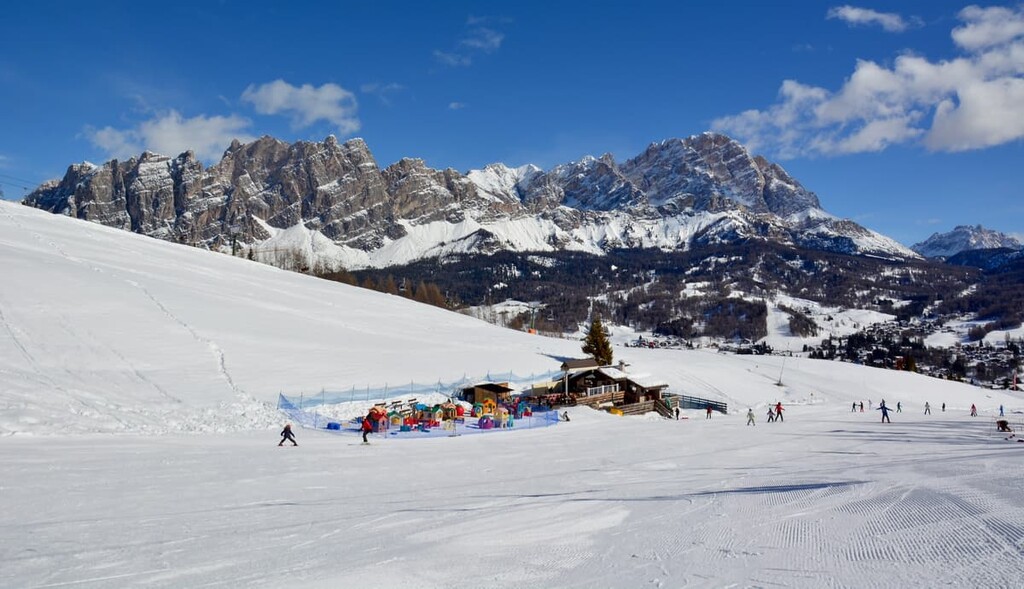
This ski area is also a part of a larger ski resort Cortina d’Ampezzo, which is part of the Dolomiti Superski system, allowing you to ski at 16 other resorts with a single ski pass.
There are a total of 16 slopes (9 red and 7 blue), including Armentarola, Lagazuoi, Col Gallina—Falzarego, Falzarego, Col Gallina, Ovest, Limedes, Falzarego—Bai de Dones, Averau, Potor, 5 Torri, Connection Faloria Col Druscie, Scoiattoli, Nuvolau, Raccordo Nuvolau, Skiweg Croda Negra, and four ski lifts: Falzarego—Lagazuoi, Falzarego, Col Gallina, 5 Torri, and Averau.
Learn more about the Lagazuoi ski area on the official Dolomiti Superski website.
Check the Nuvolau ski resort map on the larger Veneto and Italy ski maps in the World Mountain Lifts section of the site. It includes information about open ski lifts / slopes in the Nuvolau Group of the Dolomites in real-time with opening dates and hours. There are also year-round cable cars, funiculars, cog railways, aerial tramways, and all other types of mountain lifts.
There are seven mountain huts in the Nuvolau Group where you can stay overnight while hiking or climbing. Half-board, which also includes lunch and breakfast, costs €50 to €70 for a place in a shared room of 4–12 people.
The oldest rifugio in the group, the Cortina d'Ampezzo area, and one of the oldest in the Dolomites is rifugio Nuvolau. It was opened in 1883 by the German and Austrian Alpine Club under the name Sachsendankhütte, and was rebuilt and renamed to the rifugio Nuvolau by the CAI (Club Alpino Italiano) section of Cortina d’Ampezzo after it was destroyed in World War I.
Do you wonder how people become rifugio owners or managers? For example, in 2021, in this particular rifugio the CAI launched a call for tenders to select the new manager. It received 254 applications. The 27-year-old Emma Menardi from Cortina d’Ampezzo became the winner and the first woman to manage rifugio Nuvolau.
However, because of the 2020–2021 situation with worldwide travel, rifugio remains temporarily closed. Check its website, as well as other mountain huts in the group for opening and closing updates before you travel here in coming years.
Rifugio Nuvolau (2,575 m / 8,448 ft)
24 beds
Monte Nuvolao, 32043 Cortina d’Ampezzo BL, Italy
+390436867938
Rifugio Averau (2,413 m / 7,916 ft)
20 beds
Localita Forcella Nuvolau, 9, 32020, Cortina d’Ampezzo BL, Italy
+3904364660
Rifugio 5 Torri (2,137 m / 7,011 ft)
24 beds
Localita 5 Torri, 32043, Cortina d’Ampezzo BL, Italy
+3904362902
Cortinadelicious.it/IT/s4-tipo-3-Rifugio-Cinque-Torri
Rifugio Scoiattoli (2,255 m / 7,398 ft)
20 beds
Localita 5 Torri, 32043, Cortina d’Ampezzo BL, Italy
+390436867939
rifugio.scoiattoli@dolomiti.org
Rifugio Fedare (2,000 m / 6,561 ft)
9 beds
Passo Giau 8, 32020, Colle Santa Lucia BL, Italy
+390437720182
Iski.it/it/Rifugio-Fedare-Passo-Giau
Rifugio Piezza (2,175 m / 7,135 ft)
10 beds
Passo Giau, 5, Colle Santa Lucia, 32020, BL, Italy
+393291359222
Rifugio Col Gallina (2,054 m / 6,738 ft)
Passo Falzarego, 2, 32043, Cortina d’Ampezzo, BL, Italy
2 single, 1 double and 1 five person rooms
+3904362939
Before and after your hike, you can also find lodging in one of the towns around the Nuvolau Group.
The nearest visitor center is in the village of Cortina. There you can get more information about the Nuvolau group, other surrounding mountains, and the Dolomites in general. Here you can also take or buy a paper map, book, and other souvenirs, so be sure to visit the center before heading into the mountains.
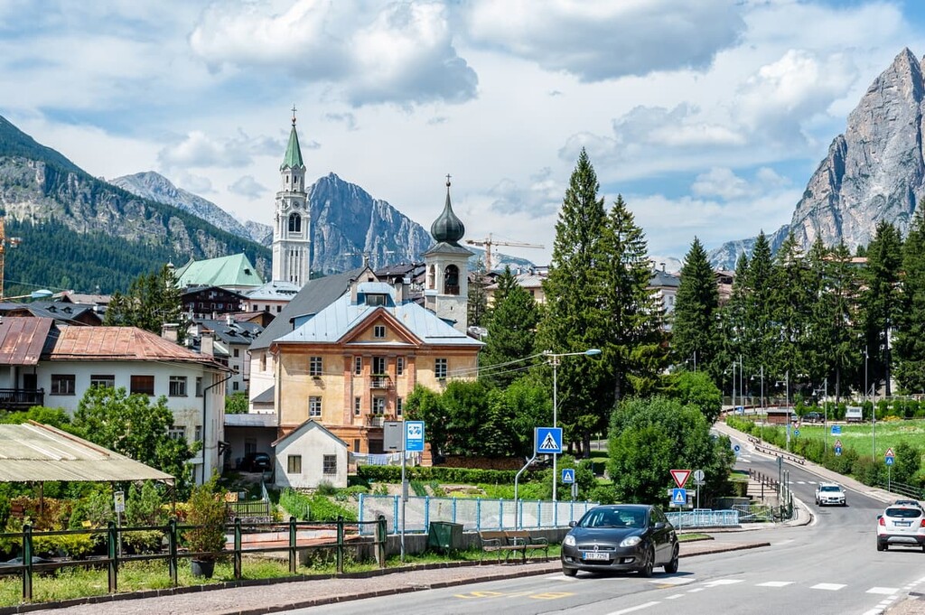
Info Point Cortina (Ufficio Informazioni Turistiche Cortina)
Corso Italia, 81, 32043 Cortina d’Ampezzo BL, Italy
General opening hours: Monday-Sunday from 9:15 am to 12:45 pm and from 3 pm to 7 pm
+390436869086
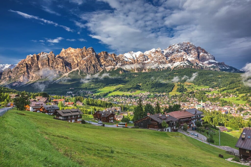
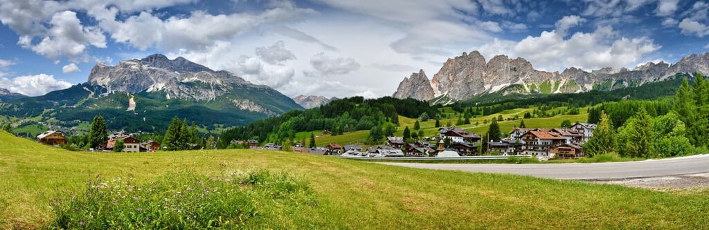
Cortina d’Ampezzo is the closest major resort to this and other groups in the Dolomites, so you may have already read about it in the guides for the Tofane Group, for example.
The second largest town is located on the west side of the Nuvolau Group and is called Livinallongo del Col di Lana. It is a small community located at 1,645 m (5,397 ft) in elevation and about 120 km (75 mi) north of Venice and about 45 km (28 mi) northwest of Belluno.
It is the center of the valley of the same name, which is one of the five Ladin valleys in the Dolomites, so 90 percent of the population speak Ladin as their native language, but, of course, they know Italian, German and some English. It is also one of the centers of the cultural region of Agordo.
The three main architectural and cultural attractions of the city and its surroundings, which can be visited in one day include:
The official tourist website: Agordinodolomiti.it.