Scan the QR code and open PeakVisor on your phone
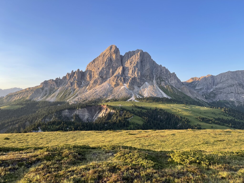
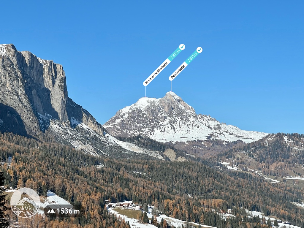
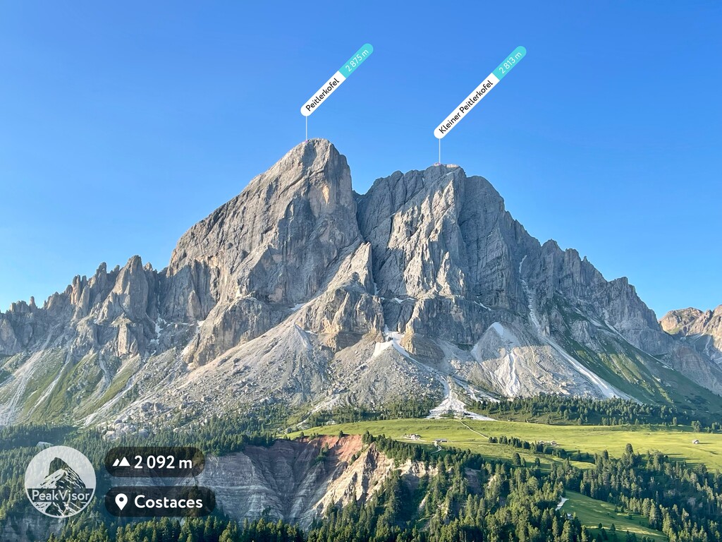
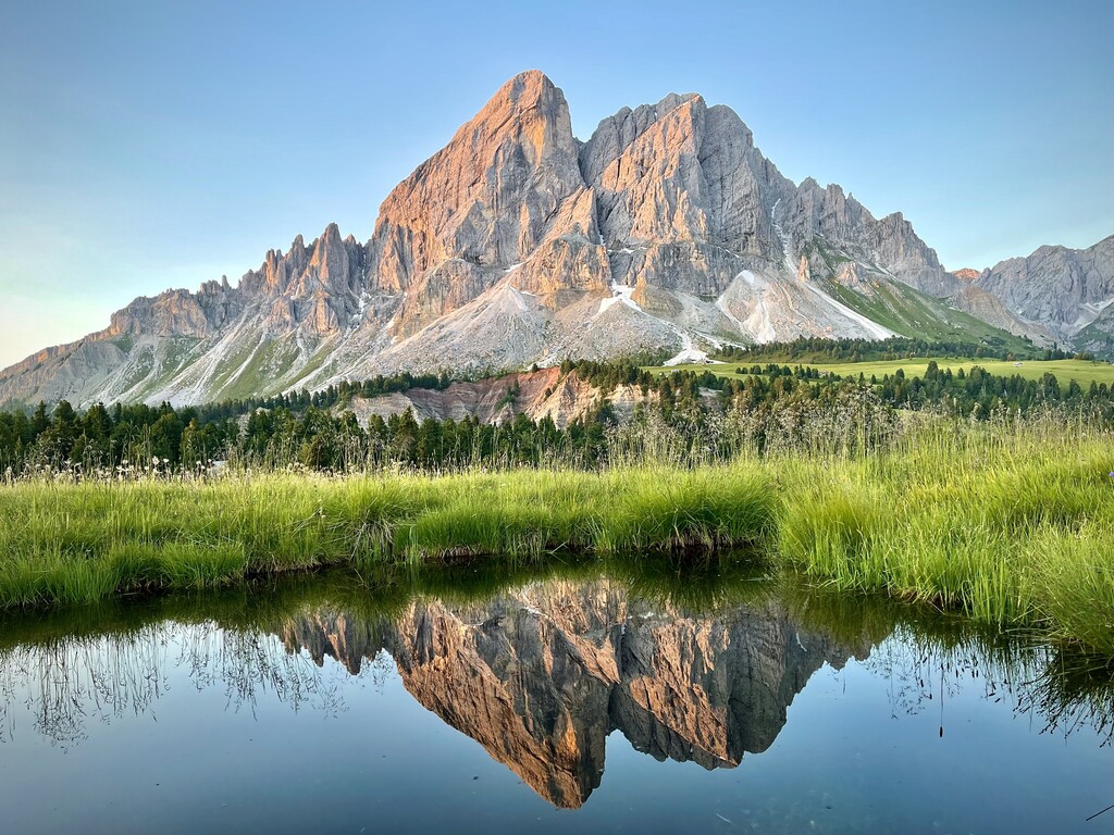
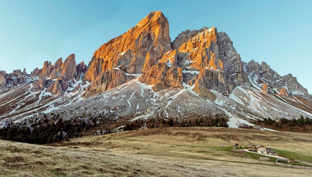
The Peitlerkofel Group is a relatively small mountain chain located in the Dolomites of northern Italy. It is mostly contained within Puez-Odle Nature Park. The main feature of the Sass de Putia is the stunning vista from Passo delle Erbe / Würzjoch, which is one of the best sunrise viewing locations in the whole Dolomites. There are 23 named mountains in Peitlerkofelgruppe. The highest and the most prominent mountain is Peitlerkofel (2,875 m / 9,432 ft).
The Peitlerkofel Group is located in the West Dolomites, which is one of the two main parts of the Dolomites alongside the East Dolomites.
It is located in the province of South Tyrol, which belongs to the Trentino-Alto Adige/Sudtirol—an autonomous region in Italy. When looking at the PeakVisor 3D map, you can also see that Peitlerkofel is one of the westernmost and northernmost groups in the Dolomites.
The boundaries of the group are the following:
To the south, the group is bordered by the Puez and Odle groups. From the latter, it is separated by the Kreuzjoch Pass (2,286 m / 7,500 ft).
Another important pass in the region is Passo delle Erbe / Würzjoch. This pass is located between Peitlerkofel and the Lüsener Berge group and the Lusner Valley (Lüsner Tal) on the north and Val d'Antermoia / Untermoital to the east. It is the starting point of most hiking trails in this part of the group.
Administratively, the Sass de Putia belongs to the municipalities of several local towns, including Santa Magdalena, San Martin de Tor / San Martino In Badia, and Chiusa / Klausen.
The latter is located on the highway from Bolzano to Brixen / Bressanone, which means it is the nearest large town to the group. It will take you 30 min (32.7 km / 20.3 mi) to get here by car or by the local Suedtirol Mobil bus lines.
In geological terms, the Peitlerkofel Group, together with the Puez and Odle, is also part of one of the nine major mountain systems in the Dolomites called Puetz-Odle, whose territory almost entirely coincides with that of its namesake nature park.
The main mineral in this group is the same as in the other eight groups in the Dolomites, a rock dolomite that was named after the French geologist Déodat Gratet de Dolomieu. Dolomite in the region began to form 200–230 years ago during the Triassic period as sediments collected on the bottom of the tropical Tethys Ocean.
However, from other systems in the Dolomites, the Puetz-Odle System is distinguished by the maximum diversity of geological layers and minerals that occur in its territory. For example, in addition to Principle Dolomite, the main type of this mineral, other varieties such as Sarl / Serla Dolomite and Schlern / Sciliar Dolomite can be seen here.
In addition to the peaks, passes, and neighboring groups, I will tell you a bit more about the famous Passo delle Erbe / Würzjoch.
Passo delle Erbe / Würzjoch attracts not only hikers but also cyclists (the famous Giro d'Italia cycling race passed through the pass three times in 1993, 1994, and 2005); climbers, thanks to several via ferratas in the group; and ski enthusiasts, who can ski at the Plose Ski Resort on the mountain of the same name opposite.
The Peitlerkofel Group is one of the dozens of groups that make up the Dolomites in the Southern Limestone Alps in the Classification of the Eastern Alps by the German and Austrian Alpine Club, also known by the acronym AVE.
By this classification, the Dolomites, in turn, are one of the 75 groups in the Eastern Alps on a par with the Carnic Alps, Fiemme Mountains, and Sobretta-Gavia Group, among others.
But according to another popular classification, the Italian SOIUSA (Suddivisione Orografica Internazionale Unificata del Sistema Alpino or International Unified Orographic Division of the Alpine System), the Peitlerkofel is also a separate group within the Dolomiti di Gardena supergroup.
In this classification system the group is part of the subsection Dolomiti di Gardena e di Fassa of the section Dolomiti in the large sector Alpi Sud-orientali (Southeastern Alps). This sector is part of the Alpi Orientali (Eastern Alps).
However, unlike the Puez and Odle groups, which also belong to the Dolomiti di Gardena supergroup, the Sass de Putia is part of the Plose-Putia Group together with the neighboring Mount Plose and Costiera di Luson, which are located on the other side of the Passo delle Erbe.
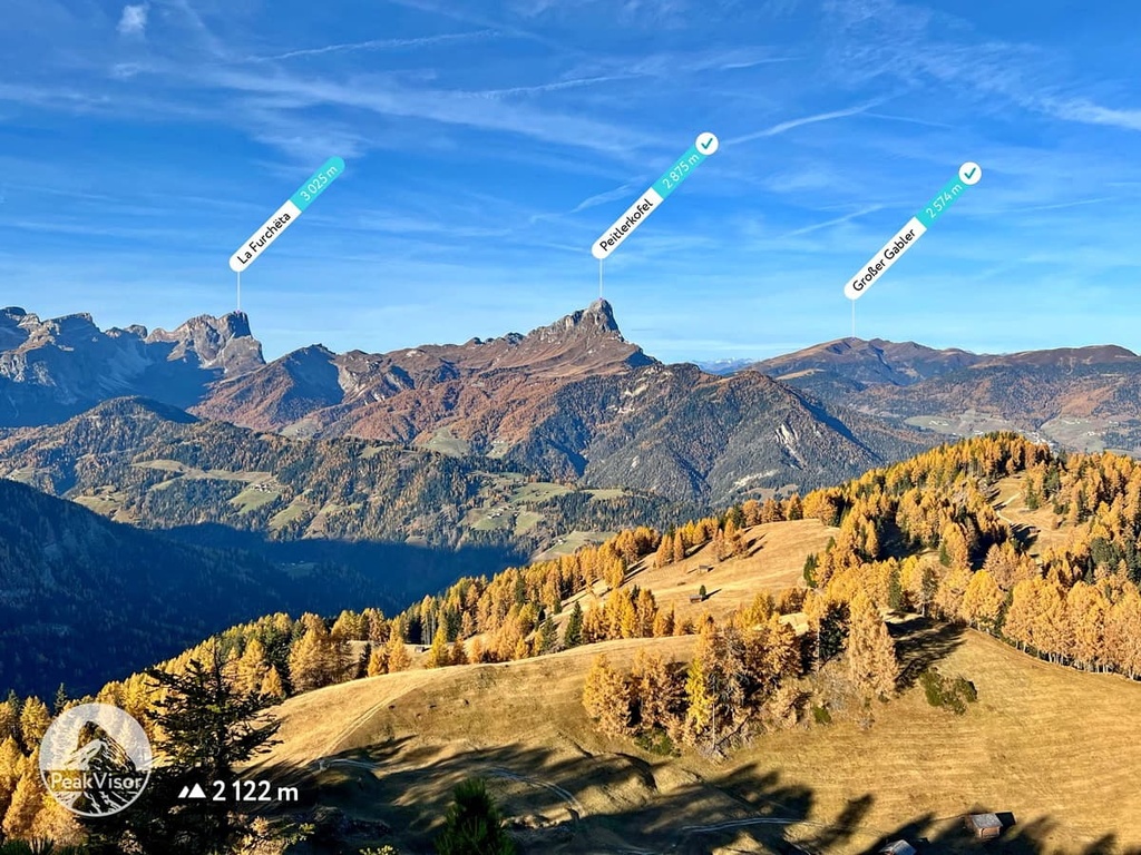
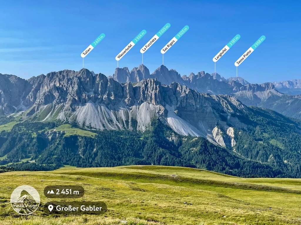
In the German-Austrian AVE classification, the Plose belongs to the Lüsener Berge Group. By the way, the highest point of Plose, Monte Gabler / Großer Gabler (2,574 m / 8,444 ft) offers a magnificent view of the mountains of the Peitlerkofel, as well as Odle and Puez.
Inside, the group can be divided into the following main sub-groups:
Next, I will briefly tell you about some of the most important peaks in the Peitlerkofel Group.
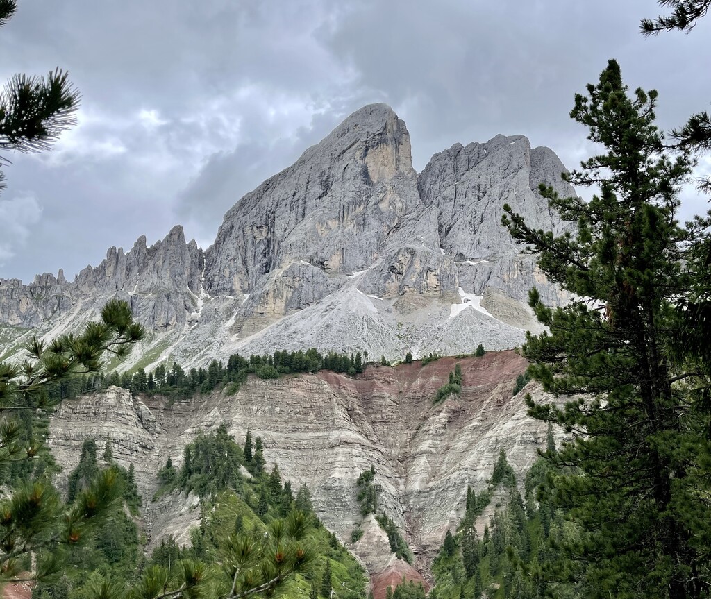
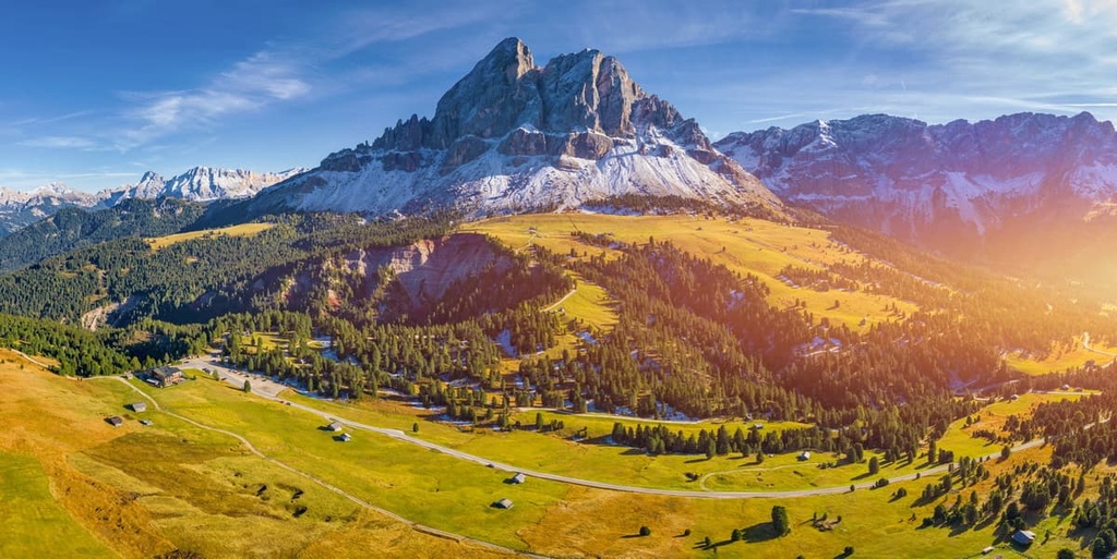
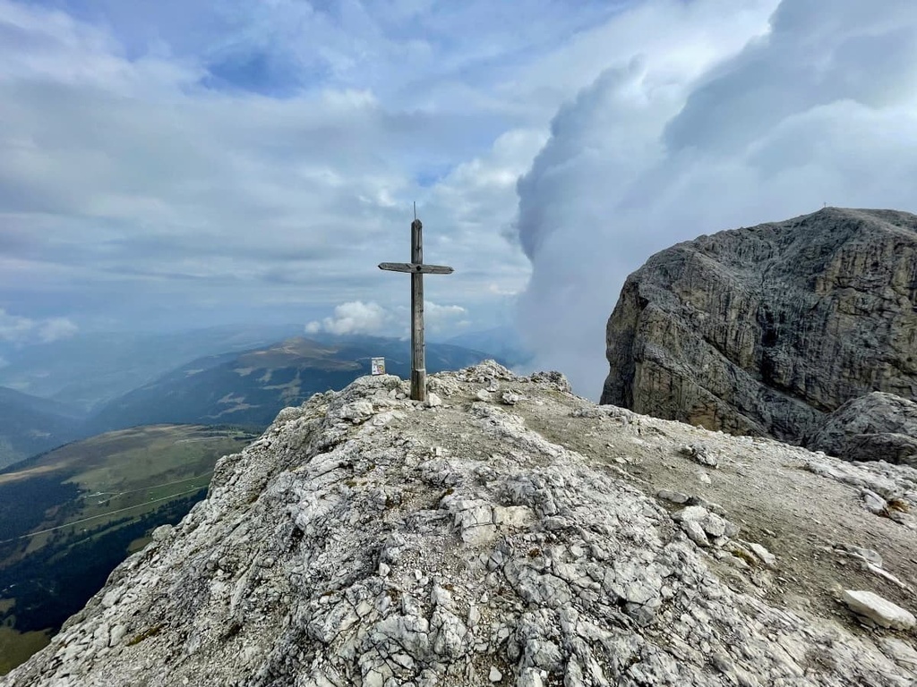
Peitlerkofel / Sass de Putia (2,875 m / 9,432 ft) is the highest and most famous peak of the group.
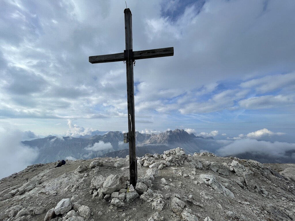
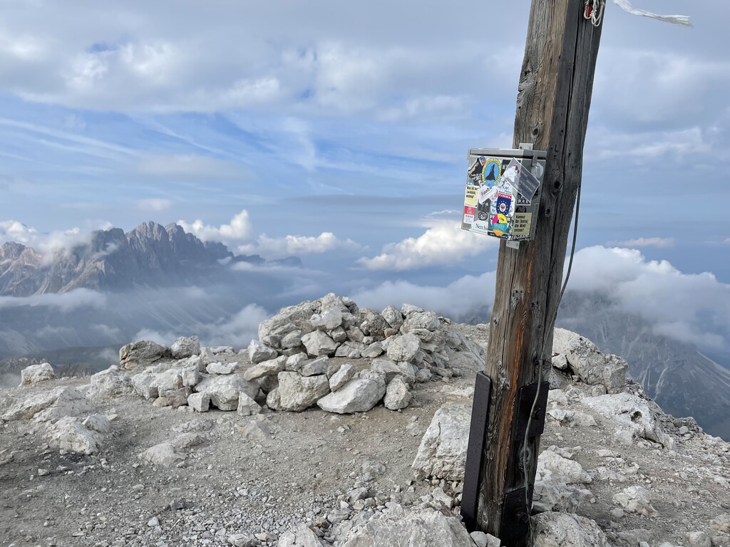
At the final section of the trail to the summit, there are several metal chains that will help you to climb to the top. Thanks to the isolation of Peitlerkofel from other groups, it offers 360-degree views of all the surrounding mountains, including not only the Dolomites but also other groups of the Alps. This is exactly what you will see:
The area around the mountain is also known for archaeological excavations in 2002–2003. During this time, many artifacts were found, such as remains of Mesolithic hunting activities and pastoral activities of the Final Bronze Age and Iron Age. Researchers also found evidence of significant cult activity in this area.
Kleiner Peitlerkofel (2,813 m / 9,225 ft) is the second highest peak of the Peitlerkofelgruppe.
You can easily bag this peak on the way to or from the main Peitlerkofel. It is just a small side trip, and from the summit, one can appreciate a dramatic drop of the north face of Peitlerkofel.
Together with Sass de Putia, like many peaks in the Dolomites, Kleiner Peitlerkofel looks like a huge pyramid, which seems to have been built on purpose—only not in the Egyptian desert, but in the middle of the Alpine meadows of South Tyrol.
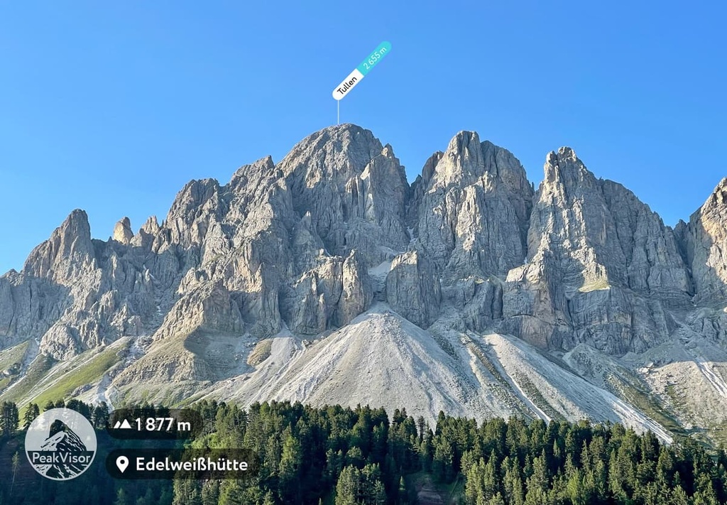
Tullen (2,655 m / 8,711 ft) is the third highest peak of the group and the first one in the Odle di Eores subgroup.
This subgroup is very famous because of its unusual shape, though its shape varies depending on the angle of view of the observer. From the south side, the mountain looks like a large round fortification tower in which the knights of the Kingdom of Tyrol could live, while from the northern side, it looks like a massive pyramid-like mountain.
The first person to climb Tullen was a climber named Hermann Delago on October 6, 1895. Today you can do it by the famous via ferrata “Günther Messner Steig.” where Tullen is one of the three peaks along this route.
The Peitlerkofel Group offers hikers and climbers a huge variety of trails of varying lengths and levels of difficulty. Here are some of the best hikes to check out in the range:
The hike around Peitlerkofel / Sass de Putia is the main route in the group that travels around its two main peaks: Peitlerkofel / Sass de Putia and Kleiner Peitlerkofel. This hike allows you to see the peaks from all sides.
The trail begins at Passo dell Erbe and goes on to the north face of Pütia. From here, it turns back to Forcella di Pütia and then to Göma Pass, returning from there back to the north face and the pass.
Moreover, those who like to climb can also climb the Peitlerkofel / Sass de Putia itself using the relatively easy via ferrata. However, this requires special equipment to complete.
The Via Ferrata "Günther-Messner-Steig" is a hiking route around Tullen, the third highest mountain in the Peitlerkofel. It also includes an ascent to its summit along the famous via ferrata, also called “Alta Via Günther Messner.”
It is named after Günther Messner, the brother of famed alpinist Reinhold Messner, who died in an avalanche while descending from Nanga Parbat in the Himalaya in 1970.
The route begins at the intersection of the SP163 and SP29 road on the Via Colle between the village Colle in Val di Funes and Passo delle Erbe. On the way, you will also travel around the mountains Kalbergartenspitze Col Magrei (2,331 m / 7,647 ft), C. Lavina Bianca (2,494 m / 8,182 ft), Ringspitz (2,625 m / 8,612 ft), and the entire Odle d’Eores subgroup.
You have to prepare for this trip with great care because on the way there will be many metal cables, old and newer ladders, difficult cliffs and so on. The whole hike will also take you at least 7 hours, so start early in the day to avoid getting benighted on the trail.
The Sass de Putia is located a little ways away from the famous Dolomiti Superski system. Therefore, it is less popular than the neighboring groups of Puez and Odle, which are part of the park of the ski area. However, you can ski here, too at one of two local resorts:
The first resort, Ski Adventure Mountain Filler (Zona sciistica Funes), is located on the mountain of the same name in the center of Funes Valley in the famous village of St. Magdalena.
There is one 350 m (1,148 ft) slope with the same elevation change. It is an ideal place for families with small children. There is also the Snow Fun Park for kids.
The valley also offers many cross-country skiing routes, for example, there is the Malga Zannes / Zanser Alm Circular Trail of 2 km (1.2 mi).
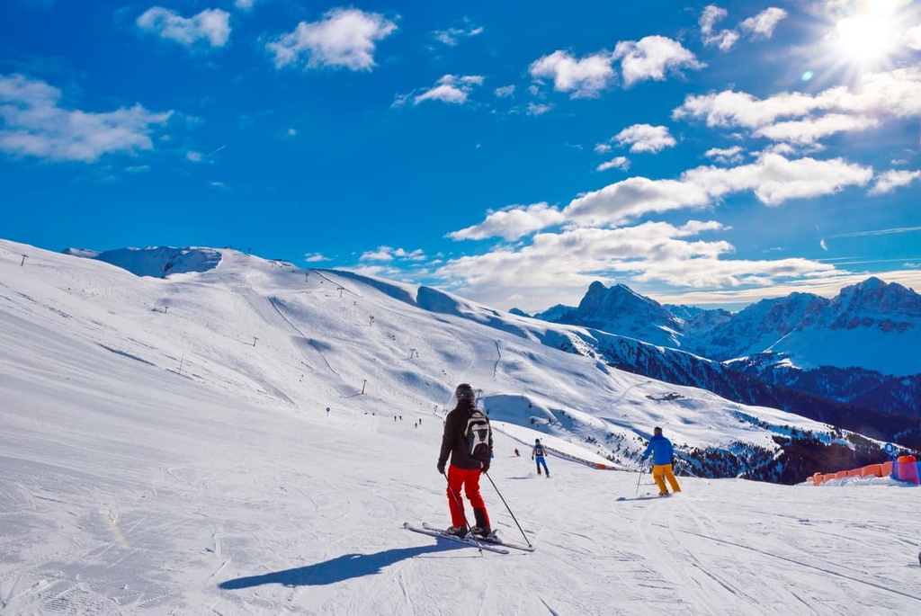
The second resort, Ski Resort Plose, is much larger. It is also situated on the mountain Großer Gabler / Plose (2,574 m / 8,444 ft) in the neighboring Lusner Valley (Lüsner Tal) to the north of the group.
Here you will find 42.5 km (26.4 mi) of ski trails of varying difficulty and seven ski lifts.
Separately, the longest run in the resort and in South Tyrol, which is called “Trametsch”, deserves a special mention. It is 8,2 km (5 mi) long with 1,400 m (4,593 ft) height difference.
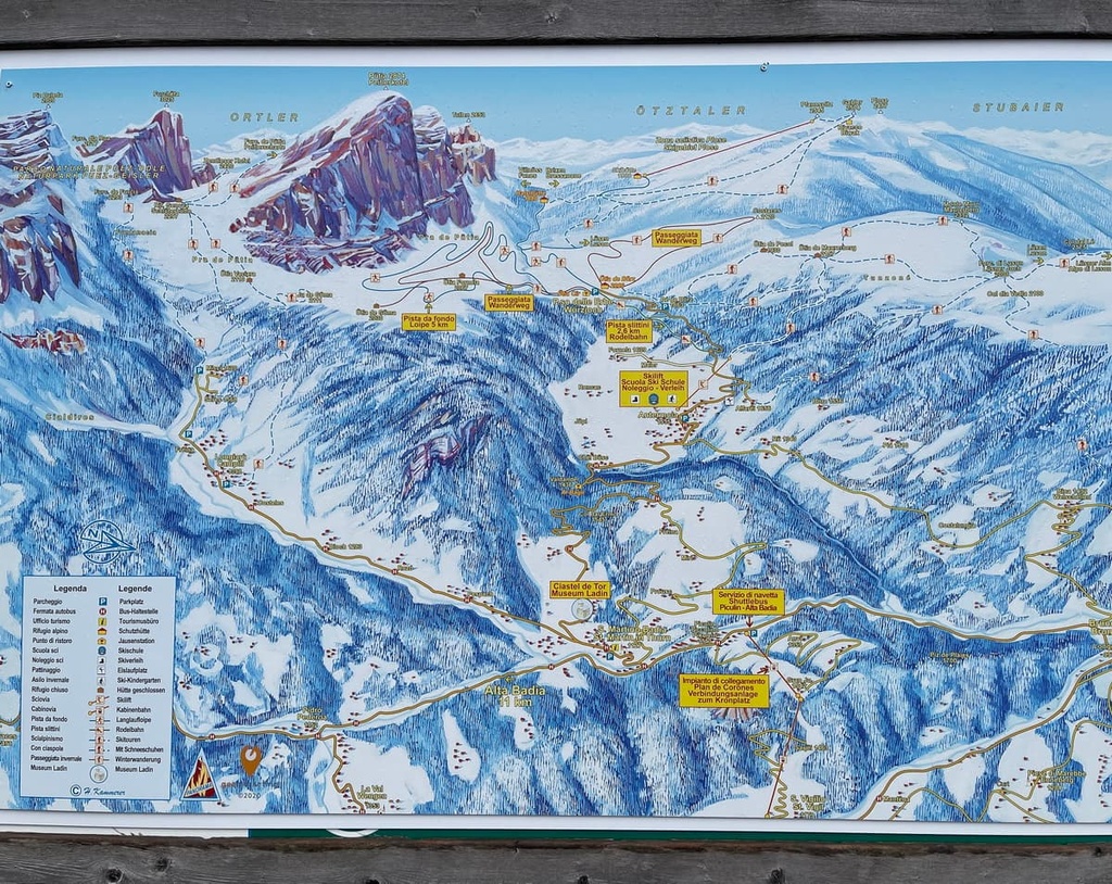
Check the Peitlerkofel / Plose ski map on the larger Trentino-Alto Adige/Südtirol and Italy ski maps in the World Mountain Lifts section of the site. It includes information about open ski lifts / slopes in the Peitlerkofel / Plose Group of the Dolomites in real-time with opening dates and hours. There are also year-round cable cars, funiculars, cog railways, aerial tramways, and all other types of mountain lifts.
The largest tourist center of the Funes Valley is located in the hamlet of Tiso / Teis in the Tiso / Teis Mineral Museum (Museo Mineralogico Tiso), which is dedicated to the geology of this region and the Dolomites in general.
Therefore, you can visit both centers during your hike through the group and the valley to get more information about the region’s geology. At the visitor center, you can also pick up useful maps and paper guides.
Tourismusbüro Teis / Ufficio Turistico Tiso
Museo Mineralogico Tiso, 39040, Funes/Villnöss, BZ, Italy
+390472844522
Opening hours:

In the Peitlerkofelgruppe, especially in the Funes Valley on the southern borders of the group, you will find all kinds of accommodation options, including hotels, alpine huts, apartments, and so on.
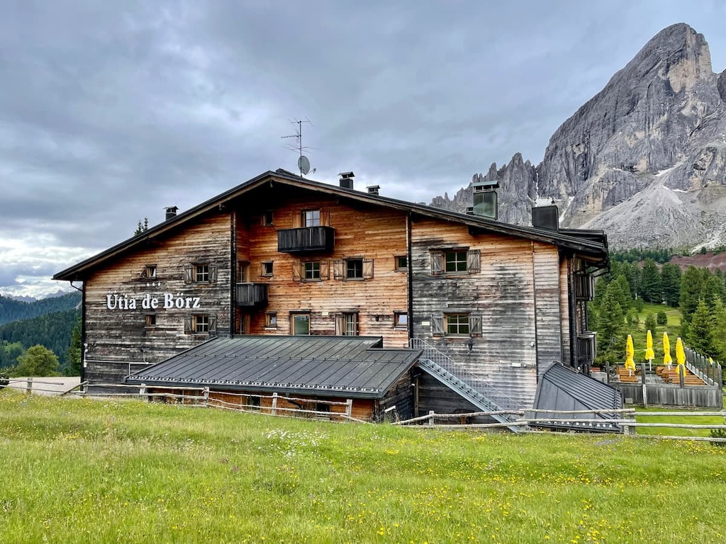
But if you want to feel what it means to have an authentic Alpine overnight hiking stay, I recommend staying in one of the four local rifugios, or traditional mountain huts, which are usually located high up in the mountains:
No doubt, the most important of the above-mentioned huts is rifugio Genova. It is located in the high part of the Funes Valley in the Alpine meadows between the Peitlerkofel and the Odle groups at 2,306 m (7,565 ft). It offers some of the best views of the entire Puez-Odle Nature Park.
The rifugio is a big two-story building that was built in 1898. It is run by the local Messner family. Yep, that’s right—the family of the world-famous mountaineer from South Tyrol, Reinhold Messner, who was born in Brixen and grew up in this valley.
Another must-know fact is that the Alta Via 2, as well as the Munich–Venice hiking routes pass right through the refuge. The annual Transalp Challenge cycling competition also passes by this region.
The hut has 90 beds in single, double, triple, and quadruple bedrooms and larger dormitories. The half-board (bed, dinner, and breakfast) costs €48 in the dormitory and €55 in other rooms. As it is written on the hut’s site, " payment is only possible in cash."
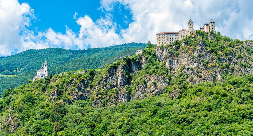
Chiusa / Klausen is the closest major town and resort to the Peitlerkofel Group. It sits at an elevation of 523 m (1,715 ft) on the highway between the two larger cities of South Tyrol, Bolzano, and Brixen.
It is another Ladin commune in the region, where the overwhelming majority of the population speaks Ladin and German, and only then Italian (and sometimes English). The name is translated from the Ladin word “clausa” or “clusa.” which means “lock of a waterway,” a reference to the Eisack River in the valley.
The history of the city goes back to 1027 when it was first mentioned in local written sources. Today, the city has a population of 5,252 (2020). The municipality includes the settlements of Gufidaun, Latzfons, and Verdings.
The main architectural and cultural attractions are:
Check out the official tourist sites for more information: Klausen.it and Suedtirol.info.