Scan the QR code and open PeakVisor on your phone
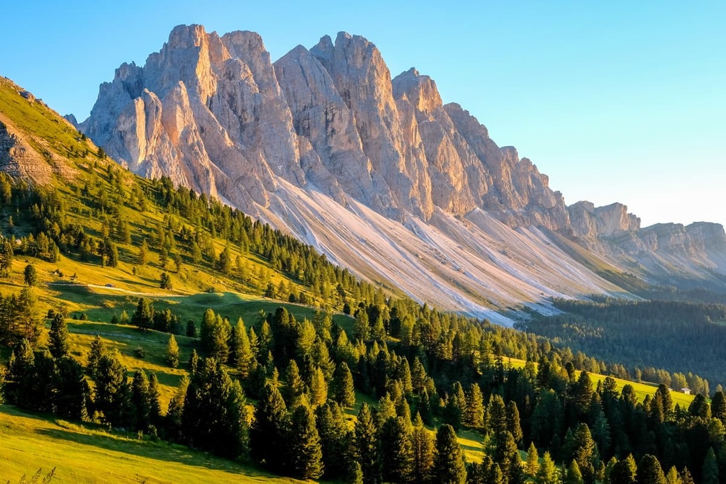
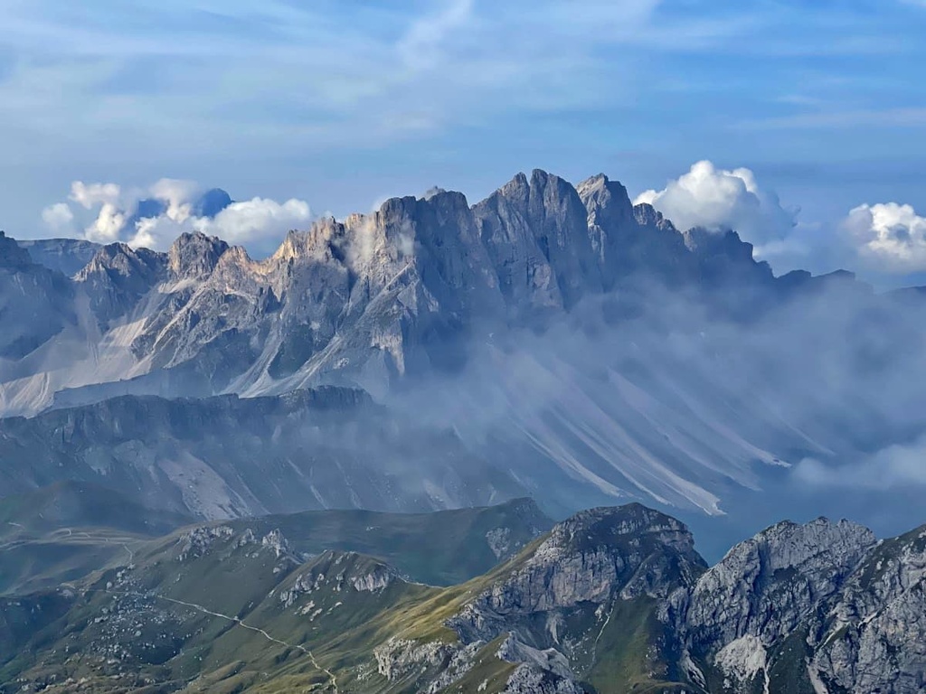
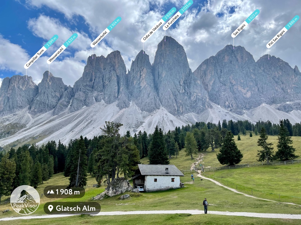
Puez-Odle Nature Park is a protected area located in the Dolomites of northern Italy that consists of three mountain groups: Puez, Odle, and Peitlerkofel. The main feature of Parco Naturale Puez-Odle is its breathtaking landscapes and diverse geology. There are 82 named mountains in Naturpark Puez-Geisler. The highest and the most prominent mountain is La Furchёta (3,025 m / 9,924 ft).
Puez-Odle Nature Park was established in 1978. It is located in the province of Bolzano / South Tyrol in the Trentino-Alto Adige / Sudtirol region in Italy. At the same time, it is part of the Western Dolomites subregion.
The park is one of the ten nature parks in the Dolomites, alongside Tre Cime Nature Park, Dolomiti Bellunesi National Park, and Bletterbach Geopark, among others. You can find the list of all parts in the guide to the Dolomites.
At the same time, Puez-Odle is the most famous park in South Tyrol, which has seven other natural parks, including Schlern-Rosengarten / Sciliar-Catinaccio Nature Park, Monte Corno Nature Park, Gruppo di Tessa Nature Park, and Stelvio National Park, among others.
The total area of the nature park is 10,722 hectares (26,494 acres), which was extended in 1999 from the original territory to include the Rasciesa area in the municipality of Ortisei. The maximum elevation difference with the valleys, which surrounds it from all sides, and the peaks of the park is 1,499 m (4,917 ft).
The exact boundaries of the Parco Naturale Puez-Odle run through the Gardena Valley (Val Gardena) on the southeast and east, the Badia Valley (Val Badia or Alta Badia) on the south, Villnößtal (Val di Funes) on the west, and the Lusner Valley (Lüsner Tal) on the north, as well as Val di Antermoia (Untermoital) to the east.
The boundaries of the park can also be easily identified by the two famous passes: Passo delle Erbe (m/ft) on the north and Grödner Joch / Passo Gardena (m/ft) on the south. Traditionally, these are the starting point of many hiking and biking routes you can follow.
There are also two smaller passes within the park: Roa-Scharte / Nives-Scharte and Kreuzjoch (2,286 m / 7,500 ft), which separate the Puez and Odle groups.
It is also important to note that the areas of these two groups, as well as the Peitlerkofel, are both partially included in the parks' boundaries.
The park is also surrounded by the following other groups: Sella, Langkofel, Schlern, Lüsener Berge and Fanes.
Administratively, the park belongs to the several municipalities, namely:
To get to the Puez-Odle Nature park, you have to go to one of these towns from Bolzano. For example, Santa Magdalena is located about 45 km (27.9 mi), 45 min by car.
To Bolzano, in turn, you can easily and quickly get from Trento and Verona in southern Italy. If you’re coming from the north, you have the choice of Innsbruck and Munich. If you travel by public transport, from Bolzano, there are Suedtirol Mobil buses to the park.
It's interesting that almost the entire territory of the Parco Naturale Puez-Odle, with the exception of some peaks in the western part of the Odle Group, is one of the nine major mountain systems of the Dolomites in the UNESCO classification system. This system was created on the basis of geology, not culture or political geography.
The exact boundaries of the system, which has a total area of 7,930 hectares (19,595 acres), can be marked (clockwise) by the Peitlerkofel, Sassongher, Monte Stevia, Sass Rigais, and Monte Tullen mountains. It does not include Santa Magdalena village.
But among all nine systems, the park stands out because all of the rock types, sediment strata, and weathering forms that are characteristic of the Dolomites can be found here, while other places are dominated by certain rocks.
For this reason, Pue-Odle is also called “The Earth’s History Book”. First, however, as elsewhere in the Dolomites, three main layers can be distinguished in the geology of the park:
The territory of the park is also characterized by the overlapping of layers. Here’s an accurate list of the major rocks that you can find in the park:
While in the park, do not miss the opportunity to learn more about its geology. Be sure to visit the Mineral Museum of Teis (Museo Mineralogico Tiso), which is located in Teis / Tiso—one of the villages of the Funes Valley.
Here is some contact information for the museum:
Museo Mineralogico Tiso
Via Teiser, 12, 39040, Villnöß / Funes, BZ, Italy
+390472844522
Opening Hours:
Ticket Prices (2021):
In particular, the museum is well-known because of the geodes from Tiso (geodi di Tiso), which are found in the vicinity of the village. A geode is a type of stone, usually round or oval in shape, with an empty cavity inside, that’s filled with other minerals such as amethyst and quartz crystals, agates, or other rock crystals.
Another must-know thing about the Tiso Museum’s collection of minerals is that it was assembled entirely by one man, a local geologist named Paul Fischnaller (born 1934), also called the “crystal hunter” (“cacciatore di cristalli” in Italian).
The unique collection includes not only valuable pieces of minerals from Tiso but also from many other places he visited, such as Switzerland, the Valle d’Aosta in the northwest of Italy, the Mont Blanc region, and Idar-Oberstein town in the Rhineland-Palatinate region in Germany.
Every single item in the museum was picked by Fischnaller himself, so the entire collection is truly a labor of love.
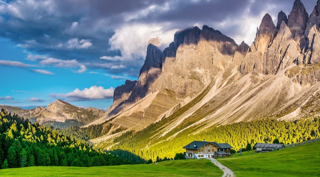
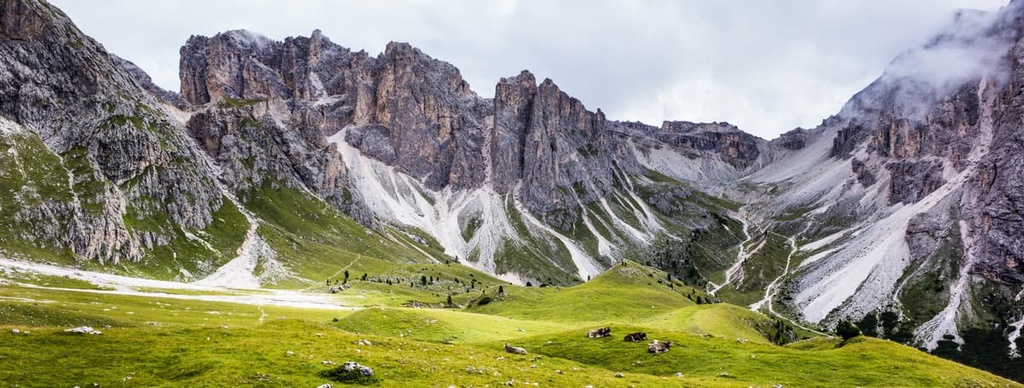
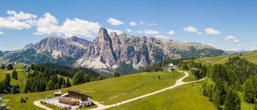
The landscape of the Parco Naturale Puez-Odle is unique and very diverse for such a relatively small area of "just" 10,722 hectares (19,595 acres).
In addition to the high mountain peaks and hiking opportunities, the park is home to almost everything that the Dolomites are known for: karst uplands, Alpine pastures, bizarre mountain crevices and canyons, high mountain plateaus, valley, dense coniferous forests, and more.
In other words, if you are traveling to the Dolomites for the first time in search of the unique landscapes of this region, but are limited in time by, say, 2–3 days, a visit to Puez-Odle Nature Park is the right choice. On the other hand, those who have a week will be able to explore it in detail and really get to know this amazing place.
The flora and fauna of the park are determined by the characteristics of the local rocks, the soil, the altitude, and the microclimate of the area.
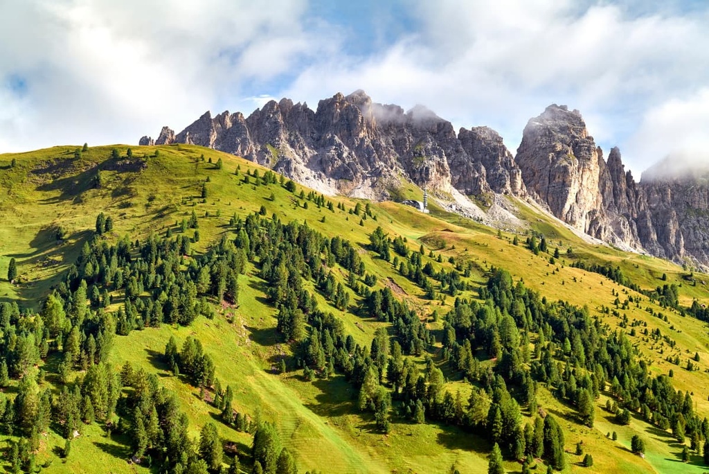
There are forests at the borders of the park and in the Passo delle Erbe / Würzjoch area that consist mainly of cembra pines and dwarf pines, larches, spruces, and even some cedars.
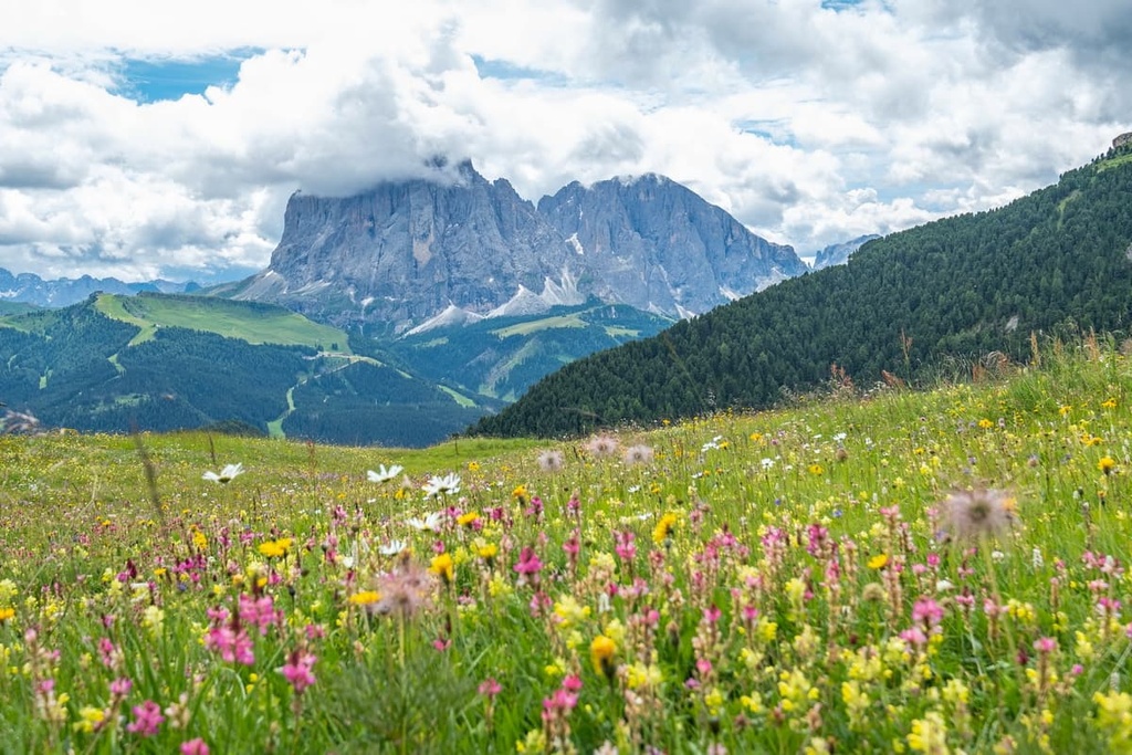
The meadows are full of flowers since every May until the end of summer, including such types as daphne mezereum, winter heath, Alpine roses, anemones, soldanels, crocuses, labiates, figworts, edelweiss, and many types of berry bushes.
Although the park doesn’t have a lot of water and no large wetlands, there are plants like cushion sedges and blue moor grass, too.
As far as animals go, there are deers, chamois, marmots, and some other medium-sized species that roam the park’s woods and meadows, but they are few in number. Some of the many birds found in the park include eagles, eagle owls, black grouses, woodchucks, northern wheatears, pipits, snow finches, rock ptarmigans and others. Various types of colorful butterflies and beetles are also very common in Puez-Odle.
When it comes to dangerous animals, the only major thing to look out for are the snakes, which can crawl out on the paths to bask in the sun. To avoid them, simply watch your step, though this can be quite difficult, given the beauty of the local scenery.
The Puez-Odle Nature Park consists of three mountain chains, each considered a separate group in the Dolomites in the classification of the Eastern Alps of the German-Austrian Alpine Club (AVE), namely:
The large but compact group of Puez is adjacent to the even larger Odle, which extends to the west. The Peitlerkofel group is sort of set apart from them to the north, and in some classifications is not considered a separate group, but a part of the larger Puetz-Odle Group.
Hiking enthusiasts will find plenty of excellent trails in Puez-Odle Nature Park, from day hikes in the valleys to challenging via ferratas, some of which require courage and climbing experience.
In this section, I’ll talk briefly about the longest route crossing the entire park, Alta Via 2. It is suitable for those who want to head out on an extended adventure.
Alta Via 2 is one of the two longest alpine hiking trails in the Dolomites, on par with Alta Via 1, which is 180 km (111.8 mi) long and takes 13 days to complete.
If you start from the very beginning in Brixen / Bressanone in South Tyrol, you will arrive at the rifugio Città di Bressanone also known as rifugio Plose / Plose Hütte that night. It will take you the next three day to cross the park to arrive to rifugio Franco Cavazza al Pisciadù / Pisciadù Hütte at the Sella Group via rifugio Genova / Schlüterhütte and rifugio Puez / Puez Hütte.
The Alta Via 2 is also known as the “Way of the Legends” because it runs through magical places mentioned in Ladin legends.
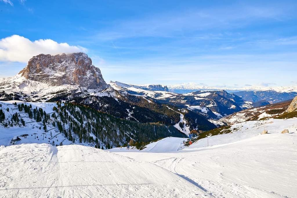
The Puez-Odle Nature Park is a great place to travel to the Dolomites not only in summer but also in winter. There are four ski areas around the park, which includes everything from small resorts of just one slope to huge ski areas with hundreds of kilometers of pistes, where you can enjoy the great peaks of Puez, Odle, and Peitlerkofel.
Check the Puez-Odle ski map on the larger Trentino-Alto Adige/Südtirol and Italy ski maps in the World Mountain Lifts section of the site. It includes information about open ski lifts / slopes in the Puez-Odle Nature Park in real-time with opening dates and hours. There are also year-round cable cars, funiculars, cog railways, aerial tramways, and all other types of mountain lifts.
The park’s visitor center is located in the village of Santa Maddalena in the geographic center of the Funes Valley to the west of the park. The modern cubic, two-story building made of papyrus-colored concrete is worth visiting.
Inside, you’ll find exhibitions and galleries on the history and nature of the valley and the park, including:
You can also take a virtual tour of the Visitor Center if you can’t visit it in person.
Puez-Geisler / Puez Odle Nature Park Visitor Center
St. Magdalena / S. Maddalena, Trebich, 1, 39040, Villnöß / Funes, BZ, Italy
+390472842523
Opening Hours & Admission
While hiking in the nature park, you can stay in one of 12 mountain huts in the region. They differ in the number of beds (from 20 to 90), elevation, price, or services they offer, but they are similar in that they all operate on the same "half-board: bed, dinner and breakfast" system.
Read about the most interesting mountain huts in individual group guides:
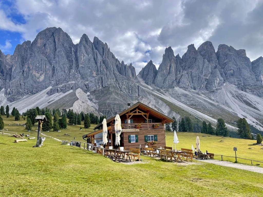
In the valleys surrounding the nature park, you will also find all other types of accommodation (hotels, B&Bs, apartments, etc.), including several campsites—an intermediate option between the mountains and civilization.
For example, at Camping Calfosch Almi (Campsite Colfosco / Corvara) at the southern borders of the Puetz Group at the foot of Sassongher, you can pitch your tent, rent a modern stylish bungalow or small wooden house, or park your caravan.
The Puez-Odle Nature Park is surrounded by medium to small towns and villages, each a worthy destination, including Klausen, St. Ulrich, Wolkenstein, Corvara, Stern, La Villa. All of these towns are located on the western, southern, and eastern borders of the park.
There are no towns comparable in size to the aforementioned on the northern borders of the park and in its central part in the Val di Funes, but there are about a dozen villages, including primarily St. Magdalena / Sankt Magdalena / Santa Maddalena, that are worth checking out.
The village of Santa Maddalena is located in the center of the municipality of Villnöß / Funes at an altitude of 1,339 m (4,393 ft), where it belongs together with Koll (Colle), St. Jakob (San Giacomo), St. Peter (San Pietro), St. Valentin (San Valentino) and Teis (Tiso).
The village has 370 inhabitants, while the entire municipality has 2,566 (2020). In contrast to many towns in the Dolomites, the population has been growing since the 1950s.
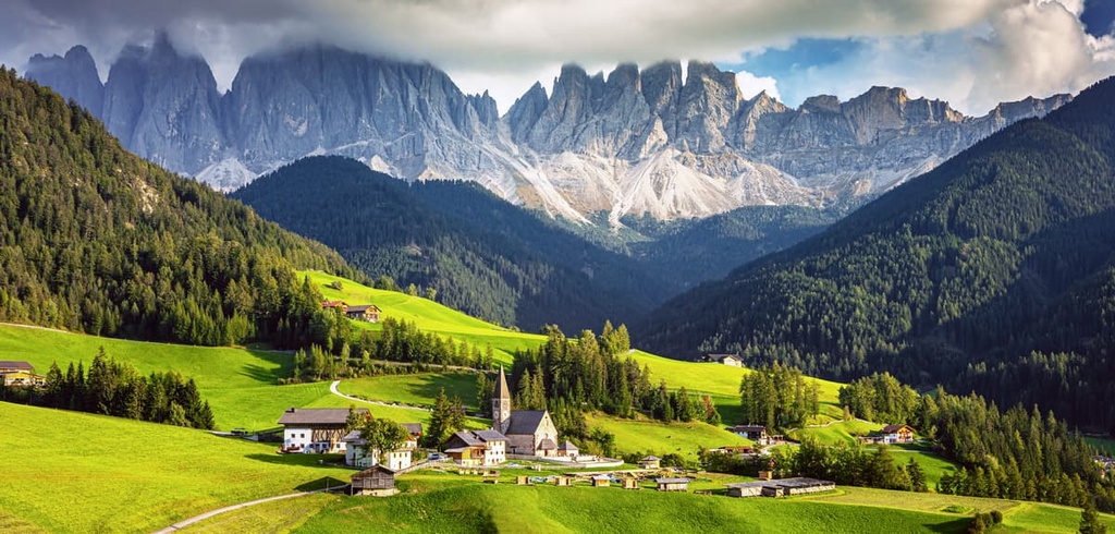
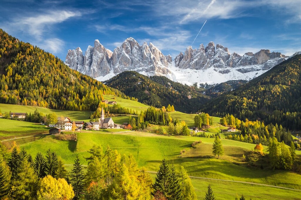
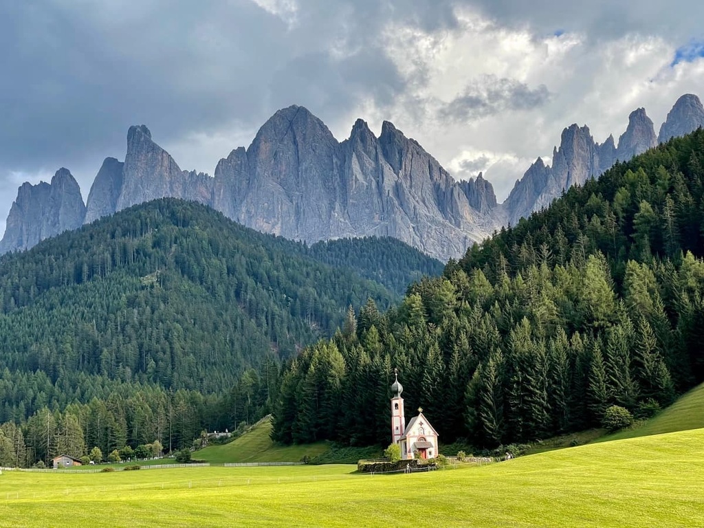
It is a very small Ladin village, which is nevertheless more popular than any other in the Funes Valley. This is because it offers incredible views of the peaks of the Odle Group (and the mountains of the neighboring Peitlerkofel and Puez groups), which grow out of green-covered alpine pastures that seem to have no end in sight.
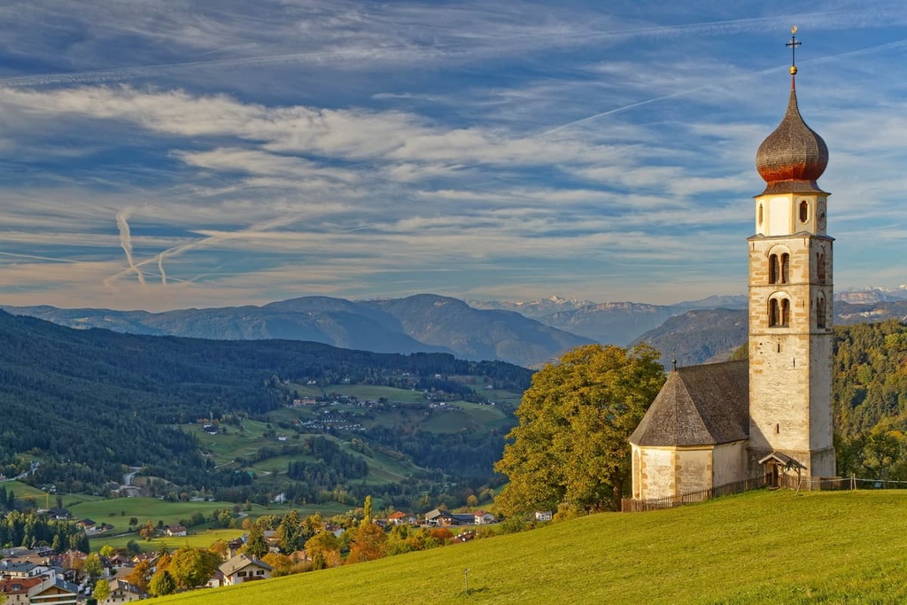
In winter, of course, the landscape is different—everything is covered with snow here, but no less magnificent. This landscape is one of the most visited and photographed places in all the Dolomites on a par with the locations around Tre Cime di Lavaredo, Lake Braies or Cortina d'Ampezzo.
The main architectural and cultural attraction of Sankt Magdalena / Santa Maddalena is the church of the same name (Chiesa di Santa Maddalena). It stands out in the landscape thanks to its tall bell tower, which contrasts with (or complements) the peaks of the Odle Group. The church was built in the fourteenth century in Gothic and Baroque styles.
There are also many other churches in the vicinity, including: Chiesa di San Valentino (1303), Chiesa di San Giovanni in Ranui (1744), Chiesa di San Giacomo al Passo (16th-century secolo), Chiesa di San Pietro e Paolo (1795), Chiesa del Sacro Cuore (19th century), Chiesa di San Bartolomeo (15th century secolo), and others.
Official tourist site: Suedtirol.info.