
Scan the QR code and open PeakVisor on your phone
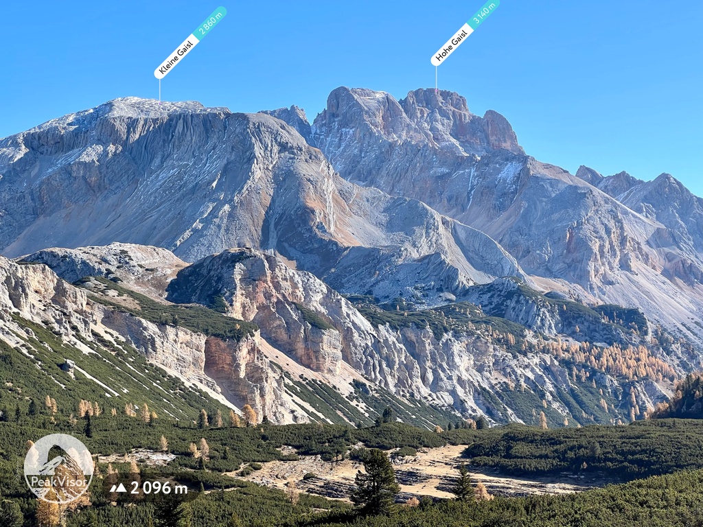
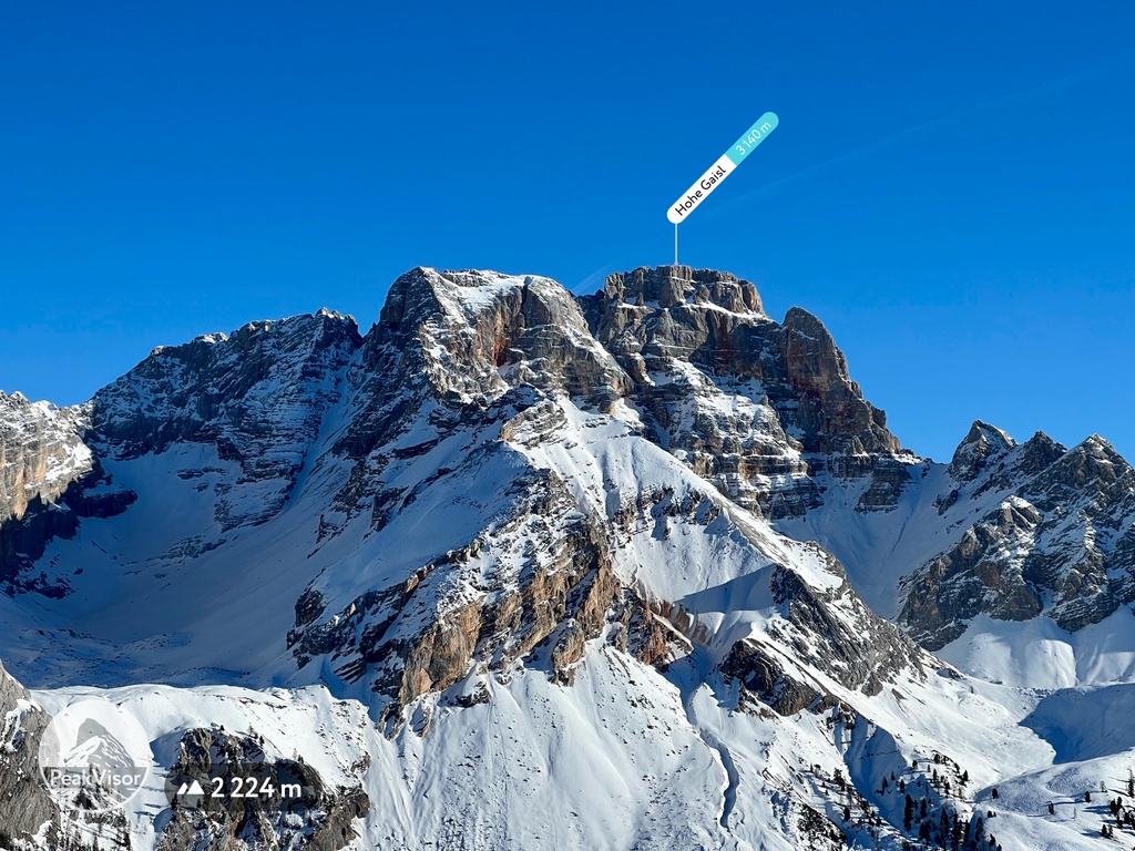
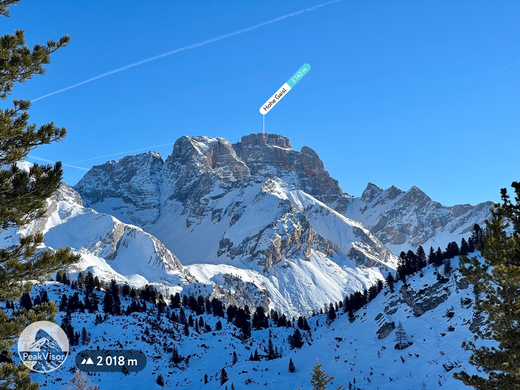
The Braies Dolomites include 84 named peaks. The highest is Hohe Gaisl at 3,140 m. Other notable peaks include Hohe Schlecht Gaisl, Kleine Gaisl and Dürrenstein.
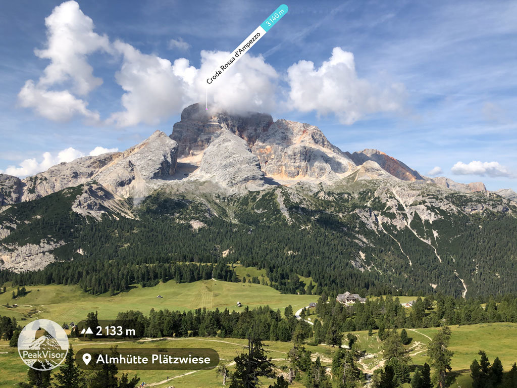
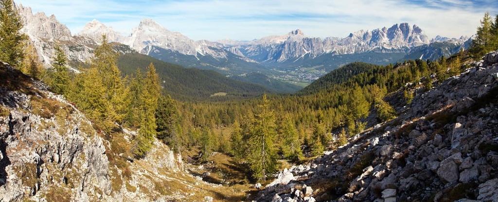
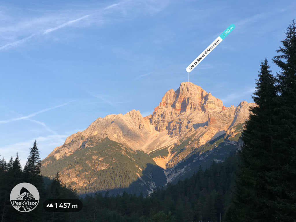
The Braies Dolomites is a mountain group located in the Eastern Dolomites in northern Italy. It is home to the famous Braies Lake. The lake is so popular that during the summer, the local government limits public and private transport to it. Dolomiti di Braies (in Italian) also attracts thousands of people thanks to the panoramic views from Prato Piazza (1,997 m / ft) plateau on the surrounding mountains. There are 84 named peaks in the Pragser Dolomiten (in German), the highest and most prominent of which is Hohe Gaisl / Croda Rossa d'Ampezzo (3,146 m / 10,322 ft).

The Braies Dolomites got its name from Lake Braies. In Italian, the Lake is called Lago di Braies but in German it is called Pragser Wildsee. As a result, the range has a number of different names including Braies Dolomites and Prags Dolomites in English, Dolomiti di Braies in Italian, and Pragser Dolomiten in German.
We don't know exactly what this word prags comes from and what it means. But, thanks to local written sources, we can say for sure that the meaning of this word and the name of the lake has changed many times since the beginning of the last millennium.
In 1296 the lake was actually called HГјnz an den Se. By 1330, it was called Praxersee and in 1400, it was called See in Prags. Later, in 1620, it was called Pragsersee and in 1885, it finally got the name Pragser Wildsee.
All these names are in German. This includes the current name with the prefix -wild, which appeared due to the development of mountaineering in the region.
The Braies Dolomites Group is located in the very north of Italy on the border between the autonomous regions of Bolzano / South Tyrol and Veneto. Most of the mountains of the group are located in South Tyrol and only a few in the former Venetian Republic.
The range is also located quite close to Italy's border with the Tyrol region in Austria. So, the Braies Dolomites, together with Peitlerkofel Group, is the northernmost of the Dolomites.
Therefore, historically and culturally, the region is more Austrian than Italian. German is more commonly spoken in this region, and there is much more traditional Alpine architecture here than in the more eastern and southern Dolomites.
The borders of the group formed by the many huge valleys of the region. This includes Val Pusteria / Pustertal in the north, the equally impressive Val di Landro / Höhlensteintal in the east, and Val di Marebbe / Enneberger Tal, which is a part of larger Val Badia / Gadertal, in the southwest.
The group also borders the following other mountain groups: Sexten Dolomites in the east, Cristallo Group in the southeast, Tofane Group and Fanes Group in the south, and Peitlerkofel / Sass de Putia Group in the west.
Most of the Dolomiti di Braies is also a part of the Fanes-Sennes-Braies Nature Park, which in the east borders Tre Cime Nature Park and Ampezzo Dolomites Nature Park. Together, these smaller parks form one huge park area that contains the Braies Group.
To get to Lake Braies, take the SS49 highway east from Bruneck / Brunico to Toblach / Dobbiaco to the Rotatoria di Braies, where you need to turn south. By car, the road will take you only 35 minutes (28 km / 17.3 mi) to drive.
The fastest way to Bruneck / Brunico is from one of the two regional capitals: Bolzano in South Tyrol (75 km / 46.6 mi or 1 h 10 min) and Innsbruck in Tyrol (106 km / 65.8 mi or 1 h 35 min).

If you don't have a car or don't plan to rent one, there are shuttle buses, which operate between Welsberg / Monguelfo and Toblach / Dobbiaco. A round trip ticket costs about €10 and the single trip is €5.
NOTE: In order to preserve the health of the lake's ecosystem, the local government instituted some transportation restrictions a couple of years ago. Keep the following in mind:
Please keep in mind that this information is valid as of 2021. However, the rules could change at any time in the future.
The Dolomiti di Braies is a part of Dolomiti settentrionali-one of the nine large mountain systems in the Dolomites according to the UNESCO classification. This system also includes many mountain groups to the east of Braies. It is the largest of the systems with a total area of 3,586 hectares (8,851 acres).
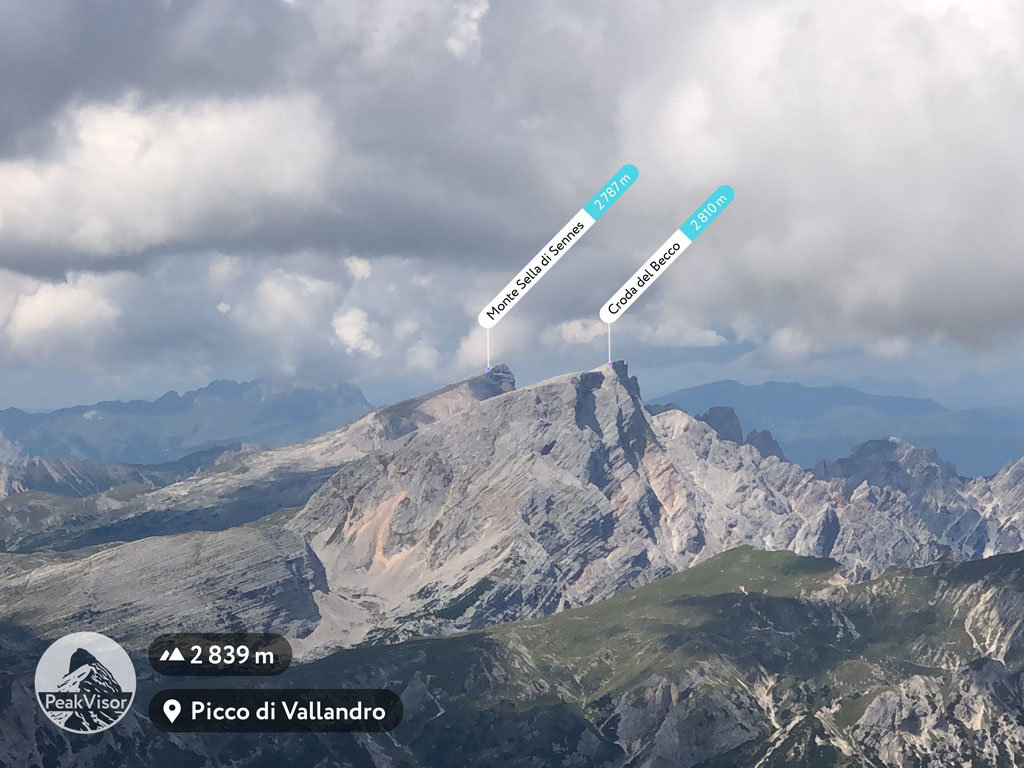
These and other mountains in the Dolomites primarily consist of the mineral dolomite. For example, Mount Seekofel / Croda del Becco (2,810 m / 9,219 ft) is made of this rock. It began to form 220230 million years ago at the bottom of a tropical ocean. Eventually, accumulations of sediment from corals and other sea creatures were compacted to form the dolomite that we see today.
The area of the Pragser Dolomiten is particularly important from a scientific point of view. This is because some of the rocks in the area date back to the Anisian age (247 to 242 million years ago).
These rocks come from the deep sea and continental basins and they were uplifted to the surface. The age's name comes from an area of limestone formations along the Enns River, a southern tributary of the Danube River, in the Austrian Alps.
Over time, as the water left, these many coral formations or atolls turned into mountains through processes of erosion, volcanic eruption, and weathering. Today, scientists find fossils in the area with the remains of plants, fish, and reptiles that date back to this Triassic period archipelago.
In other words, what the Braies Dolomites and other groups look like today is a unique moment in history. Most of the dolomite rock could be found in the eastern part of the group. Other parts contain more limestone rocks and karst formations. These can be found in the Julian Alps and the Kamnik-Savinja Alps.
In terms of landscape, the Braies Dolomites is a cluster of several subranges with high mountain peaks up to 3,000 m (9,842 ft). These peaks are separated by numerous inland valleys that were created by mountain rivers.
The main and the most famous of these valleys is the Braies Valley / Valle di Braies / Pragsertal. However, the Braise Valley is a subsection of the much larger Val Pusteria on the north.
Val Pusteria leads to Lake Pusteria along the SS49 highway between the towns of Bruneck / Brunico and Toblach / Dobbiaco. The Prags River / Rio Braies valley also cuts the mountain group into two roughly equal parts.
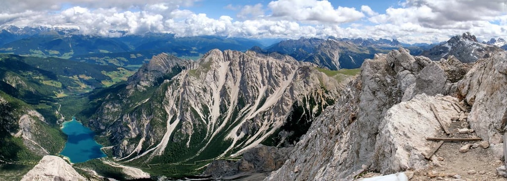
The eastern part of the group is occupied by a huge high plateau and alpine meadow called Piazza (Prato Piazza / Plätzwiese). This is located in the Valle di Braies between Picco di Vallandro / Dürrenstein (2,839 m / ft) and Croda Rossa d'Ampezzo (3,146 m / ft). It ends at the border with the adjacent Cristallo Group.
By the way, while walking through these mountains, you will notice that the word piazza (meaning a square, like a town square) is often used to refer to mountain plateaus or wide passes.
There are two of these wide passes in the range. One of these passes forms the southern boundary of the Braies Dolomites, Passo Cimabanche / Im Gemärk (1,529 m / ft), and the other is Passo di Limo (2,172 m / ft).
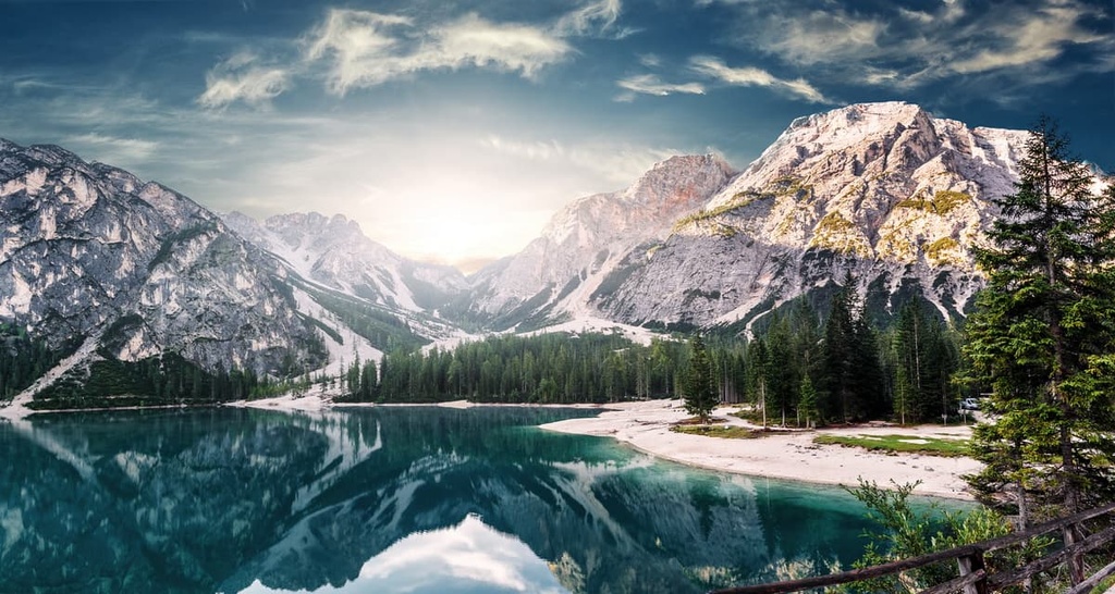
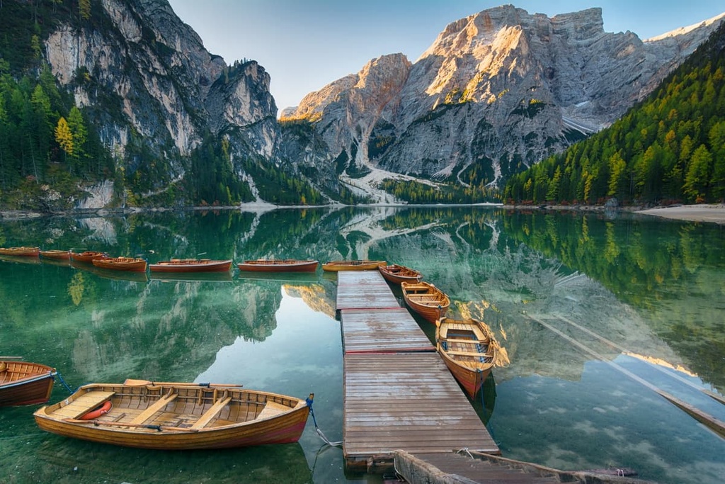
So the Dolomiti di Braies' landscape has many features. Nevertheless, the main feature of the range is not the mountains, valleys, passes and glaciers, but Lake Braies itself.
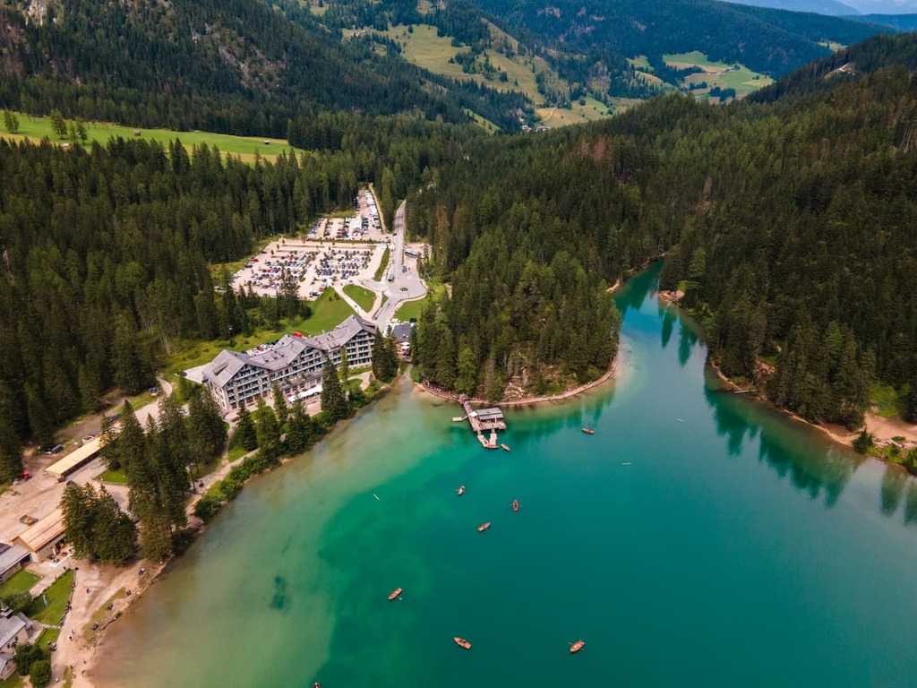
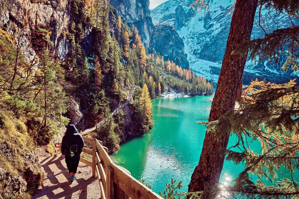
Lake Braies is a relatively small lake. However, it is often called the Pearl of the Dolomites because of the azure-colored water and the views that surround it. It is located approximately in the geographic center of the group at an elevation of 1,496 m (4,908 ft), surrounded by dense spruce forests and high mountain peaks.
The lake was formed by major rock avalanches, one of which dammed the Rio Braies at the beginning of the Late Glacial and early Holocene periods. In general, the group is characterized by a large number of significant active rock-glacier cirques that cause rockslides, landslides, and rock avalanches.
Here are more of the exact characteristics of Lake Braies:
In the Dolomites, there are many lakes similar to Lake Braies. However, it is the most popular lake in the region. It is also often called "the most photographed lake on Instagram."
In fact, if you use Instagram (check us out at the PeakVisor Instagram page!), you have almost certainly seen photos of fashionable people with wide-brimmed hats, backpacks, and Timberland boots boating on a lake. Well, most likely this lake was Lake Braies.
The lake became popular (first within Italy) because it is one of the main filming locations of the Italian TV series Un Passo dal Cielo (One Step from Heaven). The series continues to this day with the support of the region of Trentino Alto Adige. The region uses it to attract even more tourists to the area.
As for Instagram, there are nearly 400,000 posts with the #lagodibraies. There are also nearly 100,000 posts with #pragserwildsee, more than 55,000 posts with #braieslake, and more than 140,000 posts with just #braies. In total, there are more than half a million posts just about this lake!
In comparison, other popular lakes in the Dolomites, like #lagodicarezza have just 85,757 post. Meanwhile #lagodisorapis has 38,034 posts, #lagodimisurina has 37,866 posts, and #lagodidibbiaco has 23,147 posts.
However, to understand even better the popularity of Lake Braies and other lakes in the Dolomites, let's compare them with the six main Italian lakes in the north of the country. I also ranked them by the number of mentions:
Ultimately, the lakes of the Dolomites, although very popular, are still a long way from being as popular as the main centers of tourism in Northern Italy.
That being said, if you want to check out some other lakes in the region, there is Lago di Dobbiaco, which is worth visiting. Others that you can visit during the busy tourist season include Lago di Valdaora / Olanger See. You can check these out first using the 3D Map in PeakVisor.
The Braies Dolomites is one of the largest groups in the Eastern Dolomites, which is less well-known than the neighboring Sexten Dolomites and the Fanes Group.
According to the Italian classification SOIUSA, the Braies Dolomites have the following three subgroups:
Next, we'll briefly discuss three of the major peaks in the range-one from the north, one from the south, and one from the east.
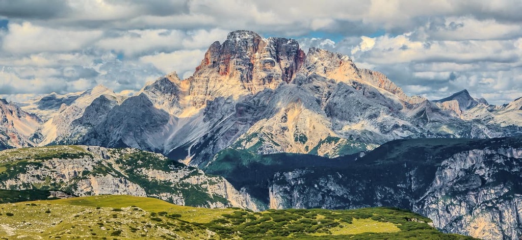
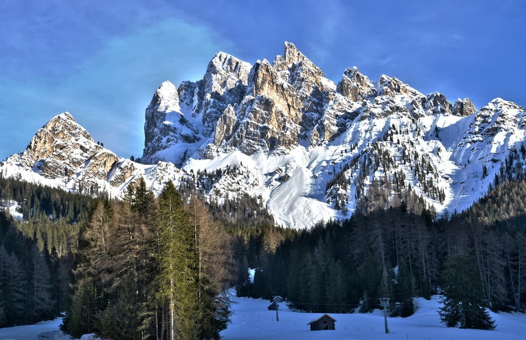
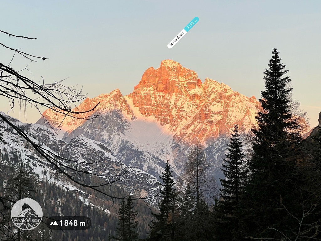
Hohe Gaisl (Croda Rossa d'Ampezzo) is the highest peak of the Pragser Dolomiten and one of only two peaks above 3,000 m (9,842 ft) in the group. It is located in the southeastern part of the range.
The mountain clearly resembles an open rosebud-both in shape but also in color. It consists mostly of Principle Dolomite but it has many Jurassic limestones and Cretaceous marls.
These various rocks make the whole mountain look more red than light gray. This makes the peak stand out substantially when compared to other peaks in the group. For example, Croda Rossa is very visible from the foot of Tre Cime di Lavaredo, even though it is dozens of kilometers away.
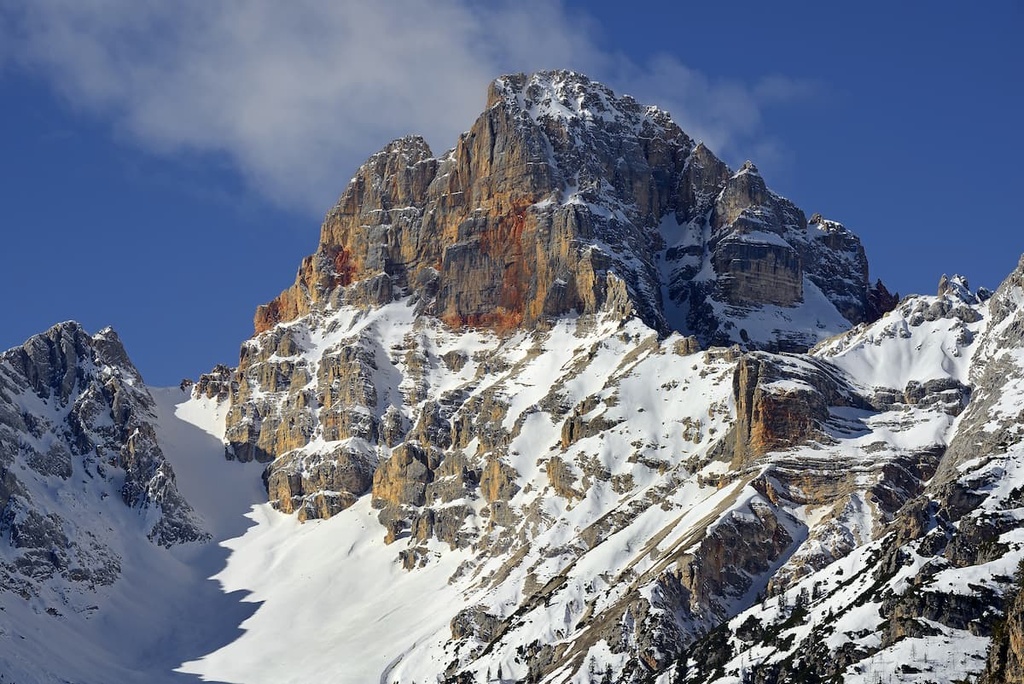
The Hohe Gaisl but it is rarely climbed due to its high risk of rockfall. At the summit, there are also small active glaciers, which are decreasing like everywhere else in the Dolomites due to the effects of climate change.
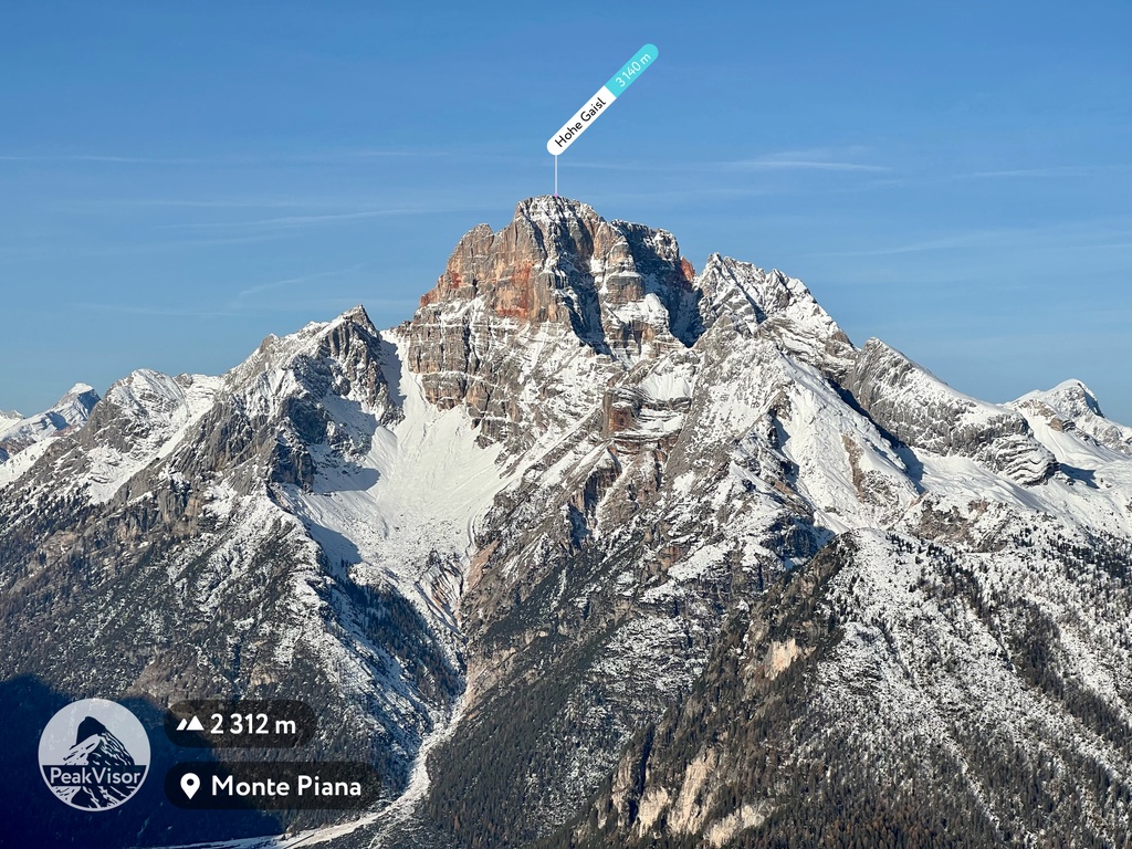
Seekofel (Croda del Becco) is the most well-known mountain in the Pragser Dolomites. It is located on the shores of Lake Braies and it is, therefore, the dominant mountain in the lake landscape.
This massive peak has an almost rounded shape that simply cannot be overlooked. So, it also usually manages to sneak its way into all photographs taken of the lake.
However, the mountain has become a popular place among tourists in recent years for reasons other than Instagram. Long before social media, the peak was a gateway to the neighboring Kingdom of Fanes or the Country of the Ladins, one of the main ethnic groups of the Dolomites. This is why the mountain also has another name in Italian: Sass dla Porta (porta means door in Italian).
The name of the mountain in Italian, Croda del Becco, also refers to the Alpine ibex (in Italian: stambecco can be shortened to becco), which used to live here in large numbers. The Alpine ibex were almost completely exterminated by hunting during the twentieth century, but the population has recently recovered to about 100 individuals.
Kronplatz (Plan de Corones) is the main mountain in the northwestern part of the Braies Dolomites that has a volcanic origin. It is relatively low-lying and it is not as impressive aesthetically as the two peaks I mentioned before, but no less popular.
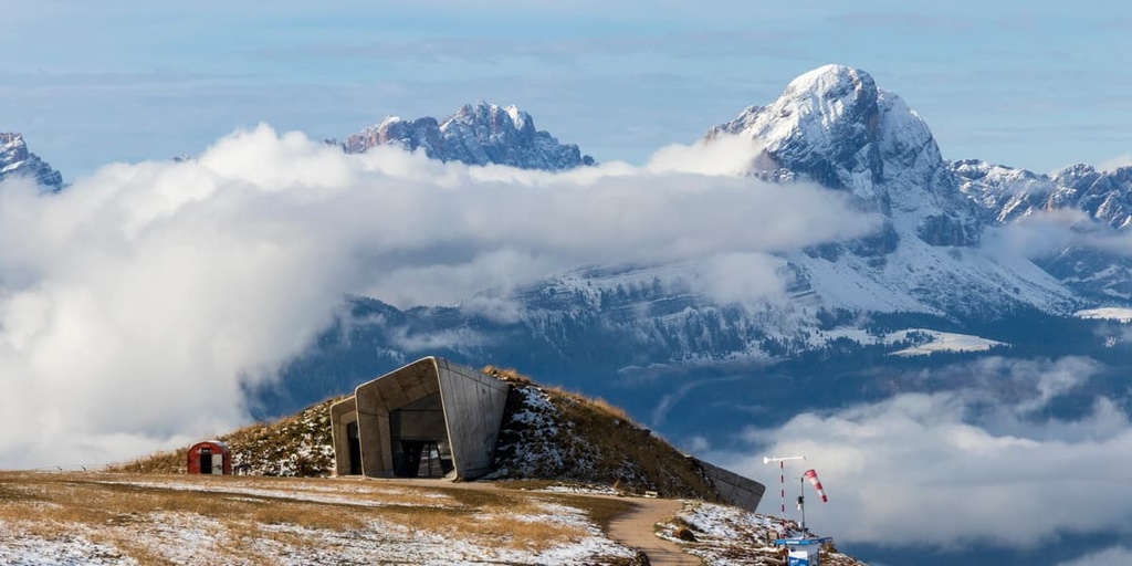
At the top of the mountain, you can find the Messner Mountain Museum (MMM), which was created by Reinhold Messner, one of the most famous mountaineers of South Tyrol. The museum on Kronplatz is the main building of a series of six museums dedicated to the history of mountaineering that are scattered throughout the Dolomites. The museum was built right into the rocks of Kronplatz.
Additionally, a large ski resort of the same name, Kronplatz, is located on the mountain. From the top-whether you get there on foot or by cable car with skis in hand-there are stunning views of Brunico and the surrounding area with more mountains, valleys, and nature parks.
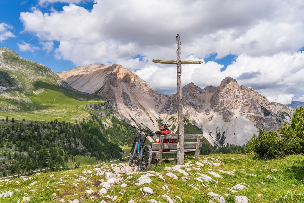
The Pragser Dolomites are a popular hiking and trekking destination. There are many short and long hiking trails, including the hike around the famous Braies Lake and Alta Via 1. Here are some of the major routes you ought to check out when planning your next trip to the region:
The hike around Lake Braies is the route around the main attraction of the Dolomiti di Braies Group. In reality, this is more of a casual walk with an opportunity to picnic on the lake than a major trek.
From the trail starting at the historical Hotel Pragser Wildsee, you will see the lake in all its glory, as well as Seekofel / Croda del Becco. The views are especially beautiful from the highest point of the trail, which is at an elevation of about 1,580 m (5,183 ft).
During the hiking season, I recommend starting the hike as early in the morning as possible to spend some one-on-one time with the lake.
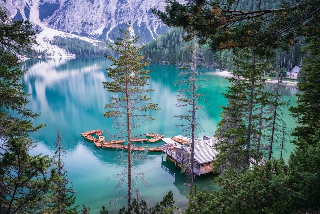
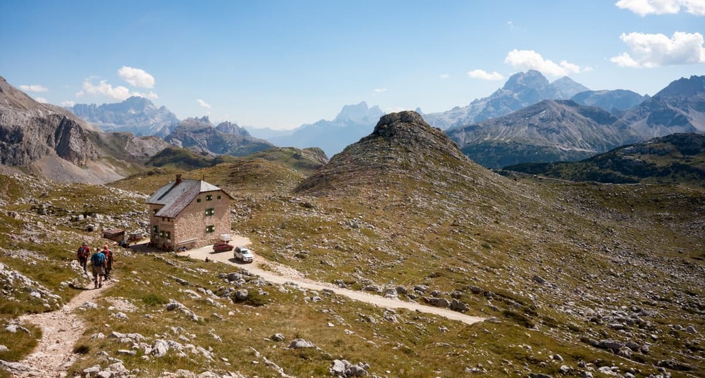
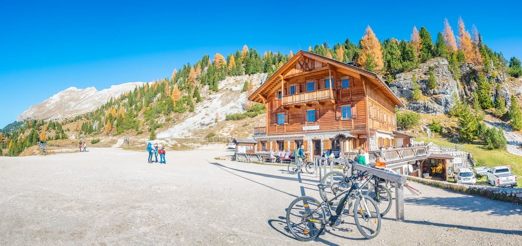
This is another great trail from Lake Braies that will lead you to the popular rifugio Biella at the foot of Croda del Becco. The rifugio has 46 beds, but it's best to book it in advance by email or phone.
The climb is relatively uncomplicated and it features an elevation gain of nearly 1,000 m (3,280 ft). But the effort is worth it-the trail offers a stunning panoramic view of the lake, which is not available to those who rest only on its shores. That's the main reason for the hike.
From the rifugio-or perhaps even from the window of the room in which you will sleep, or the dining room in which you will eat-you can see many other famous mountains including Tofana di Dentro (3,238 m / 10,623 ft), Pelmo (3,172 m / 10,406 ft), and Punta Sorapiss (3,205 m / 10,515 ft). You can also continue to the top of Croda del Becco itself.
This is the main trail in the heart of the Prato Piazza meadow in the eastern part of the Braies Group. It leads to the summit of Monte Specie / Strudelkopf (2,309 m / 7,575 ft), the main observation point in the area. The peak also offers stunning panoramic views that will please all fans of landscape photography and mountain peaks identification.
Along this hike, you can admire the highest peak of the Braies Dolomites like Croda Rossa. You can also see the neighboring mountains of Picco di Vallandro, Cimabanche (1,565 m / 5,134 ft), Croda Scarba (2,168 m / 7,112 ft), and many others. This includes more remote mountains, such as Monte Cristallo, Tofane and the symbol of Dolomites, Tre Cime di Lavoredo (2,999 m / 9,839 ft), in the distance.
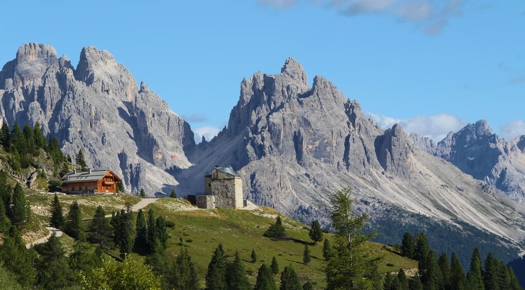
I would recommend an overnight stay on the plateau so you can see both the sunset and sunrise at the summit, especially since there is no shortage of places to stay. In addition to the rifugio Prato Piazza, there is also the Hohe Gaisl Hotel, the Almhütte Plätzwiese, the Stolla Lodge / Malga Stollab, and the rifugio Vallandro / Dürrensteinhütte at the beginning of the trail.
Alta Via 1 is one of the two most famous multi-day backpacking trails in the Dolomites. It starts at Lake Braies, which attracts even more hikers from all over the world.
From here you have to walk 125 km (77.6 miles) in 12 stages (days) with overnight stays in mountain huts and sometimes bivouacs. The first stage of the route is the rifugio Biella trail described above, the second stage is from rifugio Biella to rifugio Fanes on the borders of the Braies Group with the Fanes Group.
At the end of the whole route, you will reach the town of Belluno, the capital of the Veneto region.
This is the only major via ferrata in the Braies Group. It leads to the eastern ridge of Hochalpenkopf / Cima dei Colli Alti (2,539 m / 8,330 ft), which is located in the northwest of the lake.
It is a great and rare opportunity to see the Braies' main attractions from above and to have a climbing adventure at the same time. After the hike, you could be among just a few people sharing photos of the lake from an unusual angle.

From the parking area at the lake, take the road to the Riedlhof. Then take the path 20 to Alpe di Pra della Vacca / KГјhwiesenhГјtte, from where you'll continue on path 61 and then take the via ferrata itself until arriving at the summit.
In general, the trail is easy to moderate, but in the southwestern and northern ridges, it gets quite difficult. Good navigation skills are a must-have.
Like almost all other groups in the Dolomites, with few exceptions, in winter Braies Dolomites turn into one big ski area. However, if we talk about marked pistes and infrastructure, it is possible to distinguish three ski resorts:
First and foremost is Kronplatz Ski Resort in the west of the group. It is one of the 12 ski resorts that make up the Dolomiti Superski system.
Second is Tre Cime Dolomites Ski Resort (3 Zinnen Dolomiten), another of the 12 in the Dolomiti Superski. It is located on the northeastern borders of the group and is only slightly inferior to Kronplatz in size. As you can guess from the name, the main feature of this resort is the mountain group Tre Cime di Lavaredo, and the eponymous park is considered the best in Italy for cross-country skiing with more than 200 km (124 mi) of trails.

The third is a small ski area with the same name, Prags / Braies Ski Resort, between Braies Lake and Dobbiaco Lake with two slopes of just several km (mi) in total and 2 ski lifts.
Check the Braies ski resorts map on the larger Trentino-Alto Adige/Südtirol and Veneto ski maps of Italy in the World Mountain Lifts section of the site. It includes information about open ski lifts / slopes in the Braies Dolomites in real-time with opening dates and hours. There are also year-round cable cars, funiculars, cog railways, aerial tramways, and all other types of mountain lifts.
If the goal of your trip to the Pragser Dolomiten is to visit Lake Braies, you can get more information about it by visiting the tourist office located between the Pragser Valley and the Plätzwiese high plateau. It is operated by the staff of the neighboring tourist region 3 Zinnen Dolomites / Tre Cime Dolomites.
Pragser Tal Valley Tourist Office
AuГџerprags, 78 (Frazione Braies di Fuori, 78), 39030, Prags, BZ, Italy
Mon-Sun: 9am to 5pm
+390474748660
If you plan to travel to other places in the region, check the South Tyrol tourist site at Suedtirol.info.
There is a famous posh (and only) hotel located right on the shore of Lake Braies called the Hotel Pragser Wildsee. In 2019, it celebrated its 120th anniversary. Like almost all hotels in Italy, it also operates as a restaurant, though it's not as well-known for its food.
In the Hotel Pragser Wildsee, you can rent a single, double, or a family room, as well as a suite with balcony and lake view starting from €96 a night per person. So, the price for two persons will be around €150. However, if you visit during the off-season, the rooms tend to be more affordable.
Nevertheless, if you think of the lake as only a starting point for a hiking trip, you would probably look for an Alpine mountain hut, rather than a regular hotel. There are at least 11 major huts (rifugios), Alpine hotels and farms in the group:
For those who like to stay in a caravan or a tent, there are several camping areas near Lake Braies and other parts of the Pragser Dolomiten:
Bruneck / Brunico is the major city in the Braies Dolomites. It is located at an elevation of 838 m (2,749 ft) and it just just 77.9 km (48.4 mi) from Bolzano. The city is also just 26.6 km (16.5 mi) from Lake Braies, 20.7 km (12.8 mi) from Kronplatz, and 32.2 km (20 mi) from Hohe Gaisl / Croda Rossa d'Ampezzo.
Bruneck / Brunico is the largest city in the Puster Valley and it is a fairly large city for Dolomites, with 16,856 residents (2020). Approximately 82% of the population speak German as a first language, 15% Italian, and 2% Ladin. The Ladins call the city Bornech.
Bruneck / Brunico has reached its present size and popularity thanks to its geographical location. It has always been an important administrative, defensive, commercial, and religious center in the region. Since the 1960s, tourism has also been important in the town.
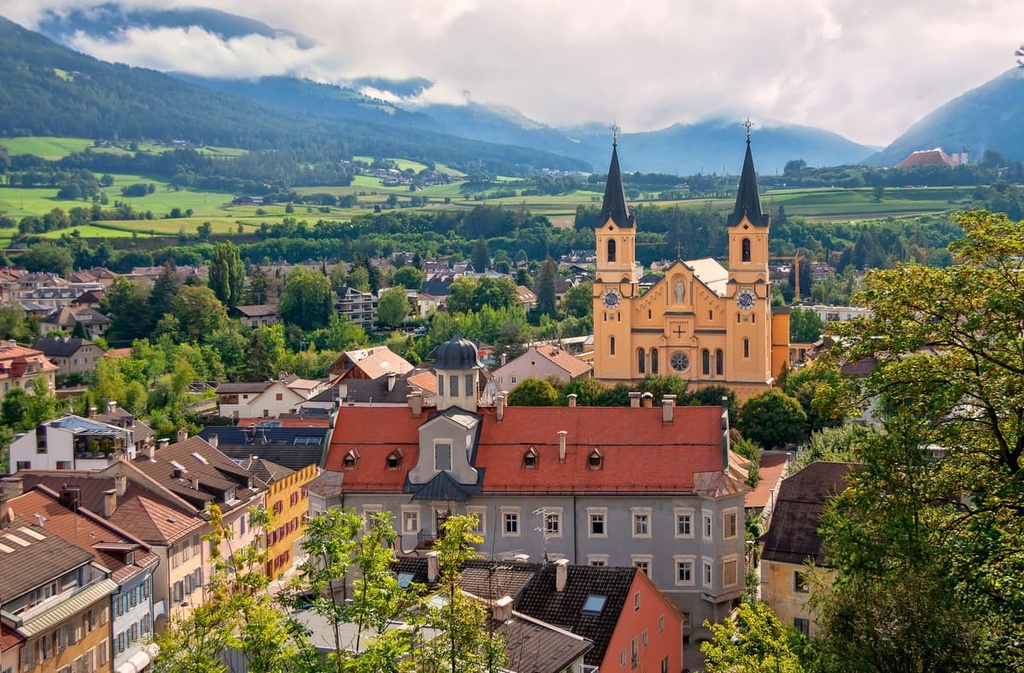
The three main architectural and cultural attractions of the city are:
Fans of modern architecture and sports will also find something to see in the city. For example, take a look at the minimalistic Bruneck / Brunico Indoor Climbing Center (Centro d'arrampicata Brunico) with its huge glass windows through which you can see the climbing wall from the street.
There are many events in the city during the whole year, too, including the main one-the Stegener / Stegona Market Weekend. This is one of the largest markets in South Tyrol and it offers food, drinks, souvenirs and other local products at the end of October.

Other important cities and towns in the Pragser Dolomites are Welsberg / Monguelfo, Niederdorf / Villabassa, Toblach / Dobbiaco, San Viglio di Marebbe, Montal / Montana.
There is no official tourist website of Bruneck / Brunico but you can find more information about the city at the Kronplatz.com and Suedtirol.info websites.


The highest peak in the Braies Dolomites is Hohe Gaisl, at 3,140 m.
The Braies Dolomites have 84 named peaks.


