
Scan the QR code and open PeakVisor on your phone
Paris is home to 3 named mountains. The highest is Montmartre at 159 m.
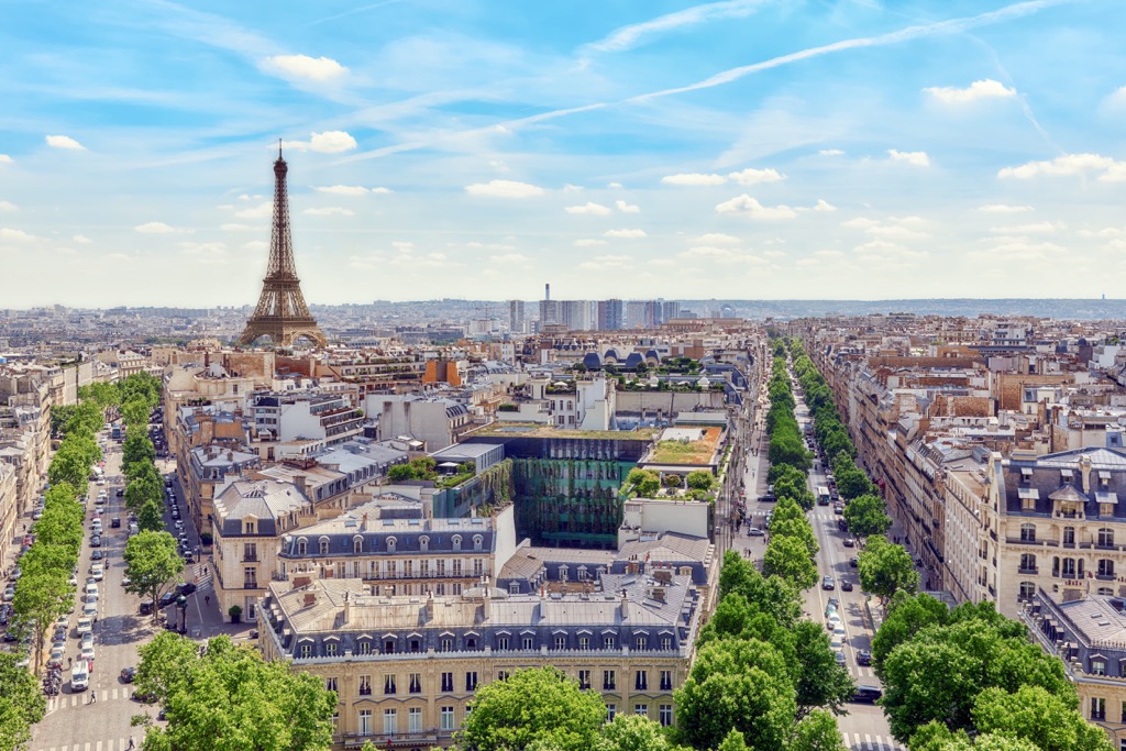
Paris is the capital of France and the most visited city in the world by tourists. However, it is not totally flat, as one might think, although it is located on a plain. The main feature of Paris mountains is Montmartre (159 m / 521 ft), its highest and the most prominent peak, which offers the best panoramic view of almost the entire city. Tourists are also attracted to it by the Basilica of the Sacred Heart (Basilique du Sacré-Cœur de Montmartre)—one of the iconic buildings of Paris, on a par with the Eiffel Tower (Tour Eiffel) and Notre Dame Cathedral (Cathédrale Notre-Dame de Paris), among others. In total there are 3 named mountains in Paris, as well as about a dozen small hills scattered throughout the city, each of which also offers a unique view of it.
The name of the city of Paris, like many other places in Europe, comes from the name of an ancient tribe that inhabited these places from the Iron Age to the Romans, namely, the Parisii.
They belonged to a larger tribe, the Gauls, from the word Galia, as the Romans called the vast areas north of Rome, that is, the Alps and everything beyond them to the North Sea, including Germany and France, which later became one of the provinces of the Roman Empire. In turn, the Gauls are a group of Celts, the largest tribe in Europe. It is the Gauls who are considered the most likely ancestors of the modern French as a whole.

The word Parisii itself seems to come from the Celtic root “pario” (cauldron). It may also mean the “commanders” from the Welsh “peryff”, or “spear people” from the Old Irish “carr” (spear). But there are other versions as well.
The Romans called Paris itself, that is, the settlement of Parisii, Lutetia Parisiorum, where Lutetia is Latin "lutum"—“mud, silt,” which goes back to the Celtic “louk-teih”—”marshy places”.
It is important to add that in contrast to English, the French themselves pronounce Paris differently: with the accent on the "i" and instead of "a" and without "s" at all. So it is Pari'.
Administratively, Paris is located in the north of France in the heart of Ile-de-France (Isle of France), one of the 18 major regions of the country. The city is surrounded by the departments of Hauts de Seine, Val-de-Marne, and Seine-Saint-Denis. The region itself is bordered by Normandy and Hauts-de-France to the north, the Great East and Bourgogne-Franche-Comté to the east and southeast, and the Centre-Loire Valley to the south and west.
Interestingly, as in other countries, the Isle of France means perhaps the isolation of the metropolitan region from the rest of the country. For example, many inner-city Americans often say that New York is not America and that Russians in Siberia, that Moscow is not all of Russia. Having spent a total of two weeks in Paris (and three months in all other major parts of the country: south, west and north) and walked its center (and not only) along and across, I also agree and disagree with them at the same time.
On the one hand, the villages of Provence, much better convey the spirit of the real France, how I felt about it, which, like the rest of Europe as a whole, is essentially a rural area with an unhurried rhythm of life. On the other hand, it is still a "French Island" and not some other. The "Frenchness" of Paris is better felt precisely because of the incredible mix of cultures that can be observed and experienced there, as well as the fast rhythm of the big city. However, this may not be the opinion of Parisians themselves (New Yorkers and Muscovites, and others). If I ask them about it, they would simply be offended. But I got off-topic…
Paris itself is divided into 20 arrondissements on either side of the Seine River. They are so named with the addition of the letter R (right) or L (left) at the end. Each district has its own original name. For example, the first is named after the main museum of Paris (and the world)—Louvre. The fifth is Panthéon, another architectural landmark. The mountainous districts which interest us the most are the last three from the 18th to the 20th: Butte-Montmartre, Buttes-Chaumont, and Ménilmontant.
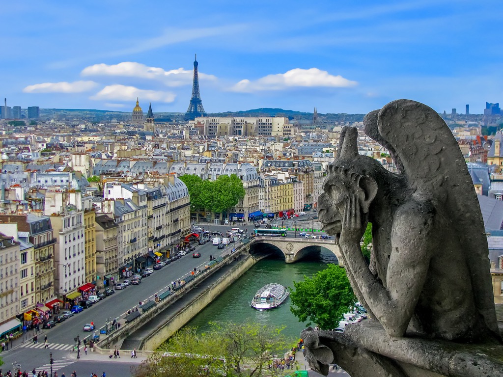
Geographically, Paris lies on either side of the Seine River, the largest in this part of the country at 777 km (483 mi), which is also the main and most famous feature of the city's landscape. The river has its origin in the village of Source-Seine near the larger city of Dijon in the northeast of the country and flows into the English Channel of the North Sea at Le Havre, the largest port city in the north of France.
The other features of the landscape I will tell you immediately below.

If you take other European capitals and major cities, the easiest and fastest way to get to Paris is by plane, bus, and train from England to the north through the Channel Tunnel; Belgium, Germany, and Holland to the east; and Switzerland and Italy to the southeast.
By the way, in early 2022, Trenitalia launched Frecciarossa 9292, the country's fastest direct train from Milan to Paris, with stops in Turin, Modane, Chambery-Challes-Les-Eaux, and Lyon. Travel time is 7 hours. In my experience of regular trips from Bergamo to Rome, 5 hours on this train will fly by unnoticed, and for another two you have time to watch a movie or read a third of a short book. The cost is also great—55 euros if you buy a week in advance but can be more than 100 euros right before departure. In the peak summer season there can be very few tickets left.
There are similar high-speed trains from Amsterdam.
Geologically, Paris lies in an area called Paris Basin (Bassin parisien), which is a lowland with many hills. The term refers mainly to Paris and its surroundings but the area extends far beyond the Ile-de-France region and in fact, covers almost all of the north of the country between the North Sea of the Atlantic Ocean and the various mountains.
Formerly, in the Triassic period, Paris Basin, like almost all of Europe, was completely covered by Tethys Ocean, as evidenced by the numerous sedimentary deposits such as limestones, chalk, clay, and others, as the main local rocks and minerals. The reverse side of this geological medal is the numerous Seine tributaries and other rivers that formed after the plain had risen above sea level and literally carved up its landscape.
It is likely that the Seine valley was deeper and more extensive in the past. This is evidenced by the low and almost inconspicuous (especially if you constantly look for the Eiffel Tower or another café with French croissants and baguettes) but numerous hills of Paris, which the further away from the city, the higher they become and literally surround the city, until they become the Ardennes and Vosges mountains to the east, Massif Central to the south, and Armorican Massif in the Brittany region to the north-west.
So, the city of Paris is not as flat as it may seem at first sight. Its average height is 35 m (115 ft), the lowest is 24 m (79 ft) on the level of the Seine River, and the highest is 159 m (521 ft).
The highest mountain peak of Paris is Montmartre, the most famous of the several Paris hills. However, it seems to me that when pronouncing this word, most people focus on its second part, losing the first and not even guessing that it is an actual mountain. But if we look closely, we see that it begins with "mont"—"mountain" in French. Hence, also if you see similar beginnings in the names of other French places, you know that they are located on high ground.
The second part of the word “martre” comes from the hill's Latin name Mons Martis—”The Mount of Mars”.
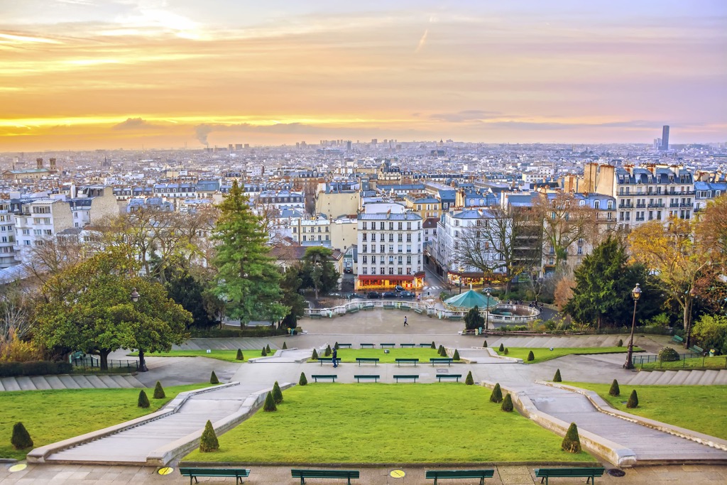
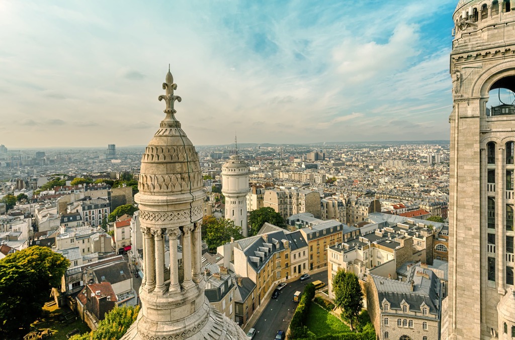
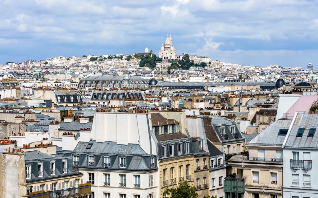
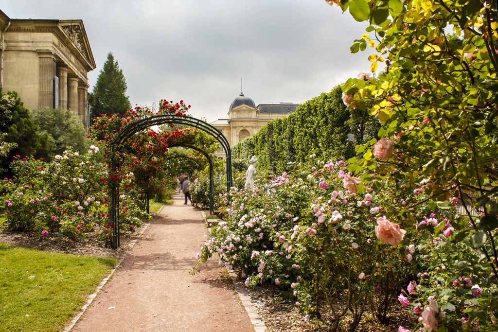
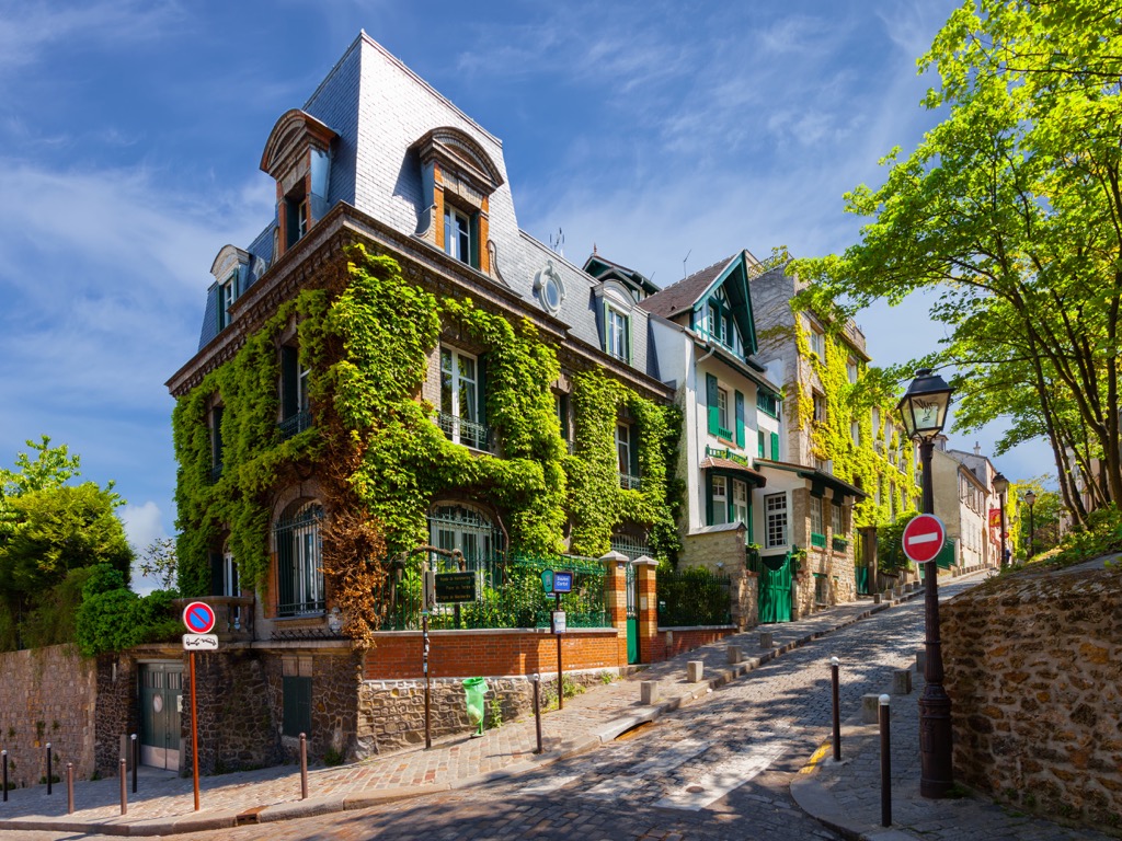
Montmartre is located on the right bank of the Seine River northeast of the center and is also an extensive neighborhood of the same name with many attractions. The main of them, the Basilica of the Sacred Heart (Basilique du Sacré-Cœur de Montmartre), is at the top of the mountain. Its construction began in 1875 and was finished in 1914. Old photographs of Paris show the basilica being built on a bare hill, which is how it looks in its natural state. The hill is fully built up with buildings. Among the other attractions of the Montmartre district are the Moulin Rouge cabaret, the eponymous Musée de Montmartre, and others.
The top of the mountain can be reached on foot from the banks of the Seine in about an hour through a series of stairs, so wear comfortable shoes, take a bottle of water and have patience—the view from the top is worth it, it is just the best in Paris you can get thanks to just your two feet (of course the Eiffel Tower shows much more, including Montmartre itself). It looks exactly like this on a cloudy day in December, but I assume it’s even better on a sunny day, so I wish you had better luck with the weather.
From the mountain, you have two ways to go—to explore the namesake district or the neighboring two, which are also the highest in Paris.
Belleville (147 m / 482 ft) is the second highest mountain in the city east of the first, which is also named after the neighborhood (or vice versa). The name translates simply as "Beautiful Village". It is one of the oldest and most interesting neighborhoods of Paris, which at the dawn of history was a separate and independent town.
For about the last century, it has been the main émigré neighborhood of Paris, home to most of the city's diverse diasporas, including, of course, the largest of two Chinatowns (the second one is next to Place d'Italie). I myself spent a week in Belleville and saw Chinese and other Asian children practicing wushu every day right in the streets from the window in my room. Although, there are also a lot of natives in Belleville. For example, my Couchsurfing host was a local theater critic, who was 100% Parisian and not a tenth less. Thanks to him I got into the Louvre for free—he lent me his universal pass to this—and all other museums in the country.
The main attraction of the area is the small park of the same name, Parc de Belleville, formed around the hill. The park offers another great view of Paris from the Belvédère de Belleville (The Belleville Viewpoint), in particular, the Eiffel Tower peeking out from behind the green trees (in summer). By the way, it is not visible from Montmartre.
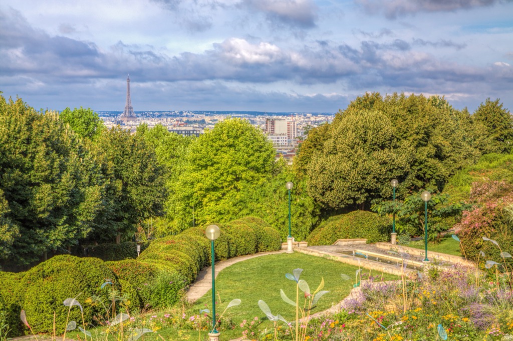
Belleville is adjacent to another famous neighborhood—Ménilmontant, also located on the namesake hill. From there, walking up and down its streets you’ll see the hilly views of the center of Paris, including, again, the Eiffel Tower. It's as if it was San Francisco. The entire 20th arrondissement of Paris is named after the neighborhood. It is known as a place of life and creativity for local artistic and progressive-minded youth.
So, I recommend taking at least an entire day to explore both neighborhoods. If you "accidentally" get lost, a little to the east you will find another, even high hill, Butte aux Papillons (112 m / 367 ft), which belongs to the neighboring district of Seine-Saint-Denis. And don't be afraid to go without lunch: these neighborhoods are also famous for their street food.
Other famous mountains in Paris include also Montagne Sainte-Geneviève (76 m / 249 ft), located in the city center—this time, on the left bank of the Seine River. Together with the Montmartre and Belleville-Ménilmontant, they form a kind of "Mountain Triangle of Paris"—don't google it, I just invented the term. At the top of this hill, also with an excellent view of the city center, is the Panthéon, the tomb of prominent men of France. Panthéon in particular contains one of the active Foucault Pendulums used to demonstrate the rotation of the Earth.
Another small famous peak of Paris is a rocky hill or cliff of Buttes Chaumont (50 m / 164 ft) in the Parc des Buttes-Chaumont next door to the Parc de Belleville. It is a much larger park than the latter with a variety of non-flat terrain, an inland pond, green picnic glades, a variety of trees, and about 10 km (6 mi) of gravel roads and hiking trails. The name of the hill translates as “Bare Hill”. At its summit is the Temple de la Sibylle, inspired by the Temple of Vesta in Tivoli, a suburb of Rome in Italy. Once you climb there, don’t forget about the time: the park’s entrance gate is locked at night, as you’ll be warned by the caretaker’s whistle sometime after 7–8 pm.
Other smaller hilly areas in Paris, which are still higher than the Seine River, are Passy (71 m / 233 ft), Chaillot (67 m / 220 ft), Montparnasse (66 m / 217 ft), Butte-aux-Cailles (62 m / 203 ft), and others. The nearest higher hilly area outside Paris is Montmorency (195 m / 640 ft), about 20 km (12.4 mi) away.

All of these Paris mountains, given their worldwide fame, have also given names to many other hills, mountains, and parks formed around them around the world.
For example, as a result of a little research right in the PeakVisor Explorer search field, I was able to find, first, another Montmartre (629 m / 2,064 ft) in France itself, located in the Massif Central in the Loire department in the Auvergne-Rhône-Alpes region; and second, several places in the US, namely Belleville Ridge (133 m / 436 ft) in Ozark Highlands and an entire Paris Mountain State Park, named after Paris Mountain (626 m / 2,053 ft), in Greenville County in South Carolina. More: there are at least five other Paris Mountains in the Appalachian Mountains alone.
I’m sure you’ll find even more Paris Mountains around the world. You may even have them in your home region.
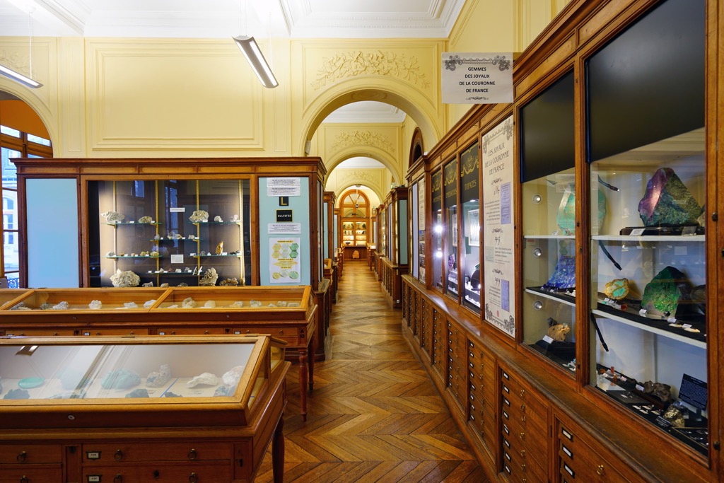
But going back to Paris itself, you can explore its mountains—especially on cloudy or rainy winter days—not only in its higher districts but also in its magnificent museums, for which it is also famous around the world. In addition to the obvious Louvre, where you are sure to find numerous mountains of France, depicted in the paintings of the best artists in history, Paris has more than five thematic museums of mineralogy, geology, and nature, one of which I would definitely visit even in the middle of a hot summer—on the contrary, to cool down. But of course not just because of bad or “too good” weather. Here’s their list:
Mineralogy and Geology Museums
Other Natural Museums
Paris is one of the greenest of the world’s capitals, where you can walk endlessly, discovering new routes and repeating your favorite ones.
Considering the enormous size of the city, there are more than 400 parks, squares, and gardens. In other words, even if you wander into one of its most urban areas, there is bound to be a green space at the exit. For example, the walk across the city from Place d’Italie through Montmartre to Belleville Park will take you at least 2:30 hours or 12 km (7 mi). That’s how I traveled on foot in Paris. About the same distance from the same square in the opposite direction to the Eiffel Tower, Arc de Triomphe, and Parc Monceau.
A little to the west of the latter is the much larger (to be precise, the second-largest) park in Paris, the Bois de Boulogne (Boulogne Woodland). The first is on the opposite east side of the city, the Bois de Vincennes (Vincennes Woodland). They are easy to navigate, thanks to their clever planning by Napoleon himself and maps located at the entrances and exits, as well as at the various landmarks—lakes, bridges, palaces, and more. Note also that it is better to visit them during daylight hours—Paris, despite the title of the main tourist city of the world, is not the safest. At least as the capital of your country (unless you are in Mogadishu, Somalia).
However, if we are talking about real hikes for which it is worth wearing special shoes and taking a larger and more comfortable backpack, the nearest nature parks and forests with more diverse and wild landscapes, as well as marked routes for hiking and biking are as follows. In total, there are more than ten (let’s keep the original names, the meaning of which is not difficult to guess: parc naturel régional—regional nature park, forêt—forest):
In the northwest
In the north
In the northeast
In the south

If you want to get a little further away from Paris for hiking, but still stay in the north, I definitely and primarily recommend the small town of Étretat in Seine-Maritime, Normandy, on the North Sea coast near Le Havre. It’s only 200 km (124 mi) from Paris by direct train to the latter, from where you can get to the coast by regional bus.
The coast is famous for its incredible snow-white rocky cliffs that plunge vertically into the sea for hundreds of meters (feet), including two extraordinary natural structures: Porte d’Aval arch and L’Aiguille (the Needle) rock—depicted in the paintings of the famous leading French impressionist Claude Monet. One of his works is so called, The Cliffs at Etretat (1885). It is held at the Clark Art Institute in Williamstown, Massachusetts, USA.
On the way to Étretat, you will also find another forest and park—Forêt Domaniale de Lyons and Parc naturel régional des Boucles de la Seine Normande.

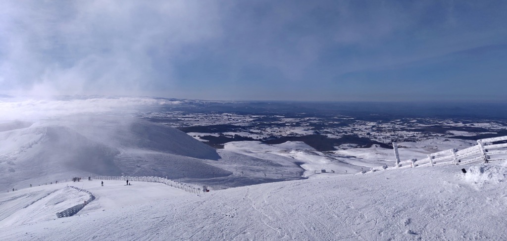
The ski resorts closest to Paris are in the Vosges Mountains and the French department of the same name in the east of the country on the border with Belgium, namely Gérardmer-La Mauselaine with more than 40 km (24 mi) of slopes and more than 20 ski lifts, La Bresse-Hohneck (20 km / 12 mi, 15 ski lifts), Lac Blanc (13 km / 7 mi, 9 ski lifts), and Le Markstein (10 km / 6 mi, 9 ski lifts).
A little further south along the French eastern border, in the department of Doubs, in the Jura Mountains between France and Switzerland, is the Métabief Ski Resort with more than 40 km (24 mi) of slopes and more than 18 ski lifts.
Alternatively, you may go skiing in the Massif Central, the only "true French" inner mountains, strictly south of Paris where the biggest resorts are SuperBesse-Puy de Sancy with more than 40 km (24 mi) of slopes and more than 20 ski lifts, and Chastreix-Puy de Sancy with more than 15 km (9 mi) of slopes and more than 8 ski lifts, as well as Le Mont-Dore (41 km / 25 mi, 14 ski lifts).
Check the France ski resorts map in the World Mountain Lifts section of the site. It includes information about open ski lifts / slopes in France in real-time with opening dates and hours. There are also year-round cable cars, funiculars, cog railways, aerial tramways, and all other types of mountain lifts.
The official tourist organization of Paris is called the Paris Convention and Visitors Bureau. It has four offices in the city, called Welcome Centers, where you can get useful information on the spot. The main one, Office du Tourisme et des Congrès de Paris—Bureau Hôtel de Ville, is located on the right bank of the Seine River in the very center in Hôtel de Ville at 29 rue de Rivoli.
To live in Paris, I would recommend all the already mentioned area near the city center, but especially Belleville and Ménilmontant on the right bank of the Seine River or the area around Place d’Italie on the left bank as an alternative—instead of narrow streets, it has wide avenues, instead of small buildings, the high ones, in case the inner “Parisian villages” will seem too tight for you. In any case, being in Paris, it is worth visiting both areas to compare the two different cities.
Among the cozy Parisian suburbs, I would mention Antony and the neighboring Massy south of the center. It consists mostly of low houses and also looks more like a village than a city.
At the very least, I lived in these neighborhoods and liked them.
In contrast (I don't want to use clichés, but this is just the right case), the Saint-Denis suburb to the north of the city, inhabited by immigrants from North African countries, is not recommended for living because of its criminal reputation. In addition, it is of little architectural interest—it consists mostly of single-type high buildings, which used to be practiced in Paris, but was stopped.
Apart from Le Havre and Étretat, the whole coast of Normandy is the main place to go from Paris for a day, or better still, two or three days to explore it better. It is a favorite vacation spot of most Parisians on the shores of the albeit cold North Sea. The coast features long, sandy beaches and famous tides for km (mi) long. Hiking, biking, and horseback riding are popular here.
There are many small coastal towns and resorts, in particular, the couple towns of Deauville and Trouville-sur-Mer to the west from Le Havre in the department of Calvados attract the most visitors in summer and early fall but are almost deserted in winter and spring.
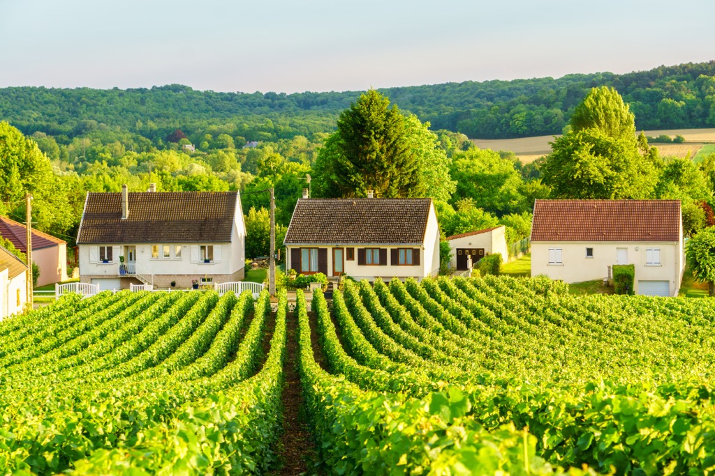
To the east of Paris is Reims, the capital of the Champagne wine-growing region; to the southwest is Le Mans with its famous "24 Hours of Le Mans" race and its history museum of the same name; to the south is Orléans, where Joan of Arc fought with the British in 1429, about what the Maison de Jeanne d’Arc museum now also tells.


Yes. Paris has 3 named mountains. The highest is Montmartre at 159 m.
The highest mountain in Paris is Montmartre, at 159 m.
Paris has 3 named mountains.


