
Scan the QR code and open PeakVisor on your phone
The Ozark Highlands include 3,319 named peaks. The highest is Magazine Mountain at 838 m. Other notable peaks include Signal Hill, Mossback Ridge and Rich Mountain.
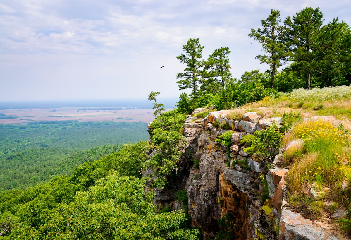
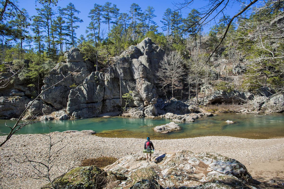
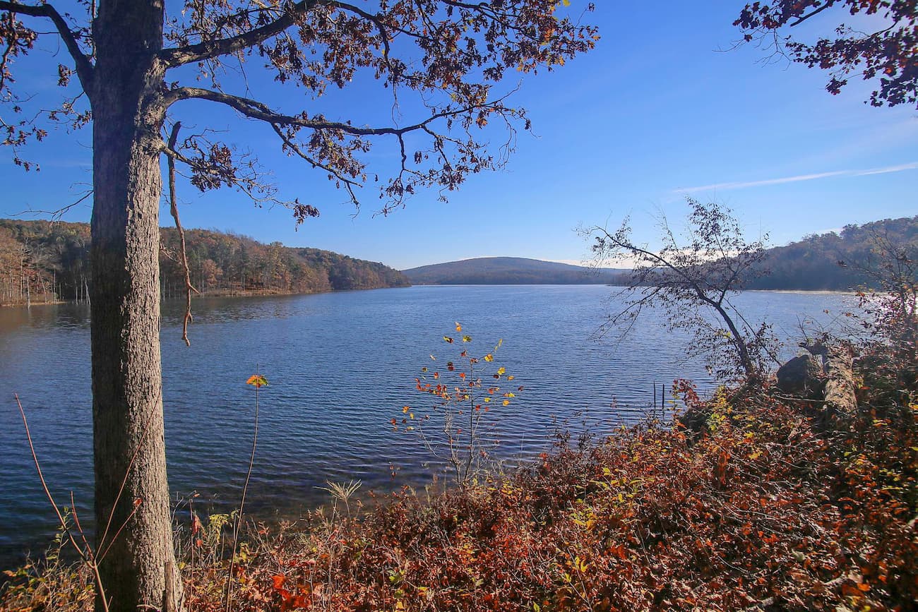
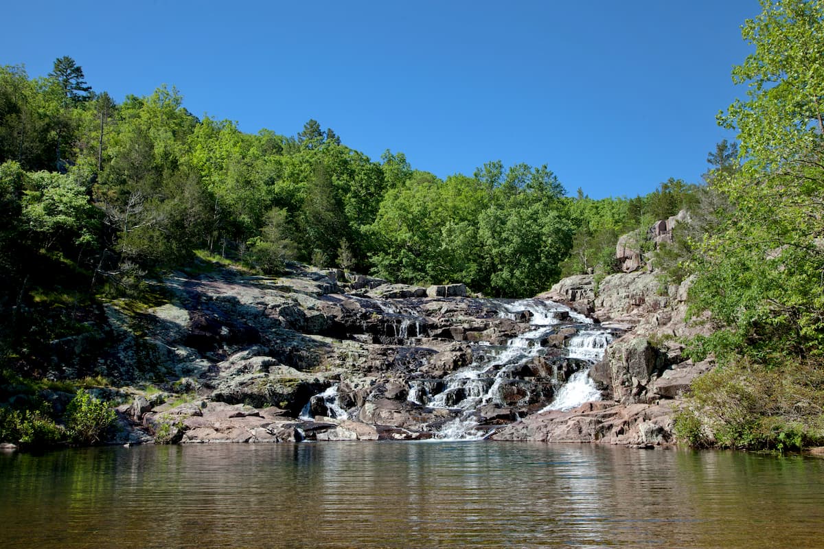
Featuring rugged terrain, sparkling springs, a seemingly endless series of caverns, and roaring waterfalls, the Ozark Highlands is a mountain range that covers sections of the US states of Oklahoma, Kansas, Missouri, and Arkansas. The range includes 2257 named mountains, the highest and most prominent of which is Signal Hill (2,753ft/839m).
The Ozark Highlands, or the “Ozarks” as they’re known locally, stretch from the southern edge of I-40 in Arkansas all the way to I-70 in Missouri in the north. With a total land area of about 47,000 square miles (120,000 sq. km), the Ozarks are the largest highland region in the midwestern United States.
Rising up from the plains between the Appalachian Mountains and the Rockies, the Ozarks represent some of the most mountainous terrain in the middle of the country. They are home to a number of major public land areas, including Ouachita National Forest, Ozark-Saint Francis National Forest, Mark Twain National Forest, and Ozark National Scenic Riverways.
Interestingly, the Ozarks formed, not through the normal mountain-building methods of folding, faulting, and tectonic activity, but by erosion.
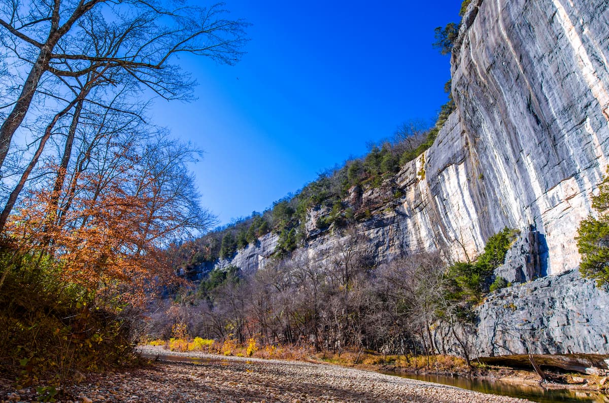
The bedrock in the region formed as thousands of layers of sand, silt, and other marine sediments were deposited at the floor of an ancient sea some 540 million years ago. Over time, these sediments formed the bedrock that we see today.
Nowadays, the bedrock is a mix of limestones, shales, sandstones, siltstones, and chert, much of which is calcium-rich as a result of the corals and shells of various sea creatures that were entrapped within the seafloor.
During the later stages of the Paleozoic Era, the region that is now the Ozarks experienced widespread geologic uplift, which raised the seafloor and created a dome-shaped plateau. Despite this uplift, the layers in the bedrock weren’t disturbed, and they still remain today.
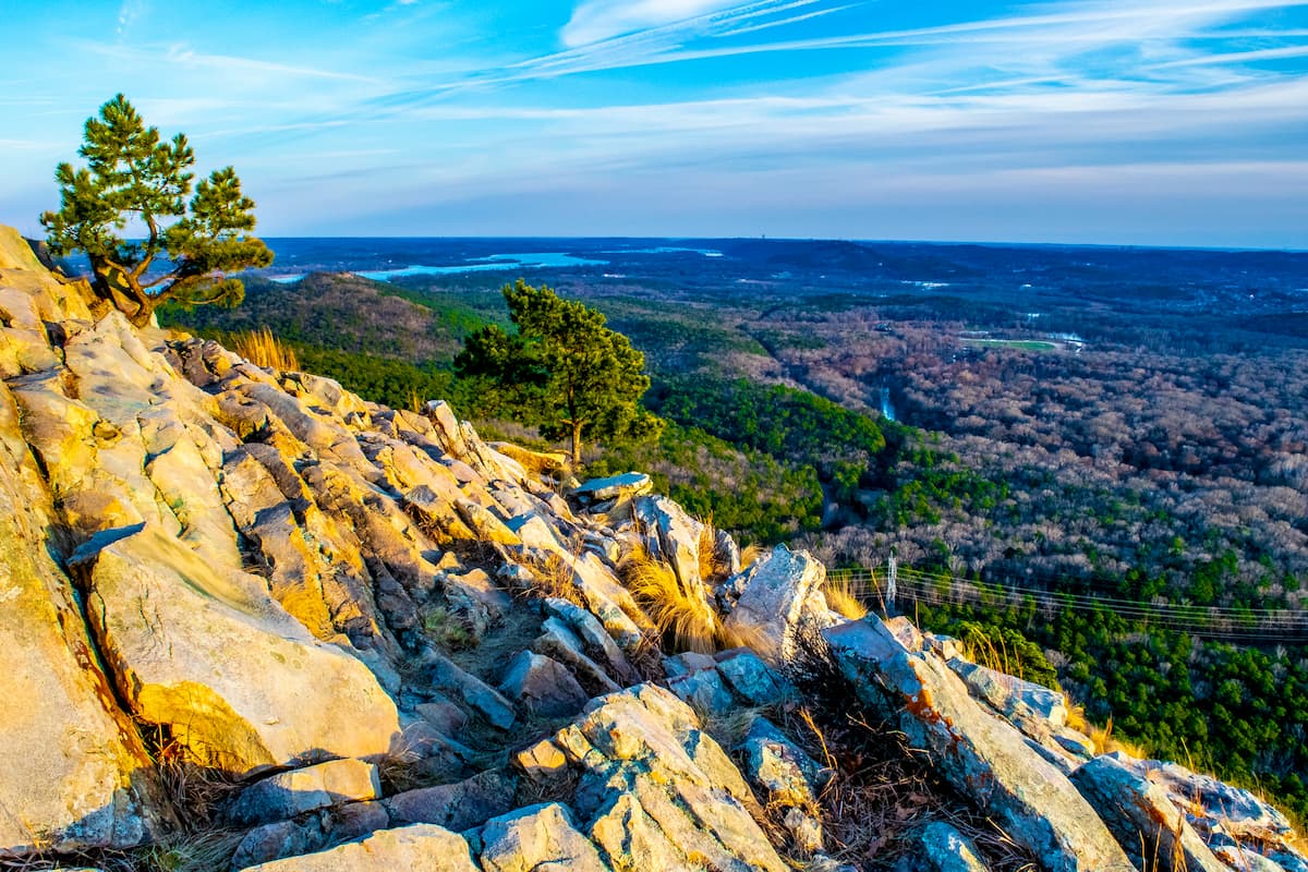
Throughout this period of uplift, various streams and rivers eroded away at the landscape, creating bluffs, valleys, and the mountains that we see today. However, the Ozarks are more an old, eroded plateau, than a highly weathered mountain chain, like the Appalachians.
The large amounts of limestone in the region has also led to the creation of large caves. Since the minerals in limestone more readily dissolve in water than the minerals in the other rock layers found in the region, caves form wherever underground water systems erode away at the rock.
Additionally, the Ozarks contain significant deposits of various ores, including zinc, iron, lead, and barite. These minerals were the focus of a number of large-scale mining operations, which have more or less depleted their stores. As a result of these mining operations, particularly within the early 20th century, the groundwater and topsoil of the Missouri/Kansas/Oklahoma Tri-State Lead Belt region is contaminated with large amounts of heavy metal.
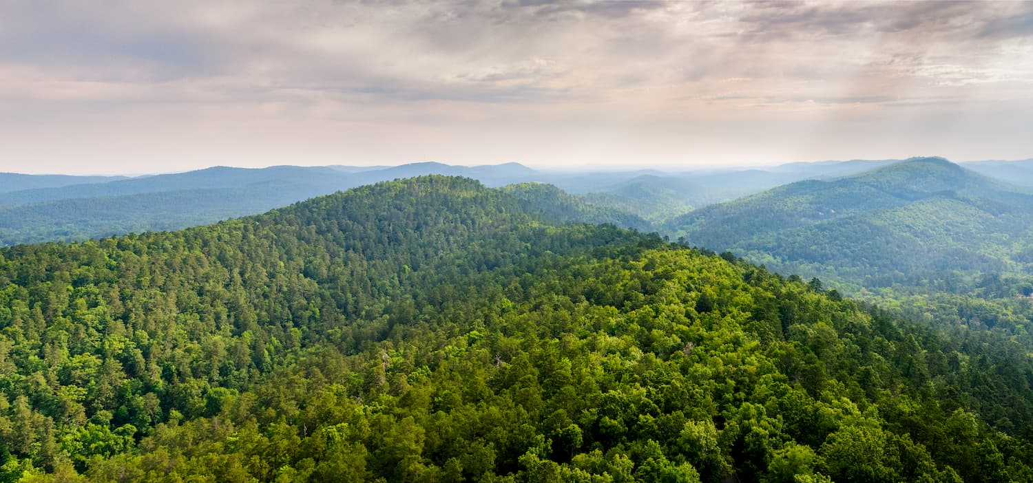
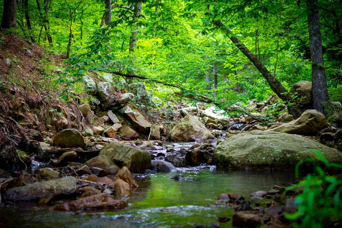
The Ozarks are home to an extensive amount of tree cover, the majority of which is oak-hickory. There are also eastern junipers and various stands of pine, particularly in the southernmost part of the range.
Even today, less than 25% of the region’s forestland has been cleared away for pasture and much of the area that was logged in the 20th century has recovered.
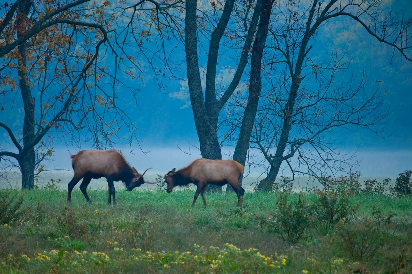
Nowadays, the Ozarks sustain a sizable amount of wildlife, including everything from black bears to white-tailed deer, beavers, muskrats, and mink. The region is also home to a large number of bats, who find suitable habitat within the Ozark’s extensive cave networks.
Additionally, there have been many sightings of mountain lions in the Ozarks, though, while these sightings are believed to be real, they have not yet been verified.
The Ozarks also provide excellent habitat for hundreds of species of birds. This is partially because of its location along the Mississippi Flyway, which is a migration route that many bird species follow from the Hudson Bay and other parts of Northern Canada, through the United States, and to the Gulf of Mexico.
The Ozarks have been home to human inhabitants for thousands of years. A number of groups, including the Saukees, Cahokia, Peoria, Kaskaskia, Shawnee, Osage, Choctaw, and Pawnee, among countless others, consider the region to be their ancestral homelands, though they were forcibly removed from the region upon the arrival of Europeans and European-Americans.
Perhaps the first Europeans to visit the area were the French fur traders, who established a small outpost in the region during the 18th century. The English-language name of the mountains “Ozark” is likely a corruption of the French aux Arcs, which is an abbreviation for aux Arkansas or “of Arkansas.”
The Ozarks were first formally protected when the Ouachita National Forest was established in 1907 and when President Theodore Roosevelt created the Ozark National Forest in 1908.
Mark Twain National Forest was later established in 1939 by an act of Congress and a number of wilderness areas in the region were created after the 1964 Wilderness Act.
While much of the Ozarks are now federally protected, the region is also home to a substantial number of towns and cities. The Ozarks have a distinctive culture, much of which is shaped by the background of the region’s initial European settlers who came primarily from Ireland, Germany, England, and Scotland.
The Ozarks are home to hundreds of miles of hiking trails and a number of great publicly-owned recreation areas. Here are some of the best places to check out:
Ouachita National Forest is located in Arkansas and Oklahoma, encompassing some 2,788 square miles (7,221 sq. km) of land. It contains 282 named peaks, the highest and most prominent of which is Poteau Mountain. Other notable peaks include Black Fork Mountain, Blue Mountain, and Wilton Mountain.
First established in 1907, the Ouachita National Forest is among the oldest federally managed forests in the southern part of the United States, though it was first called Arkansas National Forest when it was created. Interestingly, the area nearly became a national park during the 1920s, but it was vetoed at the last minute by then-President Calvin Coolidge.
Ouachita National Forest is known for its expansive woodlands, which feature white oak, northern red oak, blackjack oak, and post oak, as well as old-growth forests of gum bumelia, yaupon, winged elm, and eastern red cedar.
The national forest contains two wilderness areas - the Black Fork Mountain Wilderness and the Upper Kiamichi River Wilderness. It has an extensive network of hiking trails, including the 223 mile (359 km) Ouachita National Recreation Trail.
The Ozark-Saint Francis National Forest is a federally protected region located in the state of Arkansas. It is technically two separate National Forests - Ozark and St. Francis - though it is managed as one.
Ozark-Saint Francis contains 169 named mountains, the highest and most prominent of which is Turner Ward Knob. Other notable peaks in the forest include Hare Mountain, Fly Gap Mountain, and Garlands Knob.
Ozark National Forest contains 1,874 square miles (4,856 sq. km) of land and was established by presidential proclamation in 1908. It is well-known for its extensive woodlands, some of which is old growth forest.
There are hundreds of miles of trails in the forest, including the Ozark Highlands Trail, which extends some 165 miles (270km). Other notable trails include the Sylamore Horse Trail and the Huckleberry Mountain Horse Trail.
Ozark National Forest contains five official wilderness areas, including East Fork Wilderness, Hurricane Creek Wilderness, Richland Creek Wilderness, Leatherwood Wilderness, and Upper Buffalo Wilderness.
Saint Francis National Forest is substantially smaller than Ozark and contains only 35 square miles (91 sq. km) of land. It is actually one of the smallest forests in the United States and it was established in 1960 by President Eisenhower.
Although it doesn’t have as many hiking trails as Ozark National Forest, Saint Francis is well-known for its fishing opportunities, especially at Bear Creek Reservoir and Storm Creek Lake, which have sizable populations of crappie and largemouth bass.
Mark Twain National Forest is located in the southern part of Missouri, covering some 4,795 square miles (12,419 sq. km) of land. It contains 105 named peaks, the highest of which is Bell Mountain, and the most prominent of which is Matthews Mountain. Other notable peaks include Lindsey Mountain, Johnson Mountain, and Grassy Mountain.
The forest was established in 1939 through a presidential proclamation. However, most interestingly, it was known as both the Clark National Forest and the Mark Twain National Forest, which were both established on the same day and with the same boundaries.
In 1973, the National Forest Service formally combined the two forests, giving it one name - Mark Twain - after the author, Samuel Clemens, who famously used Twain as his pen name.
The forest was initially created as a way to preserve Missouri’s last remaining native forests, as much of them had been logged during the late 19th and early 20th centuries. When President Roosevelt first established the forest in the 1930s, he also directed the Civilian Conservation Corps to plant hundreds of acres of pine to revitalize the forests.
These days, Mark Twain National Forest contains a network of hiking trails, as well as 7 wilderness areas:
Ozark National Scenic Riverways is a federally-protected area managed by the US National Park Service in southern Missouri. It contains 9 named mountains, the highest of which is Tip Top Mountain and the most prominent of which is Barnett Mountain. Other notable peaks include Mill Mountain, Williams Mountain, and Vance Mountain.
It was first designated in 1964 through an act of Congress as a way to protect the Jacks Fork River and the Current River. The park contains 125 square miles (324 sq. km) of land and is a popular location for canoeing, kayaking, and hiking.
The Ozark Trail traverses through the park and offers great hiking opportunities. Additionally, the park’s many caves are popular among tourists, particularly Round Spring Caverns, Jam-Up Cave, and Devils Well Sink.
The Ozark Highlands are home to a number of large cities and towns. Here are some of the best places to check out before or after your visit to the mountains:
Tulsa is located just west of the southern part of the Ozark Highlands. It is the second largest city in the state of Oklahoma with over 400,000 people. The city is known for its historic importance in the production of oil and for its numerous Division 1 NCAA collegiate athletics teams.
Tulsa has a great network of roads, busses, and highways, which offer good connections to the surrounding area. It also has an international airport with great links to the rest of the United States.

The city of Memphis is situated to the east of the central part of the Ozark Highlands, just across the Arkansas border in Tennessee. It is home to over 650,000 people, which makes it the largest city on the Mississippi River.
Memphis is well connected to the rest of the United States by a number of major interstate highways, railroads, river ports, and an international airport.

Although the Ozark Highlands do not extend into Texas, Dallas’ location just to the south of the range makes it a good place to start your journey if you’re coming from further afield. Dallas has over 1.3 million inhabitants, making it the ninth-largest city in the United States.
The city is located at the intersection of four major interstate highways, and is also home to one of the busiest international airports in the world: Dallas/Fort Worth.

Little Rock is situated at the foothills of the Ozark Highlands just to the east of the range. It has a population of just under 200,000 people and it is both the capital and the most populous city of Arkansas.
Both I-40 and I-30 pass through the city, which offer good connections to the rest of the country. Little Rock also has regular passenger train service, as well as Clinton National Airport, which offers good connection flights around the United States.

The city of St. Louis is located just to the north of the Ozark Highlands in Missouri, forming its northern border. It has over 300,000 residents and is situated at the confluence of the Missouri and Mississippi Rivers.
St. Louis is known for its network of roads, highways, and bridges. It also has regular rail, ship, and bus transport links around the country. The city has two passenger airports, the largest of which is St. Louis Lambert International Airport.


The highest peak in the Ozark Highlands is Magazine Mountain, at 838 m.
The Ozark Highlands have 3,319 named peaks.


.jpg)
.jpg)