Scan the QR code and open PeakVisor on your phone
Created in 1964, Ozark National Scenic Riverways covers 134 mi (216 km) of Current and Jacks Fork Rivers in southeastern Missouri, USA. Hundreds of small springs feed the rivers and the soluble dolomite underlying the area has created a landscape marked by caves and sinkholes. There are 22 mountains in the park. Tip Top Mountain is the highest at 1,237 ft (377 m). Barnett Mountain is the most prominent with a prominence of 364 ft (111 m) to its 1,079 ft (329 m) summit.
Ozark National Scenic Riverways was established in 1964 and protects 134 mi (216 km) of Current and Jacks Fork Rivers and around 80,000 acres (32,375 hectares) of river, forest, open field, and glade habitats. It is located near the Ozark Highlands of southeastern Missouri.
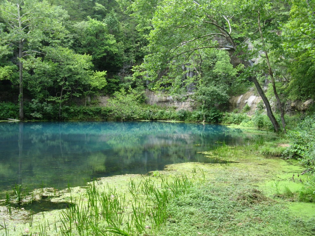
More than 60% of the river flow comes from seven major springs and hundreds of smaller springs. Big Spring is one of the largest springs in the country and it flows an average of 276 million gallons (1,255 million liters) of water per day. Several springs within the park are classified as “first magnitude” – springs that have over 65 million gallons (295 million liters) of water flowing through them daily.
The national park is the nation’s first “scenic riverways”. In fact, the establishment of the park protecting these invaluable river systems was a precursor to the Wild and Scenic Rivers Act that passed four years later.
The miles of waterways offer great opportunities for johnboating, canoeing, swimming, fishing, tubing, hiking, and bird watching. The area also has more than 300 caves. Although some are closed off to protect habitat for cave-dwelling wildlife, many of them can be explored. The park is neighbored by the Rocky Creek Conservation Area and Current River Conservation Area.
Soluble dolomite underlies much of the area which has led to the creation of sinkholes, caves, and springs – a prime example of karst topography. In addition to dolomite, the bedrock also contains smaller amounts of sandstone and chert and the landscape is punctuated by knobs made up of volcanic rhyolite.
The riverways fall within part of the Ozark Plateaus. Along the province’s eastern edge sedimentary rock has eroded away, exposing Precambrian granite and porphyries that form the mountains in St. Francois County. The riverways lie directly south of the world’s largest lead and zinc mining district.
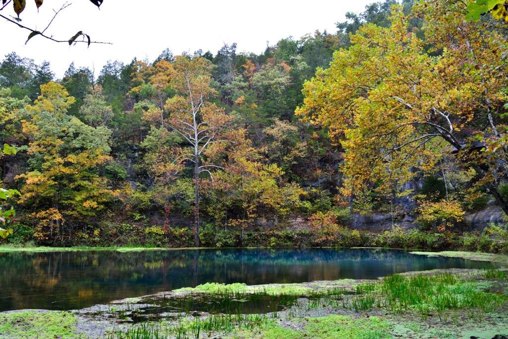
Forests set back from the rivers primarily consist of oak and shortleaf pine, the only pine native to Missouri. Dogwood fills in the understory. However, riparian habitats account for a significant portion of the park. In these areas, sycamores, maples, cottonwoods, willows, and green ash grow abundantly. In addition to forest and river, the park also supports open field, floodplain, and glade habitats.
There are a number of floodplains within the park that historically supported large stands of river cane, a native bamboo species. There are ongoing restoration efforts to return river cane to these areas to slow erosion and create nesting habitat for Swainson’s warblers.
Watercress and duckweed are two common water plants. Riparian habitats are perfect for wood ducks, great blue herons, and a number of other waterfowl. Hellbenders also live here – salamanders that can weigh up to four pounds (1.8 kg) and live for 30 years.
Several of the caves within the park provide critical habitat for endangered gray and Indiana bats. Overall, the park is home to 112 species of fish, 26 species of amphibian, 46 species of reptiles including four venomous snakes, 197 bird species, 58 mammals, and around 1,000 species of plants.
Summers are hot and humid. A few things to be aware of are ticks, mosquitoes and gnats in summer, and the chance year-round of thunderstorms, torrential rains, and flooding.
The land surrounding Ozark National Scenic Riverways was once the territory of the Osage, Quapaw, and Illini tribes. By the 1800s, other tribes originally from further east were passing through on forced westward migrations.
When early European explorers arrived in the 1500 and 1600s, tribes in the area were growing crops, living in villages, and traveling to hunt deer and bison. By the 1800s, many settlers of Scots-Irish heritage moved in, setting up farms, establishing mills, and starting small communities. Increasing settler populations increased land disputes with Native Americans, and, as in much of the US, resulted in Native Americans being removed from their homelands.
The railroad also arrived in the 1800s. The high demand for wood for ties, trestles, and fuel led to the destruction of much of the Ozark forest. Ferries were often used along waterways before bridges were built. Around the 1920s, tourism in the area began to grow.
The park was created as a local response to the proposed construction of several dams along the rivers. The resulting nationally-protected waterways was the country’s first national river park and set the bar for the Wild and Scenic Rivers Act that passed four years after the creation of Ozark National Scenic Riverways.
318 mi (512 km) of roads, some of them rough, run through the national park. State Highway 19 and US Highway 60 provide primary road access, and there are numerous other access points along the roads within the park.
The park also includes 14 mi (22.5 km) of horse trails and 48 mi (77 km) of hiking trails. An 8.5 mi (13.7 km) section of the Ozark trail runs through the park, a longer trail that, once completed, will stretch from St. Louis into Arkansas.
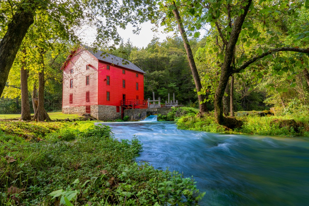
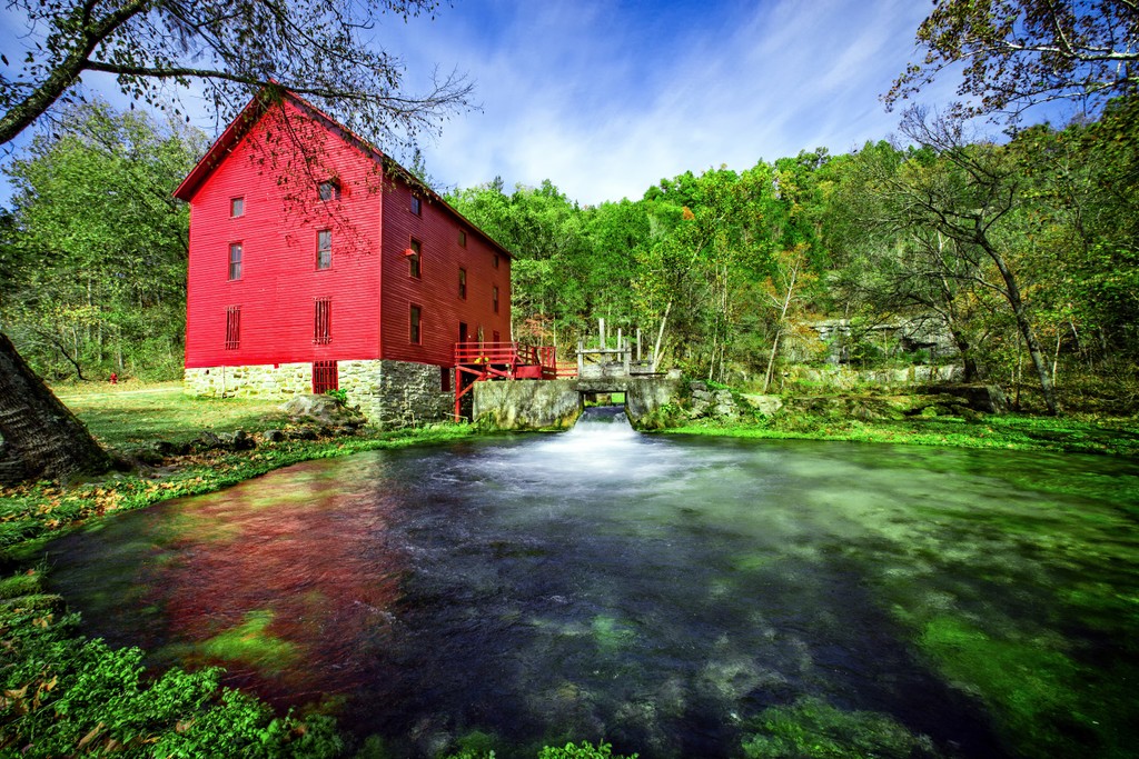
In addition to the hikes listed below, short hikes around Big Spring and Alley Spring are popular. Visit the National Park website for a full list of hikes.
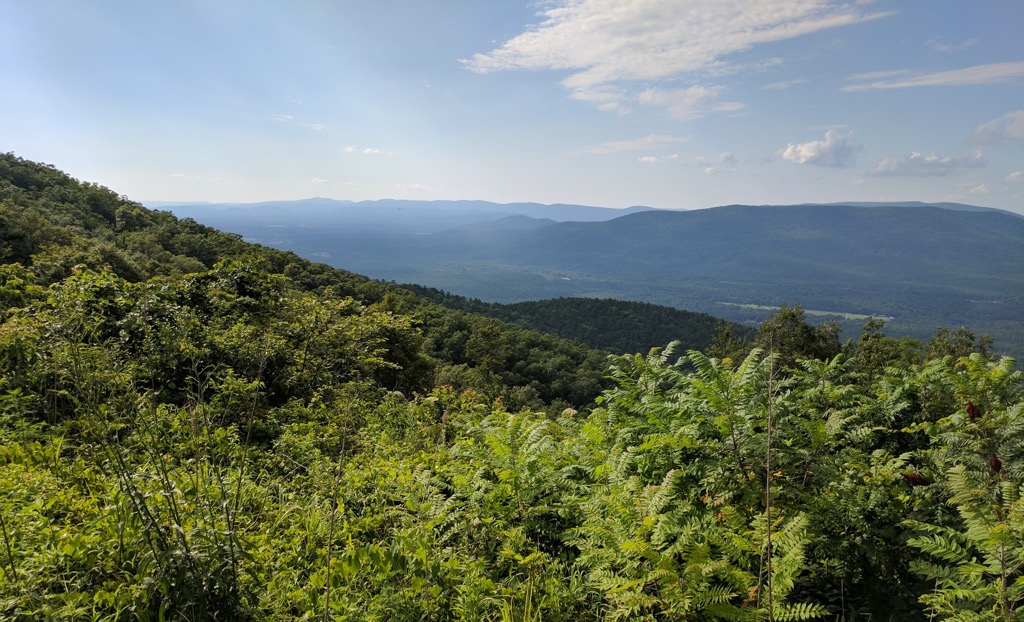
The Cave Spring loop provides a 4.6 mi (7.4 km) trail with less than 700 ft (213 m) of elevation gain. A short stint on a gravel access road leads to Devils Well – an old sinkhole with an underground lake the size of a football field at the bottom. The loop trail begins from Devils Well where it continues on through oak-pine forest ridges, crosses streams, and ultimately leads to the mouth of Cave Spring on the Current River.
The loop back has a cliff component as it cuts across the side of a dolomite bluff that overlooks the Current River. There are great views with this added elevation. The trail returns to Devils Well via Parker Hollow.
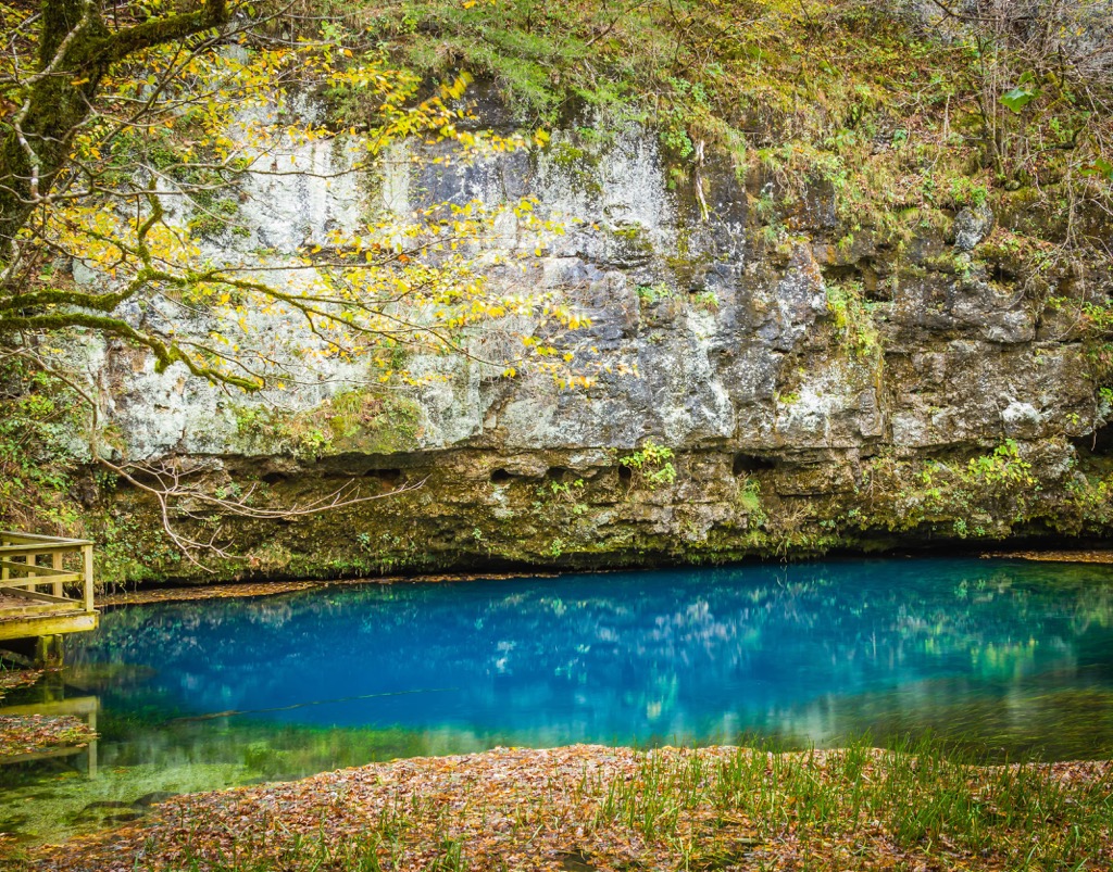
The trail to Blue Spring is 1 mi (1.6 km) roundtrip. It can be accessed from either Powder Mill or the picnic area at Blue Spring trailhead. The path wends through riparian forest before arriving at what is considered the bluest spring in the park. With a depth of 300 ft (91 m), it is also the state’s deepest spring.
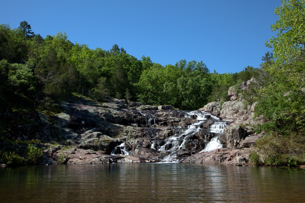
A short 0.4 mi (0.6 km) trail connects the geologically impressive falls to the Ozark trail. After running through pine, oak, and cedar forest, the trail winds up at a 40 ft (12 m) cascade where water from Rocky Creek flows over purple and pink porphyry igneous rock formations. The view is especially good in spring and summer after heavy rains.
For a fee, visitors can go into Round Spring Cave on a two hour long, ranger-led tour. Tours are filled on a first come, first serve basis. Be aware that some parts of the cave are slippery and the temperature remains around 58 Fahrenheit (14.4 Celsius) year round. There are also stairs and stooping is required in some sections while hiking through the cave.
The park has numerous developed campgrounds including Big Spring, Pulltite, Round Spring, Alley Spring, Akers Group, and Two Rivers. There are a handful of backcountry campgrounds and primitive sites. A full list of all camping options can be found here.
One and a half hours away by car, Poplar Bluff is one of the gateways to Ozark National Scenic Riverways. The town is surrounded by miles of trails perfect for hiking, biking, and birding. The abundant rivers and streams of the area provide many spots for fishing, swimming, and paddling. Mingo National Wildlife Refuge is nearby and a great option for those looking for a peaceful escape and to spot some wildlife.
The town has a population of 17,000 people and can offer hearty meals like cornmeal catfish filets with fried okra, BBQ, or comfort foods at diners, breweries, and Italian restaurants. Lodging options in town include hotels, B&Bs, RV parks, and campgrounds.
St. Louis is three and a half hours drive from the park and packed with urban adventures. One can visit the iconic Gateway Arch and even ride 630 ft (192 m) to the top. Forest Park contains miles of trails, as well as the Saint Louis Zoo, Saint Louis Art Museum, Missouri History Museum, and the Saint Louis Science Center – all with free entry! The area also houses an impressive greenhouse, the nation’s largest and oldest outdoor theater, and the World’s Fair Pavilion.
Outside the city, escape into nature along the 128 mi (206 km) of trails in the Great Rivers Greenway, with a visit to Castlewood State Park, or underground at Onondaga Cave State Park.
The downtown is brimming with live music, craft beers, steak houses, grilles, cafes, Korean BBQs, and international cuisines like Italian and Mediterranean. Hotels, B&Bs, inns, RV parks, and campgrounds are available for staying over in or near the city.

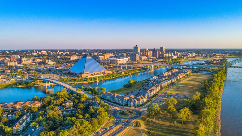
Memphis is a 3.5 hour drive across the state border in Tennessee. This city of 650,000 people is home to Elvis Presley’s Graceland, the Stax Museum of American Soul Music, and the National Civil Rights Museum. You’ll find three music museums along Beale Street alone.
Scenic riverfront parks and walkways offer a natural reprieve from the city along the Mississippi River and with kayak rentals around, it’s easy to get out on the water. The nearby Shelby Forest State Park offers hiking and mountain biking trails.
Memphis is considered a BBQ hotspot and the evidence lies in the more than 100 BBQ joints in the city. However, you can also find alternatives including fine dining, soul food, vegetarian and vegan options, and Italian and Mexican restaurants. The city also has a number of breweries and distilleries for tasting craft beverages. If you’re looking to stay over, you’ll find a selection of hotels, B&Bs, vacation rentals, campgrounds, and RV parks.