Scan the QR code and open PeakVisor on your phone
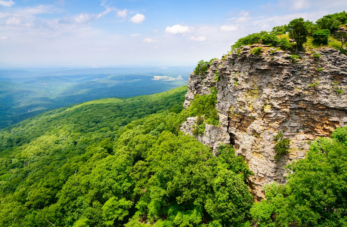
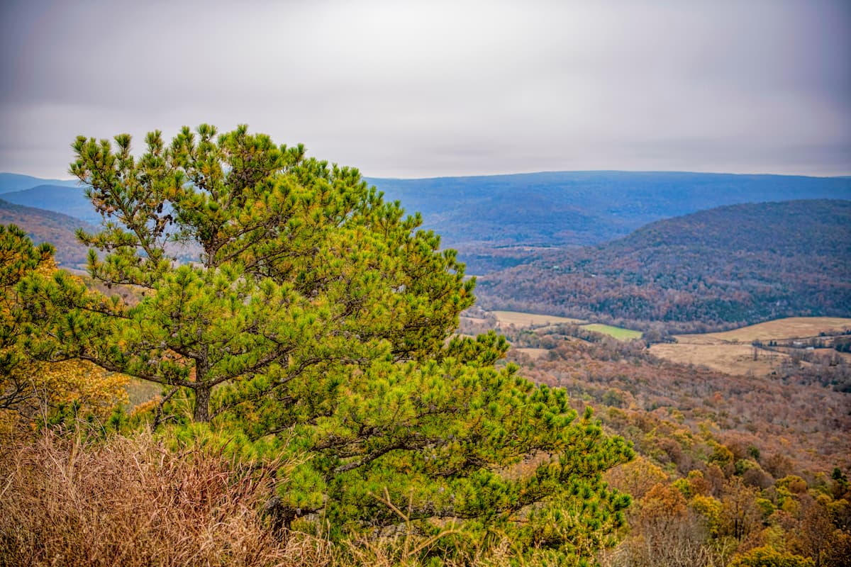
With a rich cultural history and an abundance of stunning landscapes, Arkansas, or “The Natural State,” is a state located within the south-central part of the United States. It contains 1,582 named mountains, the highest and most prominent of which is Magazine Mountain (2,749ft/838m).
The state of Arkansas is located in the south-central region of the United States. It is a land-locked state that shares a border with 6 other states: Texas to the southwest, Oklahoma to the west, Missouri to the north, Tennessee to the northeast, Mississippi to the east, and Louisiana to the south.
Boasting a total area of 53,179 square miles (137,732 sq. km), of which 1,143 square miles (2,961 sq. km) is water, Arkansas is the 29th largest state in the Union by land area. However, it is only the 33rd most populous state in the country and the 34th most population dense.
Arkansas contains a surprising diversity of different land areas, despite its relatively small size. Indeed, it can be categorized into different regions in a number of different ways, either geologically, ecologically, politically, or culturally.
That being said, it’s perhaps easiest to define the regions of Arkansas based on their ecological and topographical characteristics. As a result, there are 6 primary natural regions of the state of Arkansas: the Ozark Mountains, the Arkansas Valley, the Ouachita Mountains, the Coastal Plain, the Mississippi Alluvial Plain, and Crowley’s Ridge.
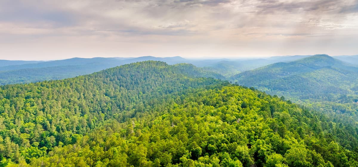
The Ozark Mountains Region of Arkansas refers to the northwestern corner of the state. It is characterized by a series of flat-topped plateaus, which are separated from each other by large river valleys.
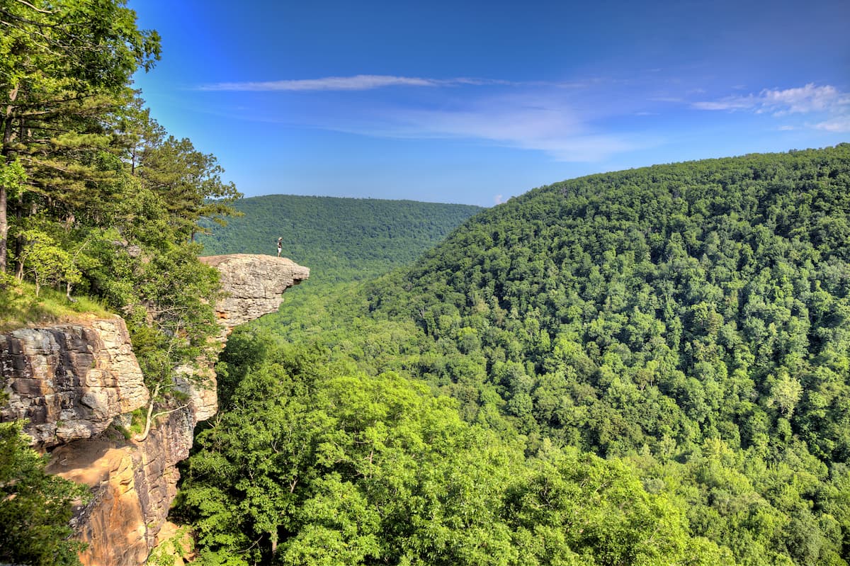
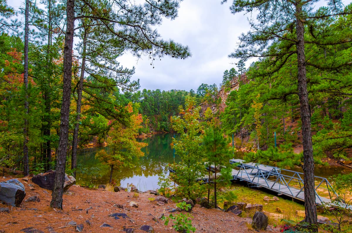
This region is highly popular among tourists because of the natural beauty provided by the Boston Mountains subrange of the Ozark Highlands. Here, you can also find large cattle farms and sizable logging operations, which take advantage of the ecological richness of the area.
There are also a handful of major public land areas in the Ozark Mountains region of Arkansas. This includes the Ozark-Saint Francis National Forest, the Buffalo National River, and the Pea Ridge National Military Park.
Situated just to the south of the Ozark Mountains region is the Arkansas Valley, which covers much of west-central Arkansas. This region forms a border between the Boston Mountains and the Ouachita Mountains and is generally characterized by lower-lying terrain.
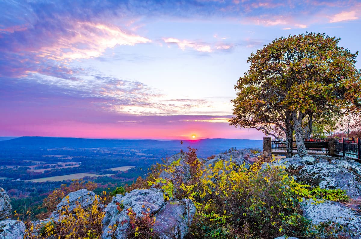
Interestingly, however, this region is home to the state’s high point, Magazine Mountain, which is part of the Ozark Highlands. Magazine Mountain, alongside Petit Jean Mountain, and Mount Nebo are collectively known as the “Tri-Peaks Region,” which is particularly popular amongst hikers.
Moreover, many of the largest cities in the state are located within the Arkansas River Valley, including Fort Smith. The region is especially rich in natural resources, such as coal, timber, and natural gas.

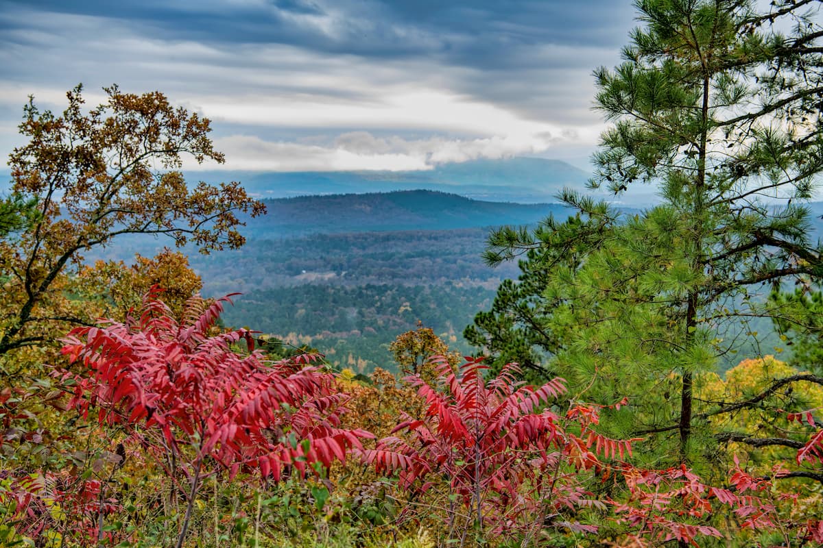
The Ouachita Mountains are located to the south of the Arkansas Valley and to the north of the Coastal Plain. This region, as the name suggests, is home to the Ouachita Mountains, which are a subrange of the Ozark Highlands.
Some of the largest and most popular recreation areas in Arkansas are located within the Ouachita Mountains region, including:

This region is very rich in natural resources and, in fact, Crater of Diamond State Park is one of the few places in the world where the public can head out and search for diamonds on publicly-owned land.
Encompassing much of southwestern Arkansas, the Coastal Plain is a low-lying region with undulating topography but little by the way of defined mountains. While Arkansas is quite far from the ocean, this region of the state is part of the larger Gulf Coastal Plain, which includes parts of Florida, Alabama, Mississippi, Louisiana, Texas, and Mexico.
In this part of Arkansas, the land is naturally forested with pine trees, though much of the region is now used for agriculture. Moreover, the Coastal Plain is rich in fossil fuels, such as natural gas and oil, which are also a major part of the region’s economy.
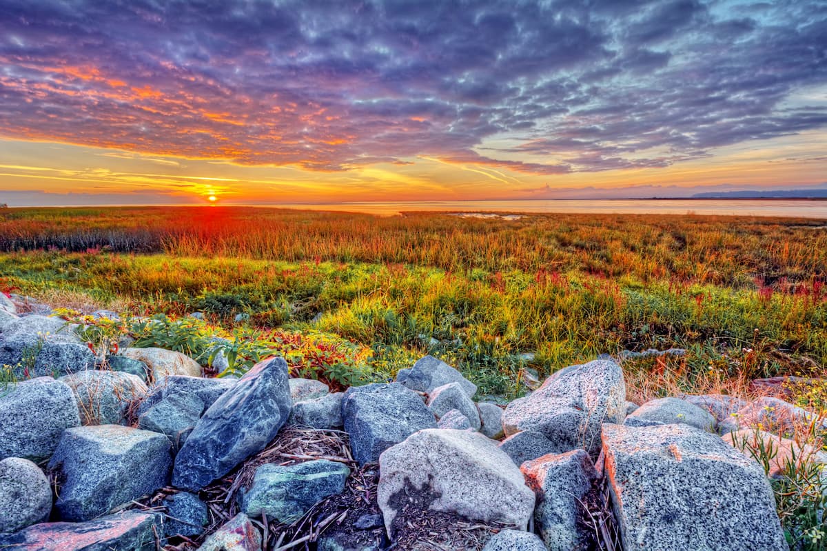
Aptly named, the Mississippi Alluvial Plain region is located alongside the Mississippi River in the eastern part of the state. This region is a collection of swamps, prairie, river, and wetlands, which all combine to create some of the most fertile areas in Arkansas.
You can find most of Arkansas’ farmlands within the Mississippi Alluvial Plain, thanks to its rich soils. Some of the most prolific crops in the region include corn, soybeans, cotton, and rice, though there aren’t very many mountains.
The final natural region of Arkansas is Crowley’s Ridge. Crowley’s Ridge rises up above the Mississippi Alluvial Plain for a few hundred feet, however, it is actually a loess rather than a proper mountain range.
Indeed, Crowley’s Ridge consists mostly of glacial sediments that were blown around in the wind until they were deposited into their current location. While this region is the most prominent part of the Mississippi Alluvial Plain between southeastern Missouri and the Gulf of Mexico, it does not have any properly defined peaks.
That being said, Crowley’s Ridge is home to some very fertile soils, so peach trees, wheat, soybeans, and timber production is common in the area. Moreover, this is the only region in the state of Arkansas where you can find naturally-occurring native tulip trees.
Arkansas is a geologically diverse state, despite being relatively small in size. The basement rock in Arkansas is exceptionally old, dating back over 1 billion years to the Proterozoic. However, this rock is not found at the surface and it is only known to scientists because of boreholes and other investigative techniques.
In fact, some of Arkansas’ oldest surface rocks are found in the Ozark Highlands, which are sedimentary in origin and date back some 540 million years. The rocks in the Ozarks formed when the region was covered by an ancient sea. Over time, the sediments deposited on his seafloor became the limestones, sandstones, chert, shales, and siltstones that we see today.
The Boston Mountains (a subsection of the Ozark Highlands) in northern Arkansas started to form when the northern part of the state experienced widespread uplift toward the end of the Paleozoic. This uplift created large plateaus, which were then slowly eroded away by the region’s rivers.
However, the Ouachita Mountains just to the south of the Boston Mountains formed through an entirely different geologic process. Unlike the Boston Mountains, which are essentially a well-eroded plateau, the Ouachita Mountains are the result of a mountain building event known as the Ouachita orogeny during the Pennsylvanian period.
More recent geologic history in the state is mostly the result of widespread sedimentary accumulation in some parts of the state (mostly the east and south) and massive erosion (particularly in the north and west).
Additionally, Arkansas is very rich in minerals and other natural resources. Some of the most important natural resources in the state include bauxite (the raw material for aluminum), antimony, copper, oil, and natural gas.
Major high points in the state include Magazine Mountain, Black Fork Mountain, Blue Mountain, Cameron Bluff, and Poteau Mountain.
The state of Arkansas contains 6 primary ecoregions, each of which has its own unique flora and fauna. Here’s what you can expect if you visit each of these regions.
The Ozark Highlands ecoregion in Arkansas covers the extreme northwestern part of the state. This region is fairly rugged and is mostly forested with oak-hickory woodlands. You can also find eastern junipers and pine in the region.
While the state of Arkansas has a large timber industry, a surprising amount of the forest in the Ozark Highlands has either escaped logging or has recovered from 20th century logging activities.
In the Ozark Highlands, you can find plenty of wildlife, including blakc bears, mink, beavers, muskrats, elk, and white-tailed deer. There are also quite a few bird and bat species in the area.
The Boston Mountains ecoregion refers to the most rugged part of the Ozark Highlands around the Boston Mountains subrange. Like the Ozark Highlands to the north, the Boston Mountains region is heavily forested, mostly with oak, hickory, and pine.
However, lower elevation regions are highly agricultural, so livestock farming is common in these areas. In general, wildlife in this region is similar to that of the Ozark Highlands, though there are quite a few endangered or threatened bird and bat species within the Boston Mountains.
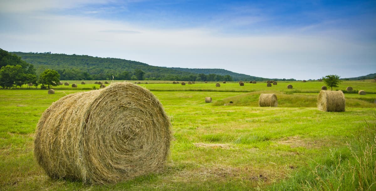
Including the entirety of the Arkansas Valley, this ecoregion is characterized by the mostly low-lying plains of the Arkansas River. Before the arrival of settlers of European descent, this area was a mix of savannas, prairie, and forest.
These days, much of the Arkansas Valley is used for agriculture, so pastureland and hayland are among the most common land uses.
The Ouachita Mountains ecoregion includes the majority of the Ouachita Mountains range in the west-central part of the state. This is one of the most rugged parts of Arkansas, with well-defined ridges and geological landforms.
Before European settlement, this region was mostly oak, hickory, and pine forest. Nowadays, much of this original forest has been cleared and regrown, so it is now dominated by shortleaf pine and loblolly pine.
Known as the South Central Plains or the Piney Woods, this ecoregion covers much of the southwestern part of Arkansas in the Coastal Plain region. It is actually part of a much larger ecoregion, which also extends down into Texas and Louisiana.
This ecoregion was historically dominated by pine, hickory, and oak forests, though widespread logging currently threatened the forests’ survival. In addition to forests, some parts of this ecoregion contain biodiverse wetlands, such as bayous, though this is most common in Louisiana.
Wildlife in this ecoregion includes small, medium, and large mammals, like opossums, white-tailed deer, ring-tailed cats, foxes, and bobcats. In wetlands, amphibians, such as newts, salamanders, and frogs, are particularly abundant.
The final major ecoregion in Arkansas in the Mississippi Alluvial Plain, which includes the majority of the eastern part of the state. This region is home to one of the largest systems of wetlands in North America and, as such, it is a treasure trove of biodiversity.
Historically, the region was home to forests of hickory, oak, and pine, as well as swamps, marshes, and other wetland ecosystems. The exceptionally fertile land in this region, however, has led to a large increase in agriculture. Indeed, this region is now mostly used for the production of soybeans, rice, cotton, and similar crops.
Arkansas, like the rest of the surrounding region, has a long and storied history of human inhabitation. Prior to the arrival of European colonizers, the region had been home to humans for thousands of years. In fact, it is considered the ancestral homelands of many Indigenous peoples, including the Osage Nation, the Quapaw Tribe, and the Caddo Nation.
Hernando de Soto was perhaps one of the first Europeans to visit the area during his 1541 expedition. Interestingly, de Soto actually died in Arkansas in 1542, near what is now the town of McArthur.
Other early European visitors to the region include Louis Jolliet and Jacques Marquette of France, who arrived in the 1670s, as well as Frenchman Robert La Salle in the 1680s. The French claimed the region that is now Arkansas as part of New France.
One of the earliest successful European settlements in Arkansas was the Arkansas Post (Pose des Arkansas), which was established in 1686 within the Mississippi River Valley near the modern city of Gillett. This became a major tradition post for French and Spanish fur traders, as well as other European settlers, for many years, even well into the late 18th century.
The region that would later become Arkansas traded hands a few times between the French and the Spanish, but it was eventually sold to the US through the Louisiana Purchase. During the same time as the Lewis and Clark Expedition in the early 19th century, the lesser known Dunbar-Hunter Expedition set off for the southern part of the newly acquired land.
During the early 19th century, Arkansas (then still a territory) saw itself at the middle of a battle over free and slave-owning states that eventually ended in the Missouri Compromise whereby Missouri and Arkansas became slave-owning territories/states while Maine was admitted to the union as a free state.
The early part of the 19th century also saw a number of failed treaties between the US settlers and the Quapaw Tribe, whereby the US reneged on a treaty that provided the tribe with about 32 million acres (13 million ha) of land along the Arkansas River. This led to widespread conflict and, eventually the removal of many Indigenous peoples from Arkansas.
Arkansas eventually became a state in 1836, just slightly before Michigan, though both territories had applied for statehood at the same time. The state went through a large banking crisis in the mid-1800s and it played an important role in helping Texas gain its independence from Mexico during the Mexican-American War.
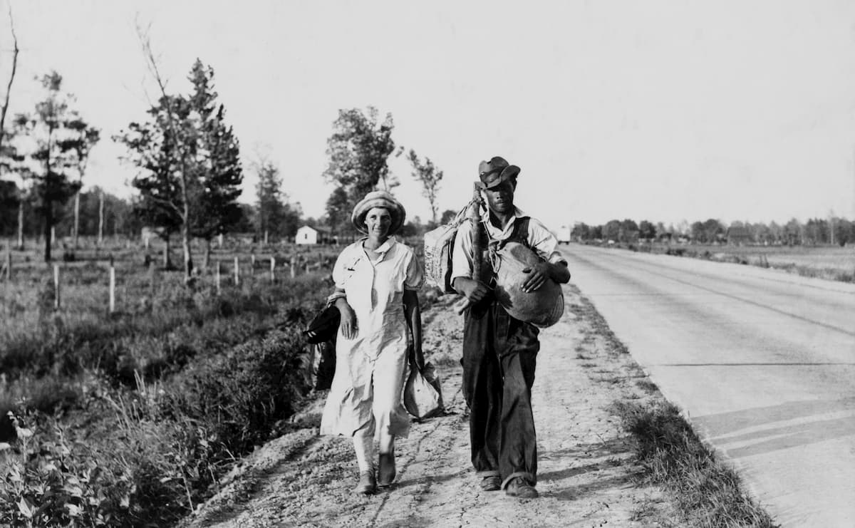
In 1861, Arkansas seceded from the Union and joined the Confederacy, though of course, they were defeated during the Civil War. Like in many other former Confederate States, Reconstruction was a tumultuous time for Arkansas as the KKK and Jim Crow laws gained support and farmers in the state faced a difficult economy.
The Great Depression was also particularly challenging in Arkansas due to the state’s rural economy.
In the mid-20th century, Arkansas was cast into the spotlight of the Civil Rights Movement, thanks to the landmark Brown v. Board of Education of Topeka Supreme Court Ruling in 1954. Although the case originated in nearby Kansas, it paved the way for the Little Rock Nine, a group of 9 Black high school students who were at the center of an angry debate over school desegregation.
These days, Arkansas has a diversified economy, which includes agriculture, timber, oil, gas, mining, and other major industries. There are quite a few Fortune 500 companies that are headquartered in Arkansas, including one of the largest corporations in the world: Walmart.
Perhaps the most famous Arkansan is Bill Clinton, who was born in the city of Hope and served as the state’s governor before becoming the 42nd president of the United States in the early 1990s.
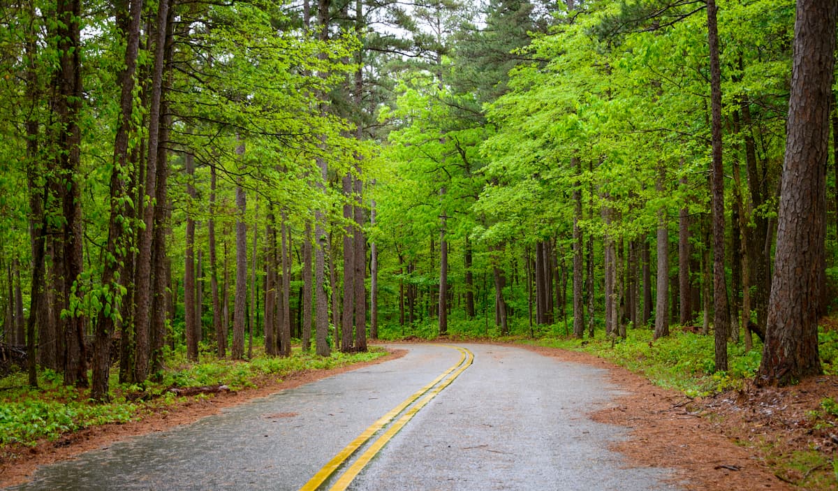
Arkansas is full of excellent places to go on an adventure. Here are some of the most popular recreation destinations to check out:
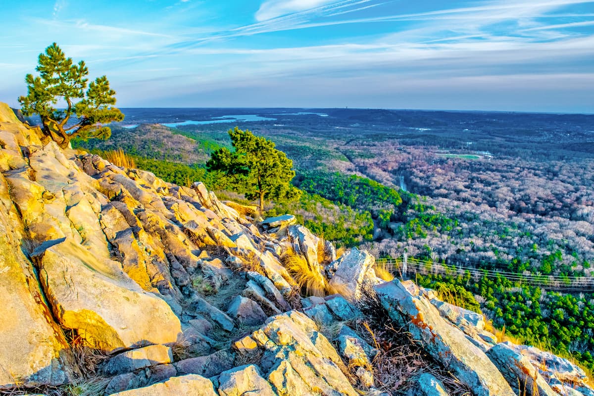
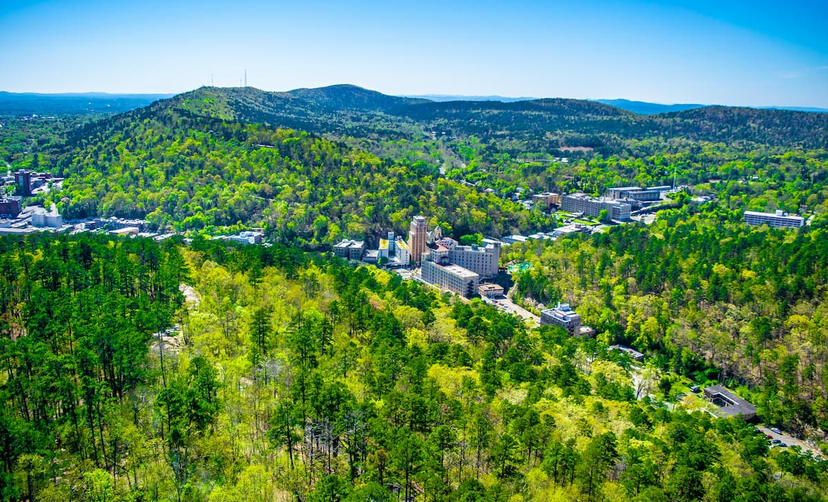
Nestled in west-central Arkansas near the city of Little Rock, Hot Springs National Park is a small federally protected area that’s popular among locals and visitors, alike. The park contains 4 named mountains, the highest and most prominent of which is West Mountain.
As you can surmise from the name, Hot Springs National Park is home to quite a few natural hot springs. The hot springs in the park have been used by humans for thousands of years and there are still places where you can enjoy a dip in these unique hot springs at an organized bathhouse. If bathing in a hot spring isn’t quite your style, there are also plenty of hiking trails to enjoy in the park.
Ouachita National Forest is located in western Arkansas and it includes most of the Ouachita Mountains. This forest contains 288 named mountains, the highest and most prominent of which is Black Fork Mountain.
The forest is actually one of the oldest in the southeastern US, having been designated in 1907. It nearly became a national park, but the re-designation was vetoed by President Calvin Coolidge in the 1920s.
Ouachita National Forest is renowned for its patches of old growth forest and for its rugged terrain. It contains 2 wilderness areas, the Black Fork Mountain Wilderness and the Kiamichi River Wilderness, though the latter is only located in Oklahoma. There are over 220 miles (354km) of trails within the forest for visitors to enjoy.
Covering much of northwestern Arkansas, the Ozark-Saint Francis National Forest was designed to protect some of the most biodiverse landscapes in the state. There are 187 named mountains in the forest, the highest and most prominent of which is Turner Ward Knob.
Within Ozark-Saint Francis, visitors can enjoy access to 23 different campgrounds, and nearly 400 miles (640km) of hiking trails. Moreover, the forest is a popular fishing destination, thanks to its plethora of streams.
Crater of Diamonds State Park is a small state-owned area in southwestern Arkansas which is very popular among locals. It is actually one of the only places in the entire world where regular people can search for diamonds on publicly-owned land.
Although it’s not known for its hiking opportunity, it is a fun place to visit if you want to hunt for diamonds, stay at the campground, or enjoy the exhibits at the Diamond Discovery Center.
Need a place to stay during your visit to Arkansas? Here are some good places to visit:
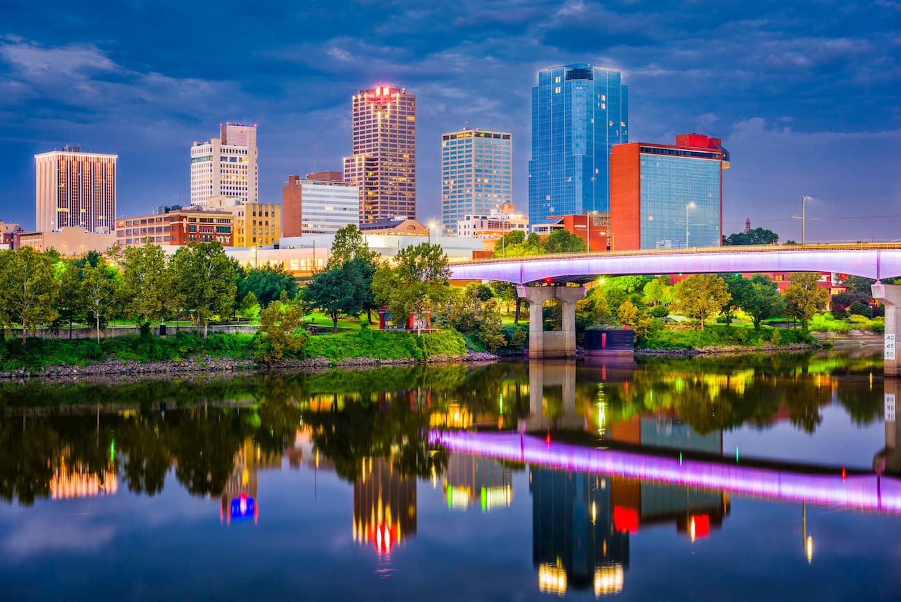
Located in the center of the state, Little Rock is the capital and largest city of Arkansas. It is home to around 200,000 residents and it is a major economic and cultural center for the region.
Little Rock is located at the intersection of I-30 and I-40, which offer good road connections to other major cities. Moreover, the city has Amtrak train service and the largest airport in the state - Clinton International.
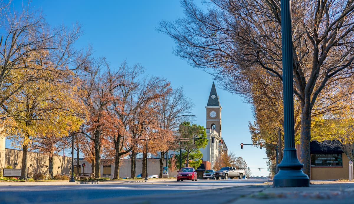
Fayetteville is situated in the northwestern corner of the state of Arkansas. It is the third largest city in the state with about 70,000 residents, Fayetteville is a population hub for the region. The city is also home to the University of Arkansas, which makes it a popular tourist destination for visitors who want to see the University’s collegiate football, baseball, and basketball games.