Scan the QR code and open PeakVisor on your phone
Buffalo National River is a protected area located in the northern portion of the US state of Arkansas. The Buffalo River is the oldest national river in the US and the protected land that surrounds the river contains 36 named mountains. The tallest peak in the protected area is Pickert Point at 2,290 ft (698 m) in elevation while the most prominent peak in the area is Kilgore Mountain, which has 502 ft (153 m) of prominence.
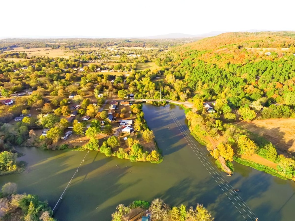
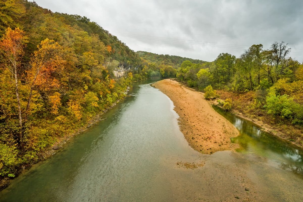
The Buffalo National River is situated in northern Arkansas, and it flows in a west to east direction for 135 miles (217 km) across the state. The river crosses land in Baxter, Marion, Newton, and Searcy counties.
The headwaters of the Buffalo River originate in the highest peaks of the Boston Mountains in the Ozark geographic region of Arkansas, Missouri, Kansas, and Oklahoma. After exiting the mountain range, the river then flows across the Springfield Plateau before traversing the Salem Plateau. The river eventually joins the White River, which is a tributary of the Mississippi River.
The headwaters of the Buffalo River begin as the Main Prong of Big Buffalo Creek. The river’s confluence with the White River is situated along the Marion-Baxter county line. A portion of the river lies within the Ozark-Saint Francis National Forest and is designated as a National Wild and Scenic River.
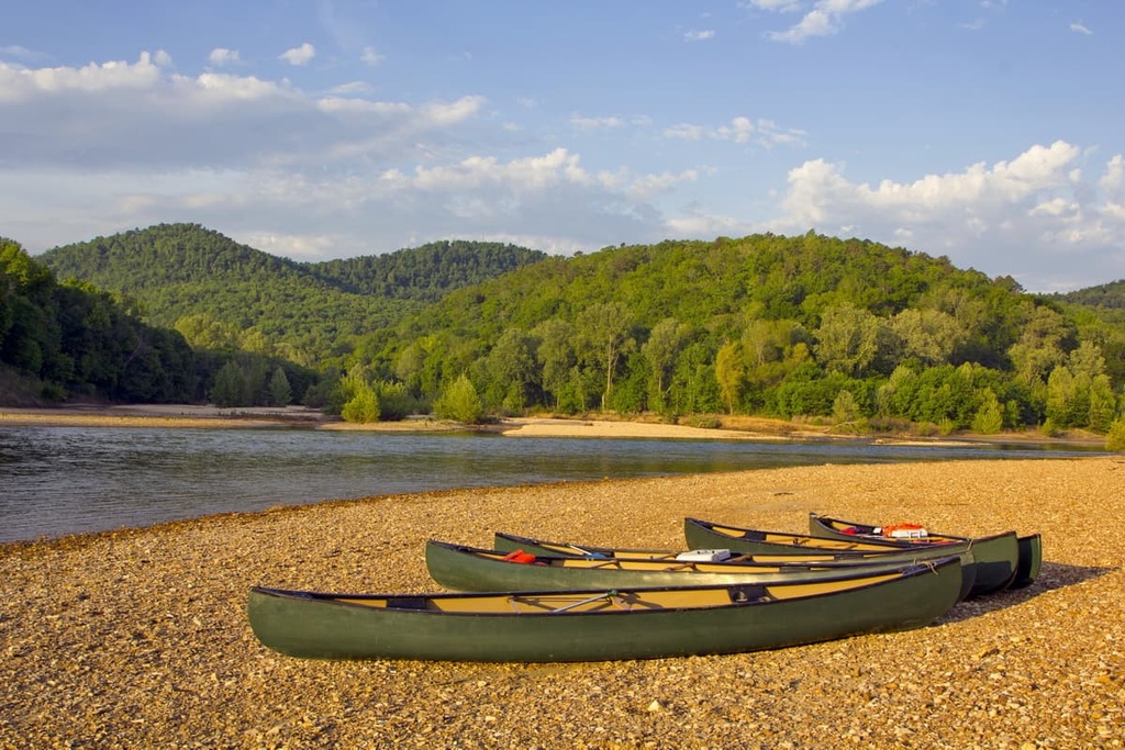
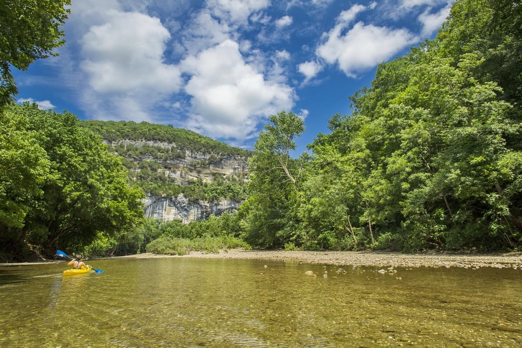
Although the river itself is simply called the Buffalo River, the protected area that surrounds it is called the Buffalo National River. This 94,293 acres (38,200 ha) area is managed by the US National Park Service as a park where visitors can hike, camp, paddle, and fish.
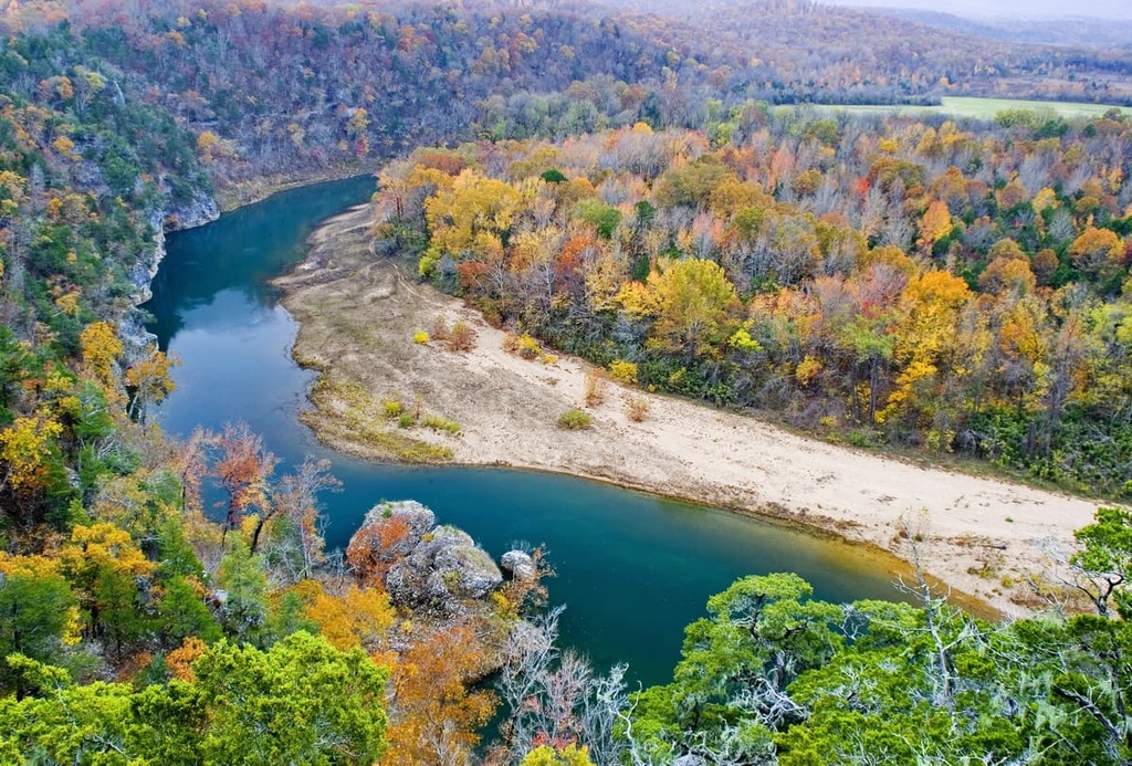
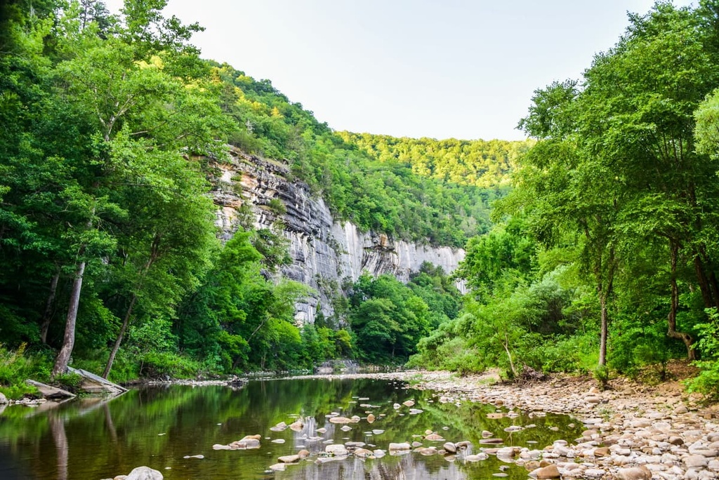
Sheer rock faces and forested hillsides tower above the river on either side of its banks. The river’s rocky shorelines also provide visitors with ample access to the water.
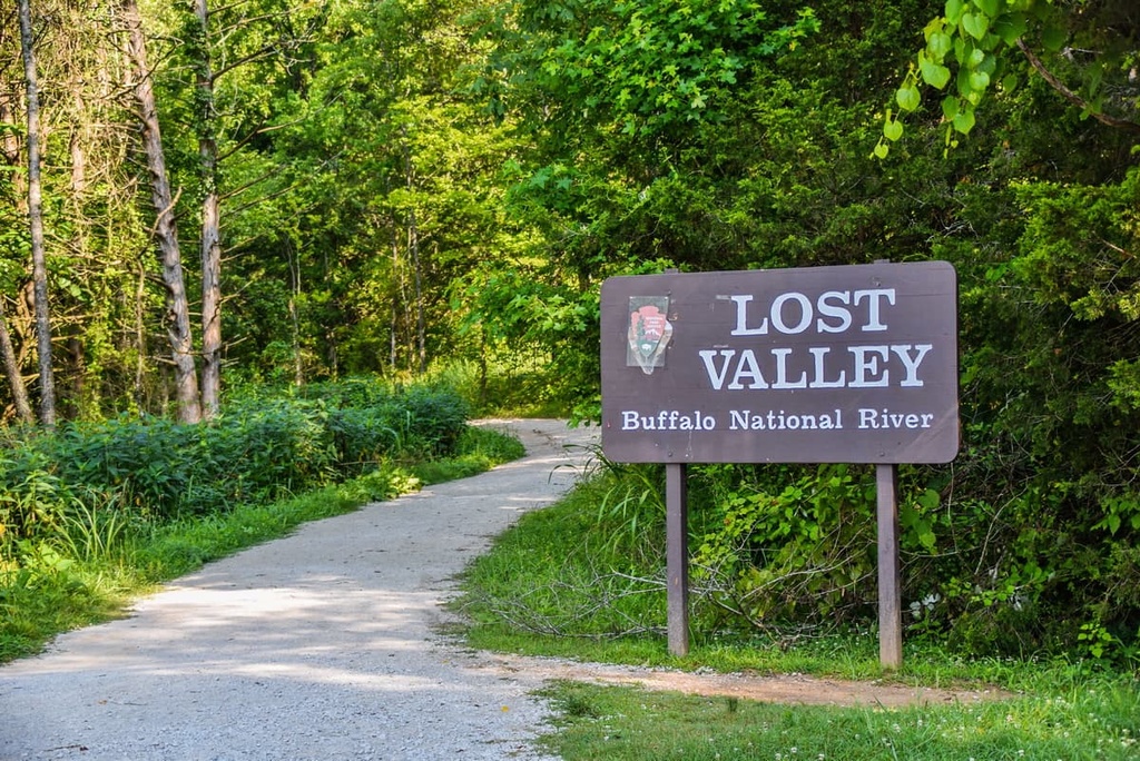
The Buffalo River winds its way through the region's forested landscape and is known for its multitude of tight turns. There are two state parks located along the shores of the Buffalo National River: Buffalo River State Park and Lost Valley State Park.
Additionally, the Buffalo National River is surrounded by other popular outdoor recreation areas. Besides the nearby state parks, Ozark-Saint Francis National Forest encompasses land to the south and east of the river.
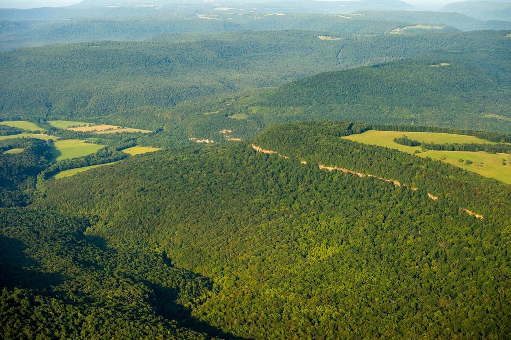
The geological history of the Buffalo National River is closely intertwined with the geological history of the Ozark Highlands. The headwaters of the river begin in the Boston Mountains, a subrange of the Ozarks. The Boston Mountains extend beyond the protected river into the nearby Ozark-Saint Francis National Forest.
The tallest peaks in the state of Arkansas can be found in the Boston Mountains, which also happens to be where streams converge to form the Buffalo River. This rugged mountain landscape began forming during the Paleozoic era.
As the South American plate collided with the North American plate, the Ozark Plateau was thrust upward. Over the course of millions of years, repeated folding and faulting transformed the sandstone uplands in the region into the rolling hills, ridges, and mountains that are visible today.
The entire plateau was once much flatter than it is now, but it was carved out by rivers that left behind a series of ridges and valleys. To this day, rivers like the Buffalo National River continue to shape the landscape through the power of erosion.
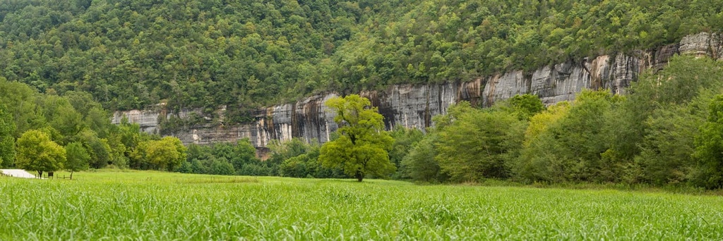
The region is rich in limestone, which has been heavily eroded away over time. Nowadays, the region is home to a vast network of caves that includes Fitton Cave, which is thought to be the longest cave in the state of Arkansas.
Major peaks located within the region include Pickert Point, Kilgore Mountain, Rollins Point, Turkey Mountain, and Fisher Point.
Besides the river that runs through the region, much of the protected land is forested. Common tree species found in the area include northern red oak, post oak, white oak, blackjack oak, and shortleaf pine. The undergrowth of the forest is often filled with maple, dogwood, and redbud trees.
The protected region marks the home of the only herd of elk found in the state of Arkansas. Other large mammals in the region include black bears and deer. Meanwhile, the river itself provides the ideal habitat for over fifty species of fish, including smallmouth bass and catfish. Populations of beavers are also common along the various creeks that feed into the Buffalo River.
Throughout the year, visitors may spot bald eagles, wild turkeys, Indiana bats, and the Ozark big-eared bat in the area around the river. Smaller mammals that live in the area include squirrels, rabbits, and raccoons.
The land surrounding the Buffalo National River has been inhabited by humans for millennia. In particular, this area was part of a traditional hunting grounds for many Tribes, particularly the Ouachita and Osage people.
The Ouachita people historically lived to the south of the Buffalo National River in what is now called the Ouachita Mountains. By the nineteenth century, the Osage people were the dominant group in the region extending to the Wichita Mountains.
European settlers started to arrive in the region during the early eighteenth century. In the process, they often disregarded Indigenous peoples' claims to their land. Repeated attacks on Indigenous people, along with the arrival of diseases such as measles and smallpox, forced many of the Ouachita to assimilate with the Natchitoches (Náshit'ush).
The Ouachita and Osage, alongside many other Tribes, were forced onto reservations, often far away from their native homelands. Today, many descendants of the Ouachita people are enrolled members of the Caddo Nation, which is based in what is now Oklahoma. Many descendants of the Osage people are enrolled as members of the Osage Nation, which is also located in present-day Oklahoma.
French and French-Canadian fur traders are thought to have begun arriving in the region during the sixteenth and seventeenth centuries. The term “Ozark” is thought to have come from a misinterpretation of the French words aux Arcs, which roughly translates to “of Arkansas.”
The Buffalo River was often admired for its beauty, but it was chosen to be the site of numerous dams in the early twentieth century. Conservationists fought against the construction of dams being built on the river, and in 1961, the National Park Service determined that it should become a ‘national river.’
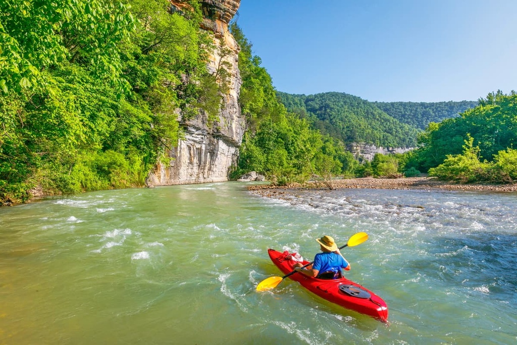
Just over a decade later, in February of 1972, the US Congress established the Buffalo National River, thereby ending any plans to create dams in the area. Nowadays, the region is a popular spot for hiking, horseback riding, canoeing, camping, swimming, and whitewater rafting.
Buffalo National River is home to numerous trails and other opportunities for outdoor adventure. Here are some of the top hiking areas to visit in the region.
The Centerpoint to Goat Trail is the most popular hiking route within the Buffalo National River. The trail descends steadily until it reaches Big Bluff. From the rocky summit of Big Bluff, hikers can enjoy panoramic views of the Buffalo River as it winds its way through the landscape below.
As it is located just off of Highway 43, the Centerpoint to Goat Trail is easily accessible throughout the year. But keep in mind that hiking back to the parking is all uphill and will likely take longer than the hike down to the bluff. The trail is 5.9 miles (9.5 km) long round trip and it has 1,076 feet (328 m) of elevation gain.
The Lost Valley Trail begins in Beechwood along the shores of the Buffalo River. The trail then climbs through the forested landscape along the banks of Clark Creek. During this hike, trekkers will cross several natural bridges over the creek itself.
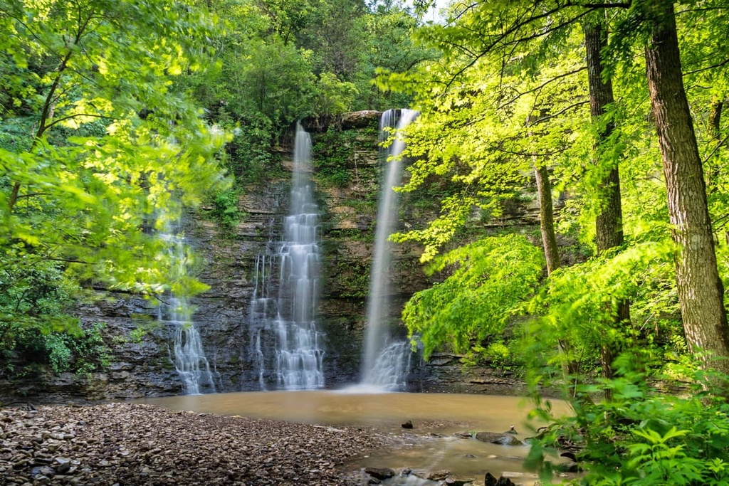
The final destination for the route takes hikers to Eden Falls and Cobb Cave. The falls cascade down over 50 feet (15 m) while the natural bridge along the route features a tunnel nearly 50 feet (15 m) long that’s carved from worn-out limestone. The entire route is 2.3 miles (3.7 km) long round trip and it has 252 feet (77 m) of elevation gain.
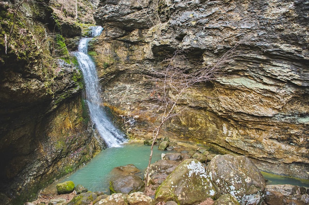
The Hemmed in Hollow Trail lies just off of Highway 43 on the north side of the Buffalo River. From the parking lot, this trail descends steeply as you make your way toward the Hemmed in Hollow Falls, which cascade down the limestone rock face.
The route then continues down to the Buffalo River. Hikers can then cool off in the river or turn around to climb back up to the parking lot. This out-and-back route is 5.7 miles (9.2 km) long round-trip and it has 1,414 feet (431 m) of elevation gain.
Looking for a place to stay near the Buffalo National River? Here are some of the best cities and villages to check out in the region.
The city of Fayetteville lies to the west of the Buffalo National River, near Arkansas’ border with Missouri and Oklahoma. Home to around 94,000 residents, Fayetteville is the second-most populous city in the state. The city is also situated on the outskirts of the Boston Mountains and it is home to the University of Arkansas.
Since it is surrounded by portions of the Ozark-Saint Francis National Forest, the city is a hub for outdoor recreation. Fayetteville was the first community in the country to be designated as a “Bike City” by the Union Cycliste Internationale. Each year, the city also hosts the Fayetteville Roots Festival, which showcases local music and cuisine.
The city of Mountain Home is situated within the Ozark Mountains to the north of the eastern edge of the Buffalo National River. Mountain Home has around 12,800 residents and it lies between both the Norfork and Bull Shoals lakes and the White and North Fork Rivers.
Fishing resorts are common near Mountain Home along the White River, as are campsites. Just outside the town lies the confluence of the Buffalo National River and the White River.
Mountain Home also boasts one of the first water resorts in the state and today is a hub for outdoor recreation, golfing, and watersports. Local shops and restaurants can be found in the downtown area of Mountain Home, too.